
Mori Atlas logo
Nature reserveFlachstal

A compact mosaic of calcareous grasslands and cold-air drainage corridors in northwest Thuringia

Flachstal Nature Reserve and Protected Limestone Valley Geography in Thuringia, Germany

Flachstal is a four-kilometre-long dry valley carved into the shell limestone plateau of Thuringia, Germany. This nature reserve serves as a critical refuge for species typical of dry-warm calcareous environments, featuring a distinct landscape mosaic of semi-dry grasslands, scrub fringes, and alluvial woodland. The valley floor, marked by the stony bed of the episodic Steingraben, acts as a primary cold-air drainage route that influences local microclimates across the surrounding agricultural plateau.

dry valleycalcareous grasslandmuschelkalksemi-dry grasslandshell limestone plateaunature reserve
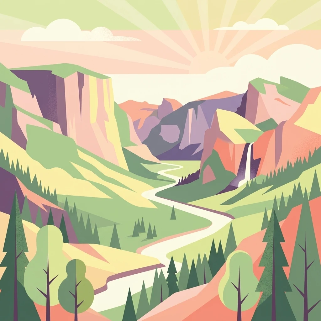
A flat-style digital illustration depicting a winding river flowing through a deep valley surrounded by high cliffs, mountains, and pine trees, with a waterfall on the right side and a sunrise in the background.

Flachstal

Nature reserve

Park overview

Structured park overview, official facts, and landscape profile for Flachstal

Flachstal park facts, protected area profile, and essential visitor context

Review the core facts for Flachstal, including designation, size, terrain, visitor scale, habitats, and operating context in one park-focused overview.

About Flachstal

Flachstal is a short but ecologically intense dry valley in the Unstrut-Hainich district of Thuringia, running from near Kaisershagen in the north down to the eastern edge of the Unstrut valley near Reiser. Although it lies within a region of broad agricultural plateaus, the valley itself feels enclosed, with steep flanks of shell limestone rising around a stony, intermittently flowing stream bed known locally as the Steingraben. The valley shifts direction roughly halfway along its length, first running northwest to southeast and then bending south-southwest, a shape that affects how wind, sun, and cold air move through its corridor.

The defining quality of Flachstal is the combination of calcareous bedrock and a long history of grazing. The valley sides expose Lower and Middle shell limestone strata and carry semi-dry grasslands of the gentian and quaking-grass type, bordered by scrub communities of privet and blackthorn higher up and elder and blackthorn along the valley floor. Along the stream course, narrow strips of alluvial woodland and pollarded willows break up the open character and add significant structural variety. Where the former military training area was planted in pine and black pine, the vegetation now reflects a mix of artificial and natural influences, yet the broader valley still reads as a working, grazed cultural landscape.

Most of the year, the Steingraben lies dry, presenting a bed of angular, edge-rounded Muschelkalk rubble peppered with fossils of the ancient sea in which these rocks were originally deposited. Water flows only seasonally, during snowmelt in spring and after heavy rain, and the entire valley functions as a cold-air drainage route for the surrounding farmland. Flachstal's significance today rests on this blend of geology, hydrology, and centuries of human management, which together create an unusually compact refuge for the flora and fauna of dry, warm, calcareous middle-European landscapes.

Quick facts and research context for Flachstal

Flachstal lies in the northern part of the Unstrut-Hainich district in Thuringia, between the villages of Kaisershagen and Reiser, draining westward to the Unstrut river. The valley is cut about fifty metres deep into the shell limestone plateau of northwest Thuringia, exposing Middle and Upper Muschelkalk layers on its flanks. Its characteristic land use is traditional sheep and goat grazing, supplemented historically by military training activity, which together created and maintained the open landscape.

Since 25 May 1999, an area of about 187 hectares has been designated as the Flachstal nature reserve, and it is also part of the Natura 2000 network of European Habitats Directive sites. The flora includes around 220 vascular plant species, and the area is recognised for its breeding birds and butterflies associated with dry, calcareous, structurally rich open countryside.

Protection and recognition

Documented terrestrial conservation parameters and historical establishment metrics

Flachstal Protection Status and Designated Area Recognition History

Flachstal maintains a documented terrestrial protection status established in nineteen ninety-nine with specific management parameters. Comprehensive designation records outline the historical framework governing the protected area and its administrative scope.

Protection details

Protection scope
Terrestrial
Designated year
1999
Transboundary protection
No
Park context

Deeper park guide and search-rich context for Flachstal

Flachstal history, landscape, wildlife, and travel context

Explore Flachstal through its history, landscape character, ecosystems, wildlife, conservation priorities, cultural context, and seasonal travel timing in a structured park guide built for atlas discovery and search intent.

Why Flachstal stands out

Flachstal is best known for its extensive gentian and quaking-grass semi-dry grasslands on steep valley flanks, broken up by privet-blackthorn and elder-blackthorn scrub, with small ribbons of alluvial woodland and pollarded willows along the intermittent streambed. It is also recognised as a key cold-air drainage channel for the surrounding intensively farmed limestone plateau, a function that has ecological as well as climatic significance. Equally distinctive is the long cultural continuity of transhumance-style sheep and goat grazing on the valley sides, a practice clearly visible on historical maps and still maintained by local shepherds. The combination of calcareous geology, repeated grazing, periodic burning, and long-term landscape openness has produced one of the most species-rich dry grassland complexes in northwest Thuringia.
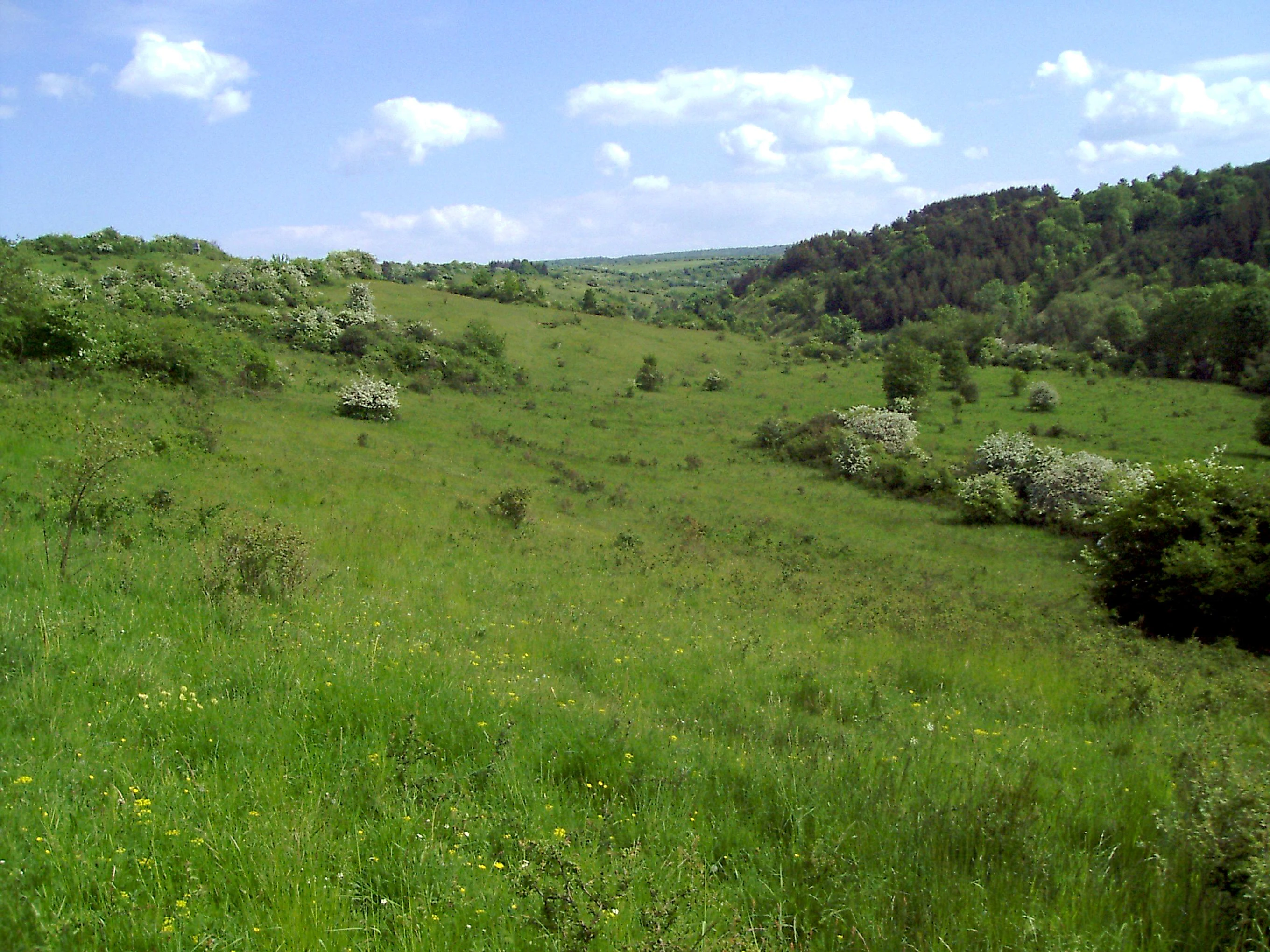
A wide view of a green, grassy valley landscape in Thuringia, Germany, featuring scattered hawthorn bushes in blossom under a blue sky.
The rolling grasslands and shrub-dotted slopes of the Flachstal valley in spring.

Flachstal history and protected-area timeline

Flachstal has a long history as grazing land, with sheep being walked along its slopes for many generations, a use already clearly visible in the nineteenth century cadastral 'Messtischblatt' maps through the characteristic signature of sheep drifts and wasteland. The grazing flocks traditionally included a mixture of sheep and goats, and the resulting short, open sward became a defining feature of the valley.

During the second half of the twentieth century the valley was used as a training ground by the National People's Army of the GDR and later by the Bundeswehr of reunified Germany. During this military period, large flocks were driven through the valley specifically to keep firing ranges clear of regenerating shrubs and trees, and the slopes were also burned on a regular basis. These interventions reinforced the already open character of the landscape but also led to the planting of Scots pine and Austrian pine on some of the steeper eastern slopes, species that are not native to this limestone habitat.

Land use returned to traditional grazing after the training area was decommissioned, and on 25 May 1999 Flachstal was formally designated as a nature reserve to protect its rare plants and animals. Shortly afterwards the site was incorporated into the European Natura 2000 network as a Habitats Directive site, recognising the valley's importance beyond regional conservation planning.

Flachstal landscape and geographic character

Geologically, Flachstal belongs to the northwest Thuringian Muschelkalk plate, a gently rolling landscape built from Middle Triassic shell limestone that was laid down in a shallow tropical sea and later uplifted into a tableland. The valley cuts roughly fifty metres into this plateau, producing steep flanks that expose layered Middle and Upper Muschelkalk limestone and reveal fossils of invertebrate marine life along the slope faces and in the streambed.

The valley itself is about four kilometres long. It begins on the plateau near Kaisershagen at roughly 355 metres above sea level, runs initially northwest to southeast, and after about one and a half kilometres bends south-southwest to end near Reiser at the edge of the broader Unstrut valley corridor. Its floor holds the stony bed of the Steingraben, an episodic stream that is dry for most of the year, with a bed of angular, slightly rounded limestone debris that gives the valley its name character of flatness and openness.

Because of its form and orientation, the valley also serves as a primary cold-air drainage route, channelling colder, denser air from the farmed plateau above down towards the Unstrut, a function that influences frost patterns and microclimate within the valley itself. The flanks show a clear zonation from semi-dry grassland and scrub on the upper slopes to more wooded, shaded patches at the base.
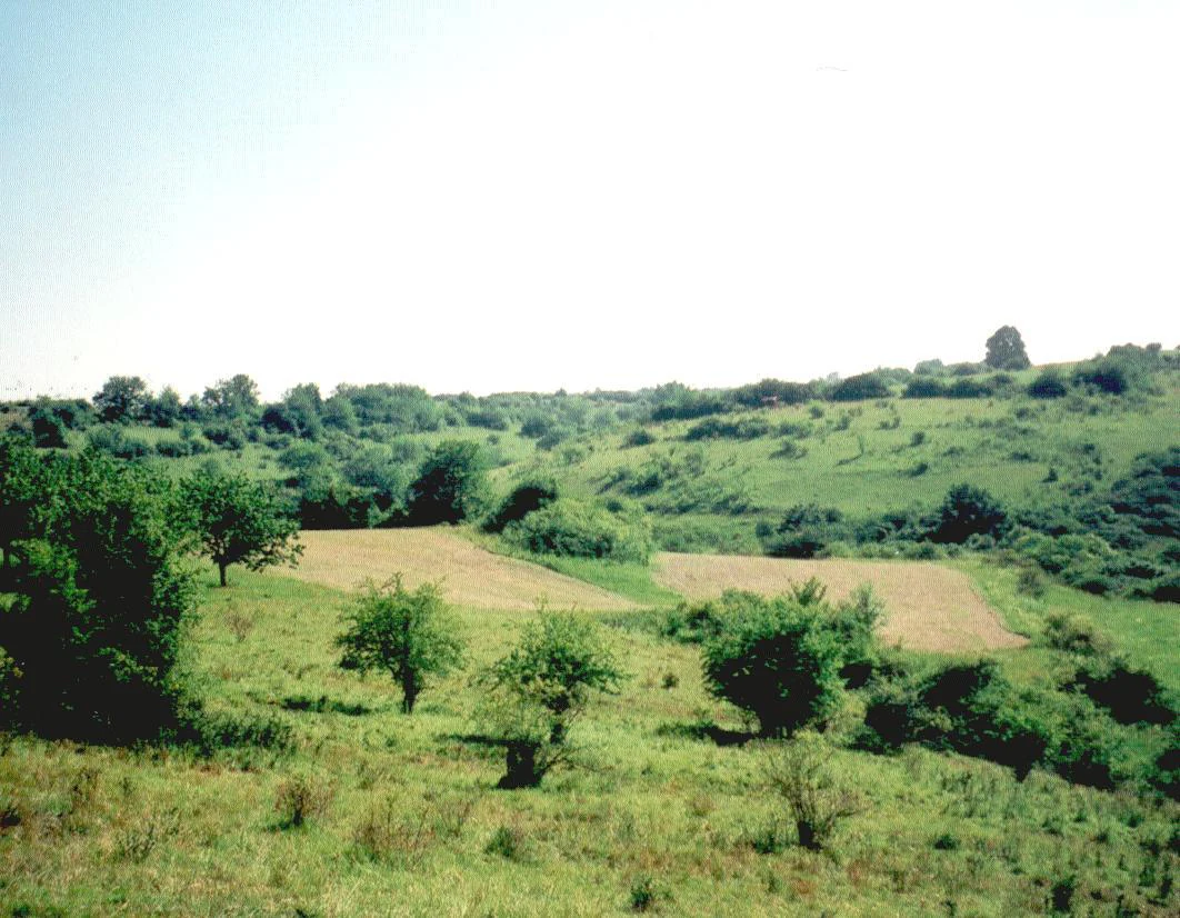
A wide view of a gently rolling, green, grassy valley in Flachstal, characterized by patches of dry yellow grass, scattered shrubs, and trees.
Calcareous grasslands and scattered trees in the Flachstal nature reserve.

Flachstal ecosystems, habitats, and plant life

The ecological character of Flachstal is defined by calcareous dry and semi-dry grasslands punctuated by scrub and small woodland fragments. Its most distinctive habitat is the gentian and quaking-grass grassland that covers much of the steep valley flanks, a community rich in orchids, herbs, and grasses typical of warm, base-rich soils. These open grasslands are not uniform; privet and blackthorn scrub breaks them up along the flanks, while elder and blackthorn scrub dominates on the valley floor.

Along the intermittent Steingraben, narrow gallery strips of alluvial woodland and scattered pollarded willows create local wetter conditions within an otherwise dry landscape. In the rear part of the valley, a near-natural wood barley beech woodland occupies shaded slopes, with a species-rich herb layer that transitions, on the steepest and driest slopes, into drought-tolerant variants of red beech woodland. Where Scots pine and Austrian pine were planted on the eastern flank during the military era, they now form an artificial element that contrasts with the otherwise largely deciduous and open character of the valley.

Around 220 vascular plant species have been recorded in the reserve, and the site also supports a significant fauna of breeding birds and butterflies typical of structurally rich, dry-warm open land on limestone. The valley's combination of open and closed habitats within a very small area gives it an unusually high habitat diversity for a site of its size in this part of Thuringia.

Flachstal wildlife and species highlights

Flachstal's wildlife value is closely tied to its mosaic of calcareous grassland, scrub, gallery woodland, and beech forest. The semi-dry grasslands and warm scrub edges support a characteristic butterfly fauna, including species associated with dry, base-rich terrain, while the structural variety provides nesting habitat for numerous breeding birds typical of open and semi-open lowlands, from ground-nesting species in the grasslands to scrub specialists in the privet-blackthorn thickets.

The Steingraben and its small alluvial strips add a different element, offering damper microhabitats that attract amphibians, invertebrates, and other groups not otherwise typical of an essentially dry valley. In the rear woodland of wood barley beech forest, birdlife shifts toward forest-interior species, while the transitions to dry beech woodland on steep slopes provide edge habitats used by a range of insects, reptiles, and small mammals.

Across these habitats, the principal conservation concern is maintaining the open, structurally rich character of the valley. Many rare and protected species of flora and fauna here depend directly on the continuation of grazing, the suppression of woody encroachment, and the persistence of warm, dry, rocky conditions on the slopes.

Flachstal conservation status and protection priorities

Flachstal was protected as a nature reserve, Naturschutzgebiet, on 25 May 1999, covering an area of 187.6 hectares in the Unstrut-Hainich district. The designation was driven by the presence of rare and threatened plant and animal species associated with dry-warm, structurally diverse open landscapes overlaying limestone bedrock. The reserve is also part of the Natura 2000 network as a European Habitats Directive site, anchoring its conservation importance at the European as well as regional level.

The overarching conservation objective is the protection of fauna, particularly the invertebrate and breeding bird assemblages of calcareous dry open land, which depend on a tightly maintained open landscape. In practice, this means preserving a high-quality mosaic of grassland, scrub, and small woodland patches, while preventing the loss of open habitat to forest succession. Traditional grazing by local shepherds with sheep and sometimes goats remains the principal management tool, supported historically by controlled burning during the period of military use.

By keeping grazing viable and protecting the integrity of the dry valley and its cold-air drainage function, the reserve aims to retain the ecological conditions that have built up over centuries of land use and that support Flachstal's distinctive combination of geological, botanical, and zoological value within central Germany.

Flachstal cultural meaning and human context

The cultural identity of Flachstal is inseparable from the long, continuous practice of transhumance-style sheep and goat grazing that has shaped both the vegetation and the visible landscape of the valley. Historical maps from the nineteenth century already record the features typical of sheep drifts, with characteristic wasteland signatures running along the slopes, indicating that this is not a recent conservation management decision but a centuries-old land use pattern.

Local shepherds and their flocks remain part of the valley today, openly tending the slopes and contributing to the maintenance of the reserve's grassy character. The use of the area as a military training ground during both the East German and post-reunification periods added another, more recent layer to its cultural geography, including the planting of pine stands and the regular cutting and burning of vegetation to keep firing lanes open. Together, these overlapping layers of agricultural, pastoral, and military land use give Flachstal a visible cultural depth that complements its natural history.

Top sights and standout views in Flachstal

Of the features that define Flachstal, three stand out. First, the compact scale and ecological intensity of the site. Within just a few kilometres of valley, an unusual range of calcareous grassland, scrub, gallery woodland, and beech forest come together to support around 220 vascular plant species and a notable fauna of breeding birds and butterflies.

Second, the visible interplay of geology and land use. Shell limestone bedrock, fossil-rich streambeds, steep exposed flanks, and centuries of grazing combine to produce a landscape that reads as both natural and thoroughly cultural. The episodic Steingraben, the cold-air drainage corridor, and the traditional sheep walks all give the valley a distinctive rhythm of seasons and uses.

Third, its layered conservation status, from a regional nature reserve designation in 1999 to its integration in the Natura 2000 network. That protection reflects both the rarity of the habitats present and the continuing importance of low-intensity, traditional management in keeping the valley open and species-rich.

Best time to visit Flachstal

Late spring is widely regarded as the most rewarding time to experience Flachstal. In May the semi-dry grasslands on the valley flanks come into flower, the gentian and quaking-grass communities are at their most visible, and many of the breeding birds and butterflies characteristic of warm, dry limestone country become active. Early summer brings continued flowering and an abundance of insect life, although vegetation becomes denser and the open character of the slopes may appear less crisp.

Late summer and early autumn offer quieter conditions and a softer colour palette across the valley, but the open grasslands remain accessible and the woodland edges provide a different kind of seasonal interest with fungi and changing leaf colour. Winter visits reveal the geological structure of the valley particularly clearly, when the absence of dense foliage exposes the limestone strata and the dry stony bed of the Steingraben along the valley floor.

Monthly climate preview

Long term temperature and precipitation records measured across representative terrain

Flachstal Climate Normals and Monthly Weather Patterns

Flachstal records multiyear climate measurements showing steady shifts in monthly temperature ranges and daily precipitation rates. Detailed climate data provides full context on annual weather patterns and long term environmental baselines.
Annual mean8 °C
-1 °C18 °C
Jan-1°
Feb-1°
Mar
Apr
May12°
Jun15°
Jul18°
Aug18°
Sep13°
Oct
Nov
Dec
Warmest month
July

17.7 °C

Coolest month
January

-1.4 °C

Wettest month
July

2.8 mm/day

Driest month
April

1.5 mm/day

Park location guide

Geography guide, regional context, and park location map for Flachstal

Flachstal park geography, regions, and map view in Germany

Understand where Flachstal sits in Germany through a broader geographic reading of the surrounding landscape, nearby location context, and its mapped position within the national park landscape.

How Flachstal fits into Germany

Germany is a federal republic in Western and Central Europe with a population of over 83 million across sixteen constituent states. It is Europe's largest economy by nominal GDP and a major global exporter and importer. The capital is Berlin, and the country borders Denmark, Poland, Czech Republic, Austria, Switzerland, France, Luxembourg, Belgium, and the Netherlands.

Wider geography shaping Flachstal in Germany

Germany is located in Western and Central Europe, spanning 357,022 km². It borders Denmark to the north, Poland and the Czech Republic to the east, Austria and Switzerland to the south, and France, Luxembourg, Belgium, and the Netherlands to the west. The country has coastlines on the Baltic Sea and North Sea to the north, with the Alps located in the southern region.

Map view of Flachstal

Use this park location map to pinpoint Flachstal in Germany, understand its exact geographic position, and read its mapped placement within the surrounding landscape more clearly.

Pigeon | © OpenStreetMap contributors

Location context for Flachstal

Thuringia

Explore protected area views, shell limestone slopes, and dry valley habitats in Thuringia

Flachstal Photos and Landscape Scenery: Visualizing the Muschelkalk Valley

Photographic records capture the steep Muschelkalk limestone flanks and semi-dry grasslands that define the protected valley environment. Visual documentation reveals the mosaic of scrub fringes and geological features across the limestone plateau.

A wide view of a green, grassy valley landscape in Thuringia, Germany, featuring scattered hawthorn bushes in blossom under a blue sky.

A wide, high-angle landscape shot of a dry, grassy valley under a bright, overcast sky. The rolling hills are covered in yellowed grass and clusters of dark green bushes and trees, sloping down toward a narrow valley floor.

A wide view of a gently rolling, green, grassy valley in Flachstal, characterized by patches of dry yellow grass, scattered shrubs, and trees.

Park atlas

Compare adjacent limestone valleys, regional nature reserves, and connected habitats

Exploring Parks Near Flachstal and Protected Areas Across the Surrounding Region

Visitors comparing Flachstal can browse other protected areas, regional nature reserves, and calcareous grassland habitats across the surrounding Thuringian limestone plateaus. Expanding the search reveals related conservation landscapes that share similar geological formations, dry valley terrains, and traditional land management histories.
A watercolor painting showing a panorama of soft green rolling hills and meadows under a hazy, pale sky.
Nature reserveThuringia
About 5.6 km away#1 closest

Southeast

Grabsche Berge Nature Reserve: Thuringia Protected Hill and Cuesta Geography

Steppe-like terrain within the Thuringian Basin

The Grabsche Berge nature reserve encompasses a series of low hills forming a notable cuesta landscape in central Germany. This protected area provides a focal point for understanding dry grassland vegetation and geological transitions on the edge of the Unstrut floodplain, offering a distinct botanical and environmental study site in the heart of the Thuringian Basin.

Area
0.544 km²
Established
1996
A soft watercolor painting of a meadow landscape, featuring a dirt path winding through wildflowers toward green trees with rolling hills in the background.
Nature reserveThuringia
About 8.4 km away#2 closest

West

Kühmstedter Berg Nature Reserve: A Protected Landscape and Archaeological Site in Thuringia

Examining forest ecology and medieval earthworks on a central German ridge

Kühmstedter Berg stands as a protected nature reserve in Thuringia, characterized by its Muschelkalk geology and established beech-rich oak and hornbeam woodland. This site maps a critical intersection of natural forest habitat and historical land use, featuring visible remnants of a Bronze Age tumulus cemetery and the defensive lines of the medieval Mühlhäuser Landgraben.

Area
0.387 km²
Established
1961
Relief
Upland
Scope
Terrestrial
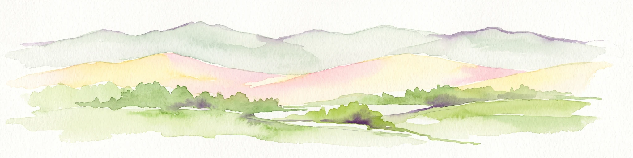
A horizontal watercolor painting showing rolling green and yellow hills with distant purple-toned forests against a white background.
Nature reserveThuringia
About 11 km away#3 closest

North

Keulaer Wald Nature Reserve: Geographic Overview of the Dün Plateau Forest in Thuringia

Mapped beech-dominated plenterwald and limestone escarpment terrain

Located in northern Thuringia, Keulaer Wald is a designated nature reserve characterized by its continuous beech canopy on shell limestone bedrock. This site serves as a vital protected area within the regional forest belt, offering high-elevation viewpoints over the surrounding Eichsfeld Basin and the distant Harz mountain range.

Area
2.97 km²
Established
1961
Relief
Mountain
Climate
Temperate
Watercolor illustration of a landscape featuring green fields, trees, a river, and distant hills under a pale sky
National parkThuringia
About 16 km away#4 closest

South

Hainich National Park: Protected Ancient Beech Forest Landscape in Thuringia, Germany

Regional geography and primeval forest boundaries

Hainich National Park occupies 75 square kilometers of the larger Hainich forest in western Thuringia. This canonical protected area is defined by its ancient beech woodland and ongoing forest restoration processes. The geography of the region, situated between Eisenach and Bad Langensalza, provides a critical example of primary forest dynamics and central European biodiversity, serving as an anchor for environmental research and landscape analysis.

Area
75 km²
Established
1997
IUCN
II
Climate
Temperate
A watercolor painting of a rolling, forested landscape with soft green and pink tones, featuring gentle hills and vegetation.
National parkThuringia
About 16 km away#5 closest

South

Nationalpark Hainich: Exploring the Geography of Thuringia's Beech Forest Wilderness

Mapped protected landscapes in the German heartland

Nationalpark Hainich protects one of the most important remaining deciduous woodlands in Central Europe. This detailed atlas entry covers the park's rolling terrain, the transition of its former training grounds into wild forest, and the geographic context of its position within the broader Thuringian landscape.

Area
75 km²
Established
1997
Relief
Upland
Climate
Temperate
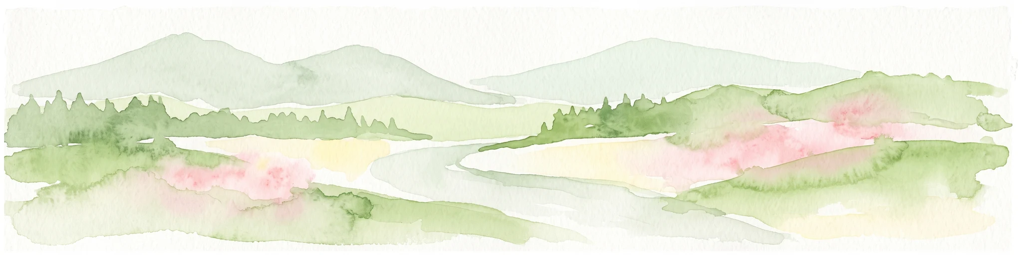
A wide watercolor painting showing a gentle river winding through green hills with pink flowering trees and pale blue mountains in the background.
Nature reserveUnstrut-Hainich-Kreis
About 17 km away#6 closest

West

Klosterschranne, Faulunger Stein Nature Reserve: Mapped Boundaries and Regional Geography

A protected Muschelkalk valley landscape in the Thuringia region

Klosterschranne, Faulunger Stein consists of a protected woodland and rock environment shaped by limestone erosion. The reserve features sharp valley spurs, calcareous springs, and cliffs that rise up to thirty meters, anchoring a larger network of habitats within the Upper Eichsfeld plateau. Users can examine the layered conservation status and distinct topographic features that define this ecologically significant German site.

Area
2.983 km²
Established
1996
IUCN
IV
Relief
Mountain
A soft watercolor illustration depicting layered green and pale pink rolling hills under a light sky.
Protected areaThuringia
About 19 km away#7 closest

North

Bleicheröder Berge: Geographic Profile and Protected Landscape Context in Thuringia

Mapping the forested ridges and Muschelkalk geology of the Thuringian region.

Investigate the Bleicheröder Berge as a vital protected area in Thuringia. This resource outlines the range's formation as a series of isolated hill remnants, its fossil-bearing limestone cliffs, and the botanical diversity characterizing its beech forests and rare orchid populations.

Area
16 km²
Relief
Mountain
Climate
Temperate
Access
Easy access
Nature reserveThuringia
About 19 km away#8 closest

Southwest

Werrahänge von Frankenroda bis Falken: A Deep Dive into Thuringian Protected Landscapes

Mapping limestone river canyons and unique forest habitats in Wartburgkreis.

This protected area captures a distinct geomorphological intersection of river-cut canyons and plateau ridges in Thuringia. The site preserves an intense mosaic of juniper heath, dry grasslands, and ancient beech forests, functioning as a vital link for species conservation. Examine the mapped boundaries, karst features, and the sculptural topography formed by the Werra river as it winds through the Muschelkalk rim of the Thuringian Basin.

Area
5.69 km²
Established
1999
IUCN
IV
Relief
Upland

Common questions about visiting, size, designation, and location context for Flachstal

Flachstal FAQs for park facts, access, geography, and protected area context

Find quick answers about Flachstal, including protected-area facts, park geography, trail and visitor context, and how the park fits into its surrounding country and regional landscape.
MoriAtlas Explorer

Continue Your Protected Areas Search Across the Global Atlas

Deepen your exploration by continuing the structured search for national parks and protected areas worldwide. Utilize the comprehensive filtering capabilities to compare different conservation landscapes and refine your understanding of global park geography. Discover more about the distribution and characteristics of protected natural areas.

Global natural geography