Mori Atlas logo
National parkHainich National Park

Map Hainich National Park's protected boundaries and discover its regional landscape setting.

Hainich National Park: A Protected Landscape in Thuringia's Geographic Context

(Nationalpark Hainich)

Hainich National Park, designated as a national park, represents a significant protected landscape within the region of Thuringia, Germany. This page offers an atlas-centric view, detailing the park's mapped geographic extent and its role within the broader regional geography. Explore Hainich National Park as a key protected area, understanding its boundaries and natural context for structured geographic discovery.

Ancient Beech ForestCentral Europe WildernessUNESCO World Heritage SiteGerman National ParkDeciduous ForestThuringia
Illustration showing a mountainous landscape with a river, waterfall, and forest.

Hainich National Park

National park

Park overview

Structured park overview, official facts, and landscape profile for Hainich National Park

Hainich National Park park facts, protected area profile, and essential visitor context
Review the core facts for Hainich National Park, including designation, size, terrain, visitor scale, habitats, and operating context in one park-focused overview.

About Hainich National Park

Hainich National Park represents a bold experiment in rewilding, aiming to restore a large section of central European forest to its primordial state. The park occupies terrain that was formerly used as a military training area, with approximately 50 square kilometers of deciduous forest that had been relatively undisturbed during the later decades of the 20th century. Unlike most German forests that are actively managed, Hainich allows natural processes to proceed without intervention, enabling the beech forest to develop according to ecological dynamics that have characterized European woodlands for millennia. The park forms part of a broader European network of old-growth beech forests recognized by UNESCO, connecting Hainich to similar protected areas across the Carpathians and other regions. Visitors can experience this wilderness through a network of trails, the prominent canopy walkway at Thiemsburg, and the Hainichblick observation tower that provides panoramic views across the regenerating forest landscape.

Quick facts and research context for Hainich National Park

Hainich National Park covers 75 square kilometers of former military training ground in Thuringia, Germany. It contains the nation's largest contiguous deciduous forest and was established in 1997 as the 13th German national park. In 2011, the park was inscribed as a UNESCO World Heritage Site as part of the Ancient and Primeval Beech Forests of the Carpathians and Other Regions of Europe. The park's core zone was expanded from 29% to 75% of its area in 2009, and over 4,875 hectares are certified as Wild-forest areas by the European Wilderness Society.

Park context

Deeper park guide and search-rich context for Hainich National Park

Hainich National Park history, landscape, wildlife, and travel context
Explore Hainich National Park through its history, landscape character, ecosystems, wildlife, conservation priorities, cultural context, and seasonal travel timing in a structured park guide built for atlas discovery and search intent.

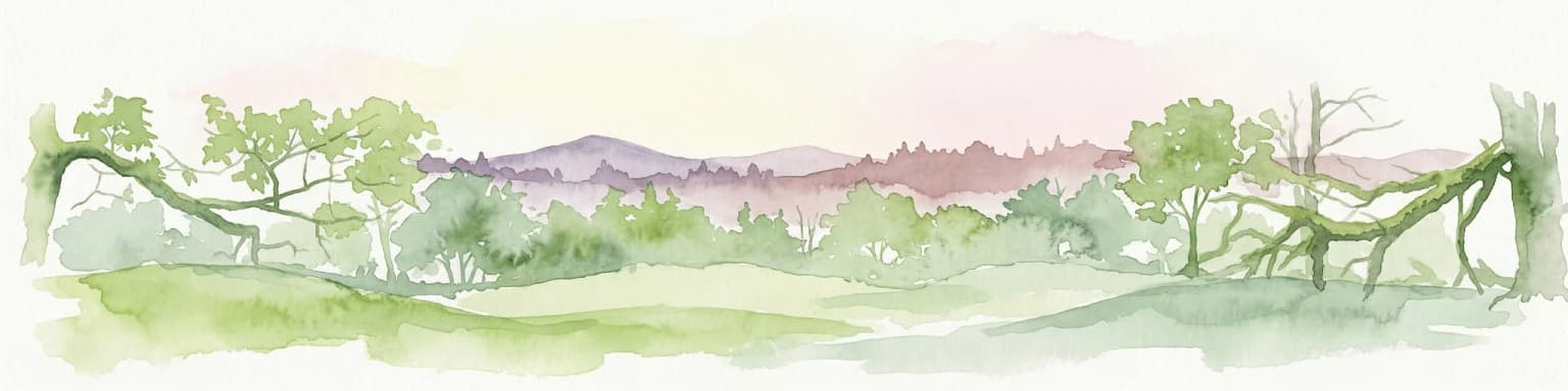
Why Hainich National Park stands out

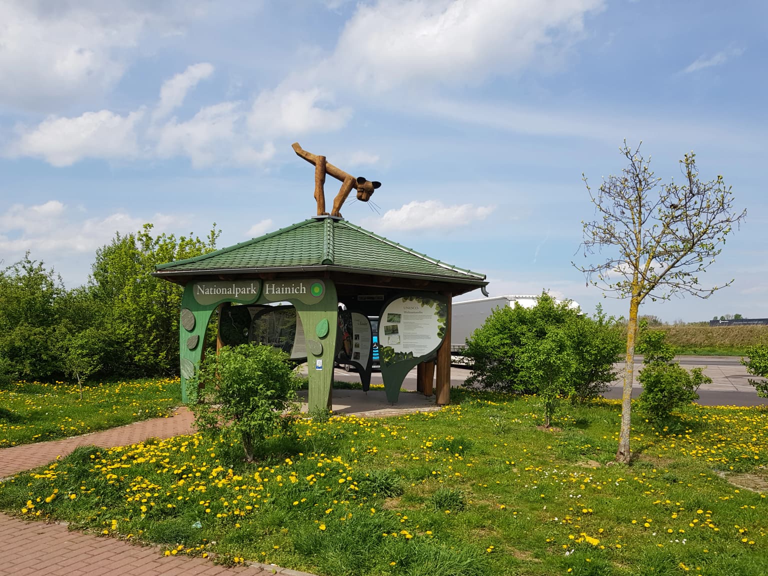
Hainich is best known for its exceptional ancient beech forests that have been allowed to develop naturally without human intervention, representing a rare example of primary forest in central Europe. The park is distinguished by its canopy walkway, a 530-meter elevated path that allows visitors to walk through the forest canopy near Thiemsburg, one of only two such structures in Germany when it was built. The presence of European wildcats, 15 bat species, and over 500 wood beetle species underscores the ecological significance of this large, unmanaged forest block. The park's designation as a UNESCO World Heritage site acknowledges its role as testimony to the ecological history of beech and forest dynamics in Europe since the Last Glacial Period.

Aerial view of dense forest with green and yellow foliage under a partly cloudy sky, with a small section of a walkway visible on the left.
Colorful treetops of Hainich National Park viewed from the Krähennest canopy walkway.

Hainich National Park history and protected-area timeline

Hainich National Park was established on December 31, 1997, becoming the thirteenth national park in Germany and the first and only such protected area in Thuringia. The park was created on land that had served as a military training ground, where decades of military use had inadvertently created conditions favorable to forest preservation. Following German reunification in 1990, the opportunity arose to convert this former military territory into a national park with the goal of allowing natural forest dynamics to restore the landscape. A significant expansion of the core protection zone occurred in July 2009, when the strictly protected area was increased from 29% to 75% of the park's total area, reflecting a strengthened commitment to wilderness preservation. The park's global significance was recognized in 2011 when it was added to the UNESCO World Heritage Site of Ancient and Primeval Beech Forests of the Carpathians and Other Regions of Europe.

Hainich National Park landscape and geographic character

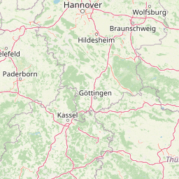
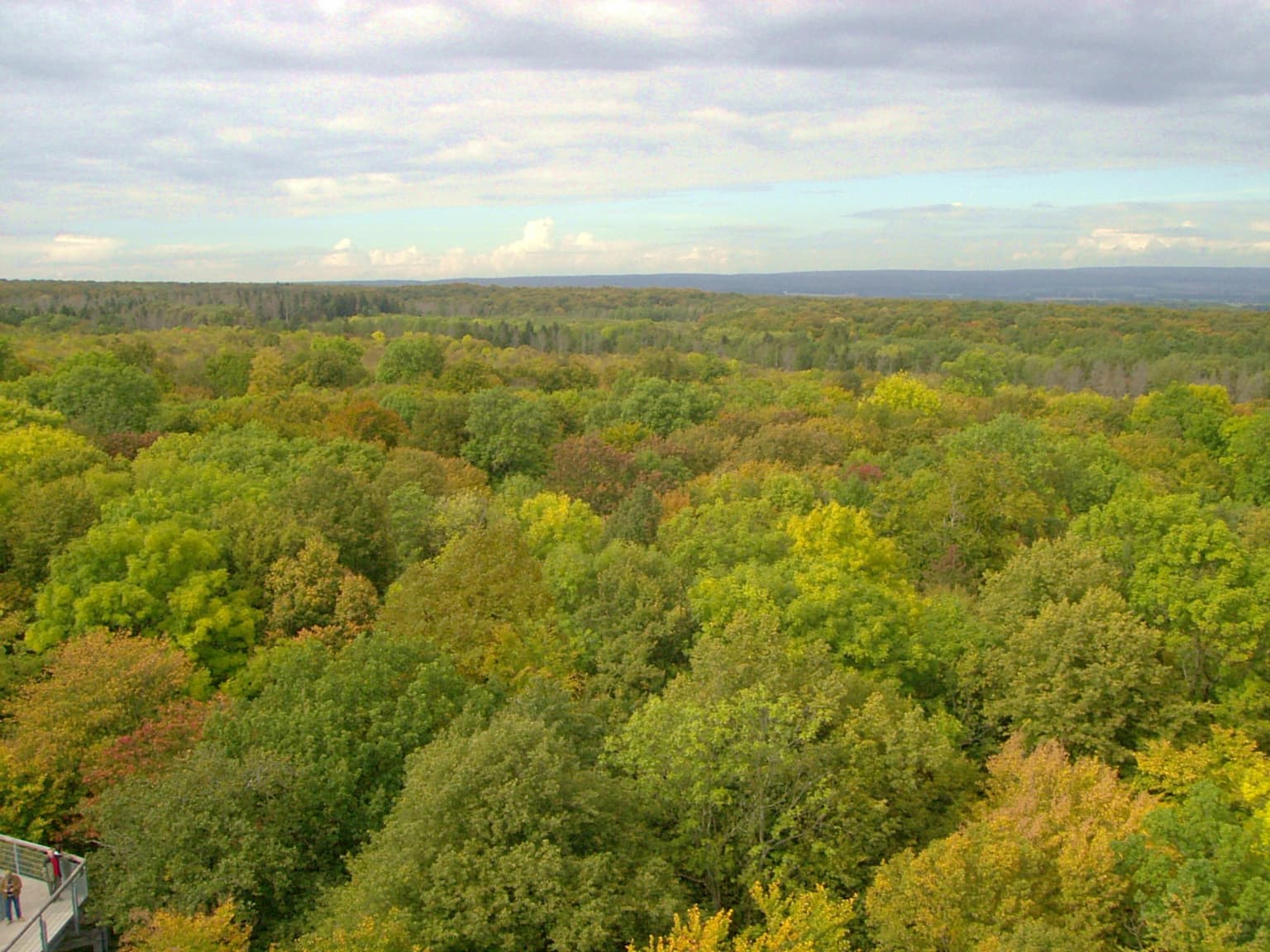
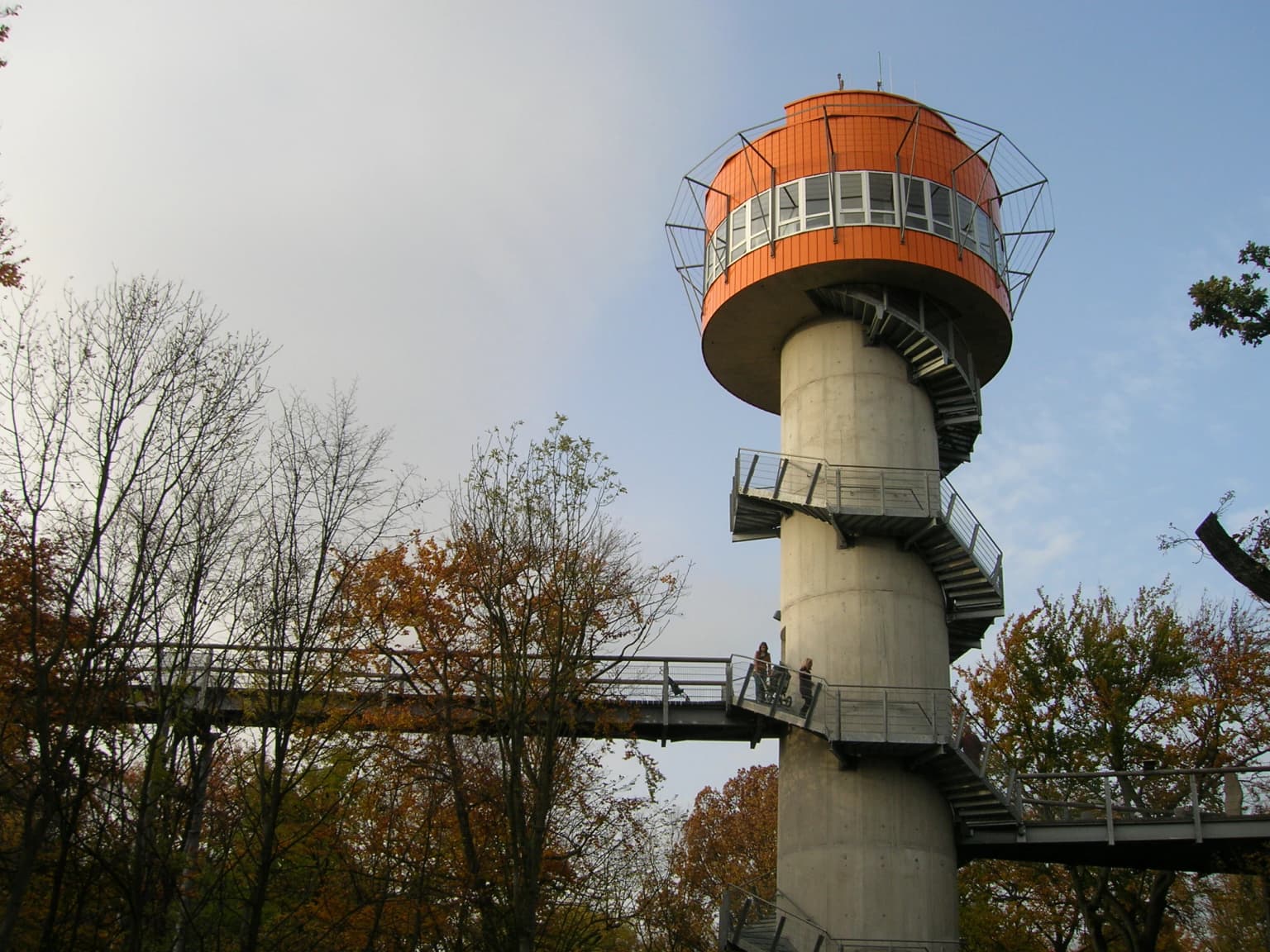
The park occupies a gently rolling landscape in western Thuringia, characterized by deciduous forest covering the hills and valleys between Eisenach, Mühlhausen, and Bad Langensalza. The terrain forms part of the larger Hainich upland, the largest contiguous deciduous forest area in Germany. The landscape includes areas that were cleared for military training in the early 1980s, which have since regenerated into young forest, creating a mosaic of mature old-growth woodland, middle-aged stands, and early successional areas. The southern portion of the park features a vast area where extensive clearing for military purposes created open ground that has since developed into a twenty-year-old young forest. The western section around the Harsberg offers higher ground with expansive views, while the eastern portion around Thiemsburg contains the canopy walkway that provides access to the forest canopy at elevations of 10 to 24 meters above ground.

Two red beetles on a green leaf
Red beech leaf beetles on a green leaf in Hainich National Park

Hainich National Park ecosystems, habitats, and plant life

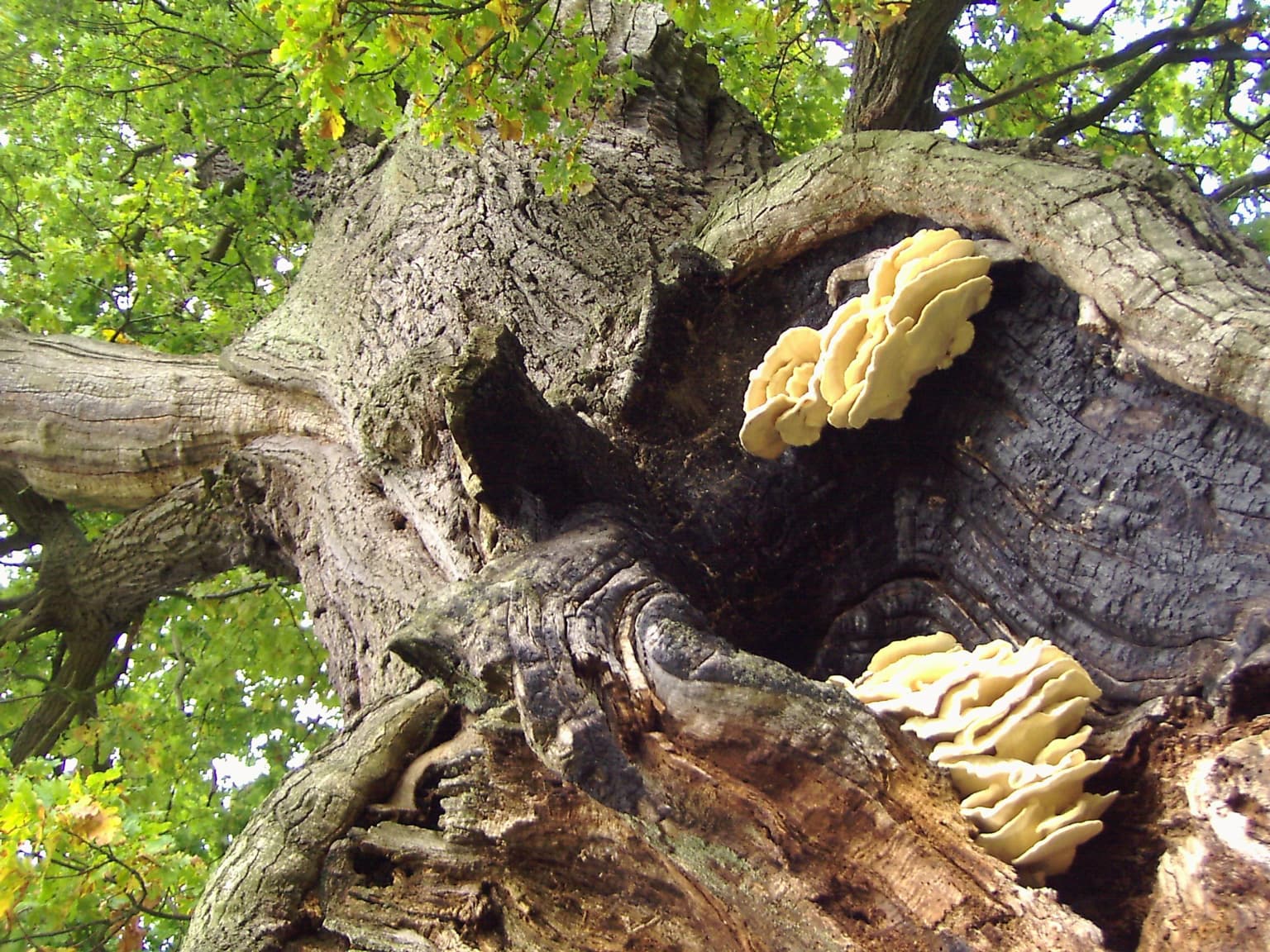
The ecological character of Hainich is defined by its extensive beech-dominated forest communities, representing a continuum from ancient old-growth stands to areas of more recent natural regeneration. European beech forms the dominant tree species, creating the layered canopy structure typical of central European deciduous forests. The forest also contains significant populations of ash trees, hornbeams, limes, maples, and the rare elsbeere. The understory supports a remarkable diversity of spring-flowering plants including spring snowflake, corydalis, liverleaf, early dog-violet, buttercup anemone, and wild garlic. The park's fungal diversity is exceptional, with over 1,600 species recorded to date and an expected total exceeding 3,000 when including lichen-forming species. Approximately 300 of the fungi are endangered or threatened with extinction, with some found nowhere else in Thuringia or extremely rare throughout Germany.

Green-roofed information pavilion for Hainich National Park with a wildcat sculpture on the roof, surrounded by grass with yellow flowers and trees
Information pavilion for Hainich National Park featuring a wildcat symbol on the roof

Hainich National Park wildlife and species highlights

Hainich supports a diverse fauna characteristic of mature deciduous forests in central Europe. The European wildcat, a shy and secretive predator, inhabits the park and serves as its symbol. Fifteen species of bats roost and hunt within the forest, utilizing the hollow trees and canopy spaces. Seven species of woodpeckers are present, including several species that require large deadwood substrates for nesting. The park is home to more than 500 species of wood beetles, representing a significant component of the invertebrate fauna that depends on decaying wood. These beetle communities play crucial roles in nutrient cycling and decomposition processes that sustain forest health. The invertebrate diversity extends to numerous insect species that form the base of the food web supporting the park's vertebrate fauna.

Close-up view of a large oak tree trunk with yellow fungi growing on its surface
Thick oak tree trunk with fungi in Hainich National Park

Hainich National Park conservation status and protection priorities

Hainich National Park embodies a conservation philosophy focused on allowing natural processes to restore ecosystem function without human management. The park represents Germany's contribution to a transnational network of old-growth beech forests recognized as World Heritage, acknowledging its global significance for preserving representative examples of Europe's forest ecosystems. The 2009 expansion of the core zone to 75% of the park's area marked a substantial commitment to wilderness protection, exceeding typical standards for German national parks. Nearly 4,875 hectares within the core zone have achieved certification as Wild-forest areas by the European Wilderness Society, recognizing their unmanaged, natural character. The protection of rare and endangered fungi, some found only in Hainich within Thuringia, creates special conservation responsibilities. The park serves as a living laboratory for understanding forest dynamics, with the University of Göttingen conducting ongoing geobotanical canopy research.

Hainich National Park cultural meaning and human context

While primarily focused on natural landscape preservation, Hainich contains elements of human heritage within its boundaries. The northern portion of the park features the Hünenburg area with the Hünenteich, where a Germanic cultural path was established in 2009. This trail features reconstructions of religious sites and sanctuaries discovered through excavations at the nearby Opfermoor Niederdorla, a sacrificial site that provides insight into Iron Age and Roman period religious practices in the region. The park encompasses areas that were part of the former Eisenach district, with several small villages and rural settlements along its edges. The landscape has been shaped by centuries of human use, transitioning from agricultural and forestry purposes to military training before becoming a protected wilderness.

Observation tower with spiral staircase and connecting walkway surrounded by trees with autumn foliage
Viewing tower on the treetop path in Hainich National Park

Top sights and standout views in Hainich National Park

The canopy walkway at Thiemsburg remains the park's signature visitor experience, offering unprecedented access to the forest canopy at heights of 10 to 24 meters, with the path extending 530 meters through the tree crowns. The Hainichblick observation tower, opened in June 2011, provides sweeping views across the regenerating southern forest area from the Generalshügel. The Urwald-Life-Camp at Harsberg offers educational programs for school groups and youth, while the Germanen Kultpfad provides a historical perspective on the region's ancient religious heritage. The visitor center in Bad Langensalza serves as the main gateway to the park, providing interpretation and orientation for visitors. The network of marked trails, including themed routes, allows visitors to explore the diverse forest environments and learn about the park's ecological restoration goals.

Wooden observation platform with a roof structure, part of a treetop walkway, surrounded by forest with several people visible on the platform
Information platform on the treetop walk in Hainich National Park

Best time to visit Hainich National Park

The park can be enjoyed throughout the year, though each season offers distinct experiences. Spring brings spectacular displays of wildflowers including spring snowflake, liverleaf, and buttercup anemone carpeting the forest floor, particularly impressive in April and May when the beech canopy has not yet fully leafed out. Summer offers full canopy cover and the opportunity to experience the canopy walkway with maximum leaf development, though trails can be warm. Autumn provides colorful foliage as the beech leaves turn golden and the forest floor becomes carpeted with fallen leaves. Winter offers a different perspective on the forest structure, with fewer visitors and the stark beauty of bare trees and the possibility of snow-covered trails. The visitor center in Bad Langensalza is open year-round, while trail conditions vary seasonally.

Park location guide

Geography guide, regional context, and park location map for Hainich National Park

Hainich National Park park geography, regions, and map view in Germany
Understand where Hainich National Park sits in Germany through a broader geographic reading of the surrounding landscape, nearby location context, and its mapped position within the national park landscape.

How Hainich National Park fits into Germany

Germany is a federal republic in Western and Central Europe with a population of over 83 million across sixteen constituent states. It is Europe's largest economy by nominal GDP and a major global exporter and importer. The capital is Berlin, and the country borders Denmark, Poland, Czech Republic, Austria, Switzerland, France, Luxembourg, Belgium, and the Netherlands.

Wider geography shaping Hainich National Park in Germany

Germany is located in Western and Central Europe, spanning 357,022 km². It borders Denmark to the north, Poland and the Czech Republic to the east, Austria and Switzerland to the south, and France, Luxembourg, Belgium, and the Netherlands to the west. The country has coastlines on the Baltic Sea and North Sea to the north, with the Alps located in the southern region.

Map view of Hainich National Park

Use this park location map to pinpoint Hainich National Park in Germany, understand its exact geographic position, and read its mapped placement within the surrounding landscape more clearly.

Pigeon | © OpenStreetMap contributors

Location context for Hainich National Park

Thuringia

Visualize the park's unique protected-area character, from its dense canopy to regenerating forest habitats, with a focus on visual discovery.

Hainich National Park Photos: Explore Germany's Ancient Beech Forest Landscapes
Browse a comprehensive gallery of Hainich National Park photos to understand its distinctive ancient beech forest landscapes and diverse habitats. Gain visual insights into the park's terrain, primeval woodlands, and ecological restoration efforts, tracing the protected area's unique environmental story.

Aerial view of dense forest with green and yellow foliage under a partly cloudy sky, with a small section of a walkway visible on the left.

Low-angle view of a tall beech tree trunk with green foliage and sunlight filtering through the canopy

Two red beetles on a green leaf

Green-roofed information pavilion for Hainich National Park with a wildcat sculpture on the roof, surrounded by grass with yellow flowers and trees

Close-up view of a large oak tree trunk with yellow fungi growing on its surface

Yellow wooden sign featuring black owl logo and 'Nationalpark Hainich' text, set against grassy field with tree in background

Observation tower with spiral staircase and connecting walkway surrounded by trees with autumn foliage

Wooden observation platform with a roof structure, part of a treetop walkway, surrounded by forest with several people visible on the platform

Aerial view of an elevated walkway winding through a dense green forest with a viewing platform visible along the path

Red and black striped insect on white wildflowers with green foliage background

Dirt trail junction in a forested area with a wooden shelter structure, surrounded by green trees and grass under a partly cloudy sky

Aerial view of a metal treetop walkway extending through a dense green forest

Wooden signpost with 'Hainich' text, metal gate, gravel path, and forest background

Tree trunk with multiple bracket fungi attached to bark, surrounded by forest vegetation.

A close-up of a beetle with black and yellow stripes on white flowers

Elevated wooden walkway with metal railings surrounded by dense green forest canopy

Park atlas

Map Nearby Protected Landscapes and Compare Forest National Parks Across Central Germany's Thuringia Region

Explore Other National Parks and Protected Areas Near Hainich National Park in Thuringia
After exploring Hainich National Park, continue your geographic discovery by browsing other national parks and diverse protected areas across Thuringia and the wider central German landscape. Compare varied forest ecosystems, trace connected conservation landscapes, and understand the regional spread of Germany's protected natural heritage through detailed geographic context.
Watercolor illustration of a mountainous landscape with forests and a winding path
National parkLower Saxony

Harz National Park: A Mapped Protected Landscape in Lower Saxony's Mountains

Explore geographic boundaries and regional terrain.

Harz National Park is a protected area defined by its unique mountain landscape and extensive forests in Lower Saxony, Germany. This MoriAtlas entry details its geographic scope, allowing for exploration of its mapped boundaries and its place within the regional geography. Understand the terrain, from its highest peaks to its alpine bogs, offering a structured view of this significant protected landscape for atlas-based discovery.

Area
247 km²
Established
2006
IUCN
II
Visitors
4M annual
Watercolor painting showing a landscape with hills, forest, and a body of water
National parkHesse

Kellerwald-Edersee National Park: Hesse's Protected Landscape Exploration

Mapped boundaries and geographic context for this German national park.

Navigate the protected landscape of Kellerwald-Edersee National Park, a key national park situated in the German state of Hesse. This atlas entry focuses on its precise geographic definition, mapped terrain features, and the broader regional context it occupies within central Germany. Gain structured insights into the park's conservation significance and its place in the mapped landscape.

Area
76.88 km²
Established
2004
Relief
Highland
Climate
Temperate
National park

Bohemian Switzerland National Park: Czech Sandstone Protected Landscape and Map Exploration

Discover its unique terrain and protected area geography.

Bohemian Switzerland National Park is a protected area in the Czech Republic known for its exceptional sandstone geology. This national park showcases a dramatic landscape of towering rock formations, deep gorges, and striking canyons, forming a significant part of the Elbe Sandstone Mountains. Through MoriAtlas, users can explore its mapped protected boundaries, understand its regional geographic context, and appreciate its unique natural heritage.

Area
79 km²
Established
2000
IUCN
II
Relief
Mixed relief
Watercolor painting showing a landscape with green hills, trees, and a river winding through the scene
National park

Saxon Switzerland National Park: Protected Area Geography and Map Exploration

Discover its mapped boundaries and regional landscape context.

Saxon Switzerland National Park, a protected national park in Germany, offers a distinct focus for geographic and atlas-based discovery. This page details the park's specific protected landscape, its mapped boundaries, and its contribution to the regional geography. MoriAtlas allows for in-depth exploration of such natural areas, providing essential context for understanding their place within broader natural systems and mapped terrains.

Area
93.5 km²
Established
1990
IUCN
II
Visitors
1.7M annual
Watercolor illustration of rolling green hills and meadows with patches of pink and yellow flowers
National parkNorth Rhine-Westphalia

Eifel National Park: North Rhine-Westphalia Protected Area Atlas

Explore mapped boundaries and regional geography.

Gain a structured understanding of Eifel National Park, a key protected area within Germany's North Rhine-Westphalia region. This page focuses on its geographic identity, detailing mapped boundaries and offering context within the state's broader natural landscapes. MoriAtlas enhances your exploration by presenting Eifel National Park as a distinct entity within a larger geographic framework, ideal for atlas-based research and understanding protected land distribution.

Area
107 km²
Established
2004
IUCN
II
Relief
Upland
Watercolor painting of a landscape featuring a stream, trees, and rolling hills
National parkLimburg

De Meinweg National Park: Unique Terraced Landscape and Protected Area in Limburg

National Park with exceptional reptile and amphibian biodiversity.

De Meinweg National Park is a remarkable protected landscape located in the Dutch province of Limburg, distinguished by its rare terraced topography unlike any other in the Netherlands. This national park, covering 1,800 hectares, is a key component of the transboundary Grenspark Maas-Swalm-Nette, bordering Germany. Its ecological significance is underscored by its status as a Natura 2000 site, with notable biodiversity, particularly among reptiles and amphibians, and regenerating raised bogs. MoriAtlas offers a map-centric view of this unique protected area, detailing its geographic context and landscape features for structured discovery.

Area
18 km²
Established
1995
IUCN
II
Relief
Upland
National parkLimburg

De Maasduinen National Park: Mapping the Longest River Dune System in the Netherlands

Protected Landscape and Dune Terrain in Limburg

Delve into the geographic identity of De Maasduinen National Park, a vital protected area in Limburg. This page offers detailed insights into its remarkable dune landscape, heathlands, and forests, emphasizing its role within the Dutch natural atlas and its connections to surrounding conservation areas.

Area
45 km²
Established
1996
IUCN
II
Watercolor painting showing green hills, a lake, and distant mountains under a light sky
National parkOverijssel

Sallandse Heuvelrug National Park: Overijssel's Glacial Ridge Protected Landscape

Explore its heathland geography and mapped park boundaries.

Sallandse Heuvelrug National Park represents a significant protected landscape within Overijssel, Netherlands, notable for its distinctive glacial ridges and extensive heathland ecosystems. As one of the country's most important conservation areas, it offers a unique opportunity to study the mapped topography and the geography of Dutch heathlands. Discover the protected area's contours and its place within the broader regional atlas context, appreciating its geological formations and ecological importance.

Area
35 km²
Established
2004
IUCN
II

Common questions about visiting, size, designation, and location context for Hainich National Park

Hainich National Park FAQs for park facts, access, geography, and protected area context
Find quick answers about Hainich National Park, including protected-area facts, park geography, trail and visitor context, and how the park fits into its surrounding country and regional landscape.
MoriAtlas Explorer

Continue Your Protected Areas Search Across the Global Atlas

Deepen your exploration by continuing the structured search for national parks and protected areas worldwide. Utilize the comprehensive filtering capabilities to compare different conservation landscapes and refine your understanding of global park geography. Discover more about the distribution and characteristics of protected natural areas.

Global natural geography