Mori Atlas logo
National parkKellerwald-Edersee National Park

Detailed geographic context and mapped boundaries for this key national park in Hesse.

Kellerwald-Edersee National Park: Central Germany's Protected Landscape Atlas

(Nationalpark Kellerwald-Edersee)

Kellerwald-Edersee National Park represents a significant protected landscape within the central German region of Hesse. This page provides an atlas-centric view, detailing the park's mapped boundaries and its geographic setting. Understand how this national park contributes to the regional conservation landscape and explore its terrain through structured map data.

beech forestsold-growth forestUNESCO World Heritage siteCentral European mountainsnature conservationGerman national parks
Illustrated landscape scene with a waterfall, mountains, green foliage, and a clear sky.

Kellerwald-Edersee National Park

National park

Park overview

Structured park overview, official facts, and landscape profile for Kellerwald-Edersee National Park

Kellerwald-Edersee National Park park facts, protected area profile, and essential visitor context
Review the core facts for Kellerwald-Edersee National Park, including designation, size, terrain, visitor scale, habitats, and operating context in one park-focused overview.

About Kellerwald-Edersee National Park

Kellerwald-Edersee National Park occupies a distinctive position among Germany's protected areas as one of the few national parks focused primarily on old-growth beech forest ecosystems in the low mountain regions of Central Europe. The park is located in the Kellerwald, a range of forested hills that form the northern edge of the Central German uplands, and it sits directly adjacent to the Edersee, a large reservoir created in the early twentieth century. The park's terrain is characterized by more than 50 individual hills reaching heights between 400 and 626 meters, with the Traddelkopf forming the highest point at 626.4 meters above sea level. The landscape was shaped by geological processes that created a series of ridges, valleys, and rock formations, particularly in the areas surrounding the Edersee's steep northern shores. The forests that cover nearly the entire park represent a remarkable ecological success story, having recovered from near-total deforestation during the early modern period to form today one of the most extensive and natural beech-dominated woodlands in Germany. The park is organized into three main sections surrounding the Edersee, with the southern portion being the largest and most significant for conservation. A visitor center called the NationalparkZentrum Kellerwald, opened in 2008, provides educational facilities and serves as the main entry point for visitors exploring the park's network of hiking trails.

Quick facts and research context for Kellerwald-Edersee National Park

Kellerwald-Edersee National Park lies in the Waldeck-Frankenberg district of northern Hesse, approximately 40 kilometers southwest of Kassel. The park encompasses the northern portion of the Kellerwald range, with elevations ranging from 194 meters near Affoldern to 626.4 meters at the Traddelkopf, the park's highest point. The landscape is dominated by beech forests growing on acidic, nutrient-poor soils, with smaller areas of oak woodland, gorge forests, and former agricultural clearing known as Triescher. The park is part of a larger nature park of the same name and is entirely uninhabited within its boundaries. Its core conservation objective focuses on allowing natural forest dynamics to proceed without human intervention, following the principle of "letting nature be nature."

Park context

Deeper park guide and search-rich context for Kellerwald-Edersee National Park

Kellerwald-Edersee National Park history, landscape, wildlife, and travel context
Explore Kellerwald-Edersee National Park through its history, landscape character, ecosystems, wildlife, conservation priorities, cultural context, and seasonal travel timing in a structured park guide built for atlas discovery and search intent.

Why Kellerwald-Edersee National Park stands out

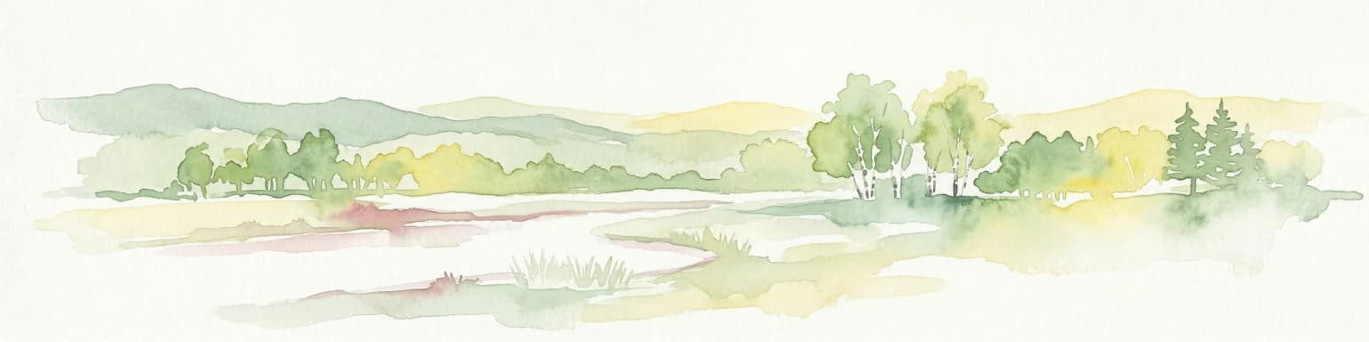
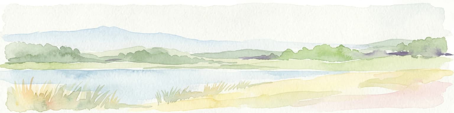
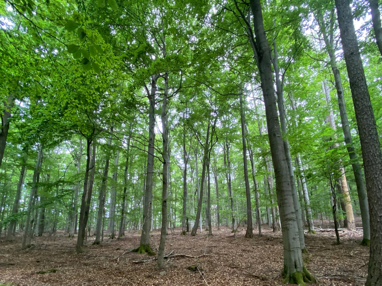
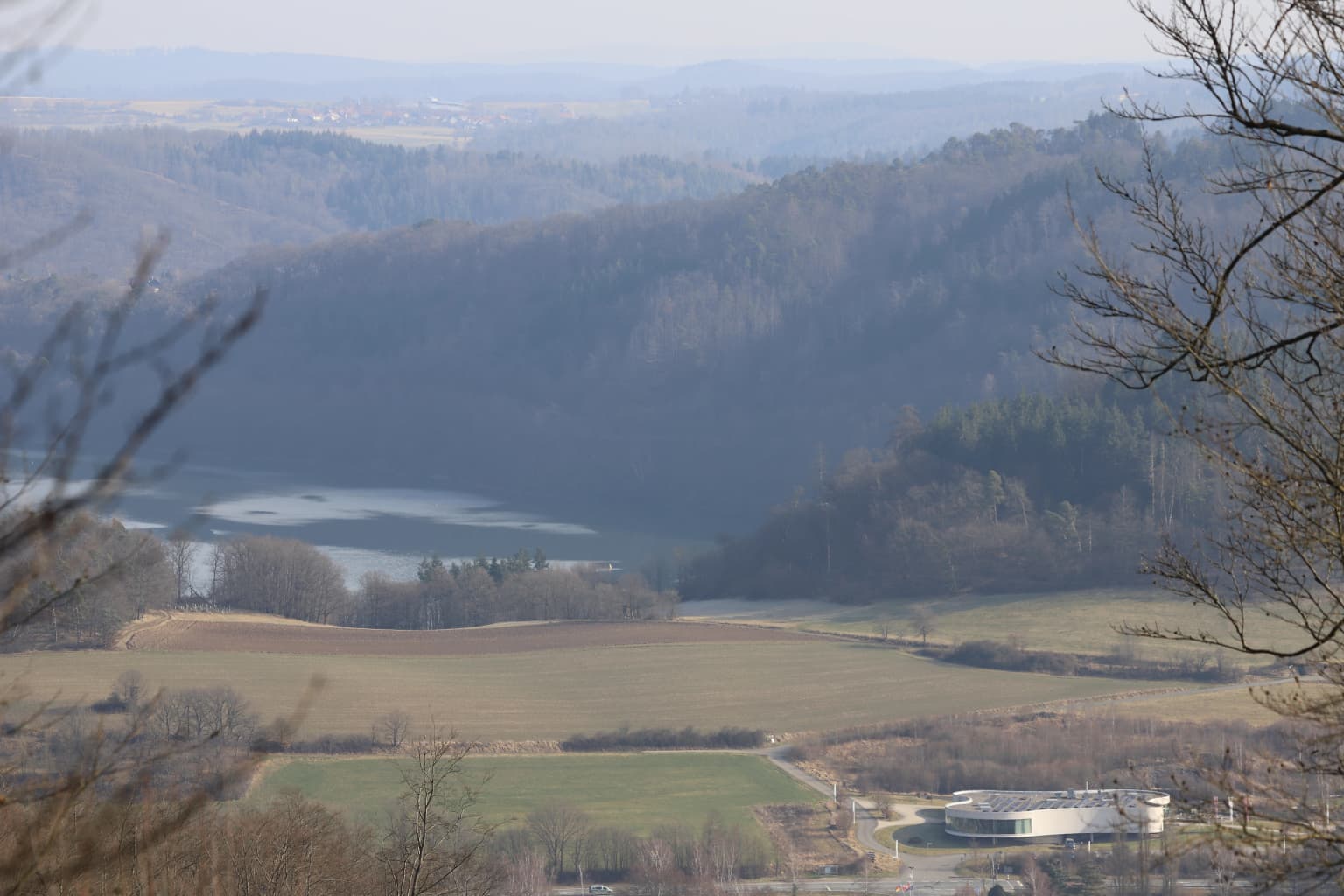
Kellerwald-Edersee is best known for its extensive old-growth beech forests, which represent some of the most ecologically significant woodland in Western Europe. The park protects the largest continuous area of near-natural beech forest in the German low mountain ranges, with trees exceeding 200 years old forming a distinctive feature of the landscape. The Wooghölle area on the Arensberg represents a true primeval forest that has never been cleared or managed by humans. Combined with the adjacent Edersee reservoir, the park offers a striking landscape of forested hills rising above a major lake, with granite cliffs, rocky outcrops, and hidden valleys adding geological interest. The park's inclusion in the UNESCO World Heritage list in 2011 brought international recognition to its beech forest conservation value.

Landscape view of a lake surrounded by dense green forests with rolling hills in the background under a partly cloudy sky
Panoramic view of Edersee lake and surrounding forested mountains from Ringelsberg

Kellerwald-Edersee National Park history and protected-area timeline

The establishment of Kellerwald-Edersee National Park in 2004 marked the culmination of more than a decade of advocacy by environmental organizations including NABU, BUND, WWF, and Greenpeace. The park was formally founded on January 1, 2004, under Hessian Minister-President Roland Koch and officially opened on May 25 of that year. Prior to national protection, the area had already received various forms of conservation status beginning in 1989, when several large nature reserves were established to protect old-growth beech forests. In 1991, the summit of the Locheiche was designated as a protection forest, and in 1998 the Edersee forest protection area and additional lands totaling 5,724 hectares were registered as an FFH site under European Union nature protection directives. The park was nominated for UNESCO World Heritage status in February 2007, and on June 25, 2011, the beech forest areas were inscribed as part of the transnational World Heritage site covering ancient beech forests across Europe. In October 2020, the park was expanded with additional areas north and east of the Edersee, increasing its total area by approximately one-third. The park achieved IUCN Category II certification in March 2011, becoming the first German national park to receive this designation.

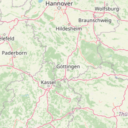
Kellerwald-Edersee National Park landscape and geographic character

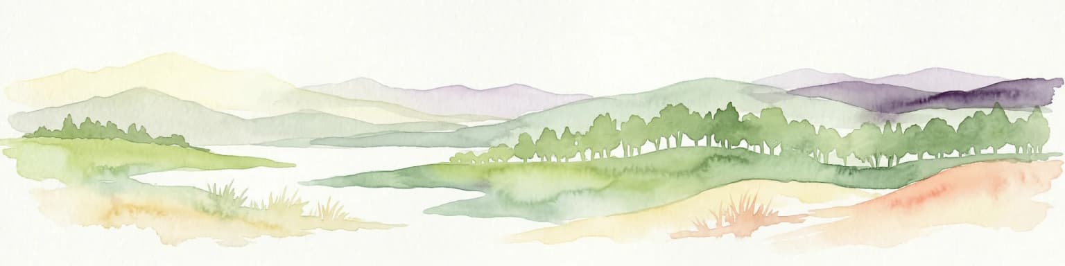
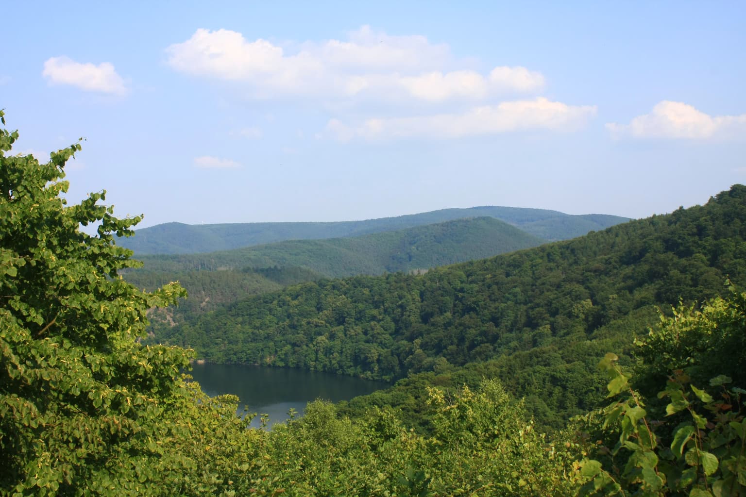
The Kellerwald-Edersee landscape presents a classic Central European low mountain environment shaped by geological forces and modified by centuries of forest dynamics. The Kellerwald range forms a series of roughly east-west trending ridges separated by narrow valleys, with the highest elevations concentrated in the park's central and southern portions. The park's terrain is dominated by rounded hills and granite rock formations, with notable features including the steep northern cliffs above the Edersee, the blocky debris slopes known as Blockschutthalden on several hills, and the narrow gorge forests that follow watercourses through the interior. The Edersee itself, though not included within the park boundaries, forms a prominent visual element from many vantage points within the protected area. The highest peaks include the Traddelkopf at 626.4 meters, the Ahornkopf at 604.1 meters, and the Dicker Kopf at 603.7 meters, all of which support old-growth beech forests. The park's lowest point lies at approximately 194 meters near Affoldern at the eastern edge of the Edersee basin. Numerous streams drain the park, feeding into the Eder River system, with the Wesebach, Banfebach, and Lorfe being the most significant watercourses.

Yellow signpost with black owl illustration and 'National-park' text, mounted on wooden post with left-pointing arrow, surrounded by forest trees and leaf-covered ground
Yellow national park sign with owl symbol mounted on wooden post in forest

Kellerwald-Edersee National Park ecosystems, habitats, and plant life

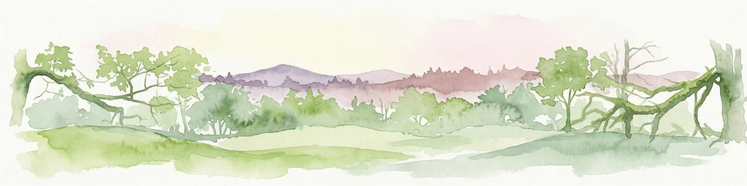
The ecological character of Kellerwald-Edersee is defined by its extensive beech forest ecosystems, which represent the natural climax vegetation for much of Central Europe. The dominant forest type is the Hainsimsen-Rotbuchenwald, or woodrush-beech forest, which thrives on the acidic, nutrient-poor soils typical of the Kellerwald region. At elevations above 500 meters, this transitions to montane beech forest communities that include species such as sycamore maple, ash, and elm. The park also contains smaller areas of oak dry forest, oak-hornbeam woodland, and gorge forests with linden, maple, and elm along watercourses. The forest structure includes significant areas of old-growth woodland, with the park's forest inventory showing that beech accounts for approximately 65 percent of the tree cover, while oaks make up about 9 percent and various conifers occupy roughly 23 percent of the area. The park contains over 600 vascular plant species, more than 270 lichen species, and 613 recorded species of large fungi, making it botanically diverse despite its relatively small size. The Wooghölle area on the Arensberg represents a rare example of continuous forest that has never been cleared, supporting unique ecological communities adapted to cool, shaded conditions.

Tall beech trees with green foliage and brown leaf-covered ground in a dense forest.
Tall beech trees in a dense forest reserve within Kellerwald-Edersee National Park.

Kellerwald-Edersee National Park wildlife and species highlights

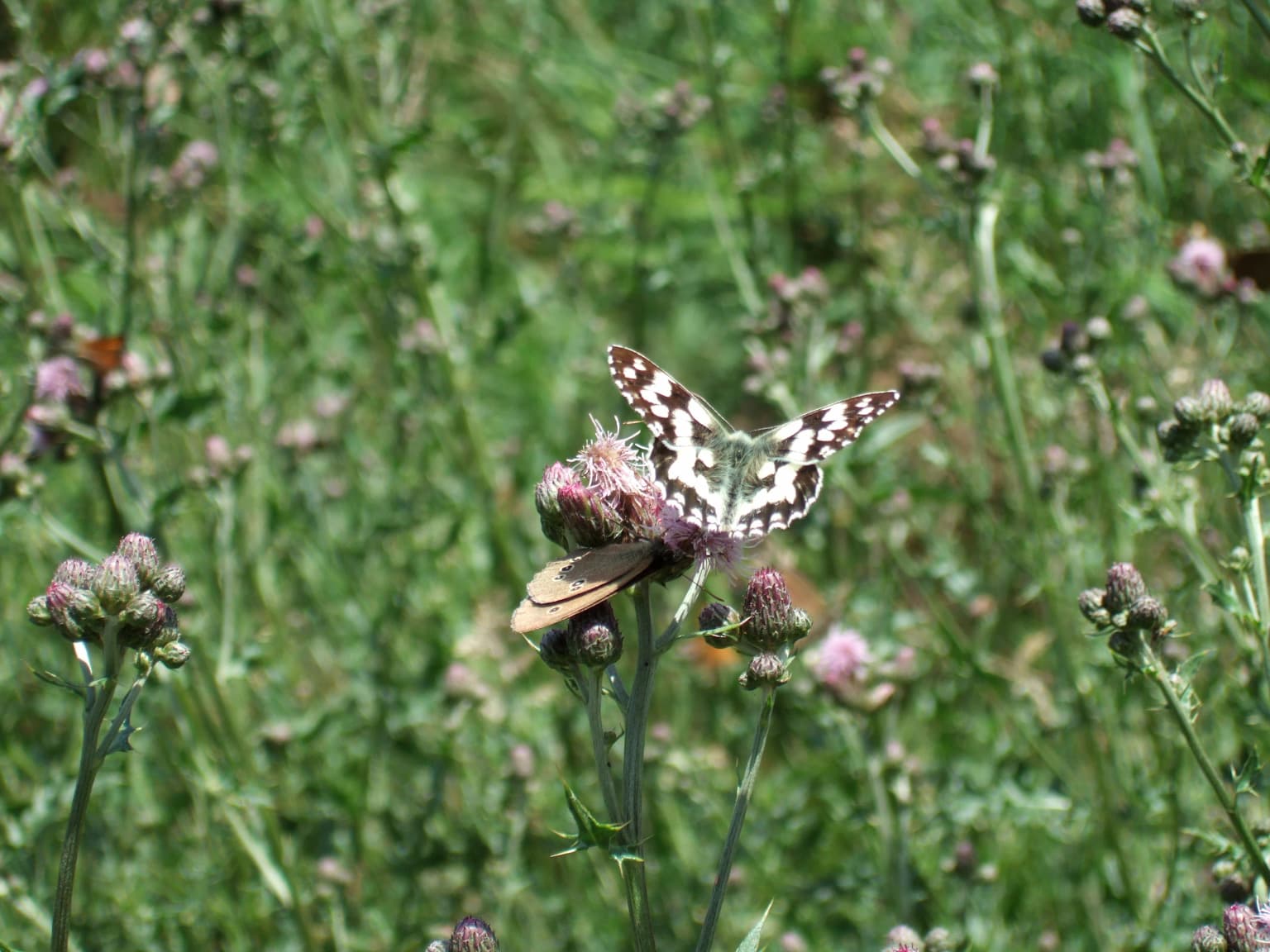
Kellerwald-Edersee supports a diverse community of wildlife species, with particular significance for forest-dwelling and cavity-nesting species. The mammalian community includes native large mammals such as red deer, roe deer, and wild boar, along with introduced species including mouflon and fallow deer that were released in the 1930s. Smaller mammals are well represented, with 44 mammal species documented including red fox, badger, pine marten, stone marten, weasel, and polecat. The European wildcat, considered extinct in the region for decades, was confirmed present in the park in 2007. The park is particularly significant for bats, with 15 of Germany's 24 bat species recorded, including the greater mouse-eared bat and Bechstein's bat, both classified as endangered. Bird life includes 75 breeding species, with the black stork being the largest breeding bird and the eagle owl nesting in the park's rocky cliffs. Woodpeckers are well represented with six of seven Central European species present, and the park supports important populations of birds associated with old-growth forest, including the stock dove, wood snipe, and collared dove. Invertebrates are exceptionally diverse, with 876 beetle species recorded, including seven primeval forest relic species, and 822 butterfly species documented through volunteer research efforts.

Wide landscape view showing Edersee lake, rolling hills, forested areas, and open fields with a building in the foreground
Panoramic view of Kellerwald-Edersee National Park with Edersee lake visible in the distance

Kellerwald-Edersee National Park conservation status and protection priorities

Kellerwald-Edersee represents one of Germany's most significant conservation achievements in recent decades, protecting what is described as a unique example of near-natural beech forest in Western Europe. The park's conservation model follows the principle of process protection, with approximately 85 percent of its area designated as a nature zone where no human intervention occurs, allowing natural forest dynamics to proceed unchecked. By 2014, roughly 92 percent of the park had transitioned to this strict protection status. The inclusion of the park's beech forests in the UNESCO World Heritage list in 2011 elevated its international conservation significance, with 1,467 hectares of the park designated as World Heritage area. The park maintains a management and maintenance zone covering about 5 percent of its area, primarily to preserve cultural landscape features such as the Triescher, traditional hay meadows that require ongoing grazing or mowing to prevent forest succession. The park has also undertaken active restoration work, including the removal of conifer monocultures, the elimination of drainage structures in streams, and the gradual removal of the historic game fencing that once surrounded much of the area. A wild animal management concept addresses the challenge of maintaining large mammal populations while allowing natural forest regeneration.

Kellerwald-Edersee National Park cultural meaning and human context

The Kellerwald region has a rich but relatively sparse human history, with evidence of human presence dating to the Bronze Age through archaeological finds of burial mounds within what is now the park. The region's name, Kellerwald, and its historical designation as the Ederhöhen or Ederberge reflect its long association with the nearby Eder River valley. Medieval settlement attempts in the area resulted in the creation of several village sites, including Eselsbach, Eschenbruch, Wellenhausen, Denninghausen, and others, all of which were abandoned by the late fifteenth century, leaving behind the Triescher clearings that remain as open grassland within the forest today. The park contains several historical structures including the ruins of the Quernstkirche on the Talgang, a church established around 800 on a former Germanic sacred site, and the ruins of the Siegelskirche on the Bracht. The area served as a hunting ground for the princes of Waldeck from the eighteenth century onward, with a game enclosure established in 1894 that eventually encompassed 47.46 square kilometers. The Bathildishütte, a hunting lodge built in 1894, remains as a historical feature within the park. A significant historical event was the battle fought on the Himmelreich in July 1760 during the Seven Years' War, where a Hessian corporal was killed and is buried at a site still maintained by his descendants' families.

Two butterflies on pink flower buds in a grassy meadow
Butterflies on flower blooms in the Fahrentriesch meadow

Top sights and standout views in Kellerwald-Edersee National Park

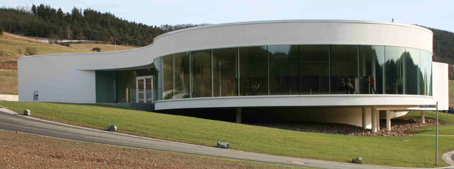
Kellerwald-Edersee offers visitors a combination of spectacular natural landscapes, excellent hiking infrastructure, and unique forest ecology. The Urwaldsteig Edersee trail, approximately 68 kilometers in length, provides access to the most significant old-growth forest areas, including the Wooghölle primeval forest on the Arensberg, the ancient oak stands of the Kahle Hardt, and the dramatic granite formations of the Daudenberg block field. The Kellerwaldsteig, a 156-kilometer circular trail, connects the national park with the surrounding nature park and passes through the historic Triescher areas. The NationalparkZentrum Kellerwald serves as an educational hub with exhibits on forest ecology and park history. The park's wildlife observation hide near the Wellenhausen valley offers opportunities to observe red deer, particularly during the autumn rutting season. The diversity of habitats, from rocky cliff faces to species-rich meadows, supports a remarkable array of plant and animal life within a relatively compact area, making the park particularly valuable for environmental education and scientific research.

Modern white building with large glass windows on a grassy hillside near a road, with hills in the background
Modern visitor center of Kellerwald-Edersee National Park, a key facility for park visitors

Best time to visit Kellerwald-Edersee National Park

The park can be visited year-round, though each season offers distinct experiences and considerations. Spring and early summer bring the forest into leaf and offer good conditions for wildlife observation, particularly for birds and the emerging insect communities. The beech forests reach their full structural complexity in summer, providing shade along the extensive trail network. Autumn is particularly significant for the park, as the beech trees display their characteristic golden-yellow foliage, and the red deer rutting season provides excellent opportunities for wildlife observation, especially from the wild observation hide near Wellenhausen. Winter reveals the park's structure differently, with bare trees exposing the地形 and the possibility of snow-covered ridges, though some trails may be less accessible. The park's relatively high elevation means that conditions can vary from the surrounding lowlands, and visitors should be prepared for changing weather throughout the year. The visitor center provides current information on trail conditions and any temporary closures.

Park location guide

Geography guide, regional context, and park location map for Kellerwald-Edersee National Park

Kellerwald-Edersee National Park park geography, regions, and map view in Germany
Understand where Kellerwald-Edersee National Park sits in Germany through a broader geographic reading of the surrounding landscape, nearby location context, and its mapped position within the national park landscape.

How Kellerwald-Edersee National Park fits into Germany

Germany is a federal republic in Western and Central Europe with a population of over 83 million across sixteen constituent states. It is Europe's largest economy by nominal GDP and a major global exporter and importer. The capital is Berlin, and the country borders Denmark, Poland, Czech Republic, Austria, Switzerland, France, Luxembourg, Belgium, and the Netherlands.

Wider geography shaping Kellerwald-Edersee National Park in Germany

Germany is located in Western and Central Europe, spanning 357,022 km². It borders Denmark to the north, Poland and the Czech Republic to the east, Austria and Switzerland to the south, and France, Luxembourg, Belgium, and the Netherlands to the west. The country has coastlines on the Baltic Sea and North Sea to the north, with the Alps located in the southern region.

Map view of Kellerwald-Edersee National Park

Use this park location map to pinpoint Kellerwald-Edersee National Park in Germany, understand its exact geographic position, and read its mapped placement within the surrounding landscape more clearly.

Pigeon | © OpenStreetMap contributors

Location context for Kellerwald-Edersee National Park

HesseWaldeck-Frankenberg

Mapped visual details of Kellerwald-Edersee National Park's ancient beech forests and low mountain terrain.

Visual Exploration of Kellerwald-Edersee National Park: Landscapes, Scenery, and Beech Forest Habitats
Browse photos of Kellerwald-Edersee National Park, revealing its UNESCO World Heritage beech forests, low mountain terrain, and protected ecosystems. These images offer crucial visual insight into the park's unique landscape character, key habitats, and its significant conservation value in Central Europe.

Landscape view of a lake surrounded by dense green forests with rolling hills in the background under a partly cloudy sky

Wooden signpost with multiple directional signs pointing to locations including EON, Standselbahn, Waldeck über, Hochapeicherbecken, and XTS Sparschwein, set against a forest background

Yellow signpost with black owl illustration and 'National-park' text, mounted on wooden post with left-pointing arrow, surrounded by forest trees and leaf-covered ground

Tall beech trees with green foliage and brown leaf-covered ground in a dense forest.

Wide landscape view showing Edersee lake, rolling hills, forested areas, and open fields with a building in the foreground

Pink Dianthus deltoides flowers with five petals surrounded by green grass and foliage

Two butterflies on pink flower buds in a grassy meadow

Modern white building with large glass windows on a grassy hillside near a road, with hills in the background

Green beech leaves on a thin branch with a blurred dark forest background

A beech forest scene with large trees, fallen leaves on the ground, and autumn foliage

Park atlas

Explore surrounding German protected landscapes and regional park geography for comparative insights.

Discover Nearby National Parks and Protected Areas Beyond Kellerwald-Edersee National Park
Explore other national parks and protected areas beyond Kellerwald-Edersee National Park, tracing the regional geography of Germany's central low mountain ranges. Compare diverse forest ecosystems and conservation landscapes to understand their mapped terrain and the broader spread of protected areas in the surrounding region.
Watercolor illustration of a landscape featuring green fields, trees, a river, and distant hills under a pale sky
National parkThuringia

Hainich National Park: Protected Landscape in Thuringia's Regional Geography

Mapped protected area boundaries and geographic context.

Hainich National Park stands as a protected national park, offering a detailed study in landscape and geography. This entry focuses on its specific mapped boundaries and its placement within the Thuringia region, providing users with clear geographic context. Discover the natural terrain and protected status of Hainich National Park, essential for understanding Germany's mapped conservation areas.

Area
75 km²
Established
1997
Climate
Temperate
Scope
Terrestrial
Watercolor illustration of a mountainous landscape with forests and a winding path
National parkLower Saxony

Harz National Park: A Mapped Protected Landscape in Lower Saxony's Mountains

Explore geographic boundaries and regional terrain.

Harz National Park is a protected area defined by its unique mountain landscape and extensive forests in Lower Saxony, Germany. This MoriAtlas entry details its geographic scope, allowing for exploration of its mapped boundaries and its place within the regional geography. Understand the terrain, from its highest peaks to its alpine bogs, offering a structured view of this significant protected landscape for atlas-based discovery.

Area
247 km²
Established
2006
IUCN
II
Visitors
4M annual
Watercolor illustration of rolling green hills and meadows with patches of pink and yellow flowers
National parkNorth Rhine-Westphalia

Eifel National Park: North Rhine-Westphalia Protected Area Atlas

Explore mapped boundaries and regional geography.

Gain a structured understanding of Eifel National Park, a key protected area within Germany's North Rhine-Westphalia region. This page focuses on its geographic identity, detailing mapped boundaries and offering context within the state's broader natural landscapes. MoriAtlas enhances your exploration by presenting Eifel National Park as a distinct entity within a larger geographic framework, ideal for atlas-based research and understanding protected land distribution.

Area
107 km²
Established
2004
IUCN
II
Relief
Upland
Watercolor painting of a landscape featuring a stream, trees, and rolling hills
National parkLimburg

De Meinweg National Park: Unique Terraced Landscape and Protected Area in Limburg

National Park with exceptional reptile and amphibian biodiversity.

De Meinweg National Park is a remarkable protected landscape located in the Dutch province of Limburg, distinguished by its rare terraced topography unlike any other in the Netherlands. This national park, covering 1,800 hectares, is a key component of the transboundary Grenspark Maas-Swalm-Nette, bordering Germany. Its ecological significance is underscored by its status as a Natura 2000 site, with notable biodiversity, particularly among reptiles and amphibians, and regenerating raised bogs. MoriAtlas offers a map-centric view of this unique protected area, detailing its geographic context and landscape features for structured discovery.

Area
18 km²
Established
1995
IUCN
II
Relief
Upland
National parkLimburg

De Maasduinen National Park: Mapping the Longest River Dune System in the Netherlands

Protected Landscape and Dune Terrain in Limburg

Delve into the geographic identity of De Maasduinen National Park, a vital protected area in Limburg. This page offers detailed insights into its remarkable dune landscape, heathlands, and forests, emphasizing its role within the Dutch natural atlas and its connections to surrounding conservation areas.

Area
45 km²
Established
1996
IUCN
II
Watercolor painting showing green hills, a lake, and distant mountains under a light sky
National parkOverijssel

Sallandse Heuvelrug National Park: Overijssel's Glacial Ridge Protected Landscape

Explore its heathland geography and mapped park boundaries.

Sallandse Heuvelrug National Park represents a significant protected landscape within Overijssel, Netherlands, notable for its distinctive glacial ridges and extensive heathland ecosystems. As one of the country's most important conservation areas, it offers a unique opportunity to study the mapped topography and the geography of Dutch heathlands. Discover the protected area's contours and its place within the broader regional atlas context, appreciating its geological formations and ecological importance.

Area
35 km²
Established
2004
IUCN
II
Watercolor painting of a peat bog ecosystem featuring green trees, pink and yellow vegetation, a body of water, and distant mountains
National park

De Groote Peel National Park: Mapped Boundaries of a Unique Raised Bog & Wetland

Protected area with exceptional birdlife and peat landscape.

De Groote Peel National Park represents a crucial protected landscape in the Netherlands, renowned as one of the last substantial raised bogs in Western Europe. Its terrain is characterized by a distinct blend of open lakes formed by historical peat extraction, heathland expanses, and sensitive peat swamps. This Ramsar-designated wetland is a vital habitat for numerous bird species, offering unique opportunities for landscape context and atlas exploration of its ecological significance and mapped geographic features.

Area
13.4 km²
Established
1993
IUCN
II
Relief
Lowland
Watercolor illustration of a park landscape with a winding stream, grassy fields, and distant hills
National parkGelderland

Veluwezoom National Park: Protected Landscape Atlas and Gelderland Geography

Explore oldest Dutch national park, heathlands, and glacial terrain.

Veluwezoom National Park is the Netherlands' inaugural national park, located in Gelderland. This page provides an atlas-driven exploration of its protected landscape, characterized by rolling heathlands, ancient forests, and dramatic glacial push moraines. Users can discover the park's geographical features, mapped boundaries, and its significance as a conserved natural area within the Veluwe region.

Area
50 km²
Established
1930
IUCN
II

Common questions about visiting, size, designation, and location context for Kellerwald-Edersee National Park

Kellerwald-Edersee National Park FAQs for park facts, access, geography, and protected area context
Find quick answers about Kellerwald-Edersee National Park, including protected-area facts, park geography, trail and visitor context, and how the park fits into its surrounding country and regional landscape.
MoriAtlas Explorer

Continue Your Protected Areas Search Across the Global Atlas

Deepen your exploration by continuing the structured search for national parks and protected areas worldwide. Utilize the comprehensive filtering capabilities to compare different conservation landscapes and refine your understanding of global park geography. Discover more about the distribution and characteristics of protected natural areas.

Global natural geography