
Mori Atlas logo
Park earthquake history

A structured repository of recorded seismic events associated with the surrounding geography.

Historical Earthquake Records and Seismic Activity Near Flaming Gorge National Recreation Area

This historical catalogue provides a comprehensive view of documented seismic activity in the vicinity of Flaming Gorge National Recreation Area. Users can examine individual event data including earthquake magnitudes, recorded depths, and calculated epicentre distances relative to the park boundaries. The collection offers a clear, data-driven perspective on regional seismic history derived from USGS records.

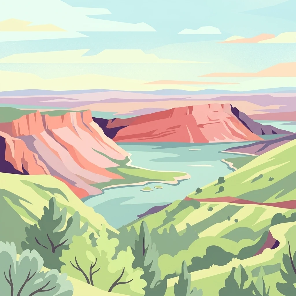
A digital illustration of a landscape featuring red sandstone cliffs dropping into a blue reservoir, with green hills in the foreground and a pale sky.

A vast reservoir and red canyon country spanning the Wyoming-Utah border, shaped by the Green River.

Flaming Gorge National Recreation Area

Flaming Gorge National Recreation Area is a large United States national recreation area straddling the border between southwestern Wyoming and northeastern Utah. Its centerpiece is the long, winding Flaming Gorge Reservoir, formed by the Green River and flanked by striking red sandstone cliffs that gave the area its dramatic name. The recreation area protects a wide corridor of canyon country, high desert terrain, forested uplands, and a major stretch of water that defines both the landscape and the visitor experience. It is administered by the Ashley National Forest and combines hydropower infrastructure with extensive outdoor recreation opportunities such as boating, fishing, camping, hiking, and rafting along the Green River below the dam. Flaming Gorge stands out as one of the signature reservoir-based recreation landscapes of the American West, blending engineering, river history, and colorful canyon geology into a single protected destination.

Location
United States of America
Park type
Protected area
Established
1968
Area
839.2 km²
Flaming Gorge National Recreation Area Map and Geography

Review Flaming Gorge National Recreation Area records by depth and distance

Study earthquakes near Flaming Gorge National Recreation Area

The Flaming Gorge National Recreation Area earthquake view positions reported epicentres around the reservoir and Green River canyon by calculated protected-area distance, not by an asserted link to its red cliffs or dammed waters. Each entry presents a date, magnitude, depth, locality, source, and distance for historical comparison while avoiding claims about landscape effects, current hazard, or future activity.

Sort by
Magnitude
Location

This page describes catalogued earthquakes associated with the park by epicentre location and distance. It does not establish causation, assess current danger, or predict future earthquakes.

No earthquake records match the current filters

Park atlas

Beyond Flaming Gorge National Recreation Area earthquake records

More parks after Flaming Gorge National Recreation Area

The atlas follows Flaming Gorge National Recreation Area earthquake history with a separate park collection. Those destinations are not portrayed as sharing gorge landscapes, recreation status, earthquake evidence, geology, geographic proximity, seismic relevance, hazards, risk, or equal record scope.
Watercolor painting of a peaceful mountain valley landscape, showing a small winding stream in the foreground, grassy meadows, clusters of pine trees, and rolling mountain peaks in a soft, sunset-colored sky.
Protected landscapeWyoming
117 km away#1 closest

North

Shoshone National Forest: A Comprehensive Map and Geography of America's Oldest National Forest

Rugged wilderness and glacial peaks in Wyoming

Discover the immense geographic scale of Shoshone National Forest, which protects a diverse landscape ranging from sagebrush valleys to 13,000-foot granite summits. This atlas overview details its role within the Greater Yellowstone Ecosystem and its expansive, federally designated wilderness areas, offering a clear perspective on its volcanic and glacial terrain.

Area
9,992.69 km²
Established
1891
IUCN
VI
Visitors
500K annual
A pale, wide watercolor landscape illustration depicting mountain peaks above a line of evergreen trees and a flat foreground.
Protected areaWyoming
129 km away#2 closest

North

Popo Agie Wilderness: Protected Landscapes in the Wyoming Wind River Range

High-altitude alpine terrain and glacial basins

The Popo Agie Wilderness in Wyoming encompasses a dramatic vertical landscape, ranging from forested valleys to alpine summits above 13,000 feet. This protected area features the iconic Cirque of the Towers, dense hydrological networks of glacial tarns, and expansive granite formations that anchor its identity within the Greater Yellowstone Ecosystem.

Area
412.3 km²
Established
1984
IUCN
Ib
Relief
Mountain
A soft, minimalist watercolor painting of a serene lake nestled among rolling hills under a gentle, pastel-toned sky.
Protected landscapeWyoming
165 km away#3 closest

North

Fitzpatrick Wilderness: Exploring the Rugged Protected Landscapes of Western Wyoming

A core alpine environment within the Wind River Range.

Fitzpatrick Wilderness represents one of the most uncompromisingly wild segments of the Wind River Range, featuring persistent glaciers, dramatic U-shaped valleys, and high granite spires. This protected landscape offers a deep look into the alpine geography of Wyoming, preserved under the Wilderness Act to maintain its rugged character, remote glacial cirques, and intricate mountain ecosystems.

Area
803.4 km²
Established
1976
IUCN
Ib
Relief
Mountain
A watercolor painting showing a panoramic view of rolling green mountains with a winding stream through a forested valley.
Protected landscapeUtah
166 km away#4 closest

Southwest

Manti, La Sal National Forest: Geographic Overview of Utah's Mountain and Canyon Landscapes

Mapped protected forest boundaries across the Colorado Plateau

Spanning over one million acres, Manti, La Sal National Forest defines a critical segment of Utah geography. This protected landscape encompasses diverse terrain including subalpine mountains, aspen-rich uplands, and deep canyon networks. Use this atlas to examine the distinct environmental characteristics that separate the northern forested plateaus from the southern wilderness canyons.

Area
5,143.09 km²
Established
1950
IUCN
V
Visitors
900K annual
A soft watercolor illustration depicting layered green hills in the foreground with faint mountain outlines in the background against a white background.
Wildlife reserveUtah
168 km away#5 closest

West

Mount Timpanogos Wilderness: Mapping the Protected Alpine Landscape and High Wasatch Terrain

An iconic Utah protected area within the northern Wasatch Range.

Mount Timpanogos Wilderness preserves a dramatic segment of the Wasatch Range, centering on an iconic summit that rises above glacial basins and forested slopes. This protected area offers a distinct study of alpine geology, featuring high-altitude cirques, steep ridges, and the prominent presence of Emerald Lake. As a critical piece of Utah wilderness, it anchors the skyline above the urban corridor, providing a concentrated look at regional mountain ecosystems and rugged natural terrain.

Area
42.56 km²
Established
1984
IUCN
Ib
Relief
Mountain
Wildlife reserveUtah
168 km away#6 closest

West

Lone Peak Wilderness: Protected Alpine Geography and Wasatch Range Map Insights

Rugged glacial terrain and granite summits in Northern Utah

Lone Peak Wilderness represents a dramatic intersection of high-mountain wilderness and urban geography. Rising from the Salt Lake and Utah Valleys, its alpine terrain features jagged granite peaks, persistent snowfields, and steep glacial canyons. This protected landscape remains a critical reference for understanding the ecological and topographical character of the central Wasatch Range and Utah's wilderness preservation history.

Area
121.76 km²
Established
1978
IUCN
Ib
Relief
Mountain
Wildlife reserveUtah
173 km away#7 closest

Northwest

Mount Naomi Wilderness: Mapping High-Altitude Protected Landscapes in Northern Utah

Alpine summits, forested ridges, and subalpine lake basins

Situated in the Bear River Range of northern Utah, Mount Naomi Wilderness stands as a protected corridor of rugged mountain terrain. This wilderness area preserves a diverse high-elevation environment, spanning from the steep western canyons of the Logan River to the prominent summits of Naomi Peak. It serves as a vital point of geographic interest for understanding the subalpine ecosystems and wilderness boundaries within the Uinta-Wasatch-Cache National Forest.

Area
180.18 km²
Established
1984
IUCN
Ib
Relief
Mountain
A pale watercolor painting showing a wide, panoramic view of layered mountains with light green and muted red hills in the foreground and clusters of pine trees.
Wildlife reserveUtah
About 174 km away#8 closest

West

Mount Olympus Wilderness: Geographic Overview of the Iconic Wasatch Range Protected Landscape

Steep granite massif and alpine terrain in northern Utah

Explore the distinct topography of Mount Olympus Wilderness, a protected sanctuary in Utah featuring soaring granite outcrops and deep drainage systems. The park is anchored by a recognizable twin-peak silhouette that rises abruptly from the Salt Lake Valley, encompassing high alpine ridges and one of the deepest known cave systems in the United States within its rugged forested boundaries.

Access
Easy access
MoriAtlas Explorer

Explore the Geographic Boundaries and Terrain of Flaming Gorge National Recreation Area

Trace the winding reservoir shoreline and canyon geology that define this major protected area. Through the MoriAtlas data, visualize the intersection of forested uplands and desert cliffs that make this region a landmark of western geography and water-based protected landscapes.