
Mori Atlas logo
Nature reserveForêt classée de la Lama

Understanding the geological depression and protected boundaries of this vital forest ecosystem

Forêt classée de la Lama: Mapping the Dense Semi-Deciduous Forest of Southern Benin

The Forêt classée de la Lama represents one of the most critical semi-deciduous forest remnants within the Dahomey Gap of southern Benin. Situated in a geological depression of Eocene marls and vertisols, this nature reserve functions as a vital refuge for primate populations and specialized plant species. This atlas entry details the physical terrain, mapped boundaries, and the ecological significance of this protected landscape.

dense semi-deciduous forestDahomey Gapclassified forest reservesubequatorial climatevertisolsEocene depression
A flat-style digital illustration of a waterfall cascading off a rocky cliff into a river, surrounded by lush green forest, palm trees, and a hazy sky at sunset.

Forêt classée de la Lama

Nature reserve

Park overview

Structured park overview, official facts, and landscape profile for Forêt classée de la Lama

Forêt classée de la Lama park facts, protected area profile, and essential visitor context

Review the core facts for Forêt classée de la Lama, including designation, size, terrain, visitor scale, habitats, and operating context in one park-focused overview.

About Forêt classée de la Lama

The Forêt classée de la Lama is a classified forest reserve located in southern Benin, straddling the communes of Toffo in the Atlantique department and Zogbodomey in the Zou department. Designated as a classified forest in 1946, it occupies a position of considerable ecological significance within West Africa because it lies inside the Dahomey Gap, a coastal stretch where drier conditions interrupt the belt of dense humid forests that otherwise runs along the Gulf of Guinea.

Geologically and ecologically, the reserve is defined by the Lama depression, a roughly elongated cut into the southern Benin's sedimentary basin. Within this depression, Eocene marls and clays are exposed at the surface and give rise to vertisols, the heavy, swelling clay soils that shape both water retention and vegetation patterns. The climate is subequatorial, marked by four seasons and irregular, but persistent humidity: even during the dry season, fog often lingers late into the morning, sustaining conditions that allow semi-deciduous forest to persist in an otherwise savanna-dominated landscape.

Historically, the original 16,250-hectare forest block was progressively reduced between 1946 and 1986 by agricultural clearing and bush fires, prompting the development of a management plan that now protects a remnant central nucleus of approximately 4,759 hectares, surrounded by plantation belts designed to shelter the core while providing timber and fuelwood to surrounding communities. This combination of strict core protection and surrounding land-use planning has become a model for integrated forest management in Benin and a focal point of research on forest dynamics, biodiversity, and human-forest interactions.

The forest's identity is closely tied to its primate fauna. It hosts a remarkable proportion of Benin's primate species, including the red-bellied monkey, a subspecies endemic to Benin, as well as other monkeys, duikers, and bush pigs, while its bird list reflects a mix of forest, savanna, and generalist species. For the surrounding Fon and Holli communities, Lama has long served as a source of bushmeat, medicinal plants, mushrooms, and non-timber forest products, and more recently as a setting for ecotourism initiatives. Together, these qualities make the Forêt classée de la Lama an exceptionally informative example of how a fragmented West African forest can be conserved, studied, and integrated with the livelihoods of nearby populations.

Quick facts and research context for Forêt classée de la Lama

The Forêt classée de la Lama is a classified forest reserve in southern Benin, formally protected since 1946 and spanning the Atlantique and Zou departments across the communes of Toffo and Zogbodomey. It covers a total historic extent of 16,250 hectares, though anthropogenic pressure reduced the remaining natural forest core to roughly 4,759 hectares by the late 1980s, leading to a management plan centered on a protected central nucleus surrounded by plantations.

The reserve lies within the Dahomey Gap, a coastal dry zone that bisects the West African humid forest belt, making it one of the most important surviving refuges of dense semi-deciduous forest in the region. Its terrain is shaped by the Lama depression, an Eocene sedimentary basin where marls, clays, and vertisols dominate, and average elevation is around 60 meters.

Protection and recognition

Examine the documented terrestrial conservation scope and recognition history for Forêt classée de la Lama.

Forêt classée de la Lama Protection Status and Official Designation Facts

Forêt classée de la Lama maintains a documented terrestrial protection scope within its registered regional boundary. Structured conservation records compile available designation data and management governance parameters for analytical review.

Protection details

Protection scope
Terrestrial
Transboundary protection
No
Core area
47.59 km²
Park context

Deeper park guide and search-rich context for Forêt classée de la Lama

Forêt classée de la Lama history, landscape, wildlife, and travel context

Explore Forêt classée de la Lama through its history, landscape character, ecosystems, wildlife, conservation priorities, cultural context, and seasonal travel timing in a structured park guide built for atlas discovery and search intent.

Why Forêt classée de la Lama stands out

The Forêt classée de la Lama is best known for being one of the last substantial remnants of dense semi-deciduous forest within the Dahomey Gap, the savanna corridor that breaks the continuity of West Africa's humid forests. Its location in a depression of Eocene marls and clays, with characteristic vertisols and persistent fog during the dry season, gives it a distinctive microclimate and a flora that includes species such as Dialium guineense, Diospyros mespiliformis, Celtis brownii, and Afzelia africana. The reserve is also distinguished as a key site for primate conservation in Benin, particularly for the red-bellied monkey (Cercopithecus erythrogaster erythrogaster), a subspecies considered endemic to Benin and frequently treated as a flagship species for protecting the wider forest ecosystem. Combined with its rich birdlife and its role as a biodiversity refuge in an otherwise heavily altered landscape, the Lama forest stands out as both a conservation landmark and a living laboratory for West African forest ecology.
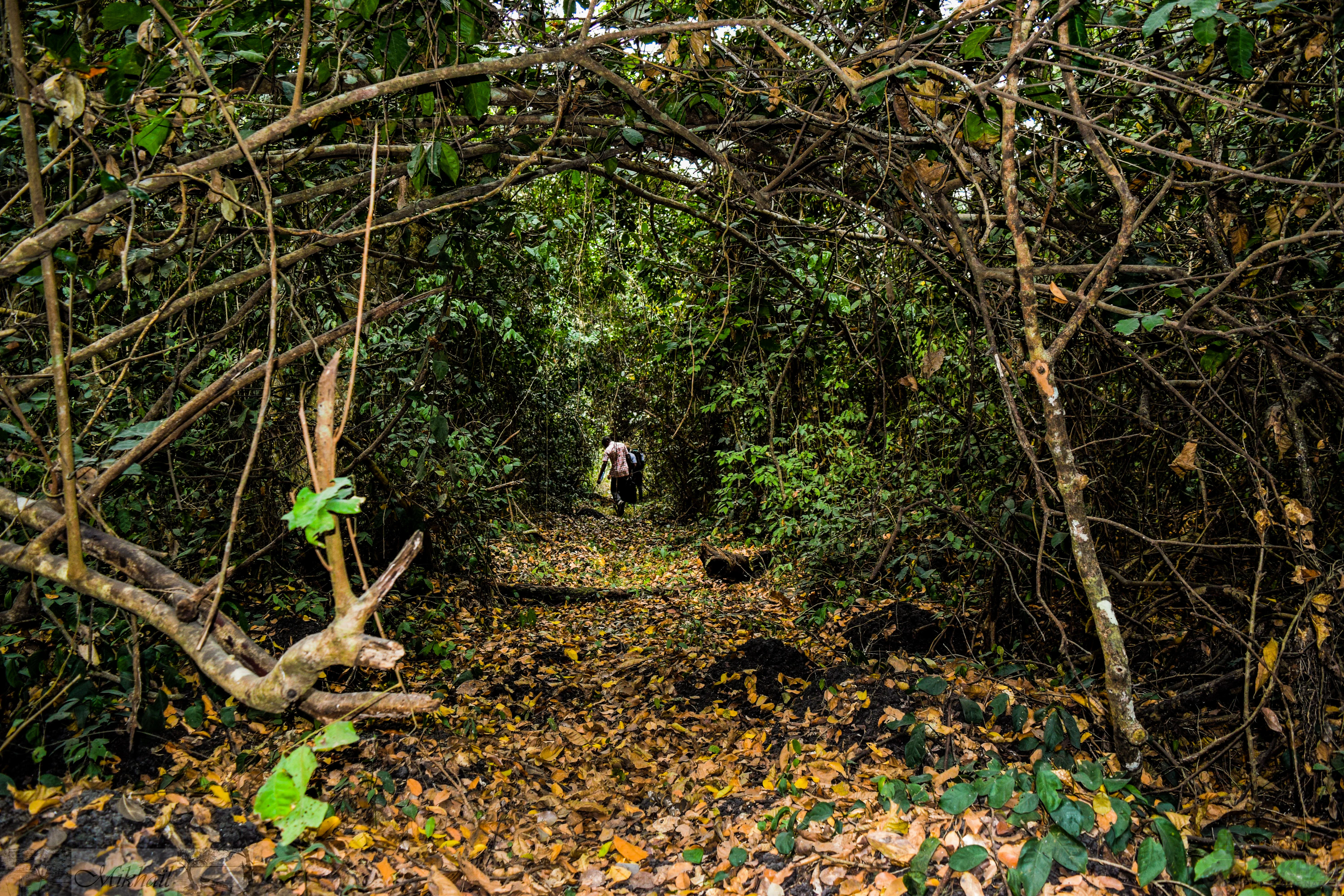
A narrow dirt trail covered in fallen leaves passes through a thick, leafy green forest tunnel in the Lama Forest.
A shaded walking path winding through the dense canopy of the Lama Forest.

Forêt classée de la Lama history and protected-area timeline

The forest that is today the Forêt classée de la Lama received formal protection in 1946, when it was officially registered among Benin's classified forests. Its status as a classified reserve long predates independent Benin, reflecting the colonial-era approach to forest management that sought to preserve strategically important timber resources and ecological assets.

For the first four decades of its classified status, the reserve faced mounting pressure from agricultural expansion and recurrent bush fires. Between 1946 and 1986, large portions of the original forest were cleared by neighboring communities seeking farmland, and the area's natural cover contracted sharply. By 1989, only about 4,770 hectares of the original 16,250-hectare extent remained as essentially intact forest, concentrated in what is now referred to as the central nucleus, or noyau central.

The recognition of this dramatic loss prompted a shift toward active management. A formal'aménagement plan was developed to protect the surviving core, while allowing controlled use of surrounding areas through plantations intended to supply construction wood, fuelwood, and other forest products. Observation plots were installed beginning in 1989 to monitor forest dynamics, including the growth and diameter structure of dominant tree species, in order to evaluate the ecosystem's recovery and productive potential.

Parallel to these conservation efforts, researchers undertook a series of inventories of the reserve's flora and fauna, work that has continued for decades. Studies by Paradis and Houngnon (1977), Kafichoni (1987), Sinsin (1995), Coubéou (1995), Oates (1996), Emrich and colleagues (1999), Kassa (2001), and Nobimè (2002) shaped modern understanding of Lama's biodiversity. Since the 2000s, attention has also turned to co-management arrangements, ecotourism development, and the role of local Fon and Holli communities in shaping the forest's future, marking a transition from purely protective status toward a more integrated conservation and development model.

Forêt classée de la Lama landscape and geographic character

The landscape of the Forêt classée de la Lama is defined above all by its geological origin as the Lama depression, a longitudinal cut into the southern Benin's sedimentary basin. Within this depression, ancient Eocene marls and clays are exposed, weather into vertisols, and produce a terrain that retains water heavily and responds dramatically to seasonal changes in moisture.
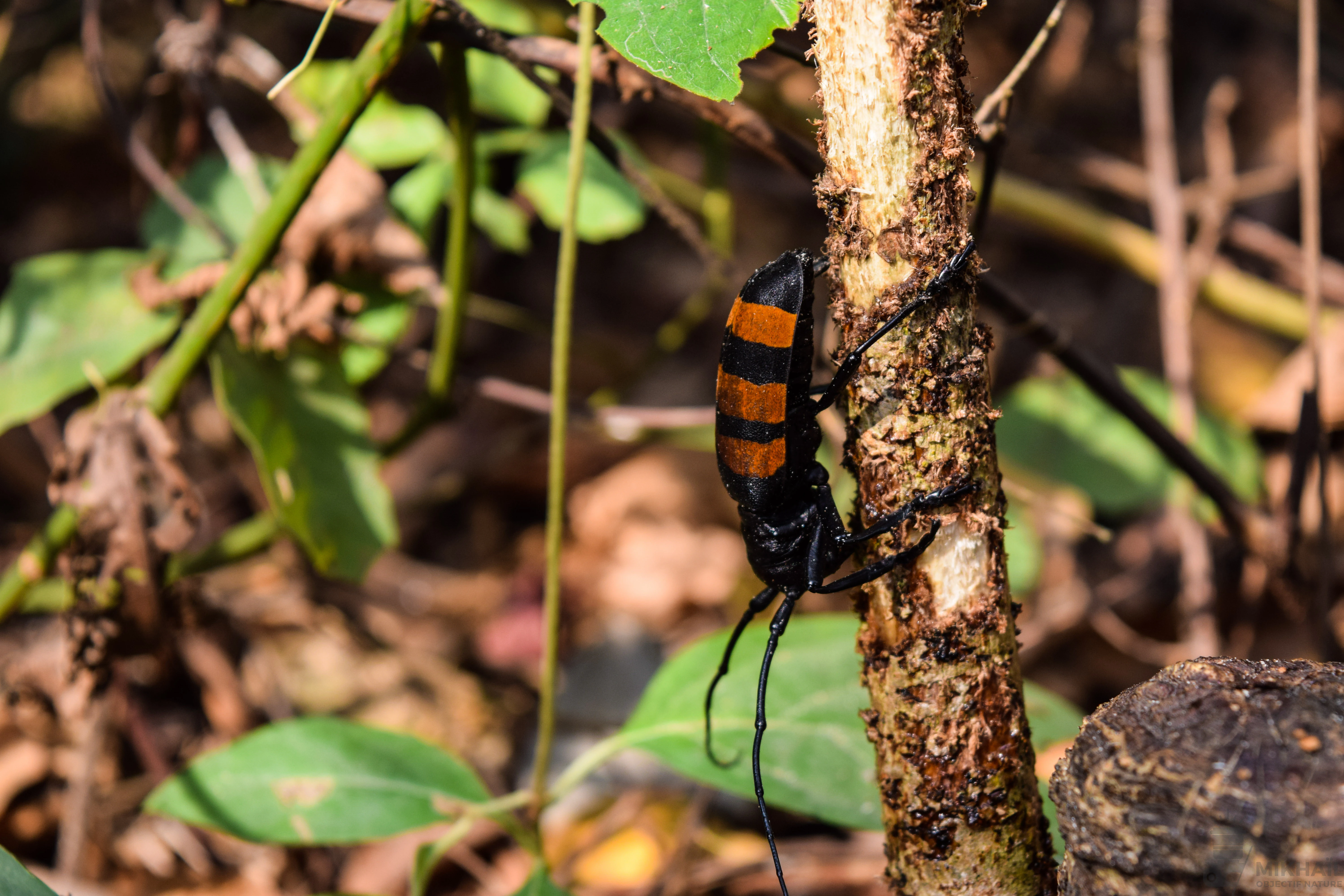
A black and orange striped beetle with long antennae climbing a thin, textured wooden stem in a forest setting.
A xylophagous beetle climbing a small sapling in the Lama Forest.

Forêt classée de la Lama ecosystems, habitats, and plant life

Ecologically, the Forêt classée de la Lama belongs to the dense semi-deciduous humid forest formation, one of the most threatened vegetation types in West Africa. It occupies a particularly important position within the Dahomey Gap, where the humid forest belt that normally runs along the Gulf of Guinea is interrupted by drier coastal vegetation. Within this otherwise savanna-dominated corridor, the Lama forest functions as a refuge of closed-canopy, multilayered forest, hosting a flora whose composition links the forests of Upper Guinea to those of Lower Guinea and the Congo basin.

Regional surveys have identified around 248 plant species in the reserve, representing roughly 10 percent of Benin's known flora. The most species-rich families in the dataset include Rubiaceae, Caesalpiniaceae, Euphorbiaceae, Papilionaceae, and Sapindaceae, while characteristic canopy and mid-story trees observed within the stand include Dialium guineense, Diospyros mespiliformis, Mimusops andongensis, Drypetes floribunda, Celtis brownii, and Afzelia africana. Tectona grandis (teak) has been introduced as part of the plantation belts that surround the central nucleus.

The soils of the Lama depression are characterized by vertisols that expand and contract with moisture, creating a particular hydrology that influences both plant rooting patterns and seasonal waterlogging. Combined with the subequatorial climate, persistent dry-season humidity, and regular morning fogs, these conditions favor a vegetation structure that is more evergreen in character than the surrounding semi-deciduous mosaic would otherwise suggest.
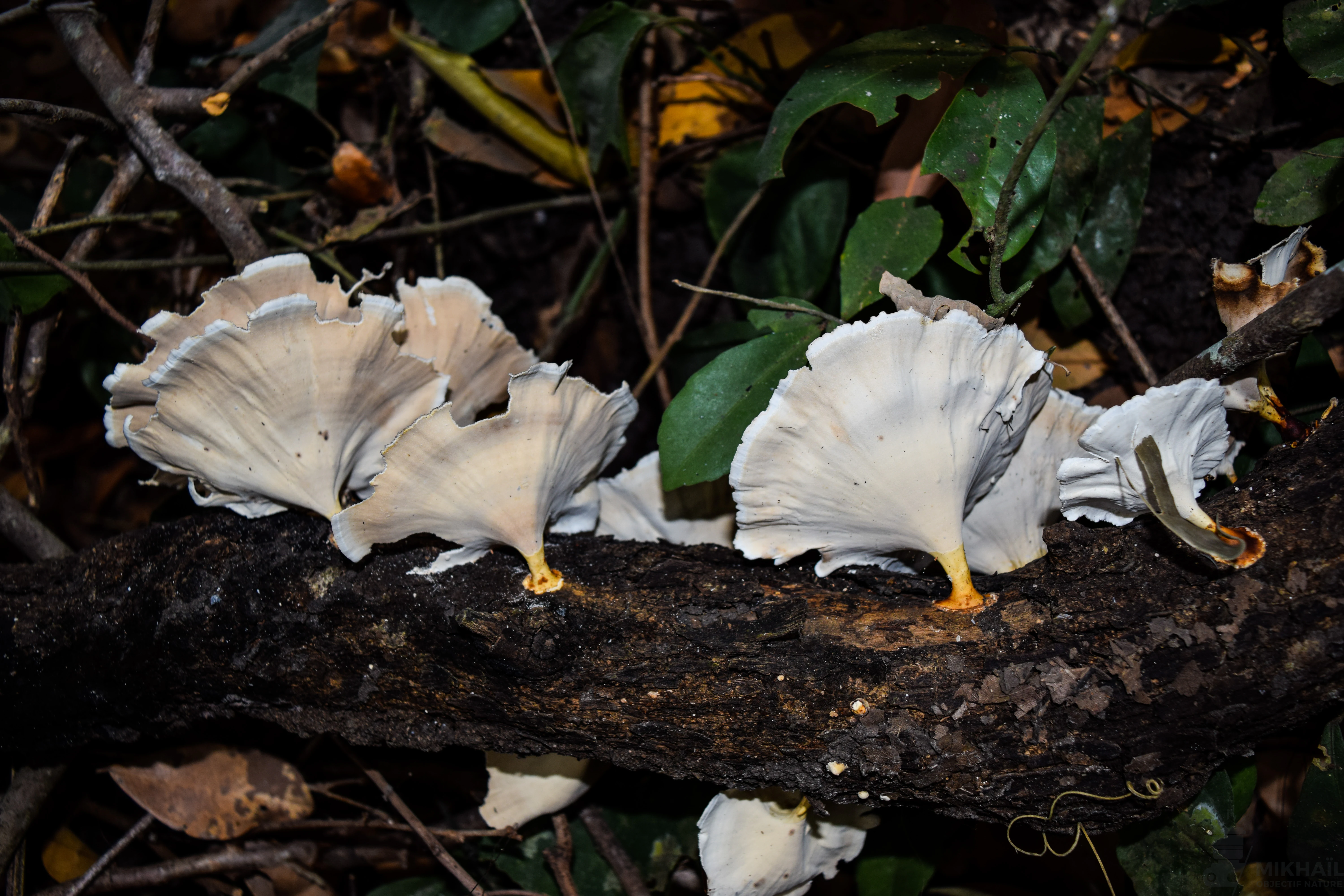
A close up view of several pale, fan shaped mushrooms growing in clusters along the side of a dark, damp tree trunk on the forest floor.
Clusters of pale fungi growing on a fallen log within the Forêt classée de la Lama.

Forêt classée de la Lama wildlife and species highlights

The Forêt classée de la Lama supports a mammal community of high regional interest, particularly with respect to primates. According to inventories compiled in studies by Kafichoni, Coubéou, Sinsin, Oates, Emrich and colleagues, Kassa, and Nobimè, the reserve harbors seven of the ten primate species known from Benin, giving it one of the densest primate diversities for the country. The red-bellied monkey (Cercopithecus erythrogaster erythrogaster), a subspecies considered endemic to Benin, has become the symbol of the reserve's conservation value, since protecting populations of this primate is thought to benefit many other forest-dwelling species.

Beyond primates, the forest sustains suids such as the red river hog (Potamochoerus porcus), duikers of the genus Cephalophus, and various rodent species. These animals, together with smaller mammals, constitute the bulk of the bushmeat resources traditionally hunted by surrounding communities, particularly the Fon and Holli populations, for whom bushmeat accounts for a very large share of animal protein intake.

The avian fauna of the Lama forest is also significant. A 1999 assessment recorded 171 bird species in the broader reserve and its surroundings, of which 91 are tied to forest habitats, 51 to savanna habitats, and 29 are considered generalists. The combination of closed forest, edge habitats, and surrounding plantations explains this mixture of forest and savanna bird species in a single protected area.

Among invertebrate fauna, the cerambycid beetle Analeptes trifasciata has attracted particular attention, as it attacks Prunier mombin (Spondias mombin) trees that are important in traditional pharmacopoeia and local food systems. Its presence illustrates the often-overlooked role of arthropods in shaping the forest's long-term dynamics.
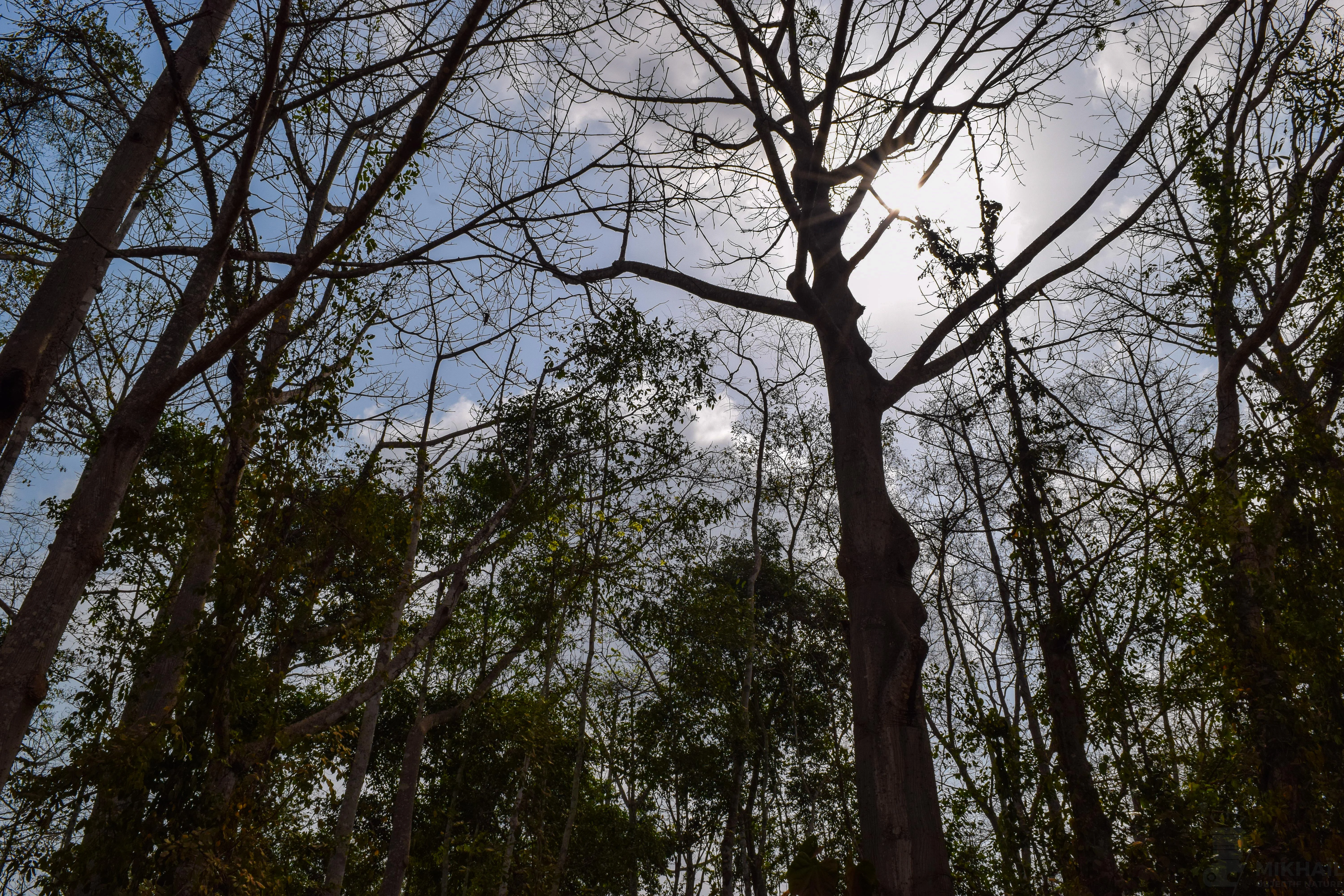
Looking upward at the bare branches of tall deciduous trees against a bright, hazy sky in the Lama Forest.
A view looking up into the canopy of the central forest area of the Forêt classée de la Lama.

Forêt classée de la Lama conservation status and protection priorities

The Forêt classée de la Lama is one of Benin's most important forest protected areas, both because of what it represents ecologically and because of what its history illustrates about forest loss in West Africa. Its classification in 1946 did not, by itself, prevent the dramatic reduction of forest cover from 16,250 hectares in the mid-twentieth century to roughly 4,770 hectares by 1989, driven by agricultural expansion and recurrent bush fires. The reserve's trajectory has become a key case study in Benin's environmental literature on how legal protection alone is insufficient without active management and engagement with surrounding communities.

In response to this loss, the management approach adopted from the late 1980s onward combined strict protection of a central nucleus, the noyau central, with the establishment of surrounding plantation belts aimed at producing timber and fuelwood while shielding the surviving forest. Observation plots established since 1989 have provided long-term datasets on tree growth, diameter structure, and ecosystem recovery, supporting evidence-based forest management decisions.

The red-bellied monkey (Cercopithecus erythrogaster erythrogaster) plays a flagship role in conservation planning for Lama, since its preservation is widely seen as a proxy for protecting the broader primate community and the forest as a whole. Surveys and monitoring programs, including those linked to broader initiatives to protect Cercopithecus erythrogaster across the Dahomey Gap, have made Lama a reference site for primate conservation in West Africa.

Conservation work in the reserve has increasingly emphasized co-management with neighboring Fon and Holli communities, as well as the development of ecotourism circuits, both of which are viewed as strategies to reconcile biodiversity protection with local livelihoods. These initiatives do not erase the underlying pressures of deforestation and hunting, but they illustrate the ongoing effort to maintain one of the last significant humid forest remnants in the otherwise fragmented Dahomey Gap landscape.

Forêt classée de la Lama cultural meaning and human context

The Forêt classée de la Lama is embedded in the daily lives of surrounding Fon and Holli communities, whose relationship with the forest extends back long before its formal protection in 1946. For these populations, the forest has long served as a source of bushmeat, particularly red river hog and the greater cane rat, edible mushrooms, medicinal plants such as those derived from Prunier mombin (Spondias mombin), and a wide range of non-timber forest products. Bushmeat alone accounts for a substantial share of animal protein in local diets, even though the targeted species represent a relatively limited fraction of total captures.

Since the reserve's reclassification and the development of co-management arrangements, the cultural relationship with the forest has shifted. Local communities are now involved in decisions about forest use, and ecotourism initiatives within the reserve have introduced new economic and educational relationships with the landscape, including guided circuits, training of local guides, and camp facilities. Together, these developments have reinforced the forest's identity not just as a conservation object but as a shared living and working landscape for the peoples of Toffo, Zogbodomey, and surrounding villages.
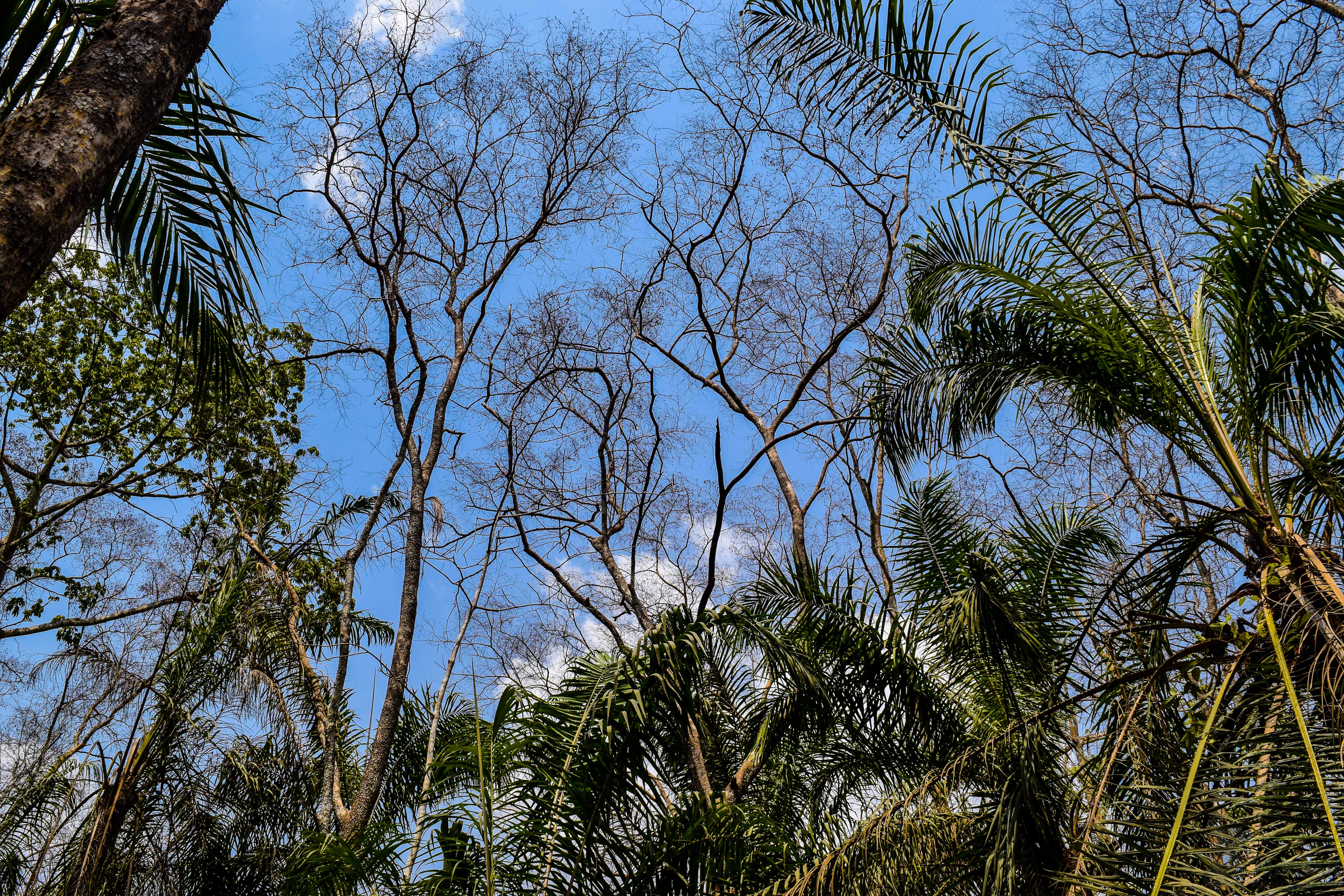
A low-angle view looking up into a canopy of trees in the Lama Forest, featuring a mix of leafless deciduous trees and lush green palms under a bright blue sky.
Natural forest regeneration in a previously degraded zone of the Lama Forest.

Top sights and standout views in Forêt classée de la Lama

Among the Forêt classée de la Lama's most distinctive qualities is its position as a flagship semi-deciduous forest refuge within the Dahomey Gap, the dry coastal corridor that interrupts West Africa's humid forest belt. Its Lama depression setting produces unusually persistent humidity and fogs, even during the dry season, sustaining a vegetation structure that is more evergreen than the surrounding mosaic suggests.

The reserve stands out for its primate fauna, particularly the red-bellied monkey, a subspecies endemic to Benin, as well as for its rich and scientifically well-documented plant and bird communities. Combined with its long history of conservation experiments, management planning, and community engagement, the Lama forest represents one of the most informative case studies of how a West African classified forest can be protected, studied, and integrated with the livelihoods of neighboring communities.

A black and white photograph of bare tree branches against a dark, featureless sky, featuring several distinct oval-shaped seed pods hanging from the twigs.
A close-up view of an Afzelia tree branch and its seed pods.

Best time to visit Forêt classée de la Lama

The Forêt classée de la Lama can be visited year-round thanks to its subequatorial climate and persistent humidity. The dry season, while offering easier walking conditions and clearer views along the forest's trails, is also marked by the morning fogs that give the canopy its striking atmospheric quality and that highlight the reserve's unusual microclimate. The rainy seasons bring lusher vegetation and more intense bird activity, though forest paths may be more difficult to traverse. Visitors interested in primate observation typically find the dry season rewarding, while those drawn to the forest's full vegetative expression may prefer the wetter months.
Monthly climate preview

Long-term representative point measurements tracking monthly temperature and precipitation variation

Forêt classée de la Lama Climate Normals, Annual Temperature and Precipitation Rhythm

Representative coordinate records for Forêt classée de la Lama reveal measured long-term averages spanning moderate daily minimums, high daytime maximums, and distinct monthly precipitation shifts. Detailed monthly climate data profiles provide complete twelve-month breakdowns for evaluating long-term environmental patterns.
Annual mean26 °C
25 °C28 °C
Jan27°
Feb28°
Mar28°
Apr28°
May27°
Jun26°
Jul25°
Aug25°
Sep25°
Oct26°
Nov26°
Dec26°
Warmest month
February

28.1 °C

Coolest month
August

24.7 °C

Wettest month
September

6.1 mm/day

Driest month
December

0.4 mm/day

Park location guide

Geography guide, regional context, and park location map for Forêt classée de la Lama

Forêt classée de la Lama park geography, regions, and map view in Benin

Understand where Forêt classée de la Lama sits in Benin through a broader geographic reading of the surrounding landscape, nearby location context, and its mapped position within the national park landscape.

How Forêt classée de la Lama fits into Benin

Benin is a West African nation formerly known as Dahomey. It gained independence from France in 1960 and operates as a unitary presidential republic. The country is known for its coastal location along the Bight of Benin, its historical kingdom of Dahomey, and its agricultural economy centered on palm oil and cotton exports.

Wider geography shaping Forêt classée de la Lama in Benin

Benin is located in West Africa, bordered by Togo to the west, Nigeria to the east, Burkina Faso to the northwest, and Niger to the northeast. The country occupies the southern coastline of the Bight of Benin, which is part of the Gulf of Guinea in the northernmost tropical portion of the Atlantic Ocean. The terrain ranges from coastal plains to hilly uplands in the north.

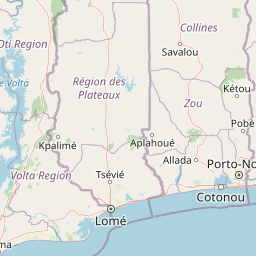
Map view of Forêt classée de la Lama

Use this park location map to pinpoint Forêt classée de la Lama in Benin, understand its exact geographic position, and read its mapped placement within the surrounding landscape more clearly.

Pigeon | © OpenStreetMap contributors

Location context for Forêt classée de la Lama

AtlantiqueZou

Visual reference of forest habitats, terrain depression, and protected reserve character

Forêt classée de la Lama Photos and Landscape Scenery

Visual documentation reveals the dense semi-deciduous canopy, distinctive vertisol terrain, and unique botanical habitats found across the reserve. Examining these protected landscapes provides direct insight into the ecological structure and microclimate defining the regional depression.

A narrow dirt trail covered in fallen leaves passes through a thick, leafy green forest tunnel in the Lama Forest.

A narrow dirt trail covered in fallen leaves winds into a dense, semi-deciduous forest with large, buttressed tree trunks framing the foreground.

A black and orange striped beetle with long antennae climbing a thin, textured wooden stem in a forest setting.

A close up view of several pale, fan shaped mushrooms growing in clusters along the side of a dark, damp tree trunk on the forest floor.

Looking upward at the bare branches of tall deciduous trees against a bright, hazy sky in the Lama Forest.

A base camp area with multiple colorful camping tents set up on dirt ground at dusk, illuminated by a string of outdoor lights, with a wooden building visible on the right.

A low-angle view looking up into a canopy of trees in the Lama Forest, featuring a mix of leafless deciduous trees and lush green palms under a bright blue sky.

A black and white photograph of bare tree branches against a dark, featureless sky, featuring several distinct oval-shaped seed pods hanging from the twigs.

A dirt path flanked by dense forest trees with stacks of cut teak logs piled on both sides of the road.

A wide angle view of an earthy, red-soil depression in a forest area, showing a small overhang and sparse vegetation.

Park atlas

Compare surrounding forest reserves, regional habitats, and connected conservation landscapes

Exploring Other Parks Near Forêt classée de la Lama and Protected Areas in the Region

Browsing other protected areas near Forêt classée de la Lama reveals broader ecological patterns across the Dahomey Gap and surrounding West African terrain. Regional park comparison provides essential context for understanding forest remnants, vertisol depressions, and local conservation efforts.
Protected areaOuémé
Mapped location lies within the park boundary#1 closest

Southeast

Basse vallée de l'Ouémé, lagune de Porto-Novo, lac Nokoué: Benin Wetland and Protected Area

Geographic analysis of a major West African riverine and lagoon system

Spanning the lower reaches of the Ouémé River, this protected wetland area in southern Benin integrates complex fluvial and coastal landscapes. The territory includes Lake Nokoué and the Porto-Novo lagoon, creating a vital hydrological basin that supports seasonal floodplains, mangrove fringes, and significant ecological connectivity. Examine the mapped boundaries and natural terrain of this unique West African environmental corridor.

Area
916 km²
Relief
Lowland
Climate
Tropical
Access
Access unknown
A soft watercolor painting of a wetland scene with green trees and reeds in the foreground and rolling hills in the background.
Protected areaZou Department
About 17 km away#2 closest

Northeast

Forêt marécageuse de Lokoli: Protected Alluvial Forest and Wetland Geography in Zou Department

A rare flooded ecosystem in southern Benin

Spanning approximately 500 hectares, Forêt marécageuse de Lokoli serves as a crucial refuge for primate species and native swamp-forest vegetation. The area illustrates a distinct alluvial geography, characterized by seasonal flooding from the Hlan stream that transforms the forest floor into a mosaic of shallow pools and dense, stilt-rooted woodland environments.

Area
5 km²
Relief
Lowland
Water
Major water bodies
A horizontal watercolor painting showing a soft, stylized forest landscape with rolling hills, diverse trees, and vegetation in shades of green, yellow, and purple.
Nature reserveAtlantique
About 21 km away#3 closest

South

Forêt relique de Niaouli Nature Reserve: Geography and Protected Landscape Boundaries

A scientific forest refuge in the Atlantique region of southern Benin

The Forêt relique de Niaouli nature reserve covers 220 hectares of protected land, serving as a rare survivor of the semi-deciduous forest that once characterized this part of coastal Benin. This site provides researchers and geography enthusiasts with a deep look into riparian and plateau forest ecosystems. Its ongoing value stems from its long-term ecological data and unique position within the broader West African forest block.

Area
2.2 km²
Established
1997
Relief
Lowland
Climate
Tropical
Nature reserveAtlantique
About 38 km away#4 closest

Southeast

Vallée du Sitatunga: Nature Reserve Geography and Wetland Protected Area Context

Community-managed marshland ecosystems in southern Benin

Vallée du Sitatunga encompasses over 67,000 hectares of diverse terrain in southern Benin, ranging from humid forest to expansive floodplains. As a community-led nature reserve, it preserves a vital network of waterways and swamp habitats that sustain rare species such as the sitatunga. This landscape focus offers clear insight into the protected basin geography of the Atlantique region.

Area
700 km²
Established
2009
IUCN
VI
Relief
Lowland
Biosphere reserveBenin
About 67 km away#5 closest

Southeast

Réserve de biosphère de la Basse vallée de l’Ouémé: Geographic Overview and Protected Area Map

Coastal lagoon and river delta ecosystems in Benin

The Réserve de biosphère de la Basse vallée de l’Ouémé represents a significant protected landscape in southern Benin where riverine and marine influences converge. This biosphere reserve map highlights a dense network of mangroves, seasonally flooded grasslands, and freshwater lakes. Gain insights into the regional geography and hydrologic patterns of this important wetland complex.

Area
3,143.4 km²
Established
2020
Relief
Lowland
Climate
Tropical
A horizontal watercolor painting depicting a winding river flowing through a lush green landscape with distant hills under a light sky.
Biosphere reserveBenin
About 86 km away#6 closest

Southwest

Mono Transboundary Biosphere Reserve: Mapped Protected Landscapes and Regional Geography

Coastal river deltas, wetlands, and savanna transition zones

The Mono Transboundary Biosphere Reserve preserves a critical intersection of freshwater river systems and marine coastal environments. Stretching along the border of Benin and Togo, this protected area includes expansive mangroves, lagoons, and floodplains that transition into inland savanna. The geography of the reserve reflects a dynamic interface between land and water, encompassing a range of natural terrain that supports both ecological conservation and integrated regional land use.

Area
3,462.85 km²
Established
2017
Relief
Lowland
Climate
Tropical
A watercolor painting showing a soft, impressionistic landscape of Keta Lagoon, featuring patches of green vegetation, yellow grasses, and calm water against a light, airy background.
Protected areaVolta Region
About 187 km away#7 closest

Southwest

Keta Lagoon Protected Area: Coastal Wetland Geography and Regional Landscape Mapping

A vital ecological and cultural landscape in Ghana's Volta Region

Keta Lagoon represents a primary coastal wetland system in eastern Ghana. Spanning the coastline between sandy barriers and inland floodplains, this protected area features a unique mosaic of mangroves, tidal flats, and islands. Its role as a major waterbird habitat and the center of Anlo-Ewe cultural life makes it a significant site for understanding West African coastal geography and environmental conservation.

Area
1,200 km²
Established
1992
Relief
Lowland
Climate
Tropical
Wildlife reserveVolta Region
About 193 km away#8 closest

West

Kalakpa Game Production Reserve: Atlas Overview of Protected Terrain in Ghana

Ecological mosaic landscape in the Volta Region

Kalakpa Game Production Reserve represents a diverse protected area where Borassus and Combretum woodlands meet semi-deciduous gallery forests. Situated on the foothills of the Togo Mountains, this reserve provides essential habitat in the forest-savanna transition of southeastern Ghana, defined by its rugged rocky hills and seasonal valley streams.

Area
320 km²
Established
1975
IUCN
VI
Relief
Upland

Common questions about visiting, size, designation, and location context for Forêt classée de la Lama

Forêt classée de la Lama FAQs for park facts, access, geography, and protected area context

Find quick answers about Forêt classée de la Lama, including protected-area facts, park geography, trail and visitor context, and how the park fits into its surrounding country and regional landscape.
MoriAtlas Explorer

Continue Your Protected Areas Search Across the Global Atlas

Deepen your exploration by continuing the structured search for national parks and protected areas worldwide. Utilize the comprehensive filtering capabilities to compare different conservation landscapes and refine your understanding of global park geography. Discover more about the distribution and characteristics of protected natural areas.

Global natural geography