
Mori Atlas logo
Protected areaForêt marécageuse de Lokoli

A distinct seasonal wetland landscape defined by Hlan stream flooding and rich primate habitats

Forêt marécageuse de Lokoli: Mapping the Alluvial Swamp Forest of Zou Department, Benin

Forêt marécageuse de Lokoli stands as a significant protected area within the Zou Department of southern Benin. This rare alluvial forest is shaped by the seasonal inundation of the Hlan stream, creating a complex network of flooded root zones, open water channels, and dense canopy patches. The protected landscape supports a diverse primate community and essential aquatic flora, offering deep insight into the region's specific wetland geography.

swamp forestflooded forestalluvial forestwetlandprotected areaBenin
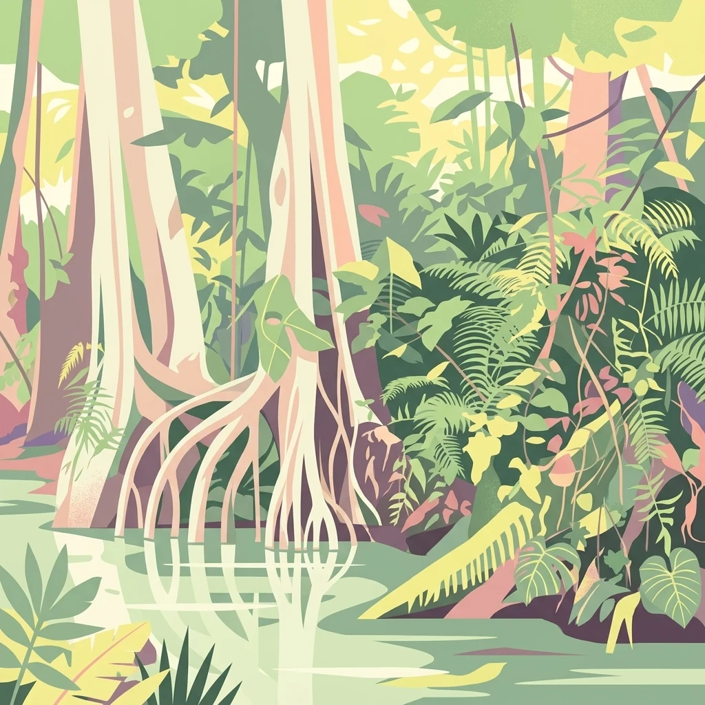
A stylized digital illustration depicting a dense swamp forest with tall trees featuring prominent buttress roots growing out of calm, shallow water surrounded by thick tropical foliage.

Forêt marécageuse de Lokoli

Protected area

Park overview

Structured park overview, official facts, and landscape profile for Forêt marécageuse de Lokoli

Forêt marécageuse de Lokoli park facts, protected area profile, and essential visitor context

Review the core facts for Forêt marécageuse de Lokoli, including designation, size, terrain, visitor scale, habitats, and operating context in one park-focused overview.

About Forêt marécageuse de Lokoli

The Forêt marécageuse de Lokoli is a small but ecologically significant protected zone in the Zou department of southern Benin, in the commune of Zogbodomey. Covering near 500 hectares, it represents one of the few remaining examples of true alluvial swamp forest in this part of West Africa. Unlike Benin’s drier savanna parks, Lokoli is defined by water: the Hlan, a tributary of the Ouémé, threads through the forest and floods it seasonally, producing a continuously shifting mosaic of standing water, saturated soils, and elevated root systems.

What makes Lokoli distinctive is the combination of botanical richness and accessible primate populations living in close proximity to human communities. The forest has been the subject of detailed academic study, particularly by researchers at the Université Libre de Bruxelles and Beninese institutions, who have documented its flora, vegetation structure, and primate behavior. The plant community includes both dense-canopy species tolerant of prolonged inundation, such as Alstonia congensis and Mitragyna stipulosa, and emergent giants like iroko (Milicia excelsa) and fromager (Ceiba pentandra). Aquatic plants such as Nymphaea lotus, Ipomoea aquatica, and Azolla africana thrive in the more open marsh zones.

Lokoli also illustrates a model of conservation rooted in longstanding human use. The surrounding villages of Lokoli, Koussoukpa, and Dèmè have traditionally harvested raphia palm products, grazed livestock in transitional zones, and cultivated adjacent land. Rather than displacing these communities, the protected area exists alongside them, an arrangement that has shaped ongoing discussions about participatory conservation in West Africa.

Quick facts and research context for Forêt marécageuse de Lokoli

The Forêt marécageuse de Lokoli covers approximately 500 hectares of alluvial swamp forest in the Zou department of southern Benin. It is crossed by the Hlan stream, a tributary of the Ouémé River, whose seasonal flooding defines the character of the habitat. Roughly 55 plant species have been catalogued, and six primate species have been documented, including several of conservation concern. The surrounding communes of Lokoli, Koussoukpa, and Dèmè have roughly 1,500 inhabitants whose livelihoods are closely linked to the forest.

Park context

Deeper park guide and search-rich context for Forêt marécageuse de Lokoli

Forêt marécageuse de Lokoli history, landscape, wildlife, and travel context

Explore Forêt marécageuse de Lokoli through its history, landscape character, ecosystems, wildlife, conservation priorities, cultural context, and seasonal travel timing in a structured park guide built for atlas discovery and search intent.

Why Forêt marécageuse de Lokoli stands out

Lokoli is best known as a rare surviving flooded alluvial forest in southern Benin, where seasonal inundation by the Hlan stream creates a mosaic of dense forest, open water, and aquatic vegetation. It is especially recognized for its primate diversity: six species coexist in this relatively small protected area, including threatened colobines and the red-bellied monkey. The forest also draws attention for its traditional use of Raphia hookeri, tapped locally for palm wine and woven into mats, tying ecological value to living cultural practice.
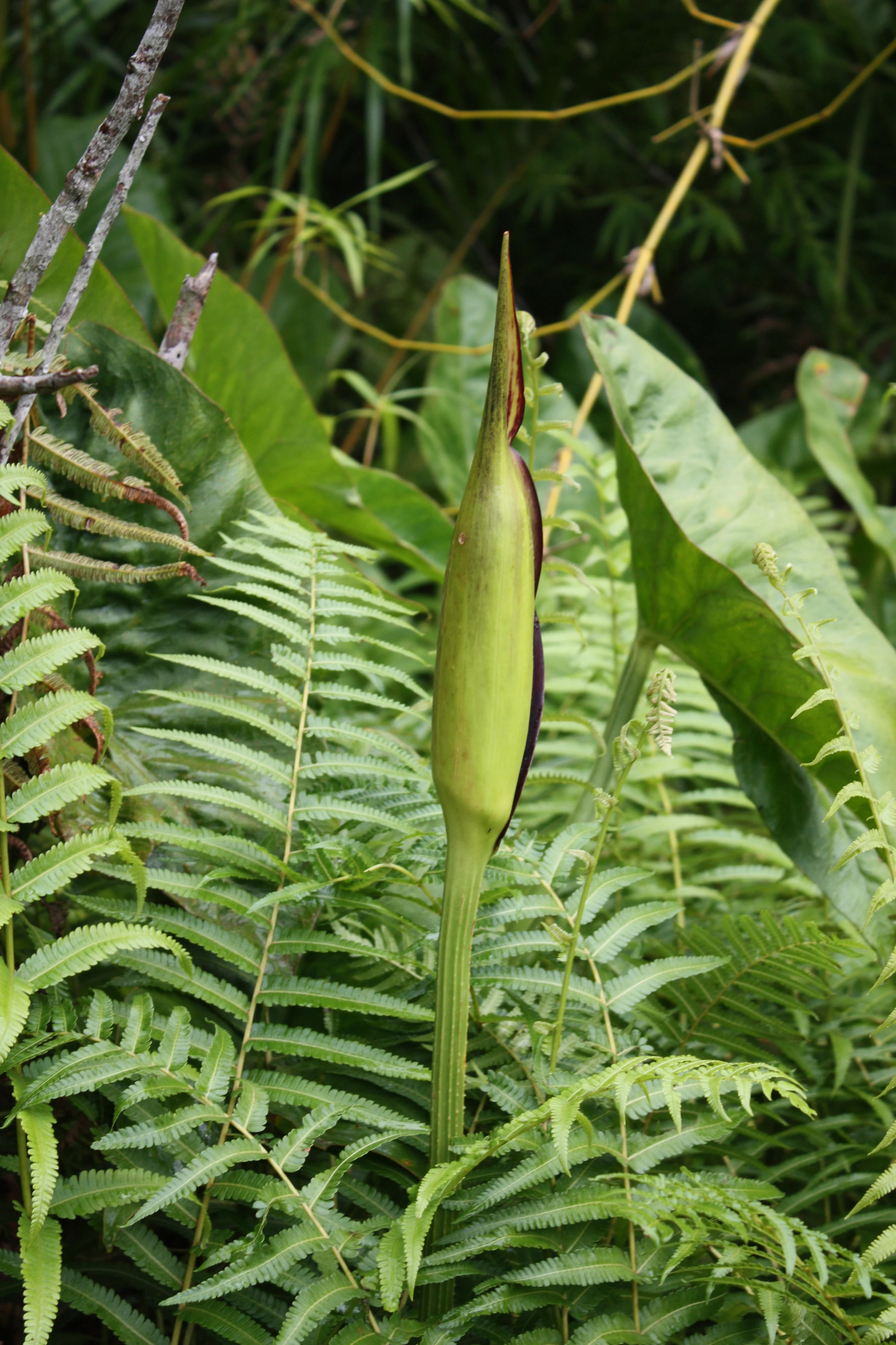
A close up vertical shot of a tall, green, pointed bud of a Lasimorpha senegalensis plant, surrounded by lush green ferns and broad leaves in a forest environment.
The inflorescence of a Lasimorpha senegalensis plant in the Lokoli swamp forest.

Forêt marécageuse de Lokoli history and protected-area timeline

The historical record for the Forêt marécageuse de Lokoli centres less on formal proclamation dates and more on its long-standing role as a community resource for the villages that border it. Local populations have drawn on the forest for raphia wine extraction, mat weaving, livestock grazing, and non-timber forest products for generations.

Its scientific and conservation profile emerged in the early twenty-first century through a series of botanical and primatological studies. Researchers including Brice Sinsin, Achille Ephrem Assogbadjo, and Céline Dan produced detailed work mapping the forest's flora, characterizing its vegetation, and assessing its primate populations, laying the groundwork for its later recognition as a protected area within Benin's national system.

Forêt marécageuse de Lokoli landscape and geographic character

Lokoli occupies a low-lying alluvial setting shaped entirely by the behaviour of the Hlan stream and the broader Ouémé drainage. Seasonal flooding turns much of the forest into a network of shallow channels, ponds, and saturated root zones, while slightly higher ground retains a more closed canopy. The result is a layered landscape of flooded forest, swamp pools, and aquatic clearings rather than any defined ridge or plateau.

Many trees grow on stilt-like or buttressed roots adapted to fluctuating water levels, with ferns and epiphytes clinging to exposed surfaces above the flood line. Open water between the trees supports lilies, water spinach, and floating mats of fern, creating an almost garden-like quality during the wet season. The transitional edges, accessible by the traditional embarcadère used by villagers, gradually give way to surrounding agricultural land.
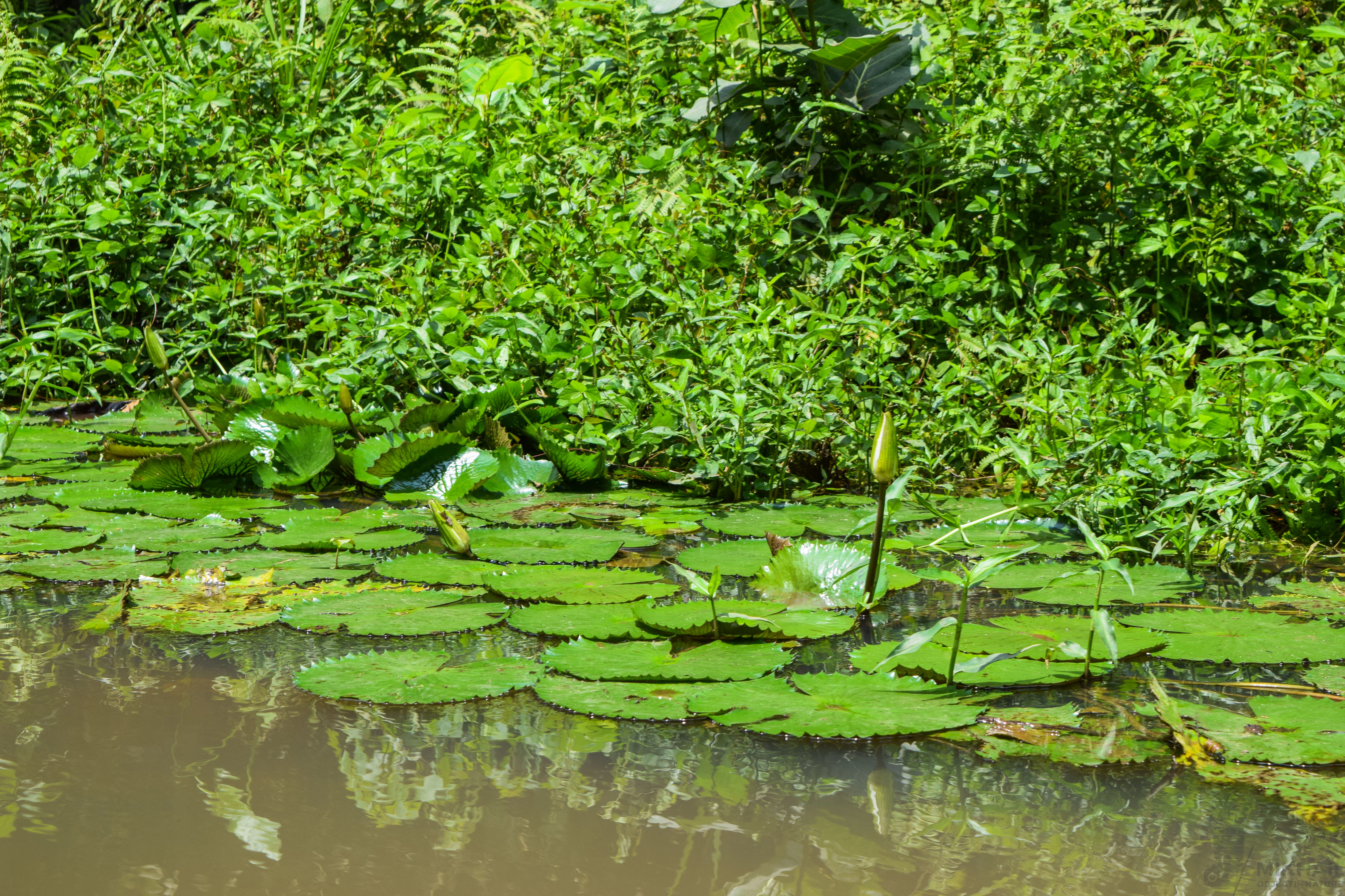
A close up view of green water lily pads floating on murky water near a lush, dense green riverbank.
Water lilies blooming on the surface of the Lokoli swamp forest waters.

Forêt marécageuse de Lokoli ecosystems, habitats, and plant life

The ecological character of Lokoli is defined by its status as a periodically inundated alluvial forest. The vegetation combines typical dense tropical forest species with a strong aquatic and semi-aquatic component, reflecting the dual pressures of standing water and seasonal drawdown.

Roughly 55 plant species have been identified, ranging from tall canopy trees such as Alstonia congensis, Nauclea diderrichii, and Pterocarpus santalinoides to characteristic raphia palms. Aquatic and marsh species, including Nymphaea lotus, Ipomoea aquatica, Azolla africana, and Cyperus difformis, occupy the more open, flooded sectors, while degraded patches indicate areas where past human use has altered the canopy. The forest's vegetation has been formally described in phytosociological work, with the climax community identified as a primary flooded forest dominated by Alstonia congensis and Xylopia rubescens.
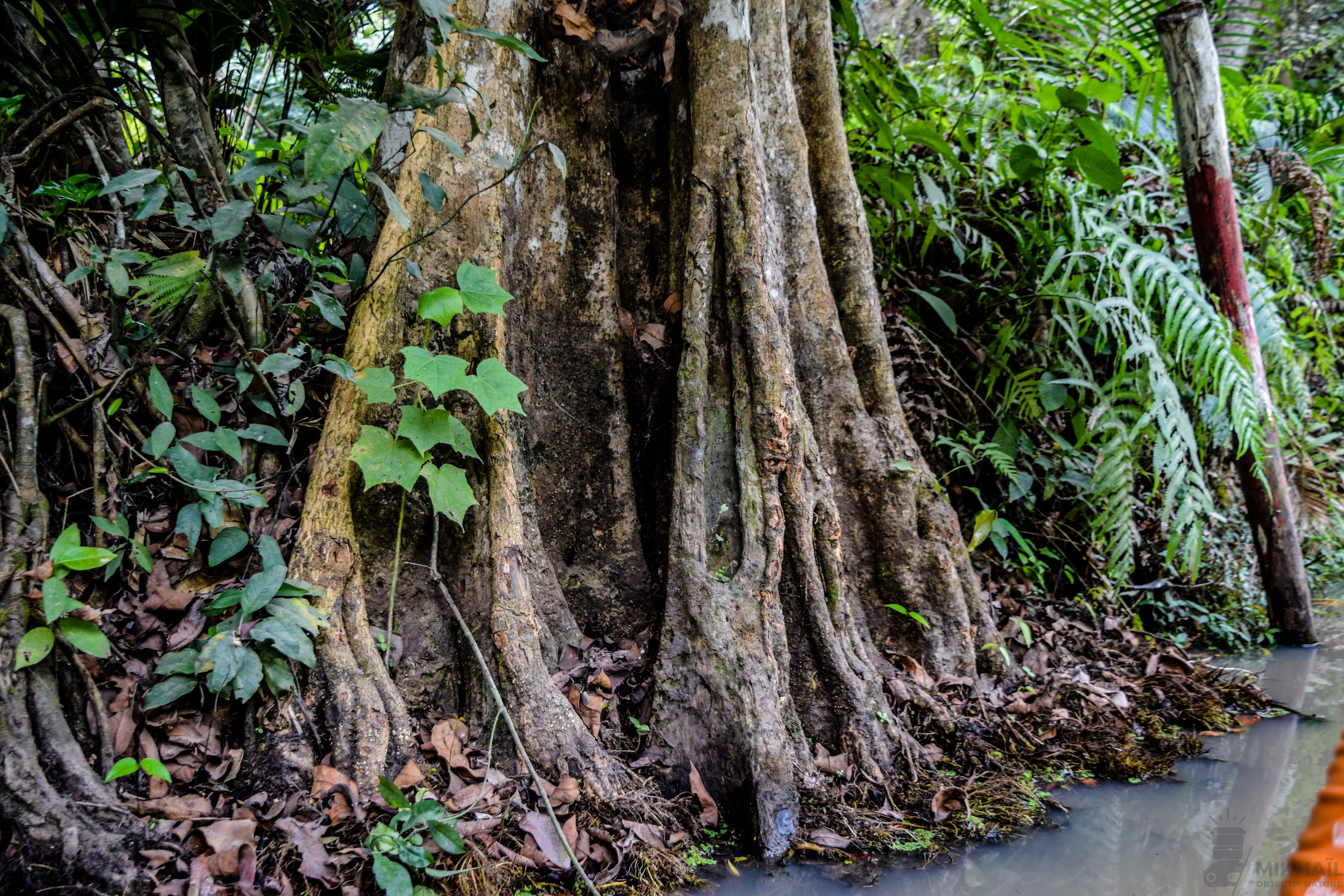
A close up view of the thick, buttressed trunk of a large tree rising from the edge of a stream in a swamp forest, surrounded by green undergrowth.
A large tree with buttress roots growing along the water's edge in the Lokoli swamp forest.

Forêt marécageuse de Lokoli wildlife and species highlights

Lokoli supports a notably rich primate community for its size. Six primate species have been recorded, including the Mona monkey, tantalus monkey, Geoffroy's colobus, van Beneden's colobus, the red-bellied monkey, and the Senegal galago. The Mona monkey is the most abundant, with documented densities around 45 individuals per square kilometre, making Lokoli one of the more important refuge areas for these species in southern Benin.

Beyond primates, the forest's mosaic of flooded habitats and adjacent agricultural land supports a broader faunal community typical of West African swamp forests, including smaller mammals, birds adapted to wetland and forest edge conditions, and reptiles associated with the standing water. The presence of multiple threatened primates is particularly significant from a conservation perspective, given the limited extent of the protected area.
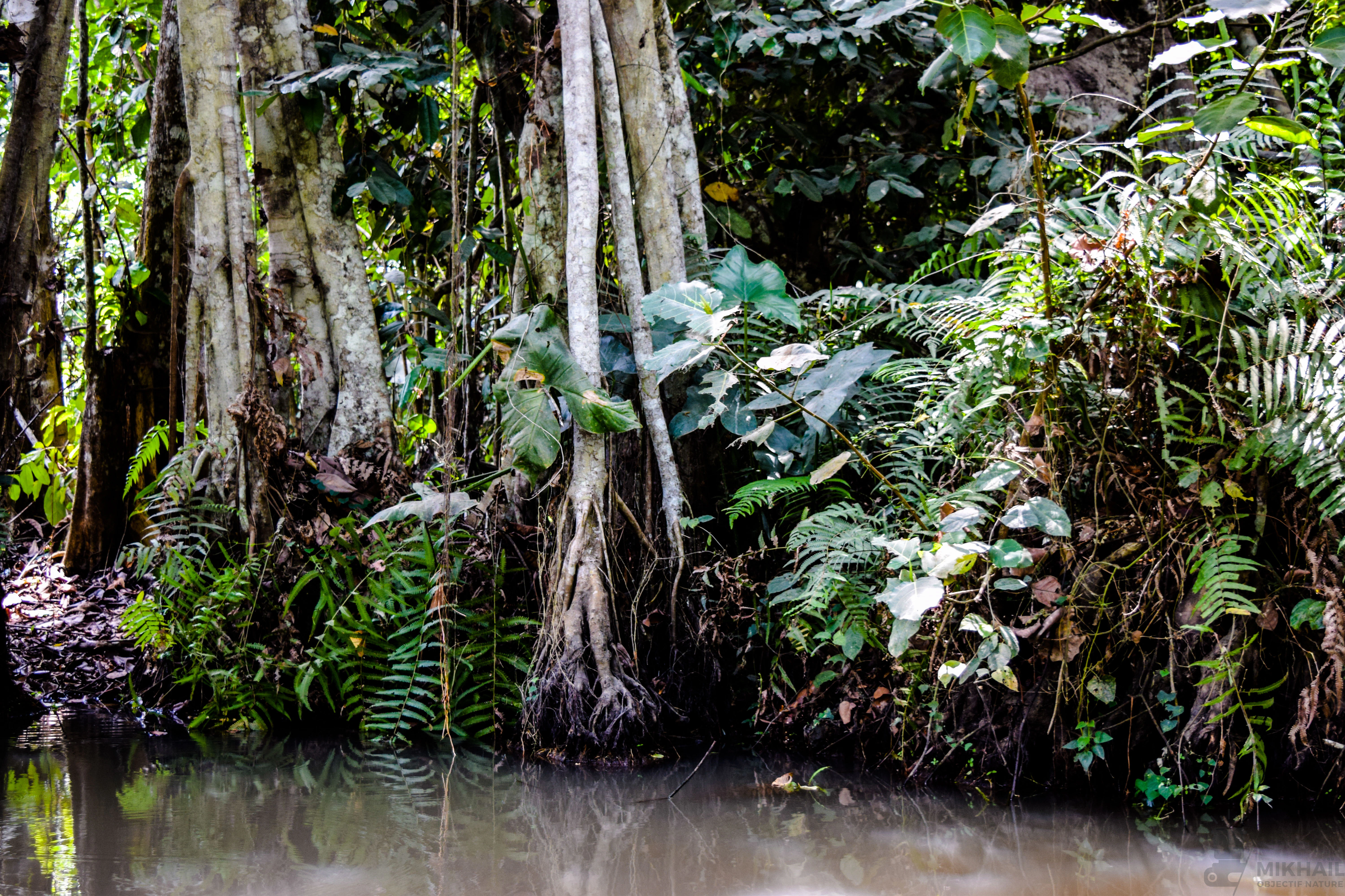
Dense tropical trees with exposed roots growing along a dark swamp water channel, surrounded by lush green ferns and foliage.
Swamp forest vegetation along the water's edge in Forêt marécageuse de Lokoli.

Forêt marécageuse de Lokoli conservation status and protection priorities

Lokoli's principal conservation value lies in preserving a representative example of southern Benin's alluvial swamp forest, a habitat type that has been extensively reduced elsewhere by agricultural expansion and logging. Within its roughly 500 hectares it maintains both climax flooded forest and degraded patches, offering researchers a natural laboratory for studying forest dynamics under varying levels of human pressure.

The forest's primate community gives it particular importance for biodiversity conservation. The presence of Geoffroy's colobus, van Beneden's colobus, and the red-bellied monkey, all of regional conservation concern, elevates Lokoli beyond a purely local protection site into a nationally and regionally meaningful refuge. Its management model, grounded in the continued use of the forest by neighbouring villages, has also made it a reference point in discussions about community-based and participatory conservation in West Africa.

Forêt marécageuse de Lokoli cultural meaning and human context

The forest is embedded in the daily life and economy of the three villages that border it: Lokoli, Koussoukpa, and Dèmè. Together these communities number around 1,500 people, most engaged primarily in agriculture but complemented by forest-based activities such as raphia wine extraction, weaving, livestock rearing, and small-scale trade.

Tapping Raphia hookeri for its sweet sap, which is either consumed fresh as wine or distilled into a stronger spirit, remains one of the most visible traditional practices tied to the forest. Raphia leaves are also processed into mats and other goods. These activities are not peripheral; they form a continuous cultural and economic relationship between the villages and the swamp forest, shaping local identity and establishing a practical basis for the participatory conservation approaches studied at Lokoli.
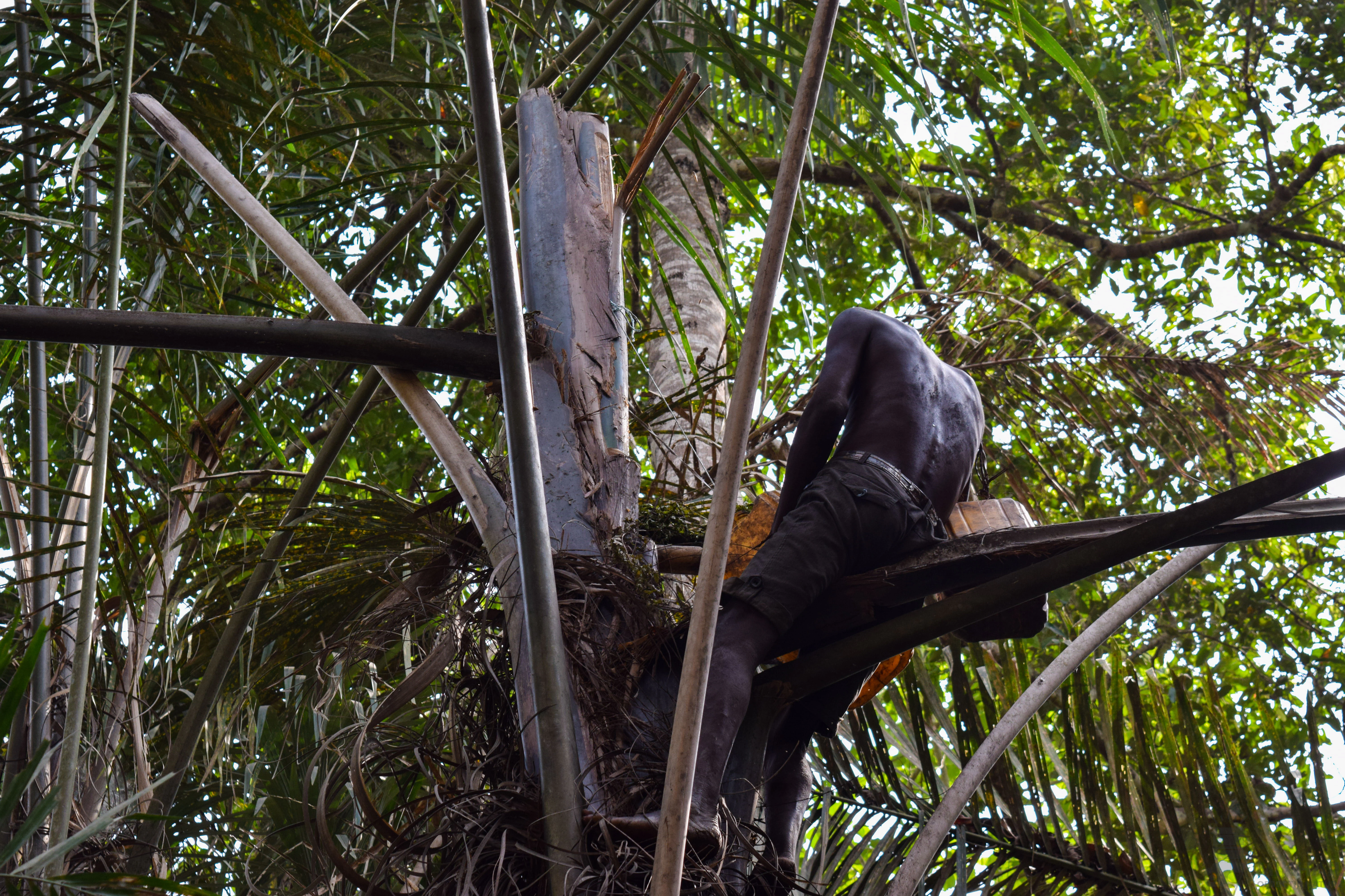
A person sitting high up in a tall palm tree, using a long tool to harvest from the trunk within a dense swamp forest environment.
A person harvests sap for raphia wine from a palm tree in the Lokoli swamp forest.

Top sights and standout views in Forêt marécageuse de Lokoli

A compact but ecologically dense flooded forest, Lokoli combines a documented flora of around 55 plant species with one of the more diverse primate assemblages in southern Benin. Its identity is shaped as much by water as by trees: seasonal flooding by the Hlan stream produces a shifting landscape of pools, lily-covered channels, and stilt-rooted canopy. Traditional use of raphia palm by surrounding villages gives the protected area a distinctive cultural dimension, making it both a biodiversity site and a living community resource.
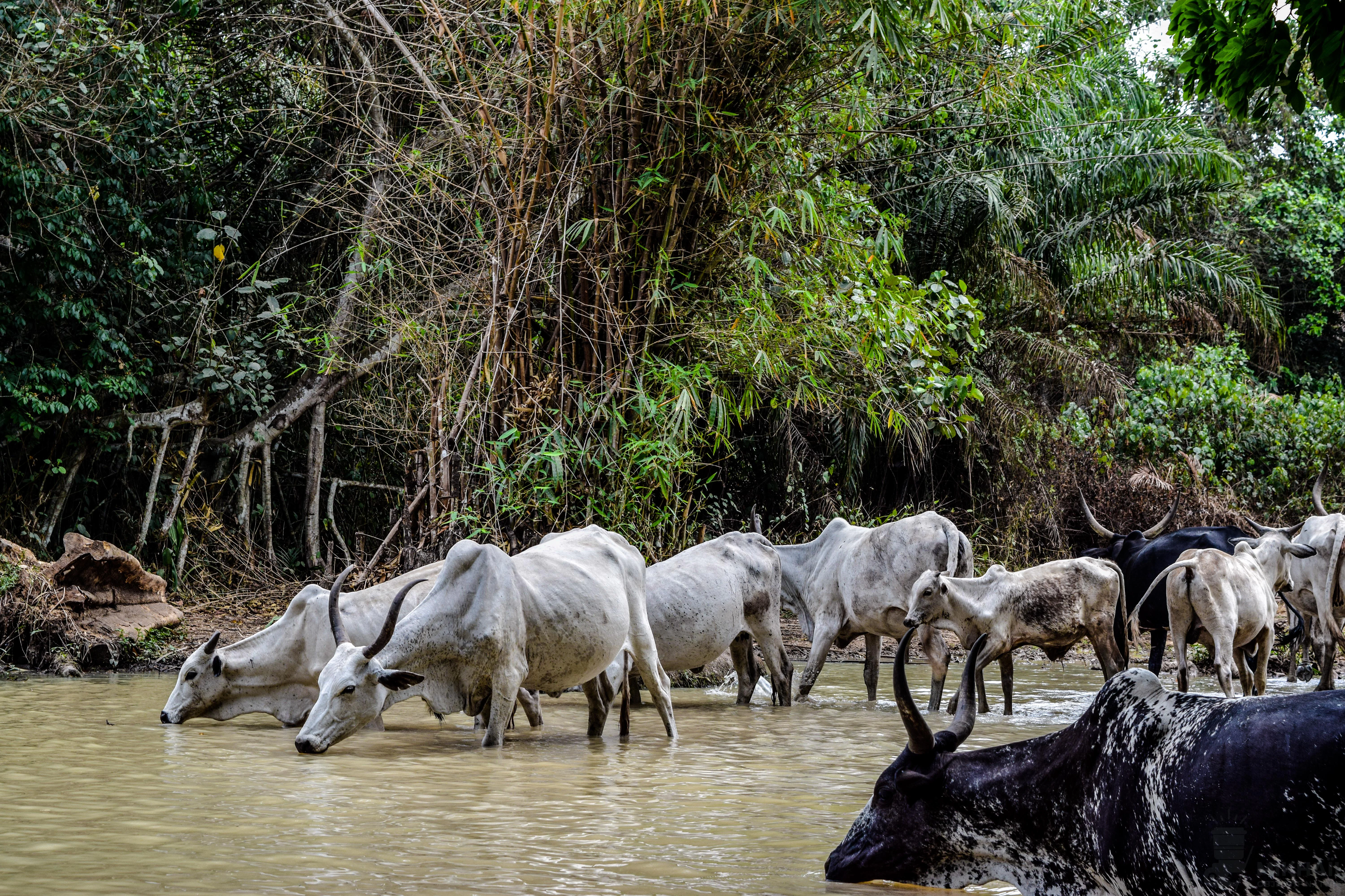
A group of zebu cattle with humped backs drinking from a shallow, muddy river in a dense, green forest.
A herd of cattle at a watering hole within the swampy environment of the Forêt marécageuse de Lokoli.

Best time to visit Forêt marécageuse de Lokoli

The character of Lokoli shifts with the hydrological cycle. During the wet and flood season, the forest transforms into an expansive flooded landscape, with rising waters reopening channels and bringing aquatic plants, including water lilies and floating ferns, into full display. This period offers the most striking visual experience of the swamp-forest habitat.

In drier months, when floodwaters recede, the forest floor becomes more accessible on foot and by traditional boat from the local embarcadère. Wildlife observation, particularly of primates, is generally easier along the forest edges in this season. Travellers interested in witnessing raphia wine extraction will find the practice active year-round, though the scale of harvest varies with the availability of sap.
Monthly climate preview

Long term representative temperature and monthly precipitation statistics for Zou Department

Forêt marécageuse de Lokoli Climate Normals and Annual Weather Patterns

Representative coordinate records show measured temperature ranges and monthly precipitation variations across twelve recorded intervals for Forêt marécageuse de Lokoli. Analyzing the complete monthly climate profile provides deeper statistical insight into historical meteorological rhythms.
Annual mean26 °C
25 °C28 °C
Jan26°
Feb27°
Mar28°
Apr27°
May27°
Jun26°
Jul25°
Aug25°
Sep25°
Oct26°
Nov26°
Dec26°
Warmest month
March

27.5 °C

Coolest month
August

24.6 °C

Wettest month
September

7.1 mm/day

Driest month
December

0.5 mm/day

Park location guide

Geography guide, regional context, and park location map for Forêt marécageuse de Lokoli

Forêt marécageuse de Lokoli park geography, regions, and map view in Benin

Understand where Forêt marécageuse de Lokoli sits in Benin through a broader geographic reading of the surrounding landscape, nearby location context, and its mapped position within the national park landscape.

How Forêt marécageuse de Lokoli fits into Benin

Benin is a West African nation formerly known as Dahomey. It gained independence from France in 1960 and operates as a unitary presidential republic. The country is known for its coastal location along the Bight of Benin, its historical kingdom of Dahomey, and its agricultural economy centered on palm oil and cotton exports.

Wider geography shaping Forêt marécageuse de Lokoli in Benin

Benin is located in West Africa, bordered by Togo to the west, Nigeria to the east, Burkina Faso to the northwest, and Niger to the northeast. The country occupies the southern coastline of the Bight of Benin, which is part of the Gulf of Guinea in the northernmost tropical portion of the Atlantic Ocean. The terrain ranges from coastal plains to hilly uplands in the north.

Map view of Forêt marécageuse de Lokoli

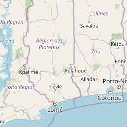
Use this park location map to pinpoint Forêt marécageuse de Lokoli in Benin, understand its exact geographic position, and read its mapped placement within the surrounding landscape more clearly.

Pigeon | © OpenStreetMap contributors

Location context for Forêt marécageuse de Lokoli

Zou Department

Protected area imagery highlighting swamp forest habitats and seasonal flood channels

Forêt marécageuse de Lokoli Photos and Landscape Scenery Visuals

Visual records reveal the distinctive alluvial terrain, stilt-rooted trees, and aquatic vegetation shaping Forêt marécageuse de Lokoli. Photographic documentation provides clear insight into the flooded forest ecosystem, canopy structure, and primate habitats across the region.

A close up vertical shot of a tall, green, pointed bud of a Lasimorpha senegalensis plant, surrounded by lush green ferns and broad leaves in a forest environment.

A close-up shot of a large, smooth green calabash fruit hanging from a tree trunk, with a brown patch on its side, set against a background of forest vegetation.

A close up view of green water lily pads floating on murky water near a lush, dense green riverbank.

A close up view of the thick, buttressed trunk of a large tree rising from the edge of a stream in a swamp forest, surrounded by green undergrowth.

Dense tropical trees with exposed roots growing along a dark swamp water channel, surrounded by lush green ferns and foliage.

A small building with a covered porch and stairs overlooks a narrow, dark waterway in a forest, with a person in a wooden dugout canoe nearby.

A person sitting high up in a tall palm tree, using a long tool to harvest from the trunk within a dense swamp forest environment.

A group of zebu cattle with humped backs drinking from a shallow, muddy river in a dense, green forest.

A close view of green ferns growing on tangled stilt roots over dark, calm water in a swamp forest.

A small, rustic outdoor processing station for raphia alcohol production, featuring a muddy mound, wooden structures, and yellow plastic containers, situated along a dark, shallow waterway in a dense forest.

Park atlas

Compare surrounding wetland reserves and alluvial landscapes across southern Benin

Parks near Forêt marécageuse de Lokoli and regional protected area discovery

Continue geographic discovery by browsing other protected areas and flooded forests situated across the regional watershed. Compare surrounding wildlife habitats and wetland ecosystems to understand the broader ecological spread of the Ouémé basin.
Protected areaOuémé
Mapped location lies within the park boundary#1 closest

Southeast

Basse vallée de l'Ouémé, lagune de Porto-Novo, lac Nokoué: Benin Wetland and Protected Area

Geographic analysis of a major West African riverine and lagoon system

Spanning the lower reaches of the Ouémé River, this protected wetland area in southern Benin integrates complex fluvial and coastal landscapes. The territory includes Lake Nokoué and the Porto-Novo lagoon, creating a vital hydrological basin that supports seasonal floodplains, mangrove fringes, and significant ecological connectivity. Examine the mapped boundaries and natural terrain of this unique West African environmental corridor.

Area
916 km²
Relief
Lowland
Climate
Tropical
Access
Access unknown
A watercolor painting showing a panoramic view of a river landscape with lush green trees, grasses, and soft pink foreground flowers against a light sky.
Nature reserveBenin
About 17 km away#2 closest

Southwest

Forêt classée de la Lama: Nature Reserve Geography and Protected Area Landscape

A dense forest refuge located within the Dahomey Gap

The Forêt classée de la Lama is a significant nature reserve in Benin, characterized by its unique position in the Lama depression. This area preserves a crucial core of dense semi-deciduous forest surrounded by managed buffer zones. Examine the mapped terrain, hydrological features, and the distinct ecological role this reserve plays in West African forest conservation.

Area
162.5 km²
Established
1946
Relief
Lowland
Climate
Subtropical
A horizontal watercolor painting showing a soft, stylized forest landscape with rolling hills, diverse trees, and vegetation in shades of green, yellow, and purple.
Nature reserveAtlantique
About 37 km away#3 closest

South

Forêt relique de Niaouli Nature Reserve: Geography and Protected Landscape Boundaries

A scientific forest refuge in the Atlantique region of southern Benin

The Forêt relique de Niaouli nature reserve covers 220 hectares of protected land, serving as a rare survivor of the semi-deciduous forest that once characterized this part of coastal Benin. This site provides researchers and geography enthusiasts with a deep look into riparian and plateau forest ecosystems. Its ongoing value stems from its long-term ecological data and unique position within the broader West African forest block.

Area
2.2 km²
Established
1997
Relief
Lowland
Climate
Tropical
Nature reserveAtlantique
About 48 km away#4 closest

South

Vallée du Sitatunga: Nature Reserve Geography and Wetland Protected Area Context

Community-managed marshland ecosystems in southern Benin

Vallée du Sitatunga encompasses over 67,000 hectares of diverse terrain in southern Benin, ranging from humid forest to expansive floodplains. As a community-led nature reserve, it preserves a vital network of waterways and swamp habitats that sustain rare species such as the sitatunga. This landscape focus offers clear insight into the protected basin geography of the Atlantique region.

Area
700 km²
Established
2009
IUCN
VI
Relief
Lowland
Biosphere reserveBenin
About 77 km away#5 closest

South

Réserve de biosphère de la Basse vallée de l’Ouémé: Geographic Overview and Protected Area Map

Coastal lagoon and river delta ecosystems in Benin

The Réserve de biosphère de la Basse vallée de l’Ouémé represents a significant protected landscape in southern Benin where riverine and marine influences converge. This biosphere reserve map highlights a dense network of mangroves, seasonally flooded grasslands, and freshwater lakes. Gain insights into the regional geography and hydrologic patterns of this important wetland complex.

Area
3,143.4 km²
Established
2020
Relief
Lowland
Climate
Tropical
A horizontal watercolor painting depicting a winding river flowing through a lush green landscape with distant hills under a light sky.
Biosphere reserveBenin
About 102 km away#6 closest

Southwest

Mono Transboundary Biosphere Reserve: Mapped Protected Landscapes and Regional Geography

Coastal river deltas, wetlands, and savanna transition zones

The Mono Transboundary Biosphere Reserve preserves a critical intersection of freshwater river systems and marine coastal environments. Stretching along the border of Benin and Togo, this protected area includes expansive mangroves, lagoons, and floodplains that transition into inland savanna. The geography of the reserve reflects a dynamic interface between land and water, encompassing a range of natural terrain that supports both ecological conservation and integrated regional land use.

Area
3,462.85 km²
Established
2017
Relief
Lowland
Climate
Tropical
A watercolor painting showing a soft, impressionistic landscape of Keta Lagoon, featuring patches of green vegetation, yellow grasses, and calm water against a light, airy background.
Protected areaVolta Region
About 203 km away#7 closest

Southwest

Keta Lagoon Protected Area: Coastal Wetland Geography and Regional Landscape Mapping

A vital ecological and cultural landscape in Ghana's Volta Region

Keta Lagoon represents a primary coastal wetland system in eastern Ghana. Spanning the coastline between sandy barriers and inland floodplains, this protected area features a unique mosaic of mangroves, tidal flats, and islands. Its role as a major waterbird habitat and the center of Anlo-Ewe cultural life makes it a significant site for understanding West African coastal geography and environmental conservation.

Area
1,200 km²
Established
1992
Relief
Lowland
Climate
Tropical
Wildlife reserveVolta Region
About 206 km away#8 closest

West

Kalakpa Game Production Reserve: Atlas Overview of Protected Terrain in Ghana

Ecological mosaic landscape in the Volta Region

Kalakpa Game Production Reserve represents a diverse protected area where Borassus and Combretum woodlands meet semi-deciduous gallery forests. Situated on the foothills of the Togo Mountains, this reserve provides essential habitat in the forest-savanna transition of southeastern Ghana, defined by its rugged rocky hills and seasonal valley streams.

Area
320 km²
Established
1975
IUCN
VI
Relief
Upland

Common questions about visiting, size, designation, and location context for Forêt marécageuse de Lokoli

Forêt marécageuse de Lokoli FAQs for park facts, access, geography, and protected area context

Find quick answers about Forêt marécageuse de Lokoli, including protected-area facts, park geography, trail and visitor context, and how the park fits into its surrounding country and regional landscape.
MoriAtlas Explorer

Continue Your Protected Areas Search Across the Global Atlas

Deepen your exploration by continuing the structured search for national parks and protected areas worldwide. Utilize the comprehensive filtering capabilities to compare different conservation landscapes and refine your understanding of global park geography. Discover more about the distribution and characteristics of protected natural areas.

Global natural geography