
Mori Atlas logo
Protected areaFrazier Islands

Analyzing the rugged rocky terrain and protected ecological status of this Vincennes Bay archipelago

Frazier Islands: Mapped Protected Landscapes and Geographic Context in East Antarctica

The Frazier Islands comprise a trio of ice-scoured rocky landforms situated along the coast of East Antarctica within the cold waters of Vincennes Bay. These protected islands serve as a critical maritime refuge for southern giant petrel breeding colonies, providing an undisturbed habitat against the backdrop of the Southern Ocean. This overview examines the geographic isolation, coastal morphology, and regional conservation role that define these landforms within the Antarctic Treaty System.

Antarctic islandsEast AntarcticaVincennes Bayrocky islandsAntarctic Specially Protected Areaseabird breeding colony

Frazier Islands

Protected area

Park overview

Structured park overview, official facts, and landscape profile for Frazier Islands

Frazier Islands park facts, protected area profile, and essential visitor context

Review the core facts for Frazier Islands, including designation, size, terrain, visitor scale, habitats, and operating context in one park-focused overview.

About Frazier Islands

The Frazier Islands are a compact group of three rocky islands - Nelly, Dewart, and Charlton - in the eastern part of Vincennes Bay along the East Antarctic coast. Their setting places them in a transitional zone between the open Southern Ocean and the frozen coastline of Wilkes Land, where rocky islands of relatively recent glacial origin rise above the surrounding sea.

The group sits approximately fifteen kilometers west-northwest of Clark Peninsula and about sixteen kilometers offshore from Casey Station, Australia's principal Antarctic research base. While not part of the station itself, the islands lie within the same operating region and benefit from the logistical and scientific attention that surrounds active national programs on the neighboring coast. The islands are uninhabited and have no permanent infrastructure, reflecting their protected status and the broader Antarctic framework governing human activity on the continent.

Above all, the Frazier Islands matter as seabird habitat. Their rocky terrain, isolation, and proximity to productive polar waters have allowed one of the continent's most important southern giant petrel colonies to persist here. The islands are formally protected as Antarctic Specially Protected Area No. 160, recognizing both their biological importance and the need to keep them free from disturbance.

Quick facts and research context for Frazier Islands

The Frazier Islands are three small rocky islands in eastern Vincennes Bay, situated off the East Antarctic coast roughly sixteen kilometers from Casey Station. They are uninhabited and administered under the Antarctic Treaty System. The group has been recognized as Antarctic Specially Protected Area No. 160 due to its importance for one of the largest southern giant petrel breeding colonies on the continent.

Protection and recognition

Documented conservation parameters and international recognition metrics

Frazier Islands Protection Status and Marine Reserve Designation Data

Frazier Islands maintains a documented marine protection scope within its designated conservation framework. Official records compile available governance parameters, management history, and international recognition sources for the protected area.

Protection details

Protection scope
Marine
Transboundary protection
No
Park context

Deeper park guide and search-rich context for Frazier Islands

Frazier Islands history, landscape, wildlife, and travel context

Explore Frazier Islands through its history, landscape character, ecosystems, wildlife, conservation priorities, cultural context, and seasonal travel timing in a structured park guide built for atlas discovery and search intent.

Why Frazier Islands stands out

The Frazier Islands are best known for hosting the largest of only four known breeding colonies of southern giant petrels on mainland Antarctica, an ecological distinction that underpins their protected-area status. Their position in the windswept coastal waters of Vincennes Bay, away from the immediate ice shelf, also gives them a distinctive role as ice-free seabird habitat in East Antarctica.
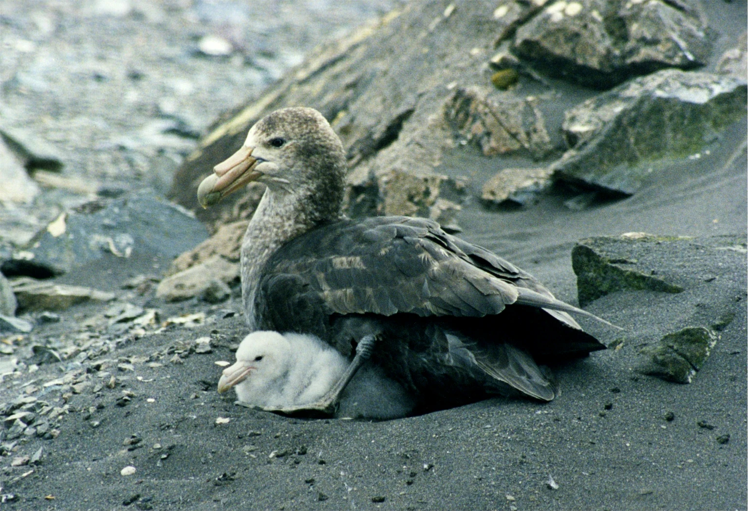
A large greyish-brown southern giant petrel sits on a dark, rocky beach, with a small, fluffy white chick tucked against its side.
A southern giant petrel with its chick on a rocky beach at Frazier Islands.

Frazier Islands history and protected-area timeline

The Frazier Islands were first photographed from the air during the United States Navy's Operation Highjump of 1946 to 1947, one of the earliest large-scale aerial surveys of the Antarctic continent. The images they produced helped establish the geographic context of the group within Vincennes Bay.

The islands were subsequently named by the Advisory Committee on Antarctic Names in recognition of Commander Paul W. Frazier, a navigator and projects officer with Operation Windmill who visited the area in January 1948. Frazier later served as operations officer with Operation Deep Freeze I at Little America V, becoming one of many U.S. Navy personnel whose wartime-era expeditions shaped early Antarctic cartography. The naming reflects the broader pattern by which features across coastal East Antarctica acquired their modern identities through mid-twentieth-century expedition activity.

Since that era of discovery, the islands have been managed collectively under the Antarctic Treaty System, and their ecological importance was eventually formalized through designation as Antarctic Specially Protected Area No. 160.

Frazier Islands landscape and geographic character

The Frazier Islands are a small group of three low rocky islands rising from the cold waters of eastern Vincennes Bay. Their rugged, ice-scoured character reflects the broader glacial history of this stretch of the East Antarctic coast, where exposed rock emerges only where local conditions have kept the islands free of permanent ice cover.

The surrounding seascape is dominated by the cold Southern Ocean, with seasonal pack ice and the distant continental ice sheet shaping the visual horizons. Relative to nearby Clark Peninsula and the broader Wilkes Land coast, the islands appear as isolated dark rocky outcrops against the prevailing whites and blues of polar sea and ice, an arrangement that makes them visually distinctive within the bay.

Frazier Islands ecosystems, habitats, and plant life

Ecologically, the Frazier Islands function as ice-free seabird habitat at the interface between ocean and continent. Their rocky surfaces, exposed slopes, and isolation from direct glaciation provide nesting grounds that would not exist on the surrounding ice-dominated coastline.

The combination of cold but biologically productive polar waters nearby and the absence of terrestrial predators creates conditions favorable for long-lived seabirds. The islands sit within a coastal Antarctic ecosystem where marine productivity pulses seasonally, and where ice-free terrain plays a disproportionately important role in sustaining breeding populations of birds that depend on land only for nesting.

Frazier Islands wildlife and species highlights

The Frazier Islands are most notable for their birdlife, and in particular for southern giant petrels. The group supports one of only four known breeding colonies of this species on continental Antarctica, and within that very small network it stands out as the largest, making it a regionally important stronghold for the species on the mainland.

Southern giant petrels are large, opportunistic seabirds that nest in open colonies on ice-free ground, often using bare rocky terrain like that found on the Frazier Islands. Their presence here reinforces the broader ecological pattern by which small Antarctic island groups, though individually modest, can carry disproportionate importance for marine-dependent bird populations along the East Antarctic coast.

Frazier Islands conservation status and protection priorities

The Frazier Islands are formally protected under the Antarctic Treaty System as Antarctic Specially Protected Area No. 160. The designation was driven by the islands' role in supporting the largest known breeding colony of southern giant petrels on continental Antarctica, one of only four such colonies across the continent.

The protected status reflects the broader Antarctic conservation framework, which seeks to limit human disturbance at biologically important sites. For seabirds with small numbers of breeding locations, preserving the integrity of each colony site is a central concern, and the Frazier Islands occupy a critical place in that continental network.

Frazier Islands cultural meaning and human context

The Frazier Islands do not have a permanent human community, indigenous presence, or built heritage. Their cultural significance lies primarily in the history of twentieth-century Antarctic exploration, with their name tied to a U.S. Navy commander involved in early postwar mapping expeditions that shaped modern knowledge of the East Antarctic coast.

Top sights and standout views in Frazier Islands

The defining features of the Frazier Islands are their trio of rocky landforms in eastern Vincennes Bay, the view across to Clark Peninsula and Casey Station, and their protected ecological role as a stronghold of southern giant petrels on continental Antarctica. The islands illustrate how even very small Antarctic land areas can carry continent-scale conservation importance.

Best time to visit Frazier Islands

Access to the Frazier Islands is governed by Antarctic Treaty conditions and is limited to permitted scientific or logistic visits coordinated with national Antarctic programs. In general, the austral summer, roughly November through February, offers the most workable conditions for ship or helicopter operations along the East Antarctic coast, with longer daylight, less extensive sea ice, and the active seabird breeding season that includes the southern giant petrel colonies for which the islands are protected.
Monthly climate preview

Track measured temperature ranges and precipitation patterns across the year

Frazier Islands Climate Normals and Long-Term Weather by Month

Frazier Islands records long-term average temperatures spanning from mild summer maximums near zero to severe winter minimums below negative twenty-five degrees Celsius alongside steady precipitation rates. Reviewing the complete twelve-month climate profile reveals the full scope of temperature shifts and monthly precipitation variations across the representative coordinate.
Annual mean-9 °C
-15 °C-2 °C
Jan-2°
Feb-3°
Mar-7°
Apr-11°
May-14°
Jun-14°
Jul-14°
Aug-15°
Sep-13°
Oct-11°
Nov-5°
Dec-2°
Warmest month
January

-1.5 °C

Coolest month
August

-14.6 °C

Wettest month
June

2.1 mm/day

Driest month
January

1.1 mm/day

Park location guide

Geography guide, regional context, and park location map for Frazier Islands

Frazier Islands park geography, regions, and map view in Antarctica

Understand where Frazier Islands sits in Antarctica through a broader geographic reading of the surrounding landscape, nearby location context, and its mapped position within the national park landscape.

How Frazier Islands fits into Antarctica

Centered on the South Pole, Antarctica is the highest, driest, coldest and windiest continent. Almost all of its land is buried beneath ice, yet its coasts and surrounding ocean sustain globally significant colonies of penguins, seals and seabirds.

Wider geography shaping Frazier Islands in Antarctica

The continent surrounds the geographic South Pole and is separated from other landmasses by the Southern Ocean. A vast ice sheet conceals mountain ranges, basins and plains, exceeds four kilometres in thickness in places and flows outward through glaciers and floating ice shelves. The Transantarctic Mountains divide East and West Antarctica, while the Antarctic Peninsula reaches north toward South America.

Map view of Frazier Islands

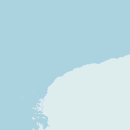
Use this park location map to pinpoint Frazier Islands in Antarctica, understand its exact geographic position, and read its mapped placement within the surrounding landscape more clearly.

Pigeon | © OpenStreetMap contributors

Location context for Frazier Islands

Antarctica

Visualizing the rugged terrain, coastal sea ice, and protected seabird habitats of Vincennes Bay

Frazier Islands Photos and Landscape Scenery in East Antarctica

Frazier Islands photos reveal the stark beauty of three low rocky outcrops rising from the cold waters of eastern Vincennes Bay. Examining these protected area views helps observers understand the remote polar terrain, ice-scoured shorelines, and critical seabird breeding habitats defining the regional park environment.

A large greyish-brown southern giant petrel sits on a dark, rocky beach, with a small, fluffy white chick tucked against its side.

Park atlas

Compare adjacent polar geography and regional seabird breeding habitats

Other Protected Areas and Parks Near Frazier Islands

Browse nearby protected landscapes and isolated coastal refuges situated across the East Antarctic coastline. Comparing regional reserves provides deeper geographic context for polar conservation landscapes and offshore marine ecosystems.
Protected areaAntarctica
About 18 km away#1 closest

East

Clark Peninsula: Antarctic Protected Landscape and Coastal Geographic Atlas

Ice-free rocky terrain on the Budd Coast of Wilkes Land

Clark Peninsula provides a window into the unique geography of East Antarctica, featuring exposed rocky outcrops, coastal coves, and significant glacial moraines. As a dedicated protected area, the site supports long-term ecological research and provides a critical habitat for seabird colonies, offering a detailed look at the interface between continental ice and the Southern Ocean.

Area
9.4 km²
Relief
Lowland
Climate
Polar
Access
Remote access
Protected areaAntarctica
About 21 km away#2 closest

Southeast

Ardery Island: Protected Coastal Geography and Antarctic Seabird Habitats

Rugged terrain and avian conservation in the Windmill Islands

Ardery Island represents a compact, rocky protected area within the Antarctic landscape. Known for its steep cliffs and essential seabird colonies, this island serves as a focal point for ecological study along the Budd Coast, offering a distinct example of high-latitude coastal geography.

Relief
Upland
Climate
Polar
Access
Remote access
Scope
Mixed
A pale, minimalist watercolor illustration of soft rolling green hills, a tree line, and a body of water in the foreground, against a plain white background.
Protected areaAustralian Antarctic Territory
About 1,426 km away#3 closest

East

Mawson's Huts Protected Area: Antarctic Heritage and Coastal Geographic Landscape

Historic polar structures in the Australian Antarctic Territory

Located at Cape Denison, Mawson's Huts represents a rare preserved footprint of the Heroic Era of Antarctic exploration. The site encompasses specialized scientific buildings set against a challenging coastal landscape, offering insight into the logistical history of polar science within the Australian Antarctic Territory.

Established
1912
Relief
Lowland
Climate
Polar
Access
Remote access
Protected areaEast Antarctica
About 1,431 km away#4 closest

Southwest

Amanda Bay Protected Area: Geography and Coastal Ice Mapping in East Antarctica

Glacial inlets, emperor penguin colonies, and stable sea ice

Amanda Bay offers a focused look at the remote East Antarctic coastline, characterized by the Hovde Glacier, Flatnes Ice Tongue, and recurring stable sea ice. This protected area serves as a vital habitat for thousands of emperor penguins and illustrates the complex relationship between glacial cliffs and coastal marine environments across the Prydz Bay margin.

Area
18 km²
Established
1957
Relief
Lowland
Climate
Polar
Protected areaMac. Robertson Land
About 1,865 km away#5 closest

Southwest

Scullin Monolith Protected Area in East Antarctica: Coastal Geography and Habitat Atlas

Ice-free coastal terrain and regional seabird breeding grounds

Scullin Monolith represents a singular landmark of exposed rock along the glaciated coastline of Mac. Robertson Land. Stretching from Mikkelsen Peak toward Douglas Bay, this crescent-shaped promontory remains essential for understanding East Antarctic coastal geography and the dense avian populations that rely on its rare snow-free terrain and protective vertical cliffs.

Established
1931
Relief
Upland
Climate
Polar
Access
Remote access
Protected areaMac. Robertson Land
About 2,039 km away#6 closest

Southwest

Rookery Islands Protected Area: Mac. Robertson Land Polar Landscape Atlas

Coastal rocky terrain and international seabird conservation zone

Located in western Holme Bay, the Rookery Islands form a protected rocky archipelago along the Mawson Coast. This site functions as a key reference area for polar seabird populations, including Adélie penguins and southern giant petrels, while providing a clear contrast to the high-relief mountain ranges of the Antarctic mainland.

Area
0.89 km²
Relief
Lowland
Climate
Polar
Access
Remote access
Wildlife reserveAntarctica
About 2,111 km away#7 closest

Southwest

Taylor Rookery Wildlife Reserve: Antarctic Protected Landscape and Research Site

Mapping a unique land-based penguin colony on the Mawson Coast.

Located on the Mawson Coast of East Antarctica, Taylor Rookery is a protected wildlife reserve of high scientific importance. This site serves as a vital benchmark for emperor penguin population studies, featuring a rare landscape of rocky outcrops that support land-based breeding. Its unique geography, framed by Taylor Glacier and the Colbeck Archipelago, provides a stable environment for observing one of the most monitored polar colonies in the region.

Area
0.26 km²
Relief
Lowland
Climate
Polar
Access
Remote access
Marine protected areaAustralia
About 2,577 km away#8 closest

East

Macquarie Island Marine Park: Subantarctic Seafloor and Marine Conservation Geography

A remote Australian marine protected area and ocean atlas

This expansive marine protected area encompasses deep ocean habitats and productive surface waters in the remote subantarctic. The park features diverse seafloor topography, such as abyssal plains and submarine canyons, while providing vital foraging grounds for penguins, seals, and diverse marine wildlife across the southwest Pacific.

Area
475,465 km²
Established
1999
IUCN
IV
Relief
Lowland

Common questions about visiting, size, designation, and location context for Frazier Islands

Frazier Islands FAQs for park facts, access, geography, and protected area context

Find quick answers about Frazier Islands, including protected-area facts, park geography, trail and visitor context, and how the park fits into its surrounding country and regional landscape.
MoriAtlas Explorer

Continue Your Protected Areas Search Across the Global Atlas

Deepen your exploration by continuing the structured search for national parks and protected areas worldwide. Utilize the comprehensive filtering capabilities to compare different conservation landscapes and refine your understanding of global park geography. Discover more about the distribution and characteristics of protected natural areas.

Global natural geography
