

Why Fulder Aue, Ilmen Aue stands out
The reserve is best known for protecting two islands in the Rhine floodplain near Bingen, together with the channels and water surfaces between them. Within an otherwise strongly modified Rhine corridor, the site preserves a stretch of active floodplain landscape shaped by seasonal inundation, alluvial processes, and the hydrological dynamics typical of the Upper Rhine lowlands. It is also recognized regionally as habitat for the common tree frog (Laubfrosch), which the regional conservation association NABU has highlighted as a flagship species of the area.
Fulder Aue, Ilmen Aue history and protected-area timeline
The current protected status of Fulder Aue–Ilmen Aue dates to 9 January 1995, when the area was officially designated as a Naturschutzgebiet (nature reserve) under a legal ordinance of the Mainz-Bingen district. This designation placed the islands and surrounding Rhine waters under formal nature protection, with the aim of preserving the floodplain landscape and its associated ecological functions.
Beyond this conservation milestone, the islands themselves have a longer history of human use. Regional reporting from the late 1980s traces the Fulder Aue back to property once held by Fulda Abbey and identifies it as a historical Fulda possession in the Rhine. That same period saw the island associated with viticulture, illustrating how floodplain islands in the Bingen area were integrated into regional agricultural and monastic economies long before modern nature conservation legislation existed.
Since its 1995 designation, the reserve has been integrated into the broader system of protected areas within the Mainz-Bingen district, contributing to a network that spans floodplain, woodland, slope, and dune habitats around the bend of the Rhine at Bingen.
Fulder Aue, Ilmen Aue landscape and geographic character
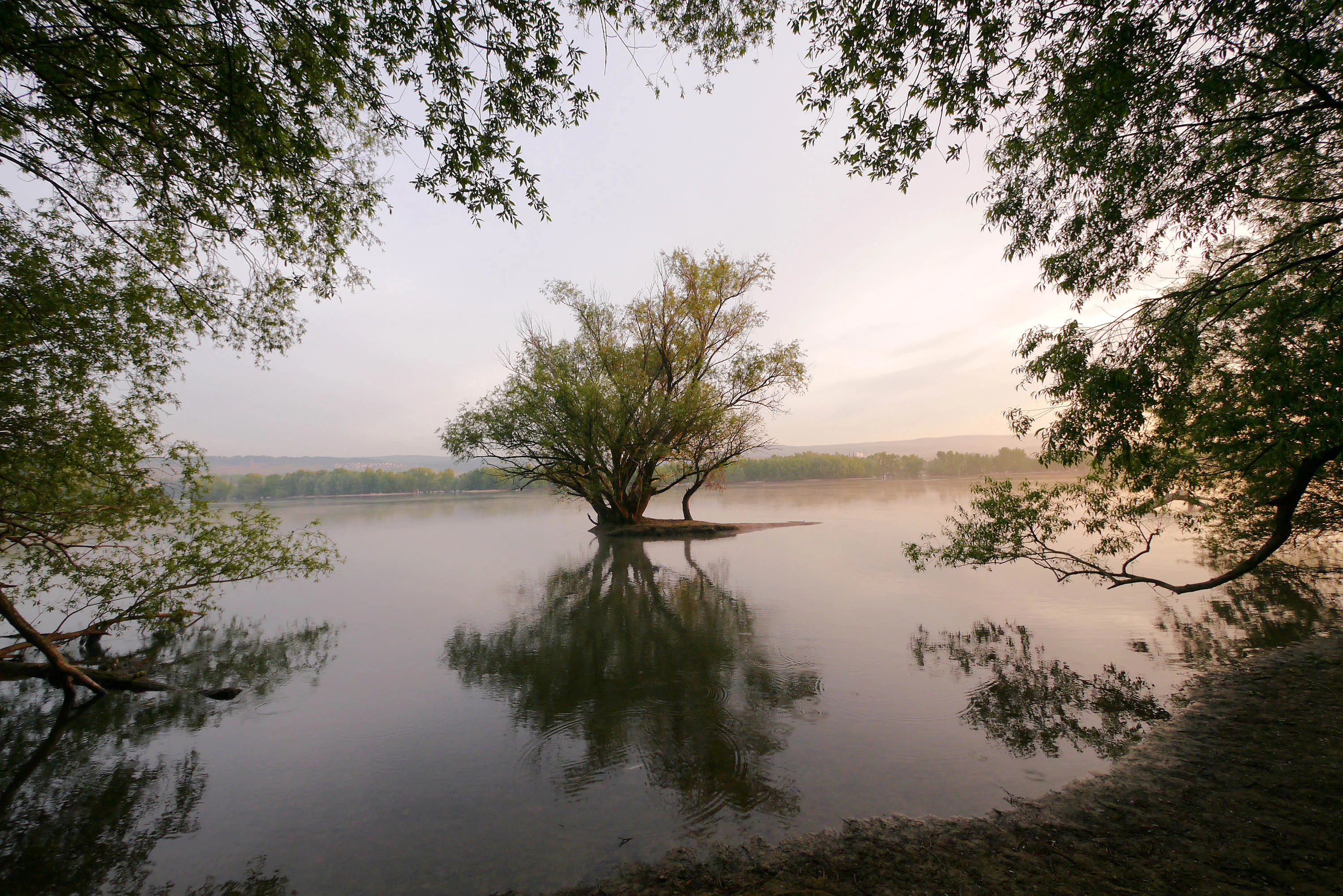
The landscape of Fulder Aue–Ilmen Aue is defined by the Rhine floodplain at the upstream end of the Rheingau, where the river forms a broad lowland corridor. The protected area consists of two alluvial islands, Fulder Aue and Ilmen Aue, separated from each other and from the riverbanks by connecting channels and open water surfaces. This island-and-channel mosaic is the defining scenic feature of the reserve.
Surrounding context plays an important role in the visual and physical character of the site. To the north, the Rhine itself forms the boundary, while the southern and southeastern edges of the area are framed by the A 60 autobahn corridor and by the outskirts of Gaulsheim and the surrounding settlements. Within the protected area, the terrain is shaped primarily by fluvial processes: seasonal flooding, sediment deposition, and the ongoing reshaping of the islands by the river.
Compared to the steep vineyards and rocky slopes that characterize the more famous stretch of the Middle Rhine nearby, the Fulder Aue–Ilmen Aue landscape is distinctly low-lying, flat, and water-dominated, offering an open, expansive atmosphere typical of the Upper Rhine floodplain rather than the narrower Middle Rhine valley.
Fulder Aue, Ilmen Aue ecosystems, habitats, and plant life
The ecological identity of Fulder Aue–Ilmen Aue centers on the floodplain habitats of the Upper Rhine. Although the area is relatively small in absolute terms, it preserves an active example of the kind of alluvial island and channel mosaic that has become increasingly restricted elsewhere along the Rhine. These floodplain systems are valued for their ability to host dynamic vegetation communities shaped by flooding cycles, including pioneer plant communities on freshly deposited sediments and more established softwood floodplain woodlands.
The combination of permanent water surfaces, periodically inundated shallows, and drier island sections creates diverse microhabitats within a compact area. Such habitat heterogeneity is particularly important for amphibians, aquatic invertebrates, and water-dependent bird species. The reserve's protected status is explicitly intended to maintain the natural hydrological dynamics of this stretch of the Rhine lowland, allowing the continued interplay of water, sediment, and vegetation that defines the floodplain environment.
Fulder Aue, Ilmen Aue wildlife and species highlights
Fulder Aue–Ilmen Aue supports a wetland-associated fauna that benefits from its combination of islands and open water. The reserve is especially recognized for its population of the European tree frog (Laubfrosch), which the regional chapter of NABU has highlighted as a characteristic species of the site and a symbol of its conservation value. This amphibian dependence on shallow, warm, periodically flooded water bodies is closely tied to the island-and-channel landscape that the reserve protects.
Beyond the tree frog, the mosaic of still water, flowing channels, and seasonally flooded ground generally provides habitat for a range of aquatic and amphibious species typical of the Upper Rhine floodplain, including fish in the connecting water bodies and waterfowl attracted to the open water surfaces. The protected area contributes to the broader ecological network of floodplain habitats in the Mainz-Bingen district, which together sustain both breeding and migratory populations along this Rhine section.
Fulder Aue, Ilmen Aue conservation status and protection priorities
Fulder Aue–Ilmen Aue was formally placed under nature protection in January 1995 through a legal ordinance of the Mainz-Bingen district, establishing it as a Naturschutzgebiet under Rhineland-Palatinate conservation law. The designation reflects the recognition that active Rhine floodplain islands have become a scarce and ecologically valuable habitat type in a river system where most shorelines have been engineered, diked, or otherwise modified.
The reserve's conservation significance lies in its role as a refuge for floodplain processes and species within the densely settled Rhine valley around Bingen. By protecting the islands and the water bodies between them, the site helps preserve dynamic hydrological conditions that would otherwise be lost, supporting amphibian populations such as the tree frog, aquatic fauna, and characteristic floodplain vegetation. The area is registered in international databases of protected areas, giving it visibility beyond the regional level.
Within the wider context of the Mainz-Bingen district, Fulder Aue–Ilmen Aue is one component of a notably dense network of nature reserves that protect complementary floodplain, woodland, slope, and sand habitats, contributing collectively to the preservation of Rheinhessen's natural heritage.
Fulder Aue, Ilmen Aue cultural meaning and human context
The islands of Fulder Aue–Ilmen Aue lie within a Rhine stretch that has long been shaped by human activity, from medieval monastic estates to modern transport corridors. Historical sources indicate that the Fulder Aue was once property of Fulda Abbey, whose holdings in this part of the Rhine are otherwise associated with Schloss Johannisberg and its wine estates. During parts of the twentieth century, the island was used for viticulture by a local Rebzuchtbetrieb, illustrating how floodplain islands in the Bingen area were integrated into the regional wine economy.
Today, these earlier cultural uses give way to a conservation-focused identity, but they remain part of the layered history of land and water at the bend of the Rhine near Bingen.
Top sights and standout views in Fulder Aue, Ilmen Aue
Fuller Aue–Ilmen Aue offers a compact but characteristic example of Upper Rhine floodplain islands within a heavily engineered river corridor, with two named islands, Fulder Aue and Ilmen Aue, framing an interconnected system of channels and open water surfaces north and east of Bingen am Rhein. Its formal protection since 1995 covers roughly 338 hectares, including islands and surrounding water, and it forms an integral part of one of Rhineland-Palatinate's densest clusters of nature reserves in the Mainz-Bingen district. The site is especially valued for its tree frog population and for the dynamic interaction of flooding, sediment, and vegetation that continues to shape the islands.
Best time to visit Fulder Aue, Ilmen Aue
As a protected floodplain landscape, Fulder Aue–Ilmen Aue is shaped throughout the year by the hydrology of the Rhine. Late spring and early summer are generally the most biologically active period, when amphibian activity, including the characteristic Laubfrosch populations, is at its peak and floodplain vegetation is fully developed. After periods of higher water, the islands may show temporary changes in exposed surface area, and visits during low-water phases can offer a clearer view of the island morphology, though visitor access is generally limited by the area's protected status.