
Mori Atlas logo
Nature reserveGampriner Seelein

Tracing the mapped boundaries and unique floodplain ecology of this protected wetland site

Gampriner Seelein Nature Reserve: A Detailed Atlas of the Only Natural Lake in Liechtenstein

Gampriner Seelein represents a distinctive protected landscape in the Rhine Valley lowlands, defined by its origin as the only naturally formed lake in Liechtenstein. This nature reserve provides a critical wetland habitat characterized by an Auenwald floodplain forest, reeds, and a managed water system that supports native fish and waterfowl. The geographic context of the lake offers a clear perspective on the alluvial dynamics and environmental protection efforts within this small Alpine nation.

natural lakefloodplain reserveAuenwald wetlandnature reservelowland lakebirdwatching
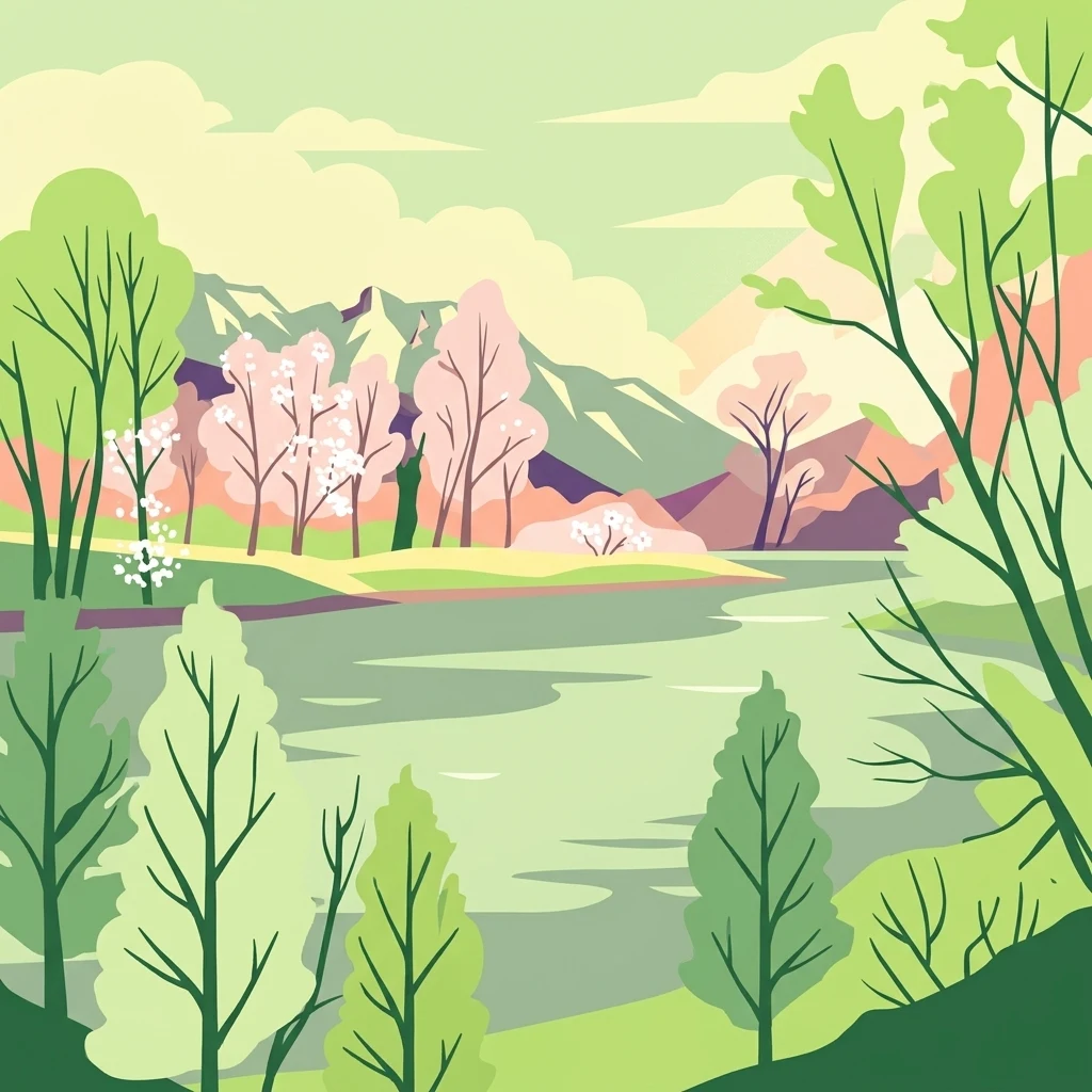
A flat vector illustration of a serene lake scene with green trees in the foreground, pink blossoming trees on the far shore, and purple mountains in the background under a pale sky.

Gampriner Seelein

Nature reserve

Park overview

Structured park overview, official facts, and landscape profile for Gampriner Seelein

Gampriner Seelein park facts, protected area profile, and essential visitor context

Review the core facts for Gampriner Seelein, including designation, size, terrain, visitor scale, habitats, and operating context in one park-focused overview.

About Gampriner Seelein

Gampriner Seelein is a small but ecologically distinctive lake in the lowland Unterland of Liechtenstein, near the village of Gamprin. Although Liechtenstein is a small country dominated by Alpine terrain, this lake lies in a much gentler landscape, sitting on the Rhine Valley floor at an elevation of about 435 meters above sea level. Its position within an open floodplain, rather than in a mountain basin, gives it a character quite different from the typical alpine lake of the wider Alpine region.

The lake was formed in 1927 during a major flood of the Rhine. Powerful erosion during that event carved out a basin that subsequently filled with water, creating a permanent lake in a country where no natural lakes had previously existed. Because every other lake in Liechtenstein is artificial, Gampriner Seelein holds a singular place in the country's geography. Locals sometimes refer to the lake affectionately as a Kleinod, meaning a small natural jewel, reflecting the way it contrasts with the otherwise heavily managed hydrographic landscape of the country.

The surroundings of the lake are equally important to its identity. A ring of Auenwald, or floodplain forest, made up of reeds, hedges, and trees frames the water, creating a transitional wetland habitat between the open water and the drained agricultural lands beyond. The government formally placed the lake and its immediate surroundings under nature protection in 1961, recognizing both its unusual origin and its ecological value. Since then, active management has improved water quality and stabilized the lake's biological condition, making it a quiet but meaningful protected area within Liechtensteins network of natural sites.

Quick facts and research context for Gampriner Seelein

Gampriner Seelein is a 1.53-hectare lake located near the village of Gamprin in the Unterland region of Liechtenstein. It sits at approximately 435 meters above sea level and reaches a maximum depth of around 6 meters, with an average depth of about 3 meters.

The lake is fed by a pipeline drawing fresh water from the Oberaukanal, a branch of the Liechtensteiner Binnenkanal, and discharges naturally through the Mölibach. The surrounding floodplain forest of reeds, hedges, and trees forms the protected buffer around the lake. It was placed under formal nature protection in 1961 and remains the only naturally formed lake in the Principality of Liechtenstein.

Protection and recognition

Examine the official terrestrial protected area records and establishment chronology.

Gampriner Seelein Protection Status and Designation History

Gampriner Seelein holds a documented terrestrial protection status established in 1961 without transboundary designation records. Review the formal conservation history and administrative background through structured park facts.

Protection details

Protection scope
Terrestrial
Designated year
1961
Transboundary protection
No
Park context

Deeper park guide and search-rich context for Gampriner Seelein

Gampriner Seelein history, landscape, wildlife, and travel context

Explore Gampriner Seelein through its history, landscape character, ecosystems, wildlife, conservation priorities, cultural context, and seasonal travel timing in a structured park guide built for atlas discovery and search intent.

Why Gampriner Seelein stands out

Gampriner Seelein is best known for being the only naturally formed lake in Liechtenstein, a country where virtually every other waterbody is artificial. Its 1927 origin during a major Rhine flood gives it a distinctive geological story compared with typical alpine lakes in the region. The lake is also distinguished by its protected floodplain setting. The surrounding Auenwald of reeds, hedges, and trees creates a wetland habitat that supports native fish, waterfowl, and a reestablished population of crayfish. The combination of natural origin, protected status, and carefully managed water quality makes the lake a small but unusually rich ecological site within the country.
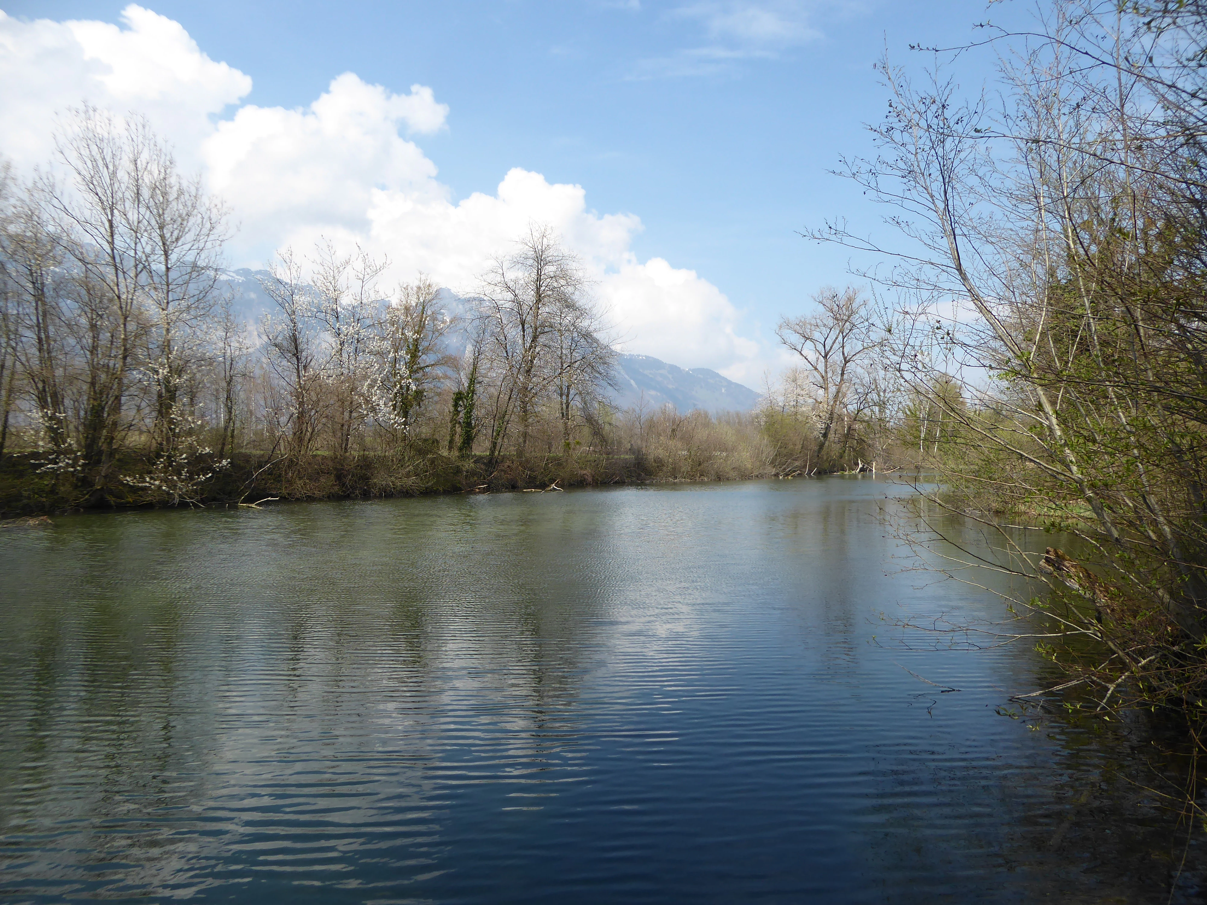
A calm blue lake reflecting the sky, bordered by bare trees and shrubs, with mountains visible in the distance under a partly cloudy sky.
View of the calm Gampriner Seelein lake surrounded by alluvial forest with mountains in the background.

Gampriner Seelein history and protected-area timeline

The lake's history begins with a natural disaster. In 1927, a major flood of the Rhine surged through the lowland area near Gamprin, and the resulting erosion carved a depression that gradually filled with water. This event created the only naturally formed lake in the Principality of Liechtenstein, setting the site apart from every other waterbody in the country, which is man-made.

For the first several decades of its existence, the lake was valued locally but did not have formal protected status. That changed in 1961, when the Liechtenstein government placed the lake and its surrounding floodplain vegetation under nature protection, recognizing it as a small but ecologically distinctive site. The protection order marked the transition of the lake from an interesting natural curiosity to a formally managed reserve.

In the years that followed, the lake was actively restored and maintained. After surrounding litter and pollution sources were addressed, the lake's water quality stabilized, and it achieved a good ecological classification. Beginning in 1979, a pipeline from the Oberaukanal, part of the Liechtensteiner Binnenkanal system, was used to bring fresh water into the lake, improving oxygenation and overall conditions. The following year, around one thousand noble crayfish were introduced, helping to establish a stable aquatic fauna that continues to characterize the site.

Gampriner Seelein landscape and geographic character

Gampriner Seelein lies in the flat to gently undulating terrain of the Rhine Valley in northern Liechtenstein, well below the alpine peaks that define much of the country. At about 435 meters above sea level, it sits in a landscape shaped less by glacial carving and more by river action, flood dynamics, and centuries of human water management along the Rhine.

The lake itself is modest: only about 1.53 hectares in surface area, with a maximum depth near 6 meters and an average depth of about 3 meters. Despite these small dimensions, the lake has clear, well-defined shorelines because of the dense vegetation that rings it. Reeds, shrubs, and trees form a continuous belt around the water, softening the edge between lake and land and giving the site a sheltered, enclosed character.

Beyond the immediate shoreline, the broader landscape is shaped by the floodplain of the Rhine and its associated canal system. The Mölibach carries water away from the lake, while the nearby Binnenkanal and Oberaukanal reflect the heavily engineered nature of the regional hydrology. In the background, when looking north toward the Swiss side, the peak of the Hoher Kasten in the Appenzell Alps forms a scenic counterpoint to the otherwise low-lying setting of the lake.

Gampriner Seelein ecosystems, habitats, and plant life

Ecologically, Gampriner Seelein functions as a small wetland reserve embedded within an otherwise heavily modified agricultural and hydrological landscape. The lake's central habitat is open freshwater, but the real ecological richness lies in the transition zone around it, where the Auenwald forms a mosaic of aquatic, emergent, shrub, and tree vegetation.

Reedbeds and submerged aquatic plants define much of the shoreline and shallow water. Recorded species include the common mare's tail (Hippuris vulgaris) and ivy-leaved duckweed (Lemna trisulca), both of which are typical of calm, nutrient-moderate freshwater in temperate Central Europe. The surrounding hedges and trees add structural diversity, offering cover for nesting birds and shade that helps regulate water temperature.

Water management has shaped the lake's ecological development. The pipeline connection to the Oberaukanal, in operation since 1979, supplies oxygenated fresh water and supports a stable aquatic environment. Combined with periodic cleanup and species introduction, this management has shifted the lake from an unstable, newly formed basin to a relatively balanced wetland ecosystem with consistent vegetation cover and a functioning aquatic community.

Gampriner Seelein wildlife and species highlights

The lake supports a small but diverse community of freshwater and wetland wildlife. Fish species recorded in and around the lake include roach, rudd, common bleak, bream, and pike, alongside the introduced noble crayfish population established in 1980. Together, these species occupy different ecological roles, from open-water schooling fish to predatory pike and bottom-dwelling crayfish, giving the small lake a relatively complete aquatic food web.

Birdlife is one of the more visible aspects of the reserve. The reeds and hedges around the lake provide nesting and foraging habitat for several water-associated species, including little grebe, common moorhen, mallard, coot, and occasional swans. These birds use the lake for feeding, shelter, and breeding, contributing to its character as a quiet wetland refuge.

Although the lake is small, the combination of open water, dense shoreline vegetation, and connections to the broader canal network of the Rhine Valley gives it an outsized importance for local biodiversity. For visitors and birdwatchers, it functions as a compact patch of wetland habitat in an otherwise intensively used lowland landscape.

Gampriner Seelein conservation status and protection priorities

Gampriner Seelein has been formally protected since 1961, when the Liechtenstein government placed it under nature protection as a reserve. The protection covers both the lake itself and its surrounding floodplain vegetation, recognizing the site as one of the few remaining natural wetland patches in the densely managed Rhine Valley of Liechtenstein.

Conservation management of the lake has combined passive protection with active restoration. Initial efforts focused on cleaning up accumulated waste and improving water quality, which allowed the lake to stabilize at a good ecological classification. The introduction of a fresh water pipeline from the Oberaukanal in 1979 was a defining moment, ensuring consistent oxygen supply and preventing stagnation in the small basin.

The reintroduction of noble crayfish in 1980 added an important ecological dimension, as native crayfish populations in Central Europe have been widely threatened by habitat loss and disease. Their presence here gives the lake a conservation role beyond simple habitat protection, contributing to the survival of a vulnerable native species within an otherwise heavily altered regional landscape.

Gampriner Seelein cultural meaning and human context

Gampriner Seelein holds a special place in local identity as the only naturally formed lake in Liechtenstein. In a small country where most waterbodies are reservoirs or canal features, the lake's natural origin during the 1927 Rhine flood gives it cultural as well as geographic significance. It is often referred to locally as a Kleinod, or small jewel, reflecting both its modest size and its symbolic value within Liechtensteins natural heritage.

The lake is also closely tied to the village of Gamprin, whose name it shares. The site is part of the everyday landscape of the Unterland region, where it is known both as a protected reserve and as a quiet local landmark. References to the lake appear in Liechtensteins historical and natural heritage literature, including the Historisches Lexikon des Fürstentums Liechtenstein, underscoring its recognized role within the country's cultural memory.

Beyond its formal recognition, the lake embodies a broader regional narrative about living with the Rhine. Its very existence is a reminder of the power of the river in shaping the lowland landscape, and its protection reflects a willingness to preserve small, fragile natural features even in an intensively managed country.

Top sights and standout views in Gampriner Seelein

Gampriner Seelein stands out as Liechtensteins only naturally formed lake, born from the powerful 1927 Rhine flood that reshaped the surrounding lowlands. Set in a rare surviving patch of Auenwald floodplain forest, it combines open water, reeds, hedges, and woodland into a compact wetland mosaic that is unusual for such a small, densely managed country.

The lakes combination of formal protection, dating to 1961, active water-quality management through the Oberaukanal pipeline, and the reintroduction of noble crayfish gives it a layered conservation story. For visitors interested in wetland ecology, native fish assemblages, and quiet birdwatching in a scenic Alpine setting, the lake offers a uniquely Liechtenstein version of these experiences.

Best time to visit Gampriner Seelein

The lake is most appealing in the warmer months, when its reeds are in full growth, waterfowl are most active around the shorelines, and the surrounding floodplain vegetation is at its most lush. Late spring through early autumn generally offers the richest combination of green vegetation, calm water conditions, and visible birdlife. In winter the lake remains a quiet, atmospheric site, though the surrounding vegetation is dormant and wildlife activity is reduced.

Because the lake is a protected reserve rather than a developed visitor site, visits tend to be quiet and observational rather than activity-based. It is well suited to short nature stops, gentle walks through the surrounding landscape, and slow-paced birdwatching, particularly during the breeding season when waterfowl are most visible.

Monthly climate preview

Long-term monthly temperature ranges and precipitation patterns for Gampriner Seelein in Liechtenstein

Gampriner Seelein Climate Normals: Measured Temperature and Precipitation Records

Representative coordinate records reveal significant annual temperature shifts alongside steady monthly precipitation variations at Gampriner Seelein. Examining the full twelve-month climate profile provides detailed insight into long-term meteorological averages across the protected terrain.
Annual mean4 °C
-6 °C14 °C
Jan-6°
Feb-5°
Mar-1°
Apr
May
Jun12°
Jul14°
Aug14°
Sep10°
Oct
Nov
Dec-4°
Warmest month
July

14 °C

Coolest month
January

-5.7 °C

Wettest month
June

5.5 mm/day

Driest month
February

2.5 mm/day

Park location guide

Geography guide, regional context, and park location map for Gampriner Seelein

Gampriner Seelein park geography, regions, and map view in Liechtenstein

Understand where Gampriner Seelein sits in Liechtenstein through a broader geographic reading of the surrounding landscape, nearby location context, and its mapped position within the national park landscape.

How Gampriner Seelein fits into Liechtenstein

The Principality of Liechtenstein is a small Central European country in the Alps, bordered by Switzerland to the west and north and Austria to the east. Founded in 1719, it became fully independent in 1866. The country is a parliamentary monarchy with the Prince holding significant executive powers. With an area of just 160 km² and a population of around 41,000, it is one of Europe's smallest and wealthiest nations.

Wider geography shaping Gampriner Seelein in Liechtenstein

Liechtenstein is situated in the Central European Alps between Austria to the east and north-east and Switzerland to the north-west, west and south. The country is doubly landlocked, meaning it is landlocked and surrounded by other landlocked countries. The terrain is mountainous with the Rhine River forming part of its western border.

Map view of Gampriner Seelein

Use this park location map to pinpoint Gampriner Seelein in Liechtenstein, understand its exact geographic position, and read its mapped placement within the surrounding landscape more clearly.

Pigeon | © OpenStreetMap contributors

Visual exploration of Liechtenstein's rare natural lake and floodplain forest habitats

Gampriner Seelein Photos, Scenery, and Protected Landscape Imagery

Visual records capture the distinctive terrain, dense shoreline vegetation, and wetland character of Gampriner Seelein. Examining these protected area photographs reveals the ecological depth of Liechtenstein's only naturally formed freshwater lake and its surrounding floodplain environment.

A calm blue lake reflecting the sky, bordered by bare trees and shrubs, with mountains visible in the distance under a partly cloudy sky.

Park atlas

Compare nearby wetland habitats, valley reserves, and regional protected landscapes.

Explore Parks Near Gampriner Seelein and Protected Areas in the Surrounding Region

Continue exploring regional protected areas and wetland habitats connected to the Rhine Valley lowlands after viewing Gampriner Seelein. Examining adjacent natural reserves provides deeper context into regional floodplain geography and protected landscapes.
A watercolor illustration of a landscape with green meadows, trees, and soft mountains in the background, set against a white background.
Nature reserveLiechtenstein
About 4.2 km away#1 closest

Northeast

Ruggeller Riet Nature Reserve: Geographic Context and Mapped Wetland Boundaries in Liechtenstein

A vital lowland moorland and wetland ecosystem in the Rhine valley.

Ruggeller Riet serves as the primary lowland nature reserve in Liechtenstein, featuring an expansive 88-hectare wetland landscape. Positioned in the Alpine Rhine valley near the tripoint with Austria and Switzerland, this protected area preserves the post-glacial history of the region through its distinctive peat meadows, bogs, and grassland habitats.

Area
0.88 km²
Established
1978
IUCN
Ia
Relief
Lowland
A wide watercolor illustration showing a landscape of green fields, trees, small white buildings, and distant purple mountains.
Biosphere reserveVorarlberg
About 11 km away#2 closest

South

Biosphere Reserve Großes Walsertal: Regional Geography and Protected Alpine Landscapes

A mapped conservation zone within the Vorarlberg Alps

Biosphere Reserve Großes Walsertal encompasses a protected valley characterized by significant geological diversity. Explore the transition from the soft flysch ridges of the Walserkamm to the dramatic limestone crests of the Kalkhochalpen, reflecting a modern approach to managing Alpine natural resources and cultural heritage in western Austria.

Area
192.31 km²
Established
2000
A watercolor painting showing a panoramic view of a wetland with water, grasses in the foreground, green hills, and purple-toned mountains in the distance.
Nature reserveVorarlberg
About 32 km away#3 closest

North

Rhine Delta Nature Reserve: Mapped Wetlands and Alpine Foothills Geography in Vorarlberg

A dynamic freshwater delta and critical bird habitat in Austria

The Rhine Delta constitutes the largest wetland biotope on Lake Constance, characterized by ongoing sediment deposits and an evolving shoreline. Its geography includes dense riparian forests, alluvial plains, and shallow bays that provide refuge for diverse amphibians and birds. This nature reserve serves as a prime example of large-scale wetland conservation nestled between the Alpine foothills and the open waters of the lake.

Area
20.65 km²
Established
1982
Relief
Lowland
Climate
Temperate
A soft watercolor painting of a wetland landscape with rolling hills, grassy plains, and gentle water channels in muted green and pink tones.
Nature reserveSt. Gallen
About 39 km away#4 closest

West

Kaltbrunner Riet Nature Reserve and Wetland Landscape in the Canton of St. Gallen

Mapping the protected fen habitats and agricultural wetland remnants of the Linthebene.

Kaltbrunner Riet serves as a primary nature reserve in the canton of St. Gallen, encompassing critical lowland fen and amphibian spawning habitats. As a protected Ramsar wetland, the reserve offers an essential window into the historic Linthebene landscape, showcasing how traditional meadow management sustains biodiversity across the Swiss plateau.

Area
0.5 km²
Established
1914
Relief
Lowland
Climate
Temperate
Protected landscapeBaden-Württemberg
About 42 km away#5 closest

North

Steilrand und Schotterfeld des Argentals südlich der Kochermühle Protected Landscape Atlas

Glacial geomorphology and river terrace geography in Baden-Württemberg

This protected area provides a diagrammatic view of the Argen valley's ice-age origins. By preserving a Late Glacial terrace complete with its characteristic steep edge and gravel-strewn surfaces, it offers an essential geographic reference for understanding the retreat of the Würm ice within the wider Bodenseebecken region.

Area
0.081 km²
Established
1954
Relief
Lowland
Climate
Temperate
A flat, stylized illustration showing a waterfall cascading from a cliff into a river that flows alongside a forest towards a large body of water under a soft-toned sky.
Protected landscapeBaden-Württemberg
About 43 km away#6 closest

North

Württembergisches Bodenseeufer: Protected Shoreline Landscapes of Lake Constance

A regional atlas of riparian habitats in Baden-Württemberg

Württembergisches Bodenseeufer preserves over 180 hectares of natural shoreline across Friedrichshafen, Langenargen, and Kressbronn am Bodensee. This protected landscape highlights essential riparian ecology, featuring diverse river mouth environments and largely unaltered forest edges that define the southern borders of the Bodenseekreis district.

Area
1.88 km²
Established
1940
Relief
Lowland
Climate
Temperate
Protected landscapeBaden-Württemberg
About 47 km away#7 closest

North

Tettnanger Wald mit Hochwacht, Krüntenbühl, Reichenbühl, Argenhardter Kopf, Schoos und Steilrand des Argentales an dem Schwandenbogen: Geography and Protected Boundaries

A Glacial Landscape Protection Area in the Lake Constance Basin

This protected landscape in Baden-Württemberg captures a classic moraine terrain shaped by glacial retreat. With its system of ridges, dead-ice hollows, and escarpments along the Argen valley, the area serves as a critical geological reference point. Explore the detailed topography and mapped boundaries of this forest landscape within the broader Bodenseebecken region.

Area
7.01 km²
Established
1954
Regional parkGraubünden
About 48 km away#8 closest

South

Naturpark Beverin: Exploring Alpine Gorges and Cultural Landscapes in Graubünden

A regional nature park shaped by high alpine ridges and ancient settlement traditions.

Naturpark Beverin encompasses a vast, multi-layered environment in the Swiss Alps. The area is defined by the sharp vertical contrast between carved river gorges like the Viamala and high-elevation ridges. Beyond the rugged mountain terrain, this protected landscape preserves centuries of pastoral history through the distinct settlement traditions of its Romanesque and Walser valleys.

Area
515 km²
Established
2013
Relief
Mountain
Climate
Alpine

Common questions about visiting, size, designation, and location context for Gampriner Seelein

Gampriner Seelein FAQs for park facts, access, geography, and protected area context

Find quick answers about Gampriner Seelein, including protected-area facts, park geography, trail and visitor context, and how the park fits into its surrounding country and regional landscape.
MoriAtlas Explorer

Continue Your Protected Areas Search Across the Global Atlas

Deepen your exploration by continuing the structured search for national parks and protected areas worldwide. Utilize the comprehensive filtering capabilities to compare different conservation landscapes and refine your understanding of global park geography. Discover more about the distribution and characteristics of protected natural areas.

Global natural geography