

Mori Atlas logo
Nature reserveGower Conservation Park

Exploring the geological terrain, limestone outcrops, and native forest remnants of this regional reserve.

Gower Conservation Park and the Protected Eucalypt Forest Landscapes of South Australia

Gower Conservation Park serves as a crucial protected landscape in the lower south east of South Australia. Covering undulating consolidated calcarenite dunes, this nature reserve safeguards a rare, representative sample of native eucalypt forest. The park terrain features distinctive sandy soils and limestone outcrops that support a diverse understorey of grass trees and banksia, offering a window into the original regional vegetation structure that once characterized this part of the Australian landscape.

south australiaconservation parksmall protected areaeucalypt forestdry sclerophyll foreststringybark woodland

Gower Conservation Park

Nature reserve

Park overview

Structured park overview, official facts, and landscape profile for Gower Conservation Park

Gower Conservation Park park facts, protected area profile, and essential visitor context

Review the core facts for Gower Conservation Park, including designation, size, terrain, visitor scale, habitats, and operating context in one park-focused overview.

About Gower Conservation Park

Gower Conservation Park is a compact protected area in South Australia's lower south east, occupying gently undulating terrain in the Hundred of Hindmarsh near the small locality of Tantanoola. Although small, the park plays an outsize ecological role in the region because it protects a stand of vegetation that is considered representative of what much of the surrounding landscape once looked like before broad-scale clearing. The reserve is managed as an IUCN Category III protected area, recognising its significance as a natural feature of conservation value.

The landscape of the park is built on consolidated calcarenite dunes, a geological substrate common in this part of South Australia, which are covered by brown to grey sandy soils that are weakly structured. In several places, particularly toward the centre and south of the park, limestone outcrops reach the surface. These outcrops are closely associated with rough-barked manna gum, giving those parts of the park a distinctive vegetation character that differs subtly from the surrounding stringybark forest.

Ecologically, the park is dominated by an open eucalypt forest in which messmate stringybark and brown stringybark are the main canopy species. Beneath the canopy, a shrub and ground layer of austral bracken, spike wattle, grass trees and silver-leaved banksia fills the habitat, while a localised stand of manna gum with large black wattle marks the southern end of the reserve. Together, these communities create a layered plant structure typical of the pre-clearing vegetation of the lower south east of South Australia.

Despite its small area, Gower Conservation Park has had a stable place in South Australia's reserve system for more than half a century. It was first proclaimed as Gower National Parks Reserve in 1971, then reclassified as a conservation park in 1972 after South Australia consolidated its conservation legislation. The park remains a quiet but enduring reference site for the original forest character of the lower south east.

Quick facts and research context for Gower Conservation Park

Gower Conservation Park is a 40 hectare reserve in the lower south east of South Australia, near the small locality of Tantanoola and within reach of Mount Gambier. It is classified as an IUCN Category III protected area and is managed by the South Australian Department for Environment and Water.

The park was first proclaimed on 21 January 1971 under the National Parks Act 1966 and became a conservation park on 27 April 1972 after the introduction of the National Parks and Wildlife Act 1972. It was also listed on the now-defunct Register of the National Estate in 1980.

Protection and recognition

Documented terrestrial protection metrics and administrative boundaries

Gower Conservation Park Protection Status and Administrative Scope

Gower Conservation Park maintains a defined terrestrial protection scope within the official registry of conservation lands. Verified administrative records outline the governance framework and formal designation parameters associated with this protected landscape.

Protection details

Protection scope
Terrestrial
Transboundary protection
No
Park context

Deeper park guide and search-rich context for Gower Conservation Park

Gower Conservation Park history, landscape, wildlife, and travel context

Explore Gower Conservation Park through its history, landscape character, ecosystems, wildlife, conservation priorities, cultural context, and seasonal travel timing in a structured park guide built for atlas discovery and search intent.

Why Gower Conservation Park stands out

Gower Conservation Park is best known for safeguarding a representative stand of the eucalypt forest that originally covered much of the lower south east of South Australia. In a region where centuries of land clearing have reduced native eucalypt cover, this small reserve preserves an example of the original forest structure, including its characteristic stringybark-dominated canopy and the limestone-associated manna gum community in the southern part of the park. It is also recognised for its underlying landscape of consolidated calcarenite dunes and sandy soils, which together support a distinctive mix of eucalypt overstorey, bracken-rich understorey and scattered banksia and grass tree shrub layers typical of the region.

Gower Conservation Park history and protected-area timeline

Gower Conservation Park was first proclaimed as a national park on 21 January 1971 under the National Parks Act 1966 of South Australia. At that time it was given the name Gower National Parks Reserve and was placed within the Hundred of Hindmarsh.

On 27 April 1972, the reserve was renamed Gower Conservation Park following the proclamation of the National Parks and Wildlife Act 1972. The new act repealed the earlier National Parks Act 1966 as well as several other conservation-related statutes, effectively reorganising the state's protected-area framework and shifting the park into the conservation-park category.

In 1980, the park was recognised as significant because it represented the type of eucalypt forest that had once covered much of the lower south east of South Australia. That same year it was included on the now-defunct Register of the National Estate, formalising its heritage and ecological value at the national level.

Gower Conservation Park landscape and geographic character

The landscape of Gower Conservation Park is shaped by the coastal geological history of South Australia's lower south east. The terrain consists of undulating consolidated calcarenite dunes, a substrate formed from ancient coastal dune systems that have since hardened into rock. These dunes are mantled by brown to grey, weakly structured sandy soils that give the park a soft, gently rolling profile rather than dramatic relief.

Limestone outcrops appear in the central and southern parts of the park, marking places where the underlying calcarenite reaches the surface. These rocky exposures are not only a feature of the park's physical character but also define a distinctive vegetation zone. The southern end of the reserve in particular carries a stand of rough-barked manna gum and large black wattle that sits apart visually from the broader stringybark-dominated forest, giving the southern part of the park its own subtle landscape identity.

Overall, the park reads as a small piece of the original south-east South Australian countryside: low dunes, sandy ground, scattered limestone and an open forest canopy that together evoke the regional character that once extended far beyond the reserve's current boundaries.

Gower Conservation Park ecosystems, habitats, and plant life

Ecologically, Gower Conservation Park is a stand of dry sclerophyll eucalypt forest, a vegetation type that was once widespread across the lower south east of South Australia. The park is significant because it preserves an example of this forest in a region where large-scale land clearing for agriculture and plantation forestry has reduced comparable native vegetation to scattered remnants.

The core of the vegetation is an open eucalypt forest dominated by messmate stringybark and brown stringybark. This canopy admits enough light to support a substantial understorey. Austral bracken forms a conspicuous ground and shrub layer, while spike wattle, grass trees and silver-leaved banksia occur as scattered shrubs through the forest. The combination of stringybark canopy and bracken-rich understorey is highly characteristic of the pre-clearing vegetation of the south east of South Australia.

In the southern part of the park, the vegetation shifts where limestone outcrops are associated with rough-barked manna gum, creating a plant community that differs in structure and species composition from the stringybark forest that dominates the rest of the reserve.

Gower Conservation Park wildlife and species highlights

The available source material does not document specific fauna records for Gower Conservation Park, so no detailed wildlife section can be reliably written. The park's open eucalypt forest, bracken understorey and limestone-associated manna gum community would generally support typical south-east South Australian woodland fauna, but unsupported species claims are not appropriate here.

Gower Conservation Park conservation status and protection priorities

Gower Conservation Park's conservation significance lies in its role as a surviving reference site for the original eucalypt forest of the lower south east of South Australia. Within a region where much of the native vegetation has been cleared or converted, the park preserves both the characteristic stringybark canopy and the less common manna gum community on limestone soils, together representing two ecologically important facets of the pre-clearing landscape.

The park is classified as an IUCN Category III protected area, acknowledging it as a natural feature of conservation value. It was also listed on the Register of the National Estate in 1980, reflecting its recognised importance at a national level. The reserve has been under continuous public protection since being proclaimed in 1971, and ongoing management by South Australia's Department for Environment and Water ensures its continued role as a representative sample of the regional forest type.

Top sights and standout views in Gower Conservation Park

Gower Conservation Park protects a representative sample of the eucalypt forest that once covered much of the lower south east of South Australia, including the stringybark-dominated canopy and the less common manna gum woodland over limestone.

Its compact 40 hectare area and its protected status since 1971 make it a long-standing reference site for regional vegetation, while its combination of consolidated calcarenite dunes, sandy soils and limestone outcrops gives the park a layered ecological character unusual for such a small reserve.

Best time to visit Gower Conservation Park

The source material does not provide detailed seasonal guidance, so no specific bestTimeToVisit content can be reliably written. As a south-east South Australian conservation park with open eucalypt forest and a mild, relatively cool regional climate, conditions are likely to be most pleasant in the warmer and drier months of the southern hemisphere late spring to early autumn, but this should not be stated as park-specific advice.
Monthly climate preview

Long-term temperature and monthly precipitation averages across the protected landscape

Gower Conservation Park Climate Normals and Annual Weather Patterns

Gower Conservation Park records measured monthly temperature variations and precipitation distributions across representative coordinates from nineteen ninety-one to twenty twenty. Examining the complete twelve-month profile provides detailed meteorological data for ongoing ecological and geographical analysis.
Annual mean14 °C
9 °C20 °C
Jan20°
Feb20°
Mar18°
Apr15°
May12°
Jun10°
Jul
Aug10°
Sep11°
Oct13°
Nov15°
Dec18°
Warmest month
February

19.8 °C

Coolest month
July

9.1 °C

Wettest month
July

2.9 mm/day

Driest month
February

0.7 mm/day

Park location guide

Geography guide, regional context, and park location map for Gower Conservation Park

Gower Conservation Park park geography, regions, and map view in Australia

Understand where Gower Conservation Park sits in Australia through a broader geographic reading of the surrounding landscape, nearby location context, and its mapped position within the national park landscape.

How Gower Conservation Park fits into Australia

Australia is a constitutional monarchy and federal parliamentary democracy comprising six states and ten territories. With a population of nearly 28 million, it is one of the world's most urbanised countries, with most people concentrated on the eastern seaboard. The country has a high Human Development Index and is known for its cultural diversity, ancient Aboriginal heritage, and unique wildlife.

Wider geography shaping Gower Conservation Park in Australia

Australia occupies the entire Australian continent, the island of Tasmania, and numerous smaller islands. It is the world's flattest and driest inhabited continent, featuring vast deserts in the interior (the Outback), tropical rainforests along the eastern coast, and a coastline bordering the Indian and Pacific Oceans.

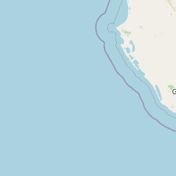
Map view of Gower Conservation Park

Use this park location map to pinpoint Gower Conservation Park in Australia, understand its exact geographic position, and read its mapped placement within the surrounding landscape more clearly.

Pigeon | © OpenStreetMap contributors

Location context for Gower Conservation Park

South Australia
Park atlas

Compare nearby national parks and regional forest reserves across South Australia

Other Parks Near Gower Conservation Park And Surrounding Protected Landscapes

Browse protected areas near Gower Conservation Park to compare regional eucalypt forests and dune landscapes. Discover adjacent reserves that share the ecological character of South Australia.
National parkSouth Australia
About 17 km away#1 closest

Northwest

Canunda National Park: South Australia's Protected Landscape and Geographic Atlas

Explore mapped boundaries and regional natural geography.

Canunda National Park in South Australia is presented here as a distinct protected landscape. This detail page focuses on its geographic setting, providing insights into its mapped boundaries and its role within the regional atlas context. Understand the park's natural geography and its protected status for informed exploration.

Area
96.24 km²
Established
1959
IUCN
VI
Relief
Lowland
Nature reserveSouth Australia
About 24 km away#2 closest

South

Carpenter Rocks Conservation Park: Geography and Protected Woodland Map in South Australia

A specialized nature reserve supporting endemic plant and bird habitats

Discover the geographic footprint of Carpenter Rocks Conservation Park in the Limestone Coast region of South Australia. This nature reserve is defined by its role in preserving the only known population of the Carpenter Rocks Manna Gum and its status as a historical sanctuary for threatened migratory bird populations.

Area
0.33 km²
Established
2001
IUCN
VI
Visitors
100 annual
Nature reserveSouth Australia
About 33 km away#3 closest

South

Douglas Point Conservation Park: Coastal Protected Area and Limestone Geography

Nature reserve atlas entry for southeastern South Australia.

Douglas Point Conservation Park serves as a crucial refuge for endangered flora along the Limestone Coast. This nature reserve highlights the intersection of coastal limestone formations and specific biodiversity conservation goals, providing a clear example of South Australia's targeted approach to regional protected lands and specialized shoreline ecosystems.

Area
0.6 km²
Established
1997
IUCN
VI
Relief
Lowland
Nature reserveSouth Australia
About 39 km away#4 closest

South

Dingley Dell Conservation Park Protected Area and Geographic Overview

Limestone Coast woodland and heritage landscape

Dingley Dell Conservation Park is a compact protected area situated in the south-east of South Australia, near Port MacDonnell. The site features a preserved woodland landscape dominated by blue gums and wattles, offering a quiet, sheltered contrast to the surrounding pastoral paddocks of the Limestone Coast. This overview examines the geography, boundaries, and historical significance of the reserve as a unique, small-scale protected land entity.

Area
0.06 km²
Established
1922
Relief
Lowland
Climate
Mediterranean
Nature reserveWattle Range
About 40 km away#5 closest

North

Calectasia Conservation Park: Protected Area Mapping and Landscape Context in Wattle Range

Rare plant habitat and stranded dune ecosystems in South Australia

Calectasia Conservation Park serves as an important protected site within Wattle Range, preserving a delicate balance between seasonally inundated swampland and dry sandy-land woodland. This geographic overview examines the reserve's protected status, its history of habitat management, and the distinct physical terrain that supports a rare population of blue tinsel lily.

Area
0.14 km²
Established
1967
IUCN
IV
Relief
Lowland
Nature reserveSouth Australia
About 41 km away#6 closest

Southeast

Ewens Ponds Conservation Park: An Atlas View of South Australia's Freshwater Springs

Geographic boundaries and spring-fed aquatic terrain analysis.

Situated in the Limestone Coast region of South Australia, Ewens Ponds Conservation Park preserves an unusual freshwater spring complex. This nature reserve serves as a critical example of limestone-fed aquatic habitats and remnant native vegetation, providing a clear window into the natural ecology of the local region compared to surrounding cleared land.

Area
0.36 km²
Established
1976
IUCN
III
Relief
Lowland
Nature reserveSouth Australia
About 44 km away#7 closest

Northwest

Furner Conservation Park Geography and Protected Woodland Atlas for South Australia

A study of forest remnants, sandy rises, and coastal dune topography

Furner Conservation Park preserves a significant mosaic of native woodlands within the Limestone Coast region. The terrain shifts between sandy rises and stony calcarenite ridges, supporting distinct forest communities that offer a vital look into the natural history and regional geography of South Australia.

Area
2.89 km²
Established
1973
IUCN
III
Relief
Upland
National parkAustralia
About 50 km away#8 closest

Southeast

Lower Glenelg National Park: Dramatic River Gorge and Limestone Cave Protected Landscape

Explore its mapped boundaries and unique geological features.

Lower Glenelg National Park in Victoria, Australia, is a national park celebrated for its visually stunning Glenelg River gorge. This protected area showcases millions of years of geological history etched into its limestone cliffs and features the accessible Princess Margaret Rose Cave. Understand the park's mapped landscape, its diverse terrain from riverine woodlands to coastal wetlands, and its significance within regional geographic exploration.

Area
273 km²
Established
1969
IUCN
II
Visitors
200K annual

Common questions about visiting, size, designation, and location context for Gower Conservation Park

Gower Conservation Park FAQs for park facts, access, geography, and protected area context

Find quick answers about Gower Conservation Park, including protected-area facts, park geography, trail and visitor context, and how the park fits into its surrounding country and regional landscape.
MoriAtlas Explorer

Continue Your Protected Areas Search Across the Global Atlas

Deepen your exploration by continuing the structured search for national parks and protected areas worldwide. Utilize the comprehensive filtering capabilities to compare different conservation landscapes and refine your understanding of global park geography. Discover more about the distribution and characteristics of protected natural areas.

Global natural geography