
Why Hambrücker Wiesen stands out
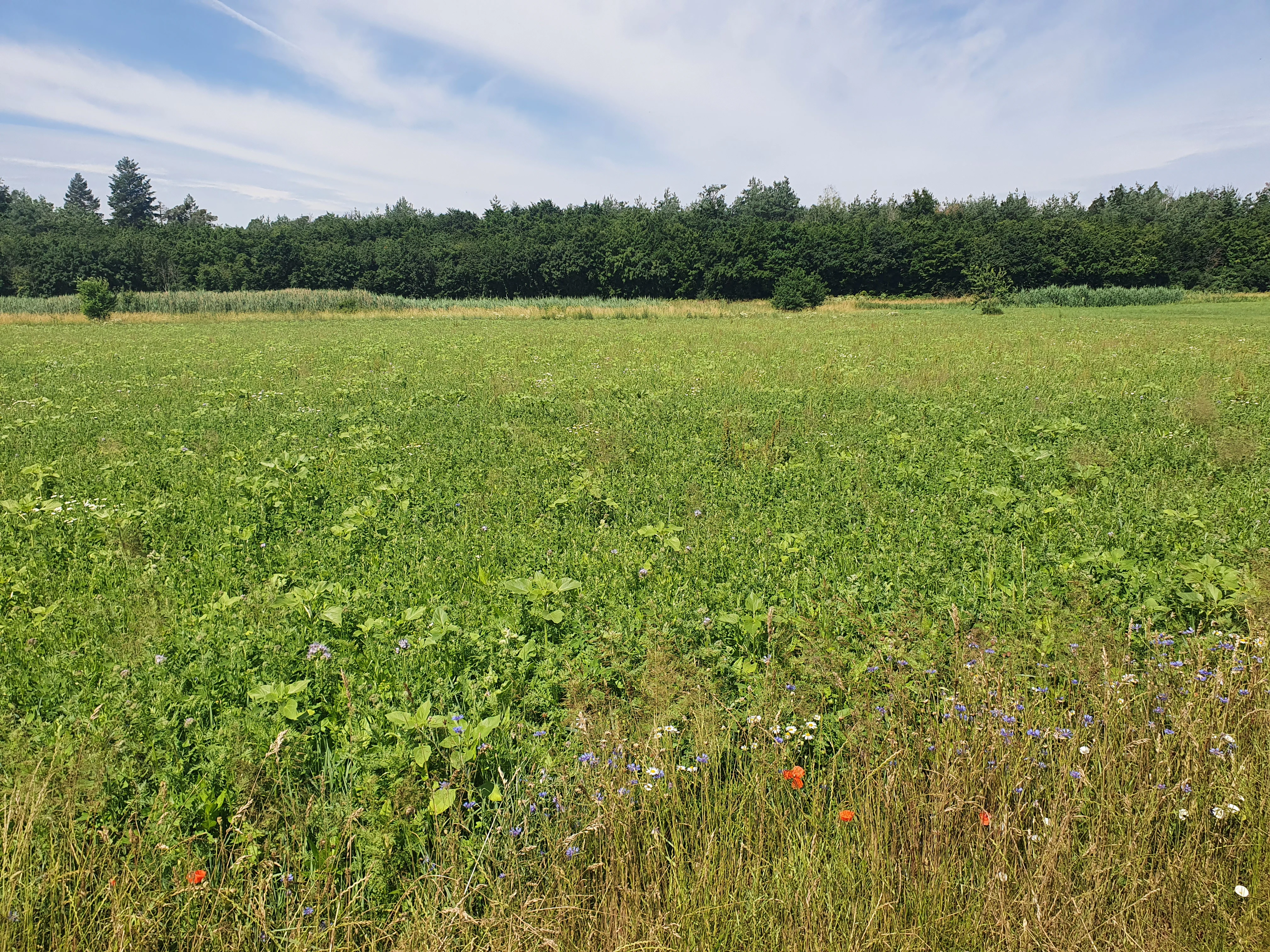
Hambrücker Wiesen is best known for its extensive species-rich meadows, including lowland hay meadows of conservation value, and for the wetland habitats along the Wagbach. It is also recognized for preserving a traditional agricultural landscape, with field barns, silage silos, and machine halls concentrated in the northern Bastwiesen area, alongside scattered orchards that reflect the region's rural heritage. The protection ordinance emphasizes both biodiversity conservation and the safeguarding of open, unfragmented farmland against building sprawl and enclosure.
Hambrücker Wiesen history and protected-area timeline
The protected landscape area Hambrücker Wiesen was formally designated through ordinance by the Landratsamt Karlsruhe on 9 September 1991. The designation brought together already-existing agricultural land west, north, and south of the village of Hambrücken under a single protective framework, responding to long-standing concerns about the loss of open farmland and meadow biodiversity in the western Upper Rhine region. The ordinance defined the Bastwiesen area north of the village as a concentration zone for permitted agricultural structures such as field barns, an arrangement that reflects the area's longstanding role as working farmland.
The area's later integration with the European Natura 2000 network strengthened its conservation standing. Substantial portions of the landscape protection area overlap with the FFH site Lußhardt between Reilingen and Karlsdorf, aligning local agricultural landscape protection with broader European habitat conservation goals. Today, the area remains under the authority of the Landratsamt Karlsruhe, with its designation registered in the World Database on Protected Areas under ID 321342 and in the Baden-Württemberg state protected areas registry under identifier 2.15.050.
Hambrücker Wiesen landscape and geographic character
Hambrücker Wiesen lies within the Hardtebenen, the natural region of the western Upper Rhine Plain where flatter lowlands give way to the sandy and gravelly terraces of the Rhine's western fringe. The terrain itself is gentle: the protected landscape sits on relatively level ground where agricultural use is straightforward and the view across the meadows extends broadly. The settlement of Hambrücken forms the eastern anchor of the area, and the open meadows and fields stretch westward toward the Wagbach stream and, beyond it, to the edge of the Lußhardt forest landscape.
The Wagbach is the single most prominent landscape feature within the area. It traces a corridor of wetland habitat that contrasts with the drier agricultural surroundings, introducing reed beds and wet meadows into an otherwise meadow-and-field dominated environment. The protected landscape is organized into several named field blocks: the Bastwiesen to the north of Hambrücken, where most agricultural structures are concentrated; the Bruchruten and Stöckwiesen areas to the south; and the broad open-land strip along the western edge of the village. To the south, the area meets the Obere Saalbachniederung protected landscape, and to the north, the Obere Lußhardt, while the Lußhardt forest itself forms a green western horizon.
Hambrücker Wiesen ecosystems, habitats, and plant life
Ecologically, Hambrücker Wiesen is defined by open meadow and farmland habitats, with the Wagbach corridor providing a distinct wetland thread through the area. The meadow vegetation includes portions classified as Magere Flachland-Mähwiesen, lowland hay meadows designated under German biotope protection for their species richness and conservation value. These meadows harbor plant communities that range from common grassland species to rarer plants of conservation concern. The ordinance's stated purpose explicitly highlights the importance of preserving extensively used meadows with species-rich, partly rare plant communities and endangered plant species.
Along the Wagbach, the habitat character shifts. Reed beds (Röhrichte) and wet meadows occupy the moister strip where the stream creates conditions favorable to moisture-dependent vegetation. Scattered orchard stands (Streuobstbestände) are found within the area, adding a traditional semi-open habitat element that bridges agricultural and ecological value. Together, these habitats create a working agricultural mosaic in which meadow biodiversity, wetland vegetation, and traditional orchard landscapes coexist, all under a unified protection framework that also determines how the land can be built upon.
Hambrücker Wiesen conservation status and protection priorities
The conservation framework of Hambrücker Wiesen rests on three explicit purposes laid out in its 1991 designation ordinance. The first is the preservation and long-term safeguarding of extensive meadow areas and their species-rich, in some cases rare, plant communities and endangered plant species. The second is the protection of the agricultural landscape from building sprawl and enclosure, ensuring the land remains in landscape-appropriate use and accessible for local recreation. The third is the concentration of permitted agricultural buildings, particularly field barns, in the Bastwiesen area north of Hambrücken, avoiding scattered construction across the open landscape.
These local aims are reinforced by the area's substantial overlap with the FFH site Lußhardt between Reilingen and Karlsdorf, providing the meadows with a layer of European habitat protection. The designation is registered under IUCN Category V, classifying it as a Protected Landscape where the interaction of people and nature over time has produced an area of distinctive character with significant ecological, cultural, and scenic value. In the broader regional context, Hambrücker Wiesen forms part of a connected network of protected landscapes in the Landkreis Karlsruhe, linking meadow, wetland, and forest protected zones along the western fringe of the Upper Rhine Plain.
Hambrücker Wiesen cultural meaning and human context
The cultural dimension of Hambrücker Wiesen lies in its character as a working agricultural landscape rather than a wilderness. Field barns, silage silos, and machine halls grouped in the Bastwiesen area reflect the ongoing role of farming in shaping the local countryside. Scattered orchard stands within the protected area point to a traditional mixed-use rural economy that combined fruit cultivation with meadow and field agriculture. The name itself, meaning "Hambrücken meadows," ties the landscape tightly to the village community and its agricultural identity.
Protection of this area is also protection of an open, publicly accessible rural landscape close to the village. The ordinance explicitly names local recreation (Naherholung) as a protected purpose, alongside ecological aims, reflecting the area's traditional role as a place where residents and visitors experience the countryside around Hambrücken.
Top sights and standout views in Hambrücker Wiesen
A continuous open agricultural landscape of around 107 hectares wrapping around the village of Hambrücken, anchored by the Wagbach wetland corridor and bordered by neighboring protected landscapes to the north and south. Conservation-focused meadow habitats including lowland hay meadows under biotope protection, complemented by reed beds, wet meadows, and scattered orchards. Substantial overlap with the FFH site Lußhardt between Reilingen and Karlsdorf, embedding the area within the European Natura 2000 network. A traditional agricultural character preserved through concentrated barns and farm structures in the Bastwiesen area, with explicit protection of the open land from residential sprawl and enclosure.
Best time to visit Hambrücker Wiesen
The meadows and wetland habitats of Hambrücker Wiesen are at their most visually expressive during late spring and early summer, when lowland hay meadows are typically at peak flowering and the reed beds along the Wagbach are in full growth. Late spring through midsummer is also the period when meadow plant communities are most identifiable, including rarer species that the protection ordinance specifically seeks to preserve. Autumn brings a quieter, more muted character to the agricultural landscape, with harvested fields and remaining meadow vegetation marking the seasonal transition. Winter visits emphasize the openness of the landscape and the contrast between the flat meadowland and the forested Lußhardt horizon to the west, though the floral interest of the meadows is largely absent.