
Mori Atlas logo
Nature reserveHildener Heide, östlich Taubenberg

Examining the ecological terrain and regional geography of this protected nature reserve.

Hildener Heide, östlich Taubenberg: A Protected Wet Heath Landscape in Nordrhein-Westfalen

(Naturschutzgebiet Hildener Heide, östlich Taubenberg)

Hildener Heide, östlich Taubenberg represents a critical fragment of wet heathland situated within the Bergische Heideterrasse of Nordrhein-Westfalen. This two hectare nature reserve protects vital mire habitats and heath vegetation, functioning as an integrated component of the broader Natura 2000 Hilden-Spörkelnbruch site. Its landscape is defined by managed plaggen soils, heath ponds, and botanically diverse heath populations that reflect historic regional land use patterns.

wet heathheathlandnature reserveheidemoorbog asphodelSphagnum bog woodland
A stylized digital illustration of a valley between rocky mountains with a waterfall flowing into a river, framed by trees in the foreground.

Hildener Heide, östlich Taubenberg

Nature reserve

Park overview

Structured park overview, official facts, and landscape profile for Hildener Heide, östlich Taubenberg

Hildener Heide, östlich Taubenberg park facts, protected area profile, and essential visitor context

Review the core facts for Hildener Heide, östlich Taubenberg, including designation, size, terrain, visitor scale, habitats, and operating context in one park-focused overview.

About Hildener Heide, östlich Taubenberg

Hildener Heide, östlich Taubenberg is a compact but ecologically significant nature reserve embedded within the larger forested landscape east of Hilden in the Mettmann district of North Rhine-Westphalia. Although the protected core covers only about two hectares, the site carries considerable weight within the regional conservation network because it preserves some of the best-quality wet heath habitat remaining on the Bergische Heideterrasse.

The reserve belongs to a constellation of small protected forest and heath sites that collectively define the Hildener Heide landscape. To the north lies the Sandbach-Krebsbach area of the Hildener Stadtwald, to the west the Biesenbach area, and further south the Sandberg and the southern Sandberg heath reserves. Together with the neighbouring Ohligser Heide and Further Moor, these protected zones form a connected biotope network stretching across the Bergische Heideterrasse toward the well-known Wahner Heide.

Ecologically, the reserve captures a transitional landscape where wet, boggy habitat meets dry heath and upland forest margins. Traditional management techniques, particularly plaggen cutting, are used here to maintain open, nutrient-poor conditions that support a specialised community of plants and animals. The site also hosts a small heath pond (Heideteich) with developing bank vegetation, adding to the diversity of wetland microhabitats.

Administratively, the area is a formally designated Naturschutzgebiet with the code ME-034, embedded within the European Natura 2000 framework through the FFH site DE-4807-302 (Hilden – Spörkelnbruch). Its small size contrasts sharply with its ecological importance, making it a key reference point for heathland conservation in this part of the Lower Rhine region.

Quick facts and research context for Hildener Heide, östlich Taubenberg

Hildener Heide, östlich Taubenberg is a habitat/species management area classified under IUCN Category IV and designated under German nature reserve (Naturschutzgebiet) law. The core protected area covers around two hectares, while the surrounding FFH site "Hilden – Spörkelnbruch" extends to roughly 108 hectares.

The reserve was first established in 1993 and was updated within the Mettmann district landscape plan of 2012. It carries the official designation ME-034 and is administered by the lower landscape authority (Untere Landschaftsbehörde) of the Kreis Mettmann.

The site forms part of the Natura 2000 site DE-4807-302 and contributes to a regional biotope network connecting the Bergische Heideterrasse, linking fragmentary heath, bog woodland, and stream habitats from Hilden and Haan toward the Wahner Heide.

Protection and recognition

Documented conservation status and international recognition data for Hildener Heide, östlich Taubenberg.

Hildener Heide, östlich Taubenberg Protection Status and Protected Area Documentation

Examine the verified protection status, designation framework, and official database records associated with Hildener Heide, östlich Taubenberg. Review structured conservation metrics and international registry entries compiled for this protected area.

Protection details

WDPA ID
165299
Park context

Deeper park guide and search-rich context for Hildener Heide, östlich Taubenberg

Hildener Heide, östlich Taubenberg history, landscape, wildlife, and travel context

Explore Hildener Heide, östlich Taubenberg through its history, landscape character, ecosystems, wildlife, conservation priorities, cultural context, and seasonal travel timing in a structured park guide built for atlas discovery and search intent.

Why Hildener Heide, östlich Taubenberg stands out

The reserve is best known for its exceptionally well-developed wet heath vegetation, particularly dense populations of the bright yellow-flowered bog asphodel (Narthecium ossifragum) alongside cross-leaved heath (Erica tetralix). These species together create the most species-rich wet heath fragment within the entire Hildener Heide complex. It is also closely associated with active conservation management using traditional plaggen-cutting techniques, which remove the upper organic layer to expose nutrient-poor soil and create open pioneer habitat for sundews, cottongrass, and characteristic heath fauna.
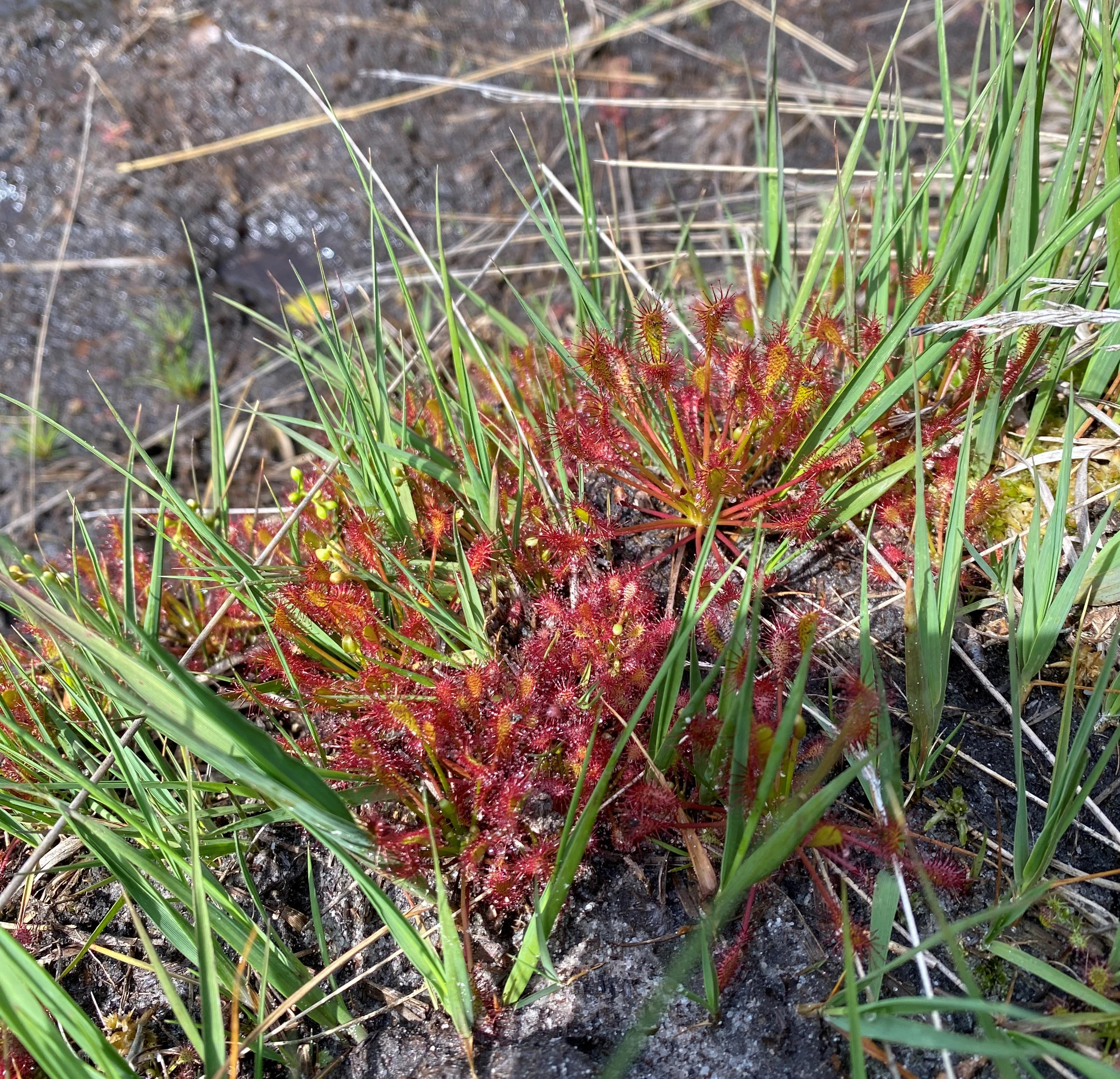
A close-up view of a cluster of reddish oblong-leaved sundew plants growing among green grasses in a damp, dark soil environment.
Oblong-leaved sundew (Drosera intermedia) in the heathland of Hildener Heide.

Hildener Heide, östlich Taubenberg history and protected-area timeline

The area now protected as Hildener Heide, östlich Taubenberg was formally established as a nature reserve in 1993, recognising the exceptional ecological value of its wet heath vegetation within the broader Hildener Stadtwald. The designation was incorporated into the regional planning framework through the landscape plan (Landschaftsplan) of the Kreis Mettmann, which was updated in 2012 to reflect current conservation priorities.

Its protection came at a moment of growing awareness in North Rhine-Westphalia of the importance of preserving fragmented heath and bog habitats on the Bergische Heideterrasse. The site already had a long history of being part of a forested municipal landscape (Stadtwald), but the increasing encroachment of woodland and loss of traditional land-use practices threatened the open heath character that gives the area its distinctive biodiversity.

Since its designation, the reserve has been managed actively to maintain its open heath structure, particularly through the practice of plaggen cutting, a technique that recreates the disturbance regime historically associated with heathland persistence. The site is also part of the broader Natura 2000 Hilden – Spörkelnbruch FFH site, integrating it into the European protected-area network.

Hildener Heide, östlich Taubenberg landscape and geographic character

The reserve sits within the gently undulating terrain of the Bergische Heideterrasse, a broad terrace landscape that historically supported extensive heath vegetation and now forms a critical refugium for heathland species in western Germany. Within the reserve, the most prominent landform is a small but well-developed heidemoor, or wet heath mire, surrounded by mixed forest and bordered by drier heath communities.

A small heath pond (Heideteich) sits within the protected area, its margins gradually being colonised by characteristic bank vegetation communities. Streams and small brooks associated with the broader Stadtwald flow through the surroundings, contributing to the mosaic of wet and dry habitats that define the local topography.

Plaggen cutting has visibly shaped the ground surface in places, creating open, bare-soil patches that interrupt the closed heath and forest cover. These exposed mineral-soil areas contrast sharply with the green and golden heath vegetation and the darker surrounding woodland, producing a distinctive patchy landscape of microsuccessional stages.
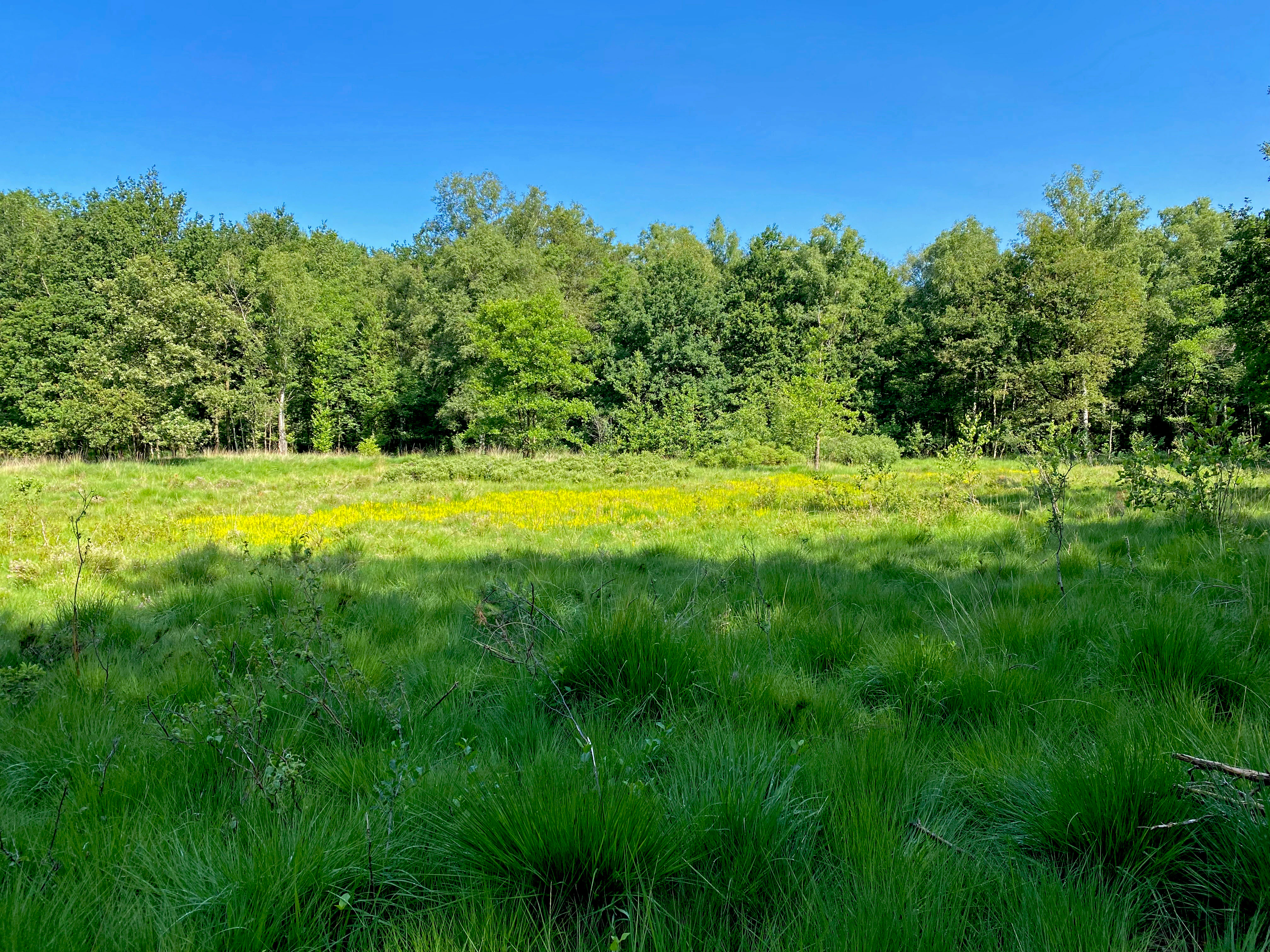
A bright green meadow filled with yellow bog asphodel flowers under a clear blue sky, with a dense forest line in the background.
A field of bog asphodel in the Hildener Heide nature reserve.

Hildener Heide, östlich Taubenberg ecosystems, habitats, and plant life

The defining ecological character of the reserve is its exceptionally well-developed wet heath vegetation. Cross-leaved heath (Erica tetralix) and bog asphodel (Narthecium ossifragum) form the most visible vegetation structure, with the bright yellow flowering of the bog asphodel being particularly conspicuous during the summer months.

On areas that have been plaggen-cut to expose bare mineral soil, the vegetation shifts toward pioneer-stage specialists adapted to nutrient-poor, open conditions. Here, narrow-leaved cottongrass (Eriophorum angustifolium) grows alongside the carnivorous round-leaved sundew (Drosera rotundifolia) and intermediate sundew (Drosera intermedia), an assemblage strongly associated with ombrotrophic and minerotrophic peatland margins.

The drier edges of the reserve support common heather or besenheide (Calluna vulgaris), producing a clear zonation from dry heath at the margins through transitional vegetation into the central, fully developed wet heath. The Heideteich adds an additional aquatic dimension, with developing bank vegetation that enhances habitat complexity.

Surrounding the reserve, the broader Hildener Stadtwald contains moors and bog woodlands, wet oak and birch woodland, near-natural sandy streams, dry heath patches, and wet meadows, creating a varied habitat matrix that supports the ecological coherence of the site.
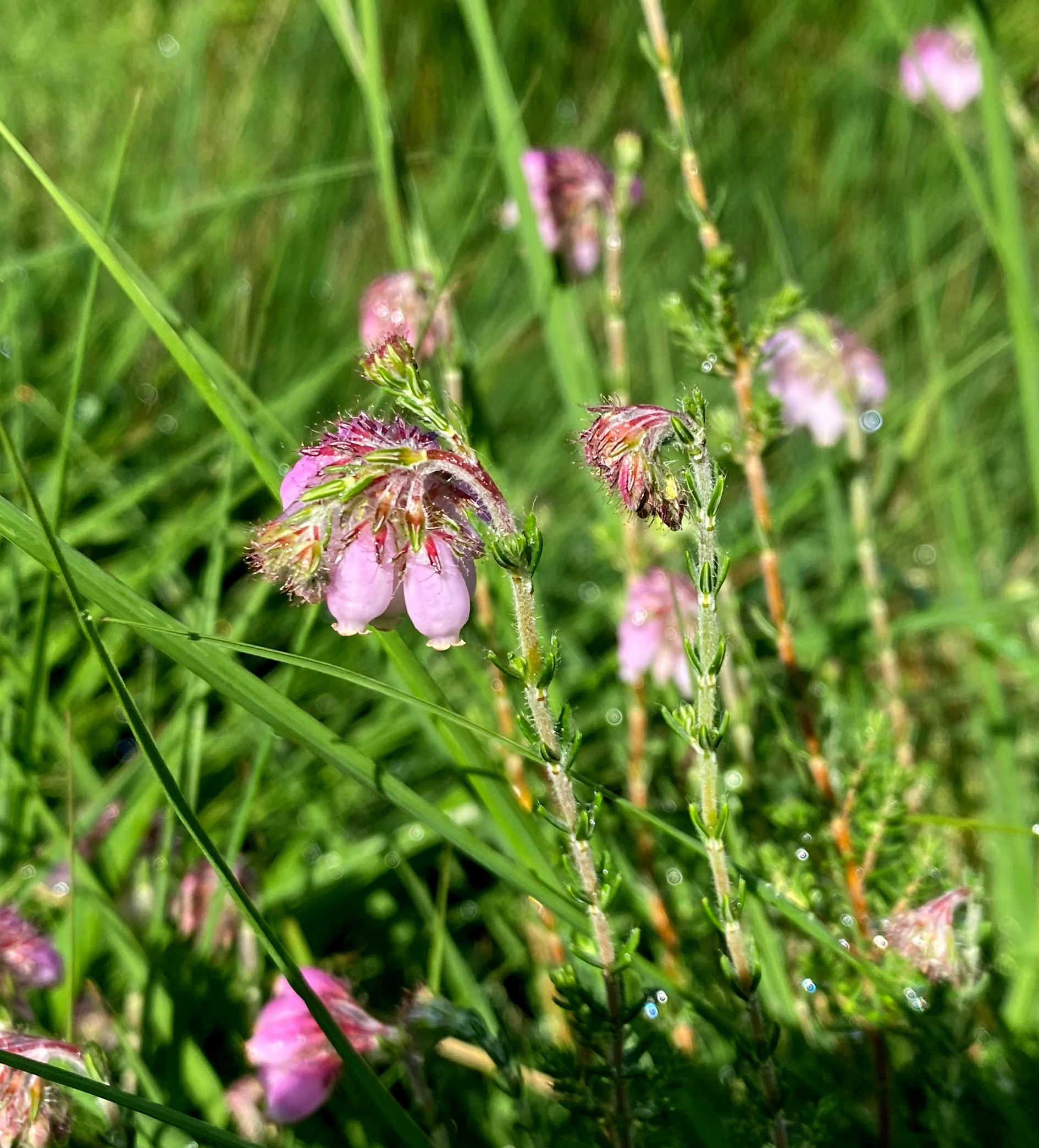
Close-up of pink, bell-shaped flowers of cross-leaved heath surrounded by green grass.
Cross-leaved heath (Erica tetralix) blooming in the Hildener Heide.

Hildener Heide, östlich Taubenberg wildlife and species highlights

The wildlife character of the reserve is closely tied to its open, nutrient-poor heath and peatland habitats. Reptiles such as the adder (Vipera berus) are associated with the structural complexity of transitional heath margins and bog edges.

The open, disturbed ground and bare-soil patches created by plaggen management support communities of ground-nesting and ground-foraging insects, including digger wasps (Grabwespen) and heath grasshoppers (Ödlandschrecken). These insects in turn sustain a range of predators and provide food resources for heathland bird species.

The wheatear (Oenanthe oenanthe) is among the bird species that utilise the open pioneer habitats of the reserve, taking advantage of bare ground for nesting and foraging. The mosaic of dry heath, wet heath, small pond, and adjacent woodland provides habitat diversity that supports a wider invertebrate and small-vertebrate fauna characteristic of the Bergische Heideterrasse.
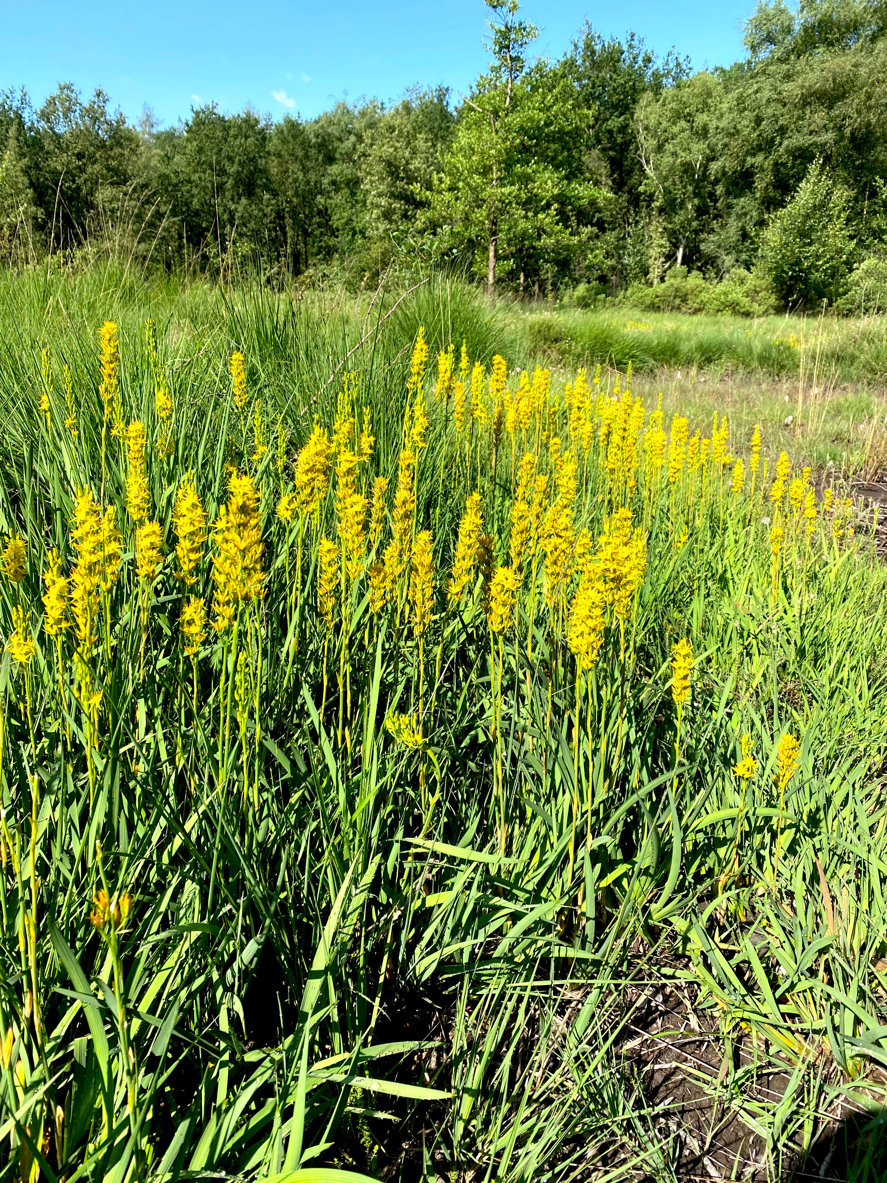
A close-up view of a large cluster of yellow bog asphodel flowers blooming in a grassy, wetland area with a forest edge in the background.
A vibrant stand of bog asphodel in the Hildener Heide nature reserve.

Hildener Heide, östlich Taubenberg conservation status and protection priorities

Hildener Heide, östlich Taubenberg is formally protected both as a German Naturschutzgebiet and as a component of the European Natura 2000 network through the FFH site DE-4807-302 (Hilden – Spörkelnbruch). The combination of national and EU-level designations reflects the strong conservation significance attached to the site's wet heath vegetation.

The primary conservation goals are the preservation and restoration of wet heath fragments, the development of species-rich bog woodland communities dominated by Sphagnum mosses alongside natural stream courses, and the optimisation of a heath pond with intact marginal vegetation zones. These aims recognise the reserve as both a habitat refuge and a restoration nucleus within a fragmented regional heath landscape.

Active management using traditional plaggen cutting is central to the conservation approach. By periodically removing the upper organic layer, managers maintain the open, nutrient-poor conditions that heath plants like Erica tetralix, Narthecium ossifragum, and Drosera species require. Without this disturbance regime, succession toward woodland would rapidly eliminate the heath character that defines the site.

The reserve's integration into the broader biotope network of the Bergische Heideterrasse, connecting with the Ohligser Heide, the Further Moor, and ultimately the Wahner Heide, gives it significance beyond its small footprint. It functions as a node in a regional strategy aimed at maintaining functional connectivity for heathland species across an increasingly fragmented lowland landscape.

Hildener Heide, östlich Taubenberg cultural meaning and human context

The site is part of the Hildener Stadtwald, a long-standing municipal forest that has shaped the relationship between the town of Hilden and its surrounding landscape for generations. The traditional land-use practices that underpin the reserve's conservation, particularly plaggen cutting, are rooted in centuries of regional heathland management that once sustained grazing, sod-cutting, and small-scale agriculture.

Within the broader context of the Bergische Heideterrasse, the reserve sits in a cultural landscape historically shaped by small-scale, low-intensity human activity, which produced and maintained the open heath mosaic. Today, the continuation of these traditional practices is itself a form of cultural continuity, preserving not only biodiversity but also a regional land-use heritage.
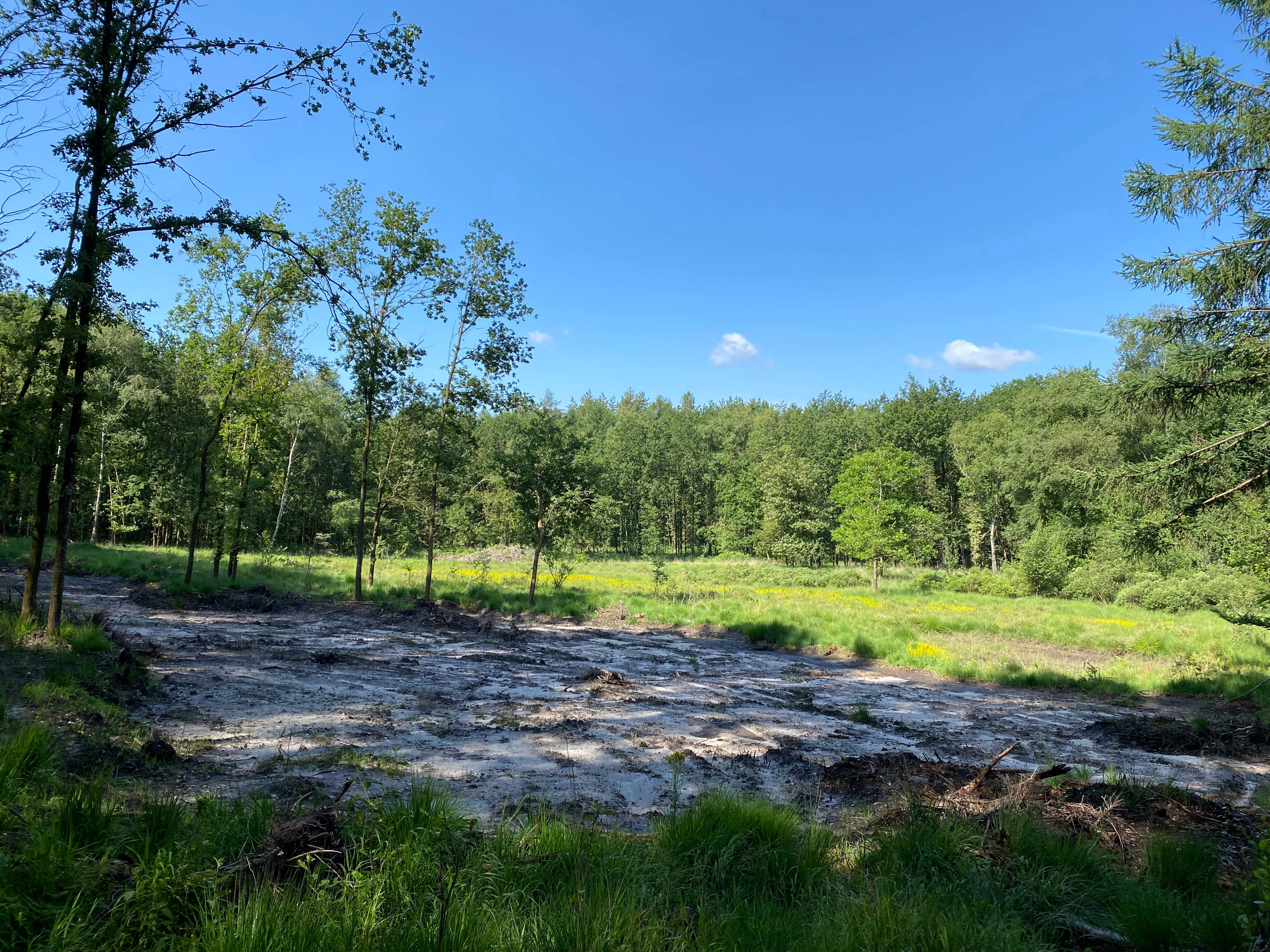
A sunny outdoor scene showing a clearing in a forest with a patch of exposed, light-colored soil in the foreground transitioning into grassy meadow and dense trees.
A managed area of exposed soil undergoing regeneration within the Hildener Heide nature reserve.

Top sights and standout views in Hildener Heide, östlich Taubenberg

Hildener Heide, östlich Taubenberg stands out as the most ecologically intact wet heath fragment within the entire Hildener Heide complex, distinguished particularly by its extensive populations of bog asphodel and cross-leaved heath.

Its position within the Natura 2000 site "Hilden – Spörkelnbruch" links it to a regional biotope network that extends via the Bergische Heideterrasse to the Wahner Heide, giving it importance far beyond its modest two-hectare core area. Active management through plaggen cutting and the conservation of a small heath pond with naturalising banks reinforces its role as a working example of lowland heath restoration.
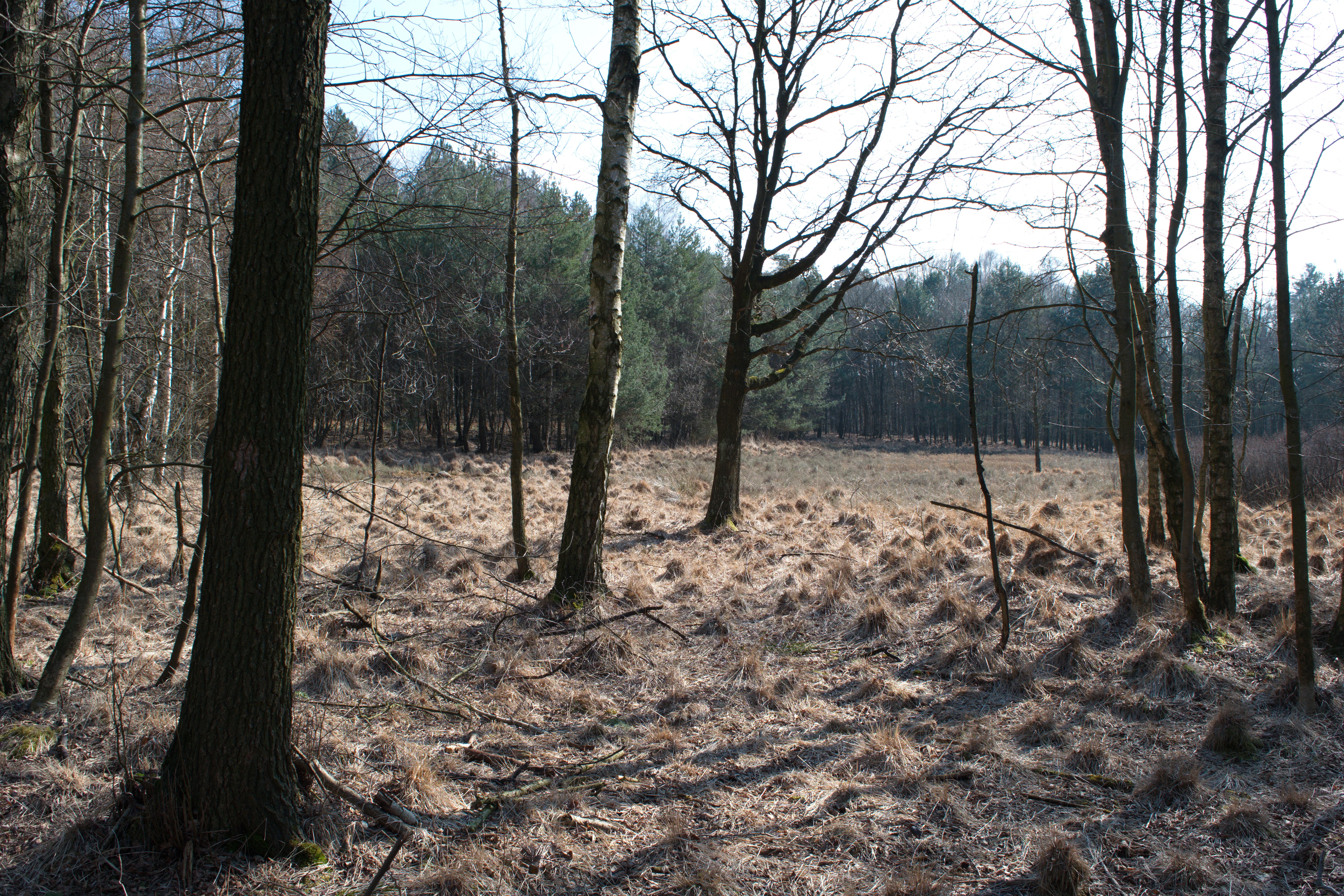
A sparsely wooded area with bare trees and dry, tussocky heathland grasses under a bright sky.
A view of the landscape within Hildener Heide featuring heathland vegetation and light woodland.

Best time to visit Hildener Heide, östlich Taubenberg

Late summer is generally the period when the wet heath community of the reserve reaches its most visually striking expression, with bog asphodel producing its characteristic bright yellow flower spikes alongside the flowering cross-leaved heath. Spring visits can show fresh post-management bare-soil patches recently exposed by plaggen cutting, while the surrounding woodland offers a quieter, more subtle seasonal atmosphere in the cooler months.

The reserve is small and embedded within forest, so it tends to be appreciated most by visitors interested specifically in heathland botany and conservation rather than dramatic scenery. Timing around weather is more important than timing around peak tourist seasons.

Monthly climate preview

Long-term representative temperature and precipitation patterns across the year

Hildener Heide, östlich Taubenberg Climate Normals and Annual Weather Rhythm

Representative coordinate records show measured temperature swings and steady precipitation rates across the twelve-month cycle in Hildener Heide, östlich Taubenberg. Detailed monthly climatology data provides deeper insight into long-term averages for sustained geographical analysis.
Annual mean10 °C
1 °C19 °C
Jan
Feb
Mar
Apr
May13°
Jun17°
Jul19°
Aug19°
Sep15°
Oct10°
Nov
Dec
Warmest month
July

19.2 °C

Coolest month
January

1.3 °C

Wettest month
December

2.6 mm/day

Driest month
April

1.6 mm/day

Park location guide

Geography guide, regional context, and park location map for Hildener Heide, östlich Taubenberg

Hildener Heide, östlich Taubenberg park geography, regions, and map view in Germany

Understand where Hildener Heide, östlich Taubenberg sits in Germany through a broader geographic reading of the surrounding landscape, nearby location context, and its mapped position within the national park landscape.

How Hildener Heide, östlich Taubenberg fits into Germany

Germany is a federal republic in Western and Central Europe with a population of over 83 million across sixteen constituent states. It is Europe's largest economy by nominal GDP and a major global exporter and importer. The capital is Berlin, and the country borders Denmark, Poland, Czech Republic, Austria, Switzerland, France, Luxembourg, Belgium, and the Netherlands.

Wider geography shaping Hildener Heide, östlich Taubenberg in Germany

Germany is located in Western and Central Europe, spanning 357,022 km². It borders Denmark to the north, Poland and the Czech Republic to the east, Austria and Switzerland to the south, and France, Luxembourg, Belgium, and the Netherlands to the west. The country has coastlines on the Baltic Sea and North Sea to the north, with the Alps located in the southern region.

Map view of Hildener Heide, östlich Taubenberg

Use this park location map to pinpoint Hildener Heide, östlich Taubenberg in Germany, understand its exact geographic position, and read its mapped placement within the surrounding landscape more clearly.

Pigeon | © OpenStreetMap contributors

Location context for Hildener Heide, östlich Taubenberg

Nordrhein-Westfalen

Explore photographic records of wet heath habitats, terrain, and regional nature reserve characteristics.

Visualizing Hildener Heide, östlich Taubenberg: Protected Landscapes and Scenery

Visual records capture the distinct wet heath vegetation, small mire fragments, and open pioneer soils defining Hildener Heide, östlich Taubenberg. Photographic documentation reveals the intimate terrain and ecological character of this protected landscape within the Bergische Heideterrasse.

A close-up view of a cluster of reddish oblong-leaved sundew plants growing among green grasses in a damp, dark soil environment.

A narrow dirt trail curves through a forest with tall deciduous and coniferous trees, with patches of grass and dappled sunlight on the ground.

A bright green meadow filled with yellow bog asphodel flowers under a clear blue sky, with a dense forest line in the background.

Close-up of pink, bell-shaped flowers of cross-leaved heath surrounded by green grass.

A close-up view of a large cluster of yellow bog asphodel flowers blooming in a grassy, wetland area with a forest edge in the background.

Close-up view of fluffy, white common cottongrass seed heads against a dark, blurred wetland background.

A sunny outdoor scene showing a clearing in a forest with a patch of exposed, light-colored soil in the foreground transitioning into grassy meadow and dense trees.

A sparsely wooded area with bare trees and dry, tussocky heathland grasses under a bright sky.

Park atlas

Compare surrounding lowland heath reserves and regional conservation landscapes

Parks Near Hildener Heide, östlich Taubenberg and Related Protected Areas

Visitors exploring Hildener Heide, östlich Taubenberg can browse adjacent protected areas and connected forest reserves across the Bergische Heideterrasse. Extending the route into neighboring biotope networks reveals wider patterns of regional heathland geography and local conservation terrain.
Watercolor illustration showing a wide landscape with rolling hills in soft pink and purple tones, a line of green conifer and deciduous trees, and a grassy foreground with a winding path or stream
Nature reserveNordrhein-Westfalen
About 0.9 km away#1 closest

Southeast

Hildener Heide, Schönholz Nature Reserve: Geography and Protected Area Context

A preserved mosaic of inland heath and bog forest habitats.

Hildener Heide, Schönholz provides a critical window into the rare wetland ecosystems of the Bergische Heideterrasse. This nature reserve in North Rhine-Westphalia retains a distinct mosaic of peat-moss-dominated bog woodland, wet heath, and alder-ash floodplain forest, offering a high density of threatened habitats within a protected geographic framework.

Area
0.36 km²
Established
1938
IUCN
IV
Relief
Lowland
A soft watercolor illustration of a calm stream winding through a wetland or bog area, with gentle hills in the background and a split tree trunk in the foreground.
Nature reserveNordrhein-Westfalen
About 1 km away#2 closest

West

Hildener Stadtwald, Bereich Biesenbach: Protected Wetland and Heathland Geography

Nature reserve complex in the Mettmann district of Nordrhein-Westfalen

This compact nature reserve preserves a critical network of bog woodland and stream-fed alder swamp within the sand-dominated terrain of the Bergische Heideterrasse. The area demonstrates a clear transition between elevated dry forest margins and permanently wet peat moss communities, anchoring a wider regional system of protected heathland habitats.

Area
0.09 km²
Established
1938
IUCN
IV
Relief
Lowland
Watercolor painting of a meandering stream flowing through a green meadow, with trees in the background.
Nature reserveNordrhein-Westfalen
About 1 km away#3 closest

Northwest

Hildener Stadtwald, Bereich Sandbach-Krebsbach Protected Nature Reserve and Wetland Geography

A mapped overview of the Bergische Heideterrasse riparian corridor.

Hildener Stadtwald, Bereich Sandbach-Krebsbach stands as an important nature reserve within the urbanised landscape of North Rhine-Westphalia. The area is characterized by its hydrologically dynamic sandy brooks, old-growth alder stands, and distinct microhabitats ranging from wet heath to dry oak-birch forests. This protected entity offers a clear look at the structural complexity of lowland mire ecosystems within a broader regional forest context.

Area
0.27 km²
Established
1938
IUCN
IV
Relief
Lowland
A soft watercolor painting of a small grove of trees standing near a body of water, featuring pale green and yellow tones.
Nature reserveNordrhein-Westfalen
About 1.3 km away#4 closest

Southeast

Naturschutzgebiet Hildener Heide, südlich Sandberg: Protected Area and Landscape Atlas

Bog woodland and wet heathland geography in North Rhine-Westphalia.

Examine the topography and habitat mosaic of Naturschutzgebiet Hildener Heide, südlich Sandberg. This nature reserve serves as an important ecological anchor on the Bergische Heideterrasse, preserving rare wetland, alder bog forest, and heath vegetation within a compact and structurally diverse geographic footprint.

Area
0.08 km²
Established
1938
IUCN
IV
Relief
Lowland
A horizontal watercolor painting of a calm stream flowing through a grassy valley with distant hills and scattered trees under a soft, pink-tinted sky.
Nature reserveKreis Mettmann
About 2 km away#5 closest

Northeast

Hühnerbachtal Nature Reserve: Geography and Protected Landscape in Kreis Mettmann

Mapped stream valley ecosystems and local habitat connectivity.

Hühnerbachtal protects a unique valley mosaic in Germany, characterized by floodplain forests and steep wooded slopes. The reserve maintains a critical biotope network near Haan, offering a deep look into the regional geography and protected terrain of the Mettmann district.

Area
0.244 km²
Established
1997
IUCN
IV
A watercolor painting showing a soft landscape scene with a winding stream, low-lying vegetation, and distant hills in pale green and earth tones.
Nature reserveNorth Rhine-Westphalia
About 2.6 km away#6 closest

Northeast

Mahnerter Bachtal: Mapping the Protected Stream Valley Habitats of North Rhine-Westphalia

A vital riparian landscape and lowland nature reserve

Mahnerter Bachtal preserves a significant lowland stream valley in Erkrath, featuring alder swamps, wet meadows, and ancient oak forests. This 28-hectare nature reserve functions as a crucial east-west ecological corridor, offering a rare glimpse of undisturbed valley geography within the sprawling industrial landscape of the German Rhine-Ruhr metropolitan area.

Area
0.28 km²
Established
1997
IUCN
IV
Watercolor painting of a tranquil, marshy landscape with soft green trees, grass, and a winding path, rendered in a pale, minimalist style.
Nature reserveNordrhein-Westfalen
About 3.6 km away#7 closest

South

Krüdersheide und Götsche Nature Reserve: Geographic Mapping and Protected Land Data

Wetland mosaic and bog forest habitats in Nordrhein-Westfalen

Located in Solingen, the Krüdersheide und Götsche nature reserve protects essential bog woodland, peat cushions, and stream habitats on the Bergische Heideterrasse. This 55-hectare site serves as an important ecological corridor for moisture-dependent flora and fauna within an urbanized region of Nordrhein-Westfalen. Study its mapped boundaries and terrain context through our specialized atlas database.

Area
0.547 km²
Established
2005
IUCN
IV
Relief
Lowland
A watercolor painting showing a soft, peaceful landscape with light green rolling hills in the background, a flat plain in the middle ground, and grasses and wildflowers in the foreground under a pale, warm sky.
Nature reserveNordrhein-Westfalen
About 5.3 km away#8 closest

North

Laubacher Steinbruch Nature Reserve: Mapped Geographic Overview and Protected Landscape Analysis

Calcareous habitats in the Neandertal valley, Germany

Laubacher Steinbruch is a distinct nature reserve characterized by a mosaic of sycamore maple forest, steep limestone cliffs, and dry scree fields. Situated within the Neandertal Natura 2000 site, it acts as a critical refuge for specialized plant communities and reptiles, forming an integral part of the regional conservation network in Nordrhein-Westfalen.

Area
0.06 km²
Established
1997
IUCN
IV

Common questions about visiting, size, designation, and location context for Hildener Heide, östlich Taubenberg

Hildener Heide, östlich Taubenberg FAQs for park facts, access, geography, and protected area context

Find quick answers about Hildener Heide, östlich Taubenberg, including protected-area facts, park geography, trail and visitor context, and how the park fits into its surrounding country and regional landscape.
MoriAtlas Explorer

Continue Your Protected Areas Search Across the Global Atlas

Deepen your exploration by continuing the structured search for national parks and protected areas worldwide. Utilize the comprehensive filtering capabilities to compare different conservation landscapes and refine your understanding of global park geography. Discover more about the distribution and characteristics of protected natural areas.

Global natural geography