

Mori Atlas logo
Nature reserveNatura 2000-område nr. 4 Hirsholmene, havet vest herfor og Ellinge Å's udløb

A comprehensive geographic examination of unique bubble reefs, coastal dune systems, and vital wetland habitats in northern Denmark

Natura 2000-område nr. 4 Hirsholmene, havet vest herfor og Ellinge Å's udløb: Protected Marine and Coastal Geography

This protected area encompasses over 9,500 hectares of marine environment and coastal terrain in Region Nordjylland, ranging from the submerged stone and bubble reefs of the Kattegat to the river-influenced meadows of the Ellinge Å outlet. Through structured geographic mapping, the region reveals a complex interplay between open sea, shifting dune sequences, and rare biological environments that host Denmark's largest colony of Sandwich terns. Explore the spatial arrangement of this dual marine and terrestrial habitat, defined by microbial gas seeps and diverse coastal plant communities.

Natura 2000Ramsar sitemarine protected areaisland groupKattegatseabird breeding

Natura 2000-område nr. 4 Hirsholmene, havet vest herfor og Ellinge Å's udløb

Nature reserve

Park overview

Structured park overview, official facts, and landscape profile for Hirsholmene, the Sea West of Them and the Outlet of Ellinge Å

Hirsholmene, the Sea West of Them and the Outlet of Ellinge Å park facts, protected area profile, and essential visitor context

Review the core facts for Hirsholmene, the Sea West of Them and the Outlet of Ellinge Å, including designation, size, terrain, visitor scale, habitats, and operating context in one park-focused overview.

About Hirsholmene, the Sea West of Them and the Outlet of Ellinge Å

Hirsholmene, the sea west of the islands and the outlet of Ellinge Å form a compact but ecologically rich Natura 2000 site in northern Denmark, in the waters of the Kattegat just off Frederikshavn. The protected area combines open marine habitats, a small offshore island group, dune systems, and freshwater-influenced coastal meadows, offering an unusually diverse cross-section of both marine and terrestrial nature within a single designated site.

The marine portion is the heart of the site and the source of its national significance. Around the Hirsholmene islands, the seabed features extensive sandbanks, lagoons, stone reefs, and the distinctive bubble reefs. These bubble reefs are unusual geological and biological structures created where gas seeps from the sub-surface and microorganisms bind sand grains into columnar sandstone formations. The resulting reef structures host a colorful, coral-reef-like community of marine organisms, while the broader reef complex around Hirsholmene supports an exceptional Danish macroalgae assemblage, notable in both total biomass and species richness.

The terrestrial portion of the site is smaller but equally varied. Along the mainland coastline near the outlet of Ellinge Å, low-lying meadows, dune formations, dune slacks, acidic grasslands, and richer calcareous grasslands create a mosaic of habitats. A 1.5 kilometer stretch of coast is protected specifically for recreational use, and a larger marine area around Hirsholmene and south toward Frederikshavn carries additional nature protection status. Hirsholmene itself is designated as a nature reserve, providing additional legal protection on top of the Natura 2000 framework.

Ecologically, the site functions as an integrated coastal-marine system. Seabirds such as Sandwich terns and black-headed gulls breed on Hirsholm in nationally important numbers, while protected butterfly populations fly in the meadows near Ellinge Å and rare plants cling to surviving dune patches. Lampreys, salmon, and natterjack toads use the freshwater and wetland habitats, and the surrounding waters carry protected seal populations. This range of features within a relatively compact area gives the site a profile that is unusually broad for a Danish Natura 2000 designation.

Quick facts and research context for Hirsholmene, the Sea West of Them and the Outlet of Ellinge Å

The site is located in Frederikshavn Municipality in the North Jutland Region of Denmark and lies within the Kattegat/Skagerrak marine area. It functions simultaneously as a Ramsar site, a Habitats Directive Special Area of Conservation, and a Bird Protection Area, reflecting the combination of marine, coastal, and freshwater habitats it contains.

Its total area is about 9,533 hectares, the majority of which is open sea around the Hirsholmene island group. The site includes protected nature reserve status for Hirsholmene and a 1.5 kilometer stretch of coastline set aside for recreational use. A Natura 2000 plan was first adopted in 2011, with the current planning cycle covering 2022-2027 and coordinated with the Northern Kattegat, Skagerrak water plan.

Protection and recognition

Examine the documented protection status and designated conservation scope for this protected area.

Protection Status and International Recognition for Natura 2000-område nr. 4 Hirsholmene, havet vest herfor og Ellinge Å's udløb

This structured reference details the mixed protection status and designation history assigned to Natura 2000-område nr. 4 Hirsholmene, havet vest herfor og Ellinge Å's udløb. Researchers examine these official conservation records to understand the established management framework and recognized boundaries.

Protection details

Protection scope
Mixed
Transboundary protection
No
Park context

Deeper park guide and search-rich context for Hirsholmene, the Sea West of Them and the Outlet of Ellinge Å

Hirsholmene, the Sea West of Them and the Outlet of Ellinge Å history, landscape, wildlife, and travel context

Explore Hirsholmene, the Sea West of Them and the Outlet of Ellinge Å through its history, landscape character, ecosystems, wildlife, conservation priorities, cultural context, and seasonal travel timing in a structured park guide built for atlas discovery and search intent.

Why Hirsholmene, the Sea West of Them and the Outlet of Ellinge Å stands out

The site is especially known for the marine environment around the Hirsholmene islands, which harbors one of Denmark's most exceptional concentrations of macroalgae in both quantity and species diversity. The reefs in this area are the visible tops of larger underwater structures, including the unusual bubble reefs formed by microbial cementation of sand around gas seeps, creating coral-reef-like habitats with colorful marine life. It is also well known for hosting Denmark's largest breeding colony of Sandwich terns on Hirsholm, along with a large black-headed gull colony, and for the rare species richness of its small terrestrial component around the Ellinge Å outlet. The combination of marine Natura 2000 habitats with bird-rich islands and species-rich coastal grasslands makes this site distinctive within the Danish Natura 2000 network.
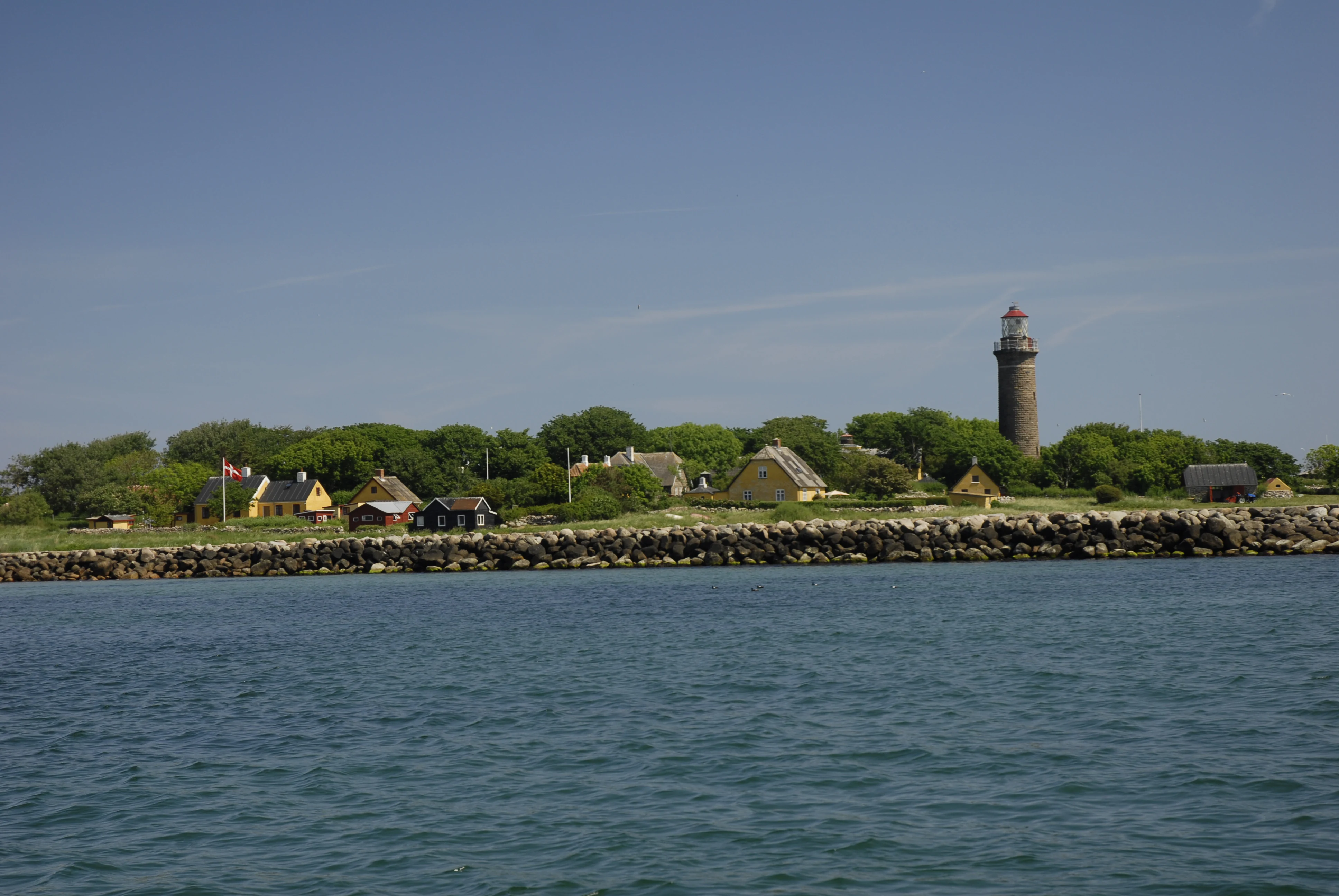
Hirsholmene from the Kattegat
View of the main island of Hirsholmene and the Hirsholm lighthouse from the Kattegat, looking west to east

Hirsholmene, the Sea West of Them and the Outlet of Ellinge Å history and protected-area timeline

The site was established as part of the pan-European Natura 2000 network, with the Natura 2000 plan adopted in 2011. Following this adoption, Frederikshavn Municipality and the Danish Nature Agency became responsible for developing binding action plans needed to implement the protection goals.

The plan is coordinated with the Water Plan 1.1 for the Northern Kattegat and Skagerrak, reflecting the strong linkage between the site's marine nature values and broader water management policy. The current planning period covers 2022-2027, anchored in the revised basic analysis and Natura 2000 plan for the area prepared by the Environmental Protection Agency's North Jutland office.

Alongside its Natura 2000 designation, the area carries older and overlapping protection layers. Hirsholmene itself has been designated as a nature reserve, and a 1.5 kilometer stretch of beach is reserved for recreational use. A larger marine area around Hirsholmene and offshore toward Frederikshavn is also formally protected, giving the site a layered legal history of conservation that predates but supports its Natura 2000 status.

Hirsholmene, the Sea West of Them and the Outlet of Ellinge Å landscape and geographic character

The landscape is essentially a dual one: a marine seascape dominated by sandbanks, reefs, and underwater formations, and a narrow coastal strip of dunes, meadows, and river outlet on the mainland.

Around the Hirsholmene islands, the sea floor is shaped into a complex of sandbanks, lagoons, stone reefs, and bubble reefs, with the visible islands themselves forming only the exposed tops of much larger geological structures. The bubble reefs are particularly unusual: they are columns of sandstone-like material cemented together by microorganisms around natural gas seeps from the underlying sediment, giving them a striking, almost artificial-looking architecture in the cool Kattegat waters.

On the mainland side, the terrain transitions quickly from sandy beach into dune formations: embryo dunes, white dunes, grey-green dunes, grey-crowberry dunes, and dune slacks in sequence. Inland from the dunes, the landscape shifts into heath-like acidic grasslands, nutrient-rich and brown-water lakes, meandering streams, periodically wet meadows, and richer calcareous mires, all shaped by the freshwater influence of Ellinge Å as it approaches the coast.

Hirsholmene, the Sea West of Them and the Outlet of Ellinge Å ecosystems, habitats, and plant life

Ecologically, the site is defined by the meeting of marine Kattegat habitats with coastal and freshwater systems. The marine environment around the Hirsholmene islands includes sandbanks, lagoons, reefs, and the highly distinctive bubble reefs, which together create one of Denmark's most important macroalgae habitats. The reef structures further support a coral-reef-like community with colorful marine organisms, making the underwater portion of the site ecologically significant at a national scale.

On land, the dunes form a complete small-scale dune ecosystem, with embryo dunes building seaward and older grey and crowberry dunes inland, interspersed with damp dune slacks that hold small lakes and varied wetland vegetation. Further inland, the meadows, acidic grasslands, and calcareous mires around the Ellinge Å outlet provide a diverse mosaic of grassland habitats, while small eutrophic and dystrophic lakes add freshwater nature value.

The site also includes habitat types such as annual strandline vegetation, perennial strandline vegetation, and coastal meadows on the narrow strip of land between the dunes and the beach, completing the transition from marine to fully terrestrial nature within a short distance.

Hirsholmene, the Sea West of Them and the Outlet of Ellinge Å wildlife and species highlights

Wildlife is a defining feature of the site, both above and below the water. The Hirsholmene islands, and especially Hirsholm, host Denmark's largest breeding colony of Sandwich terns, along with a large colony of black-headed gulls, making the small island group nationally important for seabirds. The surrounding marine waters are also important for other tern species such as Arctic tern and common tern, and for the black guillemot, all of which are listed in the site's bird protection designation.

In the marine environment, the reefs support a varied and colorful assemblage of marine organisms, with seals including harbour seal and grey seal recorded for the area. The freshwater and terrestrial habitats host a different but equally distinctive wildlife profile: Ellinge Å supports sea lamprey, brook lamprey, and salmon, while the meadows around its outlet hold an isolated population of the rare Marsh Fritillary butterfly. Dunes carry clones of the nationally important Pasqueflower, and the meadows along the river contain red-listed orchids including the Pyramidal Orchid and Elder-flowered Orchid, as well as populations of natterjack toad.

Hirsholmene, the Sea West of Them and the Outlet of Ellinge Å conservation status and protection priorities

The site is significant from a conservation perspective because it concentrates a remarkable range of rare, threatened, and nationally important species and habitats within a relatively small area. Its macroalgae-rich reefs, bubble reefs, and seabird colonies represent nature values that are difficult to replace elsewhere in Denmark, while the dune, meadow, and river habitats around Ellinge Å protect several red-listed and internationally protected species.

The conservation framework is unusually layered. The site is simultaneously a Ramsar wetland, a Habitats Directive site, and a Bird Protection Area, and it is also integrated with Danish water planning through the Northern Kattegat and Skagerrak water plan. This means protection efforts must consider both nature conservation and water quality, which is critical given the strong dependence of the marine and freshwater habitats on water conditions.

Practical conservation actions follow from the Natura 2000 plan, with municipal authorities and the Danish Nature Agency required to develop binding action plans. The 2022-2027 planning cycle emphasizes continued species monitoring, habitat preservation, and coordinated management between marine, freshwater, and terrestrial zones, helping ensure that the site's unusually broad ecological profile is maintained over the long term.

Top sights and standout views in Hirsholmene, the Sea West of Them and the Outlet of Ellinge Å

The standout feature of this site is the extraordinary marine nature around Hirsholmene, where bubble reefs and stone reefs support one of Denmark's most exceptional macroalgae communities and a coral-reef-like marine life. Equally striking is the contrast with the small but species-rich mainland habitats along the Ellinge Å outlet, which add butterflies, orchids, lampreys, and dune flora to the site's conservation portfolio.

Hirsholmene is also one of Denmark's most important seabird sites locally, hosting the country's largest Sandwich tern breeding colony alongside other terns and black-headed gulls. Together, these features make the site a compact showcase of how marine Natura 2000 protection, dune conservation, and freshwater biodiversity can be combined on a regional scale.

Best time to visit Hirsholmene, the Sea West of Them and the Outlet of Ellinge Å

The site changes character through the seasons in ways that reflect its mixed marine and coastal identity. Late spring and summer are the most biologically active periods, when the tern colonies on Hirsholmene are in full breeding mode, meadows around Ellinge Å bloom with orchids and other rare plants, and Marsh Fritillary butterflies are on the wing. Dawn and dusk in summer can bring out rich bird activity on the islands and along the coast.

Outside the breeding season, autumn and winter often bring rougher seas and a more austere, open Kattegat landscape, with fewer visitors and a quieter atmosphere. This is generally the best season to see migrating waterbirds and to experience the site's wild, exposed character, particularly along the protected coastal stretch near Frederikshavn.
Monthly climate preview

Long-term temperature averages and monthly precipitation records across representative coordinate sampling

Climate Normals and Annual Weather Patterns for Natura 2000-område nr. 4 Hirsholmene, havet vest herfor og Ellinge Å's udløb

Representative baseline measurements reveal the recorded annual temperature range and monthly precipitation rhythm across the sampling coordinate. Consulting the comprehensive twelve-month profile provides complete historical averages for detailed temperature and precipitation comparison.
Annual mean9 °C
1 °C17 °C
Jan
Feb
Mar
Apr
May11°
Jun14°
Jul17°
Aug17°
Sep14°
Oct10°
Nov
Dec
Warmest month
August

17.2 °C

Coolest month
February

1.5 °C

Wettest month
October

3.3 mm/day

Driest month
April

1.7 mm/day

Park location guide

Geography guide, regional context, and park location map for Hirsholmene, the Sea West of Them and the Outlet of Ellinge Å

Hirsholmene, the Sea West of Them and the Outlet of Ellinge Å park geography, regions, and map view in Denmark

Understand where Hirsholmene, the Sea West of Them and the Outlet of Ellinge Å sits in Denmark through a broader geographic reading of the surrounding landscape, nearby location context, and its mapped position within the national park landscape.

How Hirsholmene, the Sea West of Them and the Outlet of Ellinge Å fits into Denmark

Denmark is a constitutional monarchy and Nordic country in Northern Europe. It is the southernmost of the Scandinavian countries, bordering Germany to the south, Norway to the north, and Sweden to the southwest. The country consists of the Jutland peninsula and an archipelago of islands, with Copenhagen as its capital and largest city. Denmark has a population of over 6 million and is characterized by flat, arable land, sandy coasts, and a temperate climate.

Wider geography shaping Hirsholmene, the Sea West of Them and the Outlet of Ellinge Å in Denmark

Denmark occupies the Jutland peninsula and roughly 406 islands in Northern Europe. It is situated between the North Sea to the west and the Baltic Sea to the east. The country borders Germany to the south and is connected to Sweden via the Øresund Bridge. Denmark is predominantly flat terrain with low elevation, the highest point being Møllehøj at 170.86 meters.

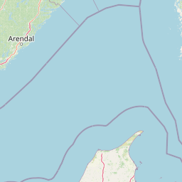
Map view of Hirsholmene, the Sea West of Them and the Outlet of Ellinge Å

Use this park location map to pinpoint Hirsholmene, the Sea West of Them and the Outlet of Ellinge Å in Denmark, understand its exact geographic position, and read its mapped placement within the surrounding landscape more clearly.

Pigeon | © OpenStreetMap contributors

Location context for Hirsholmene, the Sea West of Them and the Outlet of Ellinge Å

Region Nordjylland

Photographic documentation of marine reefs, coastal dunes, and protected island habitats

Visualizing Natura 2000-område nr. 4 Hirsholmene, havet vest herfor og Ellinge Å's udløb, Park Scenery and Mapped Landscapes

Visual records reveal the diverse terrain and coastal habitats of Natura 2000-område nr. 4 Hirsholmene, havet vest herfor og Ellinge Å's udløb through detailed field photography. Photographic documentation helps researchers examine marine formations, island nesting colonies, and protected river landscapes across the region.

Hirsholmene from the Kattegat

Park atlas

Compare nearby marine reserves, coastal dunes, and regional wetland habitats in northern Denmark

Other Parks and Protected Areas Near Natura 2000-område nr. 4 Hirsholmene, havet vest herfor og Ellinge Å's udløb

Browse protected areas and coastal reserves situated close to Natura 2000-område nr. 4 Hirsholmene, havet vest herfor og Ellinge Å's udløb. Regional park comparison reveals broader ecological patterns across marine seascapes, submarine reefs, and river outlets.
Protected areaRegion Nordjylland
About 9.9 km away#1 closest

Northwest

Jerup Hede, Råbjerg og Tolshave Mose: Protected Area and Ridge and Pool Terrain

Geographic landscape overview in Region Nordjylland

Jerup Hede, Råbjerg og Tolshave Mose contains the largest continuous area of ridge and pool landscapes in Denmark. The site features an undulating terrain of hummocks and wet hollows typical of intact raised bogs, transitioning from inland heaths to coastal dune formations near the Skagerrak coast. It remains an essential site for studying Northern European mire ecosystems and wetland habitat patterns.

Area
40.24 km²
Relief
Lowland
Climate
Temperate
Access
Access unknown
Nature reserveNordjylland
About 12 km away#2 closest

Southwest

Åsted Ådal Nature Reserve: Glacial Valley Mapping and Protected Land Context in Nordjylland

A diverse Natura 2000 habitat mosaic in Northern Denmark

Åsted Ådal serves as a premier example of Danish glacial topography, offering a deep dive into the complex environmental transitions of a moraine-carved valley. The protected site highlights a rich botanical and avian assemblage, anchored by its unique stream corridor and steep slopes, providing a comprehensive view of regional landscape character.

Area
1.24 km²
Relief
Upland
Climate
Temperate
Scope
Terrestrial
Nature reserveLæsø Municipality
About 20 km away#3 closest

Southeast

Nordre Rønner: Protected Island Landscapes and Geographic Mapping of Læsø Municipality

Remote coastal nature reserve and marine habitat within the Danish Kattegat sea

Nordre Rønner represents a significant cluster of islets in the Kattegat, showcasing the interplay of post-glacial land rise and coastal ecology. Managed within Læsø Municipality, these eleven hectares of protected land include essential nesting grounds for terns and harbor seals. This resource outlines the physical geography, mapped island connections, and the status of this unique maritime nature reserve.

Area
0.11 km²
Relief
Lowland
Climate
Temperate
Access
Moderate access
Nature reserveRegion Nordjylland
About 23 km away#4 closest

South

Solsbæk Nature Reserve: Geographic Profile and Protected Coastal Dune Landscapes

A rare calcareous dune ecosystem in Region Nordjylland, Denmark.

Solsbæk is a designated nature reserve on the Vendsyssel coast, notable for its concentrated series of coastal dune habitats. Formed by lime-rich shell sand, the landscape sustains a diverse array of vegetation including grey and green dunes, juniper scrub, and dune heath. This compact site provides a vital reference for understanding the ecological structure and botanical variety of protected coastal lands in northern Denmark.

Area
0.33 km²
Established
1972
Relief
Lowland
Climate
Temperate
Protected areaRegion Nordjylland
About 30 km away#5 closest

Northwest

Natura 2000-område nr. 5 Uggerby Klitplantage og Uggerby Å's udløb Protected Area

Coastal dune and riverine landscape mapping in Region Nordjylland

Explore the varied terrain of this 717-hectare site featuring a complete sequence of green dune habitats, fresh water slacks, and the Uggerby Å river estuary. The area displays a dense concentration of coastal geomorphology and protected plant species, providing a deep look into the natural landscape character of the northern Danish coast along the Skagerrak.

Area
7.17 km²
Relief
Lowland
Climate
Temperate
Scope
Terrestrial
Nature reserveLæsø
About 36 km away#6 closest

Southeast

Bovet Nature Reserve and Coastal Habitat Geography in Læsø, Denmark

A protected coastal corridor of heathland and salt marsh

Bovet is a 65-hectare nature reserve on the island of Læsø that safeguards a pristine 2.5 km stretch of Danish coastline. Characterized by a flat, open topography of heath, beach meadow, and reedbed, the site is defined by its sweeping views across Bovet Bugt and scattered glacial erratics. Its status as a bird protection area and Ramsar wetland highlights its importance as a habitat for breeding and resting waders within the Kattegat region.

Area
0.65 km²
Established
1964
Relief
Lowland
Climate
Temperate
Nature reserveLæsø
About 40 km away#7 closest

Southeast

Østdelen af Læsø Nature Reserve: Mapped Coastal Geography and Protected Danish Island Terrain

Explore active dune systems, beach ridges, and coastal heath-mire habitats

Østdelen af Læsø features a distinct interplay of coastal geology and traditional heathland vegetation across its 266 hectares. The reserve spans from the elevated Danzigmand dunes to the dynamic, growing barrier islands of Store Knot and Lille Knot, offering a comprehensive look at Denmark's shifting coastal margins and vital seabird nesting grounds.

Area
2.66 km²
Established
1963
Relief
Lowland
Climate
Temperate
Nature reserveRegion Nordjylland
About 42 km away#8 closest

West

Kærsgård Strand, Vandplasken og Liver Å Nature Reserve: Geographic and Landscape Atlas

Protected coastal dune systems and inland wetland geography

Examine the protected landscape of Kærsgård Strand, Vandplasken og Liver Å, a key Danish nature reserve characterized by complex dune hydrology, clear-water lake systems, and diverse botanical habitats. This site serves as a vital reference for northwestern European calcareous ecology and wetland preservation.

Area
4.42 km²
Established
2011
Relief
Lowland
Climate
Temperate

Common questions about visiting, size, designation, and location context for Hirsholmene, the Sea West of Them and the Outlet of Ellinge Å

Hirsholmene, the Sea West of Them and the Outlet of Ellinge Å FAQs for park facts, access, geography, and protected area context

Find quick answers about Hirsholmene, the Sea West of Them and the Outlet of Ellinge Å, including protected-area facts, park geography, trail and visitor context, and how the park fits into its surrounding country and regional landscape.
MoriAtlas Explorer

Continue Your Protected Areas Search Across the Global Atlas

Deepen your exploration by continuing the structured search for national parks and protected areas worldwide. Utilize the comprehensive filtering capabilities to compare different conservation landscapes and refine your understanding of global park geography. Discover more about the distribution and characteristics of protected natural areas.

Global natural geography