Mori Atlas logo
Nature reserveHluhluwe–Imfolozi Park

Discover the geographic context and protected area identity of this KwaZulu-Natal nature reserve.

Hluhluwe–Imfolozi Park Nature Reserve: Mapped Boundaries and Protected Landscape Atlas

(Hluhluwe–iMfolozi Park)

Hluhluwe–Imfolozi Park stands as a significant nature reserve within the diverse geography of KwaZulu-Natal, South Africa. This page offers a detailed atlas perspective, focusing on the park's mapped boundaries and its role as a protected landscape. Explore the regional context and understand the distinct geographic character of this protected area, providing a foundation for comprehensive map-based discovery.

Big FiveRhino ConservationSafariGame ReserveSouth AfricaKwaZulu-Natal

Hluhluwe–Imfolozi Park

Nature reserve

Park overview

Structured park overview, official facts, and landscape profile for Hluhluwe, Imfolozi Park

Hluhluwe, Imfolozi Park park facts, protected area profile, and essential visitor context

Review the core facts for Hluhluwe, Imfolozi Park, including designation, size, terrain, visitor scale, habitats, and operating context in one park-focused overview.

About Hluhluwe, Imfolozi Park

Hluhluwe–Imfolozi Park represents one of South Africa's most historically significant and ecologically diverse protected areas. Located in the heart of Zululand, the reserve encompasses a landscape of remarkable topographic variation, from the mountainous northern sections blanketed in forest and grassland to the southern floodplains of the Umfolozi river system. The park's cultural heritage is deeply intertwined with the Zulu kingdom, as the area was declared a royal hunting ground during the reign of King Shaka in the early 19th century. Archaeological evidence throughout the reserve reveals centuries of human presence, including Stone Age settlements and iron smelting sites that attest to the region's long history of occupation. Today, the park stands as a living laboratory of African savanna ecology and a critical refuge for some of the continent's most iconic wildlife species.

Quick facts and research context for Hluhluwe, Imfolozi Park

Hluhluwe–Imfolozi Park occupies a strategic position in Zululand, approximately 280 kilometers north of Durban. The park encompasses two distinct ecological zones: the northern Hluhluwe area features rugged mountainous terrain with dense forests and grasslands, while the southern Umfolozi section consists of open savanna bordering the Black and White Umfolozi rivers. Established in 1895, it represents Africa's oldest game reserve and has served as a critical stronghold for white rhinoceros conservation, having bred and relocated hundreds of rhinos to establish populations across their historic range during the mid-20th century.

Protection and recognition

Documenting the official terrestrial management scope and geographic boundaries of the reserve.

Hluhluwe-Imfolozi Park Protection Status and Terrestrial Designation

Verifying the registered protection status of Hluhluwe-Imfolozi Park offers clear insight into its terrestrial conservation boundaries and official management framework. Accessing official regional registry data helps geographers and researchers track environmental designations and analyze documented land preservation efforts.

Protection details

Protection scope
Terrestrial
Transboundary protection
No
Park context

Deeper park guide and search-rich context for Hluhluwe, Imfolozi Park

Hluhluwe, Imfolozi Park history, landscape, wildlife, and travel context

Explore Hluhluwe, Imfolozi Park through its history, landscape character, ecosystems, wildlife, conservation priorities, cultural context, and seasonal travel timing in a structured park guide built for atlas discovery and search intent.

Why Hluhluwe, Imfolozi Park stands out

Hluhluwe, Imfolozi Park is best known as the birthplace of modern rhino conservation, having successfully brought the southern white rhinoceros back from the brink of extinction through dedicated preservation efforts beginning in the 1890s. The park is renowned for its exceptional Big Five wildlife viewing, particularly its substantial rhinoceros populations, and serves as a premier safari destination in South Africa. It is also celebrated as one of the world's top locations for observing nyala antelope and supports an impressive bird list of over 340 species, including rare longclaw species that co-occur in the Hluhluwe River floodplain.

Hluhluwe, Imfolozi Park history and protected-area timeline

The formal protection of Hluhluwe–Imfolozi Park dates to 1895, when the Umfolozi Junction Reserve and Hluhluwe Reserve were established following the rediscovery of a small population of southern white rhinoceros, which had been driven to the edge of extinction by European hunting in the preceding decades. The area's isolation was historically maintained by tsetse flies carrying the nagana disease, which discouraged colonial hunters and preserved wildlife during the 19th century. As Zululand was settled by white farmers in the early 20th century, wildlife was wrongly blamed for the prevalence of tsetse flies, leading to the slaughter of over 100,000 animals between 1919 and 1950, though the rhinoceros population was protected. The park's modern conservation legacy was cemented in the 1950s and 1960s under warden Ian Player, who established Operation Rhino and the Rhino Capture Unit, relocating hundreds of rhinos to establish populations in reserves across their historic range. In 1989, the corridor between the Hluhluwe and Imfolozi reserves was added, creating the unified park that exists today.

Hluhluwe, Imfolozi Park landscape and geographic character

The park's geography is defined by a striking contrast between its northern and southern regions. The Hluhluwe area in the north presents a more rugged and mountainous character, featuring rolling hills covered in mixed woodland and extensive grasslands that create a scenic backdrop of green hills. The Umfolozi section to the south encompasses the floodplain corridors of the Black Umfolozi and White Umfolozi rivers, where the terrain opens into expansive savanna grassland. The landscape supports a variety of habitats including riparian woodlands along riverbanks, acacia savanna, dense thicket, and open grassland plains. This topographic and ecological diversity contributes to the park's ability to support such a wide array of wildlife species.

Hluhluwe, Imfolozi Park ecosystems, habitats, and plant life

Hluhluwe–Imfolozi Park supports a remarkably diverse floral and ecological community that reflects the transitional nature of its location between the savanna and subtropical zones of southern Africa. The park encompasses multiple habitat types, from the riparian forests lining the Umfolozi rivers to the mixed woodland and grassland communities of the highlands. The Hluhluwe River floodplain represents one of the most ecologically significant areas, supporting specialized bird communities and serving as a critical water source for wildlife. The vegetation ranges from dense acacia thickets in the lower elevations to open grassland communities on the plateau, creating a mosaic of habitats that supports the park's extraordinary biodiversity.

Hluhluwe, Imfolozi Park wildlife and species highlights

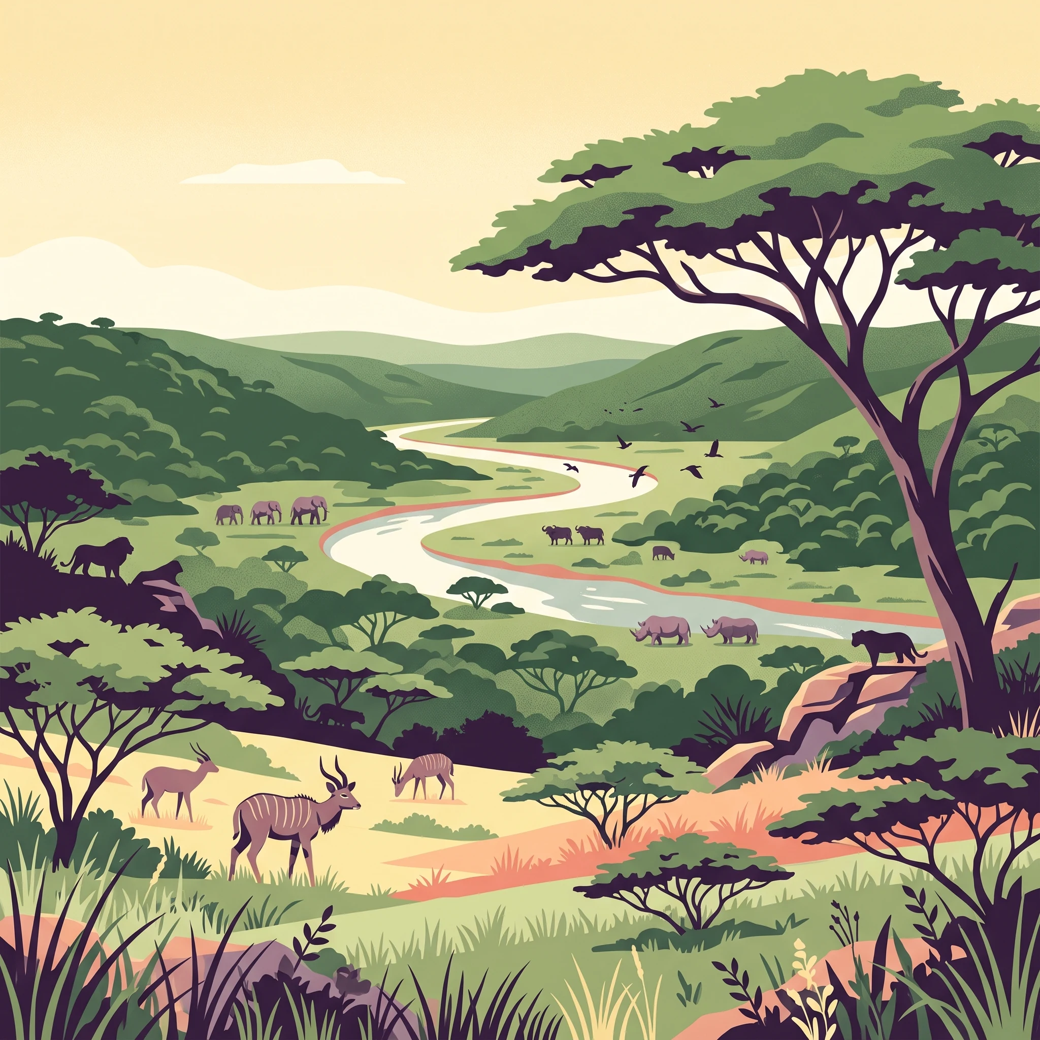
The park is home to Africa's complete complement of Big Five game species, making it a premier safari destination. The African bush elephant roams the savanna and woodland areas, while both the southern white rhinoceros and south-central black rhinoceros are present in significant numbers. The African buffalo inhabits the grasslands and floodplains, and populations of lion and African leopard maintain healthy predator communities. Beyond the Big Five, the reserve supports at least 86 mammal species including hippos, cheetahs, spotted hyenas, giraffes, zebras, and a particularly notable population of nyala antelope. The park is internationally recognized as one of the world's best locations for nyala viewing. Avian diversity is exceptional, with 340 recorded bird species including the yellow-throated longclaw, rosy-throated longclaw, and Cape longclaw that co-occur in the unique Hluhluwe floodplain environment.

Hluhluwe, Imfolozi Park conservation status and protection priorities

Hluhluwe–Imfolozi Park holds a foundational place in the history of African wildlife conservation, particularly as the site where the southern white rhinoceros was saved from extinction. The park's breeding and relocation programs in the mid-20th century established populations throughout the species' historic range, making it a cornerstone of rhino conservation globally. Today, the park faces severe threats from poaching, with the reserve recording the highest rhino poaching losses in South Africa in recent years. In response, the park has implemented Smart Park technology, integrating systems including drone surveillance for early detection and rapid response to poaching threats. The reserve is also navigating challenges from coal mining operations on its western and southern boundaries, with ongoing prospecting and expansion applications threatening ecosystem integrity.

Hluhluwe, Imfolozi Park cultural meaning and human context

The cultural landscape of Hluhluwe–Imfolozi is deeply rooted in Zulu heritage, as the area was historically a royal hunting ground for the Zulu kingdom during the era of King Shaka in the early 19th century. Throughout the park, archaeological evidence of Stone Age settlements and iron smelting operations speaks to centuries of human habitation and land use by indigenous communities. The reserve's name incorporates the Zulu nomenclature of iMfolozi, reflecting the ongoing cultural significance of the landscape to local communities. The park is situated near the town of Mtubatuba and the villages of Hluhluwe and Hlabisa, maintaining connections to the regional Zulu cultural heritage.

Top sights and standout views in Hluhluwe, Imfolozi Park

The park's defining highlights center on its dual identity as a historic conservation landmark and a premier wildlife viewing destination. Visitors can experience all Big Five species in their natural habitat, with the rhinoceros populations offering exceptional viewing opportunities at the park's waterholes and savanna viewing points. The Hluhluwe area's scenic green hills and the Umfolozi floodplain at sunset provide memorable safari experiences. The park's 300-kilometer road network allows visitors to explore diverse habitats, while the Hilltop camp in the north and Mpila camp in the south offer accommodation within the reserve. The exceptional birdlife, particularly the specialized floodplain species and nyala, adds another dimension to the wildlife experience.

Best time to visit Hluhluwe, Imfolozi Park

The park can be visited throughout the year, though the dry winter months from May to September typically offer excellent wildlife viewing as animals congregate around remaining water sources. The summer months from October to April bring greener landscapes and abundant bird activity, with the Hluhluwe floodplain supporting diverse birdlife including the longclaw species. The park is situated in a low-risk malaria area, though visitors should consult health advisories and take appropriate precautions. The dry season generally provides the most comfortable safari conditions, though the lush green scenery of the wet season has its own appeal for nature enthusiasts.
Park guides

Targeted reference material examining visitor timing and seasonal wildlife visibility dynamics

Hluhluwe–Imfolozi Park Published Guides and Focused Answers

Focused reference guides provide detailed contextual answers for visitors exploring specific park questions and ecological patterns. Selected published materials examine seasonal conditions and visitor timing to clarify wildlife visibility and landscape variations across the reserve.
Monthly climate preview

Analyze long-term temperature ranges and precipitation trends in KwaZulu-Natal

Hluhluwe, Imfolozi Park Monthly Weather and Long-Term Climate Normals

Long-term data at 355.7 meters elevation reveals a distinct climate cycle for Hluhluwe, Imfolozi Park, with mean monthly temperatures spanning sixteen to twenty-four degrees. Exploring the full twelve-month profile provides comparative metrics for daily precipitation averages and long-term temperature extremes.
Annual mean21 °C
16 °C24 °C
Jan24°
Feb24°
Mar23°
Apr21°
May19°
Jun17°
Jul16°
Aug18°
Sep20°
Oct21°
Nov22°
Dec23°
Warmest month
January

24 °C

Coolest month
July

16.2 °C

Wettest month
January

4.3 mm/day

Driest month
June

0.6 mm/day

Park location guide

Geography guide, regional context, and park location map for Hluhluwe, Imfolozi Park

Hluhluwe, Imfolozi Park park geography, regions, and map view in South Africa

Understand where Hluhluwe, Imfolozi Park sits in South Africa through a broader geographic reading of the surrounding landscape, nearby location context, and its mapped position within the national park landscape.

How Hluhluwe, Imfolozi Park fits into South Africa

South Africa is the southernmost country in Africa, spanning 1.22 million km² with a population of over 63 million. The country operates with three capital cities, Pretoria (executive), Cape Town (legislative), and Bloemfontein (judicial), and is renowned for its biodiversity, national parks, and multicultural society.

Wider geography shaping Hluhluwe, Imfolozi Park in South Africa

South Africa occupies the southernmost region of Africa, with coastline along both the Atlantic Ocean to the west and the Indian Ocean to the east. The interior features elevated plateaus including the Highveld, with the Drakensberg escarpment marking the eastern highlands. The country shares borders with Namibia, Botswana, Zimbabwe, Mozambique, Eswatini, and Lesotho.

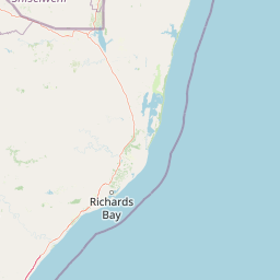
Map view of Hluhluwe, Imfolozi Park

Use this park location map to pinpoint Hluhluwe, Imfolozi Park in South Africa, understand its exact geographic position, and read its mapped placement within the surrounding landscape more clearly.

Pigeon | © OpenStreetMap contributors

Location context for Hluhluwe, Imfolozi Park

KwaZulu-Natal
Park atlas

Map the surrounding conservation landscapes, compare diverse game reserves, and discover interconnected protected areas across KwaZulu-Natal.

Explore Other National Parks and Protected Areas Surrounding Hluhluwe–Imfolozi Park, KwaZulu-Natal

Browse national parks and protected areas geographically proximate to Hluhluwe–Imfolozi Park, covering KwaZulu-Natal's diverse savanna, hilly woodlands, and vital riverine habitats. Continue your atlas exploration by comparing these protected landscapes, tracing regional conservation efforts, and identifying adjacent wildlife reserves that share similar ecological characteristics.
Wildlife reserveKwaZulu-Natal
About 45 km away#1 closest

Southwest

Thula Thula Private Game Reserve: Protected Wildlife Habitats and Geography

Bushveld and riverine geography in the KwaZulu-Natal Zululand corridor

Thula Thula Private Game Reserve features a unique intersection of bushveld habitats and river systems within South Africa. This reserve provides important protected land for elephants, rhinoceros, and over 350 avian species. It remains a key geographic entity for understanding the Royal Zulu Biosphere and the conservation history of the northeastern KwaZulu-Natal region.

Area
45 km²
Established
1911
Scope
Terrestrial
Wildlife reserveKwaZulu-Natal
About 83 km away#2 closest

West

Babanango Game Reserve: Exploring Geographic Boundaries and Rewilding Landscapes

Protected wildlife habitats in central KwaZulu-Natal

Centrally positioned in the White Umfolozi River valley, Babanango Game Reserve serves as a model for large-scale biodiversity restoration. Its terrain features a mix of mistbelt grasslands, thornveld, and river frontage supported by ancient geological structures. The reserve preserves both ecological integrity and cultural heritage near historic sites, reflecting a shift toward community-led conservation in modern South African landscape management.

Area
200 km²
Established
2017
Relief
Mixed relief
Climate
Subtropical
Nature reserveKwaZulu-Natal
About 97 km away#3 closest

North

Phongolo Nature Reserve: Mapped Protected Landscapes of Northern KwaZulu-Natal

Historic reserve terrain at the Lebombo escarpment

Spanning over 10,000 hectares, Phongolo Nature Reserve represents a critical geographic unit defined by the Pongolapoort Dam and the surrounding Lebombo range. Its terrain transitions from clay-rich lowveld plains to dramatic high-altitude rocky escarpments, forming a complex protected environment within the KwaZulu-Natal borderlands. Explore the mapped extent and structural biodiversity of this long-standing South African conservation site.

Area
104.85 km²
Established
1894
IUCN
IV
Relief
Mountain
Wildlife reserveKwaZulu-Natal
About 99 km away#4 closest

Northwest

Ithala Game Reserve: Mapping the Protected Landscape and Ancient Geology of KwaZulu-Natal

A rugged wilderness reserve defined by dramatic escarpment and river valley topography.

Ithala Game Reserve represents a critical protected area in South Africa where deep river valleys meet the high-altitude grasslands of the Ngotshe Mountains. Its topography provides a unique study in vertical relief, featuring exposed sandstone cliffs and dolerite spires. The reserve serves as a prime example of ecological diversity within the region, combining ancient geological formations with a successfully reestablished mosaic of bushveld, savanna, and forest habitats.

Area
296.53 km²
Established
1973
IUCN
IV
Relief
Mountain
Protected areaKwaZulu-Natal
About 113 km away#5 closest

Northeast

Lake Sibaya Protected Area: Mapping the Freshwater Heart of the KwaZulu-Natal Coast

Freshwater wetlands and coastal dune forest topography

Lake Sibaya encompasses the largest freshwater basin in South Africa, defined by its position near the Maputaland coast. The landscape represents a significant freshwater interface between coastal dune forests and the Indian Ocean, serving as an important protected study site for catchment ecosystems, water-bird habitats, and regional hydrological diversity.

Area
64 km²
Established
1991
Relief
Lowland
Climate
Subtropical
Protected areaKwaZulu-Natal
About 143 km away#6 closest

Northeast

Kosi Bay Protected Area: Mapped Geography and Coastal Lake Systems in KwaZulu-Natal

Coastal lake geography and protected wetland boundaries

Kosi Bay forms a complex wetland chain in KwaZulu-Natal, characterized by four linked lakes and a clear estuary mouth. The terrain transitions from coastal dunes and sandy beaches to mangrove-lined channels and Maputaland forest, providing a rich study of regional water systems and protected land boundaries.

Established
1991
Water
Water-dominated
Season
Year-round
Wildlife reserveKwaZulu-Natal
About 147 km away#7 closest

North

Ndumo Game Reserve: Geographic Atlas and Protected Landscape Overview

Wetlands and riverine ecosystems of Maputaland, KwaZulu-Natal

Ndumo Game Reserve represents a distinct protected landscape where the Pongola and Great Usutu rivers shape a dense mosaic of pans, floodplains, and sand forests. As a Ramsar site, this compact wildlife reserve serves as an essential case study in regional geography and the conservation of riverine corridors along the Mozambique border.

Area
102 km²
Established
1924
Relief
Lowland
Climate
Subtropical
Wildlife reserveKwaZulu-Natal
About 203 km away#8 closest

West

Weenen Game Reserve: Wildlife and Restored Acacia Savanna in Inland KwaZulu-Natal

A mapped wildlife reserve and ecological restoration project

Located in the inland reaches of KwaZulu-Natal, Weenen Game Reserve represents a significant success in landscape recovery. The reserve protects a distinct mix of dry tall grassveld, dense thornveld, and valley bushveld, providing critical habitat for black and white rhinoceros, giraffe, and numerous bird species. This atlas entry details the physical terrain, drainage lines, and the engineering history that transformed the land into a functioning sanctuary.

Area
50.09 km²
Established
1975
Relief
Upland
Climate
Subtropical

Common questions about visiting, size, designation, and location context for Hluhluwe, Imfolozi Park

Hluhluwe, Imfolozi Park FAQs for park facts, access, geography, and protected area context

Find quick answers about Hluhluwe, Imfolozi Park, including protected-area facts, park geography, trail and visitor context, and how the park fits into its surrounding country and regional landscape.
MoriAtlas Explorer

Continue Your Protected Areas Search Across the Global Atlas

Deepen your exploration by continuing the structured search for national parks and protected areas worldwide. Utilize the comprehensive filtering capabilities to compare different conservation landscapes and refine your understanding of global park geography. Discover more about the distribution and characteristics of protected natural areas.

Global natural geography