
Mori Atlas logo
Nature reserveHühnerbachtal

Understanding the ecological corridor and steep-flanked landscape of this conserved valley.

Hühnerbachtal Nature Reserve: Mapping the Protected Stream Valley in Kreis Mettmann, Germany

(Naturschutzgebiet Hühnerbachtal (ME-042))

Hühnerbachtal serves as a vital nature reserve and ecological corridor within the urban-adjacent landscape of Kreis Mettmann. This protected area features a sharply incised stream valley, where meandering waters support alder-dominated floodplain forests, wet meadows, and reed-fringed ponds. Steep beech-oak slopes define the valley walls, creating a distinct micro-landscape that provides essential habitat connectivity within North Rhine-Westphalia.

nature reservestream valleyfloodplain forestalder woodlandwetland mosaicmixed deciduous forest
A flat-style, digital vector illustration of a mountainous valley scene, featuring a winding river, a waterfall in the distance, pine trees in the foreground, and soft sunset-toned skies.

Hühnerbachtal

Nature reserve

Park overview

Structured park overview, official facts, and landscape profile for Hühnerbachtal Nature Reserve

Hühnerbachtal Nature Reserve park facts, protected area profile, and essential visitor context

Review the core facts for Hühnerbachtal Nature Reserve, including designation, size, terrain, visitor scale, habitats, and operating context in one park-focused overview.

About Hühnerbachtal Nature Reserve

Hühnerbachtal is one of many small nature reserves in the densely populated Mettmann district, which lies between the cities of Düsseldorf, Wuppertal, and Solingen. Although compact, the reserve represents a high-quality example of a near-natural lowland stream valley and demonstrates how small protected areas can serve as vital ecological anchors within heavily used landscapes.

The protected area follows the Hühnerbach, a tributary of the Eselsbach, as it carves a deeply incised, east-west-oriented valley just north of the built-up edge of Haan. The valley floor is dominated by wet alder forest and a mosaic of open habitats, including moist meadows, reedbeds, sedge-dominated marshy patches, scrubby abandoned grassland, and a series of small ponds. A former fishpond in the western part of the reserve has reverted to a near-natural state and now functions as an important amphibian spawning site in spring.

Above the valley floor, the steep slopes carry mixed beech and oak forest with occasional old-growth trees. The wooded slopes are characterized by frequent holly, sparse herb layers, and locally important deadwood, providing habitat for woodland birds and bats. The northern side branches into a steeper secondary valley leading toward the small settlement known as Vogelsang, where former pond structures and non-native species such as Japanese knotweed and black locust pose ongoing management challenges.

From a broader planning perspective, Hühnerbachtal is recognized as a regionally significant biotope mosaic and an important element of the local west-east habitat connectivity network. Its management aims to secure near-natural development of the stream and valley habitats, suppress invasive plant species, and maintain the surviving areas of wet grassland through low-intensity care. The reserve continues to serve as a small but meaningful green corridor in the urban fringe between the Bergisches Land and the Rhine lowlands.

Quick facts and research context for Hühnerbachtal Nature Reserve

Hühnerbachtal is a protected nature reserve in the Mettmann district of North Rhine-Westphalia, Germany, identified by the code ME-042 and classified under IUCN Category IV as a habitat and species management area.

The reserve covers about 24 hectares, lies between 90 and 142 meters above sea level, and stretches in a strongly incised east-west valley along the Hühnerbach stream. It was first designated in 1997 and last reviewed under the Mettmann district landscape plan in 2012.

Protection and recognition

Examine official designation records and conservation status details for Hühnerbachtal.

Hühnerbachtal Protection Status and International Recognition Records

Examine the verified protection status and administrative designation records for Hühnerbachtal. Official database listings provide structured conservation data regarding international recognition and protected area status.

Protection details

WDPA ID
163810
Park context

Deeper park guide and search-rich context for Hühnerbachtal Nature Reserve

Hühnerbachtal Nature Reserve history, landscape, wildlife, and travel context

Explore Hühnerbachtal Nature Reserve through its history, landscape character, ecosystems, wildlife, conservation priorities, cultural context, and seasonal travel timing in a structured park guide built for atlas discovery and search intent.

Why Hühnerbachtal Nature Reserve stands out

Hühnerbachtal is best known for its near-natural alder floodplain forest along a freely meandering section of the Hühnerbach, forming the core of a compact but ecologically rich valley landscape in an urban-adjacent setting. The reserve is also notable for the regional significance of its biotope mosaic, which combines floodplain woodland, reed-fringed ponds, wet meadows, and steep flanking slopes of beech-oak mixed forest into a coherent ecological network along the western edge of the Bergisches Land.
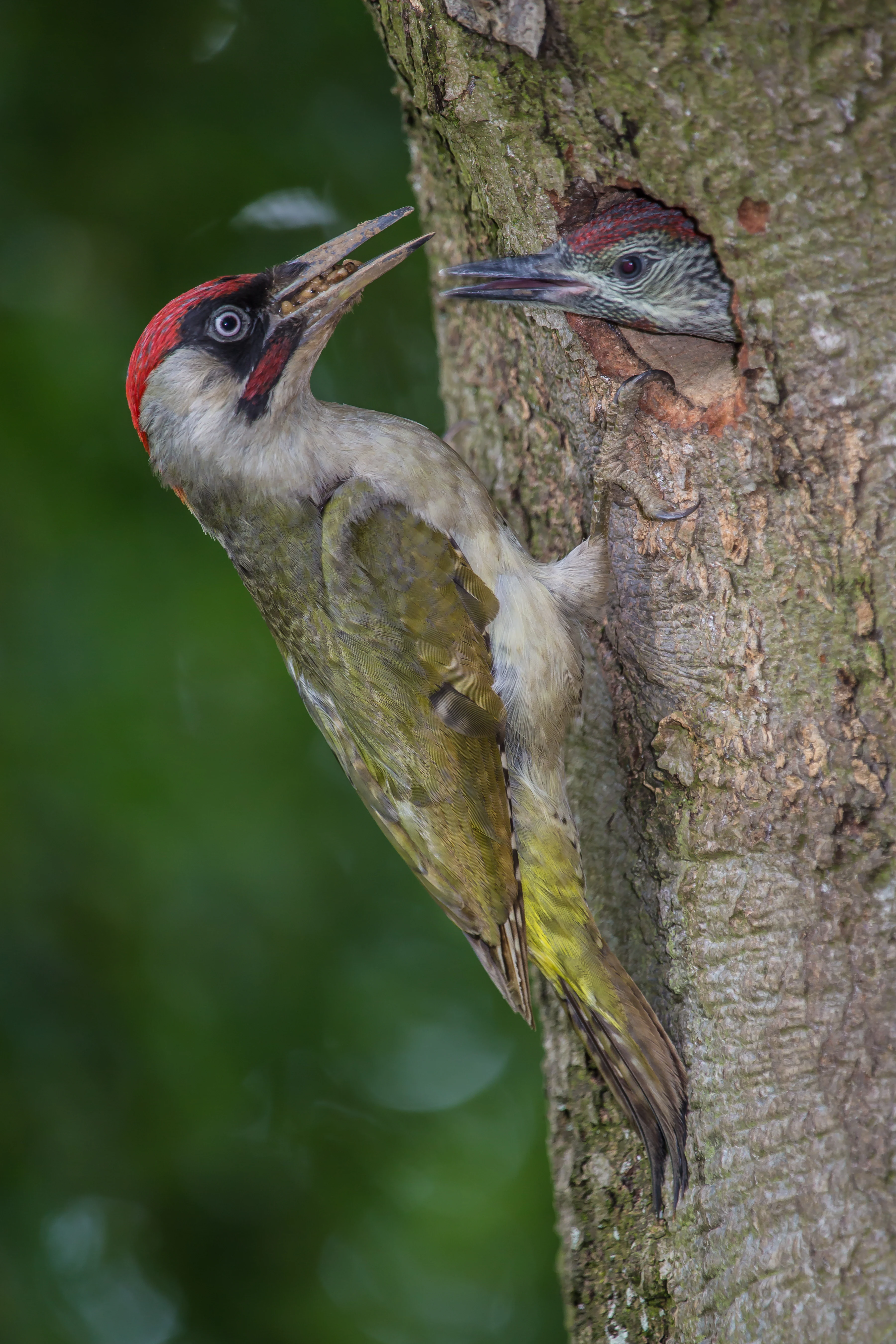
An adult green woodpecker with a red crown and olive green feathers clings to a tree trunk, holding food in its beak to feed a chick peering out from a nesting hole.
An adult European green woodpecker feeding its chick at a tree hollow.

Hühnerbachtal Nature Reserve history and protected-area timeline

Hühnerbachtal was formally designated as a nature reserve in 1997 under the framework of the Mettmann district landscape plan, responding to long-term concerns about the quality of the Hühnerbach valley and its associated habitats.

In 2012, the reserve was reviewed and reconfirmed under an updated landscape plan for the Mettmann district, reflecting ongoing efforts to align its management with regional connectivity goals and to address pressures from invasive species, neighboring infrastructure, and adjacent land use. There is no indication of earlier predecessor protected areas at this site; the current reserve designation is the principal institutional history of the area.

Hühnerbachtal Nature Reserve landscape and geographic character

The physical setting of Hühnerbachtal is defined by a sharply incised valley that runs from west to east along the course of the Hühnerbach. Elevations within the reserve range from about 90 meters in the valley bottom to roughly 142 meters on the upper edges, producing the steep wooded flanks that give the area much of its character.

The valley floor is flat, damp, and frequently waterlogged, which has favored the development of floodplain forest, wet grasslands, and small waterbodies. A partly stony, freely meandering stream channel winds through the core of the reserve, contrasting with the more heavily modified reaches in the northern side valley.

Above the valley floor, the slopes rise sharply and support mixed deciduous woodland. The combination of low, flat valley floor and steep, forested margins creates a compact but visually distinct micro-landscape that is uncharacteristic for the surrounding urban and agricultural fringe near Haan.
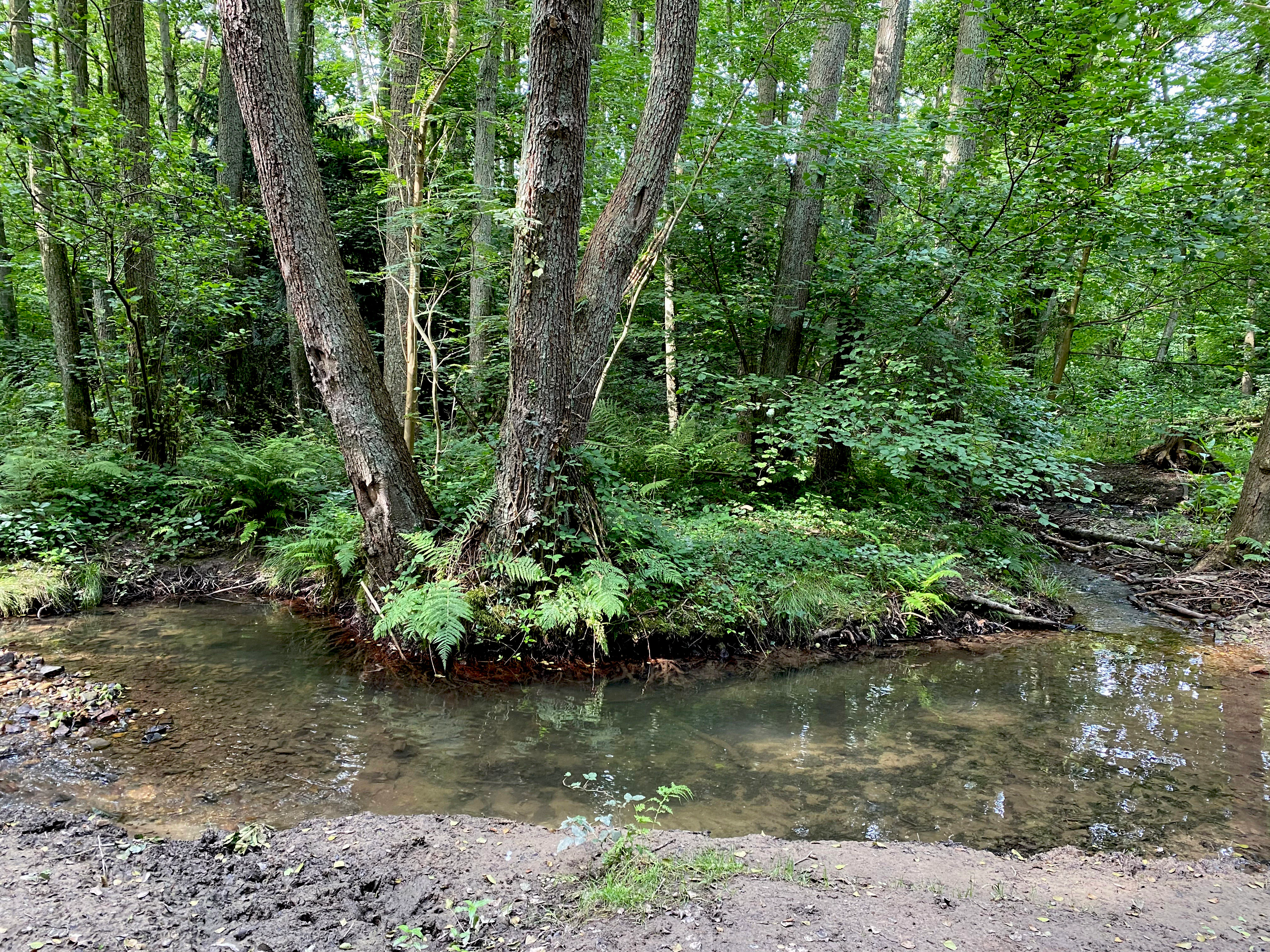
A small, clear stream winds through a dense, green deciduous forest, with a split-trunk tree standing on a muddy bank in the center.
The Hühnerbach stream flowing through the lush valley forest of the Hühnerbachtal nature reserve.

Hühnerbachtal Nature Reserve ecosystems, habitats, and plant life

Ecologically, Hühnerbachtal is dominated by near-natural alder floodplain forest along a mostly unmodified lowland brook. The wet valley floor is defined by extensive floodplain woodland, with an overstory often dominated by alder and a hybrid poplar stand in the central area, while the margins transition into spring-fed woodland communities.

Open wet habitats are an essential complement to the forested areas and include moist meadows, sedge marshes, reedbeds, and a network of small ponds, some of which are former fishponds that have reverted to near-natural conditions.

On the steeper flanks, the vegetation shifts to mixed beech and oak woodland with frequent holly and a relatively species-poor, patchy herb layer. The combination of wet valley floor habitats and adjacent steep-slope forest creates a varied biotope mosaic of clear regional significance for a reserve of this size.
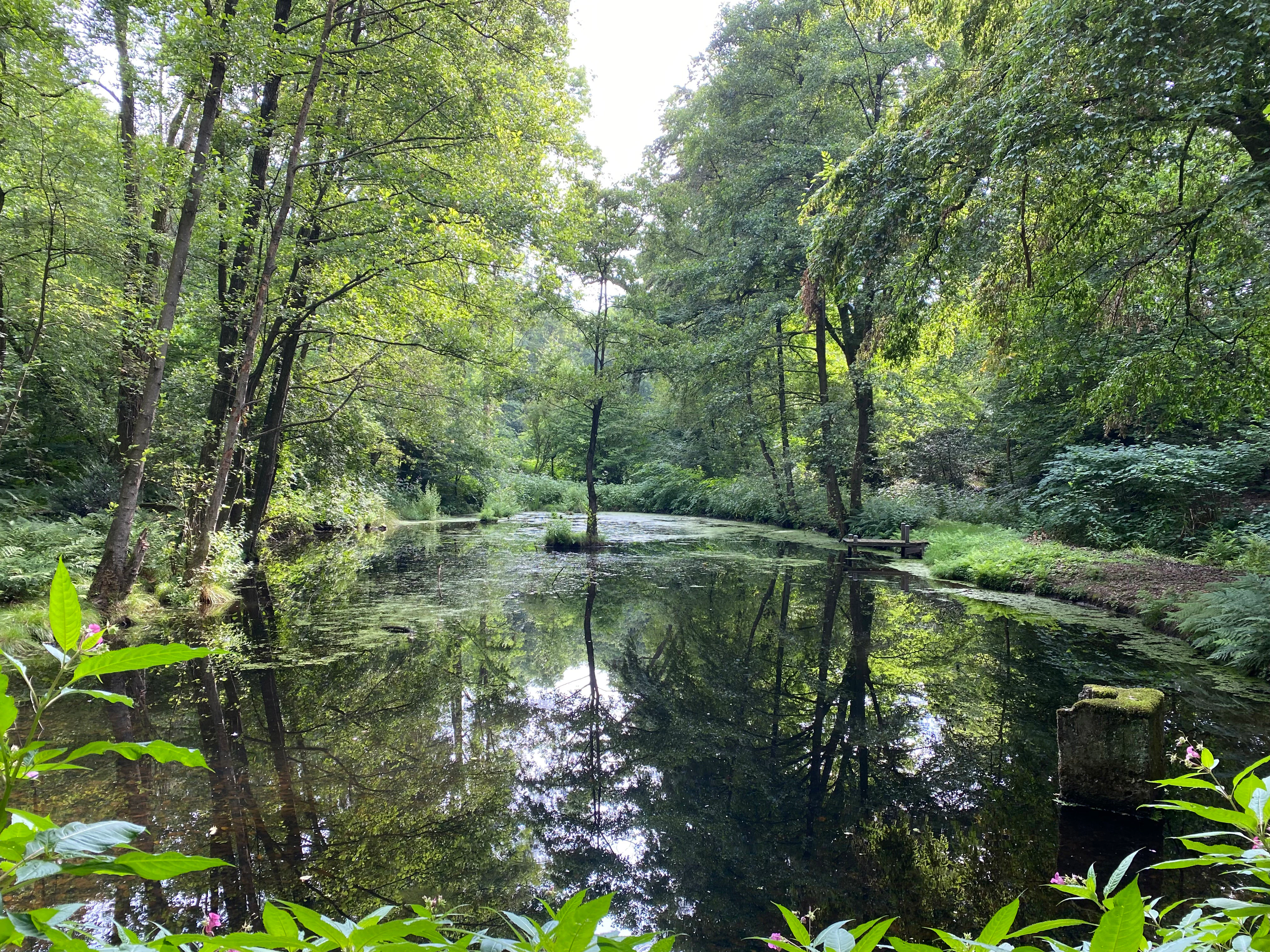
A peaceful, shaded pond reflecting the surrounding green trees and dense forest foliage in Hühnerbachtal.
A tranquil pond surrounded by lush forest within the Hühnerbachtal nature reserve.

Hühnerbachtal Nature Reserve wildlife and species highlights

The reserve provides habitat for a range of characteristic woodland and wetland species typical of near-natural stream valleys in the lower Bergisches Land. The wet valley floor and small ponds support amphibians, with an abandoned, partly shaded fishpond in the western part of the area serving as a key spring spawning site.

The mixed beech-oak forest on the slopes and the old-growth trees along the valley edges provide nesting and foraging habitat for typical woodland birds. The photographic documentation associated with the reserve includes the common kingfisher along the brook, the green woodpecker associated with deadwood-rich forest edges, and the common noctule bat using tree roosts in the area.
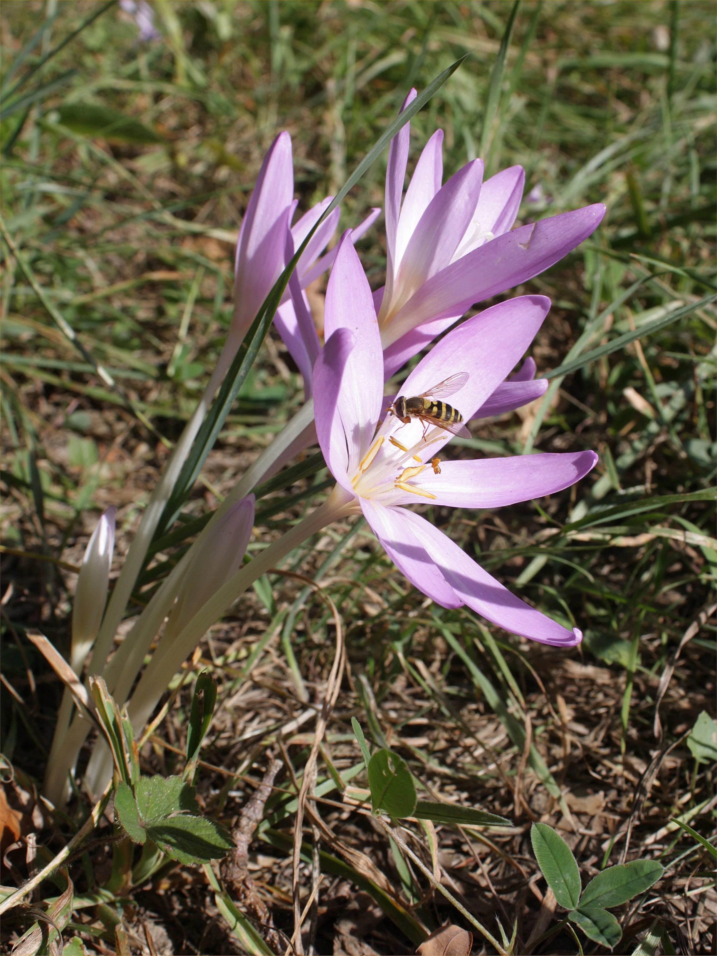
A close-up view of light purple autumn crocus flowers growing in grass, with a bee resting on one of the petals.
An autumn crocus, Colchicum autumnale, with a pollinating insect in Hühnerbachtal.

Hühnerbachtal Nature Reserve conservation status and protection priorities

Hühnerbachtal is classified as a habitat and species management area under the IUCN protected-area categories and is administered under the landscape plan of the Mettmann district by the lower landscape authority. Its conservation value lies in preserving a near-natural lowland brook valley and its associated floodplain forest mosaic in a region otherwise dominated by urban and infrastructural pressures.

The reserve functions as a regionally important node in the local west-east biotope network and provides habitat connectivity between nearby protected areas such as the Spörkelnbruch reserves to the south. Active management focuses on maintaining open wet grassland areas through low-intensity care, controlling invasive non-native species, and restoring near-natural conditions along stretches of the stream that have been affected by historical fishpond construction.

Beyond its immediate ecological role, the reserve illustrates the importance of small protected sites in retaining functional, near-natural habitats within densely populated landscapes.

Hühnerbachtal Nature Reserve cultural meaning and human context

Hühnerbachtal lies on the urban fringe of Haan, a town historically connected to the rural and small-industrial landscape of the lower Bergisches Land. The valley historically supported small-scale land uses such as fish ponds, wet meadows, and mixed woodland management, traces of which remain in the form of an abandoned fishpond and patches of orchard-like vegetation on the valley margins.

The reserve sits within a landscape shaped by centuries of interaction between farming settlements, small streams, and the surrounding wooded ridges. Features such as the settlement name Vogelsang on the northern edge reflect the traditional rural character of this part of the district, while the proximity of the railway, motorway exits, and modern settlement edges highlights the contemporary tension between historical land use and current urban pressure.
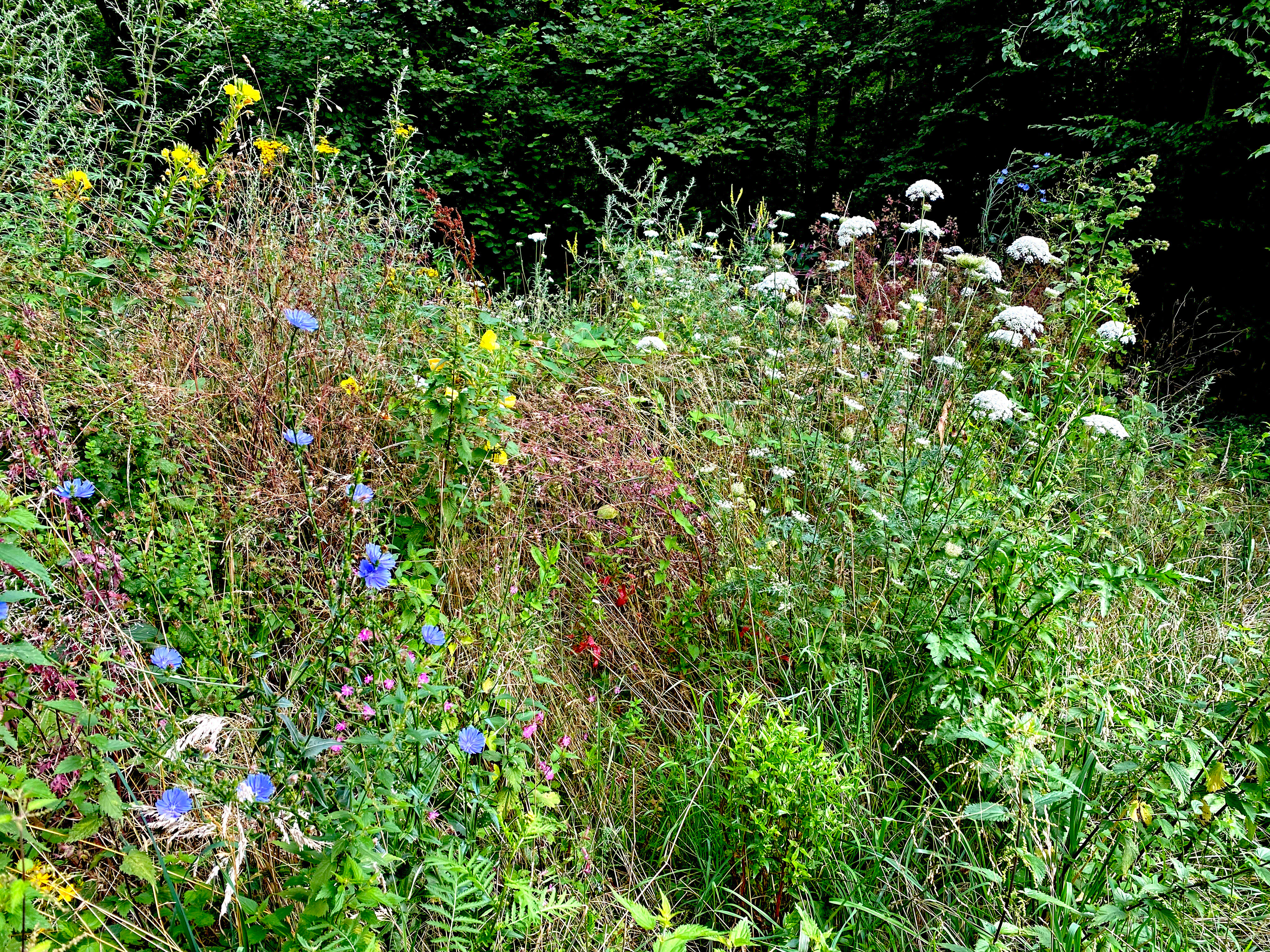
A close view of various wildflowers including blue chicory and white umbellifer flowers growing along a path near a forest edge.
Wildflowers along the path in the Hühnerbachtal nature reserve.

Top sights and standout views in Hühnerbachtal Nature Reserve

The strongest features of Hühnerbachtal include its near-natural meandering brook, its extensive alder-dominated floodplain forest, and the contrast between the wet valley floor and the steep, old-growth-influenced beech-oak slopes that frame it.

The reserve also stands out for the regional importance of its habitat mosaic, its role as a stepping stone in the local west-east biotope network, and the presence of a restored former fishpond that now serves as a key amphibian breeding site within the protected area.
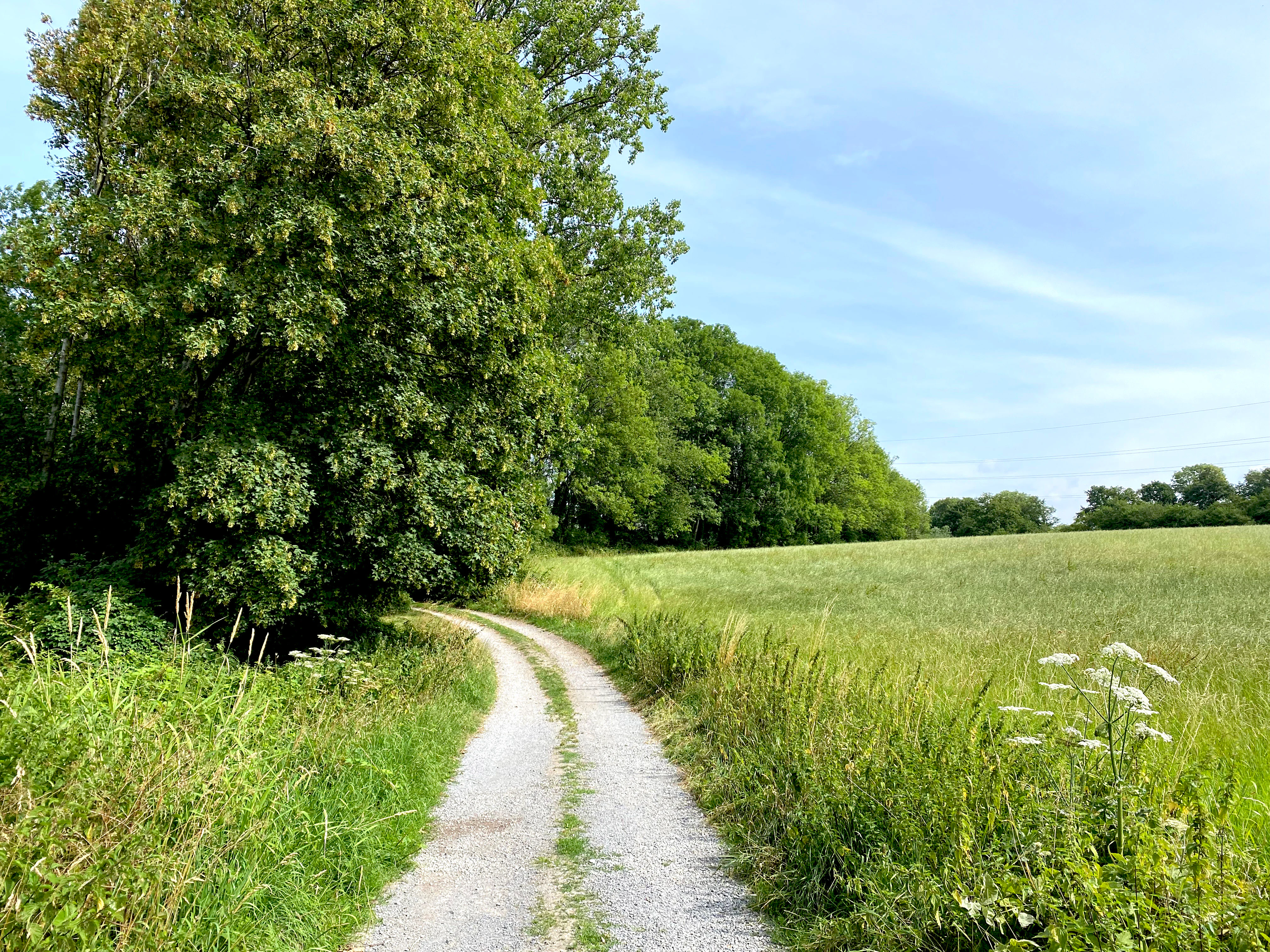
A gravel trail winding through a green field next to a lush forest under a bright sky.
A gravel path leads along the edge of the woodland in the Hühnerbachtal nature reserve.

Best time to visit Hühnerbachtal Nature Reserve

Spring is the most ecologically active period in the reserve, when the restored pond functions as an amphibian spawning site and the valley habitats come alive with breeding birds and early woodland flowers. Late spring and early summer offer the richest display of herb-layer vegetation in the meadows and along the woodland edges.

Autumn adds a different character to the valley, including the seasonal presence of meadow saffron in the damp grasslands and warmer tones in the mixed forest on the slopes. Winter visits can be quieter but still rewarding for observing the stream, the bare structure of the floodplain forest, and any deadwood-dependent wildlife along the valley margins.

Monthly climate preview

Track representative monthly temperature ranges and precipitation averages across the park terrain

Hühnerbachtal Climate Normals, Long-Term Temperature and Precipitation Rhythm

Representative coordinate measurements reveal annual temperature variations from mean lows of negative 8 degrees Celsius to highs exceeding 32 degrees Celsius alongside steady precipitation rates. Exploring the full monthly dataset provides deeper insight into long-term climate normals and multi-month environmental patterns across the protected landscape.
Annual mean10 °C
1 °C19 °C
Jan
Feb
Mar
Apr
May13°
Jun17°
Jul19°
Aug19°
Sep15°
Oct10°
Nov
Dec
Warmest month
July

19.2 °C

Coolest month
January

1.3 °C

Wettest month
December

2.6 mm/day

Driest month
April

1.6 mm/day

Park location guide

Geography guide, regional context, and park location map for Hühnerbachtal Nature Reserve

Hühnerbachtal Nature Reserve park geography, regions, and map view in Germany

Understand where Hühnerbachtal Nature Reserve sits in Germany through a broader geographic reading of the surrounding landscape, nearby location context, and its mapped position within the national park landscape.

How Hühnerbachtal Nature Reserve fits into Germany

Germany is a federal republic in Western and Central Europe with a population of over 83 million across sixteen constituent states. It is Europe's largest economy by nominal GDP and a major global exporter and importer. The capital is Berlin, and the country borders Denmark, Poland, Czech Republic, Austria, Switzerland, France, Luxembourg, Belgium, and the Netherlands.

Wider geography shaping Hühnerbachtal Nature Reserve in Germany

Germany is located in Western and Central Europe, spanning 357,022 km². It borders Denmark to the north, Poland and the Czech Republic to the east, Austria and Switzerland to the south, and France, Luxembourg, Belgium, and the Netherlands to the west. The country has coastlines on the Baltic Sea and North Sea to the north, with the Alps located in the southern region.

Map view of Hühnerbachtal Nature Reserve

Use this park location map to pinpoint Hühnerbachtal Nature Reserve in Germany, understand its exact geographic position, and read its mapped placement within the surrounding landscape more clearly.

Pigeon | © OpenStreetMap contributors

Location context for Hühnerbachtal Nature Reserve

Kreis MettmannNordrhein-Westfalen

Explore detailed imagery of alder floodplain forests, meandering brooks, and steep wooded valley slopes.

Hühnerbachtal Photos and Landscape Scenery: Visualizing the Protected Stream Valley

Visual records reveal the diverse habitat mosaic and steep topography defining the protected Hühnerbachtal reserve. Examining stream valley photography provides deeper insight into the protected environment and regional ecology.

An adult green woodpecker with a red crown and olive green feathers clings to a tree trunk, holding food in its beak to feed a chick peering out from a nesting hole.

A small, calm creek winds through a dense green forest, with trees and shrubs lining the muddy banks.

A small, clear stream winds through a dense, green deciduous forest, with a split-trunk tree standing on a muddy bank in the center.

A peaceful, shaded pond reflecting the surrounding green trees and dense forest foliage in Hühnerbachtal.

A close-up view of light purple autumn crocus flowers growing in grass, with a bee resting on one of the petals.

A calm, narrow stream flows through a dense, deciduous forest, reflecting the surrounding trees in its water.

A close view of various wildflowers including blue chicory and white umbellifer flowers growing along a path near a forest edge.

A gravel trail winding through a green field next to a lush forest under a bright sky.

A green, grassy meadow stretches into the distance, framed by dense, mature deciduous forest on both sides under a soft, overcast sky.

A small, muddy stream with shallow flowing water runs through a dense, leafy green forest floor with ferns and fallen branches.

A section of deciduous forest in Hühnerbachtal featuring a prominent tree stump and a fallen log on the forest floor, surrounded by lush green foliage and mature trees.

Park atlas

Compare regional stream valleys and connected natural reserves across the surrounding territory.

Parks near Hühnerbachtal: Explore Nearby Protected Areas and Valley Landscapes

Browse other parks near Hühnerbachtal to examine similar floodplain forests, wetland mosaics, and steep wooded terrain. Comparing adjacent protected areas reveals broader regional conservation patterns and connected habitat networks across the lower Bergisches Land.
A watercolor painting showing a soft landscape scene with a winding stream, low-lying vegetation, and distant hills in pale green and earth tones.
Nature reserveNorth Rhine-Westphalia
About 0.7 km away#1 closest

North

Mahnerter Bachtal: Mapping the Protected Stream Valley Habitats of North Rhine-Westphalia

A vital riparian landscape and lowland nature reserve

Mahnerter Bachtal preserves a significant lowland stream valley in Erkrath, featuring alder swamps, wet meadows, and ancient oak forests. This 28-hectare nature reserve functions as a crucial east-west ecological corridor, offering a rare glimpse of undisturbed valley geography within the sprawling industrial landscape of the German Rhine-Ruhr metropolitan area.

Area
0.28 km²
Established
1997
IUCN
IV
A horizontal watercolor illustration showing a landscape with sparse trees, grasses, and soft pastel colors representing a heathland habitat.
Nature reserveNordrhein-Westfalen
About 2 km away#2 closest

Southwest

Hildener Heide, östlich Taubenberg: Protected Nature Reserve and Heathland Atlas

Mapping the ecological landscape in Nordrhein-Westfalen

Hildener Heide, östlich Taubenberg is a distinct nature reserve in the Mettmann district, notable for its intact wet heath and bog asphodel populations. This protected area contributes to a wider forest and heath network across the Bergische Heideterrasse, showcasing how active conservation management shapes unique lowland terrain.

Area
2 km²
Established
1993
IUCN
IV
Watercolor painting of a meandering stream flowing through a green meadow, with trees in the background.
Nature reserveNordrhein-Westfalen
About 2.1 km away#3 closest

Southwest

Hildener Stadtwald, Bereich Sandbach-Krebsbach Protected Nature Reserve and Wetland Geography

A mapped overview of the Bergische Heideterrasse riparian corridor.

Hildener Stadtwald, Bereich Sandbach-Krebsbach stands as an important nature reserve within the urbanised landscape of North Rhine-Westphalia. The area is characterized by its hydrologically dynamic sandy brooks, old-growth alder stands, and distinct microhabitats ranging from wet heath to dry oak-birch forests. This protected entity offers a clear look at the structural complexity of lowland mire ecosystems within a broader regional forest context.

Area
0.27 km²
Established
1938
IUCN
IV
Relief
Lowland
A soft watercolor painting of a small grove of trees standing near a body of water, featuring pale green and yellow tones.
Nature reserveNordrhein-Westfalen
About 2.3 km away#4 closest

South

Naturschutzgebiet Hildener Heide, südlich Sandberg: Protected Area and Landscape Atlas

Bog woodland and wet heathland geography in North Rhine-Westphalia.

Examine the topography and habitat mosaic of Naturschutzgebiet Hildener Heide, südlich Sandberg. This nature reserve serves as an important ecological anchor on the Bergische Heideterrasse, preserving rare wetland, alder bog forest, and heath vegetation within a compact and structurally diverse geographic footprint.

Area
0.08 km²
Established
1938
IUCN
IV
Relief
Lowland
Watercolor illustration showing a wide landscape with rolling hills in soft pink and purple tones, a line of green conifer and deciduous trees, and a grassy foreground with a winding path or stream
Nature reserveNordrhein-Westfalen
About 2.6 km away#5 closest

South

Hildener Heide, Schönholz Nature Reserve: Geography and Protected Area Context

A preserved mosaic of inland heath and bog forest habitats.

Hildener Heide, Schönholz provides a critical window into the rare wetland ecosystems of the Bergische Heideterrasse. This nature reserve in North Rhine-Westphalia retains a distinct mosaic of peat-moss-dominated bog woodland, wet heath, and alder-ash floodplain forest, offering a high density of threatened habitats within a protected geographic framework.

Area
0.36 km²
Established
1938
IUCN
IV
Relief
Lowland
A soft watercolor illustration of a calm stream winding through a wetland or bog area, with gentle hills in the background and a split tree trunk in the foreground.
Nature reserveNordrhein-Westfalen
About 2.9 km away#6 closest

Southwest

Hildener Stadtwald, Bereich Biesenbach: Protected Wetland and Heathland Geography

Nature reserve complex in the Mettmann district of Nordrhein-Westfalen

This compact nature reserve preserves a critical network of bog woodland and stream-fed alder swamp within the sand-dominated terrain of the Bergische Heideterrasse. The area demonstrates a clear transition between elevated dry forest margins and permanently wet peat moss communities, anchoring a wider regional system of protected heathland habitats.

Area
0.09 km²
Established
1938
IUCN
IV
Relief
Lowland
A watercolor painting showing a soft, peaceful landscape with light green rolling hills in the background, a flat plain in the middle ground, and grasses and wildflowers in the foreground under a pale, warm sky.
Nature reserveNordrhein-Westfalen
About 4.3 km away#7 closest

Northwest

Laubacher Steinbruch Nature Reserve: Mapped Geographic Overview and Protected Landscape Analysis

Calcareous habitats in the Neandertal valley, Germany

Laubacher Steinbruch is a distinct nature reserve characterized by a mosaic of sycamore maple forest, steep limestone cliffs, and dry scree fields. Situated within the Neandertal Natura 2000 site, it acts as a critical refuge for specialized plant communities and reptiles, forming an integral part of the regional conservation network in Nordrhein-Westfalen.

Area
0.06 km²
Established
1997
IUCN
IV
Watercolor painting of a tranquil, marshy landscape with soft green trees, grass, and a winding path, rendered in a pale, minimalist style.
Nature reserveNordrhein-Westfalen
About 5.2 km away#8 closest

South

Krüdersheide und Götsche Nature Reserve: Geographic Mapping and Protected Land Data

Wetland mosaic and bog forest habitats in Nordrhein-Westfalen

Located in Solingen, the Krüdersheide und Götsche nature reserve protects essential bog woodland, peat cushions, and stream habitats on the Bergische Heideterrasse. This 55-hectare site serves as an important ecological corridor for moisture-dependent flora and fauna within an urbanized region of Nordrhein-Westfalen. Study its mapped boundaries and terrain context through our specialized atlas database.

Area
0.547 km²
Established
2005
IUCN
IV
Relief
Lowland

Common questions about visiting, size, designation, and location context for Hühnerbachtal Nature Reserve

Hühnerbachtal Nature Reserve FAQs for park facts, access, geography, and protected area context

Find quick answers about Hühnerbachtal Nature Reserve, including protected-area facts, park geography, trail and visitor context, and how the park fits into its surrounding country and regional landscape.
MoriAtlas Explorer

Continue Your Protected Areas Search Across the Global Atlas

Deepen your exploration by continuing the structured search for national parks and protected areas worldwide. Utilize the comprehensive filtering capabilities to compare different conservation landscapes and refine your understanding of global park geography. Discover more about the distribution and characteristics of protected natural areas.

Global natural geography