
Mori Atlas logo
Protected areaHungerbrunnen-, Sacken- und Lonetal

Discover the geographic intersection of limestone outcrops, meandering stream channels, and ancient juniper heaths.

Hungerbrunnen-, Sacken- und Lonetal Protected Area: Karst Valleys and Swabian Alb Landscapes

(FFH-Gebiet Hungerbrunnen-, Sacken- und Lonetal)

Hungerbrunnen-, Sacken- und Lonetal represents a distinctive protected landscape within the eastern Swabian Alb of Baden-Württemberg. This area features a mosaic of semi-natural calcareous grasslands, beech forest corridors, and karst-influenced valleys shaped by the intermittent flow of the Lone river. Visitors can examine the topographic interplay between high-plateau juniper heaths and deeply incised scree slopes that characterize this protected region.

Natura 2000FFH-GebietSwabian Albjuniper heathcalcareous dry grasslandbeech forest
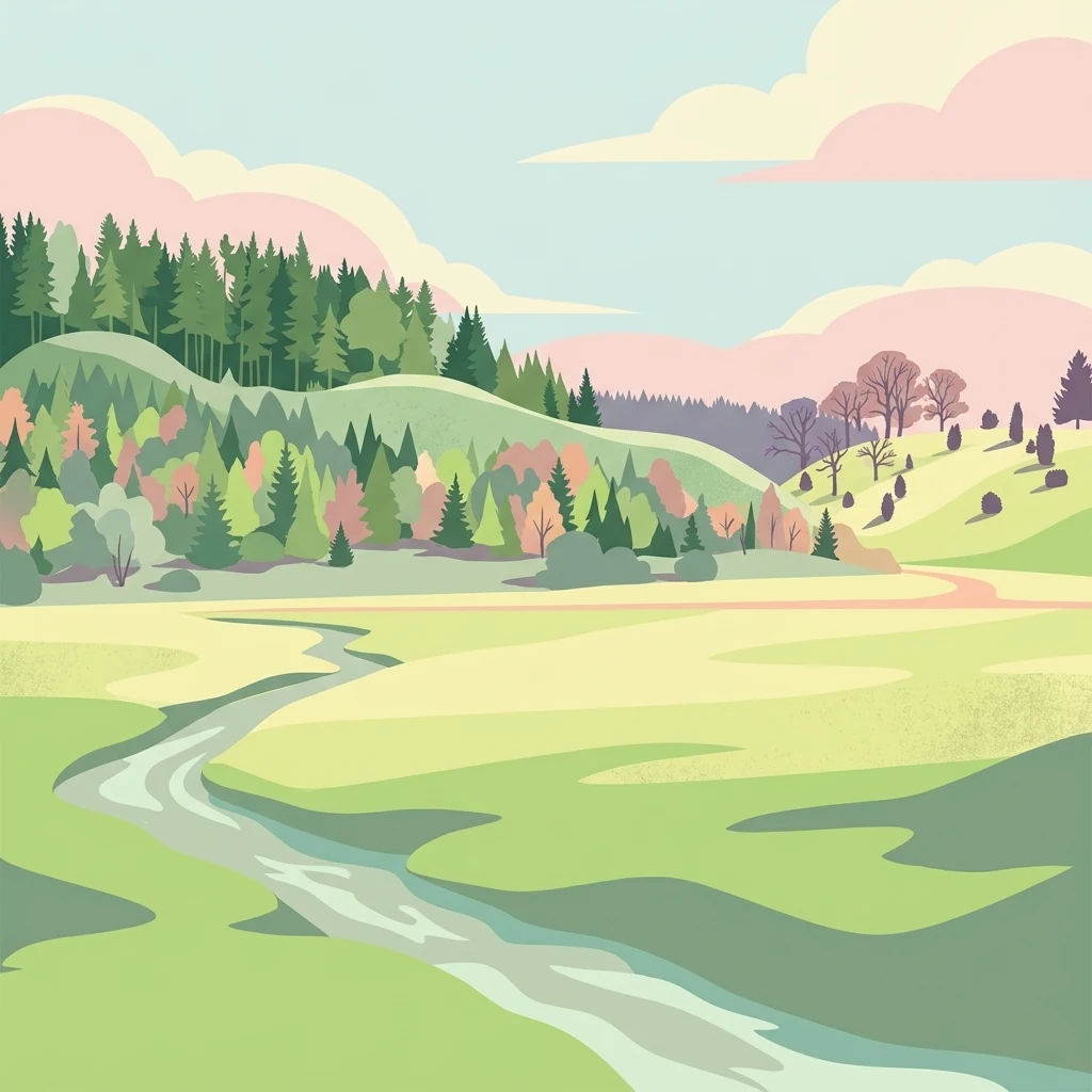
A digital illustration of a peaceful valley with a winding stream, lush green meadows, forested hills, and soft pastel clouds in the sky.

Hungerbrunnen-, Sacken- und Lonetal

Protected area

Park overview

Structured park overview, official facts, and landscape profile for Hungerbrunnen, Sacken and Lonetal

Hungerbrunnen, Sacken and Lonetal park facts, protected area profile, and essential visitor context

Review the core facts for Hungerbrunnen, Sacken and Lonetal, including designation, size, terrain, visitor scale, habitats, and operating context in one park-focused overview.

About Hungerbrunnen, Sacken and Lonetal

Hungerbrunnen, Sacken and Lonetal is a conservation area in the eastern part of the Swabian Alb in southern Germany. It belongs to the European Natura 2000 network as a Fauna-Flora-Habitat site, a category reserved for areas hosting habitat types or species of community interest listed in the EU Habitats Directive. The site number DE-7426-341 links it formally to a wider European inventory of valuable habitats.

The area focuses on the deeply cut valleys of the Lone river and several tributary valleys on the eastern Swäbische Alb. Despite the karst character of the underlying limestone, the landscape is marked by a periodic stream system in which the Lone and its side branches periodically run dry, then flow again depending on rainfall and snowmelt conditions. This continual wet-dry cycle, combined with the area's exposure and relatively poor soils, has shaped a special vegetation mosaic that contrasts with the lush forests more typical of southwest Germany.

In the valleys and on the slopes, juniper heaths on calcareous soils dominate large sections of the protected area, with patches of natural dry grassland, pioneer calcareous grasslands on stony terrain, and limestone scree slopes adding to the diversity. The higher slopes support beech forests rich in indicator species, including orchid-bearing calcareous beech forests and small areas of ravine and slope-mixed forest. Two caves located within the site add a further habitat dimension, reflecting the karst origin of the broader Lonetal landscape.

The site is not a national park in the classic sense but a comparatively small, focused nature conservation area of around 918 hectares. Its importance lies less in size than in the unusually complete range of typical eastern Swabian Alb habitat types compressed into one valley system. This compact profile makes it valuable both for European habitat conservation and for understanding how traditional land use has preserved semi-open landscapes that otherwise would risk being lost to forest encroachment.

Quick facts and research context for Hungerbrunnen, Sacken and Lonetal

Hungerbrunnen, Sacken and Lonetal is a Natura 2000 Habitats Directive site (FFH-Gebiet) in Baden-Württemberg, Germany, designated in 2019 with filing in 2005. The site covers approximately 918 hectares across four municipalities in three different administrative districts: Landkreis Heidenheim, Landkreis Göppingen, and Alb-Donau-Kreis, with the core area between Gerstetten and Altheim on the Alb.

Geographically, the site lies within the natural regions of Albuch and Härtsfeld as well as the Lonetal-Flächenalb, both part of the larger Schwäbische Alb. It lies within the landscape protection area Hungerbrunnental and contains the nature protection area Hungerbrunnental as well as the natural monument Hungerbrunnenquelle near Gerstetten. Administratively it is overseen by the Regierungspräsidium Stuttgart.

Protection and recognition

Documented terrestrial protection history and Natura 2000 recognition sources

Hungerbrunnen-, Sacken- und Lonetal Protection Status and Designation Records

Hungerbrunnen-, Sacken- und Lonetal maintains a registered terrestrial designation established in 2019 alongside official Natura 2000 recognition records. Structured protection metrics and source documentation outline the conservation framework assigned to this natural area.

International recognition

Protection details

Protection scope
Terrestrial
Designated year
2019
Transboundary protection
No
WDPA ID
555521925
Park context

Deeper park guide and search-rich context for Hungerbrunnen, Sacken and Lonetal

Hungerbrunnen, Sacken and Lonetal history, landscape, wildlife, and travel context

Explore Hungerbrunnen, Sacken and Lonetal through its history, landscape character, ecosystems, wildlife, conservation priorities, cultural context, and seasonal travel timing in a structured park guide built for atlas discovery and search intent.

Why Hungerbrunnen, Sacken and Lonetal stands out

The site is best known for its juniper heaths, calcareous dry grasslands, orchid-rich beech forests, and the dry valley landscape of the Lone river with meandering, intermittently desiccating stream channels. Its combination of typical Swabian Alb habitats within a single, geographically compact area gives the protection site a distinctive profile. The two small caves within the territory add a karst-landscape dimension to the ecological mosaic and contribute to the site's special geological character.
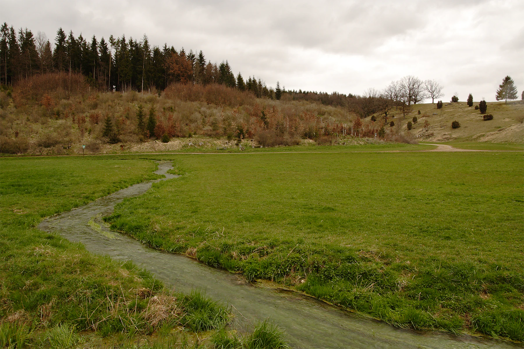
A small, winding stream flows through a lush green valley meadow with a coniferous forest and hillside in the background under an overcast sky.
The Hungerbrunnen karst spring flowing through a green meadow in the Swabian Alb.

Hungerbrunnen, Sacken and Lonetal history and protected-area timeline

The protection site was first proposed in 2005 by the Regierungspräsidium Stuttgart under the European Union Habitats Directive (Richtlinie 92/43/EWG), commonly known as the Fauna-Flora-Habitat Directive. After a long assessment and consultation process, the official designation was completed by ordinance of the Regierungspräsidium Stuttgart dated 30 October 2018, formally establishing it as a Site of Community Importance, with legal effect from 11 January 2019. Since then it has been part of the Natura 2000 network of protected areas across Europe.

Long before formal European designation, however, parts of the area had already been protected at the state level. The whole site lies inside the landscape protection area Hungerbrunnental, while within the territory lies the nature protection area Hungerbrunnental, and the Hungerbrunnenquelle spring near Gerstetten is recognized as a natural monument. This nested system of protections reflects the long-standing regional recognition of the valley's natural value.

Hungerbrunnen, Sacken and Lonetal landscape and geographic character

The landscape of Hungerbrunnen, Sacken and Lonetal is shaped by the karst geology of the eastern Swabian Alb. The Lone river and its tributaries have cut deeply into the limestone plateau over millennia, producing steep-sided valleys with terraces, rocky outcrops, scree slopes, and abrupt transitions between valley floor and plateau surface. The result is a strongly contrasting terrain where flat grassland stretches on the high plateau drop suddenly into narrow, sheltered valley arms.

A defining feature of this landscape is the periodic drying of the streams. Because water seeps easily into the karst, the Lone and its side branches can run dry during parts of the year only to return as lively meandering brooks after sustained rainfall. This hydrological rhythm helps maintain a vegetation pattern unusual for southern Germany, with dry-loving and warmth-loving species thriving alongside typical streamside vegetation.

Above the valley floor, the plateau slopes and high ground carry extensive juniper heaths and dry grasslands interrupted by patches of beech forest. Two caves within the territory highlight the karst quality of the bedrock, and limestone cliffs and rocky grasslands with rich fissure vegetation add visual structure to the side slopes. The combination of dry valley, juniper heath, rocky outcrops, and beech forest creates a layered, photogenic Swabian Alb landscape.

Hungerbrunnen, Sacken and Lonetal ecosystems, habitats, and plant life

Ecologically, the site is a representative example of the habitat mosaic of the eastern Swabian Alb. Around a third of the area is covered by wet and mesophilic grassland, including traditionally managed meadows in the valleys. The remainder is split among deciduous forest, mainly beech on the higher ground, mixed forest, and coniferous stands, with smaller shares of improved grassland, arable land, and built-up areas.

The principal open habitat types are extensive juniper heaths on calcareous soils, semi-natural calcareous dry grasslands, and small areas of pioneer calcareous grassland on stony slopes. These are classic steppe-like vegetation formations associated with warm, dry, lime-rich sites, and they harbour many specialized plants and insects that have become rare elsewhere in central Europe.

Forest cover is dominated by a Waldmeister-type beech forest, with smaller areas of orchid-rich calcareous beech forest and ravine-slope mixed forest on the steepest, most sheltered sections. Karst features such as limestone scree slopes, calcareous rock outcrops with fissure vegetation, and small caves provide additional microhabitats. The overall ecological value comes from the tight interplay of dry, warm, open habitats and cool, shady forests in one relatively compact valley landscape.

Hungerbrunnen, Sacken and Lonetal wildlife and species highlights

The combination of juniper heaths, dry grasslands, karst slopes, and deciduous forest gives Hungerbrunnen, Sacken and Lonetal a habitat mosaic that supports a wide range of typical Swabian Alb fauna. Warm, dry open sites favour invertebrates that depend on calcareous grassland, including butterflies, wild bees, and other pollinators, which in turn provide food for a variety of bird species of the open countryside.

The beech forests and ravine slopes provide nesting and feeding habitat for woodland birds, while the periodic streams and meadows support amphibians, invertebrates, and small aquatic life that respond to the regularly alternating wet and dry conditions. Bats also benefit from the presence of small caves and rocky outcrops, which can serve as roosting sites.

Hungerbrunnen, Sacken and Lonetal conservation status and protection priorities

From a conservation perspective, Hungerbrunnen, Sacken and Lonetal is significant primarily because it preserves a coherent complex of European-protected habitat types in a comparatively small area. Juniper heaths, calcareous dry grasslands, pioneer calcareous grasslands, and several Annex I beech forest types all occur within the same valley system, making the site a high-priority object for habitat conservation under the EU Habitats Directive.

The site also serves as part of a larger network of protected areas on the Swabian Alb, including the adjacent FFH areas Kuppenalb bei Laichingen und Lonetal and Härtsfeld. Its nested protection status, sitting within an existing landscape protection area, with a core nature protection area and natural monument inside it, ensures that the juniper heaths, dry grasslands, and beech forests are safeguarded at multiple administrative levels. Maintaining traditional grazing and avoiding further forest encroachment remain central to keeping the open habitats in good condition.

Hungerbrunnen, Sacken and Lonetal cultural meaning and human context

The visible character of the Hungerbrunnen, Sacken and Lonetal landscape is closely tied to centuries of agricultural use. The juniper heaths and dry grasslands are not purely natural; they have developed and been maintained through traditional grazing and other low-intensity land use by local communities. This long-standing interaction between people and the dry valley landscape has produced the cultural-natural mosaic that the conservation area now seeks to protect.

The Hungerbrunnenquelle spring is recognized as a local natural monument, suggesting that the area's geological features have held meaning for local communities well before modern nature conservation frameworks. Across the larger Swabian Alb region, valleys like these are part of the cultural landscape of the Lonetal and a touchstone of regional identity.

Top sights and standout views in Hungerbrunnen, Sacken and Lonetal

The site's main strength is its compact concentration of typical eastern Swabian Alb habitats: extensive juniper heaths, semi-natural calcareous dry grasslands, pockets of pioneer grassland on stony terrain, and a substantial share of Waldmeister-type beech forest, including small areas of orchid-rich calcareous beech forest.

A second highlight is the karst-influenced valley landscape of the Lone and its tributaries, with intermittent streams, meandering channels, limestone scree slopes, and two caves. These features together create a layered, ecologically rich picture that is more characteristic of southern European steppe-like landscapes than of southern Germany. The site's nested protection status, from Natura 2000 down to natural monument, further underlines its regional and European conservation value.

Best time to visit Hungerbrunnen, Sacken and Lonetal

Because the site is a nature conservation area, rather than a developed visitor destination, the notion of a best time to visit is tied largely to the experience of the landscape rather than to facilities or access conditions.

Late spring and early summer, when juniper heaths, dry grasslands, and orchid-bearing beech forests are in flower, are generally the most visually rewarding periods for a walk through the valley. Late spring and early summer also bring the greatest variety of flowering plants and insect activity in the calcareous grasslands. In autumn, the beech forests take on colour and offer a quieter, more contemplative atmosphere, while the periodic drying and refilling of the Lone and its tributaries creates shifting landscape moods throughout the year.

Monthly climate preview

Long-term representative temperature and precipitation averages across twelve recorded intervals

Hungerbrunnen-, Sacken- und Lonetal Climate Normals and Annual Weather Patterns

Representative coordinates record measured temperature ranges and daily precipitation totals across twelve distinct climatological intervals for Hungerbrunnen-, Sacken- und Lonetal. Comprehensive monthly climate normals provide deeper analytical context regarding sustained thermal shifts and precipitation rhythms.
Annual mean8 °C
-1 °C18 °C
Jan-1°
Feb-1°
Mar
Apr
May12°
Jun16°
Jul18°
Aug18°
Sep13°
Oct
Nov
Dec-1°
Warmest month
July

17.8 °C

Coolest month
January

-1.5 °C

Wettest month
July

3.4 mm/day

Driest month
February

1.7 mm/day

Park location guide

Geography guide, regional context, and park location map for Hungerbrunnen, Sacken and Lonetal

Hungerbrunnen, Sacken and Lonetal park geography, regions, and map view in Germany

Understand where Hungerbrunnen, Sacken and Lonetal sits in Germany through a broader geographic reading of the surrounding landscape, nearby location context, and its mapped position within the national park landscape.

How Hungerbrunnen, Sacken and Lonetal fits into Germany

Germany is a federal republic in Western and Central Europe with a population of over 83 million across sixteen constituent states. It is Europe's largest economy by nominal GDP and a major global exporter and importer. The capital is Berlin, and the country borders Denmark, Poland, Czech Republic, Austria, Switzerland, France, Luxembourg, Belgium, and the Netherlands.

Wider geography shaping Hungerbrunnen, Sacken and Lonetal in Germany

Germany is located in Western and Central Europe, spanning 357,022 km². It borders Denmark to the north, Poland and the Czech Republic to the east, Austria and Switzerland to the south, and France, Luxembourg, Belgium, and the Netherlands to the west. The country has coastlines on the Baltic Sea and North Sea to the north, with the Alps located in the southern region.

Map view of Hungerbrunnen, Sacken and Lonetal

Use this park location map to pinpoint Hungerbrunnen, Sacken and Lonetal in Germany, understand its exact geographic position, and read its mapped placement within the surrounding landscape more clearly.

Pigeon | © OpenStreetMap contributors

Location context for Hungerbrunnen, Sacken and Lonetal

Baden-Württemberg
Recorded earthquake history

Browse the Recorded Earthquake History for Hungerbrunnen-, Sacken- und Lonetal

Examine the historical record of earthquakes associated with the region surrounding Hungerbrunnen-, Sacken- und Lonetal. This collection provides access to data on past seismic activity in the Lone valley, allowing for a clearer understanding of local geographic history through organized event mapping.

Hungerbrunnen-, Sacken- und Lonetal Earthquake History

Catalogued events

9 events

Strongest magnitude

Magnitude 4.3

Most recent event

Aug 1, 1999

This history includes earthquakes recorded inside the park or within 50 km of its borders

Visualizing limestone valleys, juniper heaths, and karst habitats

Hungerbrunnen-, Sacken- und Lonetal Photos and Landscape Scenery

Visual records document the distinct terrain, rocky outcrops, and intermittent stream channels of Hungerbrunnen-, Sacken- und Lonetal. Photographic collections reveal the protected landscape character, juniper heaths, and beech forest mosaics across the eastern Swabian Alb.

A small, winding stream flows through a lush green valley meadow with a coniferous forest and hillside in the background under an overcast sky.

Park atlas

Compare surrounding karst valleys, juniper heaths, and regional limestone terrain

Explore Protected Areas and Parks Near Hungerbrunnen-, Sacken- und Lonetal

Browse nearby protected landscapes and related regional reserves connected to Hungerbrunnen-, Sacken- und Lonetal. Expanding the search helps compare adjacent limestone habitats and understand broader conservation networks across the Swabian Alb.
Nature reserveBaden-Württemberg
5.3 km away#1 closest

Southeast

Donaumoos Nature Reserve: A Detailed Atlas of Wetland Geography in Baden-Württemberg

Mapped mire ecosystems and diverse protected landscapes.

Donaumoos spans 14 sub-areas throughout the Donau-Iller-Lech plateau, defining a landscape of wet meadows, tall herb fringes, and alluvial forests. This protected area offers a deep look into the hydrological identity and ecological connectivity of the upper Danube wetland network, serving as a critical habitat node within the broader German Natura 2000 protected-land framework.

Area
9.16 km²
Established
2019
A watercolor painting showing a soft, impressionistic landscape with green hills, forested ridgelines in the distance, and pink wildflowers in the foreground.
Protected landscapeBaden-Württemberg
About 5.7 km away#2 closest

South

Mittleres Lonetal Protected Landscape: Swabian Alb Geography and Mapping

A regional protected area within the Alb-Donau-Kreis district

Mittleres Lonetal represents a key protected landscape in Baden-Württemberg, following the linear path of the Lone valley. The area integrates diverse terrain, including broadleaf forest, juniper heaths, and moisture-rich meadow dales, offering a comprehensive look at the rural geography and conservation zoning typical of the Swabian Alb region.

Area
31.581 km²
Established
1989
IUCN
V
Faint watercolor illustration of rolling green hills and a pinkish foreground against a white background.
Protected areaBaden-Württemberg
7.3 km away#3 closest

Northwest

Albtrauf Donzdorf-Heubach: Protected Escarpments and Karst Terrain in the Swabian Alb

Natura 2000 protected area in eastern Baden-Württemberg

The Albtrauf Donzdorf-Heubach site comprises eight protected parcels along the Swabian Alb. Its geography is defined by steep limestone cliffs, dissected valleys, and extensive karst systems that support specialized biodiversity. This protected landscape highlights the complex interaction between Upper Jurassic geological formations and traditional land-use patterns across the Göppingen and Ostalbkreis districts.

Area
25.333 km²
Established
2019
Relief
Highland
Climate
Temperate
Protected landscapeAlb-Donau-Kreis
About 7.7 km away#4 closest

Southwest

Westerstetten Protected Landscape: Mapping the Swabian Alb Karst and Valley Terrain

Protected landscape geography within the Alb-Donau-Kreis region

The Westerstetten protected landscape preserves a layered mosaic of karst plateaus, juniper heath, and dry side valleys in the northern Swabian Alb. This region serves as a connective buffer for local ecosystems, featuring extensive woodland blocks and traditional field hedges that represent the historic character of the Alb-Donau-Kreis countryside.

Area
5.834 km²
Established
1998
IUCN
V
Relief
Upland
A horizontal watercolor painting showing rolling green meadows with small clusters of trees and soft hills in the background on a white background.
Protected areaBaden-Württemberg
7.8 km away#5 closest

North

Albuchwiesen: A Protected Landscape of Wetlands and Historical Grasslands on the Swabian Alb

Geographic atlas of the smallest Habitats Directive site in Baden-Württemberg

Albuchwiesen represents a critical refuge for wetland biodiversity outside the Brenz valley, characterized by its scattered parcels of calcareous dry grasslands and wet meadow systems. The area preserves essential remnants of historical land use on the Ostalb, including distinct clay-lined ponds and transitional mires that define this localized plateau terrain.

Area
51.1 km²
Established
2019
Protected landscapeBaden-Württemberg
About 14 km away#6 closest

West

Weigoldsberg Protected Landscape: Mapped Terrain in the Swabian Alb of Baden-Württemberg

A contiguous hill-landscape with integrated Natura 2000 ecological zones

Weigoldsberg functions as a coherent protected landscape unit within the Mittlere Kuppenalb, spanning the transition between upland terrain and the Fils valley. This area integrates near-natural forest, traditional meadow mosaics, and high-value ecological zones such as the Filsalb FFH and Mittlere Schwäbische Alb bird protection area. Gain insights into its relief, land use patterns, and conservation designation.

Area
2.16 km²
Established
1975
IUCN
V
Relief
Mountain
Protected landscapeBaden-Württemberg
About 14 km away#7 closest

Northeast

Weidmichele, Eichelesäcker und anschließender Talgrund Protected Landscape Atlas

Geographic analysis of Swabian Alb dry valley terrain

Examine the topographical profile of Weidmichele, Eichelesäcker und anschließender Talgrund. This landscape protection area showcases the classic karst dry valley form found in Baden-Württemberg, providing a vital, narrow grassland corridor between upland plateaus and the lower Brenz valley ecosystem.

Area
0.153 km²
Established
1978
IUCN
V
Protected landscapeBaden-Württemberg
About 16 km away#8 closest

North

Ur-Brenztal Protected Landscape: Geography and River Valley Mapping in Baden-Württemberg

Wetland meadow corridors and ancestral drainage relics

Ur-Brenztal stands as a vital protected landscape in the Landkreis Heidenheim, serving as a rare open grassland passage. The area preserves flat valley floors and low-energy stream channels that provide essential stepping stone habitats for migratory birds and meadow-nesting populations between regional high plateaus.

Area
0.69 km²
Established
2003
IUCN
V
Relief
Lowland

Common questions about visiting, size, designation, and location context for Hungerbrunnen, Sacken and Lonetal

Hungerbrunnen, Sacken and Lonetal FAQs for park facts, access, geography, and protected area context

Find quick answers about Hungerbrunnen, Sacken and Lonetal, including protected-area facts, park geography, trail and visitor context, and how the park fits into its surrounding country and regional landscape.
MoriAtlas Explorer

Continue Your Protected Areas Search Across the Global Atlas

Deepen your exploration by continuing the structured search for national parks and protected areas worldwide. Utilize the comprehensive filtering capabilities to compare different conservation landscapes and refine your understanding of global park geography. Discover more about the distribution and characteristics of protected natural areas.

Global natural geography