
Mori Atlas logo
Wildlife reserveHunter-Fryingpan Wilderness

Tracing the glacially carved valleys and alpine basins of the central Colorado Rockies

Hunter-Fryingpan Wilderness: Protected Rocky Mountain Landscapes and Watershed Geography

The Hunter-Fryingpan Wilderness serves as a vital protected landscape within the central Rocky Mountains of Pitkin County, Colorado. This high-elevation terrain, managed for its wilderness character, features a complex network of glacial cirques, alpine lakes, and forested river headwaters. By examining the mapped boundaries and natural features of this area, users can better understand its role as a rugged catchment for the Roaring Fork watershed.

Rocky MountainsColorado wildernessalpine lakesheadwatersWhite River National ForestWilliams Mountains
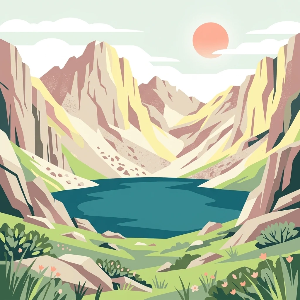
A flat-style digital illustration showing a serene blue alpine lake nestled between steep, jagged mountain slopes under a soft sun.

Hunter-Fryingpan Wilderness

Wildlife reserve

Park overview

Structured park overview, official facts, and landscape profile for Hunter-Fryingpan Wilderness

Hunter-Fryingpan Wilderness park facts, protected area profile, and essential visitor context

Review the core facts for Hunter-Fryingpan Wilderness, including designation, size, terrain, visitor scale, habitats, and operating context in one park-focused overview.

About Hunter-Fryingpan Wilderness

The Hunter-Fryingpan Wilderness is a sizeable U.S. Wilderness Area located in the heart of Colorado's Rocky Mountains, immediately east of Aspen in Pitkin County. Tucked inside the White River National Forest, it represents one of the larger designated wilderness blocks in the central Rockies, covering about 82,000 acres of mountains, forests, meadows, and lakes.

At its core, the area functions as a headwaters landscape. The upper valleys and basins of Hunter Creek and the Fryingpan River originate within the wilderness, sending clean, snow-fed water down toward the Roaring Fork Valley. The Williams Mountains, a subrange of the central Colorado Rockies, contribute dramatic ridgelines, cirques, and alpine summits that define the visual character of the wilderness. Just across the continental divide, the Mount Massive Wilderness extends this protected corridor eastward.

The wilderness features a classic Rocky Mountain elevation gradient: lower slopes carry dense conifer forest, middle elevations open into subalpine spruce and fir stands broken by wildflower meadows, and the highest terrain rises into bare tundra, talus, and rock. Numerous small glacial lakes; Linkins Lake, Independence Lake, and Lost Man Lake among them; sit in basins that were shaped during past ice ages, giving the area a distinctly rugged yet reflective character.

Roughly 50 miles of trails weave through this terrain, linking valleys to high passes and connecting lakes, streams, and ridge viewpoints. Although the wilderness lies remarkably close to the developed resort infrastructure of Aspen, its interior retains a remote, self-reliant character typical of federally designated wilderness in the United States. The combination of watershed protection, ecological diversity, and trail-accessible scenery gives the Hunter-Fryingpan Wilderness a well-defined identity within Colorado's network of protected landscapes.

Quick facts and research context for Hunter-Fryingpan Wilderness

Located in Pitkin County in west-central Colorado, the Hunter-Fryingpan Wilderness sits within the White River National Forest just east of the resort town of Aspen. It was designated a federal Wilderness Area in 1978 and covers approximately 82,000 acres of mountainous terrain in the central Rockies.

The wilderness protects the headwaters of Hunter Creek and the Fryingpan River, two important streams that drain toward the Roaring Fork watershed. It borders the Mount Massive Wilderness along the continental divide, forming a large contiguous block of protected high country. Administratively it is managed by the U.S. Forest Service and includes about 50 miles of trails linking lakes, passes, and ridgelines.

Protection and recognition

Documented terrestrial protection scope and conservation status records

Hunter-Fryingpan Wilderness Protection Status and Recognition Data

Hunter-Fryingpan Wilderness maintains a documented terrestrial protection scope within the federal protected area network. Conservation researchers evaluate assigned management parameters and formal recognition records to establish baseline administrative context.

Protection details

Protection scope
Terrestrial
Transboundary protection
No
Park context

Deeper park guide and search-rich context for Hunter-Fryingpan Wilderness

Hunter-Fryingpan Wilderness history, landscape, wildlife, and travel context

Explore Hunter-Fryingpan Wilderness through its history, landscape character, ecosystems, wildlife, conservation priorities, cultural context, and seasonal travel timing in a structured park guide built for atlas discovery and search intent.

Why Hunter-Fryingpan Wilderness stands out

The Hunter-Fryingpan Wilderness is best known for safeguarding the upper headwaters of the Fryingpan River and Hunter Creek, two of the key streams feeding the Roaring Fork drainage near Aspen. Its high country combines glacially carved valleys, alpine lakes such as Linkins Lake, Independence Lake, and Lost Man Lake, and a portion of the Williams Mountains. The wilderness is also recognized for its role as a quiet, trail-based mountain landscape bordering the Mount Massive Wilderness along the continental divide, providing a large continuous block of protected Rocky Mountain terrain managed under strict wilderness protections.
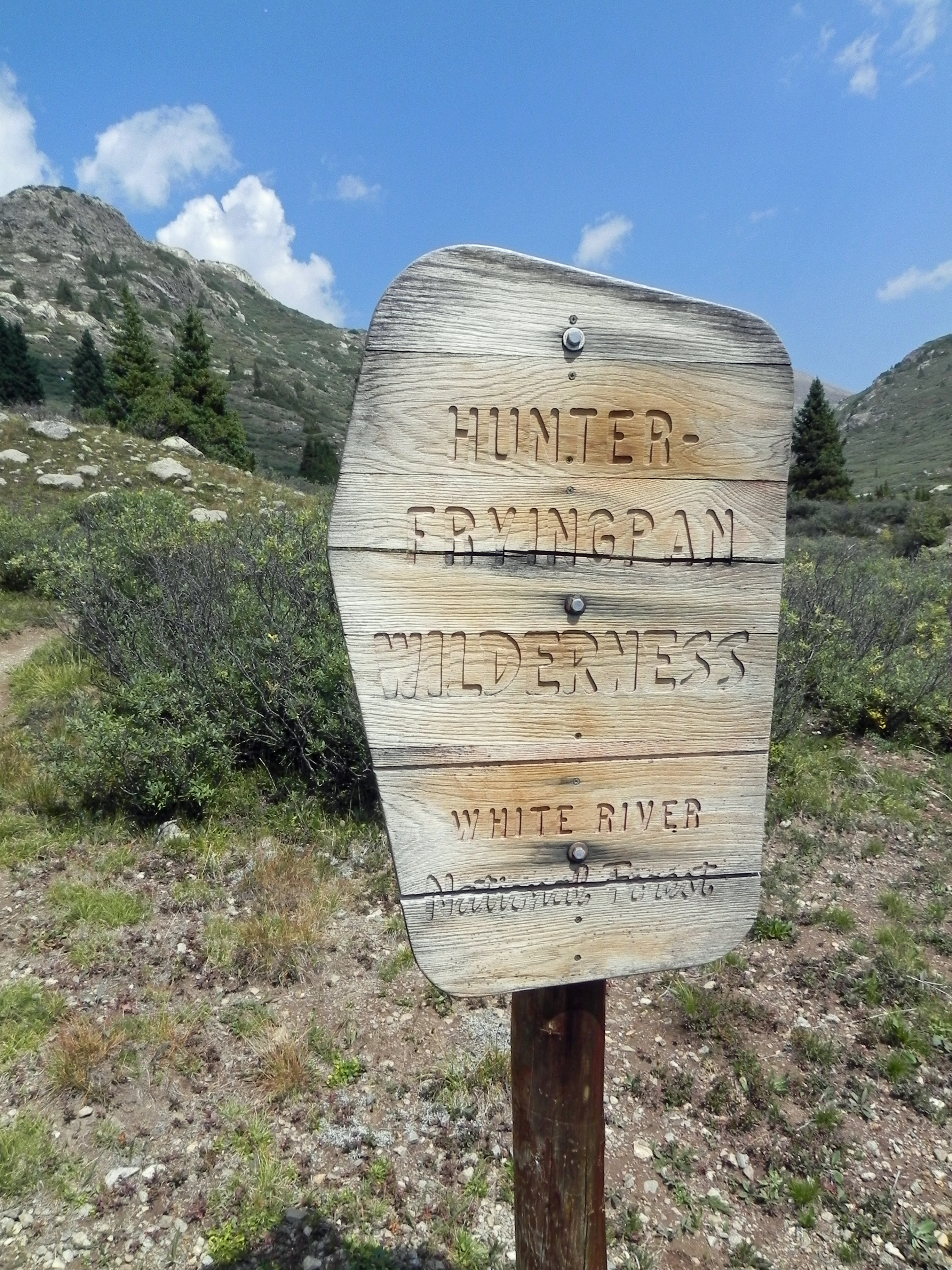
A weathered wooden sign with routed text identifying the Hunter-Fryingpan Wilderness and White River National Forest, set against a mountain landscape with green slopes.
A rustic wooden sign marking the entrance to the Hunter-Fryingpan Wilderness within White River National Forest.

Hunter-Fryingpan Wilderness history and protected-area timeline

The Hunter-Fryingpan Wilderness was formally designated as a U.S. Wilderness Area in 1978, becoming one of the many high-country wildernesses in Colorado protected under the framework of the Wilderness Act and subsequent legislation. Its designation recognized the area's outstanding value as an intact Rocky Mountain watershed and as a landscape largely unmodified by roads or extensive development.

Before formal wilderness status, the land was part of the White River National Forest and was largely shaped by early Forest Service management traditions that emphasized watershed protection and dispersed recreation. The headwaters that the wilderness preserves; Hunter Creek and the Fryingpan River; had long been valued for their contribution to downstream water supplies in the Roaring Fork Valley and beyond. Designating the area as wilderness placed these lands under a stricter protective regime, restricting mechanized use and preserving their primitive character.

The 1978 designation also cemented the wilderness's role as a connecting landscape, adjoining the Mount Massive Wilderness across the continental divide and contributing to a broader corridor of federally protected high country in central Colorado.

Hunter-Fryingpan Wilderness landscape and geographic character

The terrain of the Hunter-Fryingpan Wilderness is unmistakably that of the central Colorado Rockies: steep, glacially carved valleys rising to sharp ridges, with broad alpine basins set between them. The Williams Mountains run through the area, contributing some of the more prominent peaks and the craggy ridgelines that frame many of the wilderness's basins.

Glaciation has left a clear mark on the landscape. Cirques, U-shaped valleys, and scattered tarns are characteristic features, and small lakes such as Linkins Lake, Independence Lake, and Lost Man Lake occupy basins gouged by earlier ice. Talus fields and exposed granite outcrops cover higher elevations, while the lower valleys hold deeper soils that support continuous forest cover.

The elevation gradient runs from montane zones at the lower ends of Hunter Creek and the Fryingpan River up to subalpine and alpine environments along the divide. The continental divide forms a defining western boundary shared with the Mount Massive Wilderness, and many of the wilderness's most striking panoramas come from passes and saddles near this divide, where views extend across neighboring ranges and intervening valleys.
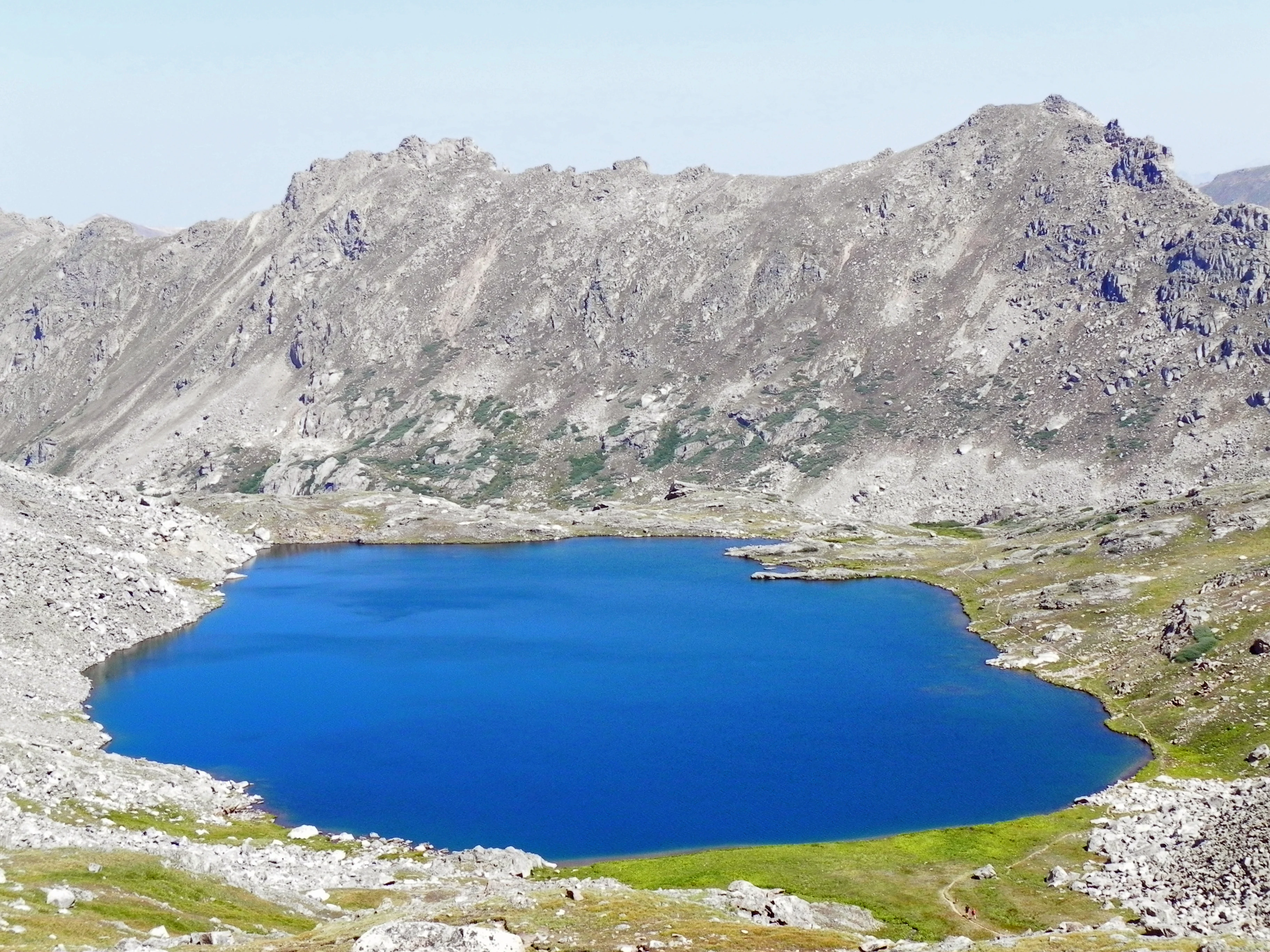
A deep blue alpine lake surrounded by steep, rocky mountain slopes under a clear sky.
Lost Man Lake nestled in the high-alpine terrain of the Hunter-Fryingpan Wilderness.

Hunter-Fryingpan Wilderness ecosystems, habitats, and plant life

Ecologically, the Hunter-Fryingpan Wilderness follows a layered Rocky Mountain pattern. Lower slopes are dominated by montane forests of Douglas fir, lodgepole pine, and aspen, giving way on middle elevations to denser stands of subalpine spruce and fir. These forests form a continuous canopy across much of the wilderness, broken by avalanche chutes, meadows, and open slopes.

Above treeline, the wilderness transitions into alpine tundra characterized by low-growing grasses, sedges, mat-forming plants, and seasonal wildflower displays in the more sheltered basins. Wet meadows and riparian areas along Hunter Creek, the Fryingpan River, and around the many small lakes add a third ecological tier, supporting moisture-loving plants and offering important habitat transitions within the broader forest matrix.

Because the area encompasses a full elevation progression from forested valleys to alpine summits, it preserves a wide spectrum of microhabitats typical of Colorado's central Rockies. This vertical range contributes to its biodiversity and reinforces its value as a watershed-protecting landscape.
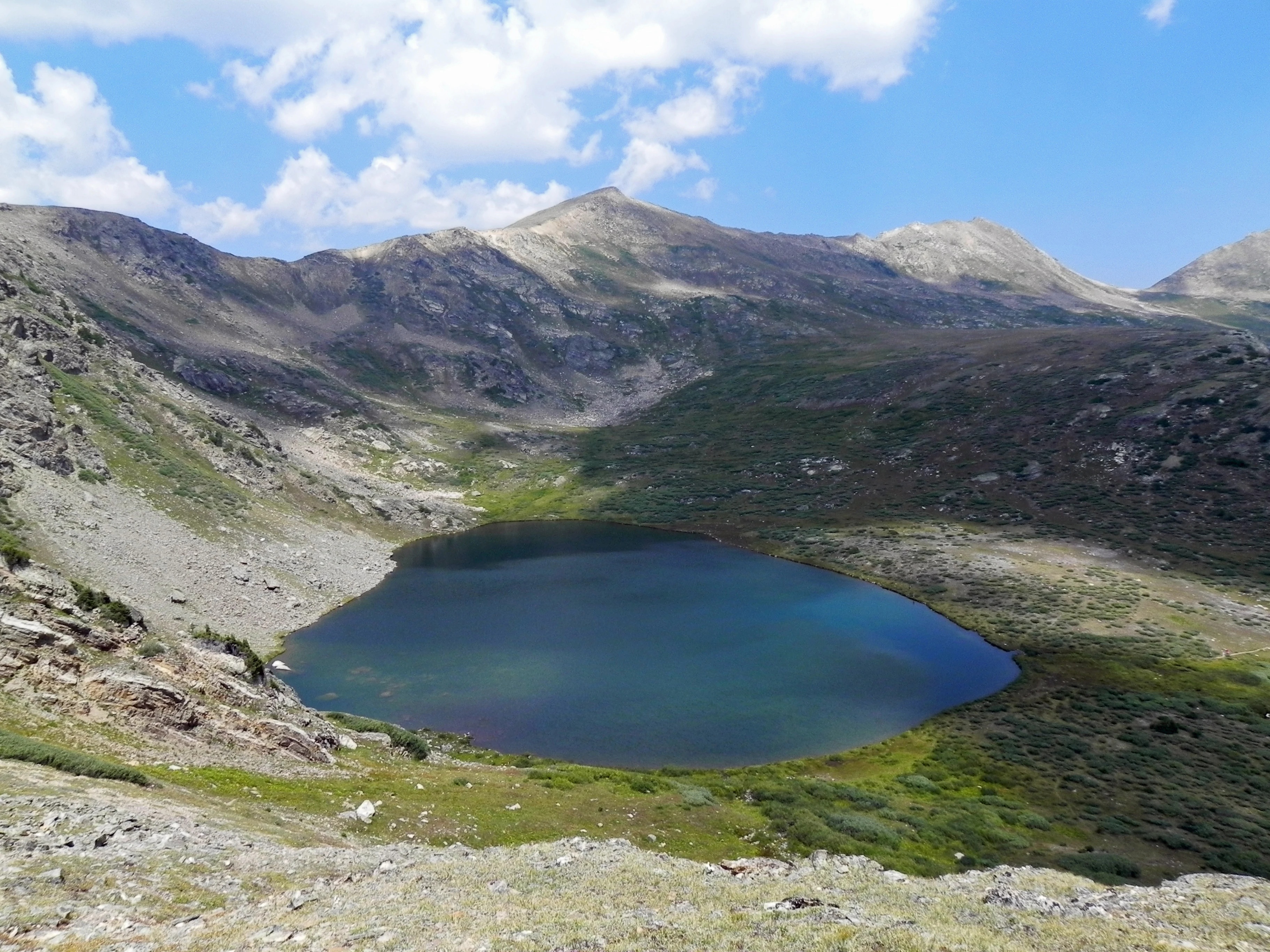
A high-altitude alpine lake surrounded by rocky slopes and sparse tundra vegetation under a blue sky.
Linkins Lake nestled in the high-alpine terrain of the Hunter-Fryingpan Wilderness.

Hunter-Fryingpan Wilderness wildlife and species highlights

The combination of forested valleys, alpine meadows, lakes, and rocky ridges supports a typical complement of central Rocky Mountain wildlife. Elk and mule deer are commonly associated with the meadow and forest edge habitats, while bighorn sheep may be found on the higher rocky terrain and along suitable cliff bands.

Black bears inhabit the wooded zones, and mountain lions range through more remote portions of the wilderness. Smaller mammals such as marmots, pikas, and red squirrels are characteristic of the talus and boulder fields just below the alpine zone. The lakes and streams of the wilderness provide habitat for various fish species, contributing to the broader aquatic network of the Fryingpan and Hunter Creek drainages.

The wilderness also supports raptor species that nest on cliff faces and forest birds associated with spruce-fir stands. While the area is not primarily known as a wildlife-viewing hotspot, its size, habitat diversity, and protection status allow wildlife populations to persist with minimal human disturbance, especially in the more interior basins away from trail corridors.

Hunter-Fryingpan Wilderness conservation status and protection priorities

The primary conservation role of the Hunter-Fryingpan Wilderness is watershed protection. By safeguarding the headwaters of Hunter Creek and the Fryingpan River in their entirety, the wilderness helps preserve water quality and flow regimes for downstream ecosystems and communities in the Roaring Fork watershed. This function underpins much of its protective value.

Its wilderness designation also acts as a strong ecological buffer. Restrictions on roads, mechanized travel, and commercial development help maintain natural processes such as fire regimes, wildlife movement, and forest succession across roughly 82,000 acres of the central Rockies. The wilderness extends a large block of contiguous protected land by connecting with the Mount Massive Wilderness along the continental divide, reinforcing landscape-scale conservation in the region.

As part of the broader White River National Forest system, the Hunter-Fryingpan Wilderness contributes to federal conservation goals related to primitive recreation, biodiversity preservation, and the long-term resilience of high-elevation Rocky Mountain ecosystems in the face of changing climate and land-use pressures.

Hunter-Fryingpan Wilderness cultural meaning and human context

The Hunter-Fryingpan Wilderness lies in a region of Colorado with deep associations with mining, ranching, and high-country recreation. The surrounding mountains historically supported hard-rock mining operations in the late 19th and early 20th centuries, and the Roaring Fork Valley became known for both resource extraction and early mountain tourism centered on Aspen.

Although the wilderness interior itself is maintained in a primitive state, its trailheads and access corridors connect to a long tradition of backcountry hiking, hunting, and fishing in Colorado's high country. The nearby town of Aspen, with its evolution from mining settlement to recreation-focused community, forms part of the broader cultural backdrop against which the wilderness is understood. Indigenous presence in the broader region also predates this more recent history, though the wilderness's contemporary cultural identity is most strongly tied to mountain recreation and conservation values.

Top sights and standout views in Hunter-Fryingpan Wilderness

One of the standout features of the Hunter-Fryingpan Wilderness is the cluster of clear alpine lakes; Linkins Lake, Independence Lake, and Lost Man Lake among them; that give the area much of its scenic identity. Combined with glacially sculpted basins and the rugged Williams Mountains, these lakes create a landscape that feels archetypal for the central Colorado Rockies.

Another highlight is the wilderness's role as a headwaters guardian for Hunter Creek and the Fryingpan River, both important contributors to the Roaring Fork watershed. The roughly 50 miles of trails connecting valleys, passes, and lakes provide a way to experience this landscape on foot while remaining within the protections of formal wilderness status. The wilderness's adjacency to the Mount Massive Wilderness across the continental divide further enhances its value as part of a large, connected block of prime Rocky Mountain wilderness.

Best time to visit Hunter-Fryingpan Wilderness

Summer and early autumn are typically the most rewarding seasons to experience the Hunter-Fryingpan Wilderness. From late June through September, snow has generally melted from the higher basins and trails, the alpine wildflower meadows are at their peak, and the lakes are fully accessible on foot. Daytime temperatures in the valleys are comfortable, while nights at higher elevations remain cool.

Late September and early October can bring strong fall color in the aspen stands at lower and middle elevations, along with quieter trail conditions after the busiest summer weeks. Winter and spring transform the wilderness into a high snowscape; access becomes far more difficult, and the area is largely left to skiers, snowshoers, and other backcountry users equipped for snow travel.

Monthly climate preview

Long-term temperature and precipitation averages across twelve distinct months

Hunter-Fryingpan Wilderness Climate Normals and Monthly Weather Records

Representative coordinate measurements reveal annual temperature ranges and precipitation rhythms across the protected landscape. Examining the full monthly climate profile provides deeper context for long-term meteorological patterns at high elevation.
Annual mean-1 °C
-12 °C13 °C
Jan-12°
Feb-12°
Mar-8°
Apr-3°
May
Jun
Jul13°
Aug11°
Sep
Oct
Nov-7°
Dec-12°
Warmest month
July

12.8 °C

Coolest month
January

-12.4 °C

Wettest month
April

1.8 mm/day

Driest month
June

0.8 mm/day

Park location guide

Geography guide, regional context, and park location map for Hunter-Fryingpan Wilderness

Hunter-Fryingpan Wilderness park geography, regions, and map view in United States of America

Understand where Hunter-Fryingpan Wilderness sits in United States of America through a broader geographic reading of the surrounding landscape, nearby location context, and its mapped position within the national park landscape.

How Hunter-Fryingpan Wilderness fits into United States of America

The United States of America is a federal presidential republic and one of the world's largest countries by area and population. It consists of 50 states across a vast territory spanning multiple time zones, with its capital in Washington, D.C. and largest city in New York City. The nation has a diverse economy, influential political system, and significant cultural and military presence globally.

Wider geography shaping Hunter-Fryingpan Wilderness in United States of America

The United States occupies a vast territory in North America, bordered by Canada to the north and Mexico to the south. The 48 contiguous states stretch from the Atlantic to the Pacific Ocean, while Alaska occupies the northwestern region and Hawaii is an archipelago in the Pacific. The country encompasses diverse terrain including the Rocky Mountains, Appalachian Mountains, Great Plains, and extensive river systems.

Map view of Hunter-Fryingpan Wilderness

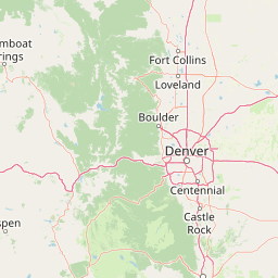
Use this park location map to pinpoint Hunter-Fryingpan Wilderness in United States of America, understand its exact geographic position, and read its mapped placement within the surrounding landscape more clearly.

Pigeon | © OpenStreetMap contributors

Location context for Hunter-Fryingpan Wilderness

ColoradoPitkin County

Explore high-elevation terrain, glacial valleys, and protected mountain habitats.

Hunter-Fryingpan Wilderness Photos and Scenery: Visualizing Alpine Landscapes

Visual records capture the rugged topography and alpine lake basins characteristic of the central Rocky Mountains. Examining these protected landscapes reveals the dramatic elevation gradients and wilderness character defining the region.

A weathered wooden sign with routed text identifying the Hunter-Fryingpan Wilderness and White River National Forest, set against a mountain landscape with green slopes.

A high-altitude alpine lake sits in the foreground with rocky tundra vegetation and boulders; behind the lake, a large, barren mountain ridge rises into a clear blue sky.

A deep blue alpine lake surrounded by steep, rocky mountain slopes under a clear sky.

A high-altitude alpine lake surrounded by rocky slopes and sparse tundra vegetation under a blue sky.

Park atlas

Compare nearby Rocky Mountain protected landscapes and high-elevation terrain

Parks Near Hunter-Fryingpan Wilderness: Protected Areas in the Surrounding Region

Browse other protected areas and national parks located near Hunter-Fryingpan Wilderness across the central Colorado Rockies. Comparing adjacent high-elevation terrain reveals broader regional watershed patterns and connected alpine wilderness zones.
A horizontal watercolor painting showing layers of pale green and soft pink mountain ridges behind a foreground of simple green and purple evergreen tree shapes.
Wildlife reserveColorado
About 6.9 km away#1 closest

East

Mount Massive Wilderness: A Protected Alpine Landscape in the Colorado Sawatch Range

High-altitude wilderness geography and Continental Divide terrain.

Mount Massive Wilderness represents a critical protected landscape in the central Colorado Rockies, encompassing glacially carved valleys, alpine tundra, and the second-highest peak in the state. This wilderness area provides a window into the rugged vertical relief and subalpine ecosystems that define the high-altitude geography surrounding Leadville, anchored by the iconic Sawatch Range and Continental Divide.

Area
123.6 km²
Established
1980
IUCN
Ib
Relief
Mountain
Watercolor painting of a serene mountain landscape featuring rolling hills, coniferous trees, and a lake in the foreground, rendered in light pastel tones.
Protected landscapeColorado
About 6.9 km away#2 closest

Southeast

San Isabel National Forest: Geographic Overview and Protected Mountain Landscape Atlas

Central Colorado alpine terrain and designated wilderness areas

Spanning eleven counties in central Colorado, San Isabel National Forest serves as a cornerstone of the Southern Rocky Mountains. The forest landscape is dominated by the Sawatch and Sangre de Cristo ranges, offering a unique atlas of alpine tundra, dense coniferous forests, and high-altitude peaks that define the character of the region. This protected area provides a vital habitat and a vast, rugged environment characterized by volcanic formations like the Spanish Peaks and glacial geological features.

Area
4,533.42 km²
Established
1902
Relief
Mountain
Climate
Alpine
Wildlife reserveColorado
About 13 km away#3 closest

North

Holy Cross Wilderness: Mapped Alpine Landscapes and Colorado Protected Areas

Glacial valleys and high-country geography in the Sawatch Range

Discover the geographic layout of the Holy Cross Wilderness, a vital protected area in central Colorado. This resource details the rugged Sawatch Range environment, from high alpine lake basins to the iconic northern couloirs of its namesake mountain, offering a clear view of the park boundaries and surrounding high-country terrain.

Area
496.94 km²
Established
1980
IUCN
Ib
Relief
Mountain
A soft watercolor illustration depicting a simplified, layered landscape of rolling hills and distant mountains in shades of light green, pale yellow, and soft pink.
Protected areaColorado
About 37 km away#4 closest

East

Pike National Forest: Protected Mountain Landscapes and Regional Geography in Central Colorado

Granite peaks, montane forests, and diverse alpine terrain

Spanning from the rolling foothills of the Front Range to the high alpine summits of the Rocky Mountains, Pike National Forest is a significant protected area defined by its unique Pikes Peak granite bedrock and deep river-carved canyons. This analysis provides a structured look at its expansive wilderness boundaries, drainage basins, and the vertical transitions that characterize this vital central Colorado highland.

Area
4,478.27 km²
Established
1892
Relief
Mountain
Climate
Alpine
Protected areaColorado
About 46 km away#5 closest

Southwest

Raggeds Wilderness: Geographic Profile and Protected Area Mapping for the Elk Mountains

High altitude wilderness terrain in west-central Colorado

Raggeds Wilderness encompasses over 65,000 acres of protected high-country terrain in the Elk Mountains. This atlas record provides a detailed look at the park, covering its dramatic vertical transitions from deep forest drainages to jagged peaks and its function as a major node in the regional wilderness network.

Area
264.64 km²
Established
1980
IUCN
Ib
Relief
Mountain
Wildlife reserveColorado
About 50 km away#6 closest

Northeast

Eagles Nest Wilderness: Alpine Geography and Protected Landscape of the Colorado Gore Range

High-mountain protected area in the White River National Forest

Spanning the southern Gore Range, Eagles Nest Wilderness represents a core protected landscape in Colorado characterized by high-elevation peaks, glacial cirque lakes, and extensive backcountry trail networks. Its geography bridges the gap between deep coniferous forests and exposed alpine tundra, maintaining significant ecological and historical value within the mountainous terrain of Eagle and Summit Counties.

Area
546.79 km²
Established
1976
IUCN
Ib
Relief
Mountain
A wide watercolor illustration depicting a gentle landscape with green hills, scattered trees, and a pale sky with pink and purple hues.
Wildlife reserveGunnison County
About 57 km away#7 closest

South

Fossil Ridge Wilderness: Mapped Geography and Protected Landscapes in Gunnison County

High-altitude ridges, Paleozoic geology, and alpine wilderness character.

Fossil Ridge Wilderness sits as a compact but geographically rich protected area within the Gunnison National Forest. This site offers an detailed look at high-elevation Rocky Mountain terrain, characterized by exposed carbonate rock, deep drainage corridors, and dramatic vertical relief that serves as essential habitat for bighorn sheep and mountain goats.

Area
56.62 km²
Established
1993
IUCN
Ib
Relief
Mountain
A horizontal watercolor illustration depicting soft layers of green rolling hills, a band of trees, and distant pinkish mountain peaks against a white background.
Protected landscapeColorado
About 76 km away#8 closest

Southwest

Gunnison National Forest: Atlas and Geographic Overview of a Colorado Protected Landscape

Mapping deep wilderness areas and high mountain watersheds

Spanning over one million acres in western Colorado, this protected landscape features dramatic glaciated valleys, subalpine meadows, and iconic volcanic features. The forest anchors the Gunnison River headwaters and offers significant insights into the ecological structure of the Southern Rocky Mountains and its dense concentration of wilderness zones.

Area
6,766.89 km²
Established
1905
Relief
Mountain
Climate
Alpine

Common questions about visiting, size, designation, and location context for Hunter-Fryingpan Wilderness

Hunter-Fryingpan Wilderness FAQs for park facts, access, geography, and protected area context

Find quick answers about Hunter-Fryingpan Wilderness, including protected-area facts, park geography, trail and visitor context, and how the park fits into its surrounding country and regional landscape.
MoriAtlas Explorer

Continue Your Protected Areas Search Across the Global Atlas

Deepen your exploration by continuing the structured search for national parks and protected areas worldwide. Utilize the comprehensive filtering capabilities to compare different conservation landscapes and refine your understanding of global park geography. Discover more about the distribution and characteristics of protected natural areas.

Global natural geography