
Mori Atlas logo
Nature reserveHutt Water Collection Area

A vital forested mountain landscape protecting water resources in the southern Tararua Range

Hutt Water Collection Area: Exploring the Rugged Nature Reserve and Mountain Catchment Geography

The Hutt Water Collection Area encompasses a vast, mountainous nature reserve in the Wellington Region of New Zealand. This protected landscape is defined by steep ridges, deep valleys, and extensive native beech and podocarp forest cover. As a critical catchment area for the region, it functions as a natural water filtration system while supporting a remote wilderness habitat for native birdlife and unique plant communities across the southern Tararua Range.

water catchmenturban water supplynative beech forestpodocarp forestsouthern ratasub-alpine bog
A flat vector-style illustration of a river flowing through a forested canyon with a small waterfall, sun, and diverse tree types.

Hutt Water Collection Area

Nature reserve

Park overview

Structured park overview, official facts, and landscape profile for Hutt Water Collection Area

Hutt Water Collection Area park facts, protected area profile, and essential visitor context

Review the core facts for Hutt Water Collection Area, including designation, size, terrain, visitor scale, habitats, and operating context in one park-focused overview.

About Hutt Water Collection Area

The Hutt Water Collection Area is one of the most important natural assets in the Wellington Region, not for tourism or scenic grandeur, but for the simple, essential role it plays in supplying drinking water to the capital. Covering roughly 8,900 hectares in the headwaters of Te Awa Kairangi / Hutt River, the reserve collects rainfall across steep ridges and forested valleys and channels it downstream, where the Kaitoke weir captures between 40 and 50 percent of the water used by Wellington's urban communities.

Geographically, the reserve sits in the southern Tararua Range, in the upper reaches of the Hutt Valley near Upper Hutt. Its terrain is unusually rugged for a catchment so close to a major city: narrow, steep-sided ridges cut by fast-rising streams, exposed hilltops battered by north-westerly and southerly winds, and sudden weather shifts that can transform quiet creeks into torrent-prone channels within hours. This combination of high rainfall, dense forest cover, and steep relief makes the area exceptionally effective at producing clean, reliable water.

Ecologically, the reserve is dominated by extensive silver beech and red beech forest, with podocarp species, alpine tussock, and sub-alpine sphagnum bog on the valley floor. It also contains some of the Wellington Region's southern rātā, an ecologically significant presence that hints at the reserve's role as a northern refuge for this species. Native birdlife includes kākā, kākāriki, and kārearea (New Zealand falcon), indicating that even within a working catchment the forest retains meaningful ecological value. Aerial 1080 pest control operations in 2019 and a planned follow-up in 2022 reflect ongoing efforts to protect that forest quality.

The reserve is administered by Wellington Regional Council and physically adjoins Kaitoke Regional Park, creating a broader block of public conservation land in the upper Hutt Valley. While its primary purpose is water supply, the area also supports a network of walking and tramping tracks linking key points in the catchment, and permits low-intensity hunting for deer, pigs, and goats, balancing its infrastructure role with quiet, low-key recreational use.

Quick facts and research context for Hutt Water Collection Area

Located in Upper Hutt, within the Wellington Region of New Zealand's North Island, the Hutt Water Collection Area protects approximately 8,900 hectares of rugged hill country in the headwaters of Te Awa Kairangi / Hutt River. The reserve was formally established in 1951 and is administered by Wellington Regional Council. It contains the Kaitoke weir, Wellington's largest water supply source, providing between 40 and 50 percent of the Wellington urban area's drinking water. The catchment sits alongside Kaitoke Regional Park and is dominated by silver beech and red beech forest, with podocarps, sub-alpine vegetation, and rare stands of southern rātā.

Protection and recognition

Documented terrestrial protection scope, designation context, and conservation governance records

Hutt Water Collection Area Protection Status and International Recognition

Hutt Water Collection Area maintains a documented terrestrial protection scope within official conservation datasets. Structured records compile available designation history and governance parameters for analytical evaluation.

Protection details

Protection scope
Terrestrial
Transboundary protection
No
Park context

Deeper park guide and search-rich context for Hutt Water Collection Area

Hutt Water Collection Area history, landscape, wildlife, and travel context

Explore Hutt Water Collection Area through its history, landscape character, ecosystems, wildlife, conservation priorities, cultural context, and seasonal travel timing in a structured park guide built for atlas discovery and search intent.

Why Hutt Water Collection Area stands out

The Hutt Water Collection Area is best known as the forested mountain catchment that supplies much of Wellington's drinking water, anchored by the Kaitoke weir on Te Awa Kairangi / Hutt River. It is valued both as a critical piece of water infrastructure and as a large block of contiguous native forest in the southern Tararua Range. Beyond its utility role, the reserve is recognized for its rugged, weather-exposed ridge and valley terrain, its intact beech and podocarp forest cover, and its pockets of southern rātā that mark it as one of the northernmost strongholds for this tree in the Wellington Region. The combination of steep topography, fast-rising streams, and largely undisturbed canopy gives the area a strong sense of remote, working-wilderness character despite its proximity to Upper Hutt.
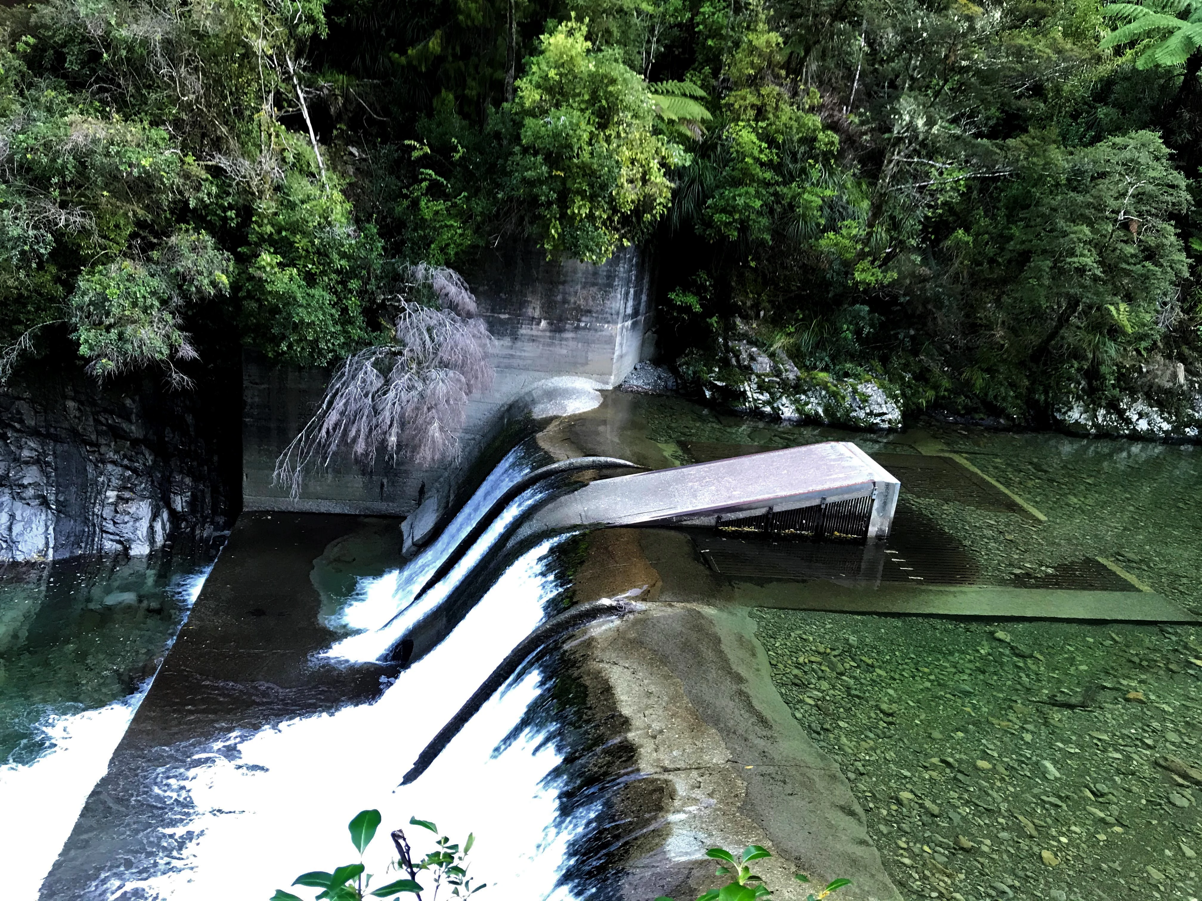
A concrete weir structure spans a clear, shallow river, creating a small waterfall, with dense native forest in the background.
The Kaitoke weir and water supply intake on the Hutt River.

Hutt Water Collection Area history and protected-area timeline

The land that now makes up the Hutt Water Collection Area has little recorded history of use before the twentieth century. There is very little evidence of significant Māori or European activity in the nineteenth century, and although parts of the surrounding land were sold during the Kāpiti Coast land sales before 1860, the New Zealand Company did not dispose of this particular area in 1840.

The reserve's modern history is tied directly to Wellington's need for reliable urban water. When the Wellington City and Suburban Water Supply Board was established in 1927, private landowners began selling holdings in this upper catchment to local authorities for water supply purposes. A further land purchase was proposed in 1936, but the decisive transaction took place on 20 November 1951, when ownership finally shifted to public hands and the catchment was formally secured as a water collection area. That 1951 transfer marked the practical birth of the reserve as an administered, infrastructure-focused protected area.

In more recent decades, the reserve's history has become increasingly shaped by ecological management. An aerial 1080 pest control operation was carried out in the area in 2019, and a further aerial drop was scheduled for winter 2022, reflecting an ongoing effort to protect the integrity of the native forest that underpins both water quality and biodiversity in the catchment.

Hutt Water Collection Area landscape and geographic character

The Hutt Water Collection Area occupies a rugged and at times dramatic stretch of the southern Tararua Range. Its topography is defined by steep, narrow ridges separated by fast-flowing tributary streams of Te Awa Kairangi / Hutt River, with valley floors that drop quickly under heavy canopy. The reserve's hilltops are unusually exposed, particularly to the north-west and the south, where high winds and drifting fog are common features of the weather pattern.

Weather in the catchment can shift abruptly, with sudden rainfall events causing rivers and streams to rise rapidly. This volatility, combined with the steep terrain, gives the reserve a working, ever-changing landscape character. The forested slopes act as a vast natural filter across the catchment, while the network of streams converges toward the Kaitoke weir, the central engineered feature of this otherwise wild upper-valley setting.

Hutt Water Collection Area ecosystems, habitats, and plant life

Ecologically, the Hutt Water Collection Area is defined by its extensive native forest cover. Silver beech and red beech dominate much of the landscape, forming a dense canopy across the ridges and valley sides. On the valley floor, the vegetation transitions into podocarp forest, with stands that include characteristic podocarpaceae species of the lower North Island hill country. The reserve is also notable for hosting some of the Wellington Region's southern rātā, a striking native tree whose presence here represents a meaningful northern foothold for the species in the region.

Above the forest line and across exposed ground, alpine tussock and sub-alpine sphagnum bog communities contribute to the area's ecological diversity. Together, these habitats create a layered environment that ranges from lowland podocarp gullies through tall beech forest to boggy sub-alpine openings, each supporting distinct ecological communities and contributing to the catchment's role as a forest-filtered water source.

Hutt Water Collection Area wildlife and species highlights

The continuous forest cover of the Hutt Water Collection Area supports a community of native forest birds characteristic of the southern Tararua Range. Kākā are present in the canopy, along with kākāriki, the small bright-green parakeets that move through the forest in flocks. The New Zealand falcon, known locally as kārearea, is also recorded in the area, indicating that the reserve retains enough prey and open hunting habitat to sustain this native raptor.

Beyond birds, the catchment hosts populations of introduced mammals, including deer, pigs, and goats, which are actively managed through permitted hunting. The combination of native birdlife and managed ungulate populations reflects the reserve's dual role as both a working water catchment and an actively managed ecological landscape, with pest control and hunting both contributing to the protection of forest condition.

Hutt Water Collection Area conservation status and protection priorities

The Hutt Water Collection Area represents an unusual case where infrastructure and conservation imperatives align. Its large, contiguous block of native beech and podocarp forest acts as a natural water filter, reducing sediment and improving water quality before the rain reaches the Kaitoke weir. Protecting forest cover is therefore not just an ecological goal here but also a direct operational requirement for maintaining a reliable, clean urban supply.

Active ecological management is part of the reserve's conservation role. Aerial 1080 pest control operations, including a documented 2019 drop and a planned winter 2022 follow-up, are aimed at suppressing introduced predators that would otherwise erode forest health and indirectly affect water quality. The presence of southern rātā, along with native bird species such as kākā and kārearea, gives the catchment measurable biodiversity value beyond its hydrological function, making it a noteworthy conservation asset within the Wellington Region.

Hutt Water Collection Area cultural meaning and human context

The cultural context of the Hutt Water Collection Area is shaped primarily by its hydrological and ecological identity rather than by a long record of human settlement. There is little evidence of significant Māori or European use of the upper catchment in the nineteenth century, and the area largely escaped the 1840 New Zealand Company land sales that shaped much of the Wellington Region, though parts of the broader region were disposed of through Kāpiti Coast land transactions before 1860.

The reserve's modern cultural significance lies more in its ongoing role as a shared regional resource than in historic settlement, with its bilingual identification of Te Awa Kairangi / Hutt River reflecting the importance of recognising the river's Māori name alongside its long-established English one.

Top sights and standout views in Hutt Water Collection Area

The Hutt Water Collection Area stands out as one of the largest intact forested catchments supplying a major New Zealand city, combining critical water infrastructure with a substantial block of native forest in the southern Tararua Range. Its mix of silver beech, red beech, podocarp forest, alpine tussock, sub-alpine bog, and rare local southern rātā gives it genuine ecological depth.

The presence of kākā, kākāriki, and kārearea, along with active pest management and permitted hunting, signals a landscape where biodiversity is taken seriously rather than treated as incidental. For visitors, the appeal lies in the combination of rugged terrain, remote-feeling ridges and streams, and low-intensity recreational access through a network of walking and tramping tracks.

Best time to visit Hutt Water Collection Area

The Hutt Water Collection Area can be visited at any time of year that suits the visitor, but the experience of the landscape is strongly seasonal. In summer, longer daylight hours and more stable weather make the ridge and valley tracks more accessible, and the forest is at its most inviting for walking and tramping centred on Hutt Forks and the routes into the catchment.

In winter, conditions become more changeable, with higher rainfall, rapid stream rises, and frequent fog on exposed ridges; this period can also coincide with operational activity such as aerial pest control drops, which may temporarily affect access. Spring and autumn offer a balance of milder weather and dramatic seasonal transitions in the beech and podocarp forest, though visitors should be prepared for the area's characteristic sudden weather shifts at any time of year.
Monthly climate preview

Long-term representative temperature and precipitation averages across the year

Hutt Water Collection Area Climate Normals and Annual Weather Patterns

Measured coordinates for Hutt Water Collection Area establish a consistent annual baseline of long-term temperature ranges and monthly precipitation rates. Detailed records track the full twelve-month climate profile to support thorough geographical comparisons.
Annual mean12 °C
9 °C17 °C
Jan16°
Feb17°
Mar15°
Apr13°
May12°
Jun10°
Jul
Aug
Sep10°
Oct11°
Nov13°
Dec15°
Warmest month
February

16.8 °C

Coolest month
July

8.8 °C

Wettest month
June

3.2 mm/day

Driest month
January

1.8 mm/day

Park location guide

Geography guide, regional context, and park location map for Hutt Water Collection Area

Hutt Water Collection Area park geography, regions, and map view in New Zealand

Understand where Hutt Water Collection Area sits in New Zealand through a broader geographic reading of the surrounding landscape, nearby location context, and its mapped position within the national park landscape.

How Hutt Water Collection Area fits into New Zealand

New Zealand is an island nation in the southwestern Pacific Ocean comprising two main islands and numerous smaller islands. Located east of Australia across the Tasman Sea, it features varied topography with the Southern Alps running along the South Island and volcanic terrain on the North Island. The country was settled by Maori people between 1280 and 1350, followed by European exploration beginning in 1642, and became a Dominion in 1907 before gaining full independence in 1947.

Wider geography shaping Hutt Water Collection Area in New Zealand

New Zealand lies in the southwestern Pacific Ocean, east of Australia across the Tasman Sea. The country consists of two main islands, the North Island and South Island, plus over 600 smaller islands. The North Island features volcanic plateaus and hills while the South Island is dominated by the Southern Alps mountain range. The country has a long coastline and is surrounded by the Pacific Ocean.

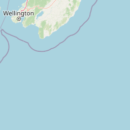
Map view of Hutt Water Collection Area

Use this park location map to pinpoint Hutt Water Collection Area in New Zealand, understand its exact geographic position, and read its mapped placement within the surrounding landscape more clearly.

Pigeon | © OpenStreetMap contributors

Location context for Hutt Water Collection Area

Wellington Region

Visual reference for rugged ridges, native beech forests, and river catchments

Hutt Water Collection Area Photos and Protected Mountain Landscape Scenery

Photographic collections reveal the steep topography, weather-exposed hilltops, and dense podocarp forest cover defining the mountain reserve. Examining these protected area views helps observers understand the wild character, watershed terrain, and natural habitat structure of the upper river catchment.

A concrete weir structure spans a clear, shallow river, creating a small waterfall, with dense native forest in the background.

Park atlas

Compare regional mountain reserves and protected areas across the Wellington terrain

Explore Parks Near Hutt Water Collection Area and Surrounding Protected Landscapes

Browse nearby national parks and protected areas connected to the rugged terrain surrounding Hutt Water Collection Area. Expanding regional comparisons helps trace shared mountain ecosystems and forested catchments across the Wellington Region.
Protected landscapeWellington Region
About 26 km away#1 closest

West

Whitireia Park: Coastal Headland and Protected Landscape in the Wellington Region

Explore mapping of coastal terrain, forests, and harbour boundaries.

Whitireia Park is a prominent coastal reserve in the Wellington Region that balances deep Ngāti Toa cultural significance with a unique geological history shaped by centuries of earthquake uplift. The headland features open grasslands, remnant kohekohe forest, and ongoing wetland restoration that offers a layered view of New Zealand's natural and social history across its accessible harbour-edge geography.

Area
1.8 km²
Established
1976
Relief
Upland
Climate
Temperate
Protected landscapeNew Zealand
About 28 km away#2 closest

Northeast

Tararua Forest Park: Protected Landscape Geography and Mapped Natural Terrain

Defining the rugged mountain spine of New Zealand's southern North Island

Covering the core of the Tararua Range, this protected landscape represents a vital ecological corridor in New Zealand. The terrain offers a diverse gradient of native forests, steep river valleys, and windswept alpine ridges. It serves as a primary example of forest conservation and complex mountain geography within the island nation's larger network of protected lands.

Area
1,149.93 km²
Established
1954
Relief
Mountain
Climate
Temperate
A soft watercolor painting of a rolling green landscape with distant hills and foreground vegetation on a plain white background.
Nature reserveWairarapa
About 30 km away#3 closest

East

Fensham Reserve: Protected Lowland Forest Geography and Conservation Mapping in Wairarapa

An essential lowland sanctuary for ancient podocarp and swamp forest ecosystems

Fensham Reserve preserves 48 hectares of significant native forest in the southern North Island of New Zealand. This nature reserve provides essential landscape context for rare kahikatea and pukatea associations, while serving as a crucial wetland refuge for endangered species like the brown mudfish. The area remains a key reference point for understanding regional forest restoration and the protection of long-standing ecological fragments.

Area
0.48 km²
Established
1957
Relief
Lowland
Climate
Temperate
Wildlife reserveWellington Region
About 31 km away#4 closest

Southwest

Wainuiomata Water Collection Area: Protected Forest Terrain and Wellington Catchment Geography

Mapping the native forest canopy and river catchments of New Zealand.

The Wainuiomata Water Collection Area remains a vital conservation landscape, preserving deep river valleys and mature podocarp-broadleaf forest within the Wellington Region. This wildlife reserve functions as a major ecological hub, featuring continuous native bush that supports intensive predator control and species recovery efforts. Its geographic integrity provides a unique perspective on protected catchment management and pristine lowland wilderness in the southern North Island.

Water
Major water bodies
Regional parkWellington Region
About 33 km away#5 closest

Southwest

Wainuiomata Regional Park: Geography and Protected Area Atlas

River valley terrain in the Wellington Region

Wainuiomata Regional Park is a protected river valley setting featuring significant lowland native forest, historic water infrastructure, and restored wetland habitats. This landscape provides a critical link in the conservation geography of the Wellington Region, connecting to extensive forest remnants and supporting a variety of native ecosystems within the Wainuiomata catchment.

Relief
Mixed relief
Water
Major water bodies
A soft watercolor painting of a rolling forested landscape featuring distant mountains and a calm body of water in the foreground.
Protected landscapeWellington Region
About 41 km away#6 closest

South

Remutaka Forest Park: Protected Landscape and Regional Hill Country Geography

A rugged forested reserve spanning the Wellington Region.

Covering extensive territory across the Remutaka Range, this protected landscape is defined by its dramatic ridges and deep river valleys. The area functions as a vital refuge for native bush and birdlife, offering a layered environment that stretches from accessible valley floors to remote upland slopes in the southern North Island.

Area
220 km²
Established
1972
IUCN
V
Relief
Mountain
Nature reserveWellington
About 52 km away#7 closest

Southwest

Te Kopahou Reserve: Nature Reserve Geography and Coastal Landscapes in Wellington

A rugged intersection of forested hills, ridgelines, and coastal cliffs.

Situated on the southern edge of Wellington, Te Kopahou Reserve offers a diverse protected landscape ranging from the summit of Hawkins Hill to the iconic red rocks of the Cook Strait shoreline. This nature reserve provides a critical geographic transition, hosting regenerating native bush, exposed ridgeline trails, and vital habitats for local wildlife, making it a prominent example of regional conservation land on the North Island of New Zealand.

Area
6 km²
Relief
Mountain
Climate
Temperate
Access
Easy access
Marine protected areaMarlborough Region
About 71 km away#8 closest

West

Long Island-Kokomohua Marine Reserve: Mapped Geography and Protected Reef Systems

Explore marine boundaries in the Marlborough Region

Located at the entrance to Queen Charlotte Sound, Long Island-Kokomohua Marine Reserve encompasses significant island and submerged reef features. This protected area serves as an essential site for understanding coastal ecosystem restoration, featuring varied terrain from shallow near-shore reefs to deeper rocky pinnacles that support diverse marine populations.

Area
6.19 km²
Established
1993
Relief
Lowland
Climate
Temperate

Common questions about visiting, size, designation, and location context for Hutt Water Collection Area

Hutt Water Collection Area FAQs for park facts, access, geography, and protected area context

Find quick answers about Hutt Water Collection Area, including protected-area facts, park geography, trail and visitor context, and how the park fits into its surrounding country and regional landscape.
MoriAtlas Explorer

Continue Your Protected Areas Search Across the Global Atlas

Deepen your exploration by continuing the structured search for national parks and protected areas worldwide. Utilize the comprehensive filtering capabilities to compare different conservation landscapes and refine your understanding of global park geography. Discover more about the distribution and characteristics of protected natural areas.

Global natural geography