
Mori Atlas logo
Nature reserveIlvericher Altrheinschlinge

Analyzing the geomorphology and protected landscape boundaries of the Lower Rhine valley

Ilvericher Altrheinschlinge Nature Reserve: An Intact Oxbow Meander and Wetland Geography

The Ilvericher Altrheinschlinge represents a singular geological feature as the only fully preserved oxbow loop on the Lower Rhine. This nature reserve in Nordrhein-Westfalen functions as a vital wetland corridor; featuring a complex mosaic of swamp woodlands, wet meadows, and reed beds. Understanding its boundaries reveals how an ancient river meander continues to support rare species and habitat continuity within a modern lowland environment.

oxbow lakeLower Rhinefloodplainwet meadowreed bedswamp forest
A flat-style digital illustration showing a river winding through a meadow towards a waterfall and mountain peaks in the distance, framed by two trees in the foreground.

Ilvericher Altrheinschlinge

Nature reserve

Park overview

Structured park overview, official facts, and landscape profile for Ilvericher Altrheinschlinge

Ilvericher Altrheinschlinge park facts, protected area profile, and essential visitor context

Review the core facts for Ilvericher Altrheinschlinge, including designation, size, terrain, visitor scale, habitats, and operating context in one park-focused overview.

About Ilvericher Altrheinschlinge

The Ilvericher Altrheinschlinge is an inland wetland reserve in the municipality of Meerbusch, just across the Rhine from Düsseldorf in North Rhine-Westphalia. Its name literally means the old Rhine loop at Ilverich, referring to the local district whose name gave the feature its identity. The site has been protected as a nature reserve since 1981 and is part of the European Natura 2000 network, one of the formal layers of long-term environmental protection that the European Union applies to its most valuable habitats.

Geologically, the loop lies on a river terrace of the Cologne Basin, within the central Lower Rhine plain. At the end of the last ice age, the Rhine shifted into a strongly meandering phase, and one of its tight bends was preserved as a near-complete ring beside the modern river bed. After the Rhine broke through the narrow neck of the meander roughly seven thousand years ago, the loop became a sidearm and then progressively silted up into a chain of still waters, reed beds, and ultimately a lowland peat zone.

Although the loop is now separated from the Rhine by a flood dike and no longer functions as active floodplain during ordinary conditions, the surrounding groundwater still rises during major high-water events, occasionally allowing the area to serve as a controllable retention space. The enclosed plain inside the loop contains arable fields, a few farms, and the Düsseldorf-Nord wastewater treatment plant, but the ring of habitat along the former riverbed remains the core of the reserve and the focus of conservation activity.

Quick facts and research context for Ilvericher Altrheinschlinge

Ilvericher Altrheinschlinge is a nature reserve (NSG NE-002) and an EU Natura 2000 / Fauna-Flora-Habitat area (site DE-4706-301) administered by the Rhein-Kreis Neuss. It lies within the broader Rheinaue landscape protection area on a river terrace of the central Lower Rhine plain, near the Meerbusch districts of Büderich, Strümp, Ilverich, and Langst-Kierst.

The reserve was established as a protected area in 1981 and sits inside one of the most intact meander loops of the Lower Rhine, with no remaining open connection to the main Rhine channel; today it is only indirectly affected by river water levels through groundwater. Its character is defined by a complete spectrum of lowland floodplain habitats, from open water and reed beds to wet meadows, hedges, and small alder and ash swamp forests.

Protection and recognition

Documented terrestrial protection scope, designation metrics, and Natura 2000 records

Ilvericher Altrheinschlinge Protection Status and International Recognition

Terrestrial protection status, management scope, and official international recognition records anchor the protected area framework for Ilvericher Altrheinschlinge. Natura 2000 source data provides documented geographic designation context and formal recognition details for the protected landscape.

International recognition

Protection details

Protection scope
Terrestrial
Transboundary protection
No
WDPA ID
163850
Park context

Deeper park guide and search-rich context for Ilvericher Altrheinschlinge

Ilvericher Altrheinschlinge history, landscape, wildlife, and travel context

Explore Ilvericher Altrheinschlinge through its history, landscape character, ecosystems, wildlife, conservation priorities, cultural context, and seasonal travel timing in a structured park guide built for atlas discovery and search intent.

Why Ilvericher Altrheinschlinge stands out

The reserve is best known for being the only fully preserved oxbow meander on the Lower Rhine, a continuous loop of still water, swamp, wet meadow, and floodplain woodland that has retained its original geomorphology since the early Holocene. It is also widely noted as a refuge for the Dusky Large Blue butterfly (Dunkler Wiesenknopf-Ameisenbläuling), whose life cycle is tied to the large great burnet flowers of the wet meadows, and as a breeding and resting site for rare meadow and water birds such as snipe, lapwing, marsh harrier, common kingfisher, and little grebe. Beyond its individual species, the area is valued as a vital ecological corridor connecting two larger bird protection zones, the Unterer Niederrhein in the north and the Schwalm-Nette-Platte in the west, helping maintain habitat continuity across a heavily altered lowland landscape.
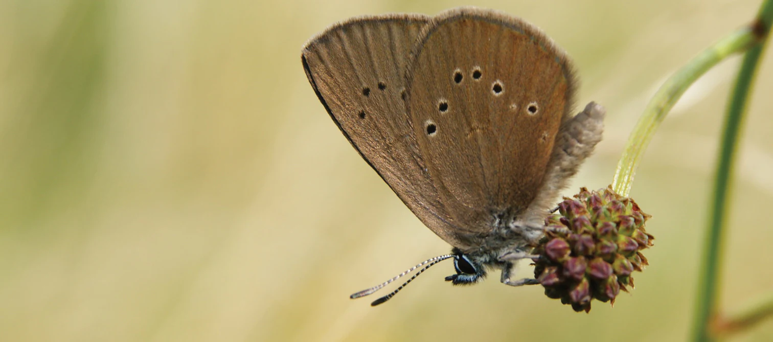
A close up profile view of a dusky large blue butterfly with brown wings and white-ringed black spots resting on a small spiky flower head.
A dusky large blue butterfly, Phengaris nausithous, resting on a plant in the Ilvericher Altrheinschlinge nature reserve.

Ilvericher Altrheinschlinge history and protected-area timeline

The meander itself is a natural historical artifact rather than a designed park feature: it formed at the start of the Holocene, around eleven thousand years ago, when warming climate conditions turned the Rhine into a strongly meandering river. About seven thousand years ago the Rhine broke through the neck of the bend, isolating the loop as a sidearm, and from roughly three thousand years ago, in the middle Holocene, the cutoff gradually silted up into the still waters and wetland mosaic seen today.

Local tradition preserved a strong memory of this landscape. Because the resulting marshland flooded extensively and felt like a sea during high water, the area was popularly called Das Meer, a name that survived in Haus Meer, a nearby manor, and eventually in the modern town name Meerbusch. Blocks of brown-coal quartzite carried downstream during the last cold period and deposited in the area are still preserved here as a legally protected natural monument.

The modern protection history began in 1981, when the loop was formally designated as a German nature reserve under the number NE-002. It was subsequently integrated into the Natura 2000 system as a Fauna-Flora-Habitat area under the identifier DE-4706-301. A biotope management plan was prepared in 1993 by the applied ecology institute aqua terra, helping guide ongoing conservation of the wet meadows, marsh habitats, and rare species such as the Dusky Large Blue butterfly.

In more recent decades the reserve became a focal point of public debate when the planned A44 motorway crossing had to be routed through it. After long controversy, a compromise was chosen in which two tunnels and a bridge, the Flughafenbrücke, were combined to span the sensitive areas, with the section crossing the oxbow built inside a sheet-pile watertight basin to manage the high groundwater levels.

Ilvericher Altrheinschlinge landscape and geographic character

The defining landform of the reserve is a single, almost closed meander loop, between roughly two hundred and five hundred meters wide, that runs along the left bank of the present-day Rhine. Inside the ring lies an agricultural block with arable land, a scattering of traditional farmsteads, and the infrastructure of the Düsseldorf-Nord wastewater treatment plant, while outside the dike the active floodplain of the modern Rhine forms a contrasting setting.

The physical surface of the loop is low-lying and shaped by water. Former channels, now reduced to still waters and ditches, trace the ancient course of the river, and these waters are fed by small streams such as the Mühlenbach, the Kringsgraben, and the Strempe. The Mühlenbach still passes the historic estate of Haus Meer, where it once powered a watermill, lending the area a layered cultural as well as natural identity.

Across the surface, the landscape shifts between open water, reed-fringed marshland, wet grassland, drier embankment meadows, and small tracts of older floodplain and swamp woodland. Hedges and avenues of pollarded willows and poplars line the field paths and former embankments, while erratics of brown-coal quartzite scattered through the area add a subtle glacial imprint to an otherwise Holocene landscape.
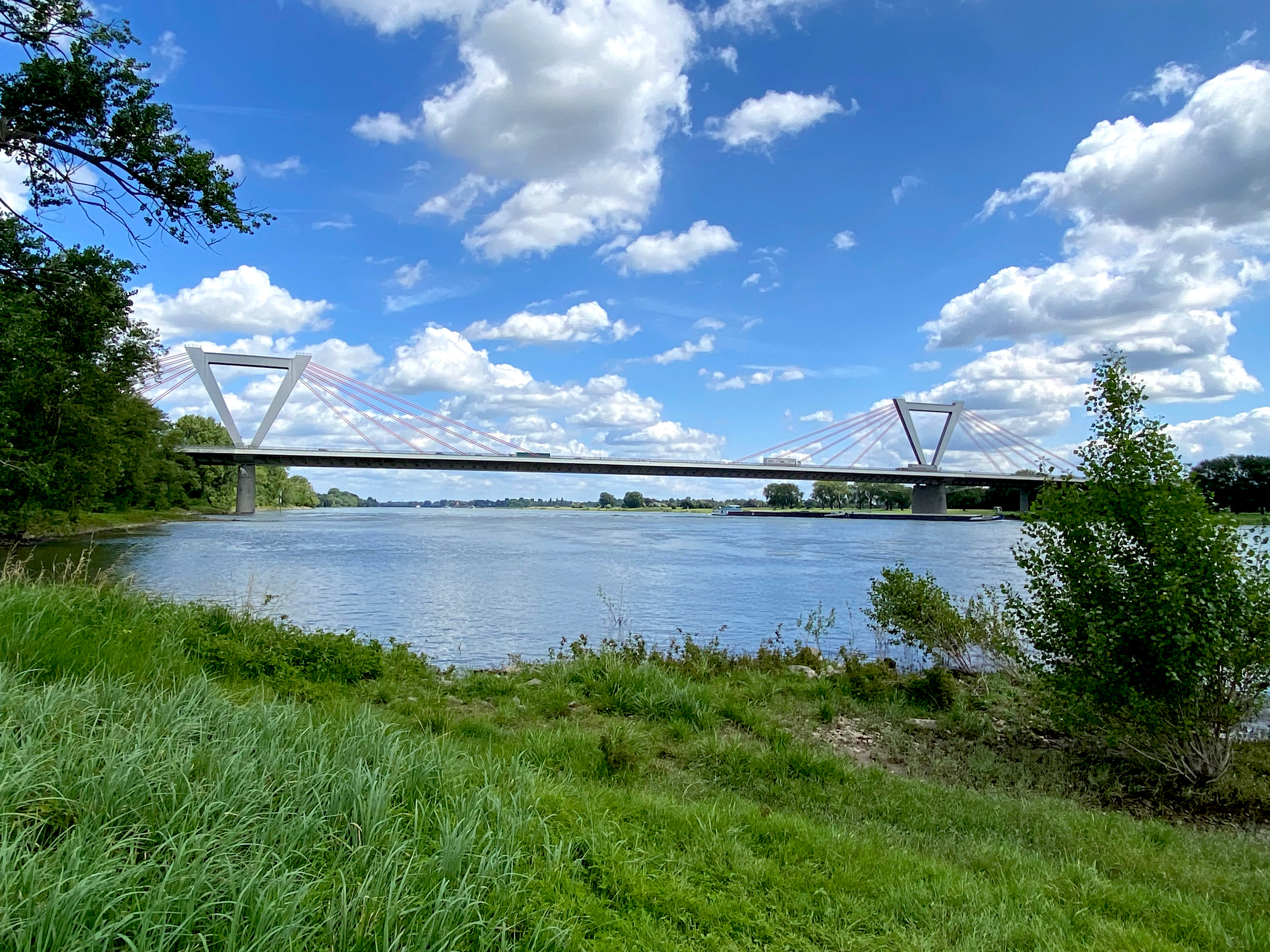
A wide view of the Rhine riverbank featuring lush green grass in the foreground and a large cable-stayed bridge spanning the water under a blue sky with scattered clouds.
The riverbank of the Ilvericher Altrheinschlinge nature reserve with the distinct bridge in the background.

Ilvericher Altrheinschlinge ecosystems, habitats, and plant life

Ecologically, the loop is a textbook example of a central European lowland floodplain in arrested retirement. The mosaic includes older remnants of softwood floodplain forest and alder swamp forest in areas like the Strümper Bruch, the Ilvericher Bruch, and Das Meer, where alders, ashes, and willows dominate the canopy. These wooded patches alternate with open, unmanaged wetland fallow land and extensive, traditionally managed wet grassland, while the dike itself supports slightly drier communities such as semi-dry grassland, sage meadows, and tall oat-grass meadows.

The water bodies and their margins carry a layered vegetation of nutrient-rich reeds: reed sweet-grass, common reed, sedge beds of both sedge and slender sedge communities, and tall-herb and pioneer forb stands along disturbed banks. These habitats create a continuous gradient from open water through reed swamp into wet meadow and ultimately to higher-lying mesic grassland, which is precisely the structural richness that allows so many specialized species to coexist here.

Because the larger surrounding landscape has been heavily simplified by agriculture and urbanization, the reserve functions as a critical habitat island and stepping stone. Its combination of open water, reed, wet meadow, and wet woodland in close proximity is unusual in the Lower Rhine plain and supports a community that would otherwise be hard to maintain in such an intensively used region.
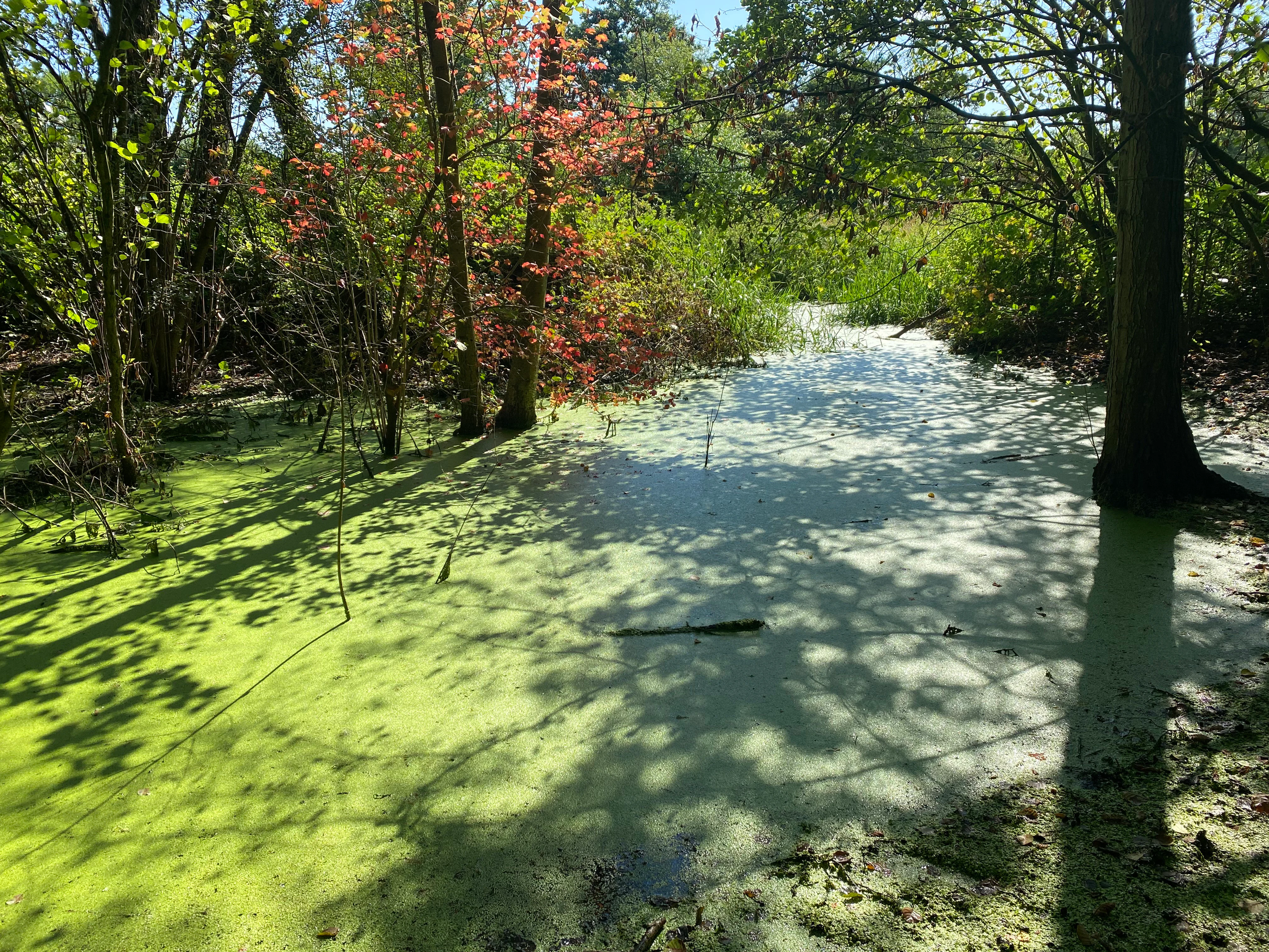
A stagnant waterway covered in bright green algae, surrounded by trees and dense vegetation in a woodland area.
A view of the algae-covered Kringsgraben within the Ilvericher Altrheinschlinge nature reserve.

Ilvericher Altrheinschlinge wildlife and species highlights

The Ilvericher Altrheinschlinge is recognized above all as a wetland bird area. The mosaic of shallow water, reed beds, and wet meadows provides breeding, feeding, and resting habitat for a long list of rare or declining species, including snipe, marsh harrier, lapwing, meadow pipit, whinchat, yellow wagtail, water rail, common teal, common nightingale, common kingfisher, little grebe, and golden oriole.

Bird conservation planning places particular weight on the site's role as a corridor in the Lower Rhine bird network, bridging the larger bird protection area of the Unterer Niederrhein to the north with the Schwalm-Nette-Platte to the west. For wetland meadow species in particular, this kind of intermediate habitat is essential for maintaining viable populations across the wider region.

The reserve is also significant for invertebrates, amphibians, and mammals. The wet meadows support the Dusky Large Blue butterfly, one of Europe's most iconic meadow species, whose larvae depend on specific ants and the great burnet flowers of traditionally managed wet grassland. Amphibians are well represented, with crested, alpine, and smooth newts documented, and fish such as the spined loach and European weatherfish inhabit the slow-moving waters. Several bat species, including the common and lesser noctule, also use the area.
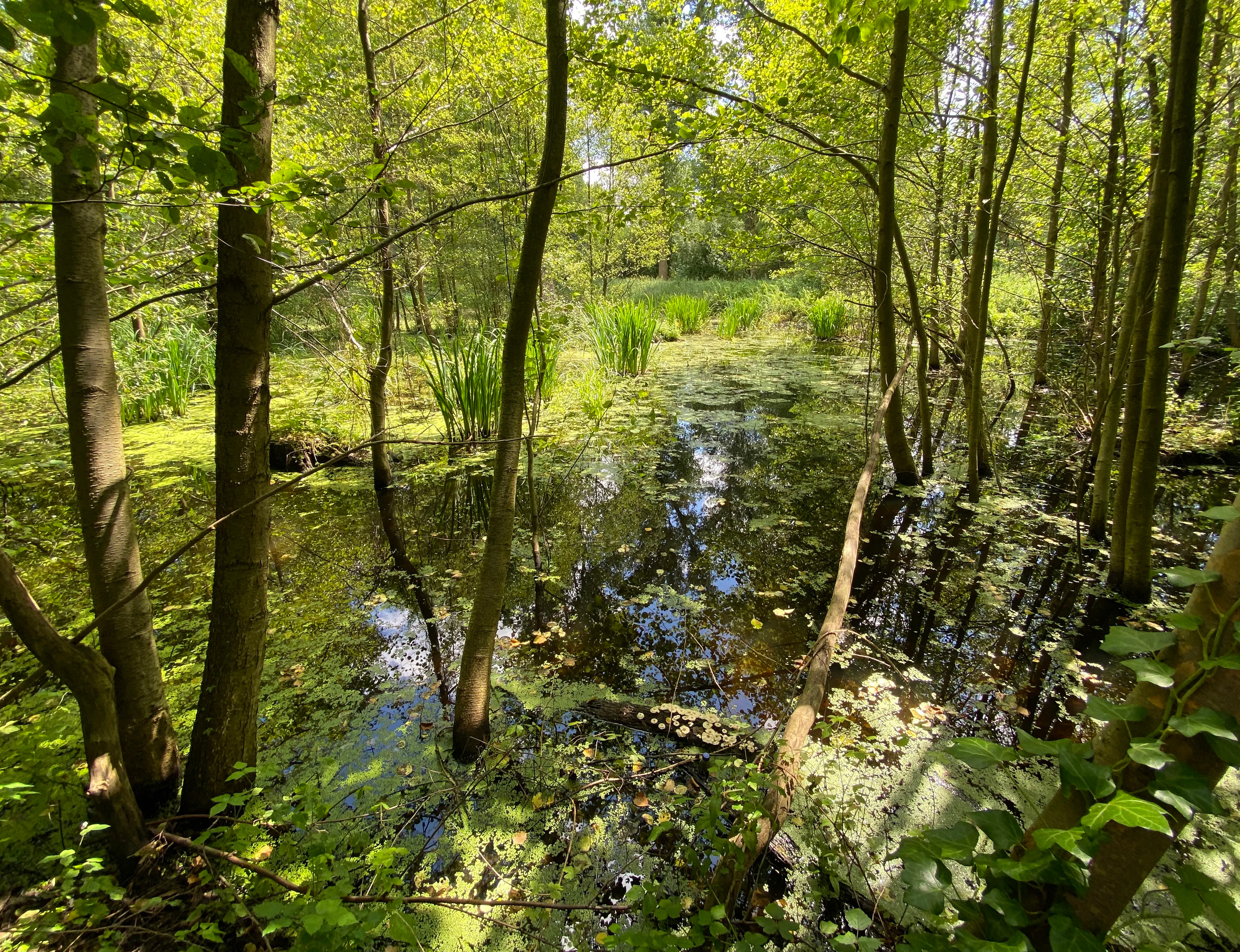
A peaceful, shaded wetland area with calm water, aquatic vegetation, and thin trees growing directly out of the shallow water in a forest setting.
A shaded section of the wetlands in the Ilvericher Altrheinschlinge nature reserve.

Ilvericher Altrheinschlinge conservation status and protection priorities

Conservation significance at the Ilvericher Altrheinschlinge rests on the unusual combination of geological intactness and habitat diversity. As the only fully preserved oxbow loop in its original geomorphology on the Lower Rhine, it preserves a structural reference point for the region's Holocene history that cannot be replaced once lost.

From an ecological standpoint, the reserve protects a complete sequence of lowland floodplain habitats, from open water and marsh to wet meadow, wet woodland, and drier dike-side grassland, in a region where these communities are otherwise fragmented and shrinking. Traditional extensive use of the wet meadows, especially mowing regimes that maintain the great burnet flowers needed by the Dusky Large Blue, is the cornerstone of management along with the protection bordering the Rhine.

Its formal protection is layered: it is a German nature reserve (NSG NE-002), a Natura 2000 / Fauna-Flora-Habitat site (DE-4706-301), and an element of the larger Rheinaue landscape protection area. Management planning, including the 1993 biotope management plan produced by aqua terra and ongoing work with the Biological Station in the Rhein-Kreis Neuss, has focused on visitor guidance, habitat restoration for the Dusky Large Blue, and the careful routing of infrastructure like the A44 motorway to keep disturbance within tolerable bounds.

Ilvericher Altrheinschlinge cultural meaning and human context

Although it is fundamentally a natural area, the reserve carries a deep local cultural imprint. The wetland inside the loop was known for centuries as Das Meer, a name rooted in the Low Franconian word for waterlogged land, and this name persists in the estate Haus Meer and, ultimately, in the modern city name Meerbusch. Traditional uses of the landscape, including watermills along the Mühlenbach and long-established patterns of meadow mowing and grazing, have shaped both the visible agricultural structures and the conservation value of the habitats themselves.
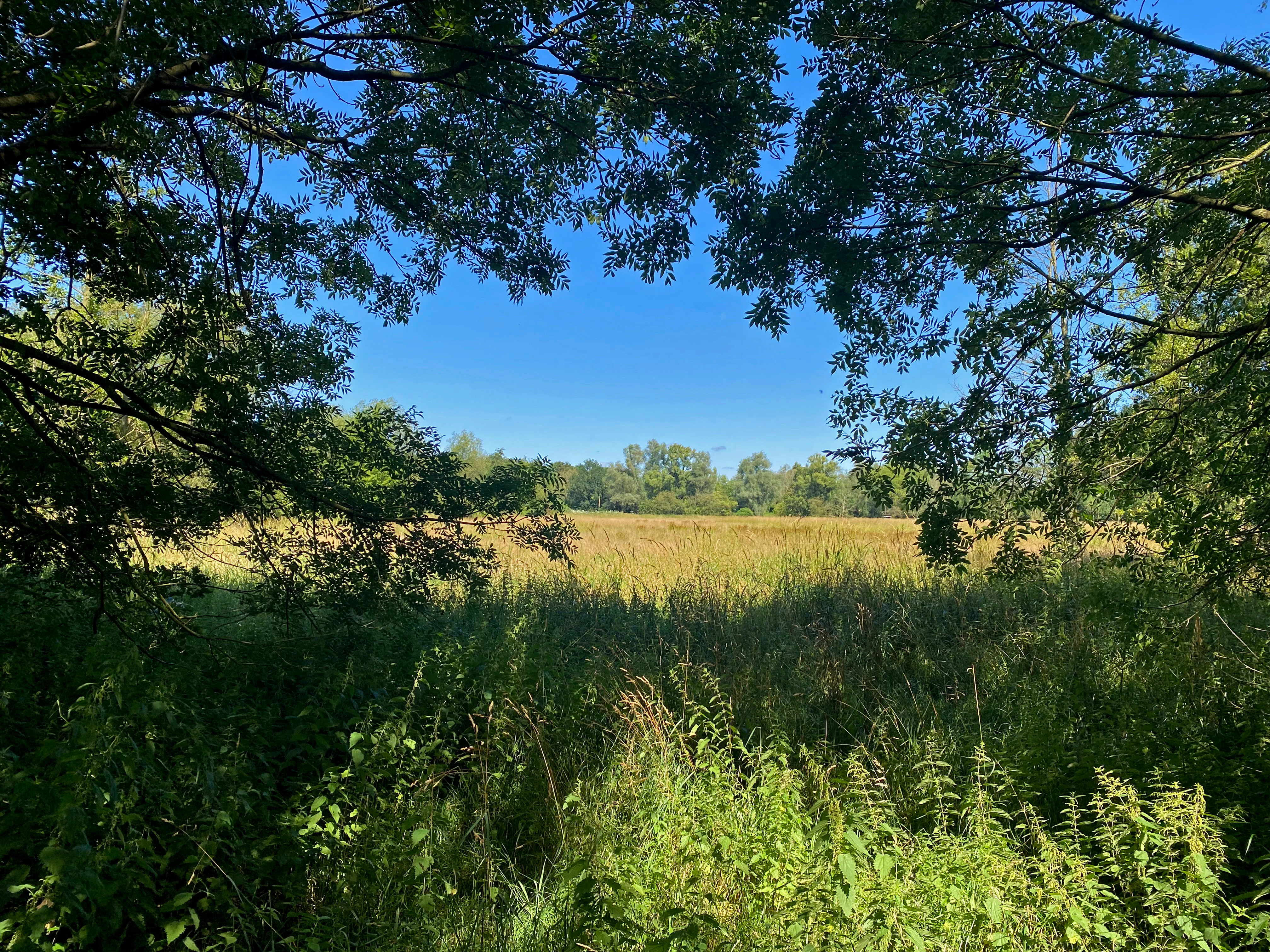
A framed view through tree branches looking out over a grassy meadow and wetlands under a clear blue sky.
A view of the wetlands within the Ilvericher Altrheinschlinge nature reserve.

Top sights and standout views in Ilvericher Altrheinschlinge

The highlights of the Ilvericher Altrheinschlinge cluster around its geological uniqueness and its thriving wetland biodiversity. Standing on the dike, one looks out over a continuous, intact meander loop that has outlived the river that created it, while inside that loop a full sequence of floodplain habitats, open water, reed beds, wet meadows, and alder swamp woodland, fits within a very compact area.

At finer scale, three features stand out: the population of the Dusky Large Blue butterfly tied to traditionally managed wet meadows, the rich bird community around the shallow waters and reed margins, and the conservation infrastructure of tunnels, bridges, and management plans that allow a modern region to coexist with a functioning floodplain ecosystem.
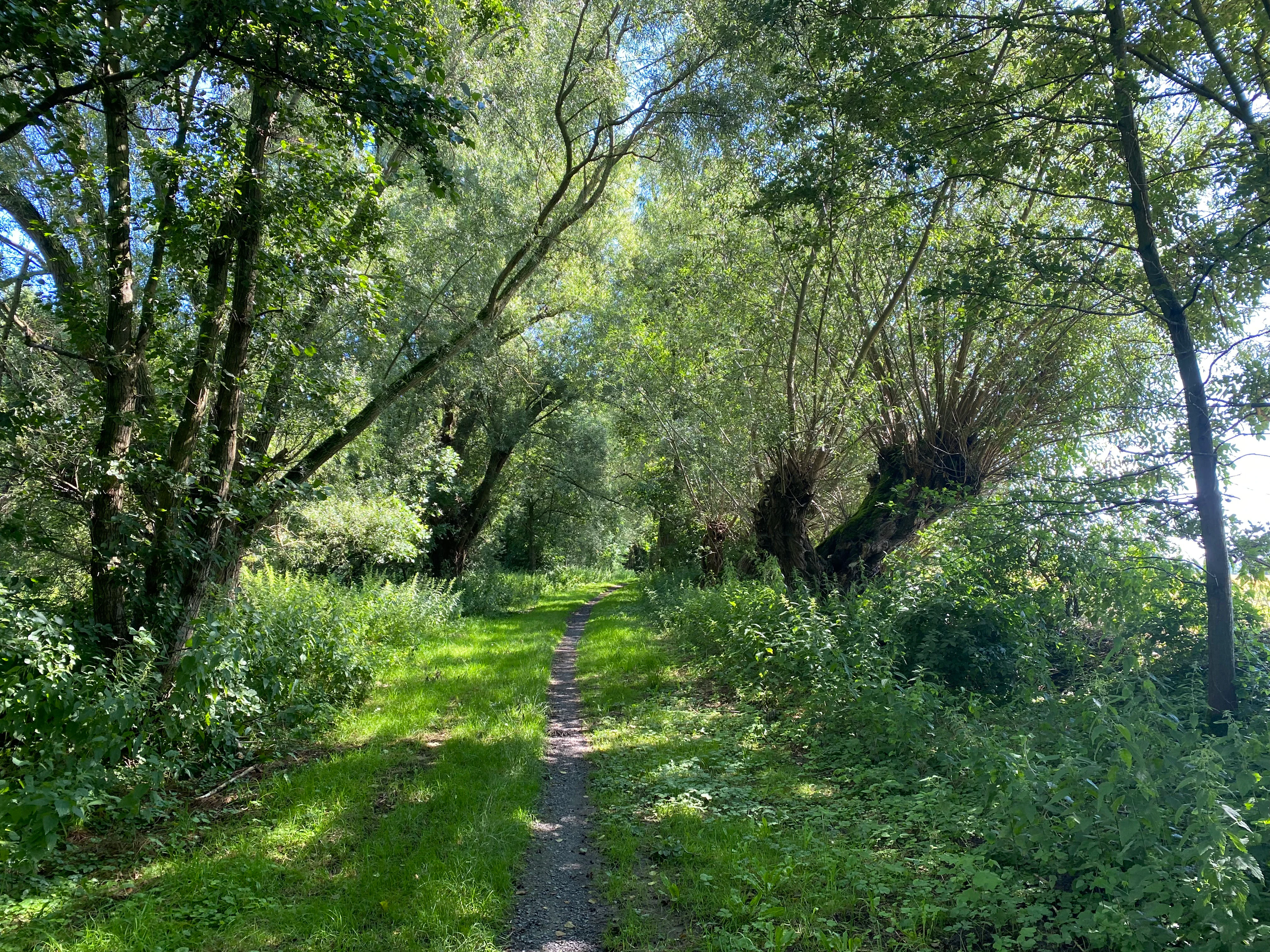
A narrow, dirt walking path stretches into the distance through a dense, green forest with tall trees and thick vegetation on both sides.
A narrow dirt trail winding through a lush, tree-lined riparian forest in the Ilvericher Altrheinschlinge nature reserve.

Best time to visit Ilvericher Altrheinschlinge

Spring and early summer tend to be the most rewarding seasons to explore the reserve. This is when wet meadows are at their richest in flowers, including the great burnet on which the Dusky Large Blue depends, and when breeding waterbirds, warblers, and meadow birds are most active around the reed beds and shallow waters. Late summer can also be productive, especially for insects and late-flying butterflies, while winter offers a calmer atmosphere and improved chances of observing waterfowl and raptors in less vegetated surroundings. Visitors should generally be prepared for damp ground and variable weather, since the wetland character of the reserve persists in all seasons.

Monthly climate preview

Long-term representative point measurements for monthly temperature and precipitation patterns

Ilvericher Altrheinschlinge Climate Normals and Annual Temperature Rhythm

Representative coordinate records show measured monthly temperature ranges and precipitation rates spanning the annual cycle at Ilvericher Altrheinschlinge. Examining the full twelve-month climate profile reveals complete long-term averages for monthly temperature and precipitation.
Annual mean10 °C
1 °C19 °C
Jan
Feb
Mar
Apr
May13°
Jun16°
Jul19°
Aug18°
Sep15°
Oct10°
Nov
Dec
Warmest month
July

18.6 °C

Coolest month
January

1.5 °C

Wettest month
December

2.8 mm/day

Driest month
April

1.6 mm/day

Park location guide

Geography guide, regional context, and park location map for Ilvericher Altrheinschlinge

Ilvericher Altrheinschlinge park geography, regions, and map view in Germany

Understand where Ilvericher Altrheinschlinge sits in Germany through a broader geographic reading of the surrounding landscape, nearby location context, and its mapped position within the national park landscape.

How Ilvericher Altrheinschlinge fits into Germany

Germany is a federal republic in Western and Central Europe with a population of over 83 million across sixteen constituent states. It is Europe's largest economy by nominal GDP and a major global exporter and importer. The capital is Berlin, and the country borders Denmark, Poland, Czech Republic, Austria, Switzerland, France, Luxembourg, Belgium, and the Netherlands.

Wider geography shaping Ilvericher Altrheinschlinge in Germany

Germany is located in Western and Central Europe, spanning 357,022 km². It borders Denmark to the north, Poland and the Czech Republic to the east, Austria and Switzerland to the south, and France, Luxembourg, Belgium, and the Netherlands to the west. The country has coastlines on the Baltic Sea and North Sea to the north, with the Alps located in the southern region.

Map view of Ilvericher Altrheinschlinge

Use this park location map to pinpoint Ilvericher Altrheinschlinge in Germany, understand its exact geographic position, and read its mapped placement within the surrounding landscape more clearly.

Pigeon | © OpenStreetMap contributors

Location context for Ilvericher Altrheinschlinge

Nordrhein-Westfalen
Recorded earthquake history

Explore the Historical Seismic Catalogue for Ilvericher Altrheinschlinge

Review a structured compilation of recorded seismic events associated with the Ilvericher Altrheinschlinge nature reserve. MoriAtlas provides this filtered historical catalogue for users interested in the regional seismic record and its spatial relationship to this protected floodplain landscape.

Ilvericher Altrheinschlinge Earthquake History

Catalogued events

80 events

Strongest magnitude

Magnitude 4.3

Most recent event

Jul 24, 2009

This history includes earthquakes recorded inside the park or within 50 km of its borders

Examine protected oxbow habitats, wetland meanders, and floodplain terrain.

Ilvericher Altrheinschlinge Photos and Landscape Scenery Visual Guide

Visual documentation captures the intact oxbow meander, open waters, and wetland habitats of Ilvericher Altrheinschlinge. Detailed photographic coverage reveals the diverse terrain, wet meadows, and floodplain characteristics of the protected Lower Rhine nature reserve.

A close up profile view of a dusky large blue butterfly with brown wings and white-ringed black spots resting on a small spiky flower head.

A green, algae-covered stream flows through a dense wetland area with tall grasses and a large tree in the foreground.

A wide view of the Rhine riverbank featuring lush green grass in the foreground and a large cable-stayed bridge spanning the water under a blue sky with scattered clouds.

A stagnant waterway covered in bright green algae, surrounded by trees and dense vegetation in a woodland area.

A peaceful, shaded wetland area with calm water, aquatic vegetation, and thin trees growing directly out of the shallow water in a forest setting.

A wide view of a flat meadow and green treeline under a partly cloudy sky, with a paved path in the foreground.

A framed view through tree branches looking out over a grassy meadow and wetlands under a clear blue sky.

A narrow, dirt walking path stretches into the distance through a dense, green forest with tall trees and thick vegetation on both sides.

A wide, sunlit meadow of tall grasses and wildflowers, bordered by a dense line of trees under a blue sky with scattered white clouds, framed by overhanging willow branches in the foreground.

A dirt hiking path runs alongside the Rhine river, bordered by dense green bushes and blooming blue wildflowers in the foreground. A modern cable-stayed bridge spans the river in the distance under a blue sky with fluffy white clouds.

A triangular trail sign stands on a metal post in the foreground, with an expansive, sunny meadow and a line of trees in the background under a blue sky.

An aerial view from an aircraft window showing the curved, oxbow-shaped forested landscape of the Ilvericher Altrheinschlinge, surrounded by agricultural fields and suburban development.

Park atlas

Compare adjacent wetland reserves and connected regional floodplain habitats

Parks Near Ilvericher Altrheinschlinge and Surrounding Protected Landscapes

Browsing parks near Ilvericher Altrheinschlinge reveals broader wetland ecosystems and connected bird reserves across the Lower Rhine region. Comparing these protected landscapes provides valuable regional context for understanding lowland river morphology and habitat corridors.
A watercolor painting showing a gentle, winding blue river flowing through a lush green landscape with soft hills in the distance.
Nature reserveNordrhein-Westfalen
About 2.1 km away#1 closest

Southwest

Der Meerbusch Nature Reserve: Mapped Protected Landscapes and Floodplain Forest Geography in Nordrhein-Westfalen

A historic alder swamp woodland and protected wetland habitat in the Lower Rhine region.

Der Meerbusch is a specialized nature reserve that preserves the ecological memory of the Lower Rhine through its intact alder swamp woodlands and old river channel formations. By examining the mapped boundaries and terrain, visitors can understand how this forest fragment functions as a critical wetland sanctuary within the industrialized landscape of Nordrhein-Westfalen.

Area
0.54 km²
Established
1987
IUCN
IV
Relief
Lowland
A soft watercolor painting of a winding stream through a grassy meadow with gentle hills in the background.
Nature reserveNordrhein-Westfalen
About 3.6 km away#2 closest

North

Latumer Bruch Nature Reserve and Protected Wetland Geography in Nordrhein-Westfalen

A mapped overview of floodplain forests and Rhine channel landscapes

Latumer Bruch protects a unique lowland mosaic of alder swamp forest and dry grassland ridges near Krefeld. This nature reserve functions as a vital wetland refuge and floodwater retention basin, offering deep insight into the complex hydrologic character and ecological connectivity of the Lower Rhine region.

Area
1.85 km²
Established
1982
IUCN
IV
Relief
Lowland
A soft watercolor illustration depicting a winding river flowing through green meadows and forest clusters against a light sky background.
Nature reserveNorth Rhine-Westphalia
About 4.8 km away#3 closest

North

Spey Nature Reserve: Protected Floodplain Geography and River Corridor in North Rhine-Westphalia

A detailed map of Rhine riverbank habitats and floodplain terrain

Spey Nature Reserve protects a characteristic slice of the Lower Rhine floodplain, featuring a layered landscape of softwood forest, river valley grasslands, and open shoreline. Situated within the Deichvorland between the cities of Krefeld and Meerbusch, this protected area serves as an essential ecological stepping stone and bird habitat. The reserve provides a valuable example of natural river processes preserved within the densely populated North Rhine-Westphalia region.

Area
1.06 km²
Established
1987
IUCN
IV
Relief
Lowland
Watercolor painting of a calm pond with cattails in the foreground and rolling hills in the background.
Nature reserveNorth Rhine-Westphalia
About 12 km away#4 closest

East

Naturschutzgebiet Pillebachtal, Dernkamp und Gallberg: Protected Landscape and Geography

Nature reserve in North Rhine-Westphalia, Germany

An urban-adjacent nature reserve, this area provides a mapped look at the transition between mature beech forest stands and moist wetland corridors along the Pillebach stream. It serves as a study in ecological structure, featuring reed beds, meadow springs, and gallery woodlands that offer a protected refuge within the Rhine-Ruhr metropolitan region.

Area
0.745 km²
Established
1996
IUCN
IV
Nature reserveKrefeld
12 km away#5 closest

Northwest

Hülser Bruch Nature Reserve: Geographic Atlas and Protected Landscape Mapping for Krefeld

A historic glacial plain and protected wetland habitat in the Lower Rhine region.

Hülser Bruch represents a vital protected area in Krefeld, characterized by clay rich soils, high groundwater levels, and ancient brook channels. The reserve preserves a distinct mosaic of coppice woodland and earthen embankments that reveal the geomorphological influence of Pleistocene ice sheets on this lowland territory.

Area
4.3 km²
Established
2002
Relief
Lowland
Climate
Temperate
A horizontal watercolor illustration of a calm stream flowing through a wetland with green trees and grasses along the banks.
Nature reserveNordrhein-Westfalen
About 13 km away#6 closest

Northeast

Hummelsbach Nature Reserve: Mapped Protected Brook and Floodplain Landscape in Nordrhein-Westfalen

Protected sandy stream and alder woodland mosaic

Located in the Mettmann district of Nordrhein-Westfalen, Hummelsbach preserves a near-natural sandy brook and alder floodplain forest. This reserve functions as an essential ecological bridge between rolling hill forests and lowland floodplains, providing a concentrated look at specialized habitats within a mosaic of meadows and wet woodland.

Area
0.13 km²
Established
1984
IUCN
IV
Watercolor painting of a green valley with a winding stream and gentle hills in the background.
Nature reserveNordrhein-Westfalen
About 14 km away#7 closest

East

Morper Bachtal: Mapped Nature Reserve and Stream Valley Geography in Germany

Protected wetland landscapes and regional habitat connectivity.

Morper Bachtal represents a tightly layered protected area where open water, reedbeds, and beech forests converge along the Rotthäuser Bach. This detailed look at its landscape composition and position within the district of Mettmann reveals the significance of its compact, undulating terrain and corridor role in German regional geography.

Area
0.74 km²
Established
1984
IUCN
IV
Relief
Upland
A watercolor illustration of a gentle winding stream flowing through a lush green valley at dawn or dusk.
Nature reserveNordrhein-Westfalen
About 14 km away#8 closest

East

Schwarzbachtal bei Götzenberg: Nature Reserve and Protected Landscape in North Rhine-Westphalia

Mapped stream valley, floodplain, and forest geography

Schwarzbachtal bei Götzenberg is an ecologically rich nature reserve located near Ratingen in the Mettmann district. The protected area features a well-preserved stretch of the Schwarzbach stream, old-growth beech stands, and complex wetland mosaics including reedbeds and ponds, providing essential habitat within a suburban landscape.

Area
0.54 km²
Established
1984
IUCN
IV
Relief
Lowland

Common questions about visiting, size, designation, and location context for Ilvericher Altrheinschlinge

Ilvericher Altrheinschlinge FAQs for park facts, access, geography, and protected area context

Find quick answers about Ilvericher Altrheinschlinge, including protected-area facts, park geography, trail and visitor context, and how the park fits into its surrounding country and regional landscape.
MoriAtlas Explorer

Continue Your Protected Areas Search Across the Global Atlas

Deepen your exploration by continuing the structured search for national parks and protected areas worldwide. Utilize the comprehensive filtering capabilities to compare different conservation landscapes and refine your understanding of global park geography. Discover more about the distribution and characteristics of protected natural areas.

Global natural geography