
Mori Atlas logo
Nature reserveIm Mörsbacher Grund von Darmstadt-Arheilgen

Examining the ecological mosaic of damp meadows, reed beds, and floodplain stream corridors.

Im Mörsbacher Grund von Darmstadt-Arheilgen: A Protected Nature Reserve in Hessen, Germany

(Naturschutzgebiet Im Mörsbacher Grund von Darmstadt-Arheilgen)

Im Mörsbacher Grund von Darmstadt-Arheilgen encompasses a sixty-eight hectare nature reserve shaped by the Hahnwiesenbach stream. This protected area supports a dense mosaic of wet meadows, reed beds, and alluvial woodland that serves as a vital ecological corridor within the broader Kranichsteiner Wald complex. The site highlights the interplay between historical land use and wetland conservation in the Darmstadt region.

wetlandnature reservemeadowreed bedsalluvial woodlandstream habitat
A flat vector illustration of a valley between rocky cliffs with a waterfall in the distance, a winding river in the foreground, and framed by trees on the sides.

Im Mörsbacher Grund von Darmstadt-Arheilgen

Nature reserve

Park overview

Structured park overview, official facts, and landscape profile for Im Mörsbacher Grund von Darmstadt-Arheilgen

Im Mörsbacher Grund von Darmstadt-Arheilgen park facts, protected area profile, and essential visitor context

Review the core facts for Im Mörsbacher Grund von Darmstadt-Arheilgen, including designation, size, terrain, visitor scale, habitats, and operating context in one park-focused overview.

About Im Mörsbacher Grund von Darmstadt-Arheilgen

Im Mörsbacher Grund von Darmstadt-Arheilgen is a nature reserve that captures one of the more quietly valuable ecological corners of northern Darmstadt. Although relatively small in area, the reserve concentrates a notable diversity of habitats within a short stretch of valley landscape, including wet meadows, reed-dominated zones, tall forb stands, alluvial woodland, and small flowing and standing water features. These habitats are organised around the Mörsbacher Grund drainage and its associated stream, the Hahnwiesenbach, which gives the protected area much of its hydrological character.

The reserve was established in 1987 to secure the long-term development of these wetland and meadow communities, recognising that such habitats had become increasingly rare in the intensively used surroundings of Darmstadt. By placing the area under nature reserve status, the regional authorities aimed to preserve not only the vegetation communities themselves but also the wildlife that depends on them. Source material notes the presence of numerous rare and threatened plant and animal species, reflecting the site's role as a refuge for biodiversity in an otherwise heavily modified suburban-rural setting.

A defining feature of the reserve is its integration into the larger European ecological network through the Natura 2000 site Kranichsteiner Wald mit Hegbachaue, Mörsbacher Grund und Silzwiesen. This connection means that the Mörsbacher Grund is not an isolated patch but functions as a component of a wider forest-stream-floodplain complex that stretches across the northern Darmstadt area. The reserve's effective conservation value therefore depends on both its internal habitat quality and its relationship to the surrounding Kranichsteiner Wald forest and the Hegbachaue floodplain.

Within the reserve, visitors encounter a layered landscape: chestnut-lined avenues that recall the area's historical estate character near the Messeler Falltorhaus, open wet meadows dotted with orchids in late spring and early summer, shaded stretches of alluvial forest along the stream, and patches of standing dead wood that support specialised fungi and saproxylic species. To the southwest, the grounds of the GSI Helmholtz Centre for Heavy Ion Research form an unusual neighbour, while to the southeast lies the Zinkenteich pond, another waterbody contributing to the broader mosaic of aquatic habitats in the area. Together, these surroundings frame the Mörsbacher Grund as a small but well-placed node within a larger and ecologically coherent landscape north of Darmstadt.

Quick facts and research context for Im Mörsbacher Grund von Darmstadt-Arheilgen

Im Mörsbacher Grund von Darmstadt-Arheilgen is a designated nature reserve in Hesse, Germany, classified under IUCN Category IV as a Habitat/Species Management Area. Established on 29 September 1987, it covers approximately 68.06 hectares on the northern edge of the Darmstadt city limits.

The site is integrated into the FFH (Fauna-Flora-Habitat) area Kranichsteiner Wald mit Hegbachaue, Mörsbacher Grund und Silzwiesen, extending its conservation significance beyond its own boundaries. Its protected features include reed beds, tall herb vegetation, semi-natural meadow communities, and the waterbodies of the Mörsbacher Grund drainage.

The reserve is bordered by major landmarks including the GSI Helmholtz research campus to the southwest and the Zinkenteich pond to the southeast, while its own interior contains the Hahnwiesenbach stream, orchid-rich wet meadows, alluvial woodland, and a historic chestnut avenue leading toward the Messeler Falltorhaus.

Protection and recognition

Examine the documented terrestrial protection scope and official records for Im Mörsbacher Grund von Darmstadt-Arheilgen.

Im Mörsbacher Grund von Darmstadt-Arheilgen Protection Status and Recognition

Im Mörsbacher Grund von Darmstadt-Arheilgen maintains a documented terrestrial protection scope within the global protected area registry. Systematic records outline the established designation framework and international recognition data associated with this protected landscape.

Protection details

Protection scope
Terrestrial
Transboundary protection
No
WDPA ID
163879
Park context

Deeper park guide and search-rich context for Im Mörsbacher Grund von Darmstadt-Arheilgen

Im Mörsbacher Grund von Darmstadt-Arheilgen history, landscape, wildlife, and travel context

Explore Im Mörsbacher Grund von Darmstadt-Arheilgen through its history, landscape character, ecosystems, wildlife, conservation priorities, cultural context, and seasonal travel timing in a structured park guide built for atlas discovery and search intent.

Why Im Mörsbacher Grund von Darmstadt-Arheilgen stands out

The reserve is best known for protecting a compact but ecologically rich mosaic of wet meadows, reed beds, alluvial woodland, and stream habitats on the northern outskirts of Darmstadt. Its damp meadows support populations of orchids such as the broad-leaved marsh orchid (Breitblättriges Knabenkraut), giving the site particular value for botanists and naturalists interested in species-rich grassland. Equally characteristic is the integration of the reserve into the broader Kranichsteiner Wald and Hegbachaue landscape, a forested and floodplain complex that connects woodland, stream valleys, and open wet habitats across the northern Darmstadt region. This combination of small-scale wetland diversity and connection to a larger forest-floodplain system gives the Mörsbacher Grund its distinctive conservation identity within the Darmstadt network of nature reserves.
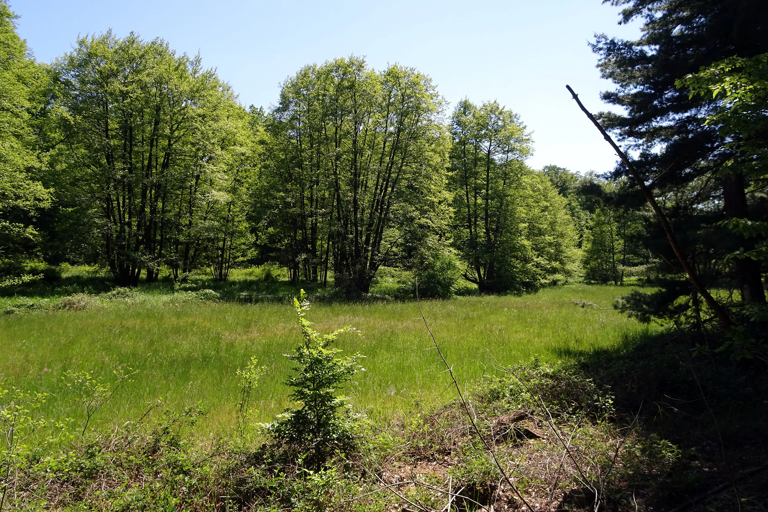
A sunny, bright green meadow surrounded by a line of deciduous trees in a nature reserve.
Riparian meadow and forest edge in the Im Mörsbacher Grund nature reserve.

Im Mörsbacher Grund von Darmstadt-Arheilgen history and protected-area timeline

The history of Im Mörsbacher Grund von Darmstadt-Arheilgen is principally a conservation history. Before its formal designation, the valley landscape formed part of the traditional agricultural and estate-related terrain on the northern outskirts of Darmstadt, suggested today by elements such as the chestnut avenue leading toward the historic Messeler Falltorhaus.

On 29 September 1987, the area was officially declared a Naturschutzgebiet, a nature reserve under German federal and Hessian nature conservation law. The designation responded to the ecological value of the valley's wetland, meadow, and stream habitats and to the need to safeguard them against ongoing pressure from urban and suburban development around Darmstadt.

In the decades following designation, the reserve became embedded in broader European conservation frameworks through its inclusion in the FFH (Fauna-Flora-Habitat) area Kranichsteiner Wald mit Hegbachaue, Mörsbacher Grund und Silzwiesen. This step connected the formerly standalone Hessian designation to a transboundary ecological planning context, reinforcing the importance of the Mörsbacher Grund within the wider northern Darmstadt landscape.

Im Mörsbacher Grund von Darmstadt-Arheilgen landscape and geographic character

The landscape of Im Mörsbacher Grund von Darmstadt-Arheilgen is shaped by its valley topography and the presence of flowing water. The reserve occupies a low-lying section of the Mörsbacher Grund, through which the Hahnwiesenbach stream runs, creating the hydrological conditions that support the area's characteristic wet habitats. The terrain is gently undulating rather than dramatic, typical of the rolling countryside on the northern edge of the Darmstadt urban area.

Within this modest topographic setting, the reserve displays an unusually diverse small-scale landscape. Damp meadows stretch out from the stream corridor, punctuated by reed beds and tall herb communities where the water table approaches the surface. Along the watercourse itself, narrow bands of alluvial woodland (Auwald) follow the stream's course, contributing shade, leaf litter, and structural complexity to the valley. Elsewhere, small clearings and field edges add openness to the landscape.

Visible landmarks frame the reserve from outside its boundaries. A chestnut avenue (Rosskastanien-Allee) leads northwest toward the historic Messeler Falltorhaus, hinting at the estate-based land use history of the wider area. The Zinkenteich pond lies along the southeastern edge, while the structures and grounds of the GSI Helmholtz Centre form the southwestern boundary, marking the meeting point between the reserve and one of Darmstadt's major research campuses.
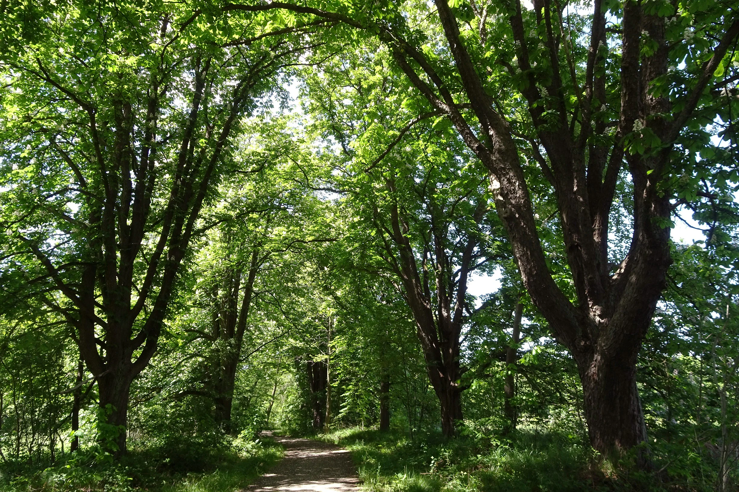
A dirt trail winds through a dense tunnel formed by large horse chestnut trees with full green foliage.
A horse chestnut tree avenue within the Im Mörsbacher Grund nature reserve.

Im Mörsbacher Grund von Darmstadt-Arheilgen ecosystems, habitats, and plant life

The reserve's ecological character is built around wetland and meadow communities that depend on the hydrology of the Mörsbacher Grund valley. The core habitats include reed beds (Röhricht), tall perennial herbaceous stands, and species-rich meadow communities, all of which benefit from the moist soils and the influence of the Hahnwiesenbach stream. These communities are the explicit focus of the reserve's protection objectives.

Along the stream, alluvial woodland adds a wooded layer to the habitat mosaic. This riparian forest contributes shade and structural diversity, while fallen and standing dead wood within the reserve provides habitat for specialised fungi and other saproxylic organisms. The combination of open wet meadow, reed bed, and shaded woodland edge produces a transition-rich environment that supports a wide range of species occupying different microhabitats.

The integration of the reserve into the larger FFH area Kranichsteiner Wald mit Hegbachaue, Mörsbacher Grund und Silzwiesen ties the local habitats into a broader ecological continuum with the surrounding forests and floodplains. This landscape-level connection increases the reserve's nature conservation value by linking it to larger populations of forest, wetland, and stream-associated species that move across the northern Darmstadt countryside.
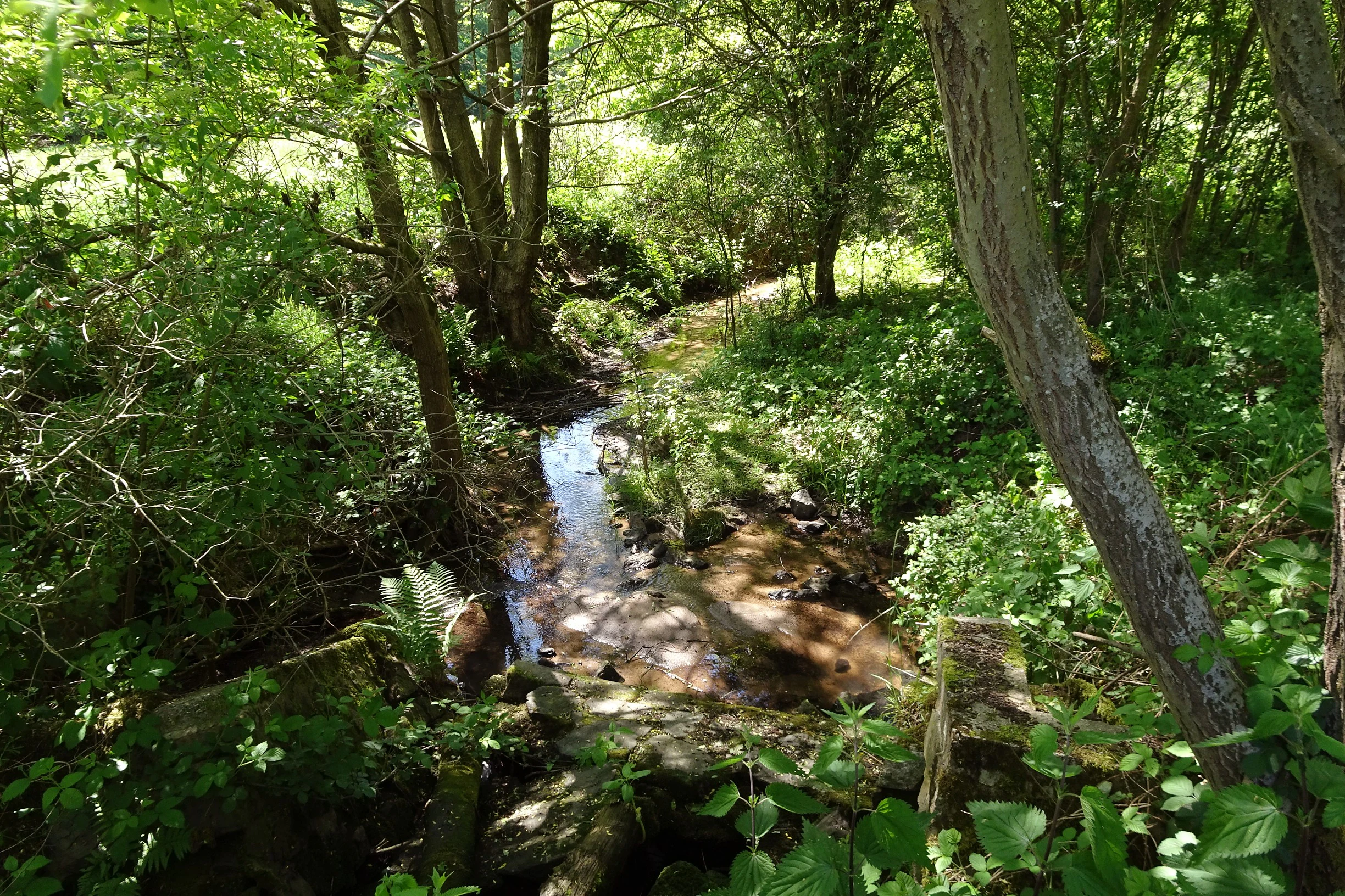
A small, narrow stream flowing through a lush, green forest setting with dense foliage and trees surrounding the water.
The Hahnwiesenbach stream flowing through the protected wetland area of Im Mörsbacher Grund.

Im Mörsbacher Grund von Darmstadt-Arheilgen wildlife and species highlights

Source material characterises Im Mörsbacher Grund von Darmstadt-Arheilgen as hosting numerous rare and threatened plant and animal species, although specific species names are not enumerated in detail. The reserve's wildlife value is closely tied to its wetland habitats and to the structural diversity of its meadow, reed bed, and alluvial woodland communities.

The damp meadows, particularly those with orchid populations such as the broad-leaved marsh orchid, support pollinator communities and other meadow-associated fauna. Reed beds and tall herb stands provide cover and nesting opportunities for birds and insects adapted to wetland margins. The alluvial woodland along the Hahnwiesenbach, together with dead wood and associated fungi, supports saproxylic invertebrates and the wider decomposer community on which many forest species depend.

Because the reserve is part of the wider Kranichsteiner Wald and Hegbachaue ecological complex, its wildlife functions within a larger landscape matrix that connects forest interior, floodplain, and wet meadow habitats, allowing species movement and ecological exchange across the northern Darmstadt region.
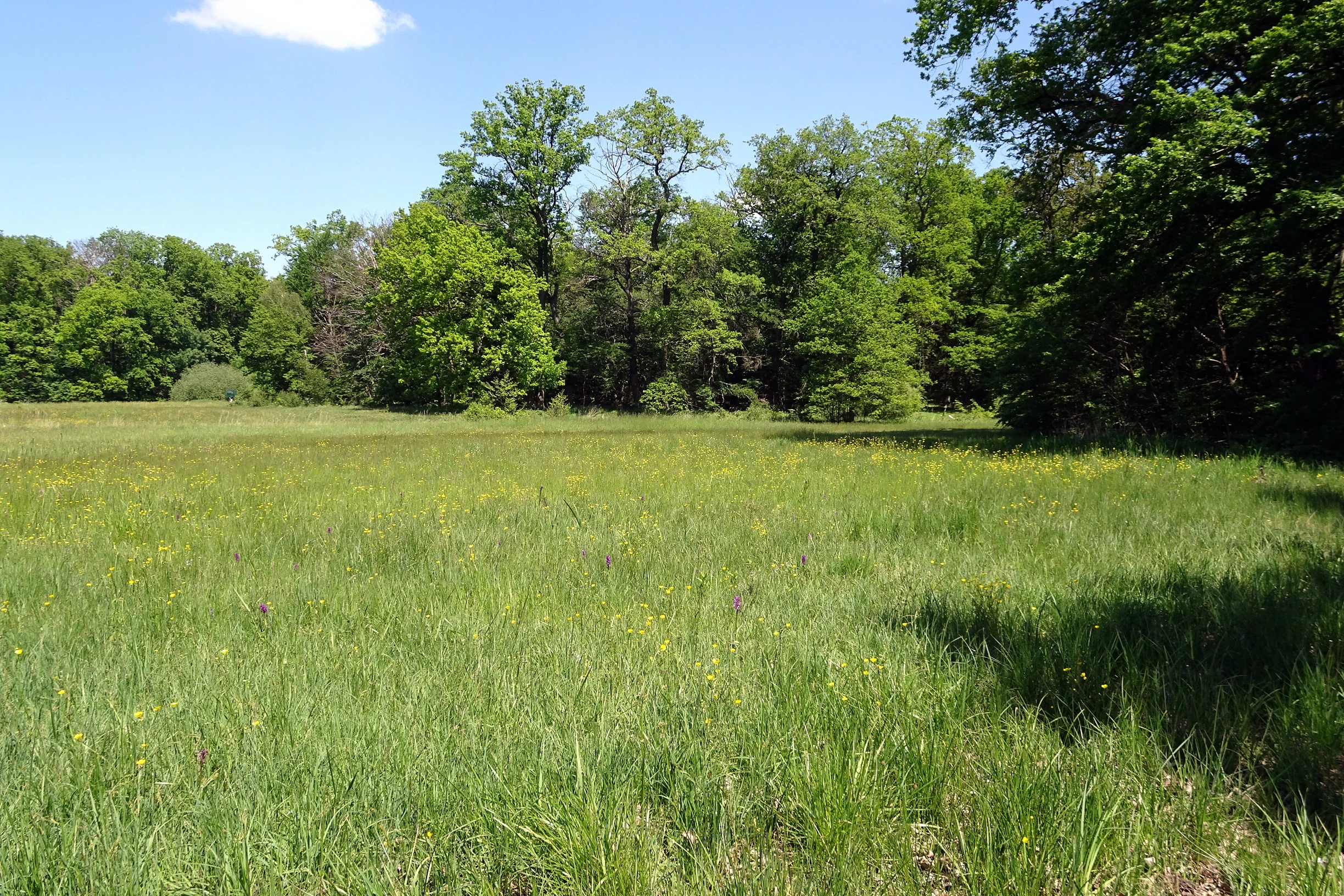
A wide, grassy meadow bordered by a dense deciduous forest under a clear blue sky.
A meadow in the nature reserve Im Mörsbacher Grund, showcasing the area's wetland and grassland habitat.

Im Mörsbacher Grund von Darmstadt-Arheilgen conservation status and protection priorities

From a conservation perspective, Im Mörsbacher Grund von Darmstadt-Arheilgen represents an effort to permanently secure a small but ecologically valuable wetland valley at the edge of a growing city. Its designation as a Naturschutzgebiet under Hessian law gives it formal protection against damaging land use changes and places its habitat management under a defined conservation framework. The site is classified as IUCN Category IV, a Habitat/Species Management Area, recognising that active management of habitats and species is part of the reserve's purpose.

The reserve's conservation significance is amplified by its inclusion in the Natura 2000 network through the FFH site Kranichsteiner Wald mit Hegbachaue, Mörsbacher Grund und Silzwiesen. This makes the Mörsbacher Grund subject to European-level habitat protection requirements and ties its future to the conservation of the broader forested and floodplain landscape to the north of Darmstadt. The combination of national nature reserve status and European habitat designation gives the site a layered protection profile.

Management focus, as indicated by the reserve's designation rationale, centres on sustaining the development and promotion of reed beds, tall herb communities, meadow vegetation, and the stream habitats themselves. Maintaining these communities is also the foundation for preserving the rare and threatened species that depend on them, making the reserve a small but important contributor to biodiversity conservation in the Darmstadt region.

Im Mörsbacher Grund von Darmstadt-Arheilgen cultural meaning and human context

The cultural context of Im Mörsbacher Grund von Darmstadt-Arheilgen is closely tied to the historic estates and rural land use patterns on the northern outskirts of Darmstadt. The chestnut avenue leading toward the Messeler Falltorhaus reflects the landscape-design traditions of historic German estate grounds, suggesting a layered cultural heritage beneath the reserve's current ecological focus.

The reserve's modern setting also includes the GSI Helmholtz Centre for Heavy Ion Research on its southwestern edge, an internationally recognised scientific institution. This juxtaposition of a nature reserve with an advanced research campus illustrates the layered land-use mosaic of the Darmstadt area, where ecological, agricultural-historical, and scientific functions coexist in close proximity. The Zinkenteich pond on the southeastern edge adds another traditional landscape element, reinforcing the sense of a culturally and ecologically varied northern Darmstadt fringe.

Top sights and standout views in Im Mörsbacher Grund von Darmstadt-Arheilgen

A compact wetland valley reserve with orchid-rich damp meadows, reed beds, and alluvial woodland along the Hahnwiesenbach stream, designated in 1987 and integrated into the larger Kranichsteiner Wald and Hegbachaue Natura 2000 complex.

Best time to visit Im Mörsbacher Grund von Darmstadt-Arheilgen

The reserve's wet meadows, including its orchid populations, are most vivid in late spring and early summer, when the broad-leaved marsh orchid and associated meadow flora reach peak display. Visiting outside this period still offers quiet enjoyment of the stream, reed beds, and alluvial woodland, while autumn brings attention to fungi and dead-wood habitats in the wooded parts of the reserve.

Monthly climate preview

Monthly temperature ranges and precipitation averages recorded at a representative coordinate

Im Mörsbacher Grund von Darmstadt-Arheilgen Climate Normals and Temperature Patterns

Representative coordinate records show measured temperature swings and monthly precipitation distributions across the protected area. Examining the full twelve-month profile reveals detailed historical climate normals for thorough environmental comparison.
Annual mean10 °C
0 °C21 °C
Jan
Feb
Mar
Apr10°
May14°
Jun18°
Jul21°
Aug20°
Sep15°
Oct10°
Nov
Dec
Warmest month
July

20.6 °C

Coolest month
January

0.2 °C

Wettest month
July

2.2 mm/day

Driest month
April

1.4 mm/day

Park location guide

Geography guide, regional context, and park location map for Im Mörsbacher Grund von Darmstadt-Arheilgen

Im Mörsbacher Grund von Darmstadt-Arheilgen park geography, regions, and map view in Germany

Understand where Im Mörsbacher Grund von Darmstadt-Arheilgen sits in Germany through a broader geographic reading of the surrounding landscape, nearby location context, and its mapped position within the national park landscape.

How Im Mörsbacher Grund von Darmstadt-Arheilgen fits into Germany

Germany is a federal republic in Western and Central Europe with a population of over 83 million across sixteen constituent states. It is Europe's largest economy by nominal GDP and a major global exporter and importer. The capital is Berlin, and the country borders Denmark, Poland, Czech Republic, Austria, Switzerland, France, Luxembourg, Belgium, and the Netherlands.

Wider geography shaping Im Mörsbacher Grund von Darmstadt-Arheilgen in Germany

Germany is located in Western and Central Europe, spanning 357,022 km². It borders Denmark to the north, Poland and the Czech Republic to the east, Austria and Switzerland to the south, and France, Luxembourg, Belgium, and the Netherlands to the west. The country has coastlines on the Baltic Sea and North Sea to the north, with the Alps located in the southern region.

Map view of Im Mörsbacher Grund von Darmstadt-Arheilgen

Use this park location map to pinpoint Im Mörsbacher Grund von Darmstadt-Arheilgen in Germany, understand its exact geographic position, and read its mapped placement within the surrounding landscape more clearly.

Pigeon | © OpenStreetMap contributors

Location context for Im Mörsbacher Grund von Darmstadt-Arheilgen

Hessen

Visualizing the protected valley habitats, wet meadows, and stream corridors

Im Mörsbacher Grund von Darmstadt-Arheilgen Photos, Scenery, and Landscapes

Visual documentation captures the diverse wetland habitats, damp meadows, and stream corridors defining Im Mörsbacher Grund von Darmstadt-Arheilgen. Photographic observation reveals the distinct topographic features, alluvial woodland vegetation, and protected landscape character.

A sunny, bright green meadow surrounded by a line of deciduous trees in a nature reserve.

A tall, light-colored dead tree trunk stands vertically in a lush green forest, with several shelf fungi growing along its side.

A dirt trail winds through a dense tunnel formed by large horse chestnut trees with full green foliage.

A small, narrow stream flowing through a lush, green forest setting with dense foliage and trees surrounding the water.

A wide, grassy meadow bordered by a dense deciduous forest under a clear blue sky.

Park atlas

Compare adjacent wetland reserves and connected floodplain landscapes across the region

Parks Near Im Mörsbacher Grund von Darmstadt-Arheilgen and Surrounding Protected Areas

Visitors exploring Im Mörsbacher Grund von Darmstadt-Arheilgen can examine nearby protected areas and connected stream valley reserves. Comparing adjacent conservation landscapes reveals wider regional ecological patterns and related wetland habitats.
Nature reserveHesse
About 4 km away#1 closest

West

Faulbruch bei Erzhausen: Protected Wetland Landscapes and Regional Nature Reserve Atlas

Mapping rare fen woodlands and wet meadow habitats in southern Hesse

This nature reserve protects an ecologically distinct combination of black alder fen, mat grass pastures, and calcareous meadows near Erzhausen. Situated on silty, peaty soils within the southern Hessian lowlands, the site serves as a vital refuge for specialized biodiversity, maintained by its unique groundwater hydrology and surrounding anthropogenic borders.

Area
0.658 km²
Established
2001
Relief
Lowland
Climate
Temperate
A horizontal watercolor illustration depicting a soft, pastel-colored meadow with wildflowers in the foreground and a gentle forest line in the background against a white background.
Nature reserveLandkreis Darmstadt-Dieburg
About 5.3 km away#2 closest

East

Neuwiese von Messel Nature Reserve: Mapped Geography and Protected Landscape Context

Essential nature reserve located in Landkreis Darmstadt-Dieburg

Neuwiese von Messel consists of open meadow islands surrounded by mature deciduous forest, creating a representative forest-meadow mosaic in the Messeler Hügelland. This nature reserve functions as a vital conservation site for specialized plants and habitat types, protected within the European Natura 2000 network. Gain insight into its terrain, soil-based biodiversity, and the centuries-old traditional management that sustains this protected German landscape.

Area
1.072 km²
Established
1986
IUCN
IV
Relief
Lowland
Nature reserveHessen
About 6.4 km away#3 closest

Northwest

Kammereckswiesen und Herchwiesen von Langen: Protected Nature Reserve in Hessen, Germany

Geographic analysis of meadowland, grassland, and wetland habitat mosaic.

Kammereckswiesen und Herchwiesen von Langen serves as a significant nature reserve within the Rhine-Main area of Hessen. The site is defined by its unusual botanical diversity, derived from a close proximity of dry sandy soil and moisture-retaining clay patches. This atlas entry details the internal terrain structure, highlighting how traditional meadow management sustains rare dragonflies, butterflies, and orchids in this protected lowland landscape.

Area
28.8 km²
Established
1982
IUCN
IV
Watercolor painting of a rolling wetland landscape featuring green fields, soft hills in the background, and marshy foreground vegetation.
Nature reserveHessen
About 6.7 km away#4 closest

South

Scheftheimer Wiesen Nature Reserve: Geographic Overview and Protected Landscape Mapping

Hessen wetland ecosystems and prehistoric heritage sites

Situated along the Ruthsenbach stream in Hessen, Scheftheimer Wiesen is a 166-hectare nature reserve known for its recovery of wet meadow habitats after decades of agricultural use. The area integrates natural terrain with cultural heritage, featuring reconstructed granite menhirs and historic burial mounds within a broader forest-framed environment near Darmstadt.

Area
1.661 km²
Established
1993
IUCN
IV
Relief
Lowland
A pale, soft watercolor landscape painting of a quiet lake with shoreline reeds, trees in the background, and branches framing the scene on the sides.
Nature reserveHesse
About 6.9 km away#5 closest

West

Am Kleewoog von Gräfenhausen Nature Reserve: Geography and Protected Area Landscape Overview

A regional sanctuary of sand habitats and former gravel pits in Hesse

Examine the distinct ecological geography of Am Kleewoog von Gräfenhausen. This reserve showcases the transition between rugged, water-filled gravel excavations and stable pine-oak forest stands on acidic inland dunes. Gain insight into the regional importance of this protected mosaic as an amphibian refuge and a remnant of the unique geological substrate found across the Darmstadt sand sheet.

Area
0.209 km²
Established
1985
IUCN
IV
Relief
Lowland
Nature reserveHessen
About 7.1 km away#6 closest

East

Erlenwiesen bei Ober-Roden Nature Reserve: Landscape and Geography in Hessen, Germany

Protected riparian forest and wetland habitat mosaic

Erlenwiesen bei Ober-Roden is a specialized nature reserve in the Messeler Hügelland of Hessen, protecting a dense concentration of alder-ash floodplain forests, sedge swamps, and wet meadows. Spanning approximately 14 hectares, it remains a crucial example of lowland stream valley conservation and habitat management within the German landscape.

Area
0.143 km²
Established
1996
IUCN
IV
A soft watercolor illustration depicting a calm wetland scene with distant rolling hills, foreground reeds, and overhanging tree branches.
Nature reserveHesse
About 7.8 km away#7 closest

East

Rallenteich von Eppertshausen Nature Reserve: Protected Landscape and Regional Geography

Wetland and forest mosaic in the Hesse region

Examine the geographic footprint of Rallenteich von Eppertshausen, a significant nature reserve in Hesse, Germany. This 12-hectare protected area showcases a dense mosaic of pond, reedbed, and acidic oak forest that evolved from historical clay mining. Understanding the park's topography and internal landscape zones offers insight into the evolution of post-industrial protected lands.

Area
0.12 km²
Established
1976
IUCN
IV
Relief
Lowland
A horizontal watercolor painting depicting a soft-focus landscape with rolling green hills, a marshy foreground with grasses, and light purple mountains in the distance.
Nature reserveHesse
About 8.6 km away#8 closest

Southeast

Das große Hörmes bei Dieburg Nature Reserve: A Wetland Protected Area in Hesse

Mapped lowland wetland habitat in the Gersprenz district

This compact nature reserve in southern Hesse provides a essential sanctuary for wetland species, featuring a rare combination of reedbeds, sedge stands, and moist litter meadows. The area highlights the historical character of the Gersprenz lowlands through its protected hydrological network and open herbaceous habitat structure.

Area
0.136 km²
Established
1985
IUCN
IV

Common questions about visiting, size, designation, and location context for Im Mörsbacher Grund von Darmstadt-Arheilgen

Im Mörsbacher Grund von Darmstadt-Arheilgen FAQs for park facts, access, geography, and protected area context

Find quick answers about Im Mörsbacher Grund von Darmstadt-Arheilgen, including protected-area facts, park geography, trail and visitor context, and how the park fits into its surrounding country and regional landscape.
MoriAtlas Explorer

Continue Your Protected Areas Search Across the Global Atlas

Deepen your exploration by continuing the structured search for national parks and protected areas worldwide. Utilize the comprehensive filtering capabilities to compare different conservation landscapes and refine your understanding of global park geography. Discover more about the distribution and characteristics of protected natural areas.

Global natural geography