Mori Atlas logo
Nature reserveImpendle Nature Reserve

Mapping the mist-prone grassland terrain and vital breeding habitats of the Drakensberg foothills.

Impendle Nature Reserve: A Protected Highland Landscape in the KwaZulu-Natal Midlands

Impendle Nature Reserve protects three thousand hectares of high-altitude terrain on the foothills of the Drakensberg escarpment. The landscape features a complex mosaic of undulating grasslands, steep dolerite ridges, and seasonal wetlands that support a critically endangered Midlands Mistbelt ecosystem. As a designated Important Bird and Biodiversity Area, the reserve serves as a essential sanctuary for the endangered wattled crane and a diverse array of endemic highland flora.

high-altitude grasslandsMistbelt Grasslandwattled crane breeding siteImportant Bird and Biodiversity AreaEzemvelo KZN WildlifeDrakensberg foothills

Impendle Nature Reserve

Nature reserve

Park overview

Structured park overview, official facts, and landscape profile for Impendle Nature Reserve

Impendle Nature Reserve park facts, protected area profile, and essential visitor context

Review the core facts for Impendle Nature Reserve, including designation, size, terrain, visitor scale, habitats, and operating context in one park-focused overview.

About Impendle Nature Reserve

Impendle Nature Reserve occupies a distinctive position within KwaZulu-Natal's protected-area network. Although it spans only around 3,046 hectares, its ecological value is disproportionate to its size because it conserves vegetation and birdlife that have been extensively lost elsewhere in the region. The reserve lies on the lower slopes of the Drakensberg, where the great escarpment transitions into the rolling hills and valleys of the KwaZulu-Natal Midlands. This geographic setting produces a cool, moist environment with frequent mists, high rainfall, and a complex mosaic of grassland, wetland, and ridge habitat.

Administratively, the reserve is managed by Ezemvelo KZN Wildlife, the provincial body responsible for biodiversity stewardship in KwaZulu-Natal. Impendle has been protected since 1983, making it a long-established component of the province's conservation estate. In ecological terms, its most important contribution is the safeguarding of the Midlands Mistbelt Grassland, a vegetation type classified as critically endangered because centuries of grazing, cultivation, and plantation forestry have removed most of its original extent.

A second defining feature is the reserve's value for birdlife, particularly the wattled crane, a species whose South African breeding range has contracted sharply. Impendle hosts several nesting pairs, alongside populations of grey crowned crane, blue crane, southern ground hornbill, and various grassland specialists. Because the cranes breed in sensitive wetlands, the reserve deliberately maintains a low-impact tourism regime, prioritising research and carefully managed birdwatching access over conventional recreational visitation.

Taken together, these qualities make Impendle less a destination of sweeping scenic vistas and more a working conservation landscape: a place whose importance lies in what it preserves rather than in visitor spectacle.

Quick facts and research context for Impendle Nature Reserve

Impendle Nature Reserve covers about 3,046 hectares on the Drakensberg foothills in the KwaZulu-Natal Midlands of South Africa. It is managed by Ezemvelo KZN Wildlife and was formally proclaimed in 1983 under the province's Nature Conservation Ordinance. The reserve protects a substantial block of the critically endangered Midlands Mistbelt Grassland and several of the few remaining functional breeding wetlands for the wattled crane in South Africa. Its altitude range, roughly 1,200 to 1,600 metres, gives it a cool, mist-prone, high-rainfall climate typical of the KwaZulu-Natal highland grasslands.

Protection and recognition

Examine documented conservation scope and international recognition facts

Impendle Nature Reserve Protection Status and Territorial Designation

Terrestrial protection status records outline the regulatory scope and administrative framework established for Impendle Nature Reserve. Verified conservation data details official designations and international recognition parameters associated with the protected landscape.

Protection details

Protection scope
Terrestrial
Transboundary protection
No
Park context

Deeper park guide and search-rich context for Impendle Nature Reserve

Impendle Nature Reserve history, landscape, wildlife, and travel context

Explore Impendle Nature Reserve through its history, landscape character, ecosystems, wildlife, conservation priorities, cultural context, and seasonal travel timing in a structured park guide built for atlas discovery and search intent.

Why Impendle Nature Reserve stands out

Impendle is most notable for its role as one of South Africa's most important breeding sanctuaries for the wattled crane. Several pairs of these endangered birds nest in the reserve's wetlands each year, and this conservation role is the principal reason the reserve was proclaimed in 1983. Beyond cranes, the reserve is recognized for preserving a large intact block of the critically endangered Midlands Mistbelt Grassland. This vegetation type, which combines rolling grasslands with patches of mistbelt forest and seasonal wetlands, has been heavily transformed outside protected areas, so Impendle's remaining coverage is now ecologically significant well beyond its compact footprint. The reserve's designation as an Important Bird and Biodiversity Area reflects both of these qualities: rare birdlife and irreplaceable highland grassland habitat.

Impendle Nature Reserve history and protected-area timeline

Impendle Nature Reserve was formally proclaimed in 1983 under the Nature Conservation Ordinance (No. 15 of 1974), which governed conservation areas in what was then Natal province. Its establishment was directly motivated by the need to protect a surviving set of breeding wetlands for the wattled crane, a species whose South African breeding range had already been substantially reduced by habitat loss across the Midlands.

At the time of proclamation, the reserve brought under formal protection a block of high-altitude grasslands on the Drakensberg foothills that was considered especially vulnerable to further conversion to timber plantations and agriculture. Management responsibility has since rested with Ezemvelo KZN Wildlife, the provincial agency that today oversees most of KwaZulu-Natal's statutory protected areas.

Since its establishment, the reserve's role has continued to evolve alongside growing recognition of the threatened status of the Midlands Mistbelt Grassland. What began primarily as a crane-focused sanctuary has increasingly been understood as a broader refuge for an entire endangered vegetation type, reinforcing its long-term conservation importance within the province.

Impendle Nature Reserve landscape and geographic character

The landscape of Impendle Nature Reserve is shaped by its position on the foothills of the Drakensberg escarpment. The terrain is a mosaic of gently undulating grasslands interrupted by steep dolerite ridges and rocky outcrops, with pockets of wetland and seepage zones scattered across the higher valleys. This varied topography gives the reserve a visually layered character, in which open sweeps of grassland give way to darker, more enclosed ridges.

Elevation within the reserve ranges from roughly 1,200 to 1,600 metres above sea level, placing it firmly within the mid-altitude grassland zone rather than the higher alpine belt of the Drakensberg proper. The combination of altitude and the influence of moisture-bearing weather systems from the Indian Ocean produces a high-rainfall, mist-prone climate. Frequent mist, cool temperatures, and reliable rainfall sustain the dense, species-rich turf that defines the area.

The dolerite intrusions that rise through the grassland create distinctive rocky ridges and koppies, which break up the otherwise continuous grassland vistas and contribute to local variation in soils and vegetation. Patches of mistbelt vegetation, including thicker shrubs and woody elements, cling to the moister slopes and drainage lines, separating the reserve visually and ecologically from the drier upland grasslands found further inland.

Impendle Nature Reserve ecosystems, habitats, and plant life

Impendle protects a significant portion of the Midlands Mistbelt Grassland, a vegetation type now considered critically endangered because its historical extent has been extensively altered by timber plantations, pasture improvement, and crop cultivation. The reserve therefore represents one of the larger intact reference sites for this grassland system, maintaining the original species composition, structure, and seasonal dynamics that have been lost across much of the surrounding region.

The grassland itself is exceptionally diverse. It contains numerous endemic wildflowers and orchids typical of the KwaZulu-Natal highland flora, along with rare plant species such as Gerbera aurantiaca, the Hilton Daisy, and several Watsonia species that favour the reserve's moist, peaty soils. These flowering species contribute to seasonal displays that reflect the underlying health of the grassland system.

Localised wetlands and seepage zones are an integral part of the reserve's ecology. Although small in individual area, they support wetland-dependent plant communities and provide perennial water sources that sustain both wildlife and the reserve's famous breeding birds. Together, the grasslands, rocky ridges, and small wetlands form an interconnected ecological mosaic whose components depend on the broader reserve being kept intact.

Impendle Nature Reserve wildlife and species highlights

Wildlife at Impendle is shaped by the reserve's identity as a high-altitude grassland refuge. Although it is not a 'big game' reserve in the conventional sense, it supports a meaningful community of mammals, amphibians, and reptiles adapted to mistbelt grassland conditions.

Among mammals, the most significant presence is the oribi, an endangered antelope that depends on intact grassland habitat. Common reedbuck, bushbuck, and grey rhebok are also recorded within the reserve, each favouring slightly different niches between open grassland, denser cover, and rocky slopes. The reserve's amphibian biodiversity includes the rare long-toed tree frog, Leptopelis xenodactylus, an indicator of the moist, sheltered conditions that persist in parts of the reserve.

The reserve's most prominent wildlife focus, however, remains its birdlife. Impendle is designated an Important Bird and Biodiversity Area, and its breeding populations of wattled cranes are nationally significant. More broadly, the reserve supports grey crowned crane and blue crane, southern ground hornbill, black-winged lapwing, and buff-streaked chat, among other species of conservation concern. The combination of mammals, frogs, and especially the cranescape makes Impendle wildlife-rich in proportion to its modest area.

Impendle Nature Reserve conservation status and protection priorities

Impendle's conservation significance rests on two interconnected priorities. The first is the protection of the endangered wattled crane, whose South African breeding range has contracted dramatically as Midlands wetlands have been drained, deepened, or converted to other land uses. The reserve's set of still-functional breeding wetlands represents one of the few reliable strongholds where the species can reproduce under relatively natural conditions.

The second priority is the safeguarding of the critically endangered Midlands Mistbelt Grassland. This vegetation type has lost the majority of its original extent in KwaZulu-Natal through commercial forestry and agricultural conversion, leaving remaining intact patches of high conservation value. By holding a substantial block of this grassland together with its associated wetlands, ridges, and edge habitats, Impendle functions as a reference site for understanding what the Midlands Mistbelt once looked like and for guiding future restoration efforts.

Because of these priorities, management is oriented around habitat integrity rather than visitor volume. Access is generally limited to research parties and organised birdwatching groups by prior arrangement with Ezemvelo KZN Wildlife, a deliberate policy intended to minimise disturbance at sensitive crane nesting sites. This low-impact approach reinforces the reserve's role as a working conservation landscape rather than a conventional public park.

Impendle Nature Reserve cultural meaning and human context

Impendle occupies a region with deep rural and agricultural traditions in the KwaZulu-Natal Midlands. The surrounding district has long been associated with mixed farming, smallholder land use, and Zulu-speaking communities whose livelihoods have historically been tied to the same grasslands the reserve now protects. The conservation of these landscapes has therefore occurred alongside an ongoing regional human presence, and the reserve forms part of a broader provincial effort to retain representative examples of highland grassland in a working landscape.

The reserve's name itself is drawn from the nearby town of Impendle, anchoring it firmly in the local geography and the cultural identity of the Midlands. While the reserve does not foreground cultural interpretation in the way some larger parks do, its existence reflects a regional values shift in which the ecological importance of mistbelt grasslands has come to be recognised against the backdrop of their long-standing agricultural use.

Top sights and standout views in Impendle Nature Reserve

Impendle's standout quality is that it compresses two major conservation priorities into a single, relatively compact reserve: a nationally important breeding site for the endangered wattled crane, and a substantial surviving block of the critically endangered Midlands Mistbelt Grassland. Few reserves in KwaZulu-Natal combine both roles so directly.

Its highland setting on the Drakensberg foothills gives the reserve a distinctive atmospheric character, with misty slopes, dolerite ridges, and seasonal wildflower displays that reflect the underlying quality of the protected grassland. The reserve is also notable for its low-impact management model, where scientific research and carefully arranged birdwatching visits take precedence over mass tourism, allowing the reserve to function primarily as a working sanctuary for the species and habitats it was established to protect.

Best time to visit Impendle Nature Reserve

Impendle's character shifts meaningfully across the seasons, and the most rewarding period for general visitation tends to align with the warmer, drier months of the South African late spring and summer, roughly from October into February. During this window the highland grasslands tend to be more accessible, and seasonal wildflowers and orchids associated with the Midlands Mistbelt Grassland are at their most visible.

For birdwatching, the wetter months and the post-rain period can be especially productive, when wetland habitats are at their fullest and breeding activity among cranes and other grassland bird species intensifies. Conditions within the reserve are cooler than in the surrounding lowlands because of its elevation, and visitors should expect changeable weather, including mist and rain at any time of year. Because access is limited and arranged in advance with Ezemvelo KZN Wildlife, planning around both the season and the reserve's access conditions is more important than tying a visit to a specific calendar window.
Monthly climate preview

Long-term temperature and precipitation patterns across representative coordinates

Impendle Nature Reserve Climate Normals and Monthly Weather Records

Impendle Nature Reserve experiences measured monthly temperature and precipitation variations across its high-elevation representative coordinate from 1991 to 2020. Examining the complete twelve-month climate profile reveals detailed long-term averages for thermal ranges and daily precipitation amounts.
Annual mean15 °C
9 °C19 °C
Jan19°
Feb19°
Mar18°
Apr15°
May12°
Jun
Jul
Aug12°
Sep15°
Oct16°
Nov18°
Dec19°
Warmest month
January

19.3 °C

Coolest month
July

9.4 °C

Wettest month
January

6.5 mm/day

Driest month
June

0.6 mm/day

Park location guide

Geography guide, regional context, and park location map for Impendle Nature Reserve

Impendle Nature Reserve park geography, regions, and map view in South Africa

Understand where Impendle Nature Reserve sits in South Africa through a broader geographic reading of the surrounding landscape, nearby location context, and its mapped position within the national park landscape.

How Impendle Nature Reserve fits into South Africa

South Africa is the southernmost country in Africa, spanning 1.22 million km² with a population of over 63 million. The country operates with three capital cities, Pretoria (executive), Cape Town (legislative), and Bloemfontein (judicial), and is renowned for its biodiversity, national parks, and multicultural society.

Wider geography shaping Impendle Nature Reserve in South Africa

South Africa occupies the southernmost region of Africa, with coastline along both the Atlantic Ocean to the west and the Indian Ocean to the east. The interior features elevated plateaus including the Highveld, with the Drakensberg escarpment marking the eastern highlands. The country shares borders with Namibia, Botswana, Zimbabwe, Mozambique, Eswatini, and Lesotho.

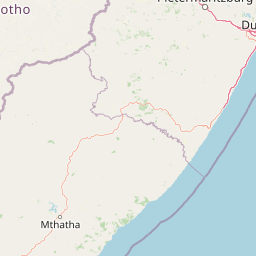
Map view of Impendle Nature Reserve

Use this park location map to pinpoint Impendle Nature Reserve in South Africa, understand its exact geographic position, and read its mapped placement within the surrounding landscape more clearly.

Pigeon | © OpenStreetMap contributors

Location context for Impendle Nature Reserve

KwaZulu-Natal
Park atlas

Compare regional park geography and adjacent grassland conservation areas

Explore Parks Near Impendle Nature Reserve and Surrounding Protected Landscapes

Visitors exploring Impendle Nature Reserve can continue browsing nearby protected areas and regional reserves across the surrounding landscape. Comparing adjacent park geography reveals broader patterns in highland conservation and regional terrain.
A watercolor illustration featuring soft, green rolling hills in the foreground with pale, layered mountain peaks in the background, set against a plain white field.
Protected areaKwaZulu-Natal
About 24 km away#1 closest

West

Maloti-Drakensberg Park Geography: Mountain Escarpments and Alpine Plateau Exploration

A transboundary protected landscape spanning South Africa and Lesotho

Spanning the core of the Drakensberg mountain system, Maloti-Drakensberg Park provides a unique window into high-altitude biodiversity and geological drama. The protected area features basalt cliffs, rolling valleys, and an extensive plateau, forming a critical ecological and cultural corridor. This atlas entry covers the topographic features and spatial distribution of one of southern Africa's most significant protected landscapes.

Area
2,493.13 km²
Established
2001
Relief
Mountain
Climate
Alpine
Protected areaKwaZulu-Natal
About 24 km away#2 closest

Northwest

uKhahlamba-Drakensberg Park: Protected Mountain Landscapes and Escarpment Geography in South Africa

Exploring the basalt cliffs and alpine plateau of KwaZulu-Natal.

uKhahlamba-Drakensberg Park encompasses an expansive protected region where the Drakensberg escarpment rises sharply from the foothills of KwaZulu-Natal. This atlas record details the park landscape, including its transition from sandstone terraces to high-altitude basalt, its extensive river gorges, and the concentration of archaeological cave sites. Use this resource to understand the geographic scale of this transboundary conservation area.

Area
2,429.13 km²
Relief
Mountain
Climate
Temperate
Access
Access unknown
Nature reserveKwaZulu-Natal
About 57 km away#3 closest

Southwest

Coleford Nature Reserve: Protected Grasslands and Wetlands in KwaZulu-Natal

Tracing the landscape of a key Drakensberg foothill reserve

The Coleford Nature Reserve represents a critical protected area in the Southern Drakensberg, featuring threatened Drakensberg Foothill Moist Grassland. Its landscape is defined by the Ngwagwane River valley and diverse wetland systems, providing essential habitat for endangered bird species. This reserve functions as a gateway to the broader montane geography of the southwestern KwaZulu-Natal region.

Area
12.72 km²
Established
1948
IUCN
IV
Relief
Highland
Nature reserveKwaZulu-Natal
About 66 km away#4 closest

Southwest

Ntsikeni Nature Reserve: High-Elevation Wetland Geography and Protected Landscape Atlas

A remote Drakensberg foothills wetland and montane grassland reserve.

Ntsikeni Nature Reserve is recognized as the largest and one of the highest wetlands in South Africa. Located in the KwaZulu-Natal province, this protected area features a unique, misty plateau landscape that sustains diverse orchid flora and essential headwater ecosystems. Use these geographic maps to examine the terrain, park boundaries, and the ecological transition between rolling foothills and the Drakensberg escarpment.

Area
92.87 km²
Established
1978
Relief
Upland
Climate
Temperate
National parkQacha's Nek District
About 78 km away#5 closest

West

Sehlabathebe National Park: Mapped Protected Landscape in Lesotho's Maloti Mountains

Explore high-altitude terrain, waterfalls, and ancient rock art sites.

Sehlabathebe National Park stands as a protected national park within the rugged Maloti Mountains of Lesotho's Qacha's Nek District. This destination is vital for understanding the geographic context of protected areas, featuring dramatic cliffs, iconic waterfalls like Tsoelikana, and numerous rock art sites that speak to its cultural and historical significance. Its high-altitude Afro-Alpine and sub-alpine ecosystems offer unique landscape characteristics and support notable biodiversity, making it a key point of interest for atlas-driven exploration of natural and protected terrains.

Area
69.5 km²
Established
1969
IUCN
IV
Relief
Mountain
Wildlife reserveKwaZulu-Natal
About 88 km away#6 closest

North

Weenen Game Reserve: Wildlife and Restored Acacia Savanna in Inland KwaZulu-Natal

A mapped wildlife reserve and ecological restoration project

Located in the inland reaches of KwaZulu-Natal, Weenen Game Reserve represents a significant success in landscape recovery. The reserve protects a distinct mix of dry tall grassveld, dense thornveld, and valley bushveld, providing critical habitat for black and white rhinoceros, giraffe, and numerous bird species. This atlas entry details the physical terrain, drainage lines, and the engineering history that transformed the land into a functioning sanctuary.

Area
50.09 km²
Established
1975
Relief
Upland
Climate
Subtropical
Nature reserveKwaZulu-Natal
About 106 km away#7 closest

Southwest

Mount Currie Nature Reserve: A Detailed Geographic Atlas of KwaZulu-Natal Mountains

High-altitude wetlands and protected Drakensberg foothills

Mount Currie Nature Reserve encompasses a rugged expanse of Drakensberg foothills characterized by sharp dolerite cliffs and expansive central wetland systems. This protected area acts as a crucial ecological intersection, bridging montane grassland and Afromontane forest patches while providing a sanctuary for diverse avian life and significant cultural heritage sites.

Area
17.77 km²
Established
1980
IUCN
IV
Relief
Mountain
A soft watercolor painting of a serene landscape with rolling hills in the background; a body of water in the midground; and grassy plains with a few scattered trees in the foreground.
Nature reserveKwaZulu-Natal
About 113 km away#8 closest

North

Spioenkop Dam Nature Reserve: Mapping KwaZulu-Natal Reservoir Landscapes and Heritage

Explore aquatic habitats and historic inland terrain.

Spioenkop Dam Nature Reserve serves as a focal point for protected biodiversity and historical land use in KwaZulu-Natal. The reserve spans a significant impoundment, creating a verdant aquatic habitat that contrasts with the surrounding grasslands and woodland terrain. Users can examine the park's boundaries and topographic features, including the historic Spion Kop battlefield that rises above the reservoir to anchor the northern landscape.

Area
44 km²
Established
1975
Relief
Upland
Climate
Temperate

Common questions about visiting, size, designation, and location context for Impendle Nature Reserve

Impendle Nature Reserve FAQs for park facts, access, geography, and protected area context

Find quick answers about Impendle Nature Reserve, including protected-area facts, park geography, trail and visitor context, and how the park fits into its surrounding country and regional landscape.
MoriAtlas Explorer

Continue Your Protected Areas Search Across the Global Atlas

Deepen your exploration by continuing the structured search for national parks and protected areas worldwide. Utilize the comprehensive filtering capabilities to compare different conservation landscapes and refine your understanding of global park geography. Discover more about the distribution and characteristics of protected natural areas.

Global natural geography