
Mori Atlas logo
Nature reserveIn der Erbach bei Mörlenbach

Mapping the ecological mosaic of wet meadows, reedbeds, and Odenwald terrain

In der Erbach bei Mörlenbach Nature Reserve: A Protected Stream Valley in Hessen

(Naturschutzgebiet In der Erbach bei Mörlenbach)

In der Erbach bei Mörlenbach represents a vital nature reserve situated in the Odenwald uplands of southern Hessen. This compact protected area serves as an essential stream corridor, preserving a diverse landscape of wet meadows, sedge stands, reedbeds, and traditional orchard patches. By tracing the Erbach stream as it winds through its narrow side valley, the area offers a focused look at the characteristic moisture-influenced habitats that define the local Bergstraße district.

OdenwaldSouthern HesseBergstraße districtstream valleywet meadowreedbed
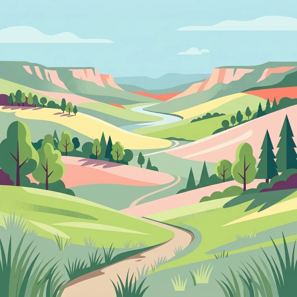
A colorful vector style illustration showing a winding dirt path through green and pink rolling hills with scattered trees and a river flowing through a valley in the distance under a blue sky.

In der Erbach bei Mörlenbach

Nature reserve

Park overview

Structured park overview, official facts, and landscape profile for In der Erbach bei Mörlenbach

In der Erbach bei Mörlenbach park facts, protected area profile, and essential visitor context

Review the core facts for In der Erbach bei Mörlenbach, including designation, size, terrain, visitor scale, habitats, and operating context in one park-focused overview.

About In der Erbach bei Mörlenbach

In der Erbach bei Mörlenbach is a small German nature reserve located in the Vorderer Odenwald, in the southern part of the Bergstraße district in Hesse. The reserve follows a short tributary valley of the Weschnitz river system: the Erbach stream, which rises in the wooded uplands near Mörlenbach and flows broadly northwest through the protected area before crossing under the B 38 federal road and joining the Weschnitz near Klein-Breitenbach.

The protected area is bounded to the south by the L 3120 state road and to the northeast by the L 3409, which helps define a clearly delimited valley and slope unit. This side-valley character is essential to the reserve's identity; the Erbach shaper has carved a narrow, moisture-retaining trough out of the Odenwald uplands, and the protected landscape combines the valley floor with the adjoining slopes and forest patches that rise away from it.

Administratively, the reserve is jointly located within the areas of the communities of Mörlenbach and Rimbach, making it a shared community resource. It is part of the broader Geo-Naturpark Bergstraße-Odenwald, a UNESCO Global Geopark-region network that links geological, ecological, and cultural landscape features across the Bergstraße and Odenwald regions.

Ecologically, the reserve is oriented toward habitat conservation rather than strict wilderness preservation. Its small size contrasts with the diversity of habitat types packed into the valley: moist grassland, reeds and sedges, shrub communities, traditional orchard meadows, and fragments of woodland sit side by side. This combination reflects centuries of small-scale agricultural use of the valley floor, interrupted and enriched by the natural moisture gradient of the stream corridor.

Quick facts and research context for In der Erbach bei Mörlenbach

In der Erbach bei Mörlenbach is a designated nature reserve, designated in December 1997 under the identifier 1431027 and registered internationally in the World Database on Protected Areas under WDPA ID 318598.

The reserve sits in the Vorderer Odenwald, within the Weschnitztal natural area, and is bordered by the L 3120 to the south and the L 3409 to the northeast. It lies inside the Geo-Naturpark Bergstraße-Odenwald and shares its locality between the communities of Mörlenbach and Rimbach in the Bergstraße district of southern Hesse.

Ecologically it functions primarily as a habitat protection area, focusing on moisture-influenced valley habitats such as wet meadows, reedbeds, sedge communities, shrubs, traditional orchard meadows, and adjacent woodland.

Protection and recognition

Documented terrestrial protection metrics and established conservation records

In der Erbach bei Mörlenbach Protection Status and Designation History

Terrestrial protection status for In der Erbach bei Mörlenbach anchors its documented designation history established in 1997. Official conservation data outlines the recorded management scope and administrative framework supporting the protected landscape.

Protection details

Protection scope
Terrestrial
Designated year
1997
Transboundary protection
No
WDPA ID
318598
Park context

Deeper park guide and search-rich context for In der Erbach bei Mörlenbach

In der Erbach bei Mörlenbach history, landscape, wildlife, and travel context

Explore In der Erbach bei Mörlenbach through its history, landscape character, ecosystems, wildlife, conservation priorities, cultural context, and seasonal travel timing in a structured park guide built for atlas discovery and search intent.

Why In der Erbach bei Mörlenbach stands out

The reserve is best known for its compact, moisture-influenced side-valley landscape (the Erbach valley north east of Mörlenbach), where wet meadows, reedbeds, sedge stands, and old orchard habitats create a small but ecologically rich traditional Odenwald stream corridor. It is also recognized locally as part of the network of small nature reserves that buffer and extend the protected landscape of the Weschnitz valley system within the Geo-Naturpark Bergstraße-Odenwald.

A common starling with iridescent dark plumage and yellow beak clings to a tree trunk, feeding chicks visible inside a tree hollow, with blurred green foliage in the background.
A common starling perched on a tree trunk feeds its young in a nest cavity within the In der Erbach bei Mörlenbach nature reserve.

In der Erbach bei Mörlenbach history and protected-area timeline

In der Erbach bei Mörlenbach was formally placed under nature protection on 13 December 1997, with the official identifier 1431027. The designation came under the German federal and state nature conservation framework and was motivated by a desire to secure the moist Erbach valley and the adjoining slopes from further intensification, drainage, or land-use change.

The reserve belongs to the broader administrative inventory of protected areas inherited through the Landkreis Bergstraße, and it sits within the framework of the Geo-Naturpark Bergstraße-Odenwald, a regional network established to coordinate conservation, geotourism, and landscape management across the Bergstraße and Odenwald regions of Hesse, Bavaria, and Baden-Württemberg.

The 1997 designation reflected an established pattern of small valley reserves in the southern Odenwald, where traditional stream-valley land use (hay meadows, pasture, orchards, and adjacent forest) had been gradually replaced by more intensive or abandoned uses, prompting protective action to halt the loss of habitat diversity. Like many neighbouring reserves (such as the Weschnitzaue von Rimbach und Mörlenbach), it functions as a locally anchored but regionally connected piece of the broader Bergstraße-Odenwald conservation mosaic.

In der Erbach bei Mörlenbach landscape and geographic character

The landscape of the reserve is defined by a narrow side valley of the Odenwald uplands. The Erbach stream flows in a broadly northwesterly direction through the area, deepening a small trough that opens out as it approaches the federal road B 38 and then continues through the small industrial area before draining leftwards into the Weschnitz river near Klein-Breitenbach.

The valley floor is bordered by gentle to moderate slopes, and the transition between flat, moist valley land and the rising, better-drained hillside forest is one of the defining visual features of the area. The lower valley bottom holds open meadows and wet communities, while the slopes and valley shoulders carry mixed forest cover.

Land access is shaped by the surrounding transport infrastructure: the L 3120 runs along the southern edge of the valley, and the L 3409 bounds it to the northeast. Together with the B 38 in the west, these roads create a clearly framed valley segment. Above and beyond the reserve, the Vorderer Odenwald continues as a densely wooded, gently rolling upland with sandstone-derived soils that give the wider region its characteristic forest, valley, and stream pattern.
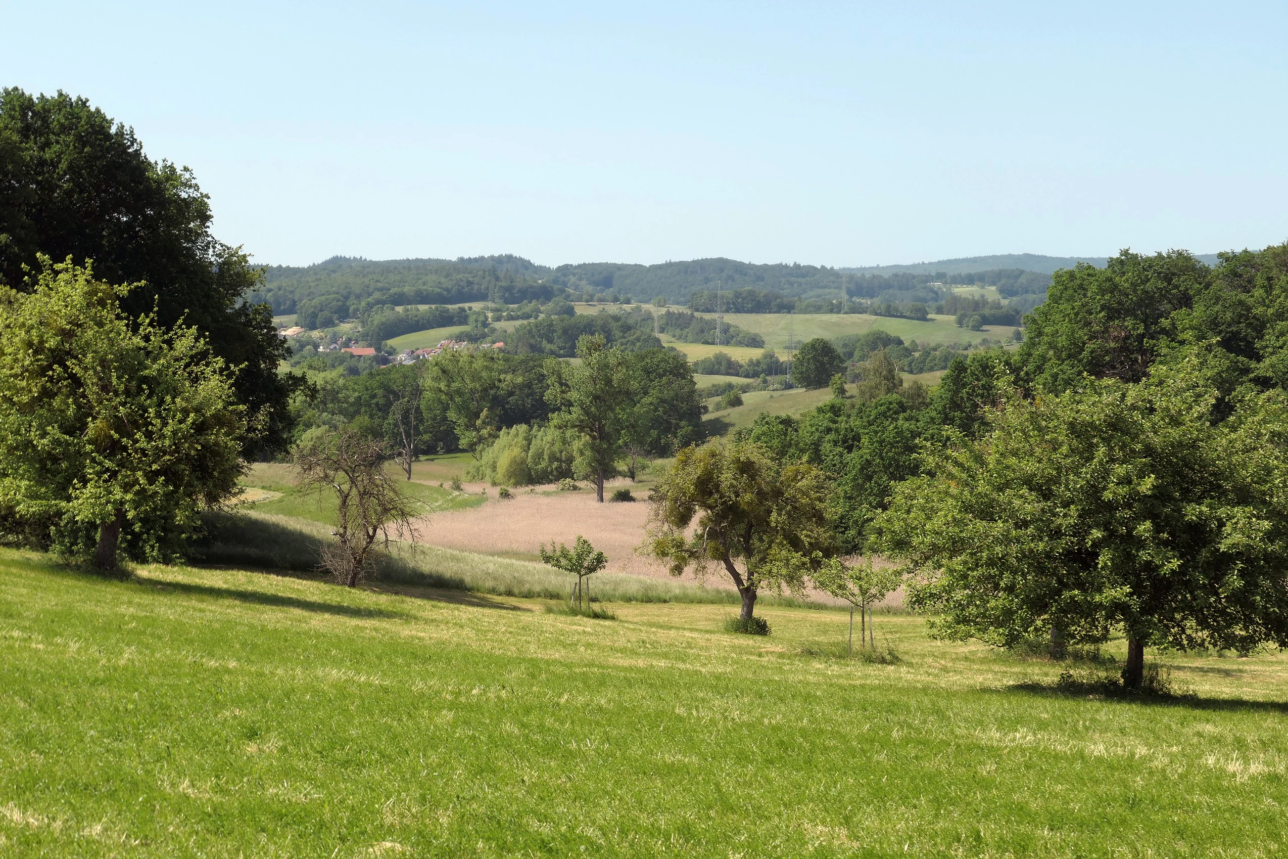
A wide landscape view of a rural nature reserve featuring green grassy meadows in the foreground, scattered trees and a brown plowed field in the midground, and forested hills under a clear blue sky in the background.
View of the In der Erbach bei Mörlenbach nature reserve showing green meadows, scattered trees, and forested hills in the distance.

In der Erbach bei Mörlenbach ecosystems, habitats, and plant life

Ecologically, the reserve is a compact mosaic of moisture-dependent and traditional cultural landscape habitats. The valley floor is dominated by wet meadow communities, reedbeds (Röhricht), and sedge-dominated marsh vegetation; together these create the moist core of the protected area and support the rare or sensitive plant and invertebrate communities associated with healthy lowland stream corridors.

Around and above the wet valley habitats, the landscape grades into drier grassland, tall-herb communities, and shrubs. Traditional orchard meadows (Streuobst) survive as a cultural-ecological layer, combining fruit trees with regularly mown or grazed undergrowth; these are particularly important for pollinators, cavity-nesting birds, and the long-term maintenance of regional agrobiodiversity.

The slopes and valley shoulders, finally, carry mixed deciduous and coniferous forest that links the reserve to the broader Odenwald woodland matrix. The combination of forest, scrub, wet meadow, reedbed, sedge marsh, and orchard in such a small area gives the reserve an unusually high habitat diversity relative to its size, and contributes meaningfully to landscape permeability for species moving along the Weschnitz tributary system.
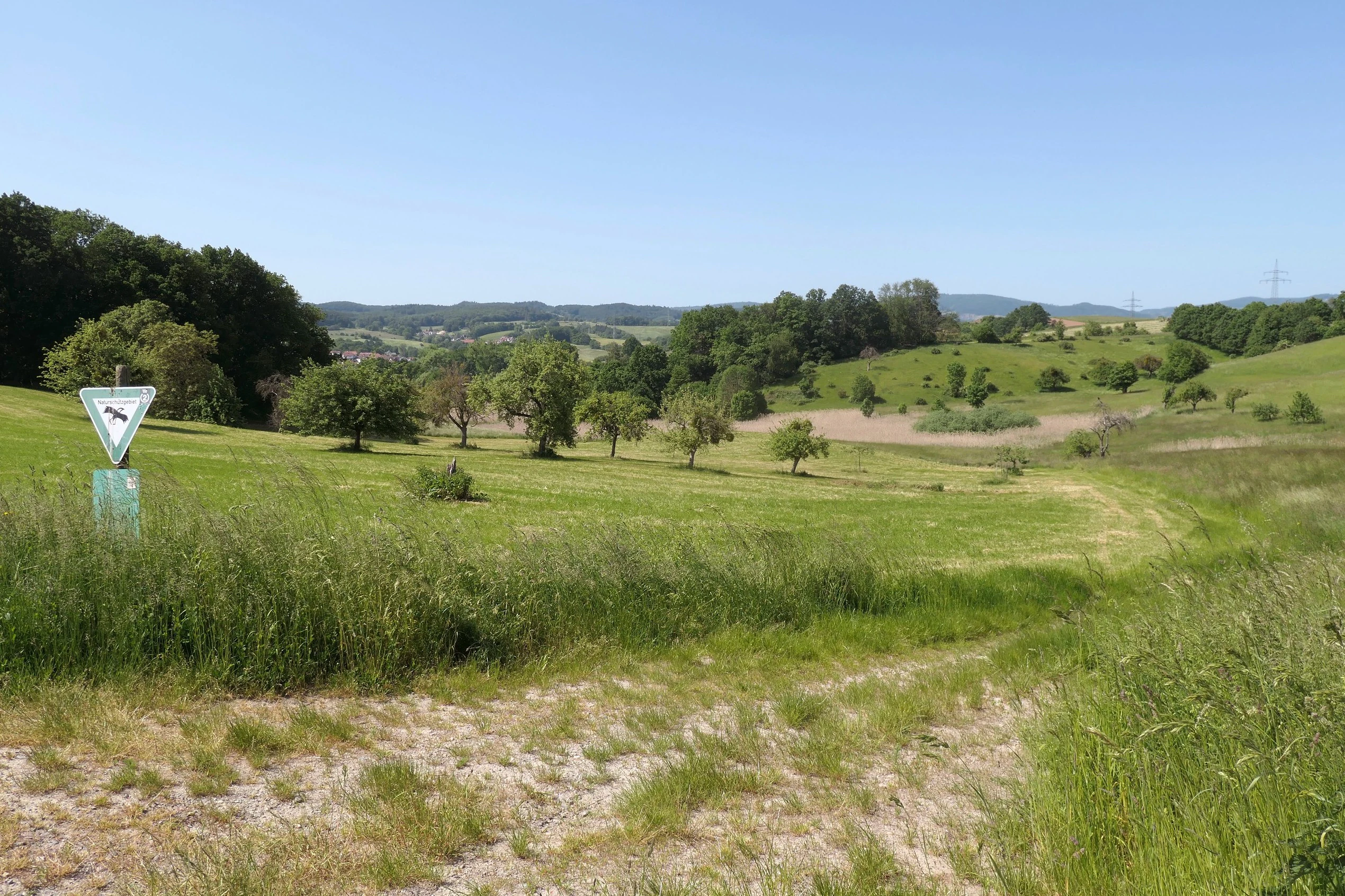
A grassy meadow landscape with scattered trees and a forest edge under a clear blue sky, featuring a triangular nature reserve sign in the left foreground.
View of the In der Erbach bei Mörlenbach nature reserve showing grassy meadows, scattered trees, and a triangular nature reserve sign in the foreground.

In der Erbach bei Mörlenbach wildlife and species highlights

The reserve's combination of open wet habitats, shrubs, orchard trees, and adjacent forest provides habitat for a wide range of woodland, meadow, and wetland-associated bird species, including typical Odenwald lowland valley birds. Photographs from the reserve document breeding behaviour of common starlings in the area, and the mix of orchard trees and lush understorey supports cavity-nesting and shrub-nesting species typical of small German stream valleys.

Wet meadow, reedbed, and sedge communities provide habitat for the invertebrates, amphibians, and small mammals associated with healthy lowland stream corridors, while the surrounding woodland edges and orchard trees provide foraging and nesting habitat for a broader community of forest-edge species. The reserve participates in the regional ecological network that allows species to move along the Weschnitz and its tributaries.

In der Erbach bei Mörlenbach conservation status and protection priorities

In der Erbach bei Mörlenbach is classified as an IUCN Category IV protected area, corresponding to a Habitat/Species Management Area. The reserve is internationally recorded in the World Database on Protected Areas under WDPA ID 318598.

Conservation objectives focus on maintaining the moisture-influenced valley landscape and its associated habitat types: wet meadows, reedbeds, sedge stands, shrub communities, traditional orchard meadows, and adjacent woodland. By protecting the Erbach valley and its slopes, the designation also helps maintain ecological connectivity within the Weschnitz river's tributary network, buffering stream-valley habitats against drainage, agricultural intensification, and conversion to other land uses.

Within the Geo-Naturpark Bergstraße-Odenwald, the reserve is one of many small, technology-light, habitat-focused reserves that together form the conservation backbone of the UNESCO-related regional geopark network. Its value lies less in landscape grandeur than in preserving a functional, diverse, lowland-Odenwald valley habitat at a scale where targeted management can produce tangible biodiversity outcomes.

In der Erbach bei Mörlenbach cultural meaning and human context

The reserve encodes an older cultural pattern of land use in the southern Odenwald. The combination of wet meadows, orchard meadows, and adjoining woodland reflects centuries of small-scale farming: mowing and grazing the valley floor, planting fruit trees on the valley edges, and using the slopes for wood, forage, and limited grazing.

The valley communities of Mörlenbach and Rimbach share this landscape between them, and the protected area continues to function as a shared local landscape element as much as a purely ecological reserve. Within the broader Geo-Naturpark Bergstraße-Odenwald network, the reserve sits amid a regional effort to acknowledge traditional land-use practices as part of the cultural-ecological heritage of the Odenwald.

Top sights and standout views in In der Erbach bei Mörlenbach

Highlights include the compact, moisture-defined side-valley setting of the Erbach stream; the unusual density of habitat types within a small area (wet meadows, reedbeds, sedge stands, shrubs, orchard meadows, and forest edge); and its role as one of the many valley reserves that link the Vorderer Odenwald to the larger Weschnitz tributary system.

The reserve also stands out for its embedded role in the Geo-Naturpark Bergstraße-Odenwald, contributing a typical, well-preserved example of southern Odenwald stream-valley landscape to the regional geopark's portfolio of protected areas.

Best time to visit In der Erbach bei Mörlenbach

The reserve can be appreciated in any season when conditions allow safe walking on valley paths, but late spring through early autumn is generally the most rewarding period. From late spring onward, wet meadow and reedbed vegetation is at its most expressive, reedbeds and sedge stands look their best, and traditional orchards near the valley edges often show flowering and fruiting cycles typical of the southern Odenwald.

Winter, particularly on calm, cold mornings, can produce the still, misty reedbed scenes the area is locally known for, as documented in winter photography of the reserve. Wet conditions, especially after rainfall, can make the valley floor paths muddy; drier spells in spring and summer usually offer easier access. As with all visits to small stream-valley reserves, staying on marked paths reduces disturbance to ground-nesting birds and sensitive wet meadow vegetation.

Monthly climate preview

Long-term temperature ranges and precipitation patterns across representative coordinates

In der Erbach bei Mörlenbach Climate Normals and Monthly Weather Records

Representative coordinate measurements reveal the multi-year temperature fluctuations and daily precipitation rhythms recorded at In der Erbach bei Mörlenbach. Detailed monthly averages provide comprehensive baseline data for analyzing long-term meteorological trends within Hessen.
Annual mean10 °C
0 °C20 °C
Jan
Feb
Mar
Apr
May14°
Jun18°
Jul20°
Aug20°
Sep15°
Oct10°
Nov
Dec
Warmest month
July

20.3 °C

Coolest month
January

0.1 °C

Wettest month
July

2.4 mm/day

Driest month
April

1.5 mm/day

Park location guide

Geography guide, regional context, and park location map for In der Erbach bei Mörlenbach

In der Erbach bei Mörlenbach park geography, regions, and map view in Germany

Understand where In der Erbach bei Mörlenbach sits in Germany through a broader geographic reading of the surrounding landscape, nearby location context, and its mapped position within the national park landscape.

How In der Erbach bei Mörlenbach fits into Germany

Germany is a federal republic in Western and Central Europe with a population of over 83 million across sixteen constituent states. It is Europe's largest economy by nominal GDP and a major global exporter and importer. The capital is Berlin, and the country borders Denmark, Poland, Czech Republic, Austria, Switzerland, France, Luxembourg, Belgium, and the Netherlands.

Wider geography shaping In der Erbach bei Mörlenbach in Germany

Germany is located in Western and Central Europe, spanning 357,022 km². It borders Denmark to the north, Poland and the Czech Republic to the east, Austria and Switzerland to the south, and France, Luxembourg, Belgium, and the Netherlands to the west. The country has coastlines on the Baltic Sea and North Sea to the north, with the Alps located in the southern region.

Map view of In der Erbach bei Mörlenbach

Use this park location map to pinpoint In der Erbach bei Mörlenbach in Germany, understand its exact geographic position, and read its mapped placement within the surrounding landscape more clearly.

Pigeon | © OpenStreetMap contributors

Location context for In der Erbach bei Mörlenbach

Hessen

Visualizing habitats, stream valley terrain, and protected area characteristics

In der Erbach bei Mörlenbach Photos and Landscape Scenery Exploration

Visual documentation captures the moist stream valley terrain, wet meadows, and traditional orchard habitats that define In der Erbach bei Mörlenbach. Examining field photography reveals the ecological composition of the protected Odenwald landscape and its surrounding forested slopes.

A common starling with iridescent dark plumage and yellow beak clings to a tree trunk, feeding chicks visible inside a tree hollow, with blurred green foliage in the background.

A landscape photograph showing a misty morning over a field of tall dry reeds in the foreground, with a green field to the right, scattered trees, and a line of trees on a distant hill under a pale sky.

A wide landscape view of a rural nature reserve featuring green grassy meadows in the foreground, scattered trees and a brown plowed field in the midground, and forested hills under a clear blue sky in the background.

A grassy meadow landscape with scattered trees and a forest edge under a clear blue sky, featuring a triangular nature reserve sign in the left foreground.

Park atlas

Compare nearby Odenwald stream valleys and regional protected landscapes

Other Parks Near In der Erbach bei Mörlenbach and Surrounding Protected Areas

Browse other nature reserves and protected areas located near In der Erbach bei Mörlenbach in southern Hesse. Continuing into adjacent stream-valley habitats reveals the broader ecological patterns of the surrounding Odenwald uplands.
Watercolor painting of a green wetland landscape with a winding stream and distant hills in soft pastel colors.
Nature reserveHesse
About 2.8 km away#1 closest

North

Albersbacher Riedwiesen Nature Reserve: Mapped Geography and Protected Landscapes in Hesse

A detailed atlas view of the Albersbach stream valley conservation corridor.

Situated in the Weschnitz valley region of Hesse, the Albersbacher Riedwiesen nature reserve offers a concentrated look at traditional Odenwald landscapes. The area protects a unique combination of wet meadows, reedbeds, and dry grasslands that follow the natural meandering course of the Albersbach stream, providing a vital study in local geomorphology and conservation geography.

Area
0.124 km²
Established
1996
Nature reserveHesse
About 5.3 km away#2 closest

South

In der Striet bei Vöckelsbach Nature Reserve: Regional Geography and Mapped Protected Landscapes

A compact forest and wetland mosaic in the Odenwald of southern Hesse

The nature reserve In der Striet bei Vöckelsbach is an essential protected area covering four and a half hectares of valley floor. It provides a dense habitat gradient from reeded spring zones through alder forests to mixed deciduous slopes. This record details the park landscape, stream systems, and its integration into the larger Geo Naturpark Bergstraße Odenwald and Natura 2000 protected areas.

Area
0.048 km²
Established
1988
A watercolor painting depicting a soft-focus, light-colored landscape of rolling green hills, clustered trees, and a gentle stream valley.
Nature reserveHessen
About 8.9 km away#3 closest

Southeast

Eiterbachtal von Wald-Michelbach Nature Reserve in the Central Odenwald Uplands

A protected stream-valley landscape in the Bergstraße district of Hessen

Eiterbachtal von Wald-Michelbach protects a near-natural stream environment characterized by its meandering course, alder-ash gallery forests, and diverse tall-herb meadow communities. This nature reserve provides essential habitat in the southern Odenwald, showcasing the interplay between hydrological stream processes and sandstone forest edges within the Hessen region.

Area
0.473 km²
Established
1983
IUCN
IV
Relief
Upland
A horizontal watercolor illustration of a soft, rolling landscape with a central winding path or stream, green meadows, distant hills, and foreground trees and flowers.
Nature reserveHesse
About 9.2 km away#4 closest

Northeast

Gras-Ellenbacher Wiesen Nature Reserve: Protected Valley Basin Geography and Map Overview

Wet meadows and seepage habitats within the Odenwald hills

Situated in a gentle hollow near the Dachsberg and Kirchberg ridges, Gras-Ellenbacher Wiesen represents an essential Hessian nature reserve. This overview highlights the interplay between the Ulfenbach stream, drainage infrastructure, and traditional meadow management that defines this distinct sandstone upland protected landscape.

Area
0.241 km²
Established
1981
IUCN
IV
Relief
Upland
Watercolor painting of soft, rolling green hills and meadows in a minimalist style, set against a light background.
Nature reserveHessen
About 9.5 km away#5 closest

Southeast

Dürr-Ellenbachtal von Wald-Michelbach: Odenwald Nature Reserve and Protected Valley Geography

A historic meadow valley in Hessen, Germany

The Dürr-Ellenbachtal von Wald-Michelbach nature reserve protects an elongated, narrow valley framed by forested ridges in the central Odenwald. This area is defined by its meandering brook, diverse alder stands, and species-rich meadows that sustain significant local biodiversity. As a key Natura 2000 site, it serves as an essential example of protected meadow landscapes and rural mountain terrain within the Bergstraße district.

Area
0.542 km²
Established
1990
IUCN
IV
Relief
Mountain
A wide watercolor painting showing rolling green hills and trees with pale pink and yellow hues across a valley landscape.
Nature reserveHessen
About 9.6 km away#6 closest

East

Rotes Wasser von Olfen Nature Reserve: Protected Wetland and Odenwald Geography

A unique bog and iron-rich stream landscape in Hessen, Germany.

Rotes Wasser von Olfen preserves a rare, small-scale mosaic of transitional bog and wet meadow vegetation within the Odenwald range. This protected site features reddish, iron-rich seepage waters and provides essential habitat for specialized flora and dragonfly populations amidst a surrounding forested mountain landscape.

Area
0.121 km²
Established
1980
IUCN
IV
Relief
Upland
A horizontal watercolor illustration of a soft green landscape with meadows, scattered trees, and distant rolling hills under a pale pink sky.
Nature reserveHessen
About 9.9 km away#7 closest

North

Schannenbacher Moor Nature Reserve: Geographic Overview and Protected Area Boundaries

Wetland and forest mosaic in the southern Hessian Odenwald

Schannenbacher Moor represents a significant protected area within Hessen, characterized by its combination of raised bog remnants, reedbeds, and near-natural floodplain woodlands. Framed by the Krehberg slopes and the Meerbach stream system, the reserve offers a rare example of low mountain bog ecology and biodiversity conservation. This mapped landscape provides essential data on the distribution of mire plant communities and bryophyte habitats in the region.

Area
0.162 km²
Established
1975
IUCN
IV
A watercolor painting of a pastoral landscape with soft green meadows, scattered trees, and distant purplish hills under a white sky.
Nature reserveHessen
About 11 km away#8 closest

Northwest

Magerrasen von Gronau mit angrenzenden Flächen Protected Landscape and Regional Geography

A network of calcareous meadows in the Odenwald foothills

Located in the Bergstraße district of Hessen, this protected area spans three distinct sub-areas characterized by nutrient-poor calcareous soils. These warm, sun-exposed meadows serve as an essential refugium for orchid diversity and specialized butterfly populations, standing as a representative example of successfully managed dry grassland ecosystems within the broader Geo-Naturpark Bergstraße-Odenwald.

Area
1.6 km²
Established
2004

Common questions about visiting, size, designation, and location context for In der Erbach bei Mörlenbach

In der Erbach bei Mörlenbach FAQs for park facts, access, geography, and protected area context

Find quick answers about In der Erbach bei Mörlenbach, including protected-area facts, park geography, trail and visitor context, and how the park fits into its surrounding country and regional landscape.
MoriAtlas Explorer

Continue Your Protected Areas Search Across the Global Atlas

Deepen your exploration by continuing the structured search for national parks and protected areas worldwide. Utilize the comprehensive filtering capabilities to compare different conservation landscapes and refine your understanding of global park geography. Discover more about the distribution and characteristics of protected natural areas.

Global natural geography