
Why Inselrhein stands out
Inselrhein is best known for its chain of eight Rhine islands and adjoining floodplain forests between Mainz and Bingen, and for the exceptional birdlife that depends on its still waters, gravel banks, and softwood and hardwood floodplain woodlands. The islands act as a refuge for wintering duck species such as goldeneye, tufted duck, and goosander; year-round residents like great crested grebes, cormorants, and grey herons; and migratory waders that pause on sandbanks and wet meadows during seasonal movements. The combination of river dynamics, protected landscape status, and proximity to major cultural landscapes such as the Rheingau wine region adds to the area's distinct identity.
Inselrhein history and protected-area timeline
The historical development of Inselrhein is closely bound to the hydrological engineering of the Upper Rhine during the 19th and 20th centuries. Original straightening and flood-control works connected several former islands to the mainland, reducing what was once a more extensive archipelago to the eight genuine islands preserved today.
In the late 20th century a shift toward ecological restoration and protective designation brought the surviving islands, adjoining groynes, still waters, and undeveloped banks under a layered system of national nature reserves (Naturschutzgebiete), European FFH designations, and Ramsar Convention wetland listings for the most important Auen. The broader area was also designated as the EU Birds Directive site Inselrhein (5914-450), extending the spatial reach of protection downstream into the Middle Rhine near Lorch.
The protection history reflects a broader European trend: as large rivers such as the Rhine were increasingly channelized, the surviving side arms, gravel banks, and floodplain forests gained outsized conservation significance. Within Germany, the Inselrhein became a focal point of auwald (floodplain forest) research and management, including studies of pedunculate oak silviculture in the floodplain forests documented in Forest Faculty publications from Göttingen.
Inselrhein landscape and geographic character
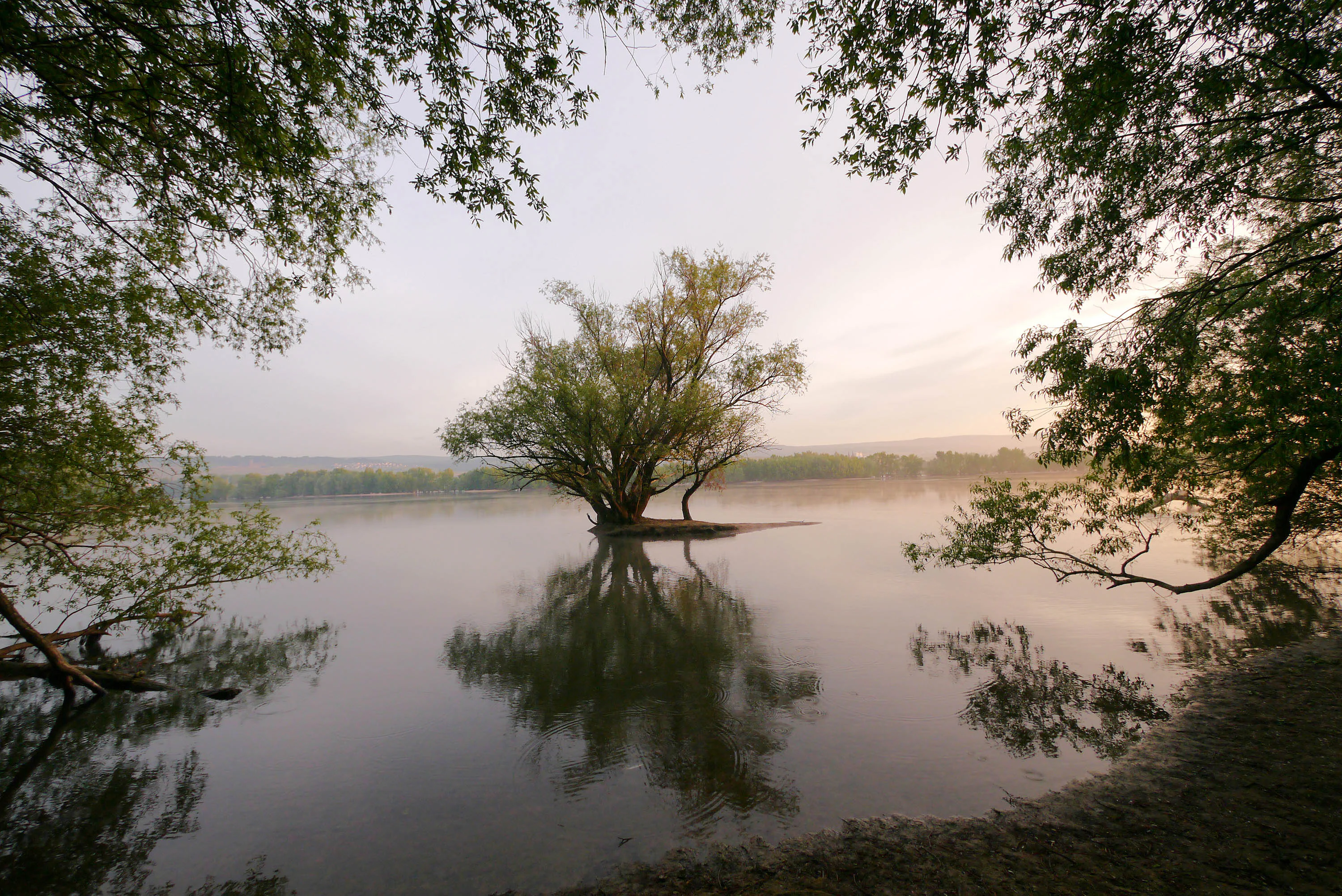
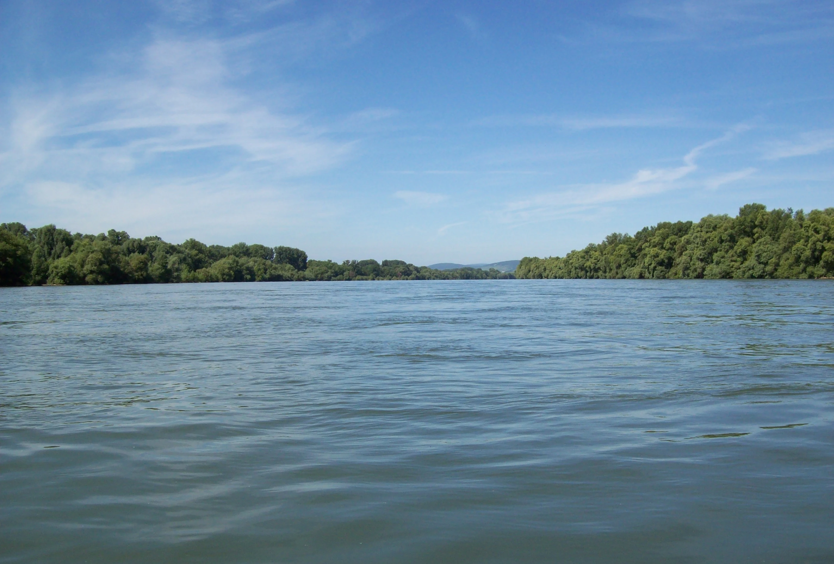
The landscape of Inselrhein is shaped by a wide, relatively flat stretch of the Upper Rhine, bordered by the urban edge of Mainz to the east and the opening slopes of the Rheingau to the north. The river here is comparatively broad and slow, divided into main channels and quieter side arms, and woven between low-lying islands that rise only slightly above the average water level.
The terrain of the individual Auen is gently undulating, marked by shallow ridges, sandbanks (visible at low water between islands such as the Ilmenaue and Fulderaue), and relict oxbow-like channels such as the Sandlache near Wiesbaden. Groynes and low training walls define many of the still-water zones, while unprotected stretches of bank retain a more natural shoreline profile. West of Bingen, the topography changes abruptly: the Rhine narrows toward the Binger Loch, the valley walls close in, and the island landscape gives way to the characteristic narrow gorge scenery of the Middle Rhine.
Vegetation patterns follow this topography closely. Near the waterline, softwood floodplain communities of willows and poplars colonize frequently flooded zones, while interior portions of the islands support hardwood stands of ash, elm, and pedunculate oak on slightly higher ground. The contrast between the flat, water-dominated island landscape and the steep vineyard-covered slopes of the adjacent Rheingau gives the area a strong visual identity.
Inselrhein ecosystems, habitats, and plant life
The floodplain forests (Auwälder) at Inselrhein are considered among the most species-rich habitats in Europe. Two main forest types dominate the islands: a softwood floodplain (Weichholzaue) of willows and poplans anchored in the regularly flooded shoreline zones, and a hardwood floodplain (Hartholzaue) of ash, elm, and pedunculate oak occupying less frequently inundated interior portions of the islands.
Still-water zones, old river arms such as the Sandlache and Niederwallufer Bucht, and undeveloped banks extend the habitat range beyond the forested islands. These wet environments support aquatic vegetation, serve as spawning grounds for vegetation-spawning fish and small fish species, and provide resting and feeding habitat for waterbirds and migratory waders. Wet meadows at the margins of the islands, such as the Rheinwiesen between Oestrich-Winkel and Geisenheim, further diversify the habitat mosaic and add value for both breeding and migratory birdlife.
Within the broader context of the Upper Rhine valley, where long stretches of the river have been heavily modified by engineering, the diversity preserved at Inselrhein, from the gravel banks at the river surface to the multi-layered floodplain forest canopy, gives the protected area an unusually rich ecological profile.
Inselrhein wildlife and species highlights
Wildlife at Inselrhein is dominated by birdlife, which uses the islands and still-water zones for wintering, breeding, and migration in unusually high concentrations. Winter visitors include goldeneyes, tufted ducks, and goosanders in sheltered side channels, while species such as common eiders, scaup, and other diving ducks concentrate in the calm waters around Auen such as the Fulderaue and Ilmenaue. Year-round residents include great crested grebes, cormorants, grey herons, and greylag geese, with cormorants nesting high in the canopy and grey herons breeding in the lower levels of the island forests at spots such as the Rüdesheimer Aue.
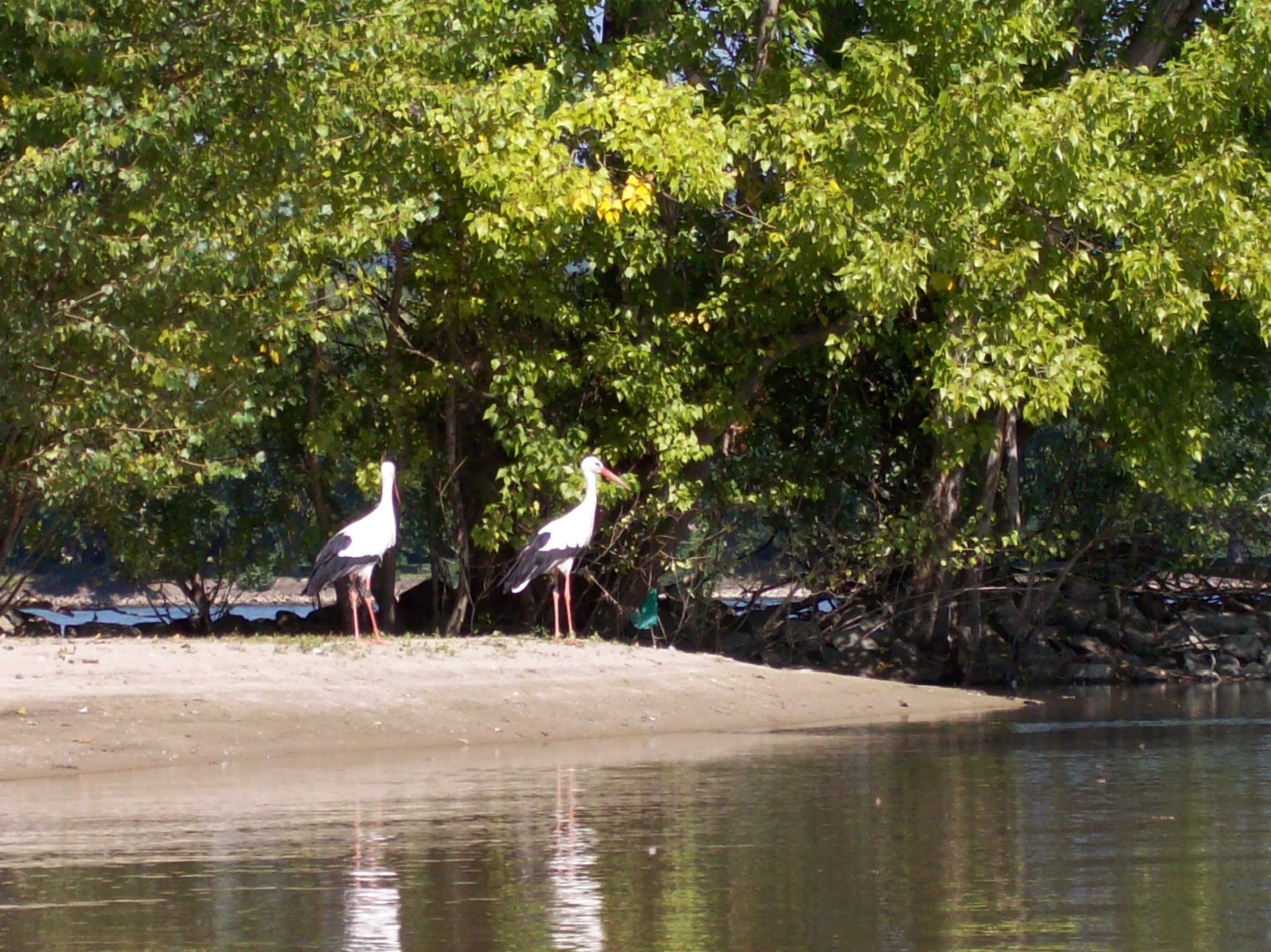
The floodplain forests harbour a rich community of woodland birds, with golden oriole, common nightingale, and black kite identified as characteristic species of the hardwood floodplain, and species such as the melodious warbler (Gelbspötter), orphean warbler, and common sandpiper recorded in the softwood and meadow zones. Sandbanks and wet meadows also draw migratory waders during seasonal movements. The middle spotted woodpecker, a threatened species, has been recorded along the Mariannenaue, and white storks have returned to several parts of the area in recent years.
The combined bird assemblage, along with the area's role as a Ramsar-listed wetland and part of the EU Birds Directive site Inselrhein (5914-450), makes the islands one of the most important sites for waterbird and woodland bird conservation along the entire German Rhine.
Inselrhein conservation status and protection priorities
The conservation significance of Inselrhein rests on the fact that it preserves a relatively intact archipelago-like stretch of one of Europe's most engineered major rivers. The eight remaining true islands, together with their adjoining groynes, still waters, and undeveloped banks, are protected through a layered network of national nature reserves, European FFH sites, and Ramsar Convention wetland listings.
Three of the Auen, the Mariannenaue, the Fulderaue-Ilmenaue complex, and the Rüdesheimer Aue, are formally recognized as Europareservate under the Ramsar Convention for their importance as habitats for waterbirds and migratory waders. The Fulderaue-Ilmenaue protected area covers roughly 341 hectares, while the Haderaue-Königsklinger Aue near Eltville spans about 165 hectares. Additional nature reserves, including the Rettbergsaue, Mombacher Rheinufer, Niederwallufer Bucht, Sandlache, Winkeler Aue, and Rheinwiesen von Oestrich-Winkel und Geisenheim, fill in the mosaic between larger Ramsar sites.
At the European level, the islands are part of the EU Birds Directive site Inselrhein (5914-450), which extends downstream into the Middle Rhine near Lorch, and inscribed in multiple FFH sites that protect the island forests, banks, and water habitats. The Auwald (floodplain forest) is regarded as one of the most species-rich biotope complexes in Europe, which gives the area a particular role in preserving declining floodplain forest communities that have largely disappeared elsewhere in the Rhine corridor.
The protected landscape is managed in cooperation with conservation organizations such as NABU, which operates the NABU-Naturschutzzentrum Rheinauen and the Auenservice programme, focusing on habitat maintenance, monitoring, and public outreach related to the area.
Inselrhein cultural meaning and human context
Inselrhein occupies a culturally strategic position in the Upper Rhine valley. The protected river section sits at the meeting point of the wine-growing Rheingau region to the north, with its vineyard slopes rising above the river at Bingen, Rüdesheim, and Oestrich-Winkel, and the city of Mainz, a major urban and historic centre, to the east across the Main confluence.
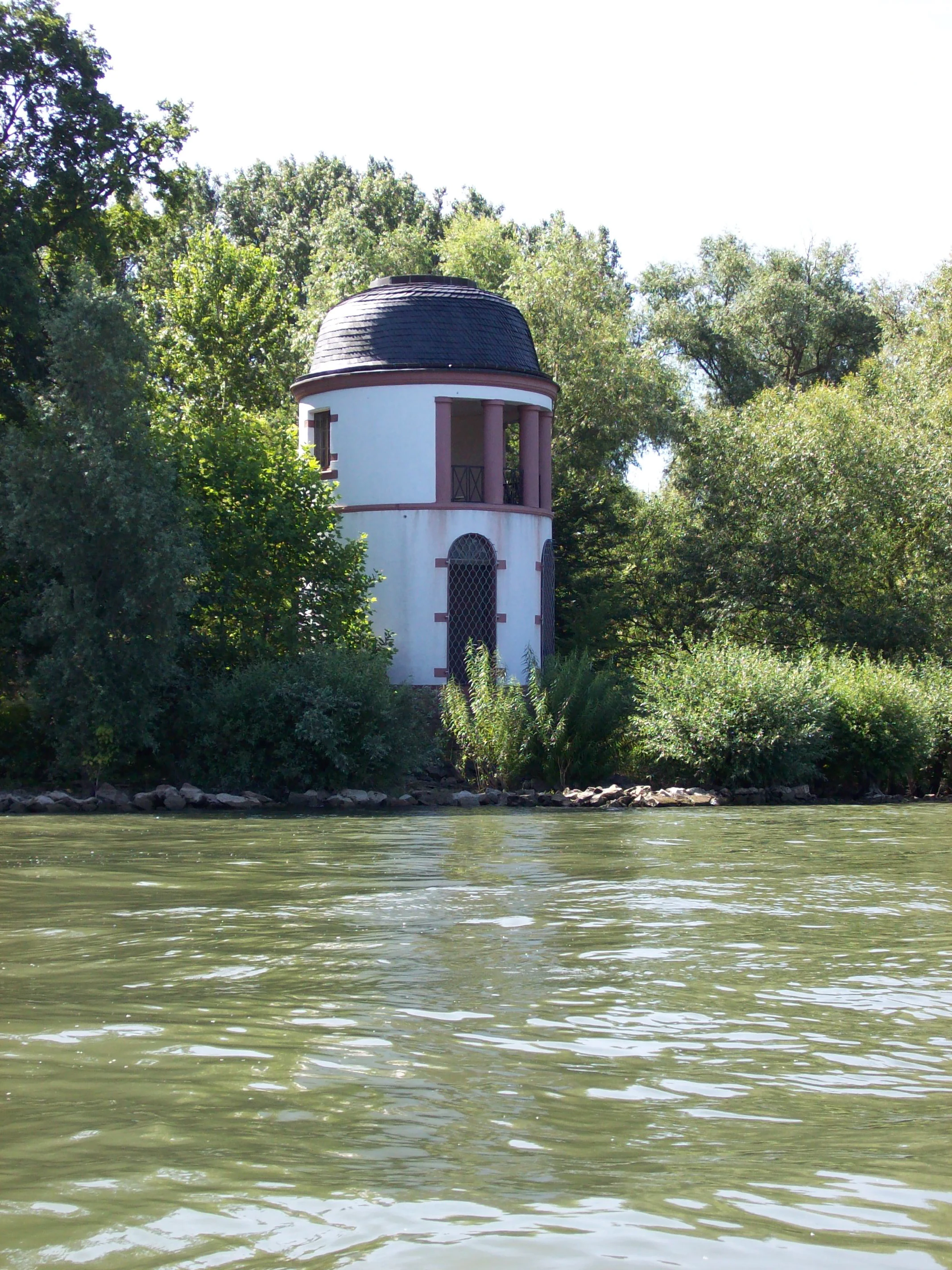
Local cultural ties to the islands have long been shaped by Rhine river culture. The Auen have historically been associated with fishing, river navigation, and small-scale agricultural use on the islands' meadows, and they remain a recognizable landscape feature for residents on both the Hessian and Rhineland-Palatinate banks. Sites such as the former Hindenburgbrücke piers still visible on the Ilmenaue give the landscape a visible layer of 20th-century infrastructure history against the protected natural environment.
At a broader regional level, Inselrhein serves as an ecological bridge between the more urbanized Rhine plain near Mainz and the deeply cultural Middle Rhine valley around the Binger Loch, integrating the protected floodplain landscape into a continuous Rhine corridor of high landscape and heritage value.
Top sights and standout views in Inselrhein
Inselrhein's strongest points of distinction are its eight surviving true river islands set within the Upper Rhine between Mainz and Bingen, the contiguous chain of nature reserves and FFH sites that protect them, and the combined Ramsar, Birds Directive, and FFH designations that underline the area's international wetland significance.
Equally distinctive are the layered floodplain forests, with softwood communities of willows and poplans along the frequently flooded edges and hardwood stands of ash, elm, and pedunculate oak on higher ground. The birdlife is a major draw in its own right, from wintering ducks on the still waters and breeding colonies of cormorants and grey herons to migratory waders on the sandbanks and the return of white storks. The setting, framed by the Mainz urban landscape on one side and the Rheingau vineyards on the other, gives the protected river corridor a strong visual and cultural identity.
Best time to visit Inselrhein
The seasonal character of Inselrhein is closely tied to its birdlife and the hydrological rhythm of the Rhine. Spring and early summer are typically the most rewarding periods for observing breeding woodland birds in the floodplain forests, including golden oriole, common nightingale, and black kite, as well as the layered breeding colonies of cormorants and grey herons on islands such as the Rüdesheimer Aue.
Autumn brings significant migratory activity, with large numbers of black kites assembling at roosts in high trees on islands such as the Rettbergsaue and a steady passage of waders along the wet meadows and sandbanks. Winter transforms the still waters into prime habitat for diving ducks, goldeneyes, tufted ducks, and goosanders, often supplemented by rarer species such as eiders and long-tailed ducks, particularly on the Fulderaue, Ilmenaue, and Mariannenaue.
Throughout the year, water-level fluctuations influence the visibility of gravel banks and the accessibility of side channels, so seasonal conditions at specific sites can vary; visitors interested in a particular species group should generally align their timing with the relevant breeding, migration, or wintering season documented in the area's conservation literature.