
Mori Atlas logo
Protected areaInyo Mountains Wilderness

Analyzing the dramatic elevation gradients, fault block structures, and desert ecology across this vast California wilderness.

Inyo Mountains Wilderness: An Atlas of Protected Arid Landscapes and Basin Range Geography

The Inyo Mountains Wilderness represents a significant protected area within the Basin and Range Province of the United States. This fault block mountain range features a sharp elevation gradient that spans from desert scrub and alluvial fans to high elevation bristlecone pine forests. The area is defined by its unique limestone geology and is recognized as critical habitat for the endangered Inyo Mountains salamander and desert bighorn sheep. This record provides a comprehensive view of the range's rugged ridgelines, deep canyons, and endemic plant life for geographic analysis.

desert mountain rangewilderness areabristlecone pine forestsagebrush slopeslimestone endemic plantsInyo Mountains
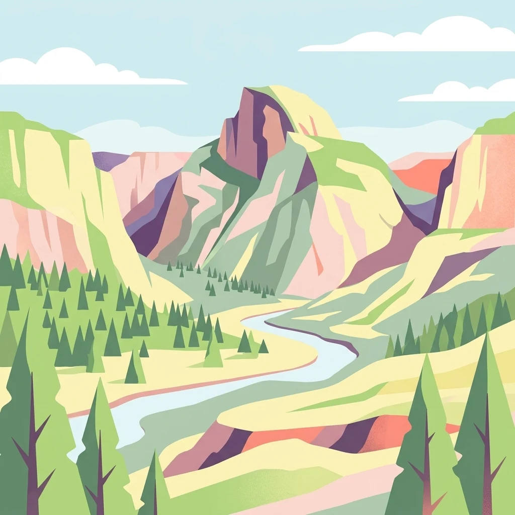
A flat, vector-style illustration of a U-shaped valley with a river running through it, framed by evergreen trees and a prominent rocky mountain peak under a pale blue sky.

Inyo Mountains Wilderness

Protected area

Park overview

Structured park overview, official facts, and landscape profile for Inyo Mountains Wilderness

Inyo Mountains Wilderness park facts, protected area profile, and essential visitor context

Review the core facts for Inyo Mountains Wilderness, including designation, size, terrain, visitor scale, habitats, and operating context in one park-focused overview.

About Inyo Mountains Wilderness

The Inyo Mountains Wilderness protects almost the entire length of the Inyo Mountains, a narrow but towering fault-block range in eastern California that runs roughly parallel to the Sierra Nevada. The range acts as a long natural wall between the Owens Valley on its western flank and the more remote Saline Valley on its eastern side, extending south-southeast from the White Mountains near Westgard Pass to the areas east of Owens Lake. Although the range is only about 10 miles wide, its elevation gain from valley floor to crest is enormous, producing one of the steepest and most ecologically layered desert mountain environments in North America.

Geologically, the Inyo Mountains belong to the Basin and Range Province and sit at the western edge of the Great Basin. They are considered among the most important exposures of Late Proterozoic through Cambrian rocks anywhere in the United States, making the range significant not only for conservation but also for scientific study of Earth's deep history. The limestone and dolomite formations that dominate parts of the range have weathered into unusual soils that, in turn, support a remarkable set of specialized plant species found nowhere else.

Vegetation in the wilderness reflects its dramatic elevation range. Lower elevations near the bordering valleys support creosote bush and other warm-desert scrub communities. Mid-elevations transition into sagebrush-dominated slopes, while the highest elevations near the crest, including Waucoba Mountain and surrounding ridges, host open stands of Great Basin bristlecone pine, some of the oldest living trees on Earth. The shift from desert to high-elevation forest within a single ridge system gives the wilderness an ecological richness that belies its arid regional setting.

Wildlife is shaped by the same elevation gradient. The cool, moist talus slopes and canyons of the range are the only known habitat of the endangered Inyo Mountains salamander, while the steeper cliffs and rocky ridges harbor desert bighorn sheep. Raptors and a variety of passerines use the range's varied habitats, linking the Inyo Mountains ecologically to both the Sierra Nevada to the west and the Great Basin ranges to the east.

Quick facts and research context for Inyo Mountains Wilderness

The Inyo Mountains Wilderness covers roughly 199,000 acres of the Inyo Mountains in eastern California, adjoining the Owens Valley and Saline Valley. It is jointly administered by the Bureau of Land Management in the southern portion of the range and by the United States Forest Service, through Inyo National Forest, in the northern portion, with about 73,300 acres under USFS management.

The range rises from low desert elevations near the valley floors to a crest exceeding 11,000 feet at Waucoba Mountain and spans roughly 70 miles in length. Ecological zones range from creosote and sagebrush scrub at lower altitudes to bristlecone pine forests near the summit, with a number of endemic plant species tied to the mountains' limestone substrates.

Protection and recognition

Examine official terrestrial conservation records and designated management parameters

Inyo Mountains Wilderness Protection Status and Territorial Designation Scope

Inyo Mountains Wilderness maintains documented terrestrial protection status across its rugged mountain terrain. Official conservation records outline the established management scope and regional designation framework for the protected landscape.

Protection details

Protection scope
Terrestrial
Transboundary protection
No
Park context

Deeper park guide and search-rich context for Inyo Mountains Wilderness

Inyo Mountains Wilderness history, landscape, wildlife, and travel context

Explore Inyo Mountains Wilderness through its history, landscape character, ecosystems, wildlife, conservation priorities, cultural context, and seasonal travel timing in a structured park guide built for atlas discovery and search intent.

Why Inyo Mountains Wilderness stands out

The Inyo Mountains Wilderness is best known for the extreme ecological compression within a desert mountain setting, where creosote flats give way to sagebrush slopes and ultimately to ancient bristlecone pine forests, all within a relatively short horizontal distance. The range is also recognized for its high concentration of rare and endemic plant species that have evolved on its unique limestone soils. Equally important is the wilderness's role as the only known habitat of the Inyo Mountains salamander, an endangered species found nowhere else. Combined with populations of desert bighorn sheep on the higher, more rugged slopes, the Inyo Mountains constitute one of the most botanically and zoologically distinctive arid mountain ranges in the American West.
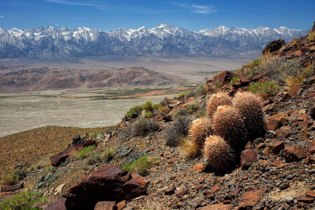
A wide, high-angle landscape shot showing a rocky, desert hillside with barrel cacti in the foreground, looking out over a dry, flat valley toward a distant range of snow-capped mountains under a clear blue sky.
A view overlooking the arid desert landscape and valley floor towards snow-capped peaks in the Inyo Mountains Wilderness.

Inyo Mountains Wilderness history and protected-area timeline

The Inyo Mountains were long utilized by Indigenous peoples of the Owens Valley and surrounding Great Basin region, including the Paiute, who moved seasonally between the valley floors and the higher mountain slopes to harvest pine nuts, hunt game, and gather plant resources. The arrival of Euro-American settlers in the 19th century brought mining, ranching, and prospecting activity into the range, leaving a scattered legacy of mining roads and diggings, particularly along the limestone-rich zones.

In the late 20th century, growing recognition of the range's ecological and geological significance led to formal wilderness designation. The Inyo Mountain Wilderness was established to protect the bulk of the range, roughly 199,000 acres, with the Bureau of Land Management administering the southern portion and the U.S. Forest Service, through Inyo National Forest, administering about 73,300 acres in the north. The designation reflected concern over the fragility of the range's endemic flora, the limited range of the Inyo Mountains salamander, and the value of preserving an intact cross-section of Basin and Range geology.

Inyo Mountains Wilderness landscape and geographic character

The Inyo Mountains form a classic fault-block range: a long, narrow spine tilted upward along a major fault system, with a steep eastern face and a more gradual western slope descending toward the Owens Valley. The crest is sharp and rugged, marked by prominent peaks such as Waucoba Mountain, which exceeds 11,000 feet, and a series of buttes and ridges that create dramatic skylines visible from both Owens Valley and Saline Valley.

The range's western side drops sharply toward the Owens Valley, with long alluvial fans and sagebrush-covered bajadas spreading toward the valley floor. The eastern side faces the more isolated Saline Valley, a deep basin ringed by escarpments. Between the two flanks lies a network of deep canyons, dry washes, and limestone ridges that create the range's distinctive texture of alternating cliffs and basins.

Although less visually famous than the Sierra Nevada immediately to the west, the Inyo Mountains possess a stark, layered beauty of their own, defined by long ridgelines, exposed bedrock, and the absence of human structures visible across most of the wilderness.
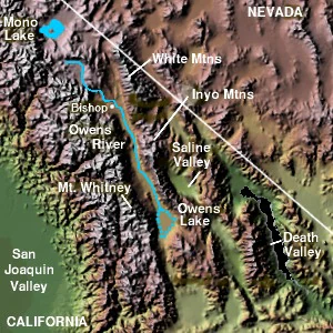
A top-down shaded relief map of the Inyo Mountains region in California, featuring labeled landmarks including the White Mountains, Saline Valley, Owens River, and Death Valley.
A shaded relief map showing the geographic relationship between the Inyo Mountains and surrounding regional features.

Inyo Mountains Wilderness ecosystems, habitats, and plant life

Ecologically, the Inyo Mountains act as a vertical island, compressing several life zones into a relatively small horizontal area. At the lowest elevations, the flora resembles that of the broader Mojave and northern Sonoran deserts, dominated by creosote bush and other drought-tolerant shrubs. Moving upward, sagebrush scrub takes over the mid-elevations, with juniper and pinyon often present on rocky slopes.

The highest elevations support stands of Great Basin bristlecone pine, among the longest-lived trees in the world. The bristlecone zone is especially significant on the Inyo Mountains because it sits in close proximity to warmer desert communities, creating unusual ecological juxtapositions. Limestone outcrops throughout the range support a specialized flora of endemic species, including the cliffdweller, bristlecone cryptantha, and Inyo rock daisy, plants found only on the Inyos' particular soil chemistry.

The combination of limestone substrate, steep topography, and elevation layering produces ecological conditions unlike those of the neighboring Sierra Nevada and White Mountains, giving the Inyo Mountains a botanical identity that is unusually distinct for an arid mountain range.

Inyo Mountains Wilderness wildlife and species highlights

The Inyo Mountains Wilderness is ecologically significant largely because of a small number of highly localized species. The most famous is the Inyo Mountains salamander, an endangered amphibian known only from talus and rocky slopes in the higher parts of the range. Its restricted distribution makes the wilderness's protection critical to its long-term survival.

Desert bighorn sheep inhabit the steep, rocky ridges and canyon walls, where their climbing ability allows them to use terrain that is inaccessible to most other large mammals. Mountain lions, coyotes, mule deer, and a variety of small mammals such as chipmunks and ground squirrels occupy the more vegetated mid-elevations.

Birdlife varies with elevation and habitat. Raptors, including golden eagles and red-tailed hawks, nest on cliffs, while smaller songbirds and woodpeckers are found in sagebrush and bristlecone habitats. The range's ecological gradients create a relatively rich avifauna for such an arid landscape.

Inyo Mountains Wilderness conservation status and protection priorities

Wilderness designation provides the Inyo Mountains with a high level of protection from development, motorized vehicle use, and mineral extraction, helping to preserve both its ecological and geological values. The wilderness is managed to maintain its natural character, with restrictions on roads, structures, and resource exploitation.

The most pressing conservation concern in the range is the survival of the Inyo Mountains salamander, which is restricted to a small number of sites and is listed as endangered. Protecting intact talus habitat and maintaining cool, shaded microclimates are central to its conservation. The range's endemic plants, especially those tied to its limestone substrates, are similarly vulnerable to disturbance and climate change.

The wilderness also preserves one of the best exposures of late Proterozoic to Cambrian strata in North America, giving it scientific as well as ecological conservation value. By keeping these rock sequences intact, the wilderness supports ongoing research into early Earth history.

Inyo Mountains Wilderness cultural meaning and human context

The Inyo Mountains have long been part of the traditional homeland of Indigenous peoples of the eastern Sierra and Great Basin, most notably the Paiute, who used the range's varied elevations for seasonal subsistence. Pine nut harvests from the higher elevations, hunting in the canyons, and gathering of plant materials in the lower slopes all drew people into the range well before Euro-American contact.

In the 19th and 20th centuries, mining activity left a visible but largely abandoned imprint on the mountains, with old roads, diggings, and small prospects scattered across the range. These features are now part of the cultural landscape but do not dominate it; the wilderness today feels largely empty of modern human presence.

Top sights and standout views in Inyo Mountains Wilderness

The Inyo Mountains Wilderness compresses an extraordinary range of environments into a narrow desert mountain range, from creosote flats near the valley floors to bristlecone pine forests near the summit. The presence of the endangered Inyo Mountains salamander and multiple endemic plant species tied to the range's limestone soils makes it one of the most biologically distinctive arid mountain ranges in the western United States.

Equally compelling is the range's geology, with extensive exposures of late Proterozoic to Cambrian rock that have made it a classic site for the study of early Earth history. The combination of scientific, ecological, and scenic values, all preserved within a single large wilderness, gives the Inyo Mountains Wilderness a depth of significance beyond its relative obscurity.

Best time to visit Inyo Mountains Wilderness

Spring and fall are generally the most comfortable seasons for visiting the Inyo Mountains Wilderness. Spring brings mild temperatures, wildflowers on the sagebrush slopes, and active wildlife, while fall offers cooler air, clear skies, and the chance to see high-elevation bristlecone groves under early-season snow. Summer can be extremely hot at lower elevations, though the higher elevations remain cooler. Winter brings cold temperatures and snow in the upper range, which can limit access but dramatically highlights the bristlecone forests.

Monthly climate preview

Long-term representative temperature ranges and monthly precipitation data

Inyo Mountains Wilderness Climate Normals and Annual Temperature Patterns

Representative coordinate records show measured multi-year temperature variations alongside shifting monthly precipitation levels across the terrain. Reviewing the complete twelve-month climatology dataset clarifies long-term meteorological trends throughout the protected area.
Annual mean10 °C
1 °C22 °C
Jan
Feb
Mar
Apr
May12°
Jun18°
Jul22°
Aug21°
Sep18°
Oct11°
Nov
Dec
Warmest month
July

22.2 °C

Coolest month
December

1.3 °C

Wettest month
January

2.1 mm/day

Driest month
June

0.2 mm/day

Park location guide

Geography guide, regional context, and park location map for Inyo Mountains Wilderness

Inyo Mountains Wilderness park geography, regions, and map view in United States of America

Understand where Inyo Mountains Wilderness sits in United States of America through a broader geographic reading of the surrounding landscape, nearby location context, and its mapped position within the national park landscape.

How Inyo Mountains Wilderness fits into United States of America

The United States of America is a federal presidential republic and one of the world's largest countries by area and population. It consists of 50 states across a vast territory spanning multiple time zones, with its capital in Washington, D.C. and largest city in New York City. The nation has a diverse economy, influential political system, and significant cultural and military presence globally.

Wider geography shaping Inyo Mountains Wilderness in United States of America

The United States occupies a vast territory in North America, bordered by Canada to the north and Mexico to the south. The 48 contiguous states stretch from the Atlantic to the Pacific Ocean, while Alaska occupies the northwestern region and Hawaii is an archipelago in the Pacific. The country encompasses diverse terrain including the Rocky Mountains, Appalachian Mountains, Great Plains, and extensive river systems.

Map view of Inyo Mountains Wilderness

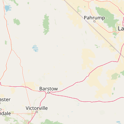
Use this park location map to pinpoint Inyo Mountains Wilderness in United States of America, understand its exact geographic position, and read its mapped placement within the surrounding landscape more clearly.

Pigeon | © OpenStreetMap contributors

Examine protected-area terrain, alpine ridges, and high-elevation desert habitats.

Inyo Mountains Wilderness Photos, Landscapes, and Scenery Visual Explorer

Photographic records reveal the stark fault-block topography and dramatic elevation gradients defining Inyo Mountains Wilderness. Visual exploration connects observers directly to ancient bristlecone pine forests, exposed limestone ridges, and remote basin ecosystems.

A wide, high-angle landscape shot showing a rocky, desert hillside with barrel cacti in the foreground, looking out over a dry, flat valley toward a distant range of snow-capped mountains under a clear blue sky.

A wide, high-angle view of a rugged, arid mountain ridge line under a clear blue sky, showing multiple peaks and sparse, scrubby vegetation.

A top-down shaded relief map of the Inyo Mountains region in California, featuring labeled landmarks including the White Mountains, Saline Valley, Owens River, and Death Valley.

Park atlas

Compare regional desert ranges, fault-block terrain, and adjacent wilderness areas.

Other Parks Near Inyo Mountains Wilderness and Surrounding Protected Landscapes

Browse protected areas near the surrounding region to compare arid mountain geography and fault-block terrain. Expanding the search reveals related conservation landscapes that share the environmental traits of Inyo Mountains Wilderness.
A horizontal watercolor painting depicting a mountain range in the background with rolling hills and a winding river or stream in the foreground.
Protected landscapeCalifornia
About 1.8 km away#1 closest

Northwest

Inyo National Forest: An Atlas of Protected Landscapes and Sierra Nevada Geography

High altitude wilderness and volcanic terrain in Eastern California

Spanning from the arid Owens Valley floor to the 14,000 foot crest of the Sierra Nevada, Inyo National Forest remains a cornerstone of the American West. This protected landscape contains the Ancient Bristlecone Pine Forest, Mount Whitney, and the Mono Inyo volcanic chain, providing a dense geographic record of glacial, tectonic, and ecological diversity across a vast managed corridor.

Area
7,702.71 km²
Established
1907
IUCN
Ib
Relief
Mountain
Watercolor painting of a panoramic mountain landscape with stylized pine trees and soft green meadows.
Protected landscapeCalifornia
About 8.2 km away#2 closest

West

Sequoia National Forest: Protected Sierra Nevada Geography and Mountain Terrain

A vast protected landscape spanning 1.1 million acres in California

Spanning Tulare, Kern, and Fresno counties, Sequoia National Forest preserves iconic giant sequoia groves across multiple river watersheds. The terrain features vertical relief exceeding 11,000 feet, showcasing a range of ecosystems from chaparral slopes and coniferous forests to glacial cirques and granite spires located within the southern Sierra Nevada range.

Area
4,829.17 km²
Established
1908
Relief
Mountain
Climate
Mediterranean
A soft watercolor painting of rolling hills and mountain ridges, featuring shades of green, yellow, and faint pink on a white background.
Wildlife reserveCalifornia
About 20 km away#3 closest

Southwest

Domeland Wilderness: Granite Spires and Kern Plateau Geography in the Southern Sierra Nevada

A protected wilderness landscape on the California high plateau

Spanning over 130,000 acres, Domeland Wilderness offers a deep look into the geological transition zone of the southern Sierra Nevada. The protected landscape is characterized by its iconic granite domes and spires, vast summer range meadows for deer, and the winding course of the Wild and Scenic South Fork Kern River. This atlas entry details the rugged terrain, ridge boundaries, and ecological diversity found across this lightly visited high-altitude wilderness.

Area
526.42 km²
Established
1964
IUCN
Ib
Relief
Mountain
A watercolor painting showing a panoramic view of mountain ranges, a treeline, and a calm body of water in the foreground.
Wildlife reserveCalifornia
About 36 km away#4 closest

Northwest

John Muir Wilderness: Sierra Nevada Protected Landscape and High Mountain Geography

California wilderness area with glacial basins and granite peaks

John Muir Wilderness represents one of the largest protected high-elevation areas in the contiguous United States. Spanning the Sierra Nevada crest, its granite terrain is sculpted by Pleistocene glaciation into sharp arêtes, deep canyons, and hundreds of alpine lakes. This wilderness serves as a vital geographic anchor for mountain ecosystems, offering an extensive look at the high-country landscape of eastern California.

Area
2,641.76 km²
Established
1964
IUCN
Ib
Relief
Mountain
National parkCalifornia
About 40 km away#5 closest

East

Death Valley National Park: Exploring California's Mapped Protected Landscape

View the geographic boundaries and desert terrain.

Access a detailed atlas perspective of Death Valley National Park, a protected national park situated in California. Understand the park's distinct mapped boundaries and its role within the regional geography. This resource highlights the unique desert landscape, offering focused insights into its protected-area identity and natural terrain for geographic discovery.

Area
13,848.4 km²
Established
1994
IUCN
II
Visitors
1.1M annual
National parkCalifornia
About 41 km away#6 closest

Northwest

Sequoia National Park National Park: Geographic Identity and Protected Landscape Atlas

Explore mapped boundaries and the terrain of this California protected area.

Gain a structured understanding of Sequoia National Park as a protected landscape, focusing on its mapped geographic boundaries and its context within California. This entry provides foundational data for exploring the park's natural terrain and its role in a broader atlas of conservation lands, ideal for users seeking detailed geographic information.

Area
1,635.19 km²
Established
1890
IUCN
II
Visitors
1.2M annual
Wildlife reserveKern County
About 48 km away#7 closest

South

Kiavah Wilderness: Geographic Overview of the Scodie Mountains Plateau

Protected desert wilderness in Kern County, California

Kiavah Wilderness provides a vital protected landscape in Kern County, defined by the Scodie Mountains and a dramatic escarpment above the Mojave Desert floor. Known for its rare pinyon-juniper woodlands and seasonal springs, this wilderness area preserves the complex geography linking the southern Sierra Nevada to the broader Mojave basin.

Area
357.3 km²
Established
1994
IUCN
Ib
Relief
Mountain
National parkCalifornia
About 67 km away#8 closest

Northwest

Kings Canyon National Park National Park: California Protected Landscape & Geography Atlas

Mapped park boundaries and regional natural context.

Kings Canyon National Park stands as a key protected national park within California, offering a specific focus for geographic understanding and atlas-based exploration. This page details the park's mapped boundaries and its integration into the broader regional geography of California. For users interested in the distribution of protected lands and the mapping of natural landscapes, Kings Canyon National Park provides a crucial point of study within the comprehensive park atlas.

Area
1,869.25 km²
Established
1890
IUCN
II
Visitors
641K annual

Common questions about visiting, size, designation, and location context for Inyo Mountains Wilderness

Inyo Mountains Wilderness FAQs for park facts, access, geography, and protected area context

Find quick answers about Inyo Mountains Wilderness, including protected-area facts, park geography, trail and visitor context, and how the park fits into its surrounding country and regional landscape.
MoriAtlas Explorer

Continue Your Protected Areas Search Across the Global Atlas

Deepen your exploration by continuing the structured search for national parks and protected areas worldwide. Utilize the comprehensive filtering capabilities to compare different conservation landscapes and refine your understanding of global park geography. Discover more about the distribution and characteristics of protected natural areas.

Global natural geography