Mori Atlas logo
Protected areaJerup Hede, Råbjerg og Tolshave Mose

A distinctive mosaic of ridge and pool terrain, heathlands, and coastal dune systems

Jerup Hede, Råbjerg og Tolshave Mose: Mapped Protected Landscapes and Regional Geography

(Natura 2000-område nr. 3 Jerup Hede, Råbjerg og Tolshave Mose)

Jerup Hede, Råbjerg og Tolshave Mose represents a major protected natural complex in Region Nordjylland, characterized by its rare ridge and pool mires. This expansive terrain integrates coastal dunes, nutrient rich lakes, and acidic heathlands into a singular wetland mosaic. The area serves as a vital ecological corridor in northern Denmark, preserving intact raised bog systems and supporting rare populations of marsh fritillary butterflies and diverse bird species.

Natura 2000dune habitatsheathlandsraised bogridge-and-pool landscapewetland mosaic

Jerup Hede, Råbjerg og Tolshave Mose

Protected area

Park overview

Structured park overview, official facts, and landscape profile for Jerup Hede, Råbjerg og Tolshave Mose

Jerup Hede, Råbjerg og Tolshave Mose park facts, protected area profile, and essential visitor context

Review the core facts for Jerup Hede, Råbjerg og Tolshave Mose, including designation, size, terrain, visitor scale, habitats, and operating context in one park-focused overview.

About Jerup Hede, Råbjerg og Tolshave Mose

Jerup Hede, Råbjerg og Tolshave Mose is one of the more ecologically diverse protected landscape complexes in Denmark. Designated as Natura 2000 area number 3, it combines coastal dune systems in its western and northern fringes with extensive heaths, raised bogs, lakes and small forest patches further inland. The result is a single administrative protected area that nonetheless spans a striking variety of habitat types, from grey and green dunes and juniper-dominated dune thickets to dry and wet heaths, nutrient-rich and brown-water lakes, watercourses, acid grassland, herb-rich fringes, and a range of mire communities including active raised bog, degraded raised bog, hanging mires, bog hollows, rich fens and wooded bog.

Geographically the site lies in the eastern part of the Vendsyssel peninsula, within Frederikshavn Municipality, north of Ålbæk and between the coast and inland Denmark. It is bordered to the north by Ålbæk Klitplantage, an extensive coastal forest plantation, and is interspersed with landscape features such as Kragskov and Strandby Hede. Its position between protected coastal plantations, heathland and inland agricultural land gives it an important transitional function between marine-influenced dune environments and more continental terrestrial habitats.

The area's ecological significance is amplified by the presence of several rare and protected species. It is the most important Danish site for the marsh fritillary butterfly, a Natura 2000 priority species that has been a focus of dedicated LIFE ASPEA conservation work. It also supports the northernmost Danish population of the protected maj-gøgeurt orchid, and the only known Danish population of mose-post, a bryophyte species of considerable conservation interest. Beyond these headline species, the combination of heath, mire and dune habitats supports a notable breeding bird assemblage, including species whose presence directly underlies the site's bird protection area designation.

Quick facts and research context for Jerup Hede, Råbjerg og Tolshave Mose

A Natura 2000 protected area of roughly 4,024 hectares in Frederikshavn Municipality, Region Nordjylland, marking the eastern part of Vendsyssel just south of Ålbæk Klitplantage.

It functions as both an EU habitat area and, in its central parts, a bird protection area, with additional national nature reserve coverage over Råbjerg Mose and the area between Jebjerg and Tolshave Mose. The area spans an unusually broad range of dune, heath, lake, mire and forest habitat types, and is widely regarded as the most important Danish site for the marsh fritillary, a priority Natura 2000 butterfly species.

Protection and recognition

Explore documented terrestrial protection status and official international recognition records.

Jerup Hede, Råbjerg og Tolshave Mose Protection Status and Natura 2000 Recognition

Documented conservation records outline the terrestrial protection status and Natura 2000 designation framework established for Jerup Hede, Råbjerg og Tolshave Mose. Official recognition sources provide verified baseline data for analyzing regional habitat management and protected area boundaries.
Park context

Deeper park guide and search-rich context for Jerup Hede, Råbjerg og Tolshave Mose

Jerup Hede, Råbjerg og Tolshave Mose history, landscape, wildlife, and travel context

Explore Jerup Hede, Råbjerg og Tolshave Mose through its history, landscape character, ecosystems, wildlife, conservation priorities, cultural context, and seasonal travel timing in a structured park guide built for atlas discovery and search intent.

Why Jerup Hede, Råbjerg og Tolshave Mose stands out

Jerup Hede, Råbjerg og Tolshave Mose is best known for holding Denmark's largest continuous area of ridge-and-pool landscape ('rimmer og dobber'), an undulating mires-and-hummocks pattern typical of intact raised bogs. This distinctive terrain is a defining feature of the area and one of the principal reasons the site is designated as an EU habitat area. Equally, the site is nationally important for conservation of the marsh fritillary butterfly, whose population here is the most significant in Denmark, and for supporting rare specialist plants and breeding birds associated with heath, mire and dune habitats.

Jerup Hede, Råbjerg og Tolshave Mose history and protected-area timeline

The area's protection history is tied directly to the Natura 2000 network, under which it is formally registered as site number 3. It was originally designated as an EU habitat area, reflecting the importance of its dune, heath, lake and bog habitats, with the central parts of the area subsequently recognized as a bird protection area because of their breeding bird interest.

In parallel, parts of the area enjoyed national protection before the Natura 2000 designation. Råbjerg Mose and the area between Jebjerg and Tolshave Mose are listed as nature reserves under Danish nature conservation law, adding a layer of older national-level protection to the modern European designation. The current management period for the site is governed by Natura 2000 plans covering 2022 to 2027, prepared by the Danish Environmental Protection Agency and supported by a revised basic analysis published for the same planning period.

Jerup Hede, Råbjerg og Tolshave Mose landscape and geographic character

The landscape of Jerup Hede, Råbjerg og Tolshave Mose is shaped by the meeting of coastal sand, acidic heath and peat-forming wetland systems. Along its edges, the terrain includes grey and green dunes, dune heath, juniper dune thickets and dune hollows, marking the transition from the inland heaths to the sand dunes that extend further toward the Skagerrak coast via Ålbæk Klitplantage.

Inland, the terrain opens into broad heaths that include both dry and wet heath communities, separated by lakes and watercourses. The lakes reflect a clear ecological gradient, from nutrient-rich lakes with small herb communities along their shores to brown-water lakes that are typical of peatland-influenced catchments. Streams and small watercourses wind through the mosaic, adding structural diversity and supporting emergent and bankside vegetation.

The most distinctive landscape element is the large area of ridge-and-pool topography, locally known as 'rimmer og dobber'. This gently undulating surface, with alternating low ridges and shallow wet hollows, is characteristic of intact raised bog systems and gives the terrain an unusually textured, hummocky appearance. Mires are represented by active raised bog, degraded raised bog, hanging mires and bog hollows, while richer habitats include rich fens and herb-rich fringes. Small oak thickets and areas of wooded bog add forest patches to an otherwise open, semi-natural landscape.

Jerup Hede, Råbjerg og Tolshave Mose ecosystems, habitats, and plant life

Ecologically, the site functions as a mosaic in which dune, heath, freshwater and mire habitats are tightly interlinked, producing unusually high habitat diversity for a Danish protected area of this size. The dune component includes grey and green dunes, dune heath, juniper dunes and dune hollows, each representing a different stage of dune succession and supporting specialist plant and insect communities adapted to sandy, nutrient-poor substrates.

Heath habitats dominate much of the inland surface, comprising both dry heath and wet heath, with acid grassland and small patches of juniper scrub adding structural variety. Lakes and watercourses within the area encompass nutrient-rich lakes, brown-water lakes, lake margins with small herb vegetation, and streams that create a network of riparian and aquatic habitats across the site. Several of these habitats are listed as priority types under the EU Habitats Directive, reflecting their rarity and conservation value at the European level.

Mire and bog habitats form a major part of the ecological identity of the area. Active raised bog, degraded raised bog, hanging mires, bog hollows, rich fens and wooded bog together create a continuous peatland complex, complemented by herb-rich fringes and periodically wet meadows along the edges. This mire mosaic is the physical basis for the distinctive ridge-and-pool landscape and supports the specialized flora and fauna for which the area is nationally known, including rare bryophytes and orchids.

Jerup Hede, Råbjerg og Tolshave Mose wildlife and species highlights

The site is nationally important for invertebrates, plants and birds. Its most celebrated wildlife value is the marsh fritillary butterfly, for which the area holds Denmark's most significant population. Because of this, the marsh fritillary was a central focus of the LIFE ASPEA project, which worked to maintain and restore habitat conditions for the species.

Among plants, the area is home to the northernmost Danish population of the protected maj-gøgeurt orchid, an occurrence that gives the site a meaningful role in conserving this species at the edge of its national range. The area also supports the only known Danish population of mose-post, a moss species of high conservation interest.

The bird fauna includes several species whose breeding presence in the central part of the area underpins the bird protection area designation. These include the plettet rørvagtel, engsnarre, trane, tinksmed, mosehornugle and rødrygget tornskade, each of which is associated with the area's mosaic of mires, meadows, heaths and dune habitats rather than with any single uniform habitat type.

Jerup Hede, Råbjerg og Tolshave Mose conservation status and protection priorities

Conservation significance at Jerup Hede, Råbjerg og Tolshave Mose operates at multiple scales. At the European level, the site is part of the Natura 2000 network under both the EU Habitats Directive and the Birds Directive, with both habitat area and bird protection area designations covering different parts of the complex. The long list of habitats registered for the site includes several priority habitat types, such as dune heath, juniper dune thicket, acid grassland and active raised bog, which carry additional weight in EU-level conservation planning.

At the national level, Råbjerg Mose and the area between Jebjerg and Tolshave Mose are protected as nature reserves under Danish conservation law, providing a traditional national framework of protection that predates and complements the Natura 2000 status. The current Natura 2000 management plan for 2022-2027, issued by the Danish Environmental Protection Agency, sets out the active management and monitoring framework for the area.

The area also has considerable value as a conservation reference site. Its large intact ridge-and-pool landscape offers one of the best opportunities in Denmark to study and manage raised bog dynamics at landscape scale, while its marsh fritillary population makes it a key site for butterfly conservation in northern Europe.

Top sights and standout views in Jerup Hede, Råbjerg og Tolshave Mose

Jerup Hede, Råbjerg og Tolshave Mose combines the qualities of a coastal dune reserve, an inland heath complex and a substantial raised bog system within a single Natura 2000 framework. Its ridge-and-pool mires, Denmark's largest, give the area a distinctive and visually memorable terrain, while its mosaic of dune, heath, lake and bog habitats supports an unusually wide range of rare species.

Its conservation role extends beyond Danish borders through the EU Natura 2000 network, and its marsh fritillary population is of pan-European significance. The combination of ecological diversity, landscape distinctiveness and protected status makes it one of the more important natural areas in northern Jutland.
Monthly climate preview

Long-term temperature and precipitation averages recorded at representative park coordinates

Jerup Hede, Råbjerg og Tolshave Mose Climate Normals and Monthly Weather Patterns

Representative coordinate measurements trace twelve-month temperature swings alongside precipitation rates for Jerup Hede, Råbjerg og Tolshave Mose. Detailed monthly comparisons provide complete climatological normals across the entire annual cycle.
Annual mean9 °C
1 °C17 °C
Jan
Feb
Mar
Apr
May11°
Jun14°
Jul17°
Aug17°
Sep14°
Oct10°
Nov
Dec
Warmest month
August

17.2 °C

Coolest month
February

1.5 °C

Wettest month
October

3.3 mm/day

Driest month
April

1.7 mm/day

Park location guide

Geography guide, regional context, and park location map for Jerup Hede, Råbjerg og Tolshave Mose

Jerup Hede, Råbjerg og Tolshave Mose park geography, regions, and map view in Denmark

Understand where Jerup Hede, Råbjerg og Tolshave Mose sits in Denmark through a broader geographic reading of the surrounding landscape, nearby location context, and its mapped position within the national park landscape.

How Jerup Hede, Råbjerg og Tolshave Mose fits into Denmark

Denmark is a constitutional monarchy and Nordic country in Northern Europe. It is the southernmost of the Scandinavian countries, bordering Germany to the south, Norway to the north, and Sweden to the southwest. The country consists of the Jutland peninsula and an archipelago of islands, with Copenhagen as its capital and largest city. Denmark has a population of over 6 million and is characterized by flat, arable land, sandy coasts, and a temperate climate.

Wider geography shaping Jerup Hede, Råbjerg og Tolshave Mose in Denmark

Denmark occupies the Jutland peninsula and roughly 406 islands in Northern Europe. It is situated between the North Sea to the west and the Baltic Sea to the east. The country borders Germany to the south and is connected to Sweden via the Øresund Bridge. Denmark is predominantly flat terrain with low elevation, the highest point being Møllehøj at 170.86 meters.

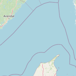
Map view of Jerup Hede, Råbjerg og Tolshave Mose

Use this park location map to pinpoint Jerup Hede, Råbjerg og Tolshave Mose in Denmark, understand its exact geographic position, and read its mapped placement within the surrounding landscape more clearly.

Pigeon | © OpenStreetMap contributors

Location context for Jerup Hede, Råbjerg og Tolshave Mose

Region Nordjylland
Park atlas

Compare nearby coastal reserves, dune heaths, and wetland complexes across northern Denmark

Explore Protected Areas Near Jerup Hede, Råbjerg og Tolshave Mose and Surrounding Regions

Browse adjacent natural reserves and protected landscapes situated close to Jerup Hede, Råbjerg og Tolshave Mose. Comparing these surrounding habitats provides a deeper geographic perspective on the distinctive coastal heaths and wetland systems of Vendsyssel.
Watercolor illustration of a lush green valley with rolling hills, meadows, and trees in soft, muted tones.
Nature reserveNordjylland
3.7 km away#1 closest

South

Åsted Ådal Nature Reserve: Glacial Valley Mapping and Protected Land Context in Nordjylland

A diverse Natura 2000 habitat mosaic in Northern Denmark

Åsted Ådal serves as a premier example of Danish glacial topography, offering a deep dive into the complex environmental transitions of a moraine-carved valley. The protected site highlights a rich botanical and avian assemblage, anchored by its unique stream corridor and steep slopes, providing a comprehensive view of regional landscape character.

Area
1.24 km²
Relief
Upland
Climate
Temperate
Scope
Terrestrial
A soft watercolor painting of a low-lying coastal scene with rolling green hills and a light foreground.
Nature reserveRegion Nordjylland
About 9.9 km away#2 closest

Southeast

Natura 2000-område nr. 4 Hirsholmene, havet vest herfor og Ellinge Å's udløb: Mapping Protected Landscapes

A dual marine and coastal nature reserve in Region Nordjylland

Analyze the marine and coastal topography of this significant Natura 2000 site. The mapped region spans from the Kattegat bubble reefs to the freshwater influence of the Ellinge Å outlet, offering a clear perspective on the distribution of sandbanks, island groups, and terrestrial habitats that characterize this protected Danish geography.

Area
95.33 km²
Established
2011
Relief
Lowland
Climate
Temperate
Protected areaRegion Nordjylland
About 11 km away#3 closest

West

Natura 2000-område nr. 5 Uggerby Klitplantage og Uggerby Å's udløb Protected Area

Coastal dune and riverine landscape mapping in Region Nordjylland

Explore the varied terrain of this 717-hectare site featuring a complete sequence of green dune habitats, fresh water slacks, and the Uggerby Å river estuary. The area displays a dense concentration of coastal geomorphology and protected plant species, providing a deep look into the natural landscape character of the northern Danish coast along the Skagerrak.

Area
7.17 km²
Relief
Lowland
Climate
Temperate
Scope
Terrestrial
Nature reserveRegion Nordjylland
23 km away#4 closest

South

Solsbæk Nature Reserve: Geographic Profile and Protected Coastal Dune Landscapes

A rare calcareous dune ecosystem in Region Nordjylland, Denmark.

Solsbæk is a designated nature reserve on the Vendsyssel coast, notable for its concentrated series of coastal dune habitats. Formed by lime-rich shell sand, the landscape sustains a diverse array of vegetation including grey and green dunes, juniper scrub, and dune heath. This compact site provides a vital reference for understanding the ecological structure and botanical variety of protected coastal lands in northern Denmark.

Area
0.33 km²
Established
1972
Relief
Lowland
Climate
Temperate
Watercolor painting of a coastal landscape with sand dunes meeting the ocean under a clear sky.
Nature reserveRegion Nordjylland
24 km away#5 closest

West

Kærsgård Strand, Vandplasken og Liver Å Nature Reserve: Geographic and Landscape Atlas

Protected coastal dune systems and inland wetland geography

Examine the protected landscape of Kærsgård Strand, Vandplasken og Liver Å, a key Danish nature reserve characterized by complex dune hydrology, clear-water lake systems, and diverse botanical habitats. This site serves as a vital reference for northwestern European calcareous ecology and wetland preservation.

Area
4.42 km²
Established
2011
Relief
Lowland
Climate
Temperate
Nature reserveLæsø Municipality
29 km away#6 closest

Southeast

Nordre Rønner: Protected Island Landscapes and Geographic Mapping of Læsø Municipality

Remote coastal nature reserve and marine habitat within the Danish Kattegat sea

Nordre Rønner represents a significant cluster of islets in the Kattegat, showcasing the interplay of post-glacial land rise and coastal ecology. Managed within Læsø Municipality, these eleven hectares of protected land include essential nesting grounds for terns and harbor seals. This resource outlines the physical geography, mapped island connections, and the status of this unique maritime nature reserve.

Area
0.11 km²
Relief
Lowland
Climate
Temperate
Access
Moderate access
Watercolor painting of a low-lying coastal landscape with grasses, shrubs, and soft, hazy distant hills.
Nature reserveLæsø
About 45 km away#7 closest

Southeast

Bovet Nature Reserve and Coastal Habitat Geography in Læsø, Denmark

A protected coastal corridor of heathland and salt marsh

Bovet is a 65-hectare nature reserve on the island of Læsø that safeguards a pristine 2.5 km stretch of Danish coastline. Characterized by a flat, open topography of heath, beach meadow, and reedbed, the site is defined by its sweeping views across Bovet Bugt and scattered glacial erratics. Its status as a bird protection area and Ramsar wetland highlights its importance as a habitat for breeding and resting waders within the Kattegat region.

Area
0.65 km²
Established
1964
Relief
Lowland
Climate
Temperate
Watercolor painting showing a green and tan coastal marshland with low hills in the distance.
Nature reserveLæsø
About 49 km away#8 closest

Southeast

Østdelen af Læsø Nature Reserve: Mapped Coastal Geography and Protected Danish Island Terrain

Explore active dune systems, beach ridges, and coastal heath-mire habitats

Østdelen af Læsø features a distinct interplay of coastal geology and traditional heathland vegetation across its 266 hectares. The reserve spans from the elevated Danzigmand dunes to the dynamic, growing barrier islands of Store Knot and Lille Knot, offering a comprehensive look at Denmark's shifting coastal margins and vital seabird nesting grounds.

Area
2.66 km²
Established
1963
Relief
Lowland
Climate
Temperate

Common questions about visiting, size, designation, and location context for Jerup Hede, Råbjerg og Tolshave Mose

Jerup Hede, Råbjerg og Tolshave Mose FAQs for park facts, access, geography, and protected area context

Find quick answers about Jerup Hede, Råbjerg og Tolshave Mose, including protected-area facts, park geography, trail and visitor context, and how the park fits into its surrounding country and regional landscape.
MoriAtlas Explorer

Continue Your Protected Areas Search Across the Global Atlas

Deepen your exploration by continuing the structured search for national parks and protected areas worldwide. Utilize the comprehensive filtering capabilities to compare different conservation landscapes and refine your understanding of global park geography. Discover more about the distribution and characteristics of protected natural areas.

Global natural geography