
Mori Atlas logo
Nature reserveJonkershoek Nature Reserve

Mapping the hydrological headwaters, mountain terrain, and indigenous flora of the Stellenbosch valley

Jonkershoek Nature Reserve: Protected Mountain Catchment and Fynbos Landscapes in Western Cape

Jonkershoek Nature Reserve acts as a vital mountain catchment and biodiversity sanctuary within the Western Cape of South Africa. The protected landscape encompasses steep slopes, forested ravines, and the critical headwaters of the Eerste and Berg rivers. This atlas entry provides a detailed look at the fynbos vegetation and rugged mountain geography that define this regionally significant nature reserve near Stellenbosch.

CapeNatureWestern CapeStellenboschmountain catchmentfynbosindigenous forest
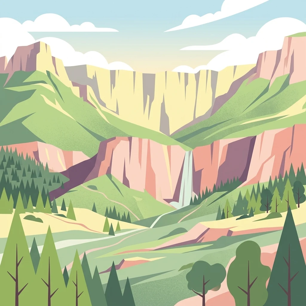
A flat-style digital illustration showing a mountainous valley landscape with steep, towering cliffs, a cascading waterfall, and a forested valley floor under a bright, sunny sky with soft clouds.

Jonkershoek Nature Reserve

Nature reserve

Park overview

Structured park overview, official facts, and landscape profile for Jonkershoek Nature Reserve

Jonkershoek Nature Reserve park facts, protected area profile, and essential visitor context

Review the core facts for Jonkershoek Nature Reserve, including designation, size, terrain, visitor scale, habitats, and operating context in one park-focused overview.

About Jonkershoek Nature Reserve

Jonkershoek Nature Reserve lies at the southeastern edge of the Stellenbosch area in the Western Cape province of South Africa, in the upper reaches of the Jonkershoek valley and the surrounding mountain terrain. Managed by CapeNature, the reserve covers approximately 11,000 hectares of protected mountain catchment landscape that forms part of the Hottentots-Holland Mountain Catchment Area. It includes the Jonkershoek Mountains and the smaller Assegaaibosch Nature Reserve nested within its boundaries.

The reserve's position north of the Hottentots-Holland range gives it a varied topography of steep slopes, kloofs, and river-cut valleys. Both the Eerste River, which flows through the Jonkershoek valley toward False Bay, and the Berg River, one of the major river systems of the Western Cape, originate within this catchment. This dual headwater function gives Jonkershoek an outsized hydrological importance beyond its borders, helping sustain downstream agricultural lands, vineyards around Stellenbosch, and towns further along both rivers.

Ecologically, the reserve is strongly aligned with the Cape Floral Region, one of the world's most botanically diverse temperate regions. Its slopes support fynbos vegetation, while the moister valley bottoms contain patches of indigenous forest interwoven with large introduced oak trees. The combination of fynbos, forest patches, and rugged mountain terrain supports a varied bird and mammal community and offers a representative sample of the Western Cape's mountain ecosystems in a single, accessible protected area.

Historically, the land carries layers of human use stretching back to the late 18th century, including a granted farmstead that became Assegaaibosch, oak plantings ordered by colonial authorities, and religious sites represented by several Kramats. Today the reserve blends these cultural traces with its conservation role, framing Jonkershoek as both a functional mountain catchment reserve and a landscape with deep regional memory.

Quick facts and research context for Jonkershoek Nature Reserve

Jonkershoek Nature Reserve is a CapeNature reserve of roughly 11,000 hectares situated southeast of Stellenbosch in the Western Cape. It encompasses the upper Jonkershoek valley and parts of the Jonkershoek Mountains, north of the Hottentots-Holland range, and falls within the Hottentots-Holland Mountain Catchment Area. The reserve contains the headwaters of the Eerste River and the Berg River, making it a key mountain catchment landscape in the region. Within it lie the smaller Assegaaibosch Nature Reserve and a national monument farmhouse used as a guest house.

Protection and recognition

Examine the documented terrestrial scope and conservation governance records.

Jonkershoek Nature Reserve Protection Status and Territorial Designation

Jonkershoek Nature Reserve maintains a documented terrestrial protection scope within its regional conservation boundaries. Review the compiled management records and official designation facts for this protected landscape.

Protection details

Protection scope
Terrestrial
Transboundary protection
No
Park context

Deeper park guide and search-rich context for Jonkershoek Nature Reserve

Jonkershoek Nature Reserve history, landscape, wildlife, and travel context

Explore Jonkershoek Nature Reserve through its history, landscape character, ecosystems, wildlife, conservation priorities, cultural context, and seasonal travel timing in a structured park guide built for atlas discovery and search intent.

Why Jonkershoek Nature Reserve stands out

Jonkershoek is best known as a mountain catchment reserve protecting the sources of both the Eerste River and the Berg River within a fynbos-dominated landscape just outside Stellenbosch. The reserve is closely associated with Cape Floral Region fynbos, mixed mountain forests along its river valleys, and a high diversity of bird and mammal species characteristic of the western Cape mountains.
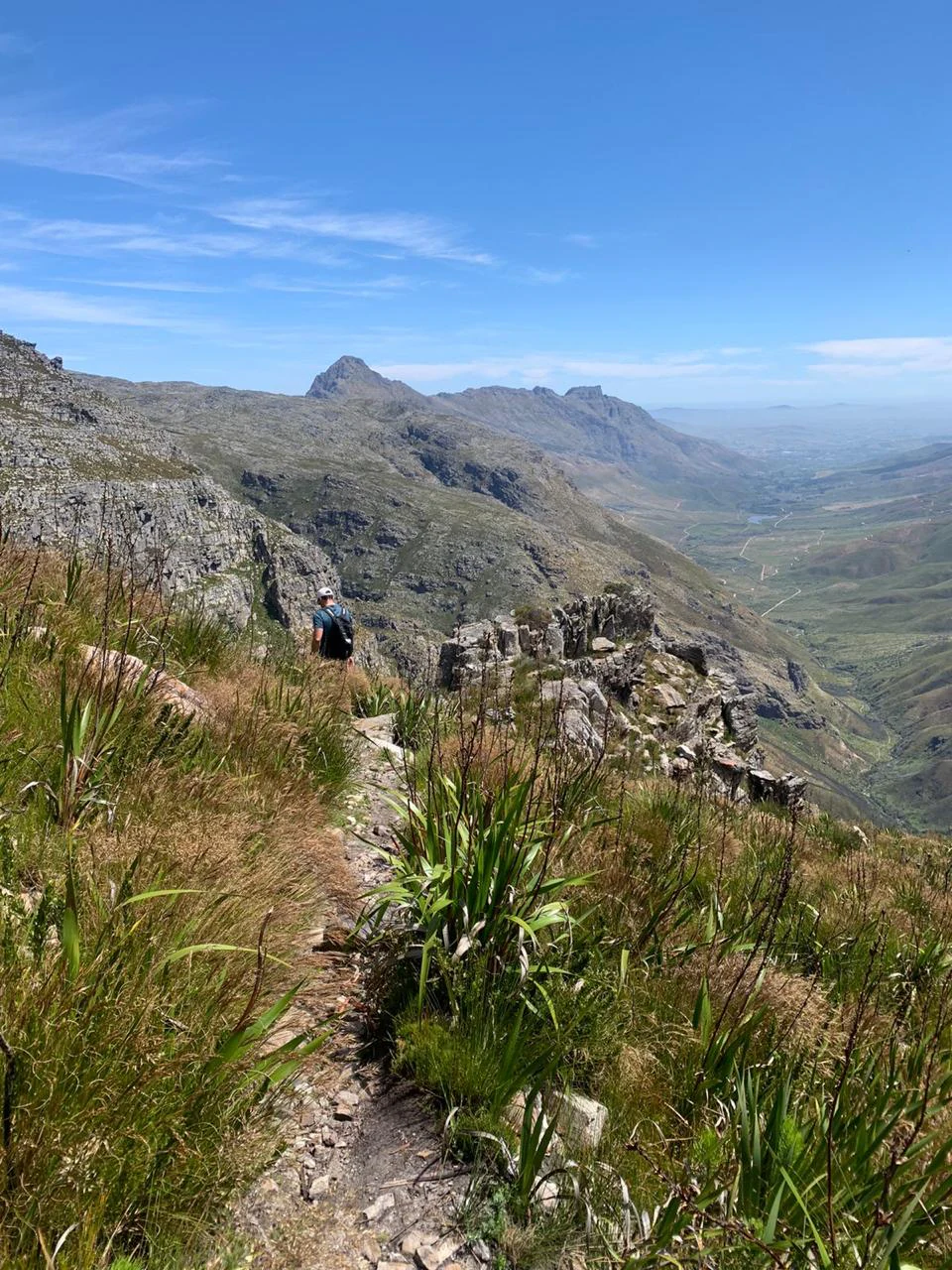
A hiker with a backpack walks along a rocky, narrow trail on a mountainside, with a vast mountain valley visible in the background under a blue sky.
A hiker traverses a mountain trail within Jonkershoek Nature Reserve, overlooking the valley below.

Jonkershoek Nature Reserve history and protected-area timeline

The name Jonkershoek is believed to derive from one of the 17th-century freehold grants Simon van der Stel issued in the valley: Jan Andriessen, a former bachelor midshipman known locally as Jan de Jonkheer, named his grant Vallei Jonkershoek. This early Dutch colonial layer of land ownership established the historic name still used by the reserve today.

The area's documented land use begins with the Assegaaibosch farmstead, established in 1790 and significantly altered over time by successive occupants. In 1817 Lord Charles Somerset granted the land to Wouter Eduard Wium with the specific requirement that oak trees be planted, a directive that has shaped the landscape; the reserve still contains many of the large oaks originally introduced under this order.

In 1960 the Cape Provincial Administration purchased Assegaaibosch, and the farmhouse was restored to its present condition and declared a national monument. It continues to function as a guest house. The reserve also preserves several Kramats, including that of Sheikh Sayed Ahmad Singosari, adding an important Islamic religious and cultural dimension to the landscape's heritage.

Jonkershoek Nature Reserve landscape and geographic character

Jonkershoek Nature Reserve lies within the northwestern slopes and valleys of the Hottentots-Holland mountain system, with the Jonkershoek Mountains forming a core part of the protected terrain. The topography is shaped by steep mountain ridges, narrow kloofs, and the broader upper Jonkershoek valley, producing a strong sense of enclosed mountain scenery rather than open vistas.

Water shapes much of the visible landscape. The Eerste River descends through the Jonkershoek valley toward False Bay, while the Berg River originates in the same mountain catchment but flows in a different direction toward the west coast. Their headwater streams carve through the terrain, sustaining moist ravines and forested patches that contrast with the drier, exposed upper slopes.

Vegetation layering is visually distinct: fynbos dominates the higher, drier slopes with its characteristic low shrubland and restio-dominated cover, while large oak trees, originally introduced in the 19th century, now stand as a striking feature along some of the valley floors. Together these elements create the patchwork of fynbos slopes, oak-lined valleys, misty kloofs, and rocky mountain terrain that defines the reserve's scenery.
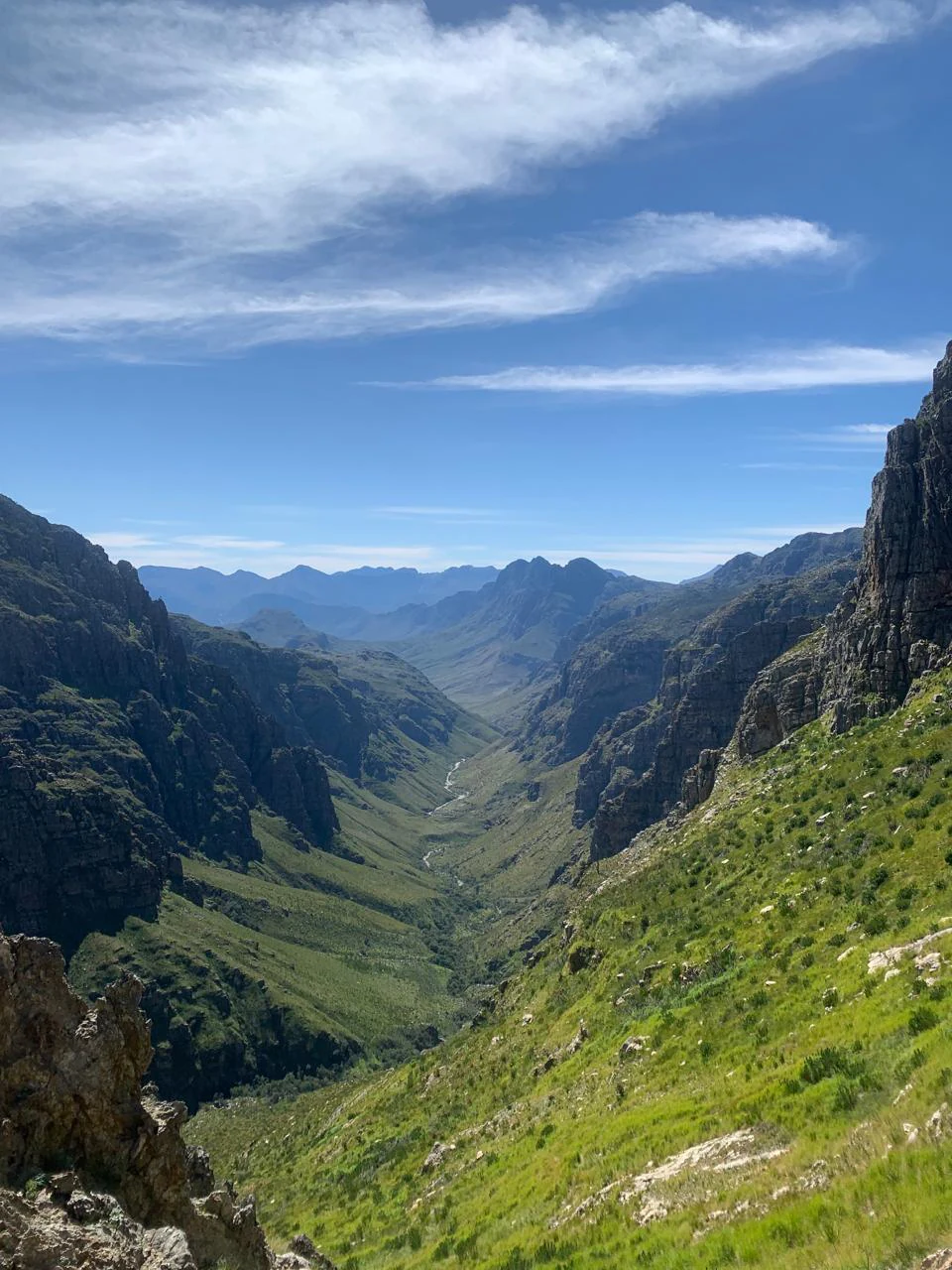
A high angle view looking down into a deep, green mountain valley with steep rocky slopes on both sides under a bright blue sky with wispy clouds.
A view overlooking the valley along the Panorama Route in Jonkershoek Nature Reserve.

Jonkershoek Nature Reserve ecosystems, habitats, and plant life

The reserve's ecological identity is rooted in the Cape Floral Region, one of the most botanically rich temperate zones on Earth. Its slopes are dominated by fynbos, the fine-leaved shrubland ecosystem unique to the southwestern Cape, which carries extraordinary plant diversity at small spatial scales and is recognized globally for its conservation significance.

In the valley bottoms and along the Eerste River corridor, the vegetation shifts into pockets of indigenous forest associated with the wetter, sheltered microclimates of the Cape mountains. These forest patches, together with the historic oak stands, create a layered landscape where fynbos, forest, and introduced broadleaves coexist in close proximity.

The combination of fynbos-covered slopes, forested kloofs, and well-vegetated riparian zones supports a wide range of ecological niches within a relatively compact area. This habitat diversity, combined with the reserve's elevational range and protected status, makes Jonkershoek a strong representation of the mountain ecosystems that characterize the western Cape. The reserve also plays a tangible role in safeguarding water resources by protecting the upper catchment of both the Eerste and Berg rivers.
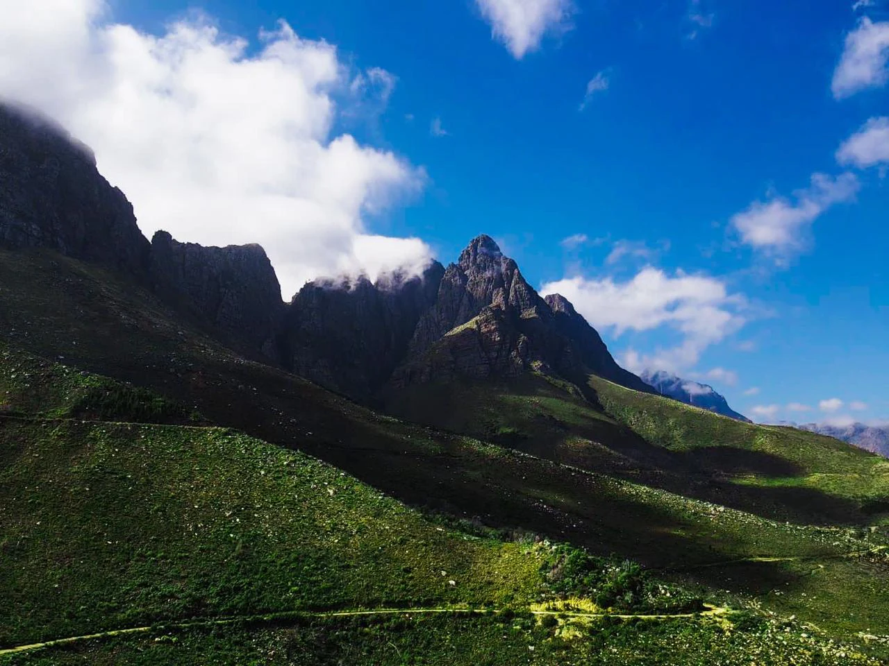
A wide angle view of a jagged mountain range in Jonkershoek Nature Reserve, with green grassy slopes in the foreground and a blue sky with scattered clouds above.
The rugged peaks of the Jonkershoek Mountains rise above the valley floor.

Jonkershoek Nature Reserve wildlife and species highlights

Mammal life in the Jonkershoek mountains is typical of the rugged terrain of the Western Cape highlands. Leopard occur in the area, though they are exceedingly elusive, alongside caracal, klipspringer on rocky slopes, chacma baboon troops that are often the most visible larger mammals, honey badger, and several mongoose species. Most of the carnivores and smaller mammals are secretive, and casual visitors are far more likely to encounter baboons than any of the predators.

Birdlife is one of the reserve's richest and most accessible features. The mountains and forested valleys support black eagle, fish eagle, and spotted eagle-owl, while the rivers and wooded patches attract kingfisher. Fynbos specialists are also present, including sugarbirds, orange-breasted sunbirds associated with protea stands, and protea seedeaters, giving the reserve a strong appeal for birdwatching across habitats ranging from protea-covered slopes to riparian woodland.
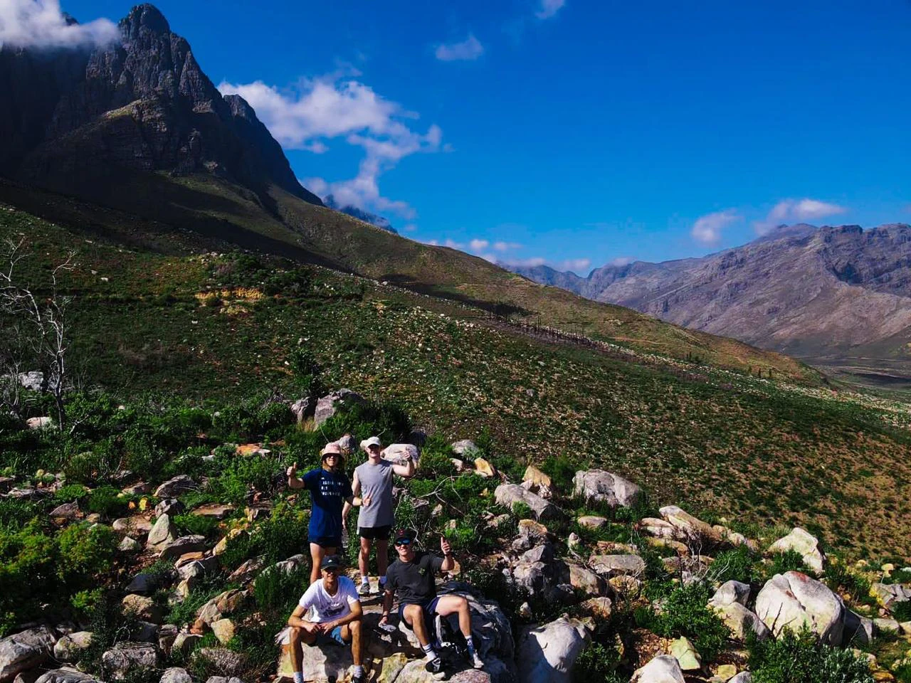
A group of five people sitting and standing on rocks along a hiking trail, with large mountain peaks under a clear blue sky in the background.
A group of hikers taking a break on a rocky trail in the Jonkershoek Nature Reserve.

Jonkershoek Nature Reserve conservation status and protection priorities

Jonkershoek's conservation value is twofold, combining biodiversity protection with critical mountain catchment protection. As part of the Cape Floral Region, the reserve helps safeguard fynbos vegetation, a globally recognized hotspot of plant endemism, while also protecting indigenous forest fragments and the predator and bird populations that depend on these habitats.

Its catchment role is equally important: by protecting the upper Eerste River, which reaches False Bay, and the upper Berg River, one of the major rivers of the Western Cape, the reserve contributes directly to the water security of surrounding agricultural areas, including the vineyards around Stellenbosch, and of downstream towns. Conservation here therefore extends beyond protecting species to maintaining the hydrological function of the wider Cape Winelands landscape.

Jonkershoek Nature Reserve cultural meaning and human context

The reserve carries a layered cultural heritage linked to both early colonial land grants and later Islamic religious tradition. The Jonkershoek valley was one of the freehold areas issued under Simon van der Stel, and the Assegaaibosch farmstead, dating to 1790, anchored European land use in the valley for more than two centuries. Oak plantings ordered by Lord Charles Somerset in 1817 left a permanent visual mark on the landscape.

The presence of several Kramats, including that of Sheikh Sayed Ahmad Singosari, introduces an important Cape Muslim religious and cultural dimension. These sites link the reserve to the broader Cape heritage of Islamic scholarship, pilgrimage routes, and communities that shaped parts of the Boland and Overberg region. The Assegaaibosch homestead itself, now a national monument and guest house, ties this cultural history directly into the reserve's modern identity.

Top sights and standout views in Jonkershoek Nature Reserve

Jonkershoek stands out as a CapeNature mountain catchment reserve where fynbos, indigenous forest, and historic oak stands converge within easy reach of Stellenbosch. Its role as the shared headwater of both the Eerste and Berg rivers gives it hydrological importance well beyond its boundaries, while the presence of leopard, caracal, klipspringer, baboon, and a rich fynbos bird community keeps it firmly on the radar of naturalists and birdwatchers.

The reserve also offers a distinctive cultural layer, blending an 18th-century farmstead at Assegaaibosch, declared national monument and repurposed as a guest house, with multiple Kramats that connect the landscape to Cape Islamic heritage. This combination of catchment ecology, biodiversity, and cultural memory makes Jonkershoek a multi-dimensional protected area rather than a purely wilderness-focused reserve.

Best time to visit Jonkershoek Nature Reserve

The character of a visit to Jonkershoek shifts meaningfully with the seasons. In the cooler, wetter winter and early spring months, the fynbos slopes come alive with flowering bulbs and proteas, and the mountain scenery is at its greenest, with waterfalls and high flows in the Eerste and Berg headwater streams. Bird activity, including fynbos specialists like sugarbirds, can be particularly rewarding in spring when proteas and other fynbos species are in bloom.

In summer, the landscape becomes drier and hotter, with more exposed rock and shorter vegetation, though the riverine and forested patches still offer shade and wildlife sightings. Cooler weather and pre-summer conditions tend to favor both general scenic quality and the visibility of raptors such as black eagle overhead. Visitors interested in fynbotany and birdwatching will generally find late winter and spring most rewarding, while those drawn to the reserve's quieter, drier mountain atmosphere often prefer late autumn through summer.
Monthly climate preview

Long term average temperature and precipitation measurements for Western Cape

Jonkershoek Nature Reserve Climate Normals and Monthly Weather Patterns

Measured coordinates track Jonkershoek Nature Reserve through a continuous annual cycle of shifting monthly temperatures and precipitation rates. Reviewing the complete twelve month climate profile reveals long term thermal averages and moisture distributions across the protected landscape.
Annual mean17 °C
12 °C22 °C
Jan21°
Feb22°
Mar20°
Apr18°
May15°
Jun13°
Jul12°
Aug12°
Sep13°
Oct16°
Nov18°
Dec20°
Warmest month
February

21.6 °C

Coolest month
July

11.8 °C

Wettest month
June

4.1 mm/day

Driest month
February

0.5 mm/day

Park location guide

Geography guide, regional context, and park location map for Jonkershoek Nature Reserve

Jonkershoek Nature Reserve park geography, regions, and map view in South Africa

Understand where Jonkershoek Nature Reserve sits in South Africa through a broader geographic reading of the surrounding landscape, nearby location context, and its mapped position within the national park landscape.

How Jonkershoek Nature Reserve fits into South Africa

South Africa is the southernmost country in Africa, spanning 1.22 million km² with a population of over 63 million. The country operates with three capital cities, Pretoria (executive), Cape Town (legislative), and Bloemfontein (judicial), and is renowned for its biodiversity, national parks, and multicultural society.

Wider geography shaping Jonkershoek Nature Reserve in South Africa

South Africa occupies the southernmost region of Africa, with coastline along both the Atlantic Ocean to the west and the Indian Ocean to the east. The interior features elevated plateaus including the Highveld, with the Drakensberg escarpment marking the eastern highlands. The country shares borders with Namibia, Botswana, Zimbabwe, Mozambique, Eswatini, and Lesotho.

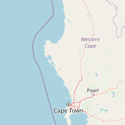
Map view of Jonkershoek Nature Reserve

Use this park location map to pinpoint Jonkershoek Nature Reserve in South Africa, understand its exact geographic position, and read its mapped placement within the surrounding landscape more clearly.

Pigeon | © OpenStreetMap contributors

Location context for Jonkershoek Nature Reserve

Western Cape

Explore protected area imagery, fynbos slopes, and river headwater landscapes in South Africa

Jonkershoek Nature Reserve Photos and Scenery: Visualizing Mountain Catchment Terrain

Examine detailed visual documentation of Jonkershoek Nature Reserve to understand its steep mountain ridges, fynbos vegetation cover, and forested river valleys. Reviewing these protected area photographs reveals the unique topography, moisture gradients, and scenic character defining the upper catchment terrain.

A hiker with a backpack walks along a rocky, narrow trail on a mountainside, with a vast mountain valley visible in the background under a blue sky.

A valley landscape in Jonkershoek Nature Reserve featuring a foreground of yellow flowering fynbos shrubs with rocky mountain slopes in the background under a blue sky.

A high angle view looking down into a deep, green mountain valley with steep rocky slopes on both sides under a bright blue sky with wispy clouds.

A wide angle view of a jagged mountain range in Jonkershoek Nature Reserve, with green grassy slopes in the foreground and a blue sky with scattered clouds above.

A group of five people sitting and standing on rocks along a hiking trail, with large mountain peaks under a clear blue sky in the background.

Park atlas

Compare surrounding mountain catchments and regional fynbos landscapes

Other Parks Near Jonkershoek Nature Reserve and Connected Western Cape Protected Areas

Browse nearby nature reserves and protected areas sharing the rugged mountain terrain of the Western Cape. Expand regional geographic comparisons by evaluating adjacent fynbos valleys and river headwaters.
Biosphere reserveWestern Cape
About 25 km away#1 closest

North

Cape Winelands Biosphere Reserve: Geographic Overview and Protected Area Mapping

Western Cape mountain terrain and sustainable landscape integration

The Cape Winelands Biosphere Reserve serves as a model for integrated landscape management in South Africa. Situated along the Cape Fold Belt, this reserve protects crucial water catchments and endemic floral habitats while encompassing a globally recognized wine-producing region. Access detailed mapping of its core, buffer, and transition zones to see how conservation persists within a working agricultural environment.

Area
1,243.4 km²
Established
2007
Relief
Mountain
Climate
Mediterranean
Nature reserveCape Town
About 33 km away#2 closest

West

Tygerberg Nature Reserve: Geographic Mapping of a Cape Town Protected Landscape

Renosterveld shale ridges and urban conservation context

Tygerberg Nature Reserve stands as a compact, high-value protected area within Cape Town, safeguarding hundreds of plant species and threatened Renosterveld habitats. The park landscape features a recognizable chain of shale hills punctuated by historic termite mounds known as heuweltjies, offering a window into the regional ecology and natural history of the Western Cape.

Area
3 km²
Established
1973
Relief
Upland
Climate
Mediterranean
A watercolor illustration of a wide landscape featuring a calm body of water in the foreground, rolling green hills, and purple-toned mountains in the background.
Nature reserveWestern Cape
About 37 km away#3 closest

South

Kogelberg Nature Reserve: Protected Mountain Geography in the Western Cape, South Africa

Coastal mountain fynbos and protected river ecosystems

Situated in the Western Cape of South Africa, Kogelberg Nature Reserve protects an exceptional concentration of fynbos vegetation and rugged sandstone terrain. The area spans coastal mountain ridges, riparian corridors, and forest-filled ravines, serving as a landmark for botanical diversity and protected-landscape mapping in the region.

Area
30 km²
Relief
Mountain
Scope
Terrestrial
Water
Major water bodies
National parkWestern Cape
About 43 km away#4 closest

West

Table Mountain National Park: Mapped Protected Landscape and Geographic Context in Western Cape

National Park details focused on atlas exploration and regional geography.

Table Mountain National Park is a designated national park within the Western Cape region, offering a distinct geographic profile for atlas exploration. This entity provides detailed mapped boundaries and landscape context, crucial for understanding its role as a protected area in South Africa. Users can explore the specific geography that defines this park and its place within the broader regional context, making it a key point of interest for structured geographic discovery and map-based research.

Area
221 km²
Established
1998
Relief
Mountain
Climate
Mediterranean
Watercolor painting of a soft, hazy mountain landscape with rolling green hills and pink-toned foreground vegetation, presented in a wide panoramic aspect.
Biosphere reserveWestern Cape
About 56 km away#5 closest

Southwest

Cape Floristic Region: A Detailed Geographic Atlas of the Western Cape Biodiversity Hotspot

Mapped protected biosphere reserve and fynbos landscapes

Explore the Cape Floristic Region, an expansive protected landscape within South Africa. This atlas provides a detailed look at the region's Mediterranean shrublands, sandstone-derived soil terrain, and its status as a singular floral kingdom. Understand the geography of the Western Cape through its mountain ranges and diverse ecological zones.

Area
78,555 km²
Established
2004
Nature reserveWestern Cape
About 59 km away#6 closest

Northwest

Koeberg Nature Reserve: A Geographical Overview of Coastal Protected Landscapes

Lowland fynbos, dune thicket, and aquifer geography in the Western Cape

Situated north of Cape Town, Koeberg Nature Reserve acts as a vital sanctuary for threatened plant communities and diverse bird populations. Its unique terrain combines sandy coastal dunes with seasonal pans and wetland complexes, providing a distinct study in protected area conservation and regional ecological management.

Area
26.81 km²
Established
1991
Relief
Lowland
Climate
Mediterranean
Nature reserveWestern Cape
About 82 km away#7 closest

Southeast

Salmonsdam Nature Reserve: Atlas of Protected Landscapes in the Western Cape Overberg

Mountain fynbos, river gorges, and forest catchment geography.

Salmonsdam Nature Reserve is a compact protected expanse in the Overberg mountains of the Western Cape. The reserve encompasses the full Paardensberg River catchment, featuring complex terrain that ranges from high rocky ridges to the wet valley floor of Die Weivlakte. Its geography supports a high concentration of Afromontane forest patches and mountain fynbos habitats within a small, accessible area.

Area
8.34 km²
Established
1962
Relief
Mountain
Climate
Mediterranean
A horizontal watercolor illustration depicting soft green rolling hills in the background, a line of light green trees in the midground, and foreground vegetation with tall reeds near a calm pinkish water channel.
Nature reserveWestern Cape
About 90 km away#8 closest

Southeast

Dyer Island Nature Reserve Complex: Protected Marine Islands and Coastal Ecosystems

A critical conservation node in the Western Cape

The Dyer Island Nature Reserve Complex encompasses a series of low lying, wind-swept rocky islets that function as a cornerstone for South African marine research. By preserving the crucial breeding grounds of African penguins and providing a hub for the Cape fur seal population, this reserve defines a unique stretch of the Western Cape marine geography where high concentrations of predators and prey interact.

Established
1988
IUCN
Ia
Water
Water-dominated

Common questions about visiting, size, designation, and location context for Jonkershoek Nature Reserve

Jonkershoek Nature Reserve FAQs for park facts, access, geography, and protected area context

Find quick answers about Jonkershoek Nature Reserve, including protected-area facts, park geography, trail and visitor context, and how the park fits into its surrounding country and regional landscape.
MoriAtlas Explorer

Continue Your Protected Areas Search Across the Global Atlas

Deepen your exploration by continuing the structured search for national parks and protected areas worldwide. Utilize the comprehensive filtering capabilities to compare different conservation landscapes and refine your understanding of global park geography. Discover more about the distribution and characteristics of protected natural areas.

Global natural geography