
Mori Atlas logo
Protected areaJuniper Dunes Wilderness

Mapping the arid shrub-steppe and northernmost western juniper dunes of the Columbia Basin.

Juniper Dunes Wilderness: A Geographic Profile of Eastern Washington Protected Landscapes

Juniper Dunes Wilderness occupies a distinct geographic niche in Franklin County, Washington, where wind-driven sand dunes intersect with shrub-steppe rangeland. As a federally designated protected area, it serves as a biogeographic landmark by hosting the northernmost population of western juniper trees in North America. This atlas entry examines the interplay of dune ecology, rare tree distribution, and the rugged terrain that defines this unique section of the Columbia Plateau.

wilderness areasand dunesshrub-steppewestern juniperarid landscapeColumbia Basin
A flat vector-style illustration of a desert landscape showing large, layered mesa cliffs in the background and a sandy, grass-covered foreground with scattered evergreen trees under a pale sky.

Juniper Dunes Wilderness

Protected area

Park overview

Structured park overview, official facts, and landscape profile for Juniper Dunes Wilderness

Juniper Dunes Wilderness park facts, protected area profile, and essential visitor context

Review the core facts for Juniper Dunes Wilderness, including designation, size, terrain, visitor scale, habitats, and operating context in one park-focused overview.

About Juniper Dunes Wilderness

Juniper Dunes Wilderness sits in the Columbia Basin of southeastern Washington, just south of the Snake River and not far from the city of Pasco. Despite being only a few thousand acres in size, the area carries an outsized sense of place because of the unusual combination of dune landscapes and juniper woodland. The wilderness is bordered by privately owned land, and its isolation has been part of what has preserved the dunes, juniper stands, and surrounding shrub-steppe in a relatively undisturbed state.

Managed by the Bureau of Land Management, Juniper Dunes is part of the National Wilderness Preservation System and was formally designated in 1984. The landscape is composed of extensive open sand dunes, rolling dune ridges, vegetated swales, and rangeland habitats that transition gradually into the broader Columbia Plateau scenery. To the east, views from the dunes reach toward Rattlesnake Mountain, a well-known landmark in the Tri-Cities region, framing the wilderness against the larger geography of the Columbia Basin.

Ecologically, the area reflects a blend of Great Basin and northern shrub-steppe influences. Juniper woodland is not native to most of Washington's shrub-steppe landscape, so the presence of mature western junipers here has long attracted scientific interest. The surrounding sand dunes host specialized plant communities, including sand-adapted grasses, buckwheats, milkvetches, cacti, and a suite of colorful wildflowers that bloom in favorable springs. Together, these features make Juniper Dunes a compact but unusually distinctive wilderness that highlights both ecological transitions and the geological character of wind-shaped terrain in the inland Pacific Northwest.

Quick facts and research context for Juniper Dunes Wilderness

Juniper Dunes Wilderness is a federally designated wilderness area of about 7,140 acres in Franklin County, southeastern Washington. It lies near Pasco and is administered by the U.S. Bureau of Land Management under the Department of the Interior. The wilderness was officially established in 1984 and is classified under IUCN Category Ib as a protected wilderness landscape.

The area is characterized by large inland sand dunes, arid shrub-steppe vegetation, and the northernmost known grove of western juniper trees. Vegetation beyond juniper is dominated by drought-adapted grasses, sagebrush associates, and dune-specialist wildflowers, while wildlife includes mule deer, coyotes, bobcats, raptors, quail, songbirds, and rattlesnakes.

Protection and recognition

Documented terrestrial protection scope and international recognition facts

Juniper Dunes Wilderness Protection Status and Recognition Data

Juniper Dunes Wilderness maintains a documented terrestrial protection scope without supplementary international recognition sources. Protected area records outline baseline conservation parameters for this landscape without detailing governing authorities.

Protection details

Protection scope
Terrestrial
Transboundary protection
No
Park context

Deeper park guide and search-rich context for Juniper Dunes Wilderness

Juniper Dunes Wilderness history, landscape, wildlife, and travel context

Explore Juniper Dunes Wilderness through its history, landscape character, ecosystems, wildlife, conservation priorities, cultural context, and seasonal travel timing in a structured park guide built for atlas discovery and search intent.

Why Juniper Dunes Wilderness stands out

Juniper Dunes Wilderness is best known for being home to the northernmost population of western juniper trees in the United States. These isolated junipers grow among large sand dunes in a part of eastern Washington where juniper woodland would normally not be expected, making the site a notable biogeographic outlier. The pairing of juniper trees with active dune formations also gives the wilderness strong landscape distinction well beyond its modest size.
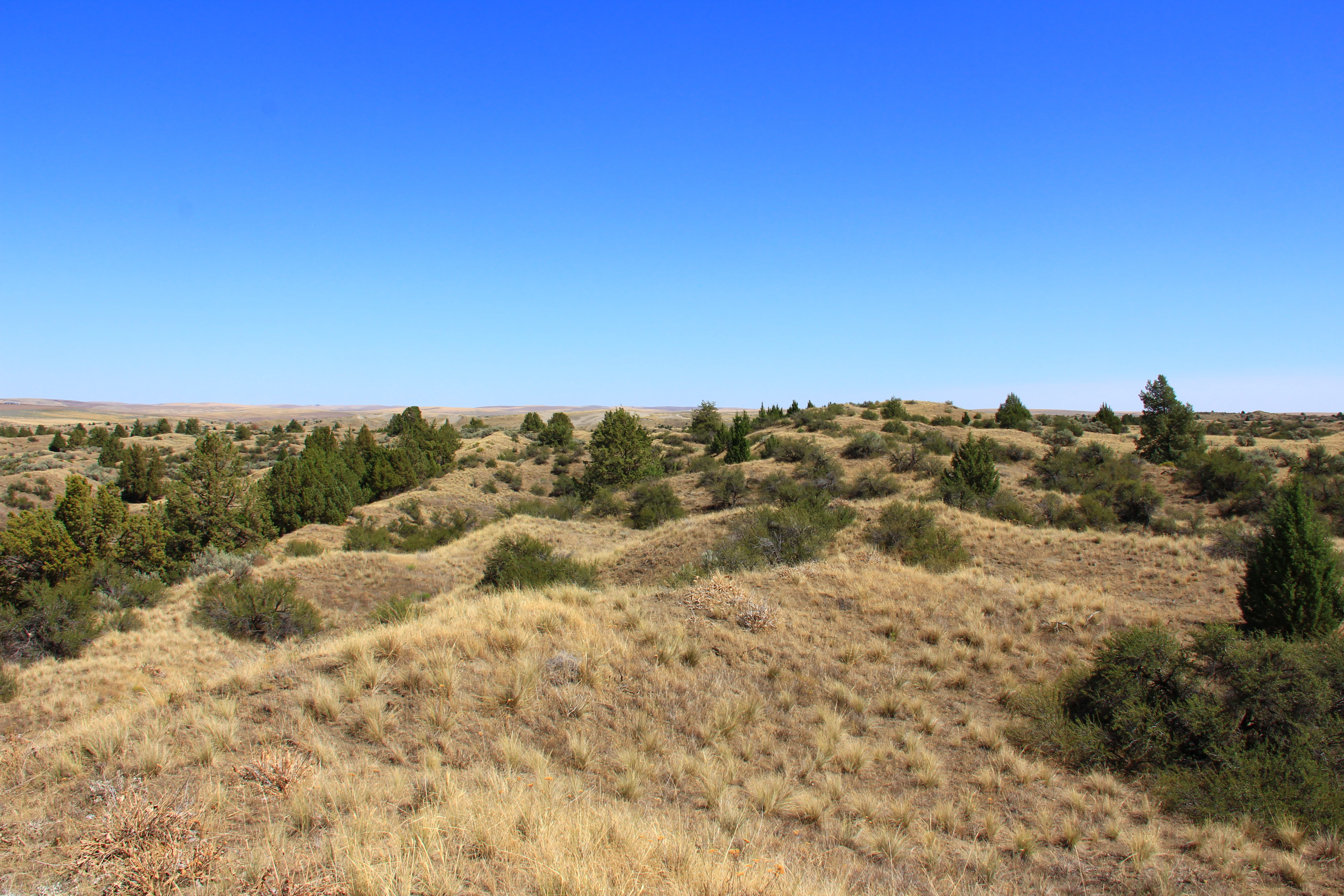
A wide, eye-level view of a desert landscape featuring rolling, golden-brown sand dunes interspersed with scattered dark green western juniper trees under a clear blue sky.
Rolling sand dunes dotted with western juniper trees in the Juniper Dunes Wilderness.

Juniper Dunes Wilderness history and protected-area timeline

Juniper Dunes Wilderness was formally established in 1984 as part of the National Wilderness Preservation System, gaining legal protection under the framework of the 1964 Wilderness Act. Its designation reflected both the unusual ecological value of the northernmost western juniper grove and the dune landscapes that surround it. Because the area sits within a working ranching and agricultural region of the Columbia Basin, protection required careful balancing with surrounding land uses, and the wilderness has remained relatively small and isolated from neighboring public lands.

In early 2007, an access agreement was reached with surrounding private landowners that allows visitors, with permission, to use one of several older jeep trails that lead toward the wilderness boundary. This agreement played an important role in acknowledging the landownership reality around the wilderness while providing a controlled way for the public to experience the dunes and juniper stands. The wilderness continues to be administered by the Bureau of Land Management, with management priorities emphasizing protection of wilderness character, native vegetation, and the unique dune-juniper landscape.

Juniper Dunes Wilderness landscape and geographic character

The dominant landscape feature of Juniper Dunes Wilderness is its system of large sand dunes, formed by wind-driven sand accumulated in this corner of the Columbia Basin. The dunes include open sandy bowls, ridgelines marked by sand movement, and broader flat areas of compacted sand interspersed with vegetation. Around and between the dunes, the terrain transitions into shrub-steppe rangeland and rolling uplands typical of eastern Washington.

Within this dune setting, scattered stands of western juniper cling to portions of the landscape, their dark, gnarled forms standing out against pale sand and lighter-colored bunchgrasses. From higher vantage points within the wilderness, the view opens eastward across the Columbia Basin, with Rattlesnake Mountain visible in the distance above the haze. The interplay between open dune, dark juniper clusters, and distant basaltic uplands creates a memorable and unusual scenic character for a wilderness of this size.

Juniper Dunes Wilderness ecosystems, habitats, and plant life

The ecological character of Juniper Dunes Wilderness reflects the meeting point between inland sand dune ecosystems and northern shrub-steppe vegetation. The most defining ecological feature is the presence of western juniper, a tree species whose main range lies much farther south. The n

Top sights and standout views in Juniper Dunes Wilderness

The single most unusual highlight of Juniper Dunes Wilderness is the grove of western juniper trees growing far north of the species' typical range. These scattered junipers grow directly within a dune system rather than on rocky ridge habitat, creating a distinctive combination of woodland and open sand.

Equally notable is the wilderness's dune plant community. Sand-adapted species such as Indian ricegrass, bluebunch wheatgrass, prickly pear cactus, sand-verbena, buckwheat, milkvetch, and wild hyacinth contribute seasonal color and ecological texture. Combined with wildlife like mule deer, coyotes, bobcats, hawks, and rattlesnakes, these dune-and-juniper habitats make Juniper Dunes Wilderness a compact but striking example of ecological exception within eastern Washington.

Best time to visit Juniper Dunes Wilderness

Spring and early summer tend to be the most rewarding periods to experience Juniper Dunes Wilderness, when cooler temperatures, occasional moisture, and the dune wildflower season combine to show the area at its most colorful and biologically expressive. These seasons support active wildlife and offer the best conditions for observing both dune plant communities and the juniper groves.

Late spring mornings and evenings are particularly favorable for cooler weather, softer light on the dunes, and higher chances of seeing raptors, songbirds, and mammals. Summer can bring intense heat across the open sand and shrub-steppe, so any summer visit benefits from very early starts and careful heat awareness. Fall typically brings quieter conditions, cooler days, and the chance to experience the juniper woodland as the surrounding grasses change color, while winter visits give the dune landscape a more austere, lightly visited character.
Monthly climate preview

Long-term representative climate normals and weather by month for Franklin County

Juniper Dunes Wilderness Average Temperature and Monthly Precipitation Profile

Representative coordinate records show measured long-term temperature ranges and monthly precipitation patterns across the protected landscape. Examining the complete twelve-month climatology dataset reveals broader annual shifts in regional weather conditions.
Annual mean12 °C
1 °C25 °C
Jan
Feb
Mar
Apr11°
May16°
Jun20°
Jul25°
Aug24°
Sep19°
Oct11°
Nov
Dec
Warmest month
July

24.8 °C

Coolest month
December

0.9 °C

Wettest month
December

1.6 mm/day

Driest month
August

0.3 mm/day

Park location guide

Geography guide, regional context, and park location map for Juniper Dunes Wilderness

Juniper Dunes Wilderness park geography, regions, and map view in United States of America

Understand where Juniper Dunes Wilderness sits in United States of America through a broader geographic reading of the surrounding landscape, nearby location context, and its mapped position within the national park landscape.

How Juniper Dunes Wilderness fits into United States of America

The United States of America is a federal presidential republic and one of the world's largest countries by area and population. It consists of 50 states across a vast territory spanning multiple time zones, with its capital in Washington, D.C. and largest city in New York City. The nation has a diverse economy, influential political system, and significant cultural and military presence globally.

Wider geography shaping Juniper Dunes Wilderness in United States of America

The United States occupies a vast territory in North America, bordered by Canada to the north and Mexico to the south. The 48 contiguous states stretch from the Atlantic to the Pacific Ocean, while Alaska occupies the northwestern region and Hawaii is an archipelago in the Pacific. The country encompasses diverse terrain including the Rocky Mountains, Appalachian Mountains, Great Plains, and extensive river systems.

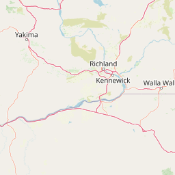
Map view of Juniper Dunes Wilderness

Use this park location map to pinpoint Juniper Dunes Wilderness in United States of America, understand its exact geographic position, and read its mapped placement within the surrounding landscape more clearly.

Pigeon | © OpenStreetMap contributors

Location context for Juniper Dunes Wilderness

Franklin CountyWashington
Recorded earthquake history

Explore the Historical Earthquake Record for Juniper Dunes Wilderness

Review recorded seismic activity associated with the geography of Juniper Dunes Wilderness. Through the MoriAtlas seismic catalogue, identify historical event locations, magnitudes, and depth data for the region to better understand the seismic context of this protected wilderness.

Juniper Dunes Wilderness Earthquake History

Catalogued events

16 events

Strongest magnitude

Magnitude 3.7

Most recent event

Nov 17, 2013

This history includes earthquakes recorded inside the park or within 50 km of its borders

Visual reference for rare western juniper trees and active inland sand dunes

Juniper Dunes Wilderness Photos and Landscape Scenery

Visual records capture the distinctive terrain of Juniper Dunes Wilderness, featuring wind-blown sand formations and isolated juniper groves. Detailed photography reveals the unique ecological character of protected shrub-steppe habitats across the Columbia Basin.

A wide, eye-level view of a desert landscape featuring rolling, golden-brown sand dunes interspersed with scattered dark green western juniper trees under a clear blue sky.

A wide landscape view of sand dunes and scattered vegetation under a hazy, overcast sky.

Park atlas

Discover regional park geography and adjacent protected landscapes in eastern Washington

Explore Protected Areas and Other Parks Near Juniper Dunes Wilderness

Browse nearby national parks and protected areas sharing the arid terrain and shrub-steppe ecosystems of the Columbia Basin. Comparing surrounding wilderness reserves provides deeper context for regional landforms and native plant communities.
Protected landscapeOregon
About 96 km away#1 closest

Southeast

Umatilla National Forest: A Comprehensive Atlas of Blue Mountains Protected Landscapes

Explore mountain terrain, wilderness areas, and river-carved geography

Spanning over one million acres, Umatilla National Forest encompasses a complex array of river-cut canyons, high-country ridges, and substantial old-growth woodlands. This protected landscape offers a deep look into the ecological and physical character of the Blue Mountains, from the remote reaches of the Wenaha-Tucannon Wilderness to the headwaters of the Umatilla River.

Area
5,694 km²
Established
1908
Visitors
703K annual
Relief
Mountain
Protected landscapeOregon
102 km away#2 closest

Southeast

Wallowa-Whitman National Forest: A Geographic Overview of Northeastern Oregon Landscapes

Alpine wilderness, mountain ranges, and deep river gorges.

Wallowa-Whitman National Forest protects a vast, varied landscape of granite peaks, alpine meadows, and forested river canyons. This detailed overview covers the geographic significance of the Wallowa and Elkhorn mountains, the Hells Canyon corridor, and the surrounding wilderness regions within Oregon.

Area
9,682 km²
Established
1905
Visitors
505K annual
Relief
Mountain
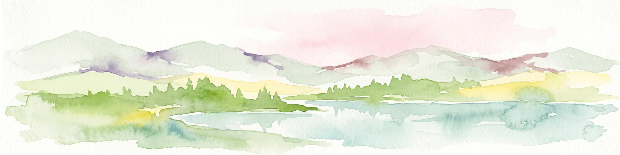
A horizontal watercolor painting depicting a soft-focus mountain range in shades of purple and pink behind a green forest and a calm blue lake.
Wildlife reserveOregon
128 km away#3 closest

Southeast

Eagle Cap Wilderness: Map and Protected Area Overview in Northeastern Oregon

High elevation terrain, glacial valleys, and mountain ecosystems

Spanning over 350,000 acres, Eagle Cap Wilderness defines the high-altitude geography of the Wallowa Mountains. This protected area is characterized by sharp granite ridges, more than 60 named alpine lakes, and deeply carved U shaped glacial valleys. It acts as a primary water source for the region, hosting the headwaters of several major rivers while supporting diverse wildlife populations in a preserved backcountry environment.

Area
1,462.72 km²
Established
1940
IUCN
Ib
Relief
Mountain
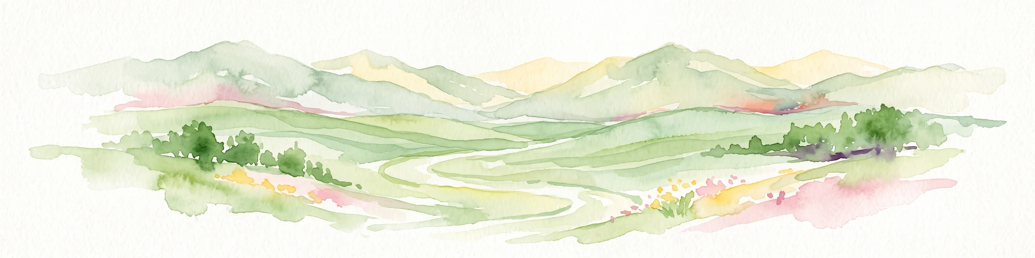
A watercolor painting of a wide, rolling landscape with green hills, a winding path or river, and soft mountains in the background against a white background.
Protected landscapeUnited States of America
143 km away#4 closest

Southeast

Hells Canyon National Recreation Area: Geologic Boundaries and Snake River Corridor Atlas

Deep canyon terrain and archaeological heritage in the American Northwest

This protected landscape encompasses the profound depth of the Snake River gorge, featuring rugged basalt cliffs and diverse forested uplands. The area serves as a significant intersection of natural history and ancient cultural presence, providing a detailed look at the topographic complexity defining the Oregon and Idaho boundary region.

Area
2,641 km²
Established
1975
Relief
Mountain
Climate
Temperate
A watercolor painting of a mountain landscape with soft-colored rolling hills, a green forest line, and foreground vegetation on a white background.
Protected landscapeWashington
145 km away#5 closest

Northwest

Okanogan, Wenatchee National Forest: A Comprehensive Look at Washington's Protected Mountain Landscapes

Mapping ecological gradients and wilderness boundaries across the eastern Cascade Range

Spanning from the moist coniferous forests of the western Cascades to the arid plateaus of the Okanogan, this massive national forest protects an unmatched diversity of terrain. Explore the intricate geography of river-carved valleys, glacial cirques, and remote wilderness areas that characterize this critical environmental corridor in the Pacific Northwest.

Area
6,066.33 km²
Established
1911
Visitors
397K annual
Relief
Mountain
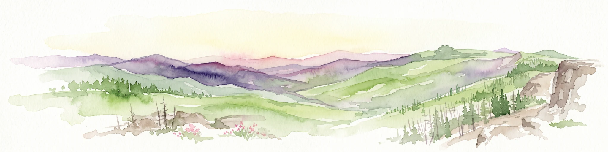
A horizontal watercolor painting showing a panoramic view of layered green and purple mountains under a pale sky, with coniferous trees in the foreground.
Protected landscapeOregon
172 km away#6 closest

South

Malheur National Forest: Exploring Oregon's Vast Protected Mountain and Desert Landscape

A geographic study of the Blue Mountains and high desert terrain

Spanning over 1.4 million acres, Malheur National Forest represents a complex protected landscape in eastern Oregon. Its geography is defined by a central spine of the Strawberry Mountains, creating a transition zone between arid high desert ecosystems and dense coniferous forests. Known for large wilderness areas and extensive old growth stands, this forest serves as a vital point for understanding the interplay between topographic elevation and regional climate in the Pacific Northwest.

Area
5,929.81 km²
Established
1908
Visitors
242K annual
Relief
Mountain
A horizontal watercolor illustration featuring a waterfall on the left, a range of rolling mountains in the background, and clusters of trees in the midground, rendered in soft, blended colors.
Protected landscapeWashington
172 km away#7 closest

West

Gifford Pinchot National Forest: Geographic Overview of Washington's Volcanic Cascade Protected Lands

Mapping volcanic peaks, deep river canyons, and old-growth wilderness corridors

Gifford Pinchot National Forest represents a major protected expanse in the Washington Cascades, characterized by a complex volcanic topography that includes active craters, cinder cones, and rugged lava fields. This atlas entry details the forest's primary geographic features, from the high-elevation alpine terrain of the Goat Rocks to the river-carved valleys of the Lewis and Cowlitz systems, providing essential context on this integral Pacific Northwest protected landscape.

Area
5,347.95 km²
Established
1908
Visitors
1.8M annual
Relief
Mountain
A soft watercolor illustration depicting a winding river flowing through a gentle landscape with distant rolling hills and scattered trees.
Protected areaWashington
About 192 km away#8 closest

North

Lake Roosevelt National Recreation Area: An Atlas of Washington Reservoir Landscapes

A sprawling protected region spanning the Columbia River corridor.

Lake Roosevelt National Recreation Area represents a massive, water-defined corridor in eastern Washington. The park preserves the 130-mile Franklin D. Roosevelt Lake, where steep basalt terrain meets arid shrub-steppe. This protected unit offers deep insight into the regional geography of the Columbia Plateau, featuring historical sites and river-system infrastructure that define the landscape's character.

Area
406.3 km²
Established
1946
Visitors
1.2M annual
Relief
Lowland

Common questions about visiting, size, designation, and location context for Juniper Dunes Wilderness

Juniper Dunes Wilderness FAQs for park facts, access, geography, and protected area context

Find quick answers about Juniper Dunes Wilderness, including protected-area facts, park geography, trail and visitor context, and how the park fits into its surrounding country and regional landscape.
MoriAtlas Explorer

Continue Your Protected Areas Search Across the Global Atlas

Deepen your exploration by continuing the structured search for national parks and protected areas worldwide. Utilize the comprehensive filtering capabilities to compare different conservation landscapes and refine your understanding of global park geography. Discover more about the distribution and characteristics of protected natural areas.

Global natural geography