Mori Atlas logo
Wildlife reserveJuniper Mesa Wilderness

Mapping the sandstone mesa and diverse canyon ecosystems within the Prescott National Forest

Juniper Mesa Wilderness: A Comprehensive Geographic Profile of Central Arizona Protected Lands

Juniper Mesa Wilderness serves as a vital geological relict of the Colorado Plateau, standing prominently above the surrounding granite terrain of central Arizona. Encompassing over 7,000 acres in Yavapai County, this protected area reveals a striking contrast between sedimentary mesa tops and igneous mountain slopes. Visitors and researchers can trace the intricate transition between pinyon-juniper woodlands and ponderosa pine forests that define the local ecology across varying elevations.

wilderness areaPrescott National ForestArizona mountainssandstone mesagranite landscapepinyon-juniper woodland

Juniper Mesa Wilderness

Wildlife reserve

Park overview

Structured park overview, official facts, and landscape profile for Juniper Mesa Wilderness

Juniper Mesa Wilderness park facts, protected area profile, and essential visitor context

Review the core facts for Juniper Mesa Wilderness, including designation, size, terrain, visitor scale, habitats, and operating context in one park-focused overview.

About Juniper Mesa Wilderness

Juniper Mesa Wilderness is a small but visually striking unit of the National Wilderness Preservation System, located in the Prescott National Forest of central Arizona. Although it covers roughly 7,406 acres, the wilderness feels expansive due to its rugged topography, isolated setting, and the dramatic presence of the mesa itself. Visitors approaching from Prescott, the nearest major city, drive about an hour northwest into the Juniper Mountains, with the small community of Paulden serving as the practical gateway to the surrounding backcountry.

The defining feature of the wilderness is its namesake mesa, a flat-topped elevation capped by Tapeats sandstone and underlain by older Martin and Redwall limestones. These sedimentary layers are a relict of an ancient and once far more extensive Colorado Plateau system, preserved here as an outlier far to the south of the plateau's main body. Around and beneath this mesa, the terrain is shaped largely by granite, producing a striking geological contrast: pale, layered cliffs and benches laid down by ancient seas, set against older crystalline rock shaped by uplift and erosion. Steep canyons are cut into the mesa's edges, giving the landscape much of its visual drama.

In addition to its geological interest, Juniper Mesa Wilderness occupies a fascinating ecological transition. Elevations between roughly 5,600 and 7,000 feet place the area within what ecologists call Arizona's Transition Zone, where plant communities typical of the Colorado Plateau and the Mogollon Rim begin to mingle with those more characteristic of the Sonoran and chaparral landscapes to the south. The effect is a wilderness in which forest type, slope exposure, and underlying rock together produce a richly varied plant cover across a relatively compact area.

Because it lies within the Prescott National Forest and was designated as wilderness in 1984, the area is managed to maintain a primitive, roadless character. Recreational use is light and largely trail-based, contributing to a sense of solitude that fits the wilderness's definition under the U.S. Wilderness Act. From the higher points of the mesa, hikers can see toward neighboring protected areas, including Apache Creek Wilderness and the rugged flanks of Granite Mountain, as well as the Woodchute and Sycamore Canyon wilderness areas, situating Juniper Mesa within a broader network of roadless landscapes in central Arizona.

Quick facts and research context for Juniper Mesa Wilderness

Juniper Mesa Wilderness is a federally designated wilderness area within the Prescott National Forest, managed by the U.S. Forest Service. Established in 1984, it covers approximately 7,406 acres and lies entirely within the Juniper Mountain USGS topographic quadrangle.

The area sits in the Juniper Mountains of Yavapai County, Arizona, north of the Apache Creek Wilderness and west of Granite Mountain. Its elevation range of roughly 5,600 to 7,000 feet places it within Arizona's Transition Zone, where Colorado Plateau geology meets Basin and Range terrain.

It is classified under IUCN Category Ib (wilderness area), reflecting its protected status and emphasis on retaining primitive, undeveloped character.

Protection and recognition

Examine terrestrial protected area designations and international recognition records

Juniper Mesa Wilderness Protection Status and Geographic Recognition

Juniper Mesa Wilderness maintains a documented terrestrial protection scope within its designated natural boundary. Official records outline the established conservation framework, management jurisdiction, and administrative recognition history.

Protection details

Protection scope
Terrestrial
Transboundary protection
No
Park context

Deeper park guide and search-rich context for Juniper Mesa Wilderness

Juniper Mesa Wilderness history, landscape, wildlife, and travel context

Explore Juniper Mesa Wilderness through its history, landscape character, ecosystems, wildlife, conservation priorities, cultural context, and seasonal travel timing in a structured park guide built for atlas discovery and search intent.

Why Juniper Mesa Wilderness stands out

Juniper Mesa Wilderness is best known for its Tapeats sandstone and limestone mesa, a conspicuous and visually distinctive landform that rises above the surrounding granite hills of the Juniper Mountains. The mesa acts as a small but vivid geological relict of the Colorado Plateau, with steep canyons cutting through layered sedimentary rock that contrasts sharply with the older igneous terrain around it. The wilderness is also recognized for its classic interior Arizona vegetation gradient, where sun-exposed pinyon pine and Utah juniper stands give way to cooler, moister north-facing slopes of ponderosa pine and alligator juniper. This juxtaposition of contrasting rock types, canyon-cut topography, and sharply zoned woodland vegetation is the defining character that sets Juniper Mesa apart from neighboring wilderness areas in the Prescott National Forest.

Juniper Mesa Wilderness history and protected-area timeline

Juniper Mesa Wilderness was formally designated in 1984, when it was added to the National Wilderness Preservation System as part of the broader effort during that era to identify and protect high-quality roadless lands within national forests across the western United States. The area had long been part of the Prescott National Forest, one of Arizona's older national forest units, and the wilderness designation reflected a recognition that the mesa and its surrounding canyons possessed a combination of scenic, geological, and ecological values that warranted a higher level of protection.

Designation as wilderness placed the area under the management framework defined by the Wilderness Act, meaning the U.S. Forest Service is responsible for preserving its wilderness character. This framework generally limits road construction, mechanized use, and resource extraction, while still allowing traditional forms of recreation such as hiking, horseback riding, and hunting. Within the Prescott National Forest, the 1984 designation added Juniper Mesa to a network of protected areas that includes the earlier-established Granite Mountain and Woodchute wildernesses, reinforcing a regional pattern of preserving distinctively Arizonan landscapes within reach of Prescott and the surrounding communities of Yavapai County.

Beyond this administrative history, the geological history of the area reaches much deeper into the past. The Tapeats sandstone at the top of the mesa and the underlying limestones are remnants of an ancient depositional system that, in earlier periods of Earth's history, extended across what is now the Colorado Plateau. Juniper Mesa effectively preserves a small piece of that vanished landscape, making it of interest not just as a contemporary wilderness but also as a window into the deep geological record of the American Southwest.

Juniper Mesa Wilderness landscape and geographic character

The physical landscape of Juniper Mesa Wilderness is dominated by the mesa after which the area is named. This flat-topped landform is capped by Tapeats sandstone, a resistant sedimentary layer that protects softer underlying rock and gives the mesa its characteristic blocky profile. Beneath the sandstone lie older Martin and Redwall limestones, which contribute to the mesa's stepped, layered appearance where canyons and gullies have cut into its flanks.

Surrounding the mesa, the landscape transitions to terrain shaped primarily by granite, part of the older geological basement that underlies much of central Arizona. This contrast between layered sedimentary rock on the mesa and massive crystalline rock around it is one of the most distinctive visual qualities of the wilderness. Steep canyons incise the mesa's edges, producing narrow drainages, exposed cliff faces, and benches that catch light and shadow throughout the day.

Elevations across the wilderness range from approximately 5,600 feet in the lower canyons up to about 7,000 feet along the higher portions of the mesa and adjacent ridges. This modest range, combined with the area's northern Arizona location, gives the landscape a mix of canyon character and mesa-top openness. From the mesa's upper surfaces and along its rim, long views open toward the surrounding highlands, including the prominent profile of Granite Mountain to the east and other nearby wilderness areas such as Apache Creek, Woodchute, and Sycamore Canyon.

Juniper Mesa Wilderness ecosystems, habitats, and plant life

Ecologically, Juniper Mesa Wilderness lies within Arizona's Transition Zone, a classic meeting ground between plant communities of the Colorado Plateau to the north and those of the more arid southern and central Arizona landscapes. This transitional setting is one of the keys to the area's ecological interest, allowing distinct vegetation types to occur within a relatively small geographic footprint.

The dominant ecological pattern is a strong contrast between south-facing and north-facing slopes. On the warmer, drier southern exposures, vegetation is dominated by pinyon pine and Utah juniper, forming the kind of open, park-like pinyon-juniper woodland characteristic of the broader Colorado Plateau region. These slopes tend to be sunnier and more sparsely vegetated, with widely spaced trees and visible bare ground between them.

On cooler, moister northern slopes and in shaded canyons, the vegetation shifts noticeably. Here, ponderosa pine becomes more prevalent, often accompanied by alligator juniper, producing denser, taller, and more continuous forest cover. The result is a patchwork ecological mosaic, with sharp transitions between woodland types driven by slope, aspect, and elevation. This diversity of habitat structure is the foundation for the wildlife communities found within the wilderness and contributes to its visual appeal for visitors traveling through the area.

Juniper Mesa Wilderness wildlife and species highlights

The wildlife of Juniper Mesa Wilderness reflects the transitional nature of its habitats and the surrounding mix of pinyon-juniper woodland, ponderosa pine forest, and rugged canyon terrain. Large and medium-sized mammals typical of Arizona's higher-elevation woodlands are present, including black bear, elk, and mule deer, all of which rely on the area's mix of forested slopes and canyon cover for foraging and movement. Bobcats are also residents, drawn to the rocky canyons and dense vegetation that provide hunting opportunities for smaller prey.

Among smaller mammals, Abert's squirrels are particularly characteristic of the area, closely associated as they are with ponderosa pine forests throughout the central and northern parts of Arizona. Their presence here underscores the ecological significance of the ponderosa pine component of the wilderness, especially on north-facing slopes and around the mesa's upper edges.

Hunting for deer and small game is among the recognized recreational uses of the area, reflecting both the presence of game species and the management approach of the U.S. Forest Service, which oversees wildlife habitat in addition to recreation. Although detailed wildlife inventories are limited by the area's relatively small size and undeveloped character, the combination of woodland types, canyon topography, and connectivity to surrounding undeveloped lands supports the kinds of species that are typical of wilderness areas in this part of Arizona.

Juniper Mesa Wilderness conservation status and protection priorities

Juniper Mesa Wilderness derives its principal conservation significance from its formal designation as a wilderness area within the National Wilderness Preservation System, a status it has held since 1984. Under this designation, the area is managed to preserve its wilderness character, with constraints on road building, mechanized use, and development. This long-term protection helps ensure that the mesa, its canyons, and the surrounding vegetation remain in a relatively undisturbed state.

From a geological perspective, the wilderness conserves a small but meaningful relict of the Colorado Plateau's sedimentary sequence, including exposures of Tapeats sandstone and Martin and Redwall limestone, in a setting far removed from the plateau's main extent. This makes the area of interest not only for recreation but also for understanding the regional geological history of the American Southwest.

Ecologically, the wilderness contributes to the broader conservation value of the Prescott National Forest by protecting a representative example of the Transition Zone vegetation gradient, where pinyon-juniper woodland and ponderosa pine forest meet and intermingle. Retaining this gradient in an undeveloped condition supports habitat continuity for wildlife species such as black bear, elk, mule deer, and Abert's squirrels, and complements the conservation functions of adjacent protected areas including Apache Creek Wilderness, Granite Mountain Wilderness, Woodchute Wilderness, and Sycamore Canyon Wilderness.

Juniper Mesa Wilderness cultural meaning and human context

The cultural context of Juniper Mesa Wilderness is tied primarily to its long administrative identity as part of the Prescott National Forest and to the broader pattern of land use in Yavapai County, Arizona. The area has historically been used for activities typical of southwestern national forest lands, including livestock grazing in surrounding allotments, scattered hunting, and low-intensity recreation.

Nearby communities such as Prescott and Paulden reflect a regional heritage shaped by ranching, logging in earlier decades, and the gradual expansion of outdoor recreation as a significant part of the local economy. The wilderness itself, however, is not a site of intensive human settlement or significant built heritage; its cultural meaning lies mostly in its preservation as an undeveloped landscape close to population centers in central Arizona.

Indigenous and pre-modern land-use history for this specific area is not strongly documented in available sources, and the wilderness's significance is best understood through its role in the contemporary system of federally protected lands rather than through detailed archaeological or ethnographic information.

Top sights and standout views in Juniper Mesa Wilderness

The wilderness's standout feature is the mesa itself: a flat-topped, Tapeats sandstone-capped landform rising above a granite landscape, with steep canyons cut into its flanks and views extending toward Granite Mountain, Apache Creek Wilderness, Woodchute, and Sycamore Canyon.

Equally distinctive is the sharp vegetation contrast between south-facing pinyon pine and Utah juniper slopes and north-facing stands of ponderosa pine and alligator juniper, a textbook example of Arizona's Transition Zone ecology compressed into a compact area.

Combined with a roughly fifteen-mile trail network, opportunities for solitude, and easy reach from Prescott, these features make Juniper Mesa Wilderness a particularly accessible example of a small but geologically and ecologically rich southwestern wilderness.

Best time to visit Juniper Mesa Wilderness

Juniper Mesa Wilderness is most comfortably experienced during the milder portions of the year, when its elevation range of roughly 5,600 to 7,000 feet offsets the heat of lower Arizona landscapes. Spring and autumn tend to offer the most pleasant conditions for hiking, with cooler temperatures, manageable trail surfaces, and active wildlife such as mule deer and elk more visible as they move through woodland edges and canyon bottoms.

In summer, higher elevations bring some relief from desert heat, but afternoon monsoon thunderstorms are common and can make slot-like canyons and exposed mesa surfaces more hazardous; meanwhile, winter can bring occasional snow and freezing temperatures, especially on north-facing slopes and along the upper rim of the mesa, but typically remains accessible to experienced visitors prepared for changing conditions.

Overall, shoulder seasons provide the most balanced combination of comfortable temperatures, clear views from the mesa's upper surfaces, and rewarding opportunities to experience the contrasting pinyon-juniper and ponderosa pine communities that define the wilderness.
Monthly climate preview

Long-term representative point measurements tracking monthly averages across Yavapai County terrain

Juniper Mesa Wilderness Climate Normals: Annual Temperature and Precipitation Patterns

Representative coordinates record measured monthly temperature swings alongside shifting long-term precipitation averages across the protected landscape. Full twelve-month tables provide complete baseline climate statistics for detailed regional analysis.
Annual mean14 °C
4 °C26 °C
Jan
Feb
Mar
Apr12°
May18°
Jun24°
Jul26°
Aug25°
Sep22°
Oct15°
Nov
Dec
Warmest month
July

26.1 °C

Coolest month
December

3.7 °C

Wettest month
August

1.5 mm/day

Driest month
June

0.2 mm/day

Park location guide

Geography guide, regional context, and park location map for Juniper Mesa Wilderness

Juniper Mesa Wilderness park geography, regions, and map view in United States of America

Understand where Juniper Mesa Wilderness sits in United States of America through a broader geographic reading of the surrounding landscape, nearby location context, and its mapped position within the national park landscape.

How Juniper Mesa Wilderness fits into United States of America

The United States of America is a federal presidential republic and one of the world's largest countries by area and population. It consists of 50 states across a vast territory spanning multiple time zones, with its capital in Washington, D.C. and largest city in New York City. The nation has a diverse economy, influential political system, and significant cultural and military presence globally.

Wider geography shaping Juniper Mesa Wilderness in United States of America

The United States occupies a vast territory in North America, bordered by Canada to the north and Mexico to the south. The 48 contiguous states stretch from the Atlantic to the Pacific Ocean, while Alaska occupies the northwestern region and Hawaii is an archipelago in the Pacific. The country encompasses diverse terrain including the Rocky Mountains, Appalachian Mountains, Great Plains, and extensive river systems.

Map view of Juniper Mesa Wilderness

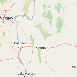
Use this park location map to pinpoint Juniper Mesa Wilderness in United States of America, understand its exact geographic position, and read its mapped placement within the surrounding landscape more clearly.

Pigeon | © OpenStreetMap contributors

Location context for Juniper Mesa Wilderness

ArizonaYavapai County
Park atlas

Compare regional geology, canyon terrain, and neighboring wilderness areas across central Arizona

Exploring Other Parks Near Juniper Mesa Wilderness and Surrounding Protected Landscapes

Visitors exploring Juniper Mesa Wilderness can continue comparing nearby national forests, protected canyons, and upland terrain across the surrounding region. Extending the geographic review reveals how neighboring highland sanctuaries share similar transition zone woodlands and granite fault lines.
Watercolor painting of a calm lake surrounded by green forests and distant mountain ridges.
Protected areaArizona
Mapped location lies within the park boundary#1 closest

Southeast

Prescott National Forest: Geographic Overview of Arizona Protected Landscapes and Wilderness

Regional geography and protected terrain map of the Bradshaw Mountains

Spanning over one million acres, Prescott National Forest represents a defining outdoor landscape in Arizona. The terrain transitions from high desert chaparral to dense ponderosa pine forests, featuring eight distinct wilderness areas, rugged canyon systems, and essential watershed corridors that shape the regional ecology near Prescott.

Area
5,100 km²
Established
1908
Relief
Mountain
Climate
Temperate
A horizontal watercolor illustration showing a calm lake in the foreground, surrounded by grassy banks, evergreen trees, and rolling mountains in the distance under a pale sky.
Protected landscapeArizona
About 47 km away#2 closest

Northeast

Kaibab National Forest: Protected Plateau Landscapes and Forested Geography in Arizona

High-elevation forest terrain bordering the Grand Canyon

Spanning over 1.6 million acres in Arizona, Kaibab National Forest is characterized by its split geographic configuration, with distinct sections flanking the North and South rims of the Grand Canyon. The terrain ranges from the high-altitude Kaibab Plateau to volcanic uplands near Williams, encompassing four designated wilderness areas and varied forest ecosystems that provide a critical buffer for the surrounding canyon country.

Area
6,500 km²
Established
1909
Relief
Mountain
Climate
Temperate
A watercolor painting showing a winding river flowing through a forested valley with gentle hills in the background.
Wildlife reserveArizona
About 87 km away#3 closest

East

Red Rock-Secret Mountain Wilderness: A Geographic Overview of Arizona Protected Lands

Canyon landscapes and high mesa terrain in Arizona

Red Rock-Secret Mountain Wilderness serves as a significant protected block near Sedona, featuring a complex network of slot canyons, natural arches, and sandstone pinnacles. This wilderness area preserves the ecological transition from the high-elevation forested rim down into warmer, arid canyon bottoms, offering a deep look at the geology of the Colorado Plateau edge.

Area
191 km²
Established
1984
IUCN
Ib
Relief
Mountain
National parkArizona
About 98 km away#4 closest

Northeast

Grand Canyon National Park: Arizona National Park Protected Landscape & Geography

Explore mapped boundaries and regional atlas context.

Grand Canyon National Park stands as a premier national park, showcasing a unique protected landscape within Arizona's diverse geography. This detailed entry focuses on the park's specific geographic identity, its mapped boundaries, and its significance within the regional atlas. Discover the contours of this protected area and its place in the natural terrain of the American Southwest.

Area
4,926.08 km²
Established
1919
IUCN
II
Visitors
4.9M annual
A horizontal watercolor illustration depicting a desert landscape with distant purple mountain peaks, rolling green hills, and a winding path, rendered in soft, light colors.
Wildlife reserveArizona
About 108 km away#5 closest

East

Munds Mountain Wilderness Protected Area and Red Rock Landscape Mapping

Arizona high-desert wilderness and canyon-edge geography

Located southeast of Sedona, Munds Mountain Wilderness encompasses roughly 18,150 acres of dramatic sandstone cliffs and elevated plateaus. This area serves as a key site for observing the convergence of pinyon-juniper woodlands with iconic desert rock formations, providing a clear window into the rugged topography of central Arizona.

Area
73.45 km²
Established
1984
IUCN
Ib
Relief
Mountain
Protected landscapeArizona
About 115 km away#6 closest

Southeast

Tonto National Forest: Understanding the Geography of an Expansive Protected Landscape

Exploring the vertical ecosystem gradients in Central Arizona

Spanning from arid Sonoran basins to the towering Mogollon Rim, Tonto National Forest offers a unique study in vertical geography and protected land management. This expansive territory provides a vital map of Southwest life zones, encompassing reservoir systems, rugged river canyons, and critical wilderness habitat that define the environmental identity of the region.

Area
11,627 km²
Established
1905
Visitors
5.9M annual
Relief
Mountain
A horizontal watercolor illustration showing rolling green hills and a treeline against a pale sky.
Wildlife reserveArizona
About 118 km away#7 closest

East

Kachina Peaks Wilderness; Geography and Protected Landscape Atlas of Arizona

High-altitude volcanic terrain and alpine ecosystems

Kachina Peaks Wilderness is a protected area in northern Arizona centered on the San Francisco Peaks. This geography includes the state's highest elevation at Humphreys Peak and a rare volcanic caldera known as the Inner Basin. The terrain transitions from dense mountain forests into an Arctic-Alpine zone, offering a distinct landscape for analyzing mountain evolution and high-elevation ecological patterns.

Area
75 km²
Established
1984
IUCN
Ib
Relief
Mountain
Wildlife reserveArizona
About 123 km away#8 closest

West

Mount Nutt Wilderness: Mapping the Volcanic Canyons and Desert Landscapes of Arizona

A protected wilderness area in the central Black Mountains

Mount Nutt Wilderness offers a dramatic look at high desert topography, characterized by fortress-like volcanic formations and deeply incised canyons. This protected area in northwestern Arizona provides essential habitat for desert bighorn sheep while showcasing the contrast between sun-baked mesas and lush, spring-fed riparian zones.

Area
114 km²
Established
1990
IUCN
Ib
Water
Minor water

Common questions about visiting, size, designation, and location context for Juniper Mesa Wilderness

Juniper Mesa Wilderness FAQs for park facts, access, geography, and protected area context

Find quick answers about Juniper Mesa Wilderness, including protected-area facts, park geography, trail and visitor context, and how the park fits into its surrounding country and regional landscape.
MoriAtlas Explorer

Continue Your Protected Areas Search Across the Global Atlas

Deepen your exploration by continuing the structured search for national parks and protected areas worldwide. Utilize the comprehensive filtering capabilities to compare different conservation landscapes and refine your understanding of global park geography. Discover more about the distribution and characteristics of protected natural areas.

Global natural geography