
Why Tonto National Forest stands out
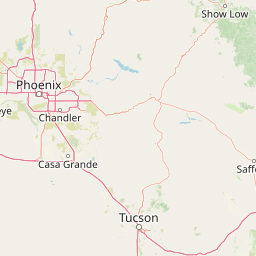
Tonto National Forest is best known for its extraordinary elevation gradient, which compresses the Sonoran Desert, riparian canyons, and high-elevation ponderosa pine forests into a single contiguous protected landscape. It is equally recognized for the string of Salt River reservoirs that draw heavy recreational use from the Phoenix area, as well as for the Superstition, Mazatzal, and Sierra Ancha wilderness areas that frame its terrain. The combination of accessibility, scale, and ecological variety makes it a flagship example of an urban-adjacent national forest in the American Southwest.
Tonto National Forest history and protected-area timeline
Tonto National Forest has its administrative origins in the early federal conservation movement of the twentieth century. The Tonto Forest Reserve was first established on October 3, 1905 by the United States General Land Office. In 1906, the country's forest reserves were transferred into the newly created U.S. Forest Service, and on March 4, 1907, the reserve was redesignated as a National Forest known as Tonto.
The forest grew through a series of consolidations in its first half-century. On January 13, 1908, lands from the Pinal Mountains National Forest were incorporated into Tonto, followed on July 1, 1908 by portions of the Black Mesa National Forest and other parcels. A much later expansion occurred on July 1, 1953, when part of the Crook National Forest was absorbed into the growing Tonto system. Together these additions produced the unusually large footprint the forest still carries today.
More recent history has centered on wildfire, recreation pressure, and contested land use. In June 2020 the Bush Fire ignited in the Tonto Basin area, ultimately burning approximately 193,455 acres and ranking as Arizona's fifth largest recorded wildfire at the time. Once containment was achieved in early July, the U.S. Forest Service conducted a Burned Area Emergency Response assessment to begin rehabilitation of the burned landscape. The fire was determined to have been human-caused.
A separate, ongoing chapter involves a proposed land exchange first pursued through the 2015 National Defense Authorization Act. Section 3003 of that legislation envisions transferring roughly 2,422 acres of Tonto National Forest to Resolution Copper, a subsidiary of the Rio Tinto Group, to enable copper mining. Because the affected land is regarded as sacred by the San Carlos Apache Tribe, the proposal has drawn strong opposition from numerous tribal nations, including the Affiliated Tribes of Northwest Indians and the Great Plains Tribal Chairmen's Association.
Tonto National Forest landscape and geographic character
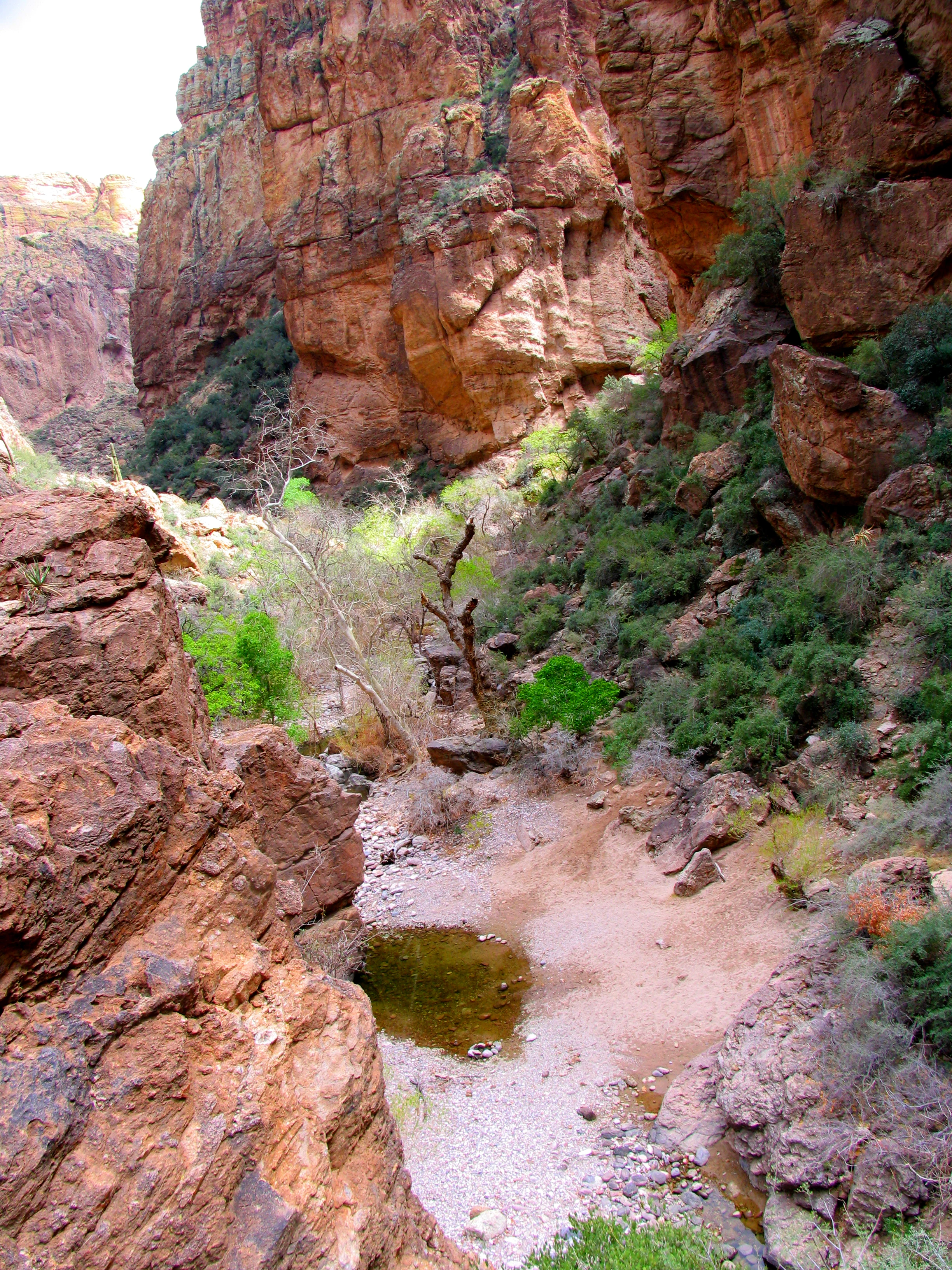
The defining character of Tonto National Forest is its extraordinary vertical range, which packs multiple Southwestern life zones into a single management unit. At its lowest elevations, the forest descends into the Sonoran Desert, where saguaro, ocotillo, creosote, and other desert flora dominate broad basins and rugged dry washes. Remnant pools in these washes capture seasonal runoff and create brief but vivid oases in an otherwise arid terrain.
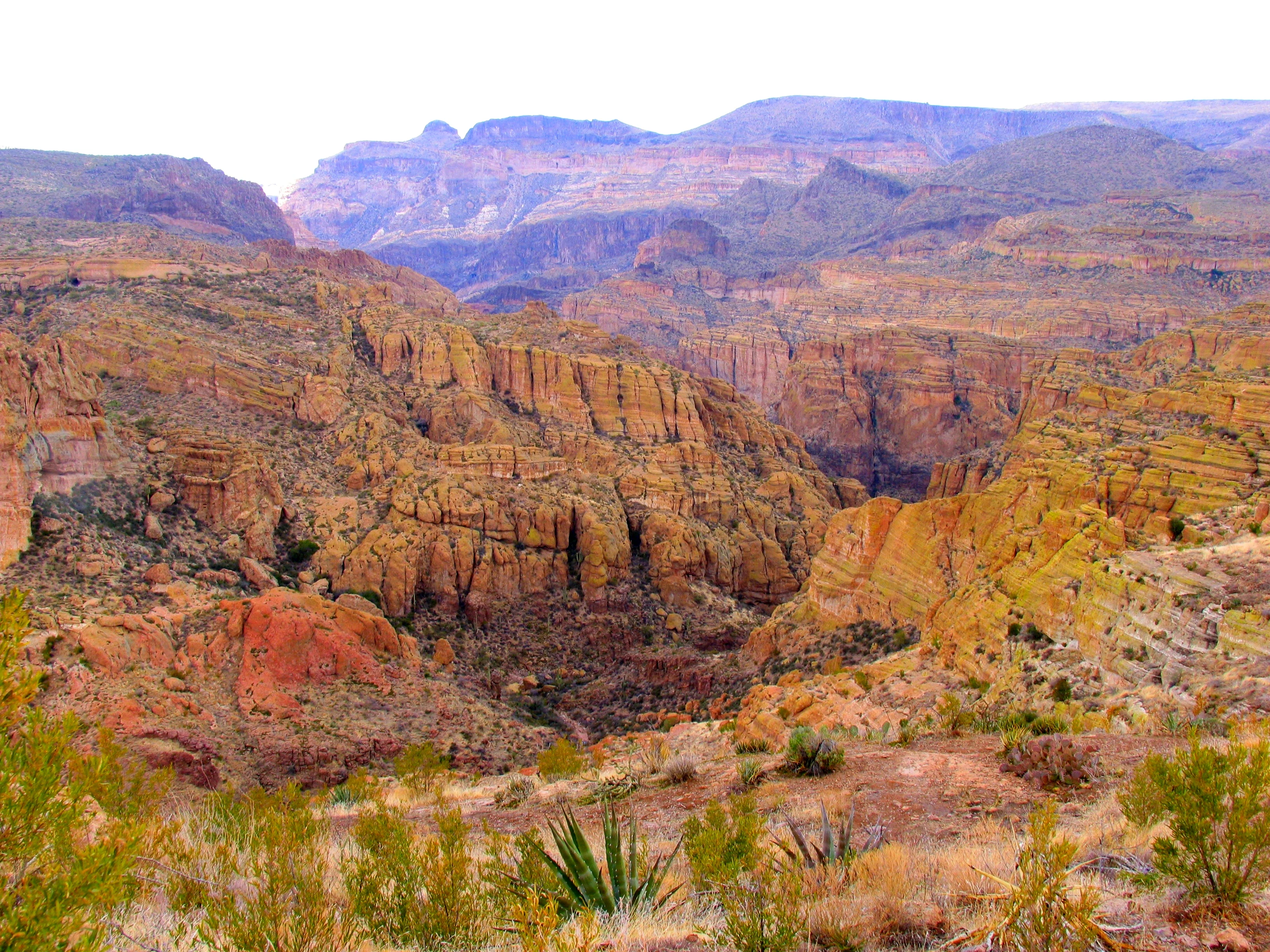
Moving upward, the landscape transitions through steep canyon country cut by the Salt, Verde, and Tonto river systems. Bench terraces, lava flows, and rocky escarpments give way to juniper, oak, and pinyon woodlands, with intermittent springs and riparian greenery along major drainages. Several reservoirs, including Bartlett, Saguaro, Canyon, Apache, and Theodore Roosevelt lakes, interrupt this corridor with bright blue expanses framed by desert cliffs.
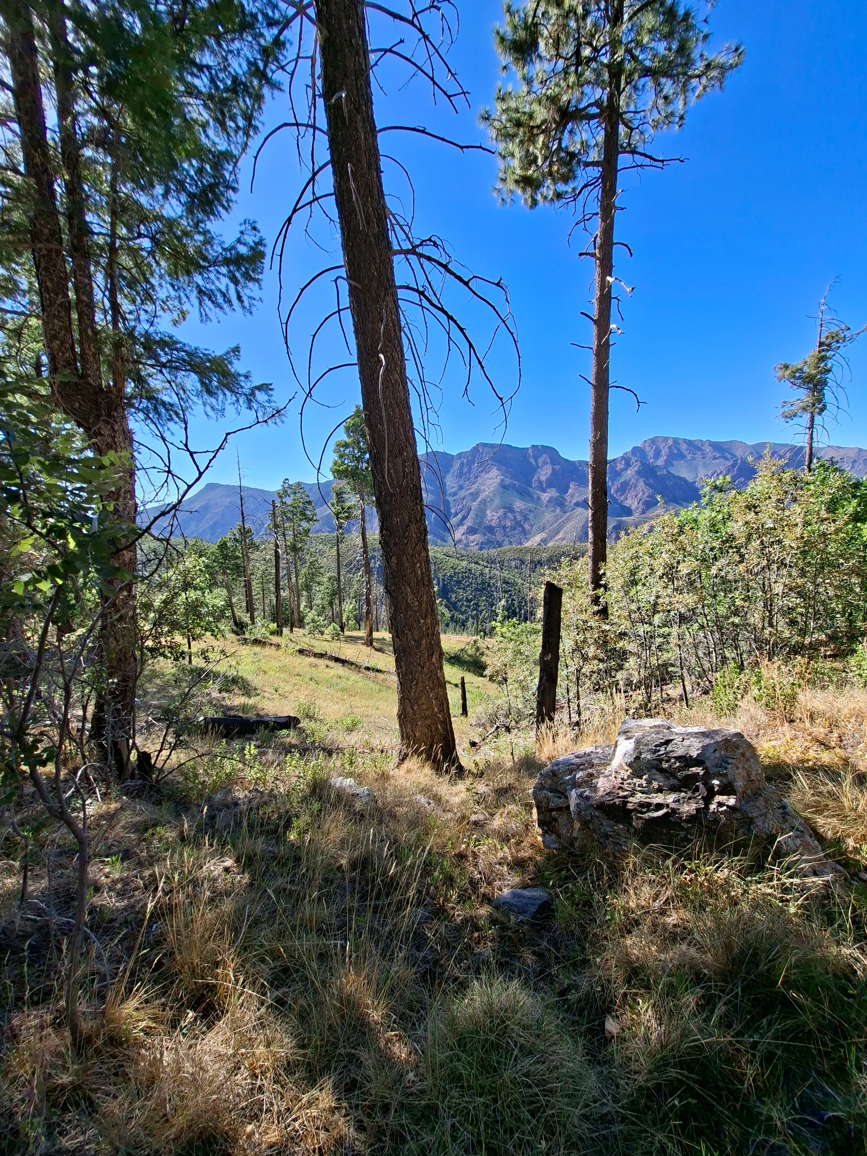
The upper reaches of the forest press against the Mogollon Rim, a major escarpment that defines the southwestern edge of the Colorado Plateau. Here, elevations reach approximately 7,400 feet, and the vegetation shifts into mature ponderosa pine forests with associated Gambel oak, manzanita, and grassy understory. Pine-oak woodland groves create some of the most visually distinctive forest interiors in the entire Tonto system. The result is a landscape that reads almost like a vertical tour of Arizona in a single national forest.
Tonto National Forest ecosystems, habitats, and plant life
Ecologically, Tonto National Forest functions as a bridge between the arid lowlands of the Sonoran Desert and the forested highlands of the Mogollon Rim. At its base, desert scrub communities support classic drought-adapted species, while mid-elevation chaparral, juniper, and oak woodlands occupy much of the transitional zone. Riparian corridors along the Salt and Verde rivers concentrate cottonwood, willow, and mesquite, and those green threads sustain disproportionately high biodiversity in an otherwise dry watershed.
In the upper forest, mature ponderosa pine and mixed conifer stands create a noticeably different ecological world. Pine-oak woodland groves, such as those along the Gold Ridge trail, host understory plant communities adapted to cooler, moister conditions, and they mark the point where the forest begins to resemble the montane systems further north. This compression of ecosystems, stacked along an elevation gradient of roughly 6,000 feet, gives the Tonto one of the most ecologically varied footprints of any national forest in the country.
Wilderness designations reinforce this ecological variety. Areas such as the Superstition, Mazatzal, Sierra Ancha, Salt River Canyon, Hellsgate, Pine Mountain, Salome, and Four Peaks wildernesses protect large blocks of relatively undisturbed habitat across the elevation gradient, helping preserve ecological processes that might otherwise be lost to development or fragmentation.
Tonto National Forest wildlife and species highlights
Tonto National Forest supports a wide cross-section of Southwestern wildlife because of its dramatic spread of habitat types. Desert-adapted species are present alongside montane and riparian-associated animals, and the forest has long been recognized for the richness of its mammal, bird, and raptor communities.
Among mammals, the forest hosts desert mule deer, Coues' white-tailed deer, Rocky Mountain elk, pronghorn, javelina (collared peccary), bobcats, North American cougars, New Mexico black bears, Mearns coyotes, Arizona skunks, Colorado desert raccoons, and ring-tailed cats. Birds of prey are a particular hallmark of the area, with bald eagles, prairie falcons, western red-tailed hawks, American kestrels, and both long-eared owls and American barn owls recorded in the forest. Greater roadrunners and great blue herons round out a bird list that spans open desert to reservoir shoreline, making the Tonto a consistent destination for wildlife observation in central Arizona.
Tonto National Forest conservation status and protection priorities
From a conservation standpoint, Tonto National Forest matters primarily because it preserves a connected block of Sonoran Desert, chaparral, riparian woodland, and ponderosa pine forest within reach of one of the fastest-growing metropolitan areas in the United States. Its wilderness areas and Wild and Scenic River segment on the Verde safeguard large parcels of habitat from road-building and intensive development, while the lake chain along the Salt River is both a recreation centerpiece and an important water management resource in central Arizona.
Wildfire is among the most pressing contemporary conservation challenges for the forest. The 2020 Bush Fire burned roughly 193,455 acres in the Tonto Basin, demonstrating how vulnerable the landscape is to large-scale fire events, particularly in the context of increasingly dry conditions in the Southwest. Post-fire rehabilitation work, including the Burned Area Emergency Response assessment, reflects the forest's role as a working landscape where active management and ecosystem recovery go hand in hand.
The forest also sits at the center of broader debates about land use, mining, and tribal rights in Arizona. The proposed Southeast Arizona Land Exchange, which would place 2,422 acres of forest land held sacred by the San Carlos Apache Tribe into private hands for copper mining, has become a major conservation and cultural preservation issue. Combined with grazing, recreation, and urban growth pressures, it ensures that the Tonto's conservation story is as much about negotiation and stewardship as it is about protection alone.
Tonto National Forest cultural meaning and human context
The Tonto region carries deep cultural significance, especially for tribal nations whose homelands overlap or border the forest. The San Carlos Apache Tribe considers parts of the Tonto sacred, a relationship that has placed the proposed Resolution Copper land exchange at the center of intertribal advocacy. The Fort Apache Indian Reservation lies along the forest's eastern edge, and broader coalitions, including the Affiliated Tribes of Northwest Indians and the Great Plains Tribal Chairmen's Association, have engaged in shaping the forest's management and future.
Non-indigenous cultural layers include the forest's long ranching and homesteading history, the early-twentieth-century conservation movement that gave the Tonto its legal form in 1905, and the post-World War II boom in outdoor recreation around Phoenix and the Salt River reservoirs. Today, the forest is woven into the everyday identity of central Arizona, frequently appearing in regional photography, literature, and outdoor tradition as a defining landscape of the state.
Top sights and standout views in Tonto National Forest
Tonto National Forest's strongest points of distinction include its sheer scale within Arizona, its dramatic elevation gradient from Sonoran Desert to high pine forest, and the popular string of Salt River reservoirs. Its eight designated wilderness areas anchor protected backcountry across every major ecological zone, and its proximity to Phoenix gives it an unmatched role as an urban-accessible recreation landscape in the American Southwest.
Best time to visit Tonto National Forest
The forest's appeal shifts meaningfully with the seasons. Late autumn, winter, and early spring are often the most comfortable periods for general exploration, with cooler temperatures making even the lower desert elevations pleasant for hiking and sightseeing. Spring can also bring wildflower displays and active wildlife in the lower zones.
Summer is challenging at low elevations due to intense heat, but it opens up cooler country along the Mogollon Rim, where ponderosa pine forests offer relief and the lake chain becomes a focal point for boating and swimming. Summer monsoon activity can briefly transform dry washes and produce dramatic thunderstorms, though it also brings heightened wildfire risk, as the 2020 Bush Fire powerfully illustrated. Wildlife viewing tends to be good around dawn and dusk across most seasons, with cooler months generally offering more rewarding conditions for extended observation.