Mori Atlas logo
Wildlife reserveNeedle's Eye Wilderness

A rugged wilderness preserve showcasing complex limestone canyon topography and riparian corridors.

Needle's Eye Wilderness: Mapping the Canyons and Mescal Mountains of Arizona Desert Lands

Needle's Eye Wilderness stands as a distinct protected landscape in Gila County, Arizona, where the Gila River slices through the Paleozoic limestone of the Mescal Mountains. This atlas entry details the dramatic geology of the narrow canyons and the contrast between exposed desert uplands and the river-bottom habitat. The area preserves a dense concentration of slickrock canyons and desert terrain within a compact geographic footprint.

Sonoran Desertwilderness areaMescal MountainsGila River corridorlimestone canyonsdesert uplands

Needle's Eye Wilderness

Wildlife reserve

Park overview

Structured park overview, official facts, and landscape profile for Needle's Eye Wilderness

Needle's Eye Wilderness park facts, protected area profile, and essential visitor context

Review the core facts for Needle's Eye Wilderness, including designation, size, terrain, visitor scale, habitats, and operating context in one park-focused overview.

About Needle's Eye Wilderness

Needle's Eye Wilderness sits in the transitional landscape between Arizona's mountain country and the lower Sonoran Desert, anchoring a stretch of the middle Gila River that flows through one of the more geologically striking reaches in the region. The wilderness takes its name from three narrow canyons, collectively called the Needle's Eye, where the Gila River forces its way through the southern flank of the Mescal Mountains. Above and below these canyons, the terrain ranges from steep, exposed limestone slopes to rolling desert uplands and, along the river itself, a narrow zone of much greener habitat.

The Mescal Mountains themselves form the spine of the area, running northwest across the center of the wilderness. Their southwestern flank is defined by a long dip slope of Paleozoic limestone that rises more than 2,500 feet above the surrounding terrain, creating one of the more visually distinctive backdrops in this part of central Arizona. Several small slickrock canyons branch off the main range and connect down to the Gila, adding to the labyrinthine character of the landscape.

Administratively, the wilderness is unusual for being almost entirely hemmed in by non-federal land. The San Carlos Apache Indian Reservation extends along much of the northern and southern boundary, while private holdings lie to the east and west. This patchwork setting means that reaching the wilderness typically requires advance permission from surrounding landowners, and the area has remained largely free of roads, development, and intensive recreational infrastructure. As a result, the experience of the place is defined largely by its natural setting rather than by visitor amenities.

For its compact 8,760-acre footprint, Needle's Eye Wilderness combines an unusually broad set of Sonoran Desert environments. The combination of rugged uplands, sharp limestone canyons, and a deep riparian corridor along the Gila gives it a layered character that many larger but more uniform desert reserves do not offer.

Quick facts and research context for Needle's Eye Wilderness

Needle's Eye Wilderness covers roughly 8,760 acres in Gila County, Arizona, about twenty miles southeast of Globe. It was established as a federal wilderness area in 1990 and is administered by the U.S. Bureau of Land Management. The Mescal Mountains and the Gila River are the defining geographic features, with the river cutting a series of narrow, deep canyons that give the wilderness its name. Surrounded mostly by San Carlos Apache tribal land and private parcels, the area functions as an island of formally protected, roadless terrain within a largely non-federal landscape.

Protection and recognition

Explore terrestrial protection scope and documented conservation status data

Needle's Eye Wilderness Protection Status and Official Designation Facts

Needle's Eye Wilderness maintains a recorded terrestrial protection scope within official conservation frameworks. Official records aggregate documented designation metrics, management jurisdiction details, and recognition history for comprehensive analysis.

Protection details

Protection scope
Terrestrial
Transboundary protection
No
Park context

Deeper park guide and search-rich context for Needle's Eye Wilderness

Needle's Eye Wilderness history, landscape, wildlife, and travel context

Explore Needle's Eye Wilderness through its history, landscape character, ecosystems, wildlife, conservation priorities, cultural context, and seasonal travel timing in a structured park guide built for atlas discovery and search intent.

Why Needle's Eye Wilderness stands out

Needle's Eye Wilderness is best known for the narrow, deep canyons where the Gila River slices through the limestone Mescal Mountains, a dramatic geological feature that gives the area its name. The contrast between the open, arid uplands of the Mescal Range and the lush, unusually dense riparian corridor along the river forms the area's most recognizable identity. Less famous than Arizona's larger national parks and monuments, the wilderness is appreciated by hikers and river runners for the way it concentrates so many classic Sonoran Desert landscapes, from slickrock canyons and limestone cliffs to desert washes and river-bottom habitat, into a relatively compact boundary.

Needle's Eye Wilderness history and protected-area timeline

Needle's Eye Wilderness was formally designated as a wilderness area in 1990 under the management of the U.S. Bureau of Land Management, becoming one of a wave of smaller desert wilderness areas added to the federal system during that era. The designation came as part of a broader effort to recognize and protect distinct desert landscapes on BLM-administered public lands in Arizona, many of which had previously been used primarily for grazing, mining access, or unregulated recreation.

Protection of the area also reflected growing recognition of the Gila River corridor itself. The river's middle reaches, including the steep canyons at the heart of the wilderness, had long been viewed as ecologically important because they concentrate surface water and create riparian habitat in a region otherwise dominated by arid uplands. Although the surrounding lands remain under tribal and private ownership, the formal wilderness boundary ensures that the steepest canyon country and the river corridor within it are shielded from development.

The area's historical identity has been shaped as much by the surrounding land ownership as by the wilderness designation itself. Because the Mescal Mountains and adjacent valleys are flanked by San Carlos Apache land and working ranches, public travel to and within the wilderness has always required coordination with neighbors. That history of restricted access has helped preserve an unusually quiet, lightly visited setting within easy reach of several Arizona towns.

Needle's Eye Wilderness landscape and geographic character

The landscape of Needle's Eye Wilderness is defined by the Mescal Mountains and the deep incision of the Gila River where it crosses their southern flank. The mountains run northwest across the center of the area, with their southwestern side forming a prominent dip slope of Paleozoic limestone that towers more than 2,500 feet above the surrounding desert. This long, tilted face of bedrock is one of the most visually dominant features of the wilderness and gives the upper terrain its rugged, exposed character.

Along the southern edge of the wilderness, the Gila River has cut through the range in three narrow canyons known collectively as the Needle's Eye. These gorges drop roughly 1,000 feet from the rim country down to the river, producing dramatic sheer walls and tight, winding passageways that contrast sharply with the wider, flatter uplands above. Several smaller slickrock canyons branch off the main range and feed down toward the river, adding finer-scale dissection to the terrain and creating a network of dry washes that comes alive during seasonal rains.

Above the canyons, the Mescal uplands are characteristic Sonoran Desert terrain: rocky slopes, scattered desert pavement, low ridges, and broad stretches of sparse vegetation. Along the river itself, the landscape transforms abruptly into a narrow but well-defined riparian zone where denser plant growth lines the channel. The constant shift between harsh upland desert and sheltered canyon country gives the wilderness a strongly layered topography despite its modest overall size.

Needle's Eye Wilderness ecosystems, habitats, and plant life

Ecologically, Needle's Eye Wilderness occupies a transitional zone where arid mountain uplands, deep canyon country, and riverine habitat all meet within a compact footprint. The southwest dip slope of the Mescal Mountains supports typical Sonoran Desert vegetation, with drought-adapted shrubs, scattered low trees, and sparse ground cover thriving on thin soils over limestone bedrock. The exposed rock faces and slickrock benches contribute their own microhabitats for lichens, succulents, and drought-tolerant specialists.

The defining ecological feature of the area is the riparian corridor that follows the Gila River along the wilderness's southern boundary. Running through the bottom of three steep canyons, this narrow band of riverside habitat supports a notably denser and more varied plant community than the surrounding desert uplands. Mesquite, willow, and other water-associated species create an almost gallery-forest effect where the river threads through the rocks, contrasting strongly with the dry ridges and slopes rising above.

Between these two extremes, the small slickrock canyons and washes that branch off the Mescal Range act as ecological bridges, channeling seasonal runoff and creating localized pockets of richer vegetation. These mid-elevation zones often harbor transitional species and offer cooler, shadier conditions than the open uplands. The result is an unusually heterogeneous ecological picture for an area of this size, with sharp contrasts between rock, sand, scrub, and river in a relatively short horizontal distance.

Needle's Eye Wilderness wildlife and species highlights

Wildlife in Needle's Eye Wilderness reflects the area's strong habitat contrasts, with different communities occupying the upland desert, the rocky canyons, and the riverside corridor. The arid Mescal uplands support the typical Sonoran Desert fauna of central Arizona, including mule deer, javelina, coyotes, bobcats, and a variety of smaller mammals adapted to sparse cover and limited water. Lizards, snakes, and other reptiles are common on the rocky slopes and in the warmer, exposed terrain.

The deep canyons and slickrock drainages that run down toward the Gila provide important shelter for wildlife that depends on rocky terrain and seasonal runoff. Raptors nest and hunt along these cliffs, using the updrafts along the steep rock faces, while cave-like recesses and shaded alcoves offer cover for bats and other rock-dwelling species. Seasonal雨水 also draws foraging animals down from the uplands into these narrower drainages.

The riparian zone along the Gila River forms the richest wildlife habitat in the wilderness and supports a more concentrated community than the surrounding desert. Migratory and resident birds are drawn to the wooded river channel, especially during migrations when the corridor functions as a green pathway through otherwise arid country. Mammals, amphibians, and reptiles associated with permanent water, including beavers along quieter stretches and various amphibian species, depend on this narrow but vital habitat. The presence of such a relatively lush riverside ribbon within an otherwise dry upland setting is one of the defining wildlife characteristics of the area.

Needle's Eye Wilderness conservation status and protection priorities

Conservation significance at Needle's Eye Wilderness centers on the protection of an unusual example of Sonoran Desert canyon landscape in central Arizona. By shielding the Mescal Mountains' southwestern dip slope, the three narrow Gila River canyons, and the associated slickrock drainages from road-building, mining disturbance, and development, the wilderness designation preserves a complete cross-section of upland, canyon, and riverside environments in a single reserve.

The riparian corridor along the Gila is particularly important from a conservation standpoint. In a region where most surface water is seasonal or heavily modified, the river's middle reaches through the Needle's Eye retain a relatively natural flow regime and a connected ribbon of riparian vegetation. Protecting this corridor within the wilderness helps maintain habitat continuity for birds, mammals, and amphibians that depend on water in an otherwise arid landscape, and contributes to the broader ecological value of the middle Gila River system.

The wilderness also plays an indirect conservation role by buffering an otherwise heavily bordering portion of the Gila and Mescal landscape. Because the San Carlos Apache lands and private ranches surrounding Needle's Eye often support traditional land uses rather than intensive development, the wilderness forms a relatively undisturbed core within a matrix of working lands. Maintaining that core preserves options for wildlife movement, watershed function, and long-term ecological integrity in a region where unprotected desert habitat continues to face pressure from growth and land-use change.

Needle's Eye Wilderness cultural meaning and human context

The cultural context of Needle's Eye Wilderness is shaped largely by the lands that surround it. The San Carlos Apache Indian Reservation extends along much of the northern and southern boundary, giving the area an important tribal landscape context. The Mescal Mountains and the middle Gila River have deep significance for the Western Apache, and the wilderness sits within a broader cultural landscape where indigenous land use, traditional stories, and contemporary tribal governance remain active presences.

Private ranching operations along the eastern and western approaches have shaped the more recent history of the area, influencing patterns of access and the persistence of open, unfenced desert surrounding the wilderness. Visitors approaching Needle's Eye typically move through a patchwork of reservation land, ranch holdings, and small Arizona towns like Globe, and any meaningful engagement with the area must acknowledge that relationship with surrounding landowners and communities.

Top sights and standout views in Needle's Eye Wilderness

Three signature features define Needle's Eye Wilderness and distinguish it from other small Arizona desert preserves. First, the three Needle's Eye canyons themselves, where the Gila River cuts roughly 1,000 feet down through Paleozoic limestone in tightly constricted gorges; second, the long Paleozoic dip slope of the Mescal Mountains, a continuous limestone wall that rises more than 2,500 feet and shapes the broader skyline of the area; and third, the unusually lush riparian corridor that traces the river through this otherwise arid terrain, providing a green contrast that runs the length of the wilderness.

Together, these elements create a compact wilderness that compresses canyon scenery, exposed desert uplands, and riverside habitat into a small but unusually varied setting.

Best time to visit Needle's Eye Wilderness

Needle's Eye Wilderness is best experienced during the cooler months of late autumn, winter, and early spring, when temperatures in the Sonoran Desert uplands are most comfortable for hiking and when the dip slopes and slickrock canyons can be explored without extreme heat. Winter and early spring also tend to bring clearer skies and sharper views across the Mescal Mountains, making the dramatic canyon scenery and the broad dip slope especially visible.

Spring can bring wildflower and vegetation responses in the uplands and washes, while the riparian corridor along the Gila remains green and relatively lush year-round, offering a particularly appealing contrast during the hotter months when the surrounding desert is dry. Summer visits are generally difficult because of high temperatures, limited shade, and the need to coordinate access with surrounding landowners, and are usually reserved for experienced desert travelers prepared for harsh conditions.

Monthly climate preview

Monthly temperature ranges and precipitation averages recorded at reference coordinates

Needle's Eye Wilderness Climate Normals and Long-Term Temperature Patterns

Historical climate records for Needle's Eye Wilderness show monthly average temperatures spanning from 7.38 to 28.89 degrees Celsius alongside variable precipitation rates. Reviewing the complete twelve-month climate profile provides detailed historical statistics for this protected area.
Annual mean18 °C
7 °C29 °C
Jan
Feb
Mar13°
Apr17°
May22°
Jun28°
Jul29°
Aug28°
Sep25°
Oct19°
Nov12°
Dec
Warmest month
July

28.9 °C

Coolest month
December

7.4 °C

Wettest month
August

1.8 mm/day

Driest month
June

0.2 mm/day

Park location guide

Geography guide, regional context, and park location map for Needle's Eye Wilderness

Needle's Eye Wilderness park geography, regions, and map view in United States of America

Understand where Needle's Eye Wilderness sits in United States of America through a broader geographic reading of the surrounding landscape, nearby location context, and its mapped position within the national park landscape.

How Needle's Eye Wilderness fits into United States of America

The United States of America is a federal presidential republic and one of the world's largest countries by area and population. It consists of 50 states across a vast territory spanning multiple time zones, with its capital in Washington, D.C. and largest city in New York City. The nation has a diverse economy, influential political system, and significant cultural and military presence globally.

Wider geography shaping Needle's Eye Wilderness in United States of America

The United States occupies a vast territory in North America, bordered by Canada to the north and Mexico to the south. The 48 contiguous states stretch from the Atlantic to the Pacific Ocean, while Alaska occupies the northwestern region and Hawaii is an archipelago in the Pacific. The country encompasses diverse terrain including the Rocky Mountains, Appalachian Mountains, Great Plains, and extensive river systems.

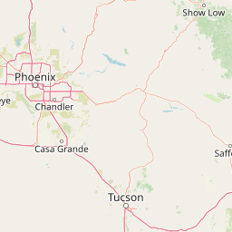
Map view of Needle's Eye Wilderness

Use this park location map to pinpoint Needle's Eye Wilderness in United States of America, understand its exact geographic position, and read its mapped placement within the surrounding landscape more clearly.

Pigeon | © OpenStreetMap contributors

Location context for Needle's Eye Wilderness

ArizonaGila County
Park atlas

Compare adjacent Sonoran Desert terrain and regional protected areas

Exploring Parks Near Needle's Eye Wilderness and Surrounding Protected Landscapes

Browse other parks near Needle's Eye Wilderness to compare limestone canyons, desert uplands, and regional protected landscapes across the surrounding region. Extending the geographic review reveals broader patterns in Sonoran Desert topography and protected-area placement.
Protected landscapeArizona
About 16 km away#1 closest

Northwest

Tonto National Forest: Understanding the Geography of an Expansive Protected Landscape

Exploring the vertical ecosystem gradients in Central Arizona

Spanning from arid Sonoran basins to the towering Mogollon Rim, Tonto National Forest offers a unique study in vertical geography and protected land management. This expansive territory provides a vital map of Southwest life zones, encompassing reservoir systems, rugged river canyons, and critical wilderness habitat that define the environmental identity of the region.

Area
11,627 km²
Established
1905
Visitors
5.9M annual
Relief
Mountain
A soft watercolor painting of a wide, rolling mountain landscape with muted greens, yellows, and purples.
Wildlife reserveArizona
About 53 km away#2 closest

Southeast

Galiuro Wilderness: A Protected Mountain Landscape in Southeastern Arizona

Mapped geography and terrain of the Galiuro range

Trace the uplifted slabs and eroded canyons that define Galiuro Wilderness. This protected area rises from the Arizona plains to reveal a complex geography of brushy slopes, spring-fed riparian zones, and sky-high summit vistas.

Area
309 km²
Established
1932
IUCN
Ib
Relief
Mountain
Wildlife reserveArizona
About 60 km away#3 closest

East

Fishhooks Wilderness: An Arizona Desert Wildlife Reserve and Protected Landscape Atlas

Mapped terrain and arid geography in Graham County

Fishhooks Wilderness represents an intact, undeveloped stretch of southeastern Arizona desert managed by the Bureau of Land Management. The area provides a critical example of basin-and-range topography, where volcanic ridges and desert flats border the San Carlos Apache Indian Reservation. This record offers a clear perspective on the wilderness boundaries, ecological transition zones, and remote backcountry character of this distinctive regional landscape.

Area
42 km²
IUCN
Ib
Relief
Upland
Climate
Arid
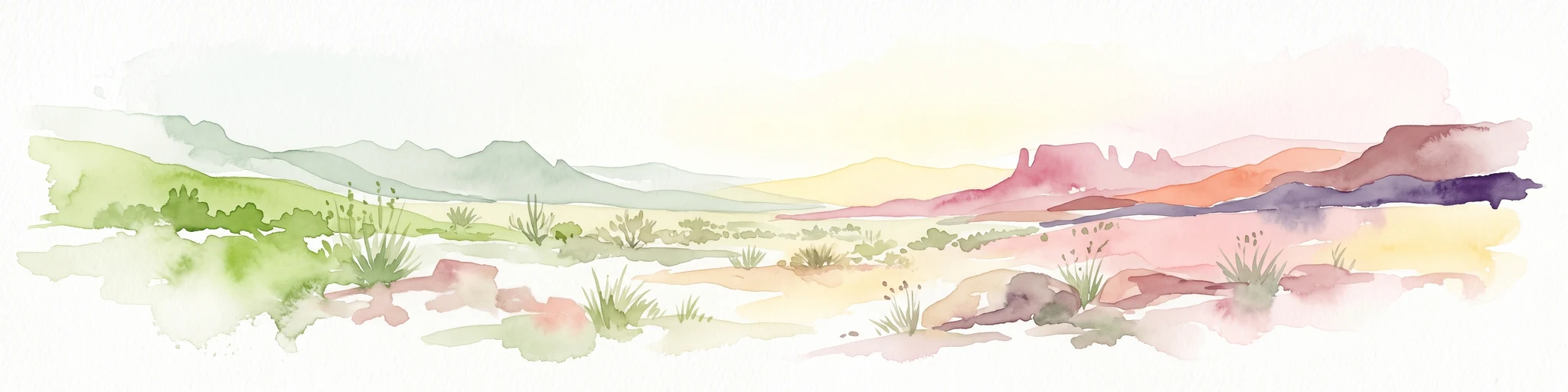
A watercolor illustration of a wide desert landscape with soft, pastel-colored mountains, arid terrain, and sparse desert vegetation against a bright sky.
Wildlife reserveUnited States of America
About 89 km away#4 closest

South

Pusch Ridge Wilderness: Wildlife Reserve and Sky Island Geography in Arizona

Protecting diverse habitats from Sonoran desert lowlands to high mountain forests.

Located in the Santa Catalina Mountains, Pusch Ridge Wilderness preserves a significant vertical gradient of ecosystems. This wildlife reserve features steep canyons and granite uplifts, providing an essential habitat for Desert Bighorn Sheep while illustrating the distinct Sky Island geography found across the southern Arizona region.

Area
228.36 km²
Established
1978
Relief
Mountain
Climate
Arid
National parkPima County
About 101 km away#5 closest

South

Saguaro National Park: Discover Its Protected Landscape Geography and Mapped Boundaries

Explore the natural terrain and regional context of this national park.

Saguaro National Park offers a focused exploration of a specific protected landscape, highlighting its unique geographic features and mapped boundaries within Pima County. This detail page provides an atlas perspective, allowing for a deep dive into the park's natural terrain and its regional significance. Understand the protected area's identity and its place within the wider geographical context.

Area
371.16 km²
Established
1994
IUCN
II
Visitors
946.4K annual
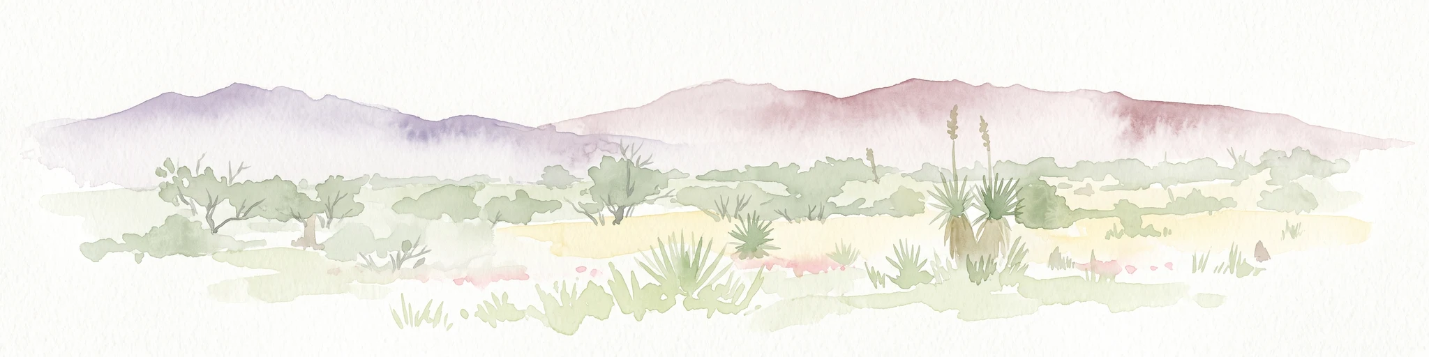
A horizontal watercolor painting depicting a desert landscape with mountains in the distance, soft green and yellow foreground vegetation, and several yucca plants.
Protected landscapeUnited States of America
About 109 km away#6 closest

South

Rincon Mountain Wilderness: Geographic Atlas and Protected Landscape Overview

Sky island ecosystems and mountainous desert terrain in Arizona

This protected landscape encompasses the core of the Rincon Mountains, defining a classic triangular range oriented southwest to northeast. The wilderness serves as a vital ecological bridge, rising from arid Sonoran lowlands to cool, high-elevation montane forests. Its boundaries protect an intricate system of ridges and canyons that support isolated relict plant communities, offering a distinct study in regional desert mountain geography.

Relief
Mountain
Access
Moderate access
Scope
Terrestrial
Water
Minor water
Wildlife reserveArizona
About 117 km away#7 closest

Northwest

Mazatzal Wilderness: Geographic Overview of Arizona's Expansive Protected Mountain Terrain

Mapping the ecological transition from desert canyon to forest ridge

Mazatzal Wilderness stands as an essential protected area in central Arizona, covering vast tracts of the Tonto and Coconino National Forests. The landscape is defined by the stark vertical contrast between the low-lying Verde River corridor and the high-elevation forests of the Mazatzal Mountains. This expansive wilderness remains a key study in regional topography and ecological zonation for those exploring the rugged backcountry of the southwestern United States.

Area
1,021.4 km²
Established
1964
IUCN
Ib
Relief
Mountain
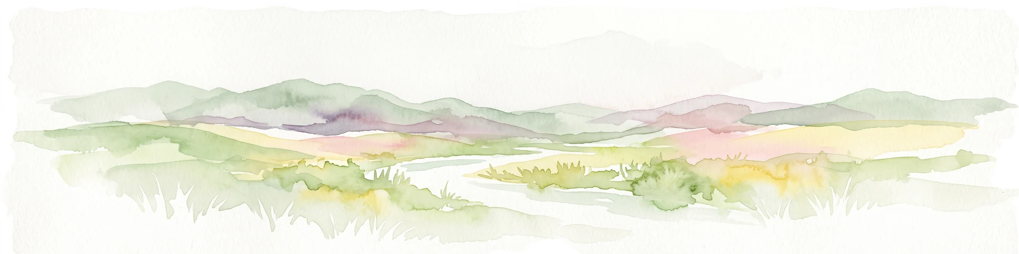
A horizontal watercolor painting showing distant mountains in shades of purple, soft green rolling hills, a central winding river or stream, and grassy foreground elements on a white background.
Protected landscapeNew Mexico
About 146 km away#8 closest

East

Gila National Forest: A Geographic Overview of New Mexico's Protected Wilderness Core

Mapped terrain, forest boundaries, and regional wilderness character

Gila National Forest stands as a critical protected landscape in New Mexico, encompassing immense mountain ranges, narrow river gorges, and extensive backcountry basins. This atlas entry details the forest's topographic transition from high-altitude ponderosa stands to desert lowlands, highlighting its status as the foundational site for the global wilderness movement and a stronghold for regional ecological diversity.

Area
10,969.7 km²
Established
1905
Relief
Mountain
Climate
Temperate

Common questions about visiting, size, designation, and location context for Needle's Eye Wilderness

Needle's Eye Wilderness FAQs for park facts, access, geography, and protected area context

Find quick answers about Needle's Eye Wilderness, including protected-area facts, park geography, trail and visitor context, and how the park fits into its surrounding country and regional landscape.
MoriAtlas Explorer

Continue Your Protected Areas Search Across the Global Atlas

Deepen your exploration by continuing the structured search for national parks and protected areas worldwide. Utilize the comprehensive filtering capabilities to compare different conservation landscapes and refine your understanding of global park geography. Discover more about the distribution and characteristics of protected natural areas.

Global natural geography