
Why Rincon Mountain Wilderness stands out
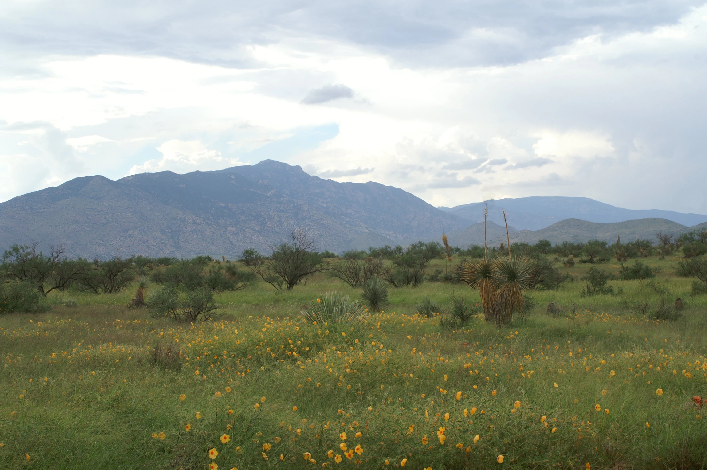
The Rincon Mountain Wilderness is best known for its dramatic ecological transition from low-elevation Sonoran Desert to high-elevation Madrean woodland within a compact mountain range. The wilderness preserves a classic example of a Madrean sky island, where isolated peaks support relict forests of oaks, pines, and other woodland species disconnected from larger mountain systems. Saguaro cactus forests dominate its lower slopes, while higher elevations around Mica Mountain and Rincon Peak support coniferous forests and oak woodlands that contrast sharply with the surrounding desert. This layering of ecosystems within a single wilderness area, in close proximity to the Tucson metropolitan area, makes the Rincons ecologically distinctive in the American Southwest.
Rincon Mountain Wilderness history and protected-area timeline
The Rincon Mountains long predate their designation as wilderness territory. The range is identified by the O'odham name Cew Doʼag and has been part of the landscape and cultural geography of Indigenous peoples of the Sonoran Desert for centuries. With Spanish settlement of the broader Tucson region, the range acquired the name Rincon, meaning "corner," in reference to its triangular footprint defined by Mica Mountain, Rincon Peak, and Tanque Verde Peak.
In the modern era, the range became part of the Coronado National Forest, and most of its higher-elevation terrain was subsequently designated as the Rincon Mountain Wilderness under the federal wilderness system. Adjacent Saguaro National Park protects much of the western front of the range, including some of the most extensive stands of saguaro cactus in the United States. The wilderness designation restricted motorized and bicycle access, preserving the range as a backcountry landscape reached primarily on foot or by horseback.
Trails such as Tanque Verde Ridge, Douglas Springs, Espiritu Creek, Italian Ranch, Miller Creek, and Turkey Creek were established or maintained to provide non-motorized access from multiple sides of the range. The Arizona Trail later incorporated segments of the Rincons into its longer cross-state route. The Little Rincon Mountains, a separate smaller range to the east, and Happy Valley, popular for camping, hunting, and off-roading, lie adjacent to the wilderness but are not part of it.
Rincon Mountain Wilderness landscape and geographic character
The Rincon Mountains form a roughly triangular range oriented southwest to northeast, with an overall length of about thirty-three miles and a width of around twenty-eight miles. The high apex of this triangle is Mica Mountain, rising to roughly 8,664 feet. Rincon Peak, at about 8,482 feet, marks the southern point, while Tanque Verde Peak, near 7,049 feet, marks the western point. Together these three peaks define the distinctive "corner" shape reflected in the range's Spanish name.
The terrain transitions sharply from flat basin floor to steep ridges and canyons. Compared with the Santa Catalina Mountains to the north and the Santa Rita Mountains to the south, the Rincons are often described as somewhat less rugged, but they still contain long ridges, deep drainages, and sky-island highlands that rise abruptly from the surrounding desert.
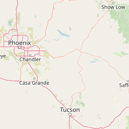
To the west lies Rincon Valley, largely former ranchland now increasingly converted to residential development, and beyond that the broad Tucson basin. To the east sit the Little Rincon Mountains and Happy Valley, and farther east the San Pedro River valley. To the south, Cienega Creek and Interstate 10 mark the southern shoulder of the range. The eastern edge of Rincon Valley includes Colossal Cave county park, known for its limestone cave system and its position as a gateway destination near the community of Vail.
Rincon Mountain Wilderness ecosystems, habitats, and plant life
The Rincon Mountain Wilderness lies within the broader Madrean sky islands system, a network of isolated mountain ranges scattered across southeastern Arizona, southwestern New Mexico, and northern Sonora, Mexico. Because each sky island is separated from neighboring ranges by expanses of hot, dry desert, the higher elevations of the Rincons support relict plant and animal communities that persist in isolation. This geography gives the wilderness unusually high ecological diversity within a relatively compact footprint.
Vegetation in the Rincons follows a pronounced elevational gradient. Lower slopes rise out of the Sonoran Desert, dominated by saguaro cactus and characteristic desertscrub species that extend into Saguaro National Park on the western side of the range. As elevation increases, the vegetation shifts into Madrean evergreen woodland and oak woodland, and the highest elevations around Mica Mountain and Rincon Peak support mixed-conifer and pine forests strongly reminiscent of more northern mountain landscapes. This layering of desert, woodland, and montane forest on a single range is a defining ecological trait of the wilderness.
The surrounding desert context is shaped by the San Pedro Valley to the east, a significant regional watershed, and by riparian corridors such as Cienega Creek to the south. Together, these features create a mosaic of springs, drainages, and canyon microhabitats that further increase habitat diversity within the wilderness.
Rincon Mountain Wilderness wildlife and species highlights
As a Madrean sky island rising out of the Sonoran Desert, the Rincon Mountain Wilderness supports wildlife communities drawn from both desert and montane environments. Lower elevations host species associated with the Sonoran Desert and Saguaro National Park, including desert mammals, reptiles, and the birdlife that depends on saguaro forests for nesting and feeding. The presence of mature saguaro stands across the lower slopes gives the wilderness particular importance for species tied to this iconic cactus habitat.
Higher elevations, especially around Mica Mountain and Rincon Peak, support montane and woodland species more typical of interior chaparral and pine-forest environments. The vertical zonation from desert to woodland to mixed-conifer forest allows a relatively wide range of bird, mammal, and reptile species to occur within the same wilderness. Riparian and canyon habitats along drainages such as those feeding toward Cienega Creek and the San Pedro basin add further habitat complexity.
Because much of the wilderness is managed as non-motorized backcountry, wildlife observation in the Rincons tends to be concentrated along trail corridors and at springs and canyon bottoms where animals concentrate. The wilderness is regarded by regional naturalists as an important area for sky-island species and for the broader Mojave and Sonoran Desert fauna that surrounds it.
Rincon Mountain Wilderness conservation status and protection priorities
The Rincon Mountain Wilderness plays an important role within the larger conservation landscape of southeastern Arizona. As part of the Coronado National Forest, it contributes to the federal network of protected National Forest lands spanning the Southwest, while its close adjacency to Saguaro National Park expands the effective scale of protected Sonoran Desert and sky-island habitat around the Tucson basin.
Wilderness designation has shaped the area's conservation character. By restricting motorized and bicycle travel across most of the range, the wilderness preserves the Rincons as a primarily backcountry landscape, reducing fragmentation and disturbance of sensitive habitats. This status protects saguaro cactus forests on the lower slopes, oak and pine woodlands at mid and high elevations, and the riparian systems associated with drainages like Cienega Creek.
The wilderness contributes to the broader Madrean sky islands conservation context, which is considered significant for its relict species and isolated ecosystems. The combined presence of national park, national forest wilderness, and nearby protected valleys and river corridors, including the San Pedro River valley to the east, makes the Rincons a key component of regional habitat connectivity in the desert Southwest.
Rincon Mountain Wilderness cultural meaning and human context
The cultural identity of the Rincon Mountains predates modern European settlement. The range is known by the O'odham name Cew Doʼag, reflecting its longstanding significance to Indigenous peoples of the Sonoran Desert region, including the Tohono O'odham. The mountains were part of broader Indigenous land-use, travel, and cultural geographies long before they were formally surveyed or protected.
Spanish-speaking settlers and later Anglo-American settlers named the range Rincon, or "corner," for its triangular footprint, and Spanish-era land use, ranching, and settlement shaped the Rincon Valley on the western side of the range. Vail, the community on the east side, and broader ranching traditions in the surrounding valleys reflect the continuing human presence in the landscape.
Today, the cultural context of the wilderness is shaped by this layered history, from Indigenous place names and traditions to Spanish colonial naming, ranching heritage, and modern conservation and recreational use associated with Tucson. Colossal Cave county park, a well-known limestone cave on the eastern edge of Rincon Valley, adds a popular regional attraction and an additional cultural and geological landmark adjacent to the wilderness.
Top sights and standout views in Rincon Mountain Wilderness
A protected Sonoran Desert and sky-island landscape within easy reach of Tucson.
A dramatic ecological transition from saguaro cactus desert to oak and pine woodland within a single mountain range.
Part of the Madrean sky islands system, supporting relict plant communities isolated from other mountain ranges.
Wilderness character preserved by restricting motorized and bicycle access across most of the range, with travel on foot or horseback.
Best time to visit Rincon Mountain Wilderness
The Rincon Mountain Wilderness is most pleasant to experience during the cooler months, when lower desert temperatures ease travel across saguaro-dominated slopes and clear views reward ascents toward the higher peaks. Spring brings warming temperatures and active desert wildlife, while autumn offers cooler backcountry conditions ideal for reaching Mica Mountain, Rincon Peak, and Tanque Verde Peak.
Summer in the Rincons is harsh, with intense desert heat at lower elevations, though the higher elevations remain cooler than the basin below. Because most trails are non-motorized and can be long, water sources are limited, and summer travel in the interior of the range requires careful preparation. Shoulder seasons generally offer the most balanced conditions for both desert and montane sections of the wilderness.