
Mori Atlas logo
Nature reserveKalkmagerrasen bei Ottbergen und Bruchhausen

Discover the distinctive calcareous grasslands, juniper heaths, and limestone hill topography.

Kalkmagerrasen bei Ottbergen und Bruchhausen: Mapped Protected Landscapes and Regional Geography

(Naturschutzgebiet Kalkmagerrasen bei Ottbergen und Bruchhausen (HX-075))

Kalkmagerrasen bei Ottbergen und Bruchhausen represents a unique complex of seven protected parcels situated within the limestone hills of the Weser valley. This nature reserve in Nordrhein-Westfalen features a rich mosaic of species-rich dry grassland, juniper-studded shrub heath, and varied beech forest stands. The site demonstrates the traditional grazed cultural landscape, where centuries of land management have fostered a significant array of biodiversity on shallow, stony soils.

calcareous grasslandnature reservejuniper heathbeech forestorchid habitatsemi-dry grassland
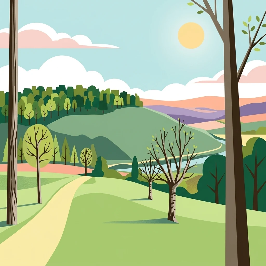
A flat-style digital illustration depicting a sunny landscape with a yellow dirt path winding through green grassy hills, scattered trees, and a distant forested ridge under a pale blue sky.

Kalkmagerrasen bei Ottbergen und Bruchhausen

Nature reserve

Park overview

Structured park overview, official facts, and landscape profile for Kalkmagerrasen bei Ottbergen und Bruchhausen

Kalkmagerrasen bei Ottbergen und Bruchhausen park facts, protected area profile, and essential visitor context

Review the core facts for Kalkmagerrasen bei Ottbergen und Bruchhausen, including designation, size, terrain, visitor scale, habitats, and operating context in one park-focused overview.

About Kalkmagerrasen bei Ottbergen und Bruchhausen

Kalkmagerrasen bei Ottbergen und Bruchhausen is a small but ecologically dense nature reserve in the eastern part of the German state of North Rhine-Westphalia, on the edge of the upper Weser river valley. The reserve belongs administratively to the Kreis Höxter, with most of its area on the territory of the town of Höxter and a smaller portion on the territory of the town of Beverungen. Its seven separate parcels are arranged between the village of Hembsen to the west, Ottbergen and Bruchhausen in the middle, and Amelunxen to the east, with the River Nethe, a left tributary of the Weser, and the B 64 federal road running through the broader area.

The protected landscape consists of hill and slope positions, often on exposed hilltops (Kuppenlagen) and steeper slopes (exponierte Hanglagen), where thin limestone soils have prevented agricultural intensification. These conditions have allowed the survival of an unusually rich mosaic of open and semi-open habitats. Calcareous grassland communities, juniper-rich dwarf shrub heath, semi-dry grassland, and nutrient-poor lean meadows form the open backbone of the reserve, while small areas of calcareous beech forest, including orchid-rich and woodruff-rich beech forest variants, as well as conifer stands and shrub patches, provide structural variety. Traditional orchard meadows (Obstweiden), fat meadow patches, and some set-aside grassland add further nuance to the habitat mosaic.

A roughly 13-kilometer circular hiking trail (Rundwanderweg) makes the area accessible to walkers and helps connect its dispersed parcels into a coherent experience. The reserve's blend of typical Weser valley scenery, calcareous soils, open grazed landscape, and fragmented woodland makes it a representative example of the regional Kulturlandschaft and an important site for understanding the ecological heritage of this part of Germany.

Quick facts and research context for Kalkmagerrasen bei Ottbergen und Bruchhausen

Kalkmagerrasen bei Ottbergen und Bruchhausen is a German nature reserve (Naturschutzgebiet) with the official designation code HX-075, located in the Kreis Höxter area of North Rhine-Westphalia. It covers around 113 hectares across seven separate parcels on territory belonging mainly to the town of Höxter, with a small southeastern portion in the town of Beverungen.

The reserve lies between Hembsen (a district of Brakel) and Amelunxen (a district of Beverungen), with four parcels north of Ottbergen and three south of Ottbergen, Bruchhausen, the B 64 road, and the River Nethe, a left tributary of the Weser. Established in 1988 and managed by the lower landscape authority of the Höxter district, a portion of the area is also protected as the EU Natura 2000 site Kalkmagerrasen bei Ottbergen (DE-4221-302).

Protection and recognition

Documented terrestrial protection scope, designation year, and official recognition records

Protection Status and Designation History for Kalkmagerrasen bei Ottbergen und Bruchhausen

Kalkmagerrasen bei Ottbergen und Bruchhausen holds a recorded terrestrial protection status established in 2004 within the global WDPA registry. Structured protection details outline the official designation history and administrative scope for this conservation area.

Protection details

Protection scope
Terrestrial
Designated year
2004
Transboundary protection
No
WDPA ID
329474
Park context

Deeper park guide and search-rich context for Kalkmagerrasen bei Ottbergen und Bruchhausen

Kalkmagerrasen bei Ottbergen und Bruchhausen history, landscape, wildlife, and travel context

Explore Kalkmagerrasen bei Ottbergen und Bruchhausen through its history, landscape character, ecosystems, wildlife, conservation priorities, cultural context, and seasonal travel timing in a structured park guide built for atlas discovery and search intent.

Why Kalkmagerrasen bei Ottbergen und Bruchhausen stands out

The reserve is especially known for its species-rich calcareous grassland communities on limestone soils, a relatively rare habitat type in this part of Germany. Stands of juniper within low shrub heath, semi-dry grassland (Halbtrockenrasen), and nutrient-poor mown and grazed meadows form the core of its conservation value, interspersed with smaller woodland stands and traditional orchard meadows. It is also recognized for the combination of calcareous beech forest types, including orchid-rich orchid-limestone beech forest and woodruff beech forest, found on the same sites as the open grassland. This juxtaposition of woodland and open calcareous habitats on a relatively compact area makes the reserve a particularly good example of the traditional, grazed cultural landscape of the Weser valley.
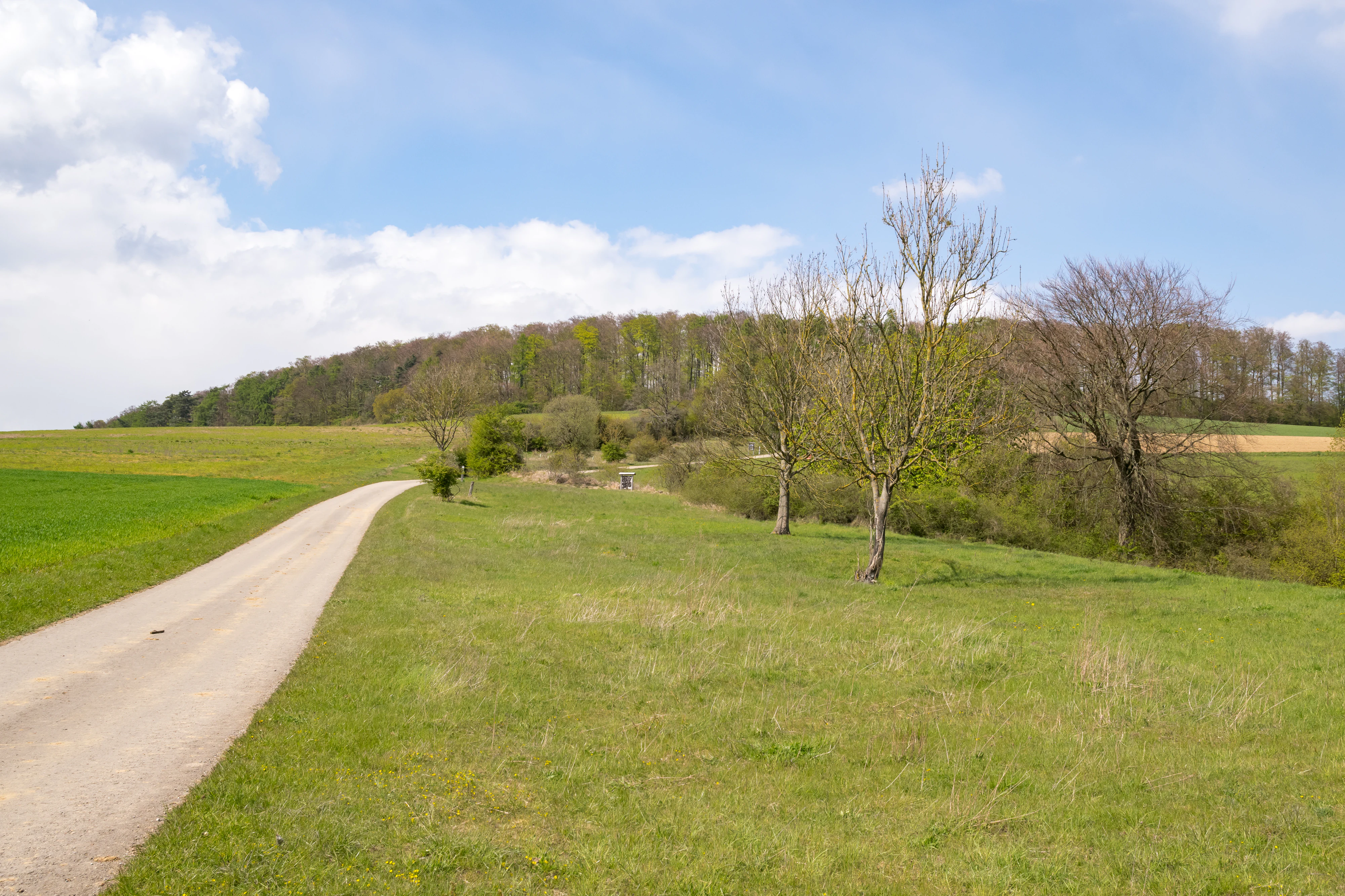
A gravel path winds through open green meadows with scattered deciduous trees, leading toward a forested hill under a blue sky with light clouds.
A scenic view of the Kalkmagerrasen bei Ottbergen und Bruchhausen nature reserve, showcasing the rolling grasslands and woodland edges.

Kalkmagerrasen bei Ottbergen und Bruchhausen history and protected-area timeline

The area that is now Kalkmagerrasen bei Ottbergen und Bruchhausen has long been shaped by human land use, with centuries of grazing, hay-cutting, and small-scale woodland management creating the open grassland and juniper heath communities that exist today. These traditional practices maintained nutrient-poor grasslands and prevented the encroachment of dense forest, producing the habitat mosaic that later became the basis for formal nature protection.

The reserve itself was formally designated in 1988 as a Naturschutzgebiet under the German nature conservation framework, with the official code HX-075 and an area of around 113 hectares across seven non-contiguous parcels. Responsibility for its management lies with the Untere Landschaftsbehörde (lower landscape authority) of the Kreis Höxter.

In 2004, three of the seven parcels, together with the neighboring Stockberg nature reserve, were additionally designated as the European Fauna-Flora-Habitat (FFH) site Kalkmagerrasen bei Ottbergen, with the Natura 2000 code DE-4221-302 and an area of around 77 hectares. This recognition as part of the EU Natura 2000 network highlighted the site's importance for the conservation of calcareous grassland habitats at the European level and reinforced existing protection measures.

Kalkmagerrasen bei Ottbergen und Bruchhausen landscape and geographic character

The reserve lies in the gently rolling limestone hill country on the western edge of the Weser valley. Its seven parcels occupy a mixture of exposed hilltops and steeper slope positions, where shallow, stony, calcareous soils have limited agricultural use. This topography gives the area its characteristic pattern of open, sun-exposed slopes alternating with small woodland patches and field hedges.

Kalkmagerrasen bei Ottbergen und Bruchhausen wildlife and species highlights

The varied structure of woodland edges, shrubs, and open calcareous grassland supports a characteristic insect and bird fauna. Shrub-nesting birds such as the red-backed shrike (Neuntöter) and the common whitethroat (Dorngrasmücke) are recorded in the reserve, using the dense thickets of juniper and other shrubs as nesting and foraging habitat.

Top sights and standout views in Kalkmagerrasen bei Ottbergen und Bruchhausen

The reserve's strongest features are its species-rich calcareous grassland communities on limestone soils, its juniper-rich dwarf shrub heath, and the way calcarean beech forest types, including orchid-rich variants, sit directly beside open grassland within a single reserve. Cattle and sheep grazing keep the open landscape character intact and support rare orchids, gentians, and a specialized butterfly fauna.

Monthly climate preview

Long term monthly temperature averages and precipitation patterns for Kalkmagerrasen bei Ottbergen und Bruchhausen

Kalkmagerrasen bei Ottbergen und Bruchhausen Climate and Temperature Normals

Representative coordinate measurements record the long term annual temperature progression alongside steady monthly precipitation levels across the terrain. Reviewing the complete twelve month climate profile reveals detailed shifts in average temperature and precipitation metrics.
Annual mean8 °C
-1 °C18 °C
Jan-1°
Feb
Mar
Apr
May12°
Jun16°
Jul18°
Aug18°
Sep14°
Oct
Nov
Dec
Warmest month
July

18 °C

Coolest month
January

-0.6 °C

Wettest month
July

2.5 mm/day

Driest month
April

1.5 mm/day

Park location guide

Geography guide, regional context, and park location map for Kalkmagerrasen bei Ottbergen und Bruchhausen

Kalkmagerrasen bei Ottbergen und Bruchhausen park geography, regions, and map view in Germany

Understand where Kalkmagerrasen bei Ottbergen und Bruchhausen sits in Germany through a broader geographic reading of the surrounding landscape, nearby location context, and its mapped position within the national park landscape.

How Kalkmagerrasen bei Ottbergen und Bruchhausen fits into Germany

Germany is a federal republic in Western and Central Europe with a population of over 83 million across sixteen constituent states. It is Europe's largest economy by nominal GDP and a major global exporter and importer. The capital is Berlin, and the country borders Denmark, Poland, Czech Republic, Austria, Switzerland, France, Luxembourg, Belgium, and the Netherlands.

Wider geography shaping Kalkmagerrasen bei Ottbergen und Bruchhausen in Germany

Germany is located in Western and Central Europe, spanning 357,022 km². It borders Denmark to the north, Poland and the Czech Republic to the east, Austria and Switzerland to the south, and France, Luxembourg, Belgium, and the Netherlands to the west. The country has coastlines on the Baltic Sea and North Sea to the north, with the Alps located in the southern region.

Map view of Kalkmagerrasen bei Ottbergen und Bruchhausen

Use this park location map to pinpoint Kalkmagerrasen bei Ottbergen und Bruchhausen in Germany, understand its exact geographic position, and read its mapped placement within the surrounding landscape more clearly.

Pigeon | © OpenStreetMap contributors

Location context for Kalkmagerrasen bei Ottbergen und Bruchhausen

Nordrhein-Westfalen

Visualizing calcareous grassland habitats, juniper heath, and Weser valley terrain

Kalkmagerrasen bei Ottbergen und Bruchhausen Photos and Landscape Scenery

Visual documentation reveals the distinct limestone topography, species-rich calcareous grasslands, and juniper heath characterizing Kalkmagerrasen bei Ottbergen und Bruchhausen. Field photographs provide clear insight into the protected habitats, grazed slopes, and woodland transitions shaping the Weser valley reserve.

A gravel path winds through open green meadows with scattered deciduous trees, leading toward a forested hill under a blue sky with light clouds.

Park atlas

Compare limestone hills, juniper heath, and connected conservation landscapes in the upper Weser valley.

Other Parks Near Kalkmagerrasen bei Ottbergen und Bruchhausen and Regional Protected Areas

Browsing other parks near Kalkmagerrasen bei Ottbergen und Bruchhausen reveals similar calcareous grasslands, grazed hillslopes, and limestone beech forests across the surrounding region. Extending the geographic comparison allows visitors to examine related protected landscapes and regional habitat patterns in greater detail.
Nature reserveNiedersachsen
About 10 km away#1 closest

East

Wälder im südlichen Solling Nature Reserve: A Detailed Atlas of German Protected Woodlands

Ecological mapping of Niedersachsen's southern Solling forest complexes.

Navigate the protected boundaries and landscape character of Wälder im südlichen Solling. This nature reserve provides an essential study in forest conservation, highlighting the intersection of traditional wood-pasture management and steep, near-natural slope forest ecosystems within the Solling-Vogler upland.

Area
10.16 km²
Established
2020
Relief
Upland
Climate
Temperate
Nature reserveLower Saxony
About 13 km away#2 closest

Northeast

Stuckenstein-Eichen Nature Reserve: Historic Oak Pasture and Beech Forest Landscapes

A preserved woodland territory within the Solling hill range of Lower Saxony

Stuckenstein-Eichen serves as a vital nature reserve and protected landscape in Germany. It is defined by its striking internal contrast between a southern oak pasture woodland, characterized by historic planting grids, and a northern beech forest developing through natural succession. The site provides a compact yet detailed look at the coexistence of cultural history and forest ecology within the broader Solling region.

Area
0.2 km²
Established
1988
IUCN
IV
Relief
Upland
A soft watercolor painting of gentle green rolling hills and meadows under a faint pink sky.
Nature reserveHesse
About 15 km away#3 closest

South

Flohrberg und Ohmsberg bei Deisel Nature Reserve; Calcareous Landscape and Park Boundaries

A protected Hessian site near Trendelburg

Situated in the Landkreis Kassel, Flohrberg und Ohmsberg bei Deisel encompasses 107 hectares of calcareous ground, disused quarries, and sheep-grazed grasslands. The area provides a critical landscape context for orchid-rich flora and rare butterfly fauna within the northern Hessian hill country, acting as a protected link between open farmland and the Reinhardswald forest edge.

Area
0.418 km²
Established
1990
Nature reserveLandkreis Holzminden
About 19 km away#4 closest

Northeast

Teiche am Erz- und Finkenbruch im Solling: Protected Nature Reserve and Wetland Geography

Mapped forest ponds and bog-margin habitat in Landkreis Holzminden

Teiche am Erz- und Finkenbruch im Solling comprises a network of forest ponds and peat-moss communities protected within a two-zone nature reserve. Its sheltered position in the Solling range preserves critical habitat for rare dragonfly populations, serving as an essential wetland segment within the larger Solling-Vogler landscape protection area.

Area
0.03 km²
Established
2016
A soft watercolor illustration showing rolling green hills, small groups of conifer trees, and a pale pink and peach sky in the background.
Natural monumentEberschütz
About 20 km away#5 closest

South

Der Bunte Berg bei Eberschütz: Natural Monument and Landscape Geography

Limestone ridge and calcareous grassland habitat in Germany

Examine the topography and protected land features of Der Bunte Berg bei Eberschütz. This compact reserve provides a critical study of limestone-influenced terrain, transitioning from mature pine and beech woodland to specialized juniper heath and dry grassland habitats essential for regional biodiversity.

Watercolor illustration of rolling green and pink-tinted hills with scattered small trees against a white background.
Nature reserveNordrhein-Westfalen
About 21 km away#6 closest

Southwest

Kalktriften Willebadessen Nature Reserve: Mapped Geography and Protected Limestone Grasslands

Protected calcareous slopes within the Nethe valley region

Kalktriften Willebadessen encompasses a unique Muschelkalk limestone ridge in the Weser Uplands. This protected nature reserve provides a essential habitat for threatened flora and fauna, thriving within an open, sun-baked landscape that contrasts sharply with the surrounding forests. The site serves as a key example of how historical agricultural practices sustain biodiversity, featuring varied terrain from steep southern spurs to panoramic valley overlooks.

Area
1.12 km²
Established
2003
IUCN
IV
Relief
Upland
A soft watercolor illustration showing rolling green hills, distant mountains, and forested slopes on a white background.
Nature reserveHesse
About 21 km away#7 closest

South

Dingel und Eberschützer Klippen: Protected Landscapes and Geography in Hesse, Germany

A dense mosaic of limestone slopes, juniper scrub, and beech forest communities.

Discover the geographic identity of Dingel und Eberschützer Klippen, a combined nature reserve and Natura 2000 site in northern Hesse. The protected area features a unique concentration of orchid-rich habitats, south-facing limestone slopes, and broadleaf forest blocks that define this essential part of the Reinhardswald region.

Area
1.123 km²
Established
1987
Relief
Upland
Climate
Temperate
A soft watercolor painting depicting a gentle, winding river flowing through a forested landscape with rolling hills in the background.
Protected landscapeLower Saxony
About 21 km away#8 closest

East

Naturpark Solling-Vogler Protected Landscape: Regional Geography and Mapped Terrain

Extensive forested low-mountain region in Lower Saxony

Naturpark Solling-Vogler acts as a core protected region within the Weserbergland of Lower Saxony. This atlas entry details its dual landscape identity, bridging the wide upland Solling plateau with the sharp, narrow Vogler ridge. Explore the mapped river valleys and woodland habitats that define this important German nature park.

Relief
Mountain
Climate
Temperate
Scope
Terrestrial
Water
Major water bodies

Common questions about visiting, size, designation, and location context for Kalkmagerrasen bei Ottbergen und Bruchhausen

Kalkmagerrasen bei Ottbergen und Bruchhausen FAQs for park facts, access, geography, and protected area context

Find quick answers about Kalkmagerrasen bei Ottbergen und Bruchhausen, including protected-area facts, park geography, trail and visitor context, and how the park fits into its surrounding country and regional landscape.
MoriAtlas Explorer

Continue Your Protected Areas Search Across the Global Atlas

Deepen your exploration by continuing the structured search for national parks and protected areas worldwide. Utilize the comprehensive filtering capabilities to compare different conservation landscapes and refine your understanding of global park geography. Discover more about the distribution and characteristics of protected natural areas.

Global natural geography