
Mori Atlas logo
State or regional parkKentucky Alleyne Provincial Park

Examining the unique kettle lake geography and dry forest terrain of Southern British Columbia

Kentucky Alleyne Provincial Park: A Protected Landscape of Glacial Lakes and Interior Grasslands

Kentucky Alleyne Provincial Park is a protected area in the southern interior of British Columbia, defined by its striking turquoise kettle lakes and open Ponderosa pine forests. This landscape showcases distinct glacial landforms including eskers and fluvial outwash deposits, offering a deep look into the Pleistocene history of the Nicola Plateau. The surrounding dry interior grasslands and historic ranchlands provide a unique ecological context, contrasting sharply with coastal ecosystems across the province.

glacial lakeskettle lakesdry interior forestDouglas firPonderosa pinegrasslands
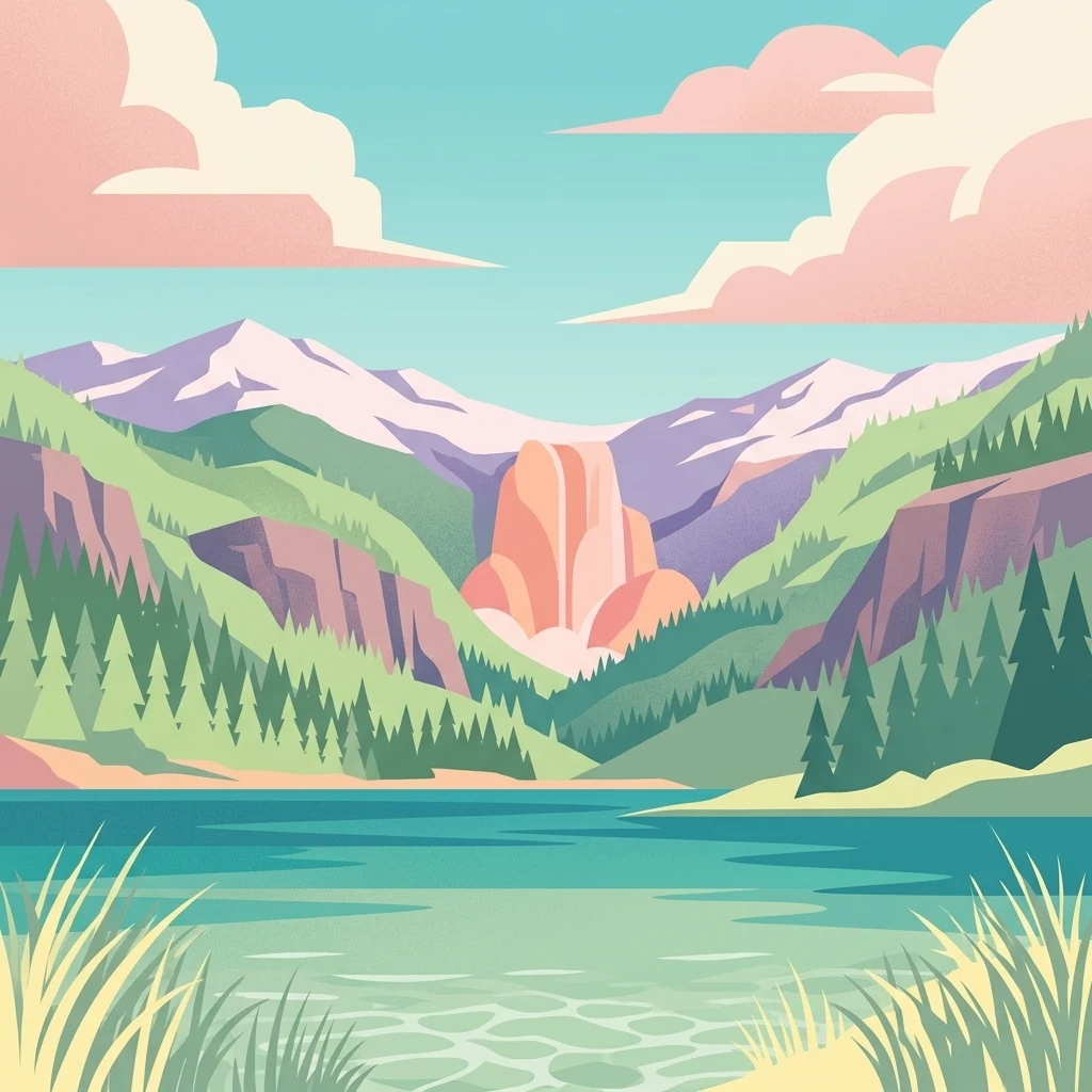
A flat vector illustration featuring a turquoise lake in the foreground, surrounded by evergreen forests and mountains under a pastel sky with pink clouds.

Kentucky Alleyne Provincial Park

State or regional park

Park overview

Structured park overview, official facts, and landscape profile for Kentucky Alleyne Provincial Park

Kentucky Alleyne Provincial Park park facts, protected area profile, and essential visitor context

Review the core facts for Kentucky Alleyne Provincial Park, including designation, size, terrain, visitor scale, habitats, and operating context in one park-focused overview.

About Kentucky Alleyne Provincial Park

Kentucky Alleyne Provincial Park sits in the rain-shadow heart of southern British Columbia, where the landscape shifts from the dense coastal forests most travellers associate with the province to open rangeland, ponderosa pine stands, and dry grasslands dotted with glacial lakes. The park lies southeast of Merritt and east of Aspen Grove, in a region historically shaped by ranching and shaped geologically by Pleistocene glaciation. Its founding name reflects the two largest water bodies within its boundaries, Kentucky Lake and Alleyne Lake, which together define the visual and recreational identity of the site.

The lakes themselves are kettle lakes, formed when blocks of ice calved from retreating glaciers were buried in glacial outwash and slowly melted, leaving broad water-filled depressions. The surrounding terrain preserves a notable suite of glacial features including eskers and fluvial outwash deposits, making the park a compact outdoor classroom for ice-age landforms. Today, those same turquoise lakes lie at the centre of a quiet recreational landscape framed by Douglas Lake Ranch, one of Canada's largest operating cattle ranches and a presence on the land for well over a century.

Ecologically, the park blends dry interior forest with open water and grass, producing habitat variety well beyond what its modest 190-hectare size might suggest. Mature Douglas fir and Ponderosa pine tower over rolling grasslands, while aspen groves and juniper thickets create transitional shrubby cover. Kentucky Lake reaches depths of over 40 metres, while the larger but shallower Alleyne Lake extends in two lobes, only the southern portions of which fall within the protected area. Together, the lakes, forests, and grasslands make the park valuable for both wildlife conservation and visitor recreation.

The park's recreational role is straightforward and accessible. It is primarily a destination for vehicle camping, with around 79 campsites, and for non-motorized lake-based activities such as canoeing, kayaking, and fishing. Rainbow trout are stocked, the lakes are calm and clear, and the campground and picnic areas are positioned to take advantage of the lake views. Yet beneath this casual surface, the park carries meaningful ecological responsibility: it shelters a breeding population of Western toad, a Canadian species of special concern, and uses seasonal trail closures and pioneering toad underpasses to keep migrating toadlets safe from vehicle traffic.

Quick facts and research context for Kentucky Alleyne Provincial Park

Kentucky Alleyne Provincial Park is a 190-hectare provincial park located in the interior of British Columbia, about 38 kilometres south of Merritt and east of Aspen Grove. It was established on March 5, 1981 and is classified as an IUCN Category II protected area. The park protects two large glacial lakes, Kentucky Lake and Alleyne Lake, both known for their distinctive turquoise colour, together with surrounding grasslands and dry open forest of Douglas fir and Ponderosa pine.

Protection and recognition

Examine the documented terrestrial protection metrics and official designation data.

Kentucky Alleyne Provincial Park Protection Status and Conservation Scope

Kentucky Alleyne Provincial Park maintains a defined terrestrial protection scope within its regional conservation framework. Official records compile available administrative designations, management parameters, and recognition details for the protected area.

Protection details

Protection scope
Terrestrial
Transboundary protection
No
Park context

Deeper park guide and search-rich context for Kentucky Alleyne Provincial Park

Kentucky Alleyne Provincial Park history, landscape, wildlife, and travel context

Explore Kentucky Alleyne Provincial Park through its history, landscape character, ecosystems, wildlife, conservation priorities, cultural context, and seasonal travel timing in a structured park guide built for atlas discovery and search intent.

Why Kentucky Alleyne Provincial Park stands out

Kentucky Alleyne Provincial Park is best known for its two strikingly turquoise glacial lakes set within rolling grasslands and dry interior forest. The vivid colour of the water, combined with mature Douglas fir, Ponderosa pine, aspen, and juniper stands, gives the park a distinctive character that reflects the warm, dry climate of the southern British Columbia interior. The park is also recognized for its clear geological fingerprint: kettle lakes, eskers, and fluvial outwash deposits tell the story of the Pleistocene glaciers that retreated across the Nicola Plateau. This combination of ice-formed lakes and dry forest makes Kentucky Alleyne one of the more visually unusual protected areas in the province, distinct from the rainforests and alpine parks elsewhere in British Columbia.
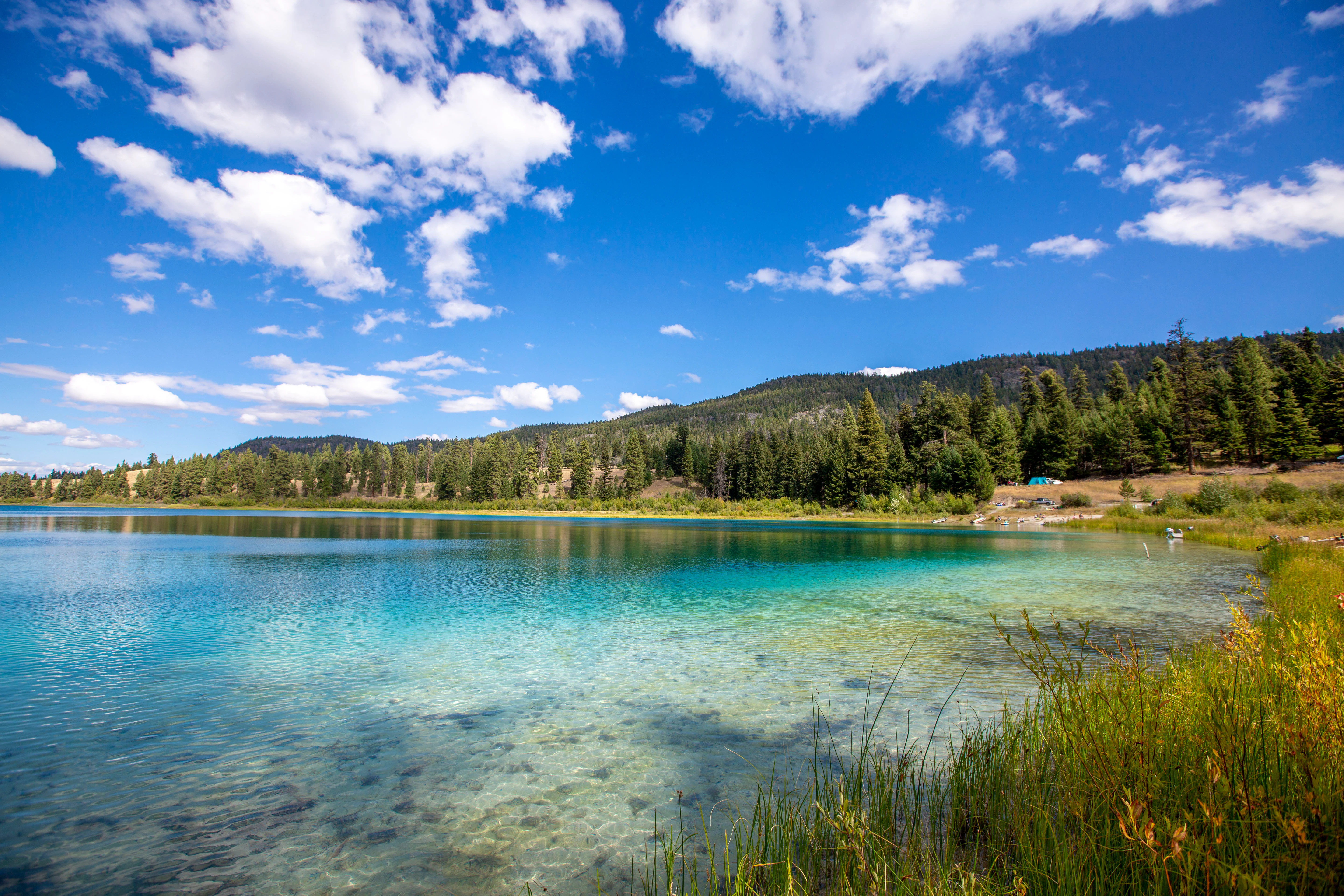
A wide, eye-level shot of a bright turquoise lake surrounded by coniferous trees, rolling hills, and a clear blue sky with white clouds.
A scenic view of the turquoise waters of a kettle lake at Kentucky Alleyne Provincial Park.

Kentucky Alleyne Provincial Park history and protected-area timeline

Kentucky Alleyne Provincial Park was established on March 5, 1981, securing formal protection for two of the most distinctive glacial lakes in the Nicola region and the surrounding dry forest landscape. Although relatively young as a designated park, the land itself had long been part of the working ranching country of southern British Columbia.

The park is nearly surrounded by Douglas Lake Ranch, one of Canada's largest and oldest cattle ranches, with origins stretching back more than a century before the park's creation. This long-standing ranching context helped preserve much of the open rangeland character that surrounds the park today, while also placing limits on how closely the protected area can expand into adjacent lands. Over time, management attention has increasingly turned to the smaller, less visible aspects of the park's heritage: the seasonal migrations of Western toad, and the need to integrate conservation infrastructure such as toad underpasses and seasonal trail closures into a park that otherwise functions primarily as a summer camping destination.

Kentucky Alleyne Provincial Park landscape and geographic character

The landscape of Kentucky Alleyne Provincial Park is shaped by the slow disappearance of Pleistocene ice. The lakes that give the park its name are classic kettle lakes, formed when isolated blocks of buried glacial ice melted and left broad basins that filled with groundwater. Eskers, the sinuous ridges of sand and gravel deposited by subglacial streams, and broader fluvial outwash deposits, where meltwater once spread sediment across the valley, are also preserved within the park. Together, these features create gently rolling terrain with subtle elevation changes, broken by the flat reflective surfaces of the lakes themselves.

Kentucky Lake is the deeper of the two main lakes, reaching around 40.5 metres at its maximum, with a surface of approximately 35.6 hectares; only the northern third of the lake lies within the park. Alleyne Lake is broader but shallower, covering about 54.6 hectares and reaching depths of roughly 35.6 metres; here the protected area follows the southern end of the lake and continues northward along its western shore. Both waters are noted for their unusually clear turquoise hue, an effect that derives from the mineral content of the glacial sediments suspended in them, and that contrasts strikingly with the tawny grasslands and dark conifer stands surrounding the shoreline.

Surrounding the lakes, the land rises gently into a mosaic of dry open forest and rolling grassy slopes. Ponderosa pine and Douglas fir frame the lakes, while aspen groves and juniper stands fill in transitional edges. The overall impression is of a warm, dry, sun-lit landscape more reminiscent of the western United States than of the coastal rainforest image many visitors associate with British Columbia. The near-presence of Douglas Lake Ranch reinforces this ranchland feel, with open range country stretching to the edges of the protected area.
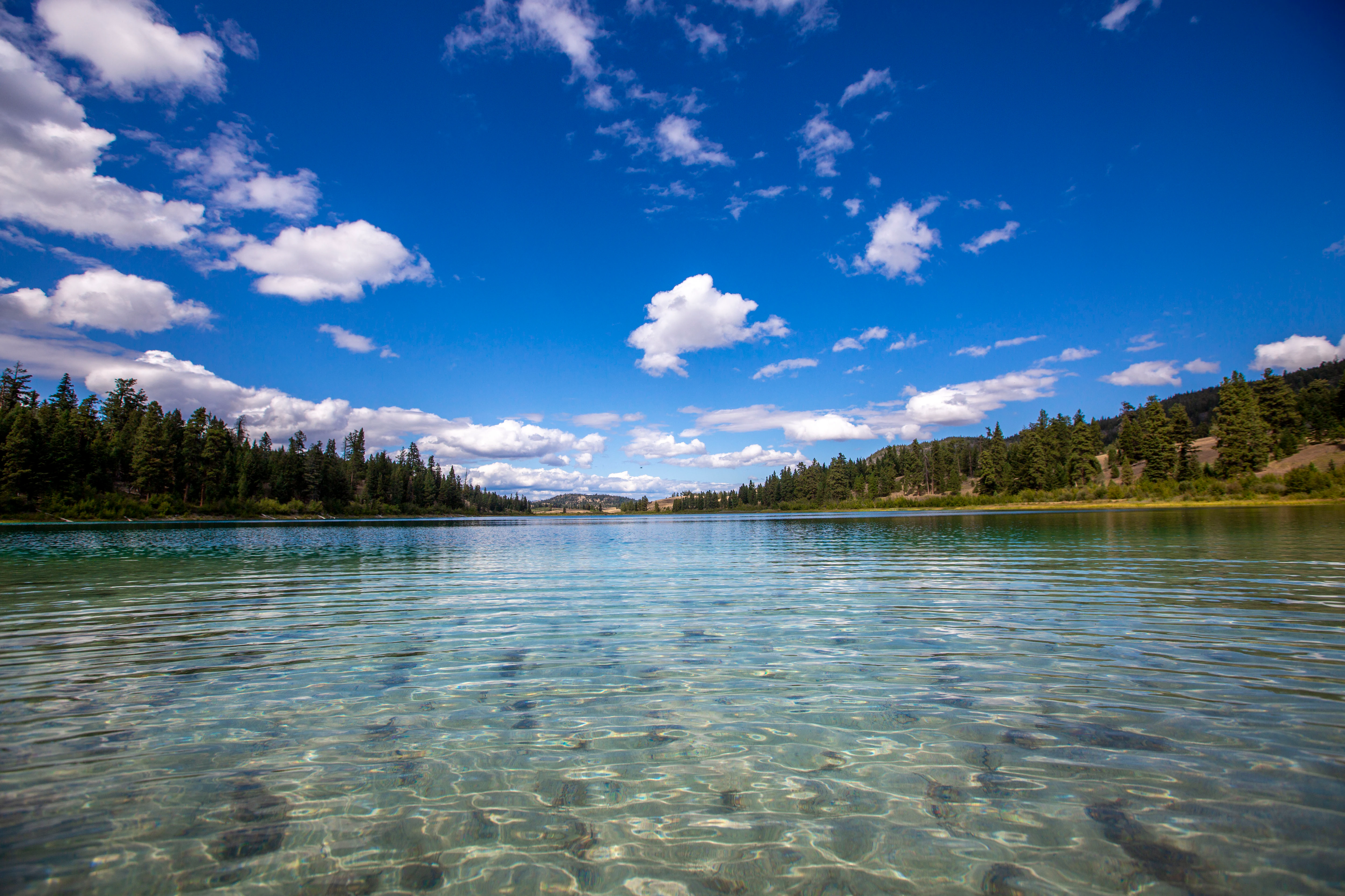
A low-angle view across a crystal-clear turquoise lake, with a coniferous forest lining the shore under a blue sky with scattered white clouds.
A wide view of one of the iconic turquoise lakes in Kentucky Alleyne Provincial Park, showing clear water and surrounding forest.

Kentucky Alleyne Provincial Park ecosystems, habitats, and plant life

Kentucky Alleyne Provincial Park captures an unusually complete slice of the dry interior ecosystems of southern British Columbia in a compact footprint. The forest communities are dominated by mature Douglas fir and Ponderosa pine, two conifers characteristic of the province's warmer valleys and lower-elevation slopes. Beneath and between these trees, aspen groves and juniper shrubs create a softer shrub layer, while patches of rolling grassland extend toward the lake margins.

The juxtaposition of open water, dry pine forest, and grassy slope gives the park its ecological richness. Waterfowl and aquatic species are drawn to the lakes, raptors use the surrounding forest edge for hunting, and small mammals and reptiles move through the juniper and aspen stands. The lakes also serve as a managed fishery, with regular stocking of rainbow trout that links aquatic habitat directly to recreational use.

A defining element of the park's natural character is its importance as breeding habitat for Western toad, a species considered of special concern in Canada. The lakes, wet meadows, and forest edges together support the full annual cycle of these amphibians, including the vulnerable juvenile migration phase that has driven targeted conservation action within the park.
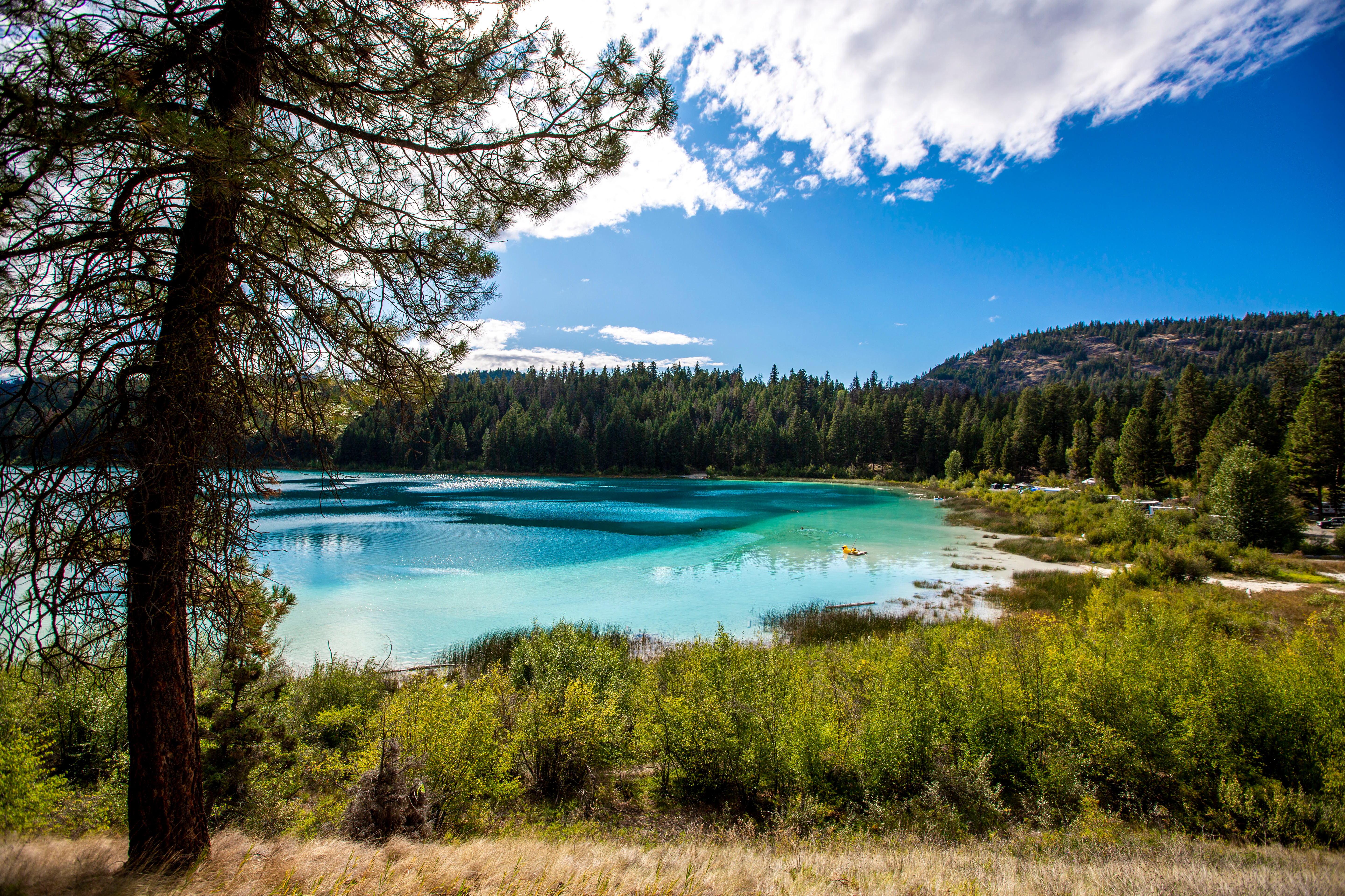
A bright, sunny view overlooking a turquoise lake surrounded by dense evergreen trees and golden-green vegetation.
A scenic view of the vibrant turquoise waters characteristic of Kentucky Alleyne Provincial Park.

Kentucky Alleyne Provincial Park wildlife and species highlights

The lakes of Kentucky Alleyne Provincial Park attract a varied community of waterfowl, including goldeneye, mallard, green-winged teal, and grebes, which use the calm kettle waters throughout the open-water season. Hawks and falcons patrol the surrounding grasslands and forest margins, hunting the small mammals and ground-nesting birds that share the open terrain.

Among the more significant wildlife values of the park is its population of Columbian sharp-tailed grouse, a Blue-listed species in British Columbia whose presence has become increasingly rare across much of its former range. The park's mix of shrubby aspen, juniper cover, and open ground provides valuable habitat structure for this grouse, and the surrounding Douglas Lake Ranch lands continue to support much of the broader population.

Smaller mammals are common in the dry forest, with jack rabbits and ground squirrels especially associated with the aspen and juniper shrub layer. The lakes are stocked with rainbow trout, making them part of the angling experience as well as the natural food web. Perhaps most importantly from a conservation perspective, the park supports a breeding population of Western toad, whose life cycle, particularly the late-summer migration of newly metamorphosed toadlets, has become a focus of active wildlife management within the protected area.
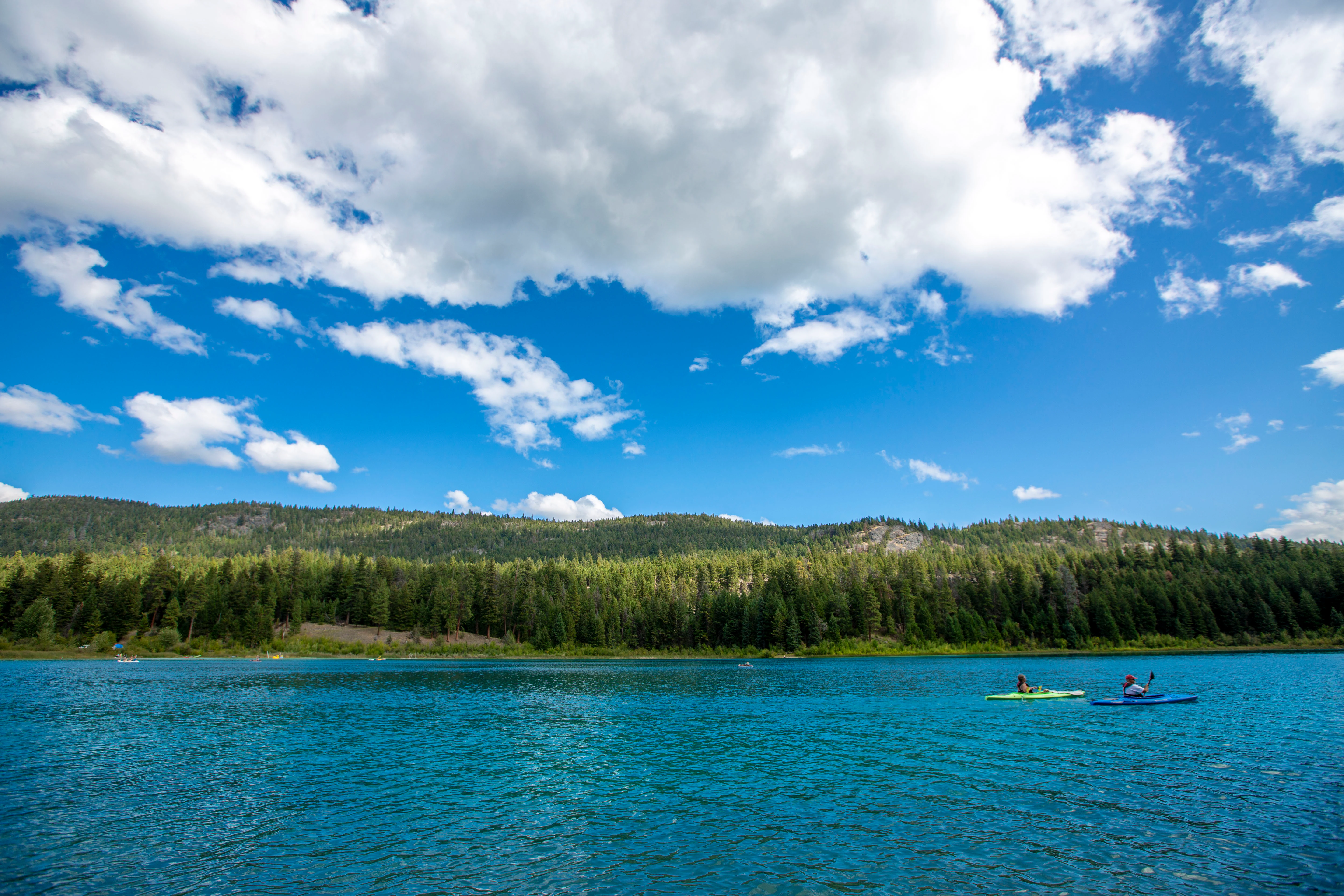
A wide, eye-level shot of a bright turquoise lake with two kayakers in the distance, backed by a dense green pine forest and rolling hills under a blue sky with fluffy clouds.
Kayakers paddling on the turquoise waters of a lake at Kentucky Alleyne Provincial Park.

Kentucky Alleyne Provincial Park conservation status and protection priorities

Kentucky Alleyne Provincial Park plays a meaningful role in conserving a representative sample of the dry interior ecosystems of southern British Columbia. By protecting two large kettle lakes along with their surrounding grasslands, Douglas fir, Ponderosa pine, aspen, and juniper habitats, the park maintains a working example of an ecological community that has been heavily altered by ranching, logging, and settlement elsewhere in the Nicola region.

Its most distinctive conservation contribution is the protection it provides for Western toad. As a Canadian species of special concern, the Western toad depends on connected aquatic breeding sites and surrounding terrestrial habitat, both of which the park supplies. To reduce road-related mortality during the juvenile toad migration, park managers have implemented seasonal restrictions on some trails and campsites, and have tested toad underpasses and fencing in cooperation with conservation researchers, with some success in lowering toadlet mortality.

The park's nearly complete enclosure by Douglas Lake Ranch gives it an unusual conservation context: a small but ecologically distinct protected area set within one of Canada's largest working ranches. This relationship highlights both the importance of private land stewardship to the broader region and the value of the park as a secure refuge for sensitive species like the Western toad and the Blue-listed Columbian sharp-tailed grouse.

Kentucky Alleyne Provincial Park cultural meaning and human context

The cultural fabric surrounding Kentucky Alleyne Provincial Park is shaped in large part by its relationship with Douglas Lake Ranch, the neighbouring cattle operation that has defined land use in the area for more than a century. The ranch's long-standing presence has left an imprint on the open rangeland scenery that visitors experience at the park, with grasslands managed for cattle grazing extending nearly to the park boundary. This shared landscape gives the park a strong sense of continuity with British Columbia's ranching heritage rather than positioning it as a detached wilderness reserve.

The dry-country setting, with its open pine forest, bunchgrass slopes, and broad turquoise lakes, also reflects the broader cultural geography of the Nicola region, where interior First Nations histories, early ranching families, and outdoor recreation traditions intersect. While the park itself is primarily a recreational destination, its landscape carries echoes of these interwoven human and ranching histories that have shaped the southern interior of British Columbia.

Top sights and standout views in Kentucky Alleyne Provincial Park

Two strikingly turquoise glacial lakes, Kentucky Lake and Alleyne Lake, sit at the centre of the park and give it both its name and its distinctive visual identity. Surrounding mature Douglas fir, Ponderosa pine, aspen, and juniper create a dry interior forest setting that feels closer to the American West than to coastal British Columbia.

Glacial landforms including kettle lakes, eskers, and fluvial outwash deposits make the park a compact showcase of Pleistocene landscape history, while seasonal trail closures and toad underpasses demonstrate an active conservation programme centred on the Western toad, a Canadian species of special concern. Combined with vehicle-accessible camping, canoeing on calm clear lakes, and rainbow trout fishing, the park offers a rare blend of accessible recreation and meaningful ecological protection.

Best time to visit Kentucky Alleyne Provincial Park

The park's dry interior climate means that summer is the most comfortable season for camping, boating, and kayaking on the lakes, with warm temperatures and long daylight hours supporting classic paddle-and-camp experiences. Spring and early summer bring active waterfowl and the early phases of amphibian breeding around the lakes, while late summer is the key period when juvenile Western toads undertake their vulnerable migrations; visitors during this window should expect some trails and occasionally campsites to be temporarily closed as part of conservation efforts.

Cooler shoulder seasons can offer quieter visits with cooler water and landscapes transitioning toward early frost, though services and access may be reduced outside the main summer recreation period.
Monthly climate preview

Long-term representative monthly averages for temperature and precipitation patterns

Kentucky Alleyne Provincial Park Climate Normals and Temperature Rhythms

Kentucky Alleyne Provincial Park exhibits a measured annual cycle featuring freezing winter minimums alongside warm summer maximums and steady precipitation distribution. Detailed monthly records reveal precise baseline shifts across the coordinate point for comprehensive climate comparison.
Annual mean3 °C
-7 °C14 °C
Jan-7°
Feb-6°
Mar-2°
Apr
May
Jun11°
Jul14°
Aug14°
Sep10°
Oct
Nov-3°
Dec-7°
Warmest month
July

14.4 °C

Coolest month
December

-7.3 °C

Wettest month
November

2.5 mm/day

Driest month
August

0.9 mm/day

Park location guide

Geography guide, regional context, and park location map for Kentucky Alleyne Provincial Park

Kentucky Alleyne Provincial Park park geography, regions, and map view in Canada

Understand where Kentucky Alleyne Provincial Park sits in Canada through a broader geographic reading of the surrounding landscape, nearby location context, and its mapped position within the national park landscape.

How Kentucky Alleyne Provincial Park fits into Canada

Canada is a federal parliamentary constitutional monarchy spanning North America from the Atlantic to the Pacific and Arctic Oceans. With a population of over 41 million, it is officially bilingual in English and French at the federal level. The country gained independence from the United Kingdom through a gradual process culminating in 1982.

Wider geography shaping Kentucky Alleyne Provincial Park in Canada

Canada occupies the northern portion of North America, sharing its longest international border with the United States. The country extends from the Atlantic Ocean to the Pacific Ocean and northward into the Arctic Ocean, giving it the longest coastline of any nation.

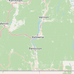
Map view of Kentucky Alleyne Provincial Park

Use this park location map to pinpoint Kentucky Alleyne Provincial Park in Canada, understand its exact geographic position, and read its mapped placement within the surrounding landscape more clearly.

Pigeon | © OpenStreetMap contributors

Location context for Kentucky Alleyne Provincial Park

British Columbia

Visual reference of turquoise kettle lakes and dry interior forest habitats

Kentucky Alleyne Provincial Park Photos, Scenery, and Landscapes

Examine professional field photography documenting the distinctive turquoise glacial waters and Ponderosa pine forests of Kentucky Alleyne Provincial Park. Visual documentation reveals the subtle kettle topography and open range character defining this southern interior protected area.

A wide, eye-level shot of a bright turquoise lake surrounded by coniferous trees, rolling hills, and a clear blue sky with white clouds.

A low-angle eye-level view of a dirt trail leading through a sunlit field of wildflowers and tall grasses under a bright blue sky with puffy white clouds.

A low-angle view across a crystal-clear turquoise lake, with a coniferous forest lining the shore under a blue sky with scattered white clouds.

A bright, sunny view overlooking a turquoise lake surrounded by dense evergreen trees and golden-green vegetation.

A wide, eye-level shot of a bright turquoise lake with two kayakers in the distance, backed by a dense green pine forest and rolling hills under a blue sky with fluffy clouds.

A gravel parking area with two vehicles and wooden picnic tables, bordered by a dense conifer forest and a turquoise lake under a bright blue sky with white clouds.

Park atlas

Compare regional dry interior forest reserves and glacial lake ecosystems

Exploring Parks Near Kentucky Alleyne Provincial Park and Surrounding Protected Landscapes

Browse protected areas and natural reserves situated near Kentucky Alleyne Provincial Park across the southern interior. Comparing adjacent regional geography reveals broader patterns in dry forest terrain and glacial lake ecosystems.
A wide watercolor painting showing layers of purple mountains in the distance, a misty valley, and green pine trees in the foreground under a pale pink and yellow sky.
Protected landscapeBritish Columbia
About 53 km away#1 closest

Southwest

Coquihalla Summit Recreation Area: A Protected Landscape in the British Columbia Mountains

Mapping ecological transition zones and mountain terrain

Covering 5,750 hectares of rugged slopes and high-elevation ridges, Coquihalla Summit Recreation Area anchors a vital ecological transition between the coastal and interior climates of British Columbia. This mapped protected area offers a deep look into the granite peaks of the North Cascades and the historic remnants of transportation corridors spanning over a century.

Area
57.5 km²
Established
1987
Relief
Mountain
Scope
Terrestrial
A horizontal watercolor painting depicting a soft-focus mountain landscape with rolling green meadows, patches of coniferous forest, and distant pale mountains under a white sky.
State or regional parkBritish Columbia
About 68 km away#2 closest

South

E. C. Manning Provincial Park: A Comprehensive Geographic Atlas and Protected Area Overview

Mountainous terrain and ecological transitions in southern British Columbia

Spanning the cross section of the Canadian Cascades, E. C. Manning Provincial Park preserves a high-elevation landscape of wildflowers, glacial valleys, and mountain ridges. The protected area links temperate coastal rainforests with the arid interior, providing a study in regional hydrology and subalpine ecology defined by the Hozameen Range and the northern reaches of the Pacific Crest Trail.

Area
836.71 km²
Established
1941
IUCN
II
Visitors
1.1M annual
State or regional parkBritish Columbia
About 75 km away#3 closest

Southwest

Emory Creek Provincial Park: Protected River Valley Landscapes in British Columbia

Historical boomtown site within the Fraser Canyon corridor

Located on the western bank of the Fraser River, Emory Creek Provincial Park preserves a landscape shaped by nineteenth century gold rushes and Canadian Pacific Railway construction. This protected area offers insight into the forested riverside terrain and historical geography that define one of the most storied corridors in southern British Columbia.

Established
1956
IUCN
II
Water
Major water bodies
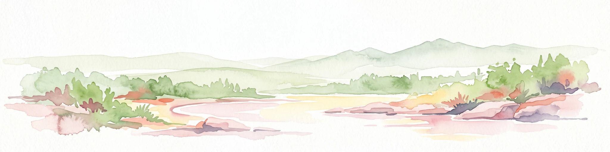
A pale, minimalist watercolor illustration of a soft, hazy landscape featuring rolling mountains in the distance, low-lying green shrubs, and rocky terrain along a shoreline.
State or regional parkBritish Columbia
About 83 km away#4 closest

Southwest

Coquihalla Canyon Provincial Park: A Deeply Eroded Granite Gorge in British Columbia

Mapping historic railway tunnels and river canyon landscapes

Trace the winding Coquihalla River as it cuts through ancient volcanic and metamorphic bedrock. This park preserves a unique intersection of industrial heritage and river morphology, showcasing four iconic tunnels bored through solid granite that define this section of the British Columbia interior landscape.

Area
1.59 km²
Established
1986
IUCN
III
Relief
Upland
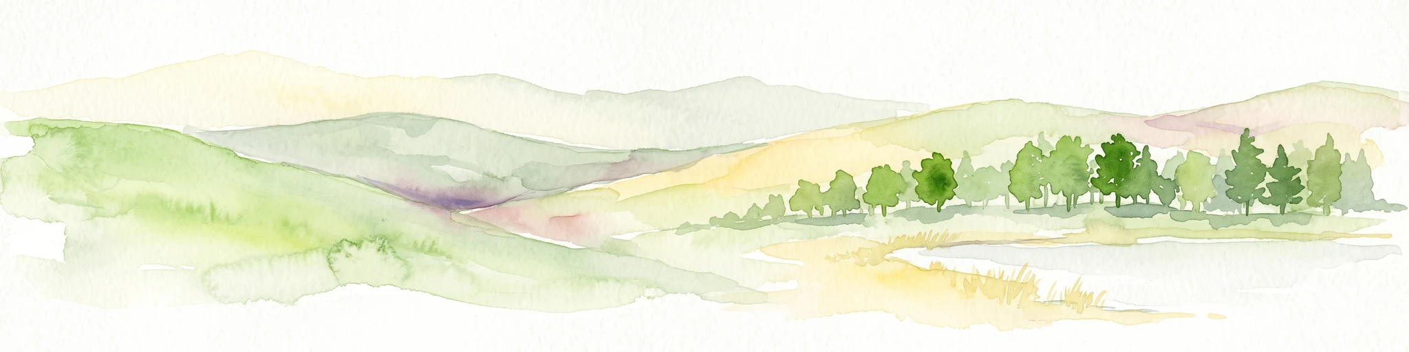
A horizontal watercolor illustration depicting gentle green hills, a small grove of trees, and a pale ground plane against a white background.
Protected areaBritish Columbia
About 95 km away#5 closest

North

Lac du Bois Grasslands Protected Area: Mapped Geography and Interior Plateau Landscapes

Exploring dryland ecosystems and native prairies in British Columbia.

Located in the Thompson-Nicola Regional District, this protected area spans over fifteen thousand hectares of rolling hills and elevated rocky benches. It remains a flagship example of interior plateau conservation, preserving a unique ecological gradient that stretches from arid sagebrush-covered terrain up into denser montane coniferous forest communities.

Area
157.12 km²
Established
1996
IUCN
II
Relief
Upland
State or regional parkBritish Columbia
About 98 km away#6 closest

East

Kalamalka Lake Provincial Park and Protected Area: Mapped Geography and Regional Context

A conservation landscape of the North Okanagan valley

Kalamalka Lake Provincial Park and Protected Area preserves 978 hectares of essential grassland and lakeshore habitats in British Columbia. The area features a complex mosaic of open meadows and mixed forest stands, offering a detailed perspective on the ecological transitions found within the Okanagan Valley. Its geography is defined by the shimmering turquoise waters of Kalamalka Lake, reflecting the unique interplay between seasonal mineral shifts and the surrounding arid terrain.

Area
9.78 km²
Established
1975
IUCN
II
Relief
Upland
A watercolor painting of a mountain landscape with soft-colored rolling hills, a green forest line, and foreground vegetation on a white background.
Protected landscapeWashington
About 102 km away#7 closest

South

Okanogan, Wenatchee National Forest: A Comprehensive Look at Washington's Protected Mountain Landscapes

Mapping ecological gradients and wilderness boundaries across the eastern Cascade Range

Spanning from the moist coniferous forests of the western Cascades to the arid plateaus of the Okanogan, this massive national forest protects an unmatched diversity of terrain. Explore the intricate geography of river-carved valleys, glacial cirques, and remote wilderness areas that characterize this critical environmental corridor in the Pacific Northwest.

Area
6,066.33 km²
Established
1911
Visitors
397K annual
Relief
Mountain
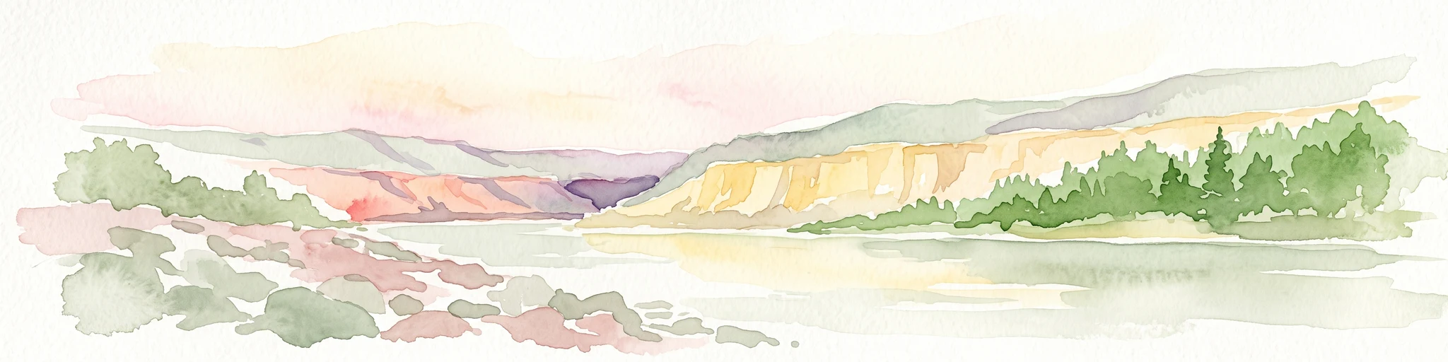
A watercolor illustration showing a river winding through a valley with soft colored hills, a sandy bank in the foreground, and sparse trees along the shore.
State or regional parkBritish Columbia
About 102 km away#8 closest

North

Juniper Beach Provincial Park: Geography and Protected Landscapes in British Columbia

Arid sagebrush steppe along the Thompson River corridor

Juniper Beach Provincial Park preserves a specialized pocket of desert ecology within British Columbia. Spanning 260 hectares, the area features a flat riverfront beach, steep bluffs, and open sagebrush slopes. This protected landscape offers a study in interior plateau geography, bridging the gap between riparian river systems and the dry, sun-exposed terrain of the Thompson Country.

Area
2.6 km²
Established
1989
IUCN
II
Relief
Lowland

Common questions about visiting, size, designation, and location context for Kentucky Alleyne Provincial Park

Kentucky Alleyne Provincial Park FAQs for park facts, access, geography, and protected area context

Find quick answers about Kentucky Alleyne Provincial Park, including protected-area facts, park geography, trail and visitor context, and how the park fits into its surrounding country and regional landscape.
MoriAtlas Explorer

Continue Your Protected Areas Search Across the Global Atlas

Deepen your exploration by continuing the structured search for national parks and protected areas worldwide. Utilize the comprehensive filtering capabilities to compare different conservation landscapes and refine your understanding of global park geography. Discover more about the distribution and characteristics of protected natural areas.

Global natural geography