Mori Atlas logo
Wildlife reserveKentville Migratory Bird Sanctuary

Mapping the riparian floodplains, forest mosaics, and migratory habitats of the Cornwallis River valley.

Kentville Migratory Bird Sanctuary: An Essential Protected Wildlife Reserve in Nova Scotia

Kentville Migratory Bird Sanctuary represents a vital protected landscape within the Cornwallis River floodplain of Nova Scotia. This atlas entry provides geographic context for its diverse mosaic of marshlands, open pine woods, and river channels. By serving as both a breeding ground and a critical seasonal stopover along the Atlantic flyway, the sanctuary maintains a significant ecological presence in the regional terrain of Atlantic Canada.

migratory bird sanctuarywetlandsfloodplainNova ScotiaAtlantic Canadabirdwatching

Kentville Migratory Bird Sanctuary

Wildlife reserve

Park overview

Structured park overview, official facts, and landscape profile for Kentville Migratory Bird Sanctuary

Kentville Migratory Bird Sanctuary park facts, protected area profile, and essential visitor context

Review the core facts for Kentville Migratory Bird Sanctuary, including designation, size, terrain, visitor scale, habitats, and operating context in one park-focused overview.

About Kentville Migratory Bird Sanctuary

Kentville Migratory Bird Sanctuary sits in the northwestern portion of the Nova Scotia peninsula, in a corner of the province shaped by the tidal influences of the nearby Bay of Fundy. Although small in absolute terms, the sanctuary covers a varied landscape built around the Cornwallis River floodplain west of the town of Kentville, blending open water, marsh, forest patches, and human-adjacent land into a single protected mosaic. The reserve is administered by the Canadian Wildlife Service, the federal body responsible for migratory bird protection across Canada, and operates as one of more than ninety migratory bird sanctuaries distributed across the country.

The protected landscape is anchored by a roughly hundred-hectare river floodplain. River channels and wetland areas together make up a significant share of the reserve, while the surrounding lands add important habitat diversity through former fields, a thin cover of open pine woodland, and deciduous shrub communities. Residential and commercial areas also fall within the sanctuary footprint, a reflection of how the reserve threads through working land rather than sitting as a fully remote wilderness block. This mixed land-use context gives the sanctuary a distinctive character: a small but functioning wildlife refuge embedded in a populated river valley.

Ecologically, the sanctuary matters because it provides habitat at multiple points in the annual cycle of migratory and resident birds. Wetlands and river channels support feeding and resting waterfowl, while the surrounding old fields, shrub thickets, and pine openings provide cover, nesting structure, and hunting grounds for raptors and other species. Together, these features make Kentville a key local node within the broader network of Atlantic Canadian reserves that collectively protect migratory birds across their range.

Quick facts and research context for Kentville Migratory Bird Sanctuary

Kentville Migratory Bird Sanctuary is a federally designated migratory bird reserve in Nova Scotia, Canada, near the Bay of Fundy. Established in 1939, it covers roughly five square kilometers and is administered by the Canadian Wildlife Service. The sanctuary is built around a floodplain on the Cornwallis River, west of the town of Kentville, and combines wetlands, river channels, old fields, open pine forest, and deciduous shrub thickets. It was established in the same era as many early Canadian migratory bird sanctuaries and remains part of a national system of more than ninety such sites.

Protection and recognition

Documented terrestrial protection scope and international recognition records

Kentville Migratory Bird Sanctuary Protection Status and Conservation Recognition

Kentville Migratory Bird Sanctuary maintains a documented terrestrial protection scope without imported international recognition sources on file. Structured conservation records compile official designation history and management parameters for geographic analysis.

Protection details

Protection scope
Terrestrial
Transboundary protection
No
Park context

Deeper park guide and search-rich context for Kentville Migratory Bird Sanctuary

Kentville Migratory Bird Sanctuary history, landscape, wildlife, and travel context

Explore Kentville Migratory Bird Sanctuary through its history, landscape character, ecosystems, wildlife, conservation priorities, cultural context, and seasonal travel timing in a structured park guide built for atlas discovery and search intent.

Why Kentville Migratory Bird Sanctuary stands out

Kentville is best known as a Nova Scotia stopover and breeding site for migratory waterfowl and raptors. Its floodplain mosaic of wetlands, marshes, and old fields along the Cornwallis River concentrates birds during migration, while its mix of ponds and shrubby edge provides nesting habitat for several duck species. The reserve also illustrates how a small, mixed-habitat sanctuary in close proximity to human settlement can still play a meaningful role in regional waterfowl protection along the Atlantic flyway.

Kentville Migratory Bird Sanctuary history and protected-area timeline

Kentville Migratory Bird Sanctuary was formally established in 1939, placing it among the earlier protected sites in what became a broad Canadian network of migratory bird sanctuaries. Like many of its contemporary sanctuaries, it was created during a period when the federal government, working through what is now the Canadian Wildlife Service, was systematically setting aside habitat to safeguard migratory bird populations across the country. The reserve today remains under the same federal administration and continues to function under that long-standing mandate. Beyond the founding date, the available record does not provide additional milestones, structural changes, or major expansions, so its history is best understood as a long-running, modestly scaled federal protection of a floodplain site rather than an evolving landscape subject to large shifts in designation or boundary.

Kentville Migratory Bird Sanctuary landscape and geographic character

The sanctuary's physical setting is defined by the Cornwallis River floodplain west of Kentville, in a region of Nova Scotia shaped by the proximity of the Bay of Fundy. The protected area occupies the lower country of the river valley, where channels, marshy flats, and marginal wetland spread across the alluvial corridor. Beyond the floodplain itself, the landscape rises into surrounding terrain that includes open pine woodland and deciduous shrub communities, with sprinkled pockets of former agricultural land now maintained as open habitat.

The mix is unusually varied for a small reserve. Approximately one-third of the sanctuary footprint is composed of wetlands and river channels, giving the reserve a strong riparian character. Additional portions are made up of old fields, open pine, and deciduous shrub vegetation, while the remainder lies within residential and commercial land that overlaps with the protected boundary. This pattern creates a gentle mosaic of wet, open, and lightly wooded habitats, where shallow water, soft marsh vegetation, and patchy tree cover interlock across a relatively compact floodplain landscape.

Kentville Migratory Bird Sanctuary ecosystems, habitats, and plant life

Ecologically, Kentville is a floodplain reserve where wetland habitats meet forest and shrub communities along a small Atlantic Canadian river. The wetland core is dominated by herbaceous marsh vegetation, including extensive stands of blue-joint grass (Calamagrostis canadensis) and common sedge or rush species (the locally noted Gewöhnliche Sumpfbinse), both characteristic of damp floodplain soils. These graminoid communities form the structural backbone of the marsh and provide both foraging and nesting cover for waterfowl.

Around the wetland fringes, the reserve transitions into aged field habitat, open stands of pine, and broader deciduous shrub thickets. These drier habitats complement the wetland core by providing different foraging opportunities and structural diversity: open pine offers perching and hunting stations for raptors, while shrubby edge habitat supports small birds and brooding cover near water. Even the residential and commercial portions of the sanctuary footprint play a role in the broader mosaic, because birds can move between settled and natural land within the protected boundary.

Kentville Migratory Bird Sanctuary wildlife and species highlights

Kentville supports an active migratory and breeding bird community centered on waterfowl and complemented by raptors. Its primary significance lies as a refuge for ducks: the sanctuary hosts breeding dark-plumaged ducks (locally referred to as Dunkelenten), and visitors and monitors regularly observe Blue-winged Teal and the American, or Carolina, Green-winged Teal within the wetland network.

Raptors are also a regular part of the sanctuary's wildlife profile. Both Red-tailed Hawks and Northern Harriers use the reserve, hunting across the open floodplain, marsh edges, and adjacent pine patches for small prey. Beyond these flagged species, the reserve's combination of open water, marsh, shrubby edge, and nearby mature trees attracts a wider community of marsh and field birds typical of Atlantic flyway floodplains, while the periodic gathering of several hundred birds in late summer and early autumn underscores its role as a genuine migratory concentration point rather than a single-species refuge.

Kentville Migratory Bird Sanctuary conservation status and protection priorities

As a designated migratory bird sanctuary under the federal Canadian wildlife protection framework, Kentville is part of a long-standing national strategy to safeguard habitat for migratory species. Its establishment in 1939 places it within the early wave of Canadian protected-area designations intended to ensure that sufficient wetland, marsh, and floodplain habitat remains available across the country for birds moving along multiple flyways. Today, the site continues to be managed by the Canadian Wildlife Service under that migratory bird mandate.

From an ecological standpoint, the sanctuary's conservation value comes from its habitat diversity within a small footprint: by protecting wetlands, marsh edges, old fields, pine openings, and shrubby land in close proximity, Kentville delivers more habitat complexity than its modest size would suggest. This mix supports both breeding ducks and seasonal migrants, while preserving a working example of a river-floodplain sanctuary embedded in a populated region of Atlantic Canada.

Top sights and standout views in Kentville Migratory Bird Sanctuary

Kentville's strongest points of distinction are its habitat diversity and its dual role for breeders and migrants. A substantial share of the reserve is wetland and river channel along the Cornwallis River, but it also incorporates old fields, open pinewood, and deciduous shrub communities, producing an unusually varied floodplain mosaic within a small footprint. The sanctuary is a known late-summer and early-autumn gathering site for migratory waterfowl, and it is also a breeding area for several duck species, including Blue-winged Teal and American Green-winged Teal, watched over by raptors such as the Red-tailed Hawk and Northern Harrier. Its location near the Bay of Fundy in Nova Scotia, combined with its long-standing federal protection since 1939, gives Kentville a clear identity as a compact but ecologically meaningful Atlantic flyway refuge.

Best time to visit Kentville Migratory Bird Sanctuary

For observing the sanctuary's most distinctive bird activity, late summer through early autumn is the strongest window: this is when several hundred birds gather in the reserve during the migration season, and when the marsh, channel, and field habitats are simultaneously in use by both local breeders and passing migrants. Spring is also a meaningful period, as waterfowl return to breeding habitat along the Cornwallis River floodplain and raptors resume hunting across the open landscape. Because the reserve combines open water, marshes, and adjacent uplands, visits across the warmer months will generally offer a mix of breeding, feeding, and resting bird activity rather than the dormant landscape typical of deep winter.
Monthly climate preview

Long-term monthly temperature averages and precipitation metrics for Nova Scotia

Kentville Migratory Bird Sanctuary Climate Normals and Temperature Patterns

Representative coordinates record measured annual temperature fluctuations alongside stable daily precipitation baselines for Kentville Migratory Bird Sanctuary. Exploring the full monthly dataset reveals complete long-term climatological normals across the entire annual cycle.
Annual mean6 °C
-6 °C18 °C
Jan-6°
Feb-5°
Mar-1°
Apr
May
Jun15°
Jul18°
Aug18°
Sep15°
Oct
Nov
Dec-2°
Warmest month
July

18.3 °C

Coolest month
January

-5.8 °C

Wettest month
December

3.7 mm/day

Driest month
July

2.5 mm/day

Park location guide

Geography guide, regional context, and park location map for Kentville Migratory Bird Sanctuary

Kentville Migratory Bird Sanctuary park geography, regions, and map view in Canada

Understand where Kentville Migratory Bird Sanctuary sits in Canada through a broader geographic reading of the surrounding landscape, nearby location context, and its mapped position within the national park landscape.

How Kentville Migratory Bird Sanctuary fits into Canada

Canada is a federal parliamentary constitutional monarchy spanning North America from the Atlantic to the Pacific and Arctic Oceans. With a population of over 41 million, it is officially bilingual in English and French at the federal level. The country gained independence from the United Kingdom through a gradual process culminating in 1982.

Wider geography shaping Kentville Migratory Bird Sanctuary in Canada

Canada occupies the northern portion of North America, sharing its longest international border with the United States. The country extends from the Atlantic Ocean to the Pacific Ocean and northward into the Arctic Ocean, giving it the longest coastline of any nation.

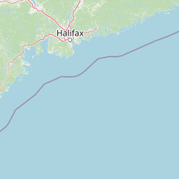
Map view of Kentville Migratory Bird Sanctuary

Use this park location map to pinpoint Kentville Migratory Bird Sanctuary in Canada, understand its exact geographic position, and read its mapped placement within the surrounding landscape more clearly.

Pigeon | © OpenStreetMap contributors

Location context for Kentville Migratory Bird Sanctuary

Nova Scotia
Park atlas

Compare surrounding regional geography and connected protected landscapes

Other Parks and Protected Areas Near Kentville Migratory Bird Sanctuary

Browsing other protected areas near Kentville Migratory Bird Sanctuary reveals connected wetlands and regional wildlife habitats across Nova Scotia. Comparing these adjacent sanctuaries provides deeper geographic context for Atlantic flyway conservation landscapes.
A soft watercolor painting showing a coastal landscape with green low-lying vegetation, a stretch of water, and rolling hills in the distance under a pale sky.
Wildlife reserveNova Scotia
About 20 km away#1 closest

East

Boot Island National Wildlife Area: Mapping Coastal Conservation in Nova Scotia

Protecting intertidal mudflats and migratory bird habitats

Located in the Southern Bight of the Minas Basin, Boot Island National Wildlife Area serves as a key protected refuge within the Bay of Fundy. This reserve safeguards essential coastal and marshland habitats that support migratory bird populations, offering a focused look at how specific island geography functions within a larger, dynamic estuarine wetland system.

Area
1.07 km²
Established
1979
IUCN
Ia
Relief
Lowland
A minimalist watercolor illustration showing soft green hills in the distance, a calm body of water, and stylized reddish vegetation in the foreground.
Wildlife reserveNova Scotia
About 38 km away#2 closest

Northwest

Île Haute Wildlife Reserve: Mapped Volcanic Geography and Coastal Protected Terrain

Bay of Fundy protected area, Nova Scotia

Rising abruptly from the Bay of Fundy, Île Haute features a steep, isolated plateau encircled by 100-meter basalt cliffs. This wildlife reserve showcases Jurassic volcanic geology and provides essential habitat for migratory seabirds and marine mammals. Gain insights into the island's unique coastal geography and its role as a protected natural sanctuary in Atlantic Canada.

Area
0.8 km²
Established
2025
Relief
Upland
Scope
Mixed
National parkNew Brunswick
61 km away#3 closest

Northwest

Fundy National Park: New Brunswick National Park Atlas and Geographic Exploration

Mapped protected landscape and regional park context.

Fundy National Park represents a vital protected area, offering rich geographic discovery within New Brunswick, Canada. This national park detail provides context for its mapped boundaries and landscape, supporting atlas-based exploration of its regional significance. Understand Fundy National Park's protected status and its contribution to the mapped natural terrain of eastern Canada.

Area
207 km²
Established
1948
IUCN
II
Visitors
303.6K annual
Watercolor painting of a coastal landscape with green marshlands in the foreground, water, and soft, warm-toned rolling hills in the background.
Wildlife reserveNew Brunswick
About 70 km away#4 closest

North

Réserve nationale de faune de Shepody: Geographic Overview of a New Brunswick Wildlife Reserve

Coastal wetlands and protected intertidal geography

Located along the Bay of Fundy, Réserve nationale de faune de Shepody represents an essential network of salt marshes and freshwater habitats. This mapping analysis traces the intersection of tidal dynamics, riverine estuaries, and ancient sandstone formations that define this critical protected area in New Brunswick.

Area
10.69 km²
Established
1980
IUCN
IV
Relief
Lowland
Watercolor painting of a tranquil marshy wetland with calm water, sparse dead trees, and distant hills under a light, hazy sky.
Wildlife reserveNova Scotia
About 81 km away#5 closest

North

Amherst Point Migratory Bird Sanctuary: Wetland Protected Landscape and Map Explorer

Nova Scotia Wildlife Reserve and Managed Marshland Habitat

Amherst Point Migratory Bird Sanctuary protects a significant freshwater marsh and ponded wetland network in Nova Scotia. This reserve is defined by its engineered diked impoundments and role as a crucial stopover for migratory birds in the Atlantic flyway, offering a clear window into managed wetland conservation and coastal marsh terrain.

Area
4.33 km²
Established
1947
IUCN
IV
Watercolor painting showing a river landscape with green trees, rolling hills, and mountains in the background
National parkNova Scotia
86 km away#6 closest

Southwest

Kejimkujik National Park: Detailed Protected Landscape and Regional Geography

Explore mapped boundaries and geographic context in Nova Scotia.

Kejimkujik National Park offers a dedicated entry for understanding protected natural areas. As a national park in Nova Scotia, its geographic features and protected boundaries are detailed here to support atlas-based exploration. Discover the park's unique landscape context and its positioning within regional geography, providing a factual basis for comprehending its role as a conservation area.

Area
404 km²
Established
1967
IUCN
II
Visitors
75.3K annual
A horizontal watercolor painting showing a pale green and soft pink landscape with distant hills, a calm body of water, and a tree-lined shore.
Wildlife reserveNew Brunswick
About 131 km away#7 closest

Northeast

Réserve nationale de faune du Cap-Jourimain: Protected Coastal Wetlands and Wildlife Maps

Essential geographic context for a strategic New Brunswick wildlife reserve

Examine the mapped boundaries and complex ecosystem transitions of Réserve nationale de faune du Cap-Jourimain. This federally protected area in New Brunswick offers a distinct look at coastal marshlands, tidal flats, and island topography situated at the narrowest point of the Northumberland Strait.

Area
6.617 km²
Established
1980
IUCN
IV
Relief
Lowland
Wildlife reserveNova Scotia
137 km away#8 closest

South

Zugvogelschutzgebiet Port Hebert: Coastal Protected Landscapes of Nova Scotia

Wildlife reserve and intertidal wetland geography

Spanning the shallow reaches of Port L'Hebert, this wildlife reserve serves as a foundational element of the South Shore protected area network. The sanctuary is defined by its wide tidal range, which uncovers extensive sand and mudflats to provide essential feeding grounds for migratory geese and ducks. This site offers deep insight into the coastal geography and wetland preservation status of Nova Scotia's rugged Atlantic fringe.

Area
3.46 km²
Established
1941
IUCN
Ia

Common questions about visiting, size, designation, and location context for Kentville Migratory Bird Sanctuary

Kentville Migratory Bird Sanctuary FAQs for park facts, access, geography, and protected area context

Find quick answers about Kentville Migratory Bird Sanctuary, including protected-area facts, park geography, trail and visitor context, and how the park fits into its surrounding country and regional landscape.
MoriAtlas Explorer

Continue Your Protected Areas Search Across the Global Atlas

Deepen your exploration by continuing the structured search for national parks and protected areas worldwide. Utilize the comprehensive filtering capabilities to compare different conservation landscapes and refine your understanding of global park geography. Discover more about the distribution and characteristics of protected natural areas.

Global natural geography