

Mori Atlas logo
National parkKidepo Valley National Park

Discover the rugged savannahs and unique ecosystems of this Ugandan national park.

Kidepo Valley National Park: Remote Protected Landscape and Geographic Atlas

Kidepo Valley National Park, situated in the Karamoja region of northeastern Uganda, stands as a testament to protected wilderness. This national park encompasses approximately 1,442 square kilometers of dramatic savannah landscapes, defined by isolated granite kopjes and intersecting river valleys. Its remote character offers a unique window into the geographic context of East African protected areas, inviting exploration of its mapped terrain and diverse ecosystems.

Uganda national parksKaramoja regionSavanna ecosystemsRift Valley wildlifeRemote wilderness areasAfrican big five habitat
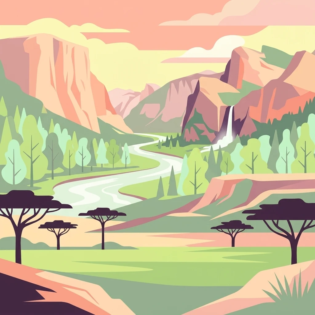
Illustrated landscape with winding river, mountains, acacia trees, and green savannah

Kidepo Valley National Park

National park

Park overview

Structured park overview, official facts, and landscape profile for Kidepo Valley National Park

Kidepo Valley National Park park facts, protected area profile, and essential visitor context

Review the core facts for Kidepo Valley National Park, including designation, size, terrain, visitor scale, habitats, and operating context in one park-focused overview.

About Kidepo Valley National Park

Kidepo Valley National Park represents one of Uganda's most significant protected areas and one of the most remote safari destinations in East Africa. Located in the Karamoja region, the park sits at the northeastern edge of Uganda, approximately 520 kilometers from Kampala and 220 kilometers northwest of Moroto town. The park's isolation has helped preserve its wilderness character, as it remains far less visited than Uganda's more famous parks such as Murchison Falls or Queen Elizabeth National Park. The landscape is defined by the two major valley systems of the Kidepo and Narus rivers, whose floors contain fertile soils supporting distinct vegetation communities. The Narus Valley, receiving higher rainfall, supports more dense woodlands and grass cover, while the drier Kidepo Valley features more open savanna with scattered acacia woodlands. Isolated granite inselbergs, known locally as kopjes, punctuate the flat valley floors, providing important habitat for rock-dwelling species and creating scenic focal points across the landscape. The park's position at the interface between the Ugandan highlands and the South Sudanese lowlands contributes to its ecological diversity, supporting species from both regions. Despite its remote location, the park offers infrastructure including accommodation facilities and game viewing tracks, with the Narus Valley being the most accessible area for wildlife viewing.

Quick facts and research context for Kidepo Valley National Park

Kidepo Valley National Park occupies a remote corner of northeastern Uganda in the Karamoja region, near the town of Karenga in Kaabong District. The park covers 1,442 square kilometers of predominantly open tree savanna, characterized by two major valley systems drained by the Kidepo and Narus rivers. The landscape features isolated granite kopjes rising from the savanna plains, with the park's northern boundary adjacent to South Sudan's Kidepo Game Reserve. The region experiences differential rainfall between the valleys, with the Narus Valley receiving approximately 89 centimeters annually compared to 64 centimeters in the Kidepo Valley, creating distinct ecological zones within the same protected area. Kanangorok hot spring in the far north provides the most permanent water source in the park. The park is managed by the Uganda Wildlife Authority and was designated an IUCN Category II protected area.

Protection and recognition

Examining terrestrial protection scope and transboundary wilderness coordinates

Documenting Kidepo Valley National Park Protection Status and Designation

Researchers can evaluate the official terrestrial protection boundaries and transboundary status associated with Kidepo Valley National Park. Verifiable designation records and international boundaries offer essential framework data for regional conservation analysis and geographic research.

Protection details

Protection scope
Terrestrial
Transboundary protection
Yes
Park context

Deeper park guide and search-rich context for Kidepo Valley National Park

Kidepo Valley National Park history, landscape, wildlife, and travel context

Explore Kidepo Valley National Park through its history, landscape character, ecosystems, wildlife, conservation priorities, cultural context, and seasonal travel timing in a structured park guide built for atlas discovery and search intent.

Why Kidepo Valley National Park stands out

Kidepo Valley National Park is best known for its remarkable population of maneless zebras, a distinctive form of plains zebra that inhabits the savanna grasslands. The park is also celebrated for its elephant herds, which have recovered from near extinction in the early 1900s through effective anti-poaching efforts, with populations now estimated between 407 and 552 individuals. The Narus Valley supports dense concentrations of wildlife around the permanent water sources, while the more remote Kidepo Valley offers opportunities to see species adapted to drier conditions. The park's dramatic landscape of granite kopjes, particularly the Katurum kopje which hosted an abandoned luxury lodge project from the 1960s, adds to its distinctive character. The successful reintroduction of Rothschild giraffes, which had been poached to near extinction by the 1990s, has been a notable conservation achievement, with the population growing from just three individuals in 1992 to approximately 89 by 2022.
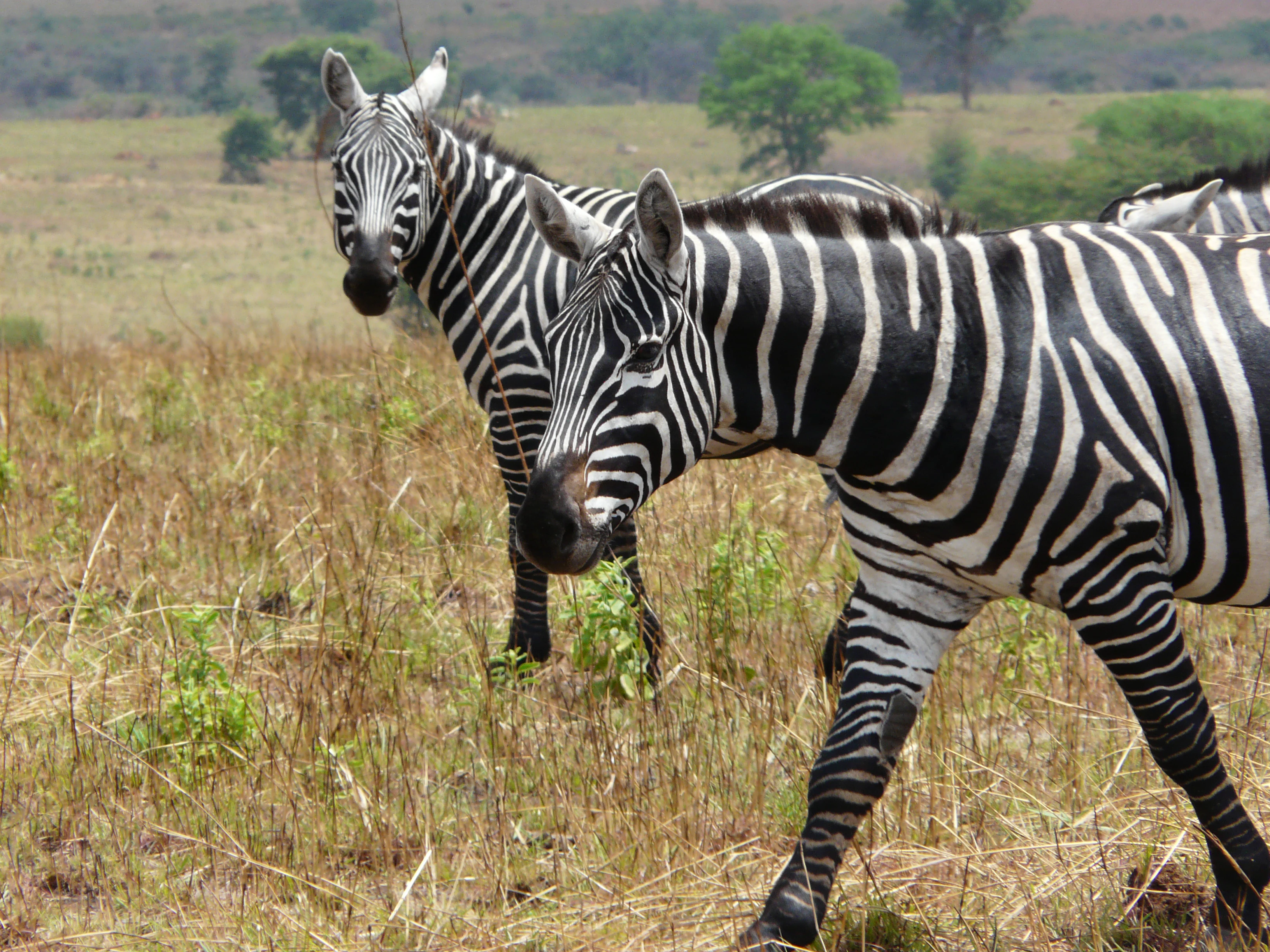
Two maneless zebras standing in a grassy savannah landscape with sparse vegetation and distant trees
Maneless zebras walking in the savannah of Kidepo Valley National Park

Kidepo Valley National Park history and protected-area timeline

The history of Kidepo Valley National Park is deeply intertwined with the displacement of its original inhabitants, the Ik and Ketebo peoples who had lived in the area since approximately 1800. The British colonial government gazetted the area as a game reserve in 1958, forcibly evicting the resident communities in what has been cited as an example of the problematic approach to protected area establishment that failed to consider community needs. The stated purposes of creating the reserve were wildlife conservation, specifically protecting animals from hunting, and preventing bush clearing for tsetse fly control. The relocation contributed to famine and hardship among the displaced communities, a history that has been documented by anthropologist Colin Turnbull and acknowledged by park management as a cautionary tale in conservation planning. Following Uganda's independence, President Milton Obote's government converted the reserve into Kidepo Valley National Park in 1962. In 1967, construction began on a luxury lodge at Katurum kopje with Swedish support, intended to be a 56-room facility, but the project was never completed and the site had been abandoned and vandalized by 1978. The lodge was revived and finally opened with 100 rooms in 2019. The park's management transition from British to Ugandan leadership occurred in 1972 when Ian Ross, the last British chief warden, handed over to Paul Ssali, an event that became the subject of the American documentary film 'The Wild and the Brave' in 1974.

Kidepo Valley National Park landscape and geographic character

The physical landscape of Kidepo Valley National Park is characterized by two major valley systems, the Kidepo Valley and the Narus Valley, which form the core of the park's geography. The valley floors lie at elevations between 3,000 and 4,000 feet above mean sea level, creating a relatively flat terrain punctuated by dramatic granite kopjes that rise abruptly from the plains. The most notable of these is Katurum kopje, an isolated inselberg that has served as a landmark and previous site of lodge development. The park is transected by the Kidepo River and Narus River, though these are seasonal in nature, with the Narus generally holding water longer than the Kidepo. In the extreme north of the park near the South Sudanese border lies Kanangorok hot spring, a tepid spring that represents the most permanent water source in the entire protected area. The soils throughout the park are predominantly clay-based, with the Kidepo Valley characterized by black chalky clay and sandy-clay loam, while the Narus Valley features freer-draining red clays and loams. This soil variation contributes to the different vegetation patterns observed between the two valleys and influences wildlife distribution across the park.
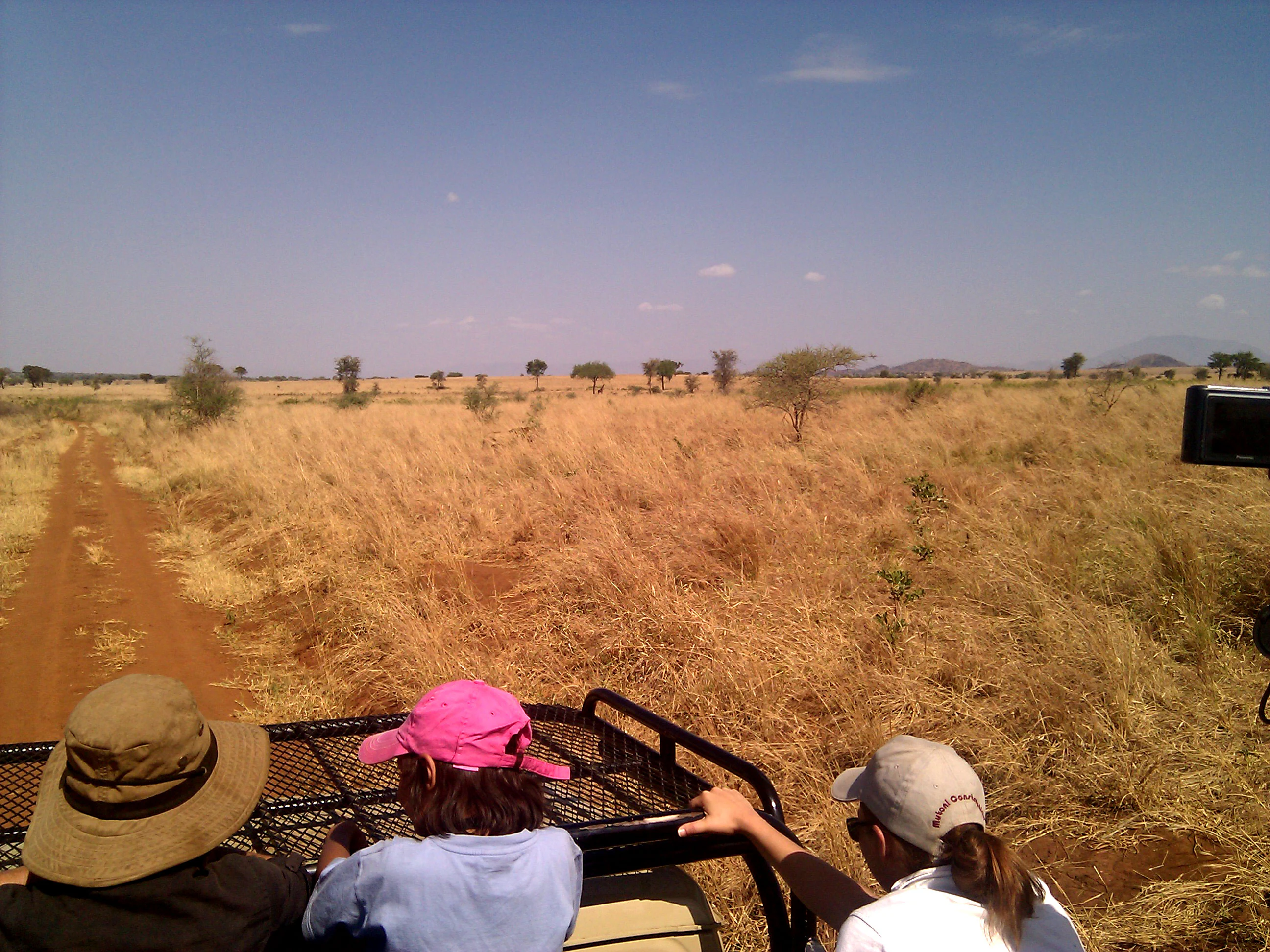
Safari vehicle with people viewing dry grasslands, scattered trees, and distant hills under a clear sky
Safari vehicle with visitors observing the savannah landscape in Kidepo Valley National Park

Kidepo Valley National Park ecosystems, habitats, and plant life

The ecological character of Kidepo Valley National Park is defined by open tree savanna that differs markedly between its two primary valleys due to variations in rainfall and soil conditions. The Narus Valley, receiving approximately 89 centimeters of rain annually, supports taller grasses including Guinea grass and fine thatching grass, with common trees such as red thorn acacias, desert date trees, and sausage trees lining the watercourses. The drier Kidepo Valley, with annual rainfall around 64 centimeters, features more open savanna with palm groves along stream beds and whistling thorn acacia dominating higher elevations. The differential rainfall creates a mosaic of habitats that supports diverse wildlife populations and explains why the Narus Valley typically supports higher concentrations of animals, particularly during the dry season when water becomes scarce in the Kidepo Valley. The park's position at the transition between different ecological zones contributes to its species diversity, with elements from both highland and lowland communities present.
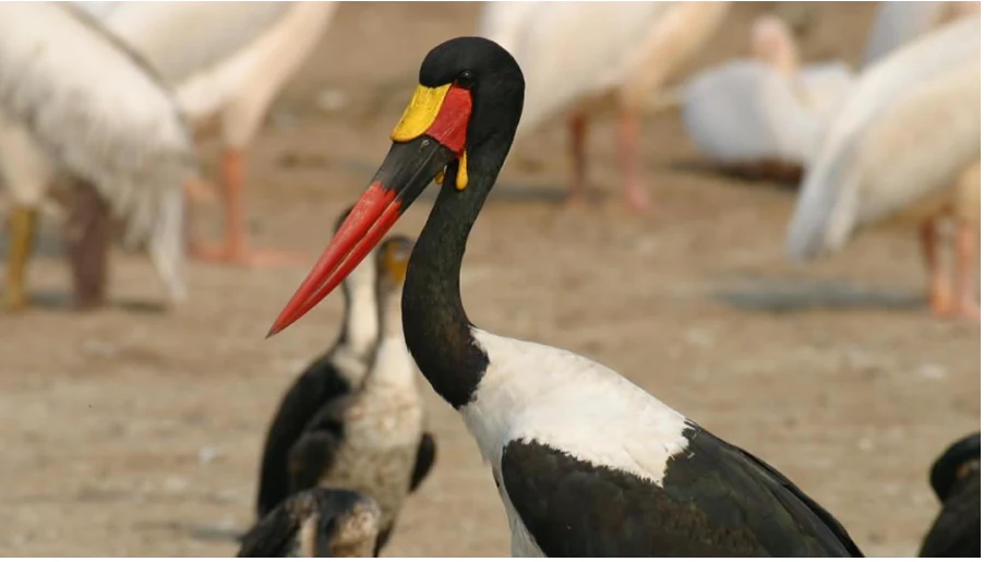
Saddle-billed stork with long red beak, black head, white body, and yellow facial patch with other birds in background
Saddle-billed stork with distinctive red beak and black white plumage in Kidepo Valley National Park

Kidepo Valley National Park wildlife and species highlights

Kidepo Valley National Park hosts impressive biodiversity with over 77 mammal species and 476 bird species recorded within its boundaries. The park is particularly known for its population of maneless zebras, a distinctive form of the plains zebra adapted to the savanna environment. Elephant populations have recovered significantly from the near-extermination they suffered in the early 20th century when unchecked hunting for ivory nearly wiped out the species in the region. By 2003, the population had recovered to approximately 400 individuals, and current estimates range from 407 to 552. The Rothschild giraffe population represents one of the most dramatic conservation stories in the park, having been reduced to just three animals by 1992 after intensive poaching in the 1960s and 1970s. A translocation program from Kenya's Lake Nakuru National Park and later from Murchison Falls National Park has successfully rebuilt the population to approximately 89 individuals by 2022. The Narus Valley supports particularly dense wildlife concentrations around its permanent water sources, with buffalo, waterbuck, and various antelope species commonly observed. The drier Kidepo Valley, while less accessible and historically subject to more poaching, offers opportunities to see species adapted to more arid conditions.

Kidepo Valley National Park conservation status and protection priorities

Kidepo Valley National Park represents significant conservation value in East Africa, protecting a relatively intact savanna ecosystem in a region that has faced considerable human pressure. The park's conservation history reflects both challenges and achievements. The early establishment as a game reserve in 1958 led to the displacement of local communities, a practice now recognized as problematic, but also initiated protection that allowed wildlife populations to recover from the decimation of the early 20th century. Elephant populations, driven to extinction locally by 1900, have recovered through sustained anti-poaching efforts, demonstrating the potential for ecosystem recovery with adequate protection. The giraffe reintroduction program stands as a particularly successful conservation intervention, with the population growing from just three individuals to nearly 90 through carefully planned translocations and habitat management. The park faces ongoing challenges including poaching pressure, particularly in the more remote Kidepo Valley, and the need to balance conservation with the welfare of surrounding communities. Current efforts include translocations of additional species including kob from other Ugandan protected areas and plans to reintroduce southern white rhinos, which were last seen in the park in 1983 after being poached to extinction.

Kidepo Valley National Park cultural meaning and human context

The cultural context of Kidepo Valley National Park is marked by the painful history of the displacement of its original inhabitants, the Ik and Ketebo peoples who had inhabited the region since approximately 1800. The forced eviction of these communities in 1958 to establish the game reserve represents a colonial approach to conservation that prioritized wildlife protection over human rights, a pattern common across Africa during the colonial era. The Ketebo, also known as the Mening or Amening clan, gave the Narus Valley its name, and the landscape holds cultural significance for these communities even though they no longer reside within the park boundaries. The Karamoja region as a whole is known for its distinct cultural traditions, including pastoralist lifestyles that have shaped the broader landscape over centuries. The park's location near the border with South Sudan places it in a region that has experienced security challenges, with the Northwestern boundary adjacent to South Sudan's Kidepo Game Reserve. Understanding this human context is essential for meaningful conservation planning that considers both ecological and social dimensions.

Top sights and standout views in Kidepo Valley National Park

The highlights of Kidepo Valley National Park center on its remote wilderness character and distinctive wildlife viewing opportunities in a landscape that feels far removed from more developed safari destinations. The Narus Valley offers the most reliable wildlife viewing, with permanent water sources attracting dense concentrations of elephants, buffalo, and various antelope species. The maneless zebras of Kidepo represent a unique variant of plains zebra not commonly seen in other East African parks. The dramatic granite kopjes scattered across the savanna provide scenic variety and excellent vantage points for landscape photography. The successful recovery of wildlife populations from historical lows, particularly the giraffe reintroduction success story, demonstrates the park's conservation value. The park's relative isolation means fewer visitors than other Ugandan parks, creating a more intimate safari experience. The Katurum kopje with its revived lodge development offers a unique historical element to the park visit. The Kanangorok hot spring in the far north provides a distinctive geological feature and rare year-round water source.

Best time to visit Kidepo Valley National Park

The best time to visit Kidepo Valley National Park depends on what experience visitors seek, with the dry seasons generally offering the most reliable wildlife viewing. The long dry season from December through February typically provides optimal conditions for viewing animals concentrated around the remaining water sources in the Narus Valley. The short rainy season from March to May can make some roads impassable but also brings green scenery and newborn animals. The period from June through November represents another dry season, though the Kidepo Valley may offer different viewing opportunities as the Narus water sources diminish. Wildlife viewing is generally most productive in the Narus Valley year-round due to its more reliable water supply. Visitors should note that the park's remote location requires advance planning for logistics, and the dry seasons coincide with higher visitor numbers at accommodation facilities. The landscape retains its beauty throughout the year, though the green season offers a different aesthetic with fresh vegetation and dramatic skies.

Monthly climate preview

Long-term representative monthly averages for temperature and precipitation patterns

Kidepo Valley National Park Climate Normals and Annual Temperature Rhythm

Kidepo Valley National Park exhibits a measured annual temperature range alongside distinct monthly precipitation variations recorded from a representative coordinate. Reviewing the complete twelve-month climatology dataset clarifies long-term meteorological trends across the protected landscape.
Annual mean24 °C
22 °C26 °C
Jan24°
Feb26°
Mar26°
Apr24°
May24°
Jun23°
Jul22°
Aug23°
Sep24°
Oct23°
Nov23°
Dec23°
Warmest month
March

25.6 °C

Coolest month
July

22.1 °C

Wettest month
October

3.1 mm/day

Driest month
February

0.4 mm/day

Park location guide

Geography guide, regional context, and park location map for Kidepo Valley National Park

Kidepo Valley National Park park geography, regions, and map view in Uganda

Understand where Kidepo Valley National Park sits in Uganda through a broader geographic reading of the surrounding landscape, nearby location context, and its mapped position within the national park landscape.

How Kidepo Valley National Park fits into Uganda

Uganda is a landlocked East African nation spanning approximately 241,000 km². It borders five countries and contains part of Lake Victoria, the world's second-largest freshwater lake. The country operates as a presidential republic with Kampala as its capital and largest city.

Wider geography shaping Kidepo Valley National Park in Uganda

Uganda is situated in East Africa, bordered by Kenya to the east, South Sudan to the north, the Democratic Republic of the Congo to the west, Rwanda to the southwest, and Tanzania to the south. The southern portion includes a substantial part of Lake Victoria. The terrain features volcanic hills, mountains, and lakes.

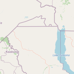
Map view of Kidepo Valley National Park

Use this park location map to pinpoint Kidepo Valley National Park in Uganda, understand its exact geographic position, and read its mapped placement within the surrounding landscape more clearly.

Pigeon | © OpenStreetMap contributors

Location context for Kidepo Valley National Park

Karamoja

Discover Kidepo's Iconic Granite Kopjes, Extensive Savannahs, and Diverse Protected Area Habitats Through Imagery

Kidepo Valley National Park: Visual Guide to Remote Savannah Landscapes and Distinctive Wildlife

Browse a curated collection of Kidepo Valley National Park imagery to visually understand its vast savanna plains, dramatic granite kopjes, and essential river valleys that define its protected landscape. These photographs illustrate the park's distinct environment, showcasing the remote wilderness character and critical habitats for species like maneless zebras and Rothschild giraffes.

Two maneless zebras standing in a grassy savannah landscape with sparse vegetation and distant trees

A group of elephants including adults and a juvenile standing in tall grass under a tree with mountains in the background

Safari vehicle with people viewing dry grasslands, scattered trees, and distant hills under a clear sky

Saddle-billed stork with long red beak, black head, white body, and yellow facial patch with other birds in background

Park atlas

Uncover the Atlas of Protected Areas in Uganda and East Africa, Tracing Regional Savanna Ecosystems

Discover Other National Parks Near Kidepo Valley National Park, Uganda

Continue exploring beyond Kidepo Valley National Park by browsing other protected areas and national parks across Uganda and the wider East African savanna, comparing unique landscapes and conservation profiles. Map the geographic spread of these wild territories, from remote wilderness to diverse wildlife habitats, to understand regional park geography and find your next discovery.
National parkSouth Sudan
About 174 km away#1 closest

West

Nimule National Park: South Sudan's National Park Geography and Protected Boundaries

Explore the terrain and mapped context of this protected landscape.

Nimule National Park represents a key protected area in South Sudan, providing essential geographic data for atlas exploration. This detail page focuses on the park's mapped boundaries, its role as a national park, and its contribution to the regional landscape context of East Africa. Understand the specific terrain and protected land identity that defines this important natural area within the country.

Area
410 km²
Established
1954
IUCN
II
Scope
Terrestrial
National parkKenya
About 223 km away#2 closest

East

Central Island National Park: Kenya National Park Atlas and Protected Landscape

Discover the mapped geography and protected area context.

Central Island National Park is a designated national park in Kenya, offering a distinct protected landscape within the country's expansive Rift Valley. This detailed entry focuses on the park's geographic identity and its significance as a protected area, providing users with clear information on its mapped boundaries and regional landscape context. Dive into the specific geography and natural terrain that distinguish Central Island National Park for comprehensive atlas-style exploration.

IUCN
II
Scope
Mixed
National parkSouth Sudan
About 228 km away#3 closest

Northwest

Bandingilo National Park: South Sudan's Protected National Park Identity

Explore its mapped boundaries and East African landscape.

Bandingilo National Park stands as a distinct protected area within South Sudan, contributing to the nation's catalog of national parks. This entry offers a focused atlas perspective, detailing the park's geographic setting and its mapped features. Understand the landscape context and its relation to the surrounding regional geography of East Africa, providing a foundation for structured discovery of protected lands.

Area
10,000 km²
Established
1992
IUCN
II
Relief
Lowland
National parkEthiopia
231 km away#4 closest

Northeast

Omo National Park: Ethiopia's Remote Protected Landscape with Rich Wildlife Spectacles

Mapped boundaries, savannah plains, and Maji Mountains terrain.

Omo National Park is a remote protected area in Ethiopia renowned for its expansive savannah, riverine woodlands, and remarkable wildlife concentrations. Covering over 4,000 square kilometers, this national park presents a landscape of sweeping plains, the vital Omo River corridor, and the dramatic Maji Mountains. The park's protected status safeguards exceptional populations of large mammals, offering a glimpse into an untamed African wilderness. Explore the mapped geography and the unique ecological zones that contribute to its significant conservation value.

Area
4,068 km²
Established
1980
IUCN
II
Relief
Mixed relief
National parkRift Valley Province
About 254 km away#5 closest

East

Sibiloi National Park: National Park with Mapped Geographic Boundaries

Explore the protected landscape of Rift Valley Province.

Sibiloi National Park is a designated national park offering a distinct protected landscape within the broader geographic region of Rift Valley Province, Kenya. This entry focuses on its mapped boundaries and its identity as a key area for conservation, providing a structured view for geographic atlas exploration. Understand the foundational elements of Sibiloi National Park's protected status and its place within regional natural landscapes.

Area
1,570.85 km²
Established
1973
IUCN
II
Relief
Mixed relief
National parkSouth Sudan
About 256 km away#6 closest

North

Boma National Park: Protected Landscape in South Sudan's East African Geography

Explore mapped boundaries and regional terrain context.

Boma National Park represents a vital protected landscape within South Sudan. As a national park, it contributes significantly to the geographic understanding of conservation areas in East Africa. Its distinct location and mapped outlines provide essential context for those exploring the regional atlas, highlighting its importance in understanding South Sudan's natural terrain and protected area network.

Area
22,800 km²
Established
1977
IUCN
II
Relief
Lowland
National parkUganda
About 258 km away#7 closest

Southwest

Murchison Falls National Park: Uganda's Largest Protected Landscape with Dramatic Nile Gorge

Explore mapped boundaries and diverse savanna terrain.

Murchison Falls National Park represents a significant protected landscape in Uganda, renowned for the powerful cascade of the Victoria Nile through a narrow gorge. This expansive national park encompasses varied terrain, from savanna woodlands to riparian forests, offering a rich geographic context. Understanding its mapped distribution within the region is key to appreciating its conservation importance and unique natural features, providing a compelling atlas-style entry point for exploration.

Area
3,893 km²
Established
1952
IUCN
II
Relief
Lowland
National parkUganda
About 292 km away#8 closest

South

Mount Elgon National Park: Uganda's Transboundary Volcano and Mapped Protected Area

Explore volcanic terrain, unique cave systems, and diverse montane landscapes.

Mount Elgon National Park offers a rich tapestry of protected landscapes, centered on a dormant shield volcano straddling the Uganda-Kenya border. This park is recognized for its extraordinary botanical diversity and spectacular cave systems, such as Kitum Cave, where wildlife congregates to lick salt. The elevation gradient supports distinct vegetation zones, from dense montane forests to high-altitude heath and moorland, providing crucial habitat and watershed protection. Understanding Mount Elgon National Park through its mapped boundaries and geographic context reveals a unique protected area in East Africa.

Area
1,279 km²
Established
1968
IUCN
II
Relief
Mountain

Common questions about visiting, size, designation, and location context for Kidepo Valley National Park

Kidepo Valley National Park FAQs for park facts, access, geography, and protected area context

Find quick answers about Kidepo Valley National Park, including protected-area facts, park geography, trail and visitor context, and how the park fits into its surrounding country and regional landscape.
MoriAtlas Explorer

Continue Your Protected Areas Search Across the Global Atlas

Deepen your exploration by continuing the structured search for national parks and protected areas worldwide. Utilize the comprehensive filtering capabilities to compare different conservation landscapes and refine your understanding of global park geography. Discover more about the distribution and characteristics of protected natural areas.

Global natural geography

