
Mori Atlas logo
Protected landscapeKlamath National Forest

A diverse mosaic of coniferous forests, rugged mountain terrain, and remote wilderness areas

Klamath National Forest; Mapped Geography and Protected Landscapes in Northern California

Klamath National Forest spans the rugged Klamath Mountains and extends into the southern Cascade Range, creating a physically complex environment of deep river valleys, forested ridges, and high-elevation mountain summits. This protected landscape is defined by an unusually varied vegetation mosaic, featuring extensive old growth stands and embedded wilderness areas across Siskiyou County. The region remains a vital reference point for understanding the intersection of botanical diversity and forest conservation within the American West.

Klamath Mountainsold growth forestconifer forestwilderness areasSiskiyou CountyCascade Range
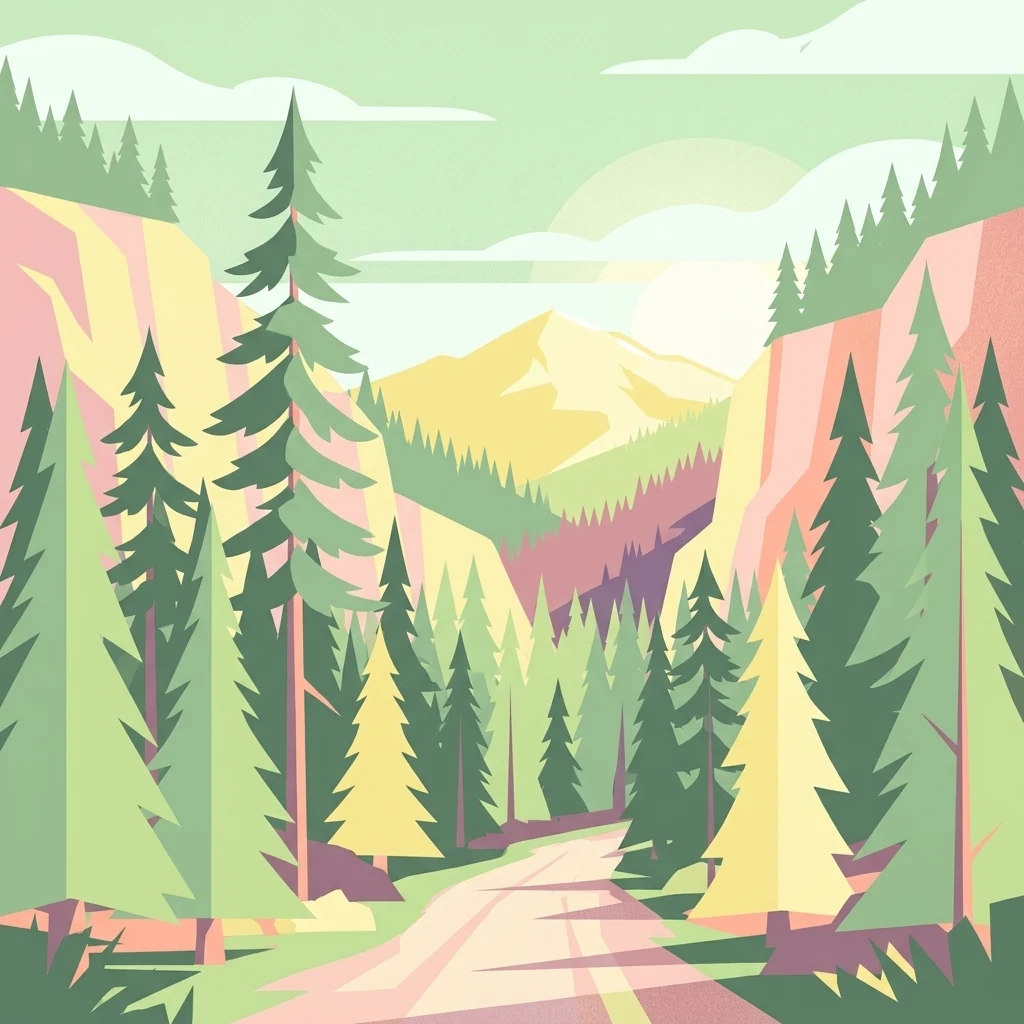
A minimalist flat-design illustration showing a dirt path leading through a dense conifer forest toward a distant, sunlit mountain peak.

Klamath National Forest

Protected landscape

Park overview

Structured park overview, official facts, and landscape profile for Klamath National Forest

Klamath National Forest park facts, protected area profile, and essential visitor context

Review the core facts for Klamath National Forest, including designation, size, terrain, visitor scale, habitats, and operating context in one park-focused overview.

About Klamath National Forest

Klamath National Forest is one of the largest national forests in California and a defining landscape of the far northwestern corner of the state. Straddling the Klamath Mountains and a southern slice of the Cascade Range, the forest stretches across rugged terrain in Siskiyou County and reaches into Jackson County, Oregon, at a small scale. Forest headquarters are located in Yreka, while ranger district offices serve Fort Jones, Happy Camp, and Macdoel, reflecting the dispersed character of access to the landscape.

Ecologically, the forest is shaped by an unusually broad combination of climatic zones, elevations, and geological substrates. Its conifer forests blend species more typical of the Sierra Nevada with species more typical of the Coast Range, producing stands that range from dry, low elevation ponderosa pine and Jeffrey pine to moist mixed conifer, true fir, and lodgepole pine forests higher up. This variety, combined with the presence of Baker cypress and incense cedar, gives the forest a botanical richness that distinguishes it from many neighboring national forests.

The forest also contains a meaningful reserve of old growth, with more than 168,000 acres in old growth condition. Six wilderness areas lie within or partly within its boundaries, protecting fragments of the landscape under the highest level of federal preservation. Beyond wilderness, the forest includes notable landmarks such as Kangaroo Lake and the Sawyers Bar Catholic Church, the latter being a recognized historic site set within the forest itself.

Although the Klamath is respected for its natural values, its history is also marked by sustained debates over logging, roadless areas, and species protection. Between the late 1980s and 2010, regional coalitions including the Klamath Forest Alliance engaged in legal and political campaigns that shaped forest policy across the broader Klamath-Siskiyou bioregion.

Quick facts and research context for Klamath National Forest

Klamath National Forest lies primarily in Siskiyou County in northern California, with a small portion extending across the state line into Jackson County, Oregon. It is managed by the United States Forest Service and is co-administered with the neighboring Butte Valley National Grassland.

The forest was established in 1905 and today covers roughly 1.7 million acres of mountainous terrain in the Klamath Mountains and the southern Cascade Range. It contains extensive conifer forests, more than 168,000 acres of old growth, six official wilderness areas, and notable sites such as Kangaroo Lake and the Sawyers Bar Catholic Church.

Protection and recognition

Documented management scope, transboundary status, and international recognition records

Klamath National Forest Protection Status and Terrestrial Conservation Data

Klamath National Forest holds a documented terrestrial protection status with verified transboundary characteristics and conservation boundaries. Official records organize management scope and international designation details for structured atlas research.

Protection details

Protection scope
Terrestrial
Transboundary protection
Yes
Park context

Deeper park guide and search-rich context for Klamath National Forest

Klamath National Forest history, landscape, wildlife, and travel context

Explore Klamath National Forest through its history, landscape character, ecosystems, wildlife, conservation priorities, cultural context, and seasonal travel timing in a structured park guide built for atlas discovery and search intent.

Why Klamath National Forest stands out

Klamath National Forest is best known for its exceptional botanical diversity within the Klamath Mountains, a region widely recognized as one of the most floristically rich temperate mountain areas in North America. The overlap of several distinct forest types creates a vegetation mosaic that is unusually varied for a single national forest. The forest is also widely known for its old growth stands and for the wilderness areas embedded in its terrain, which include Marble Mountain, Russian, Red Buttes, Siskiyou, and Trinity Alps. In addition, Klamath became a focal landscape of late twentieth century forest politics in the Pacific Northwest, particularly around old growth protection and the protection of the northern spotted owl.
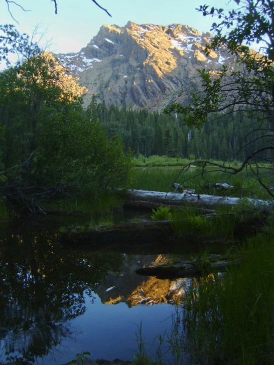
A serene mountain lake reflecting a craggy peak at sunrise, with dense forest and fallen logs in the foreground.
A peaceful morning view of Little Elk Lake reflected in the water, framed by surrounding forest and the rugged peaks of the Klamath Mountains.

Klamath National Forest history and protected-area timeline

Klamath National Forest was formally established on May 6, 1905, as part of the early federal effort to protect and manage forested watersheds in the western United States. Its creation coincided with a period when national forest designations were being widely applied across mountainous regions of the American West in order to stabilize timber supplies and protect watersheds.

For much of the twentieth century, the forest was an important timber-producing landscape for northern California and adjacent Oregon. Its conifer forests supplied raw material for lumber, milling, and regional industries, and a network of roads, ranger stations, and small communities developed to support this activity.

From the late 1980s onward, the Klamath became a focal landscape of the so-called timber wars that played out across the Pacific Northwest. The Klamath Forest Alliance, working with allied groups, engaged in timber sale appeals, lawsuits, and public campaigns aimed at protecting roadless areas and old growth stands. Debates over the northern spotted owl, ancient forest protections, and federal forest legislation also intersected with the forest's management, leaving it at the center of broader national conversations about how to balance timber harvesting with ecological preservation.

Klamath National Forest landscape and geographic character

The terrain of Klamath National Forest is dominated by the Klamath Mountains, with a small portion extending into the southernmost Cascade Range. Elevations vary from foothill slopes down through forested canyons and up to higher mountain ridges, producing a topographically diverse landscape of ridges, valleys, river drainages, mountain lakes, and exposed rocky summits.

The forest's river valleys are deeply incised in many places, creating steep walls and narrow corridors that have historically limited access and continue to define travel through the region. High elevation surfaces and plateaus give way to meadow systems, glacial features in the higher ranges, and the rugged uplands that connect the wilderness areas together.

This varied topography underpins the forest's ecological diversity. Because the landscape spans both the Klamath geologic province and a southern extension of the Cascades, it combines ultramafic and sedimentary substrates with volcanic terrain, producing a physical setting that supports an unusually varied vegetation mosaic across relatively short distances.

Klamath National Forest ecosystems, habitats, and plant life

The vegetation of Klamath National Forest is one of its most distinctive ecological features. Coniferous forests cover most of the landscape and include major stands of ponderosa pine, Jeffrey pine, Douglas fir, red fir, white fir, lodgepole pine, incense cedar, and the regionally significant Baker cypress. These species often occur in close proximity because of how geological substrates, slope, and elevation interact across the region.

The forest also preserves extensive old growth, with an estimated 168,000 acres in old growth condition. Old growth stands provide important habitat continuity, structural complexity, and resilience, and they remain a defining ecological feature of the larger landscape.

Beyond its conifer forests, the Klamath supports riparian corridors, meadow systems, montane chaparral patches, and rocky barrens that contribute additional layers of habitat diversity. The combination of these environments with old growth forests and high elevation wilderness makes the forest an unusually rich ecological mosaic within the western United States.

Klamath National Forest wildlife and species highlights

Because of the forest's broad habitat diversity, Klamath National Forest supports a wide spectrum of wildlife species typical of the Klamath Mountains and southern Cascades. Its mature and old growth conifer forests provide essential habitat for cavity nesting birds, small mammals, and forest dependent species, while its meadows and riparian corridors host a different community of songbirds, ungulates, and aquatic species.

The forest has been particularly associated with debates around the northern spotted owl, a species that depends on older forest structure and that became a central focus of conservation policy in the Pacific Northwest during the 1990s and 2000s. This connection placed the Klamath at the heart of regional efforts to understand how forestry practices affect sensitive wildlife.

In addition to spotted owls, the forest provides habitat for black bears, mule deer, elk, mountain lions, and a variety of smaller mammals, as well as fish in its cold water rivers and mountain lakes. The wilderness areas in particular support wildlife communities that are less affected by roads and active timber management, giving them additional conservation value across the broader forest landscape.

Klamath National Forest conservation status and protection priorities

Klamath National Forest holds significant conservation value because it connects large blocks of forest habitat in a region recognized globally for its botanical richness. Its old growth reserves, multiple designated wilderness areas, and ecologically diverse vegetation all contribute to its importance from a protection standpoint.

Six wilderness areas are located within or partly within the forest's boundaries. Marble Mountain Wilderness and Russian Wilderness lie largely within the Klamath, while Red Buttes Wilderness, Siskiyou Wilderness, and Trinity Alps Wilderness extend into neighboring national forests, and in some cases Bureau of Land Management lands. Together these wilderness designations preserve large, roadless landscapes that anchor ecological connectivity across the region.

The forest has also played a central role in late twentieth century conservation debates in the American West. Through legal action, public campaigns, and policy engagement, community groups worked to limit logging in sensitive areas, defend roadless terrain, and promote protections for old growth forest ecosystems. These efforts shaped both the management of the Klamath itself and broader national conversations about federal forest stewardship.

Klamath National Forest cultural meaning and human context

Klamath National Forest occupies a landscape with deep human history, long preceding its 1905 designation as a national forest. The Klamath and broader Siskiyou region sustained Indigenous communities for thousands of years, and those cultural connections continue to shape the identity of the area today.

More recently, the forest's history is closely tied to small communities scattered across its valleys. Towns such as Yreka, Fort Jones, Happy Camp, and Macdoel developed alongside forestry, ranching, and mining, and the Sawyers Bar Catholic Church stands as a notable historic landmark embedded within the forest itself, reflecting the role of settlement and community life in shaping access to this remote landscape.

Top sights and standout views in Klamath National Forest

Klamath National Forest's standout qualities include its rare convergence of multiple conifer forest types in one landscape, a meaningful reserve of old growth, and an unusually large share of designated wilderness among national forests in California. Its botanical richness makes it a reference area for understanding the ecology of the Klamath Mountains.

The forest is also distinctive for how deeply it has been woven into broader American conversations about forest conservation. From local community activism to national debates over old growth and the northern spotted owl, the Klamath has played an outsize role in shaping how the United States thinks about managing complex forested landscapes.

Best time to visit Klamath National Forest

The character of a visit to Klamath National Forest shifts meaningfully across the seasons. Late spring and early summer typically bring blooming meadows, active rivers, and accessible higher elevation trails once winter snow retreats, while summer offers the widest window for exploring mountain lakes, wilderness areas, and the forest's varied conifer stands under long daylight hours.

Autumn can be a particularly rewarding time to visit, with cooler temperatures, fewer crowds, and color changes in the mixed conifer forests at mid elevations. Winter brings snow to the higher elevations, including areas around the wilderness, which often limits road access and transforms the forest into a quieter, snow-covered landscape suited to different kinds of recreation.
Monthly climate preview

Long-term temperature ranges and monthly precipitation averages for Klamath National Forest

Klamath National Forest Climate Normals and Annual Weather Patterns

Klamath National Forest records a measured annual rhythm of shifting mean temperatures and changing precipitation levels across twelve recorded periods. Accessing the comprehensive monthly profile clarifies the complete long-term temperature bounds and precipitation distribution for this location.
Annual mean9 °C
1 °C20 °C
Jan
Feb
Mar
Apr
May10°
Jun14°
Jul20°
Aug20°
Sep17°
Oct10°
Nov
Dec
Warmest month
July

20.4 °C

Coolest month
December

1 °C

Wettest month
December

7.3 mm/day

Driest month
August

0.2 mm/day

Park location guide

Geography guide, regional context, and park location map for Klamath National Forest

Klamath National Forest park geography, regions, and map view in United States of America

Understand where Klamath National Forest sits in United States of America through a broader geographic reading of the surrounding landscape, nearby location context, and its mapped position within the national park landscape.

How Klamath National Forest fits into United States of America

The United States of America is a federal presidential republic and one of the world's largest countries by area and population. It consists of 50 states across a vast territory spanning multiple time zones, with its capital in Washington, D.C. and largest city in New York City. The nation has a diverse economy, influential political system, and significant cultural and military presence globally.

Wider geography shaping Klamath National Forest in United States of America

The United States occupies a vast territory in North America, bordered by Canada to the north and Mexico to the south. The 48 contiguous states stretch from the Atlantic to the Pacific Ocean, while Alaska occupies the northwestern region and Hawaii is an archipelago in the Pacific. The country encompasses diverse terrain including the Rocky Mountains, Appalachian Mountains, Great Plains, and extensive river systems.

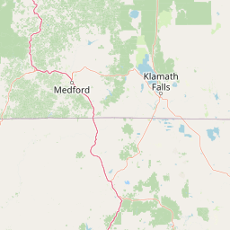
Map view of Klamath National Forest

Use this park location map to pinpoint Klamath National Forest in United States of America, understand its exact geographic position, and read its mapped placement within the surrounding landscape more clearly.

Pigeon | © OpenStreetMap contributors

Location context for Klamath National Forest

CaliforniaJackson CountyOregonSiskiyou County

Examine the rugged terrain, old growth stands, and diverse botanical habitats of Northern California.

Klamath National Forest Photos and Landscape Scenery Visual Explorer

Visual documentation captures the complex topography of rugged mountain ridges, deep river valleys, and diverse conifer forests spanning the protected landscape. Examining these field photographs reveals the unique botanical mosaics and remote wilderness character that define regional conservation areas.

A serene mountain lake reflecting a craggy peak at sunrise, with dense forest and fallen logs in the foreground.

A dirt and gravel road leads into the distance, flanked on both sides by a dense, sunlit forest of conifers and deciduous trees, with a mountainous slope visible in the background.

Park atlas

Compare adjacent protected areas, wilderness terrain, and regional forest geography

Explore Other Parks Near Klamath National Forest and Surrounding Mountain Regions

Visitors browsing Klamath National Forest can discover nearby protected areas and adjacent mountain reserves across northern California. Expanding the geographic comparison reveals connected regional ecosystems, contiguous wilderness corridors, and diverse conifer forest landscapes.
Protected landscapeCalifornia
Mapped location lies within the park boundary#1 closest

East

Marble Mountain Wilderness: Exploring Protected Mountain Landscapes in Northern California

Klamath Mountains Wilderness and Alpine Geography

Spanning hundreds of thousands of acres, Marble Mountain Wilderness offers a dense concentration of subalpine fir, deep glacial lakes, and steep drainage basins. This northern California protected landscape provides an atlas of rugged ridges and marble-toned peaks that represent one of the most ecologically diverse backcountry areas in the region.

Area
978.3 km²
Established
1964
IUCN
Ib
Relief
Mountain
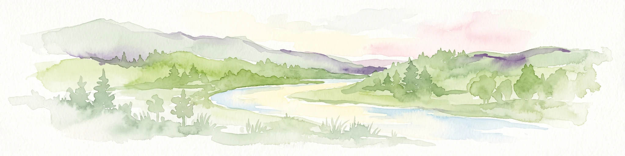
Watercolor painting of a peaceful river landscape, featuring rolling green hills, dense trees, and distant soft-toned mountains.
Protected areaCalifornia
About 19 km away#2 closest

Northwest

Six Rivers National Forest: Exploring Protected River Valleys and Mountain Terrain in California

A regional protected area spanning California river systems

Six Rivers National Forest defines much of the rugged landscape in northwestern California. Named for the six major river drainages within its borders, the area features a unique combination of coastal forests, deep river canyons, and high-country ridges that offer significant insight into the region's broader geographic and ecological character.

Area
3,875.2 km²
Established
1947
Relief
Mountain
Climate
Mediterranean
A horizontal watercolor illustration showing a winding river flowing through a lush green valley with rolling hills in the background.
Protected landscapeCalifornia
About 33 km away#3 closest

Northwest

Smith River National Recreation Area: Mapping the Klamath Mountain Protected Landscape

Watershed geography and rugged mountain terrain in northwestern California

Located in the heart of the Klamath Mountains, Smith River National Recreation Area represents a critical protected watershed in northern California. The area is defined by its deep, forested canyons and the clean, wild waters of the Smith River, which serve as a primary link between coastal redwood ecosystems and mountainous inland terrain. Users can study the park boundaries and regional landscape characteristics that sustain this remote environment.

Area
1,235 km²
Established
1990
Relief
Mountain
Climate
Mediterranean
A soft watercolor painting depicting a serene landscape with gentle green hills, a small forest, and a calm lake at sunrise or sunset.
Protected landscapeCalifornia
About 36 km away#4 closest

South

Shasta, Trinity National Forest: Mapping the Protected Landscapes of Northern California

Volcanic peaks, expansive reservoirs, and rugged mountain wilderness

Spanning over two million acres, Shasta, Trinity National Forest represents a major protected landscape in Northern California. The geography includes the iconic Mount Shasta volcano and the complex shoreline of Shasta Lake, while hosting expansive wilderness areas and diverse terrain ranging from oak-forested foothills to alpine meadows.

Area
8,942.87 km²
Established
1954
Relief
Mountain
Climate
Temperate
Wildlife reserveCalifornia
About 48 km away#5 closest

North

Red Buttes Wilderness: Mapping the Protected Mountain Geography of the Siskiyou Range

A rugged wilderness reserve straddling California and Oregon

Red Buttes Wilderness preserves a complex mountainous terrain shaped by ancient metamorphic rocks and glacial history. The area features high ridgelines, alpine lakes, and specialized botanical habitats, providing a vital window into the ecological and geological diversity of the broader Klamath and Siskiyou mountain landscapes.

Area
80.7 km²
Established
1984
IUCN
Ib
Relief
Mountain
An artistic watercolor illustration showing a line of green evergreen trees in the foreground with hazy, distant mountains in the background against a light, neutral sky.
Protected landscapeOregon
About 48 km away#6 closest

Northwest

Rogue River, Siskiyou National Forest: Mapped Geography and Protected Area Overview

Tracing volcanic peaks and river-carved mountain terrain in Oregon

Spanning nearly 7,300 square kilometers, the Rogue River, Siskiyou National Forest acts as a crucial ecological anchor in the Pacific Northwest. This overview details its unique mountain geography, the extensive wilderness tracts within its boundaries, and the river systems that define its mountainous character.

Area
6,973.46 km²
Established
2004
Visitors
915K annual
Relief
Mountain
National parkCalifornia
About 55 km away#7 closest

West

Redwood National and State Parks: Protected Landscape Geography and Mapped Boundaries

Explore California's protected area atlas.

Gain a structured understanding of Redwood National and State Parks as a protected national park within the geographic context of California. This dedicated page focuses on its mapped boundaries and protected landscape identity, offering critical atlas-level insights for regional geography exploration and conservation land context. Discover how this protected area fits into the larger mapped terrain.

Area
562.88 km²
Established
1968
IUCN
V
Visitors
458.4K annual
Wildlife reserveOregon
About 79 km away#8 closest

Northwest

Kalmiopsis Wilderness: Mapping the Protected Landscapes and Geology of Southwestern Oregon

Botanical richness and dramatic canyon terrain in the Klamath Mountains

Kalmiopsis Wilderness preserves a dramatic landscape of steep ridges and river-cut valleys across 180,000 acres in southwestern Oregon. Known for its distinct serpentine soils and high botanical diversity, the wilderness area offers a look at complex mountain ecology and significant Wild and Scenic River headwaters within the Rogue River-Siskiyou National Forest.

Area
727.44 km²
Established
1964
IUCN
Ib
Relief
Mountain

Common questions about visiting, size, designation, and location context for Klamath National Forest

Klamath National Forest FAQs for park facts, access, geography, and protected area context

Find quick answers about Klamath National Forest, including protected-area facts, park geography, trail and visitor context, and how the park fits into its surrounding country and regional landscape.
MoriAtlas Explorer

Continue Your Protected Areas Search Across the Global Atlas

Deepen your exploration by continuing the structured search for national parks and protected areas worldwide. Utilize the comprehensive filtering capabilities to compare different conservation landscapes and refine your understanding of global park geography. Discover more about the distribution and characteristics of protected natural areas.

Global natural geography