
Mori Atlas logo
Nature reserveKnüll-Storkenberg

Tracing the twin-peak terrain, spring-fed valleys, and historic cultural trails within this Teutoburg Forest habitat.

Knüll-Storkenberg Nature Reserve: A Detailed Geographic Atlas of Protected Woodland and Hill Landscapes

Knüll-Storkenberg is a defined nature reserve situated in the North Rhine-Westphalia region of Germany. This protected area spans approximately 79 hectares across the Teutoburg Forest, featuring a distinct landscape of two neighbouring hills, the Knüll and Storkenberg, linked by a meadow valley. The geography encompasses a diverse mosaic of beech woodlands, calcareous grasslands, and stream-fed sedge wetlands that offer a compact study of protected terrain.

beech forestteutoburg forestlow mountain landscapenature reservewet meadowcalcareous grassland
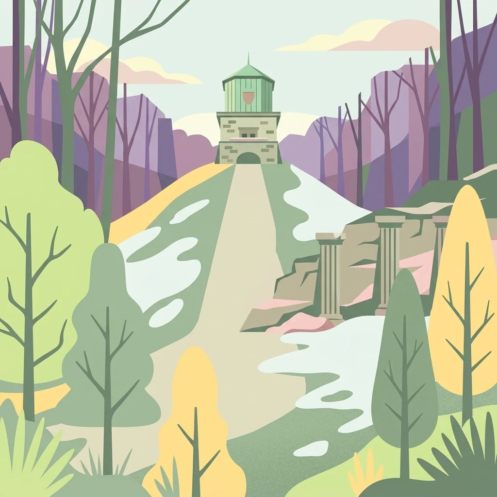
A digital illustration of a park landscape featuring a small stone tower atop a grassy hill, surrounded by trees and architectural columns.

Knüll-Storkenberg

Nature reserve

Park overview

Structured park overview, official facts, and landscape profile for Knüll-Storkenberg

Knüll-Storkenberg park facts, protected area profile, and essential visitor context

Review the core facts for Knüll-Storkenberg, including designation, size, terrain, visitor scale, habitats, and operating context in one park-focused overview.

About Knüll-Storkenberg

Knüll-Storkenberg sits at the northern edge of the town of Halle in Westphalia, in the eastern part of North Rhine-Westphalia, and forms one of the cluster of small but ecologically rich nature reserves in the district of Gütersloh. The protected area wraps around two adjacent hills of the Teutoburg Forest, the Knüll and the Storkenberg, and the meadow valley that links them. Including the slopes, the forest clearings, and the valley floor, the reserve covers just under 79 hectares, a compact but characterful patch of central German low-mountain landscape.

The nature reserve is not a wilderness but a carefully managed mosaic of habitats, the kind of site where open-canopy woodland, springs, wet meadows, and limestone grassland meet in a single small catchment. Brook headwaters feed small standing pools along the streambed, and these wet pockets give way to large-sedge communities and then to extensively managed, species-rich greenlands that have been shaped by traditional low-intensity land use rather than intensive agriculture. Closer to the ridges, the forest is dominated by beech, which is the broader regional signature of the Teutoburg Forest and the reason the area fits into the wider network of European beech forest protection.

What makes the reserve distinctive is the way it combines these forest and meadow habitats with a warm-loving, open-forest character in places. On lighter, more open sections categorized as Niederwald (coppice-like low forest), the herb layer beneath the trees shifts toward thermophilic plants, and on calcareous soils this transitions into half-dry grassland (Halbtrockenrasen) with their own characteristic flora and fauna. The inclusion of the disused Storkenberg quarry adds a further element, with its own rocky and partially open surfaces, so the protected site effectively captures woodland, wetland, meadow, semi-dry grassland, and post-industrial rock habitat within walking distance of each other.

Quick facts and research context for Knüll-Storkenberg

Knüll-Storkenberg is a nature reserve of about 78.94 hectares established in 2001 in the district of Gütersloh, in the northern part of Halle, Westphalia. It carries the official German designation GT-033 and a World Database on Protected Areas identifier of 318675, and has been proposed as a site under the European Habitats Directive (FFH).

The reserve covers two adjacent ridges of the Teutoburg Forest, the Knüll and the Storkenberg, together with the meadow valley between them and an abandoned quarry on the slope of the Storkenberg. It is managed by the lower landscape authority (Untere Landschaftsbehörde) of Kreis Gütersloh, and its protection focus emphasizes beech woodland, spring-fed headwaters, wet sedge meadows, and calcareous semi-dry grassland on open forest glades.

Protection and recognition

Documented conservation data, designation history, and administrative scope

Knüll-Storkenberg Protection Status and International Recognition Record

Knüll-Storkenberg maintains an official protected area designation recorded within global conservation registries. Designated management frameworks and international recognition records outline the administrative scope governing the landscape.

Protection details

WDPA ID
318675
Park context

Deeper park guide and search-rich context for Knüll-Storkenberg

Knüll-Storkenberg history, landscape, wildlife, and travel context

Explore Knüll-Storkenberg through its history, landscape character, ecosystems, wildlife, conservation priorities, cultural context, and seasonal travel timing in a structured park guide built for atlas discovery and search intent.

Why Knüll-Storkenberg stands out

Knüll-Storkenberg is especially known for protecting a mosaic of beech forest, small spring-fed brooks with tümpel-quellen (pool-like springs), large-sedge wetland communities, and open calcareous half-dry grassland that thrives on the warm edges where the forest is intentionally kept light. An abandoned limestone quarry on the Storkenberg is incorporated into the reserve, expanding its range of habitats and microclimates. The area is also notable for being a cultural-natural site where medieval and early 20th-century German literary history meets forest conservation, with monuments to Walther von der Vogelweide and Hermann Hagedorn sitting within the protected landscape alongside the Kaffeemühle viewpoint and a forest educational trail.
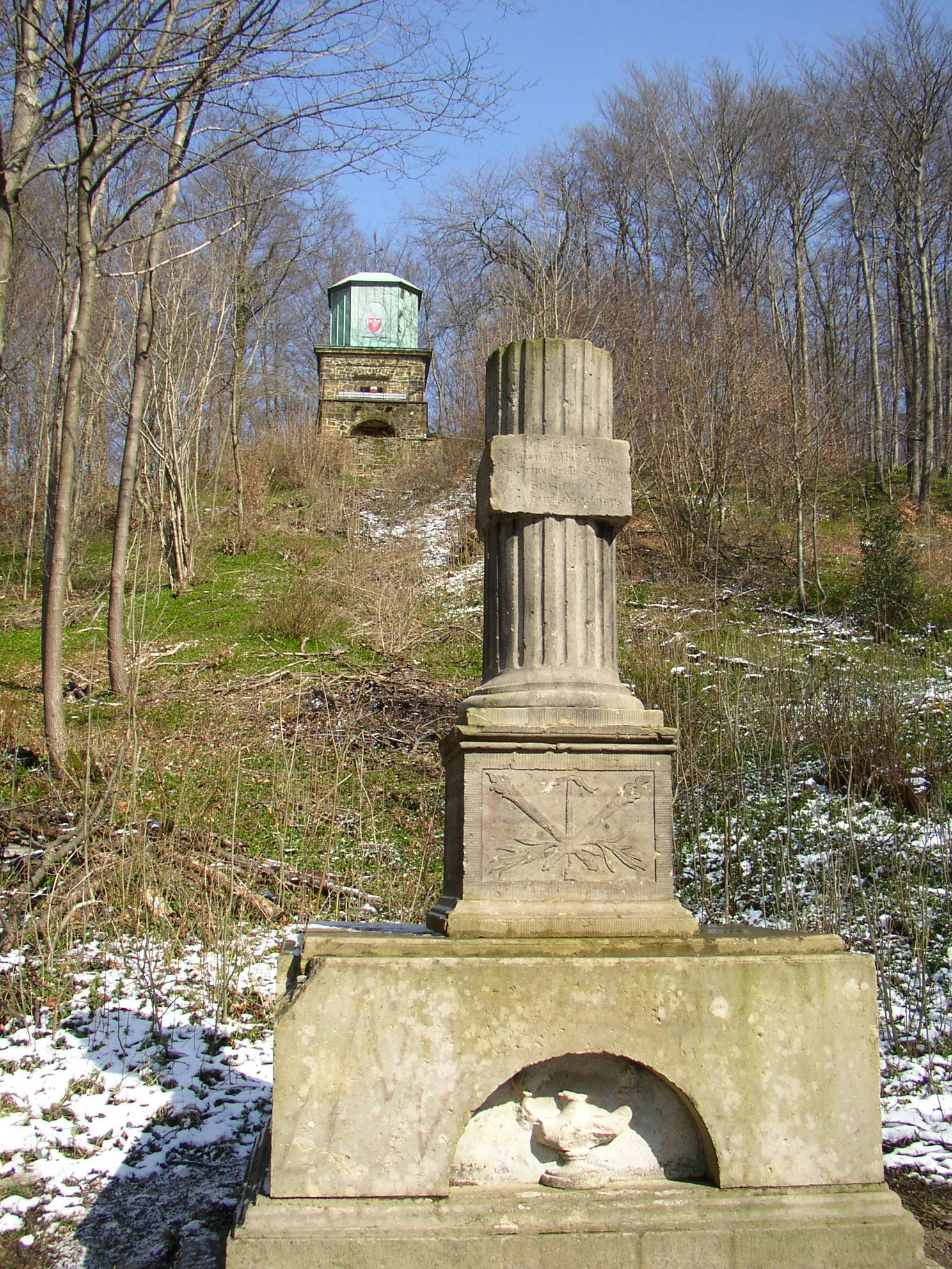
A stone monument with a fluted column stands in the foreground on a gentle, partially snow-covered slope, with a small stone tower, known as the Kaffeemühle, visible in the distance among bare trees.
The Hagedorn Monument in the foreground, with the Kaffeemühle tower visible on the hill behind in the Knüll-Storkenberg nature reserve.

Knüll-Storkenberg history and protected-area timeline

The area that today forms the Knüll-Storkenberg nature reserve was protected in 2001 under the German Naturschutzgebiet framework, with the official designation GT-033. The designation process recognized the site's accumulating ecological significance and made it an IUCN Category IV Habitat/Species Management Area, acknowledging that the reserve's purpose is not just passive protection but the active stewardship of habitats and species.

The reserve was also proposed as a candidate site under the European Union Habitats Directive (the Fauna-Flora-Habitat or FFH directive), placing it within the continental European network aimed at conserving natural habitat types and wild species of fauna and flora. Management responsibility lies with the lower landscape authority (Untere Landschaftsbehörde) of the district of Gütersloh, which coordinates the practical conservation and monitoring of the site.

Though the formal conservation history is relatively recent, the landscape around Knüll and Storkenberg has carried cultural and memorial significance for far longer. Forest graves of the Kisker family are located within the area, the Kaffeemühle viewpoint has long been a local landmark, and the Walther von der Vogelweide and Hermann Hagedorn monuments tie the hillsides to broader currents of German literary and memorial culture. These cultural elements were present before the nature reserve was established and continue to coexist within it today.

Knüll-Storkenberg landscape and geographic character

The terrain of Knüll-Storkenberg is shaped by two neighboring hills in the Teutoburg Forest, the Knüll at roughly 254 meters above normal null (the German height reference) and the Storkenberg slightly east of it at about 234 meters. Between the two elevations lies a meadow valley, the Wiesental, which softens the transition from ridge to ridge and gives the protected area its elongated, twin-peak character.

Seen from the slopes and viewpoints, the landscape reads as a layered mix of closed beech forest on the upper slopes, more open coppice-like Niederwald on certain warmer sections, and bright grassland strips along the valley bottom. An abandoned stone quarry is integrated into the protected area on the Storkenberg side, and its exposed rock faces and ledges contribute to the variety of microhabitats within the small footprint of the reserve.

The hydrology of the site is quiet but central to its identity. A small upper stream course with pool-like springs (Tümpel-Quellen) emerges from the slopes and feeds wet pockets along the valley. These are the sources that sustain the large-sedge communities downstream and that make the wet meadows of the Wiesenal function as they do. The interplay of rocky spur, forest, spring, and meadow valley gives the reserve a compact but visually varied topography for its modest size.
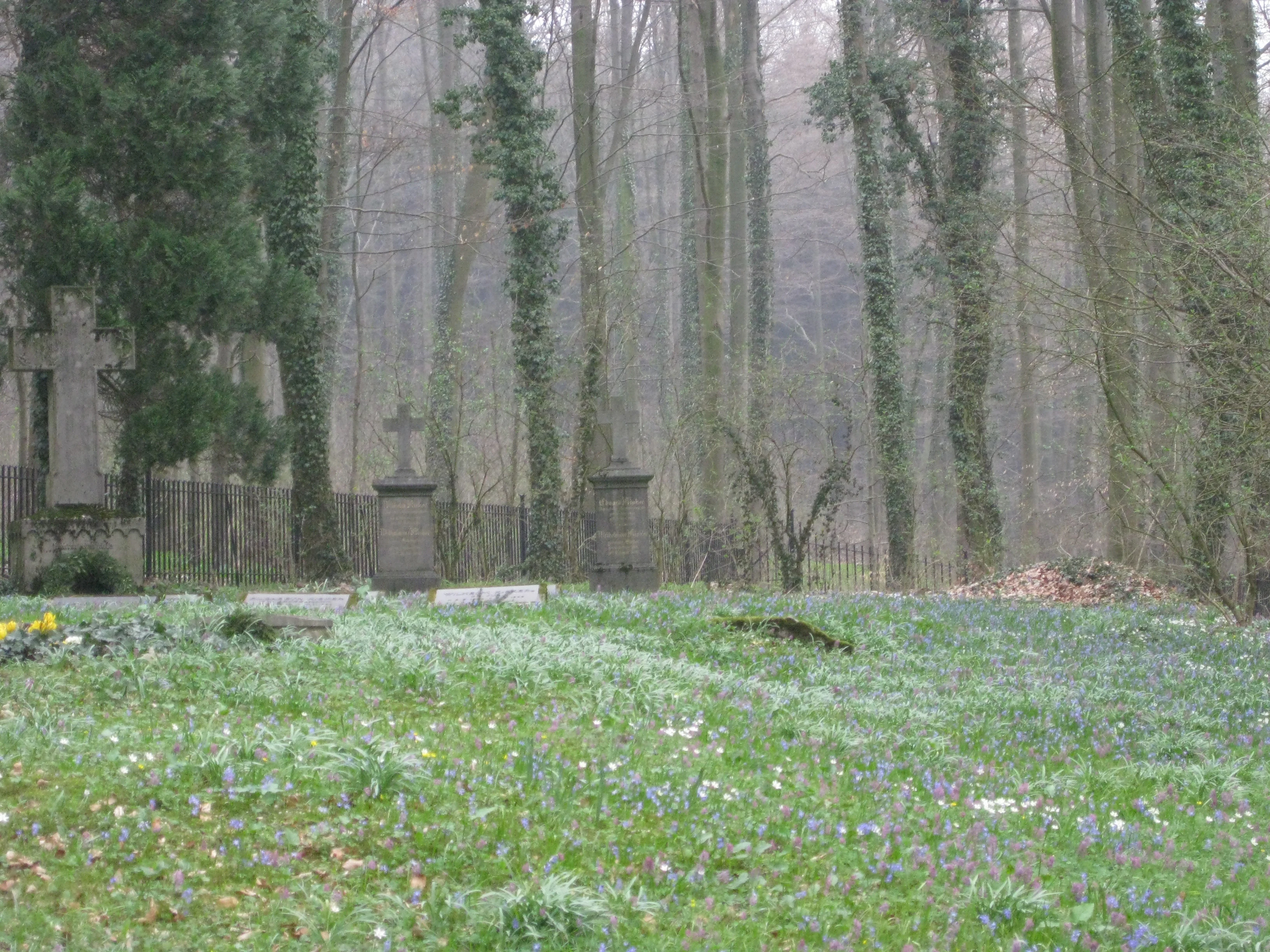
A historical stone grave monument with a cross, located in a grassy clearing surrounded by tall, leafless forest trees in a misty, overcast environment.
The historic Kisker family tomb situated within the wooded landscape of the Knüll-Storkenberg nature reserve.

Knüll-Storkenberg ecosystems, habitats, and plant life

Ecologically, Knüll-Storkenberg is a textbook example of a small beech-forest reserve managed around its associated non-forest habitats. The dominant matrix is beechwood (Rotbuchenwald), the regional climax forest type of the Teutoburg Forest and much of central Europe, and the protection of these beech stands as habitat for wild native species is one of the principal reasons the reserve was designated.

Woven into that beechwood matrix is a more delicate network of wet habitats. The reserve's spring-fed headwaters and tümpel-like sources open into small streams that maintain large-sedge (Großseggen) communities and connect to extensively managed wet and semi-wet grasslands. These wet greenland communities are among the most biologically diverse parts of the reserve, providing habitat for amphibians, invertebrates, and moisture-loving plants that would not survive under modern intensive land use.

A second narrative runs through the warmer, more open parts of the site. On the lighter Niederwald sections, the herb layer shifts toward thermophilic plant species that prefer sun and warmth, and where the soil is calcareous this transitions into Halbtrockenrasen, half-dry grasslands rich in distinctive grasses and herbs. The exposure of the old quarry at Storkenberg adds further microhabitat variety, so the reserve effectively compresses woodland, wetland, meadow, calcareous grassland, and rock habitat into a single small nature reserve in the Teutoburg Forest.

Knüll-Storkenberg wildlife and species highlights

Wildlife interest at Knüll-Storkenberg centers on the species assemblages tied to its mix of beech forest, spring-fed wetlands, and warm open habitats rather than on any single flagship species. The beech stands support the typical community of forest-dwelling birds, mammals, and invertebrates associated with mature deciduous woodland in the Teutoburg Forest region, while the spring-fed streams, pool-like sources, and sedge meadows offer breeding and feeding habitat for amphibians, dragonflies, and other wetland-sensitive fauna.

The extensive wet and semi-wet grasslands in the valley bottom are particularly important for invertebrates, including pollinators and other groups that depend on traditional, low-intensity management to persist. The open Niederwald areas and the calcareous Halbtrockenrasen, in turn, support warmth-loving insects and other fauna characteristic of dry grassland habitats. Together these communities make the reserve a small but unusually complete representative sample of the habitats once common across the Teutoburg Forest margins.

Knüll-Storkenberg conservation status and protection priorities

The conservation significance of Knüll-Storkenberg lies in its compact preservation of several habitat types that are either declining or heavily fragmented in modern North Rhine-Westphalia. The reserve protects beech forest and its associated species, spring-fed headwaters and tümpel springs, large-sedge wetland communities, extensively managed wet grasslands, and calcareous half-dry grassland with its warmth-loving flora and fauna, all within an area of under 80 hectares.

The site's IUCN Category IV designation as a Habitat/Species Management Area, combined with its status as a proposed FFH site under the European Habitats Directive, reflects recognition that these habitats require active stewardship, not just protection from development. Management under the lower landscape authority of Kreis Gütersloh focuses on maintaining the open and semi-open character of valleys, light forest, and grassland through traditional forms of use such as extensive mowing and grazing.

By integrating the abandoned Storkenberg quarry into the protected area, the reserve also turns a former extractive site into habitat, demonstrating how post-industrial land surfaces can be incorporated into mosaic conservation strategies. As part of the wider cluster of nature reserves around Halle in Westphalia and across the district of Gütersloh, Knüll-Storkenberg contributes to a regional network of small protected areas that collectively conserve a representative cross-section of the Teutoburg Forest landscape.

Knüll-Storkenberg cultural meaning and human context

While its primary identity is ecological, Knüll-Storkenberg also carries notable cultural and memorial weight, a feature that is unusually prominent for a nature reserve of its size. In the Knüll area, two family forest graves are maintained, one for a single individual and one for the Kisker family, embedding human memorial practice into the forested landscape.

A signed forest educational trail (Waldlehrpfad) passes through the area, encouraging visitors to read the landscape as both a natural and a cultural artifact. The Kaffeemühle, a well-known local viewpoint, has long drawn visitors to the ridge for its outlook over the surrounding countryside and is a station on the Teutoburg Forest cultural trail known as the Laibachweg.

Two monuments further tie the reserve to wider currents of German literary culture. A monument honors Walther von der Vogelweide, one of the most celebrated medieval German Minnesänger, while another is dedicated to the poet Hermann Hagedorn. Both are listed as stations on the Laibachweg cultural trail, so a walk through Knüll-Storkenberg links ecological conservation directly to the region's heritage as a setting for poetry and memory.

Top sights and standout views in Knüll-Storkenberg

A two-hill ridge reserve in the Teutoburg Forest combining beech woodland, spring streams, large-sedge wetlands, and calcareous grassland within less than 80 hectares. Highlights include the upper spring-fed brook with its pool-like sources, the open meadow valley between Knüll and Storkenberg, the controlled light forest with thermophilic plants, the abandoned Storkenberg quarry now part of the protected area, the Kaffeemühle viewpoint, and the Waldlehrpfad educational trail.

Cultural gems thread through the natural setting: monuments to Walther von der Vogelweide and Hermann Hagedorn stand on the cultural trail Laibachweg, and forest graves of the Kisker family lie quietly within the woodland.

Best time to visit Knüll-Storkenberg

Knüll-Storkenberg has a classic central European low-mountain seasonality. Spring through early summer is the most rewarding time to appreciate the wet meadows, sedge communities, and forest herb layer, when wildflowers are most visible and the beech canopy is still light enough to allow ground flora to bloom. Late spring and early summer are also when the contrast between fresh beech foliage, bright meadow greens, and the warmer microclimates of the lighter woodland is most pronounced.

Late summer and early autumn bring a different character: drier conditions clarify the half-dry grassland flora and make the calcareous slopes at the Storkenberg easier to read, while the beech forest takes on richer tones. Winter visits are quieter and emphasize the structure of the landscape, the open Wiesental, and the viewpoints such as the Kaffeemühle. Because the reserve is small and primarily visited on foot along the forest trails, any season can suit a short exploratory walk, though wetter periods require appropriate footwear along the valley paths.

Monthly climate preview

Long-term representative temperature and precipitation averages for Knüll-Storkenberg

Knüll-Storkenberg Climate Normals and Monthly Temperature Patterns

Historical data records monthly average temperatures ranging from 0.91 to 18.43 degrees Celsius alongside consistent precipitation patterns across the representative coordinate. Examining the complete twelve-month climate profile reveals detailed temperature ranges and monthly precipitation metrics for further study.
Annual mean9 °C
1 °C18 °C
Jan
Feb
Mar
Apr
May13°
Jun16°
Jul18°
Aug18°
Sep14°
Oct10°
Nov
Dec
Warmest month
July

18.4 °C

Coolest month
January

0.9 °C

Wettest month
December

2.6 mm/day

Driest month
April

1.6 mm/day

Park location guide

Geography guide, regional context, and park location map for Knüll-Storkenberg

Knüll-Storkenberg park geography, regions, and map view in Germany

Understand where Knüll-Storkenberg sits in Germany through a broader geographic reading of the surrounding landscape, nearby location context, and its mapped position within the national park landscape.

How Knüll-Storkenberg fits into Germany

Germany is a federal republic in Western and Central Europe with a population of over 83 million across sixteen constituent states. It is Europe's largest economy by nominal GDP and a major global exporter and importer. The capital is Berlin, and the country borders Denmark, Poland, Czech Republic, Austria, Switzerland, France, Luxembourg, Belgium, and the Netherlands.

Wider geography shaping Knüll-Storkenberg in Germany

Germany is located in Western and Central Europe, spanning 357,022 km². It borders Denmark to the north, Poland and the Czech Republic to the east, Austria and Switzerland to the south, and France, Luxembourg, Belgium, and the Netherlands to the west. The country has coastlines on the Baltic Sea and North Sea to the north, with the Alps located in the southern region.

Map view of Knüll-Storkenberg

Use this park location map to pinpoint Knüll-Storkenberg in Germany, understand its exact geographic position, and read its mapped placement within the surrounding landscape more clearly.

Pigeon | © OpenStreetMap contributors

Location context for Knüll-Storkenberg

Nordrhein-Westfalen

Visual exploration of Teutoburg Forest terrain, beech woods, and protected habitats

Knüll-Storkenberg Landscape Photos and Scenery

Photographic records reveal the twin-hill topography, spring-fed brooks, and calcareous grasslands defining the protected terrain of Knüll-Storkenberg. Visual documentation helps observers understand the ecological mosaic and microclimates spanning the low mountain reserve.

A stone monument with a fluted column stands in the foreground on a gentle, partially snow-covered slope, with a small stone tower, known as the Kaffeemühle, visible in the distance among bare trees.

A stone monument built from stacked boulders with a metal plaque, situated in front of a stone retaining wall and a forest background with patches of snow.

A historical stone grave monument with a cross, located in a grassy clearing surrounded by tall, leafless forest trees in a misty, overcast environment.

Park atlas

Compare surrounding Teutoburg Forest reserves and regional protected landscapes

Other Protected Areas and Parks Near Knüll-Storkenberg for Regional Comparison

Visitors exploring Knüll-Storkenberg can continue browsing nearby nature reserves and regional forest habitats. Expanding the search reveals connected protected landscapes across the surrounding terrain.
Watercolor painting of a rolling forested landscape with hills and a central water feature, stylized with soft green and peach tones.
Nature reserveNorth Rhine-Westphalia
About 7.5 km away#1 closest

Northwest

Johannisegge-Schornstein Nature Reserve: Protected Woodland and Ridge Terrain Atlas

Exploring the Teutoburg Forest ridge geography in North Rhine-Westphalia.

Johannisegge-Schornstein stands as a vital nature reserve in Borgholzhausen, characterized by its exposed beech stands and its position on the Teutoburg Forest ridge. The reserve offers a clear look at historic coppice woodland management and local watershed geography, stretching from the rocky Bönkersche Steinbruch quarry to the prominent Luisenturm lookout point.

Area
2.255 km²
Established
2001
IUCN
IV
Relief
Mountain
Watercolor painting of a green and pink moor landscape with a distant tree line.
Nature reserveNordrhein-Westfalen
About 14 km away#2 closest

South

Hühnermoor Nature Reserve: Geographic Analysis of a Protected Peatland in Nordrhein-Westfalen

A preserved raised-bog landscape and historic botanical refuge

Hühnermoor represents a rare, compact peatland ecosystem situated between ancient sand dunes in the Münsterland region. This nature reserve functions as a critical protected landscape, offering deep insights into regional vegetation history through its stratified peat layers while supporting threatened specialist wetland species.

Area
0.085 km²
Established
1938
IUCN
IV
Relief
Lowland
A watercolor painting showing a soft, peaceful landscape with bare trees in the foreground, green trees in the midground, and distant hills under a pale sky.
Nature reserveNorth Rhine-Westphalia
About 17 km away#3 closest

Southeast

Kampeters Kolk Nature Reserve: Geographic Overview and Protected Wetland Boundaries

Senne region heath pond and wetland mosaic in North Rhine-Westphalia

Kampeters Kolk preserves a significant fragment of the historic Senne heath landscape in North Rhine-Westphalia. The reserve centers on a small, artificial pond created by peat extraction, now surrounded by a rich sequence of sedges, reed stands, and willow-alder shrub thickets that provide critical habitats for local amphibian populations.

Area
0.02 km²
Established
1993
IUCN
IV
A wide watercolor illustration showing a green landscape with a winding white path or stream, pink blossoming trees, and distant purple mountains under a pale sky.
Nature reserveNorth Rhine-Westphalia
About 19 km away#4 closest

North

Kilverbachtal Nature Reserve: Protected Valley Geography in North Rhine-Westphalia

A refined look at lowland stream morphology and regional riparian habitats.

Kilverbachtal preserves a rare example of a narrow, box-shaped stream valley known as a Siek. This protected landscape features a mosaic of wet meadows, alder-lined riparian zones, and forested slopes that cut through the agricultural terrain of North Rhine-Westphalia. The area acts as a vital refugium for specialized flora and fauna, providing deep insight into the regional natural heritage and geological character of northwestern Germany.

Area
1.07 km²
Relief
Lowland
Climate
Temperate
Access
Access unknown
Nature reserveNordrhein-Westfalen
About 19 km away#5 closest

East

Windweheniederung Nature Reserve: Geographic Atlas of an East Westphalian Floodplain

Riparian ecosystems and protected valley land mapping

Windweheniederung represents a specialized nature reserve in Nordrhein-Westfalen that centers on the natural morphology of the Windwehe stream. This protected area provides a critical refuge for wetland-dependent species through its alder-ash woodland and reed-fringed pools. Explore the structural geography of this lowland catchment and understand its role in maintaining functional floodplains amidst a heavily developed regional environment.

Area
0.297 km²
Established
1991
IUCN
IV
Nature reserveNordrhein-Westfalen
About 21 km away#6 closest

East

Windwehetal Nature Reserve: Mapped Protected Brook Valley in Nordrhein-Westfalen

Dynamic stream geography and woodland protected landscapes

Windwehetal represents a compact yet ecologically significant protected area in the German federal state of North Rhine-Westphalia. The reserve showcases near-natural stream dynamics, including undercut slopes reaching three metres, alongside a complex mosaic of gallery woodlands, damp grasslands, and beech forests that define the valley floor and surrounding ridges.

Area
0.565 km²
Established
1998
IUCN
IV
Relief
Upland
A horizontal watercolor painting showing a small winding river flowing through a lush green forest with soft pink and yellow meadow areas in the foreground.
Nature reserveKreis Gütersloh
About 23 km away#7 closest

Southeast

Holter Wald Nature Reserve: Mapping the Protected Woodland and Senne Landscape of Kreis Gütersloh

A major contiguous forest block on the eastern edge of the Westfälische Bucht

Situated in the district of Kreis Gütersloh, Holter Wald is a significant protected area defined by its sandy Senne soils and network of parallel brook valleys. The forest provides a critical lowland habitat for diverse flora and fauna, serving as a rare, large-scale woodland anchor within a largely agricultural region. Explore the terrain characteristics and ecological structure of this key North Rhine Westphalia site.

Area
6.13 km²
Established
2008
IUCN
IV
Relief
Lowland
Watercolor painting of a green, rolling landscape with trees and soft hills, rendered in a minimalist, light-toned style on a white background.
Nature reserveNordrhein-Westfalen
About 24 km away#8 closest

East

In der Masch Nature Reserve: Mapped Floodplain Geography in Nordrhein-Westfalen

Protected nature reserve with rare lowland meadow habitats.

In der Masch offers a focused look at protected lowland river-meadow terrain within Germany. This 23-hectare nature reserve in Nordrhein-Westfalen protects interconnected oat-grass grasslands, riparian wood fringes, and historical boundary markers, providing a distinct study in regional floodplain topography and habitat preservation.

Area
0.23 km²
Established
2002
IUCN
IV

Common questions about visiting, size, designation, and location context for Knüll-Storkenberg

Knüll-Storkenberg FAQs for park facts, access, geography, and protected area context

Find quick answers about Knüll-Storkenberg, including protected-area facts, park geography, trail and visitor context, and how the park fits into its surrounding country and regional landscape.
MoriAtlas Explorer

Continue Your Protected Areas Search Across the Global Atlas

Deepen your exploration by continuing the structured search for national parks and protected areas worldwide. Utilize the comprehensive filtering capabilities to compare different conservation landscapes and refine your understanding of global park geography. Discover more about the distribution and characteristics of protected natural areas.

Global natural geography