
Visitor Planning
When to visit Kouchibouguac National Park: the short answer
Deciding when to visit Kouchibouguac National Park involves choosing between two distinct coastal experiences. The park operates on a strong seasonal rhythm, dictated primarily by the shift from the sub-zero temperatures and frozen landscapes of winter to the long, bright days of summer. If you prioritize beach access, swimming, and warm-weather exploration of the park's 25 kilometres of sand dunes and barrier islands, the summer months are the clear choice. Conversely, if your goal is quiet hiking, wildlife observation, or appreciating the park as a Dark-sky preserve without the humidity of peak season, the shoulder months offer a more tempered environment.
Balancing Coastal Climate and Visitor Goals
Because Kouchibouguac National Park is situated on the Canadian Maritime Plain along the Gulf of St. Lawrence, its climate is heavily influenced by the sea. Summer brings the warmest temperatures, with daily maximums peaking in July and August, often hovering near or slightly above 27 degrees Celsius. These months offer the longest daylight hours, sometimes exceeding 15 hours, which provides significant time for cycling the park's trails or exploring the boardwalks that crisscross the salt marshes. However, these peak conditions also align with periods of higher visitor activity. The combination of warm sand and accessible coastal habitats makes this the primary window for those interested in the park's famous dune systems and maritime heritage at the Cap-St-Louis fishing port.
Understanding Seasonal Transitions
Visitors should not overlook the transition periods, as the park undergoes a dramatic shift in character outside of the mid-summer peak. Spring arrives slowly, with lingering freezing temperatures through April, while autumn brings a cooling trend that begins in September. These shoulder seasons are often preferred by those seeking to avoid the peak heat and busier trails. During these times, the park's landscape changes significantly, and the environmental conditions become more suited to active exploration like hiking or birdwatching, particularly for those interested in the park's role as habitat for species such as the piping plover. The humidity levels, which can be notable during the warmest months of July and August, are generally lower in the spring and autumn, providing a more comfortable climate for sustained physical activity.
Preparing for a Variable Maritime Environment
It is essential to view these climate trends as general patterns rather than guaranteed forecasts. Because the park is an exposed coastal environment, wind speed and ocean proximity play a consistent role in how the weather feels on the ground. Regardless of when you plan your visit, the maritime influence means that conditions can change rapidly. Readers should recognize that while summer offers the most consistent warmth, the late autumn and winter months are characterized by persistent cold and lower daylight availability, which fundamentally limits the type of recreational access available in the park. Always verify current park status and service alerts before finalize your travel dates, as the official accessibility of specific trails, campgrounds, and facilities is managed independently of broad climate averages.
Seasonal Breakdown
Best Periods to Visit Kouchibouguac National Park for Key Activities
Peak Coastal Warmth: Mid-July through August
For visitors whose priority is experiencing the iconic barrier islands and the beach-centric offerings of Kouchibouguac, the window from mid-July through August offers the most consistent warmth. During this period, mean temperatures typically peak near 19 degrees Celsius, with maximums frequently climbing toward 28 degrees. This is the time when the water temperatures in the Gulf of St. Lawrence are most inviting for coastal exploration, and the salt marsh boardwalks are at their most vibrant. The trade-off for this prime weather is that these months align with the peak visitor cycle, meaning parking and trailheads are more likely to see concentrated activity. Travelers seeking solitude should be aware that these conditions are popular, and the reliance on daylight, which remains high throughout July, dictates a busy schedule for those looking to explore the dunes and lagoons.
Transition Months for Active Exploration: June and September
Visitors who prefer moderate temperatures for cycling, hiking, and wildlife observation often find June and September to be the most balanced months. June brings long daylight hours, often exceeding 15 hours, providing an expansive timeframe for navigating the park's network of bicycle paths and forest trails. While the average daytime temperatures are slightly lower than the mid-summer peak, they remain comfortable for sustained outdoor activity. September offers a different appeal, characterized by cooling air and fewer crowds. The average mean temperature settles around 15 degrees Celsius. This period is particularly favorable for those focused on photography or wildlife viewing, as the reduced temperature makes for more comfortable trekking across the diverse habitats, from the forested areas to the fragile salt marshes. The primary compromise during these shoulder months is a higher degree of weather variability compared to the stability of mid-summer.
The Cool Shoulder: May and October
May and October act as the transitional bookends to the main visitor season. During these months, the park undergoes significant climatic shifts. May marks the rapid thawing of the landscape, while October sees the onset of sharper, cooler air and shorter days. These periods are best suited for visitors who prioritize internal quiet and are prepared for rapid changes in conditions. Temperatures can fluctuate between near-freezing overnight lows and pleasant daytime highs, requiring a flexible approach to packing and activity planning. Those visiting in these months must be prepared for the reality that certain coastal features may be less accessible due to shifting weather patterns, and the interpretive programming may be limited compared to the height of the summer season.
Climate and Weather Data
Kouchibouguac National Park Weather and Climate Trends by Month
Interpreting Coastal Climate Patterns
Understanding the climate at Kouchibouguac National Park requires looking at the interplay between its coastal location on the Gulf of St. Lawrence and the significant annual shifts in daylight and temperature. These climate normals, based on data from 1991 to 2020, illustrate a region defined by marked seasonal transitions. Visitors should view these figures as long-term historical averages rather than specific weather forecasts, as the maritime setting can lead to localized, rapid weather shifts that differ from inland records.
The Shift from Winter Cold to Spring Awakening
Winter months, specifically January and February, represent the peak of the park's cold cycle. During this time, the mean temperatures frequently drop below -8 degrees Celsius, with average minimums sinking toward the -22 degree mark. The landscape is dominated by persistent cold and shorter daylight hours, which dip to approximately 8.4 to 8.8 hours in mid-winter. While the data shows lower wind speeds compared to the transitional months of October and November, the ambient temperature remains the most significant factor for visitors during this quiet, snow-covered period.
As spring emerges, the rate of change is pronounced. Between April and May, the average maximum temperature jumps from roughly 15 degrees to 21 degrees Celsius. Daylight also increases rapidly, extending from about 13.4 hours in April to nearly 15 hours by the end of May. This transition marks the arrival of more moderate conditions, though the lingering effects of a cold winter often mean that near-freezing overnight minimums can persist into early May.
Summer Warming and Humidity Trends
July and August serve as the primary months for warmth, with average maximum temperatures peaking between 27 and 28 degrees Celsius. These months offer the most consistent daylight, reaching a maximum of 15.6 hours in June before gradually receding. Humidity is a notable factor during the height of summer, with relative humidity levels hovering around 76 to 79 percent. While these percentages indicate a degree of atmospheric moisture, the coastal breeze from the Gulf of St. Lawrence often plays a critical role in tempering the feeling of heat, preventing the extreme, stagnant conditions sometimes found further inland.
Precipitation is relatively evenly distributed throughout the year, but the experience of that rainfall changes significantly with the seasons. A daily precipitation average of 2.68 mm in June compared to 2.14 mm in August suggests that while rain is a constant possibility, the early summer can be slightly more damp. Because these values are long-term averages, they reflect general trends rather than the intensity of any single storm event, which can vary wildly in a coastal environment.
Autumn Transitions and Wind Exposure
September acts as a bridge between the warmth of summer and the cooling of autumn, with average maximums sliding from 25.8 degrees in early September to 19.6 degrees by the end of October. One of the most critical climatic shifts during this period is the rise in wind speeds, which peak in December at 4.94 m/s. As the air cools in October and November, the increased wind often makes the coastal regions feel significantly colder than the raw temperature data might suggest. Visitors planning late-season trips should account for these rising winds and the steady decline in daylight, which drops below 10 hours by November, as these factors fundamentally change the usability of the park's dunes and exposed salt marshes.
Annual Climate Patterns
Understanding Seasonal Weather Phases in Kouchibouguac National Park
The Maritime Coastal Cycle
Kouchibouguac National Park operates on a maritime rhythm dictated by its position along the Gulf of St. Lawrence. Rather than a conventional four-season model, the park experience is better understood through three distinct phases: the long, dormant winter, the rapid awakening of spring, and the high-energy coastal summer. This rhythm is heavily influenced by the sea, which keeps the coastal air cooler than inland New Brunswick during the height of the summer and lingers with a damp, chill character as the seasons turn.
The Peak Coastal Window: July and August
Mid-summer marks the only time when the maritime environment reaches its thermal apex. July and August are defined by average maximum temperatures consistently rising above 25 degrees Celsius. During these months, the park shifts into its most active phase. The persistent coastal winds, which can feel biting in late autumn or early spring, provide a necessary cooling effect during these warmest weeks. Daylight hours are at their longest, lingering past the mid-point of summer, providing expansive windows for exploring the 25 kilometres of sand dunes and salt marshes. This is the period when the landscape is most accessible, and the water temperatures of the lagoons reach their most tolerable levels for visitor engagement.
The Transitional Shoulders: May-June and September-October
Transition periods in the park are marked by sharp variability. May acts as a bridge where average maximum temperatures rise from around 14 degrees Celsius in late spring toward the 20-degree mark, yet the risk of nighttime frost remains high until the end of the month. June brings a rapid increase in daylight and vegetation growth, though the water remains cold, and the air can feel raw when winds shift off the Gulf. September mirrors this volatility in reverse, providing stable, pleasant conditions early in the month that degrade as daylight shortens rapidly. By October, the park enters a cooling phase where the daily mean temperature drops toward single digits, and the wind frequency increases, signaling the end of the mild exploration window.
The Winter Dormancy: November through April
From November until the end of April, the park experiences a long, cold phase characterized by high humidity and consistent sub-zero overnight temperatures. January and February are the most severe months, with average daily temperatures well below freezing. This period is defined by high moisture content in the air and a lack of thermal relief, creating a landscape that is fundamentally different from the summer iteration. Visitors during this time face a reality of persistent cold and wind-driven chill factors. The maritime influence, which moderates summer heat, serves to sustain a damp, penetrating cold during the winter months, making the park a place of quiet, stark beauty rather than active recreation.
Seasonal Experiences
Experiencing the Annual Cycles and Landscapes of Kouchibouguac National Park
Navigating Coastal Habitats through the Seasonal Cycle
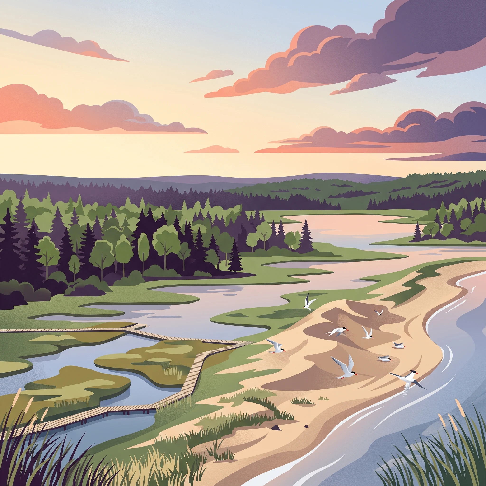
The coastal geography of Kouchibouguac defines the rhythm of visitor activities. Because the park features an extensive network of barrier islands, sand dunes, and salt marshes, the timing of your visit significantly dictates how you interact with these delicate ecosystems. During the late spring and early summer months, the focus remains on the vitality of these transition zones. As the daylight duration increases toward its peak in June, the boardwalks that wind through the salt marshes become primary routes for observing migratory patterns and coastal vegetation. Visitors should note that these areas are highly sensitive to human presence, especially during the nesting cycles of species such as the endangered piping plover.
Accessing Barrier Islands and Aquatic Environments
Experiencing the park's iconic 25-kilometre sand dune system is most viable when weather conditions are stable and water levels are calm. The warmest period, spanning July and August, provides the necessary environmental context for beach-based recreation at locations like Kelly's Beach. The mean temperatures observed in mid-summer facilitate extended stays along the shoreline, where maritime breezes provide relief from inland heat. When planning for water-based exploration, such as navigating the lagoons or engaging in voyageur-style canoe excursions, the relatively lower wind speeds in July often provide safer conditions for surface-level travel compared to the heightened wind averages noted in the autumn months.
Wildlife Viewing and Seasonal Shifts
Wildlife interactions within the park are tied to the seasonal transition of the Gulf of St. Lawrence coastline. The harbour and grey seal colonies frequenting the area are often spotted during the warmer months, as the water temperature and sunlight exposure influence their haul-out behavior. Interpretive programming regarding the Mi'kmaq history and local biodiversity is frequently most accessible during the peak visitor season, when park services operate at their maximum capacity. Conversely, as temperatures dip in October and November, the experience shifts from active aquatic exploration toward terrestrial observation. The cooling air and changing foliage alter the park's atmosphere, making the forest trails more suitable for those prioritizing solitude and cooler, crisp air rather than the humid, heat-dependent activities of mid-summer. Always check current, park-specific alerts before arrival, as shifting weather patterns can lead to temporary closures of dune access points to protect fragile habitats or ensure safety during volatile marine conditions.
Visitor Priorities
Timing Your Visit to Kouchibouguac National Park Based on Interests
Balancing Warmth and Water Activities
For travelers whose primary goal is swimming or lounging at Kelly's Beach, the window from mid-July through August offers the most reliable warmth. During this period, mean temperatures consistently hover near 19 degrees Celsius, with daytime highs often reaching the mid-20s. This is the only time of year when the Gulf of St. Lawrence waters reach their most hospitable temperatures for extended aquatic exposure. The trade-off for this peak heat is the concentration of visitors; while the park remains a natural sanctuary, common service areas and beach access points experience their highest usage during these two months. If your priority is maximum comfort for water-based recreation, you must accept the likelihood of sharing space with more visitors than in any other season.
Targeting Mild Temperatures for Trail Exploration
If your focus is on active exploration such as cycling the park's extensive trail network or hiking through the forest and salt marsh ecosystems, the months of June and September represent the most effective balance of climate and physical comfort. In June, you benefit from significantly longer daylight hours compared to autumn, with sunlight lasting until late evening. This allows for longer days on the trails before the sun dips below the horizon. However, June can present more variable weather as the region emerges from the cooler spring phase. By contrast, September offers more stable, moderate daytime temperatures, typically ranging from the mid-teens to low 20s. The humidity, which can be noticeable during the peak of July and August, drops significantly in September, making strenuous physical activity feel less taxing. The compromise here is the reduced daylight, which shortens your effective daily window for deep exploration compared to the height of summer.
Avoiding Humidity and Maximizing Quiet
For those who prioritize solitude and mild-to-cool conditions over warmth, the late spring and early autumn transitions offer distinct advantages. May and October provide a starkly different experience from the summer peak, defined by brisk air and a noticeable lack of heat. These periods are ideal for wildlife viewing, particularly for birdwatching, as the park's diverse ecosystems are less disturbed by high human traffic. Temperatures in these months often drop toward freezing at night, requiring careful attention to clothing. Because the Gulf of St. Lawrence maritime influence remains strong, even sunny days can feel cool when the wind picks up. Visitors choosing these shoulder periods must be prepared for the reality that water-based activities become significantly less comfortable, and the primary appeal shifts entirely toward the terrestrial landscape and the quiet observation of the salt marshes and dunes.
Visitor Access
Seasonal Access and Operational Considerations for Kouchibouguac National Park
Access to Kouchibouguac National Park is primarily achieved by private vehicle, as there is no public transit service providing direct entry into the park. Visitors arriving by air or rail generally rely on regional hubs such as Moncton or Miramichi, where car rentals are available for the final leg of the journey. Given the park's location along the Acadian Coastal Drive, the drive itself serves as an integral part of the visitor experience, with routes like Highway 11 and local coastal roads providing the primary access points for traffic coming from either the north or the south.
Seasonal Accessibility and Infrastructure
While the park landscape remains a permanent feature, the availability of facilities and services fluctuates significantly throughout the year. The coastal environment, defined by its 25 kilometres of sand dunes and maritime forest, creates unique management challenges. During the winter dormancy period, park operations are typically reduced, and visitor services may be restricted or entirely suspended. Conversely, the peak summer season sees the activation of full visitor facilities, including those at Kelly's Beach. Because specific dates for the opening and closing of campgrounds, visitor centres, and seasonal road segments are subject to annual adjustments based on weather, resource management requirements, and infrastructure maintenance, travellers should always verify the status of these amenities on the official Parks Canada website before finalizing their travel dates.
Operational Planning and Regulatory Considerations
Planning a visit to this coastal region involves accounting for both environmental and regulatory factors. As a protected area that includes critical habitat for species at risk, such as the piping plover, certain zones within the park,particularly the dune systems,may experience temporary access restrictions to protect sensitive breeding sites. These closures are not predictable based on monthly climate averages; they are dynamic measures enforced to ensure ecological integrity. Similarly, the use of certain facilities, such as designated group areas or specific boat launches, may require advance permits or reservations.
Because park operations, including trail maintenance, service hours, and administrative policies, can change due to storm events or evolving conservation priorities, you must treat all historical or third-party service descriptions as potentially outdated. For the most current information regarding park access, road status, and permit requirements, consult the official Kouchibouguac National Park website or contact the park administration directly before your departure. Relying on current, verified sources is essential to ensure that your planned activities align with the actual operational status of the park during your chosen visit window.
Safety and Logistics
Seasonal Weather Safety and Packing for Kouchibouguac National Park
Adapting to Coastal Weather Shifts
Preparation for a visit to the Canadian Maritime Plain requires understanding that coastal conditions can change rapidly. While monthly climate normals show a steady progression from the biting cold of winter to the warmth of July and August, local weather often defies these long-term averages. The Gulf of St. Lawrence coastline is subject to shifting winds and varying humidity levels, which can make temperatures feel significantly different than the recorded mean. Visitors should prioritize layering, as the temperature difference between a sunny afternoon and a foggy, wind-swept morning can be substantial regardless of the season.
Preparing for Seasonal Temperature Swings
During the peak summer months of July and August, daily maximums average near 28 degrees Celsius, yet the proximity to the water keeps evenings considerably cooler. Packing should include versatile options that allow for quick adjustments, such as lightweight base layers for daytime activities and heavier, insulating layers for early morning or evening coastal walks. In the shoulder seasons of May, June, September, and October, temperatures fluctuate more dramatically. Travelers should be prepared for brisk air, especially when spending time on the barrier islands or near the salt marshes where wind speeds remain consistent. It is essential to verify current, park-specific weather forecasts immediately before departure, as these provide the only accurate picture of upcoming conditions compared to broad historical data.
Navigating Environmental and Habitat Considerations
Safety in the park is closely tied to the sensitivity of its natural features. Extensive sand dunes and salt marshes require visitors to stay on designated trails and boardwalks, not only to protect fragile ecosystems like the piping plover breeding grounds but also to avoid unstable terrain. The wind patterns, which peak in the late autumn and winter months, can increase the difficulty of cycling and hiking along exposed coastal paths. Because climate normals indicate a higher frequency of precipitation during the transition months, waterproof outer layers are recommended for those planning extended time outdoors.
Always consult the park’s official website for current alerts regarding trail closures, storm damage, or temporary restrictions on coastal access. These alerts take precedence over general seasonal advice and reflect real-time safety information. Whether you are visiting for the summer beach experience or a quiet autumn hike, your comfort and safety depend on monitoring daily conditions and official guidance rather than relying on seasonal expectations alone.
Final Decision Framework
How to Choose the Right Time for Your Kouchibouguac National Park Visit
Deciding when to visit Kouchibouguac National Park ultimately hinges on whether your priorities lie with the warm, sun-drenched experience of the Maritime coastline or the quiet, atmospheric conditions of the shoulder seasons. There is no single universal window that satisfies every traveler. Instead, the right time depends on matching your specific interests with the distinct seasonal transitions defined by the Gulf of St. Lawrence maritime climate.
Prioritizing Summer Beach and Coastal Access
If your primary goal is to enjoy the iconic barrier islands, sand dunes, and swimming at Kelly's Beach, the window from mid-July through August offers the warmest air and water temperatures. During these months, the park experiences its peak of daylight and stable weather patterns. This period is the most practical choice for visitors looking to engage in water-based activities or full-day coastal exploration. However, this is also when visitor density is at its highest, and planning should focus on securing necessary access and managing higher levels of park activity. If these months align with your goals, be prepared for peak-season operational norms and consider booking well in advance.
Selecting Shoulder Seasons for Active Exploration
For travelers who prioritize hiking, cycling, or wildlife viewing, the shoulder seasons of June and September present a different, often more favorable, set of conditions. These months provide cooler, more comfortable temperatures for physical exertion compared to the heat of mid-summer. The thinner crowds during these times allow for a more solitary experience of the park's diverse habitats, including salt marshes and forest trails. While you trade the guaranteed warmth of summer for a higher likelihood of variable weather, these months are better suited for those who find the peak summer heat or density a distraction from the park's natural landscapes.
Considering Transition and Dormant Periods
The late-spring and early-autumn windows of May and October offer the quietest, most introspective experiences. These transitional months require a higher degree of preparation, as the weather is less predictable and many seasonal services may be limited. Winter, while visually striking, marks a period of dormancy where access is significantly altered by cold and snow. Visitors should view these periods as opportunities for quiet photography or nature observation rather than traditional recreation.
Making Your Final Decision
As you finalize your travel dates, remember that climate normals provide a baseline for what to expect, but they are not daily forecasts. Always verify current park status, weather alerts, and operational updates through official channels before you travel. By choosing a window that aligns with your preferred pace and activity level, you can ensure a visit that matches your personal objectives. Once you have identified your ideal season based on the climate patterns and experiences discussed, you will be well-prepared to move from planning to booking.