
Mori Atlas logo
Nature reserveKripp- und Hielöcher

Explore ancient gypsum sinkholes, dolomite cliffs, and rare grassland habitats preserved within this protected German landscape.

Kripp- und Hielöcher Nature Reserve: A Geological Karst Landmark in the Werra-Meißner-Kreis

(Naturschutzgebiet Kripp- und Hielöcher)

Kripp- und Hielöcher stands as a distinctive nature reserve in the Werra-Meißner district of northern Hesse, characterized by its complex gypsum and dolomite karst terrain. Shaped by millions of years of geological dissolution, the area features a network of sinkholes, dramatic dolines, and karst springs that create a unique microtopography. This protected landscape is maintained by traditional shepherding practices, which support rich dry grasslands, juniper heaths, and specialized flora that thrive across these rugged limestone formations.

karst landscapegypsum dolomitenature reservejuniper heathdry grasslandkarst springs
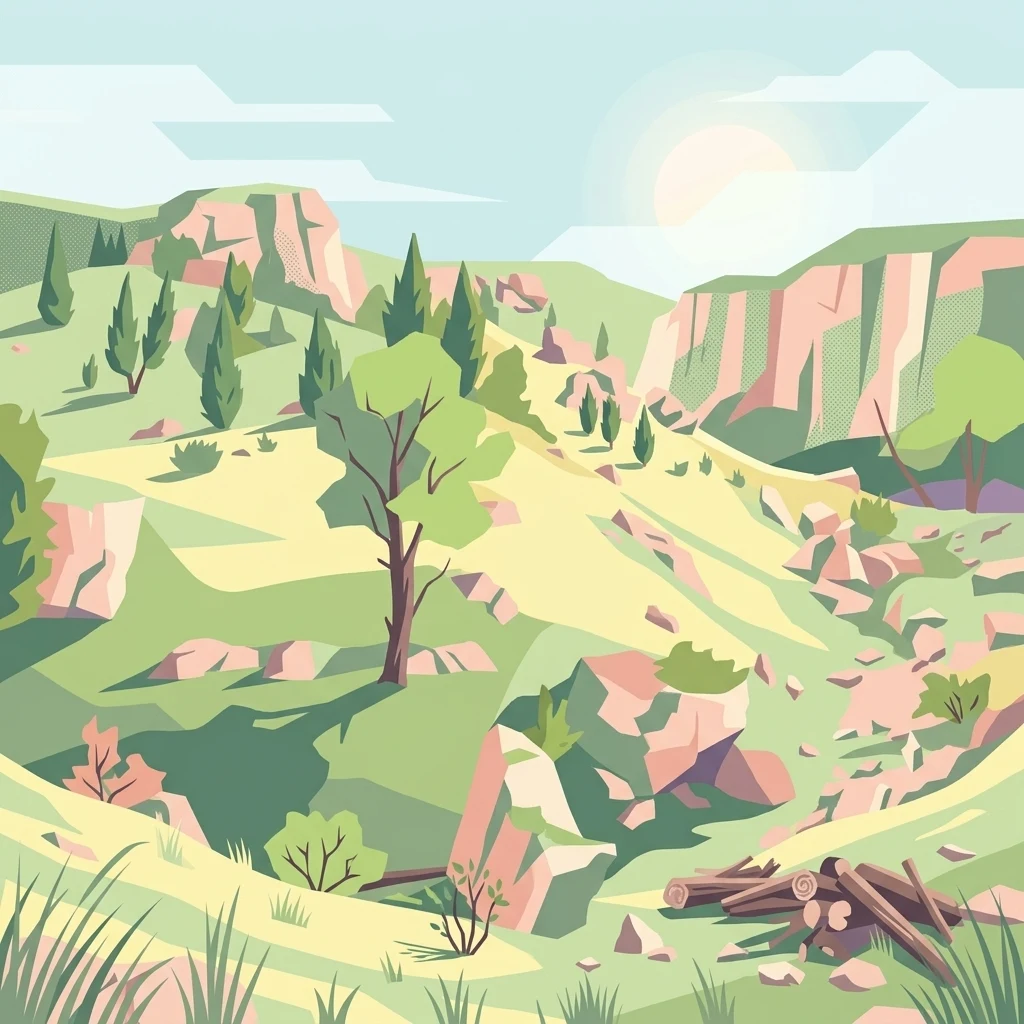
A stylized vector illustration of a hilly, rocky natural landscape with scattered trees, juniper bushes, and stone formations.

Kripp- und Hielöcher

Nature reserve

Park overview

Structured park overview, official facts, and landscape profile for Kripp- and Hielöcher Nature Reserve

Kripp- and Hielöcher Nature Reserve park facts, protected area profile, and essential visitor context

Review the core facts for Kripp- and Hielöcher Nature Reserve, including designation, size, terrain, visitor scale, habitats, and operating context in one park-focused overview.

About Kripp- and Hielöcher Nature Reserve

Kripp- und Hielöcher is a small but ecologically and geologically significant nature reserve in the eastern part of northern Hesse, anchoring the karst side of the Geo-Naturpark Frau-Holle-Land between the Hoher Meißner massif and the village of Frankershausen. Although its surface area is modest, the reserve captures a remarkable cross-section of the geological and ecological identity of this part of the Werra-Meißner region, where Permian evaporite rocks have been sculpted by long-term dissolution into a varied surface of dolines, rocky outcrops, and emerging springs.

The reserve is built on gypsum and dolomite deposits left behind by the Zechstein Sea around 250 million years ago, the same geological episode that left traces across much of central Germany but is here particularly well exposed at the surface. As groundwater slowly dissolved the soluble rock layers, the landscape developed the diagnostic karst features for which the site is now protected: rounded sinkholes, abrupt dolines, exposed dolomite rock, and clear karst springs such as the Kressenborn and Breitenborn, both of which can be visited along the circular trail through the Hielöcher.

Above and around this geological foundation, the reserve supports an unusually diverse mosaic of semi-open habitats. Dry grasslands rich in wild herbs and orchids spread across the warmer slopes, juniper heaths colonize thinner soils, and small rocky cliffs provide specialized niches for drought-adapted plants. Traditional shepherding, in particular seasonal grazing with the Timmerberg Dudenrode flock producing regional Meißner lamb products, has been critical in preventing scrub encroachment and keeping the open habitats functional. The result is a tightly woven patch of landscape where geology, vegetation, and long-standing human land management reinforce one another.

The reserve is also a meaningful cultural landscape. The Hielöcher includes the natural monuments known as the Kleiner Marstein and the larger Großer Marstein, rock features that are tied into the local sense of place, and the trail continues past the historic Oberdorfer Mühle and Blaumühle, two traditional mills that reflect the long history of using karst spring water for local industry. Today, the area attracts walkers, geology enthusiasts, and botanists rather than mass tourism, and is best appreciated slowly, along the 3 kilometer circular path or the longer Premium hiking route Frankershäuser Karst that links the reserve to surrounding features of the Meißner foreland.

Quick facts and research context for Kripp- and Hielöcher Nature Reserve

Kripp- und Hielöcher is a designated nature reserve, with CDDA code 164260, located in the Berkatal municipality in the Werra-Meißner district of Hesse. It lies inside the Geo-Naturpark Frau-Holle-Land and represents a classic gypsum and dolomite karst terrain with dolines, rock outcrops, karst springs, juniper heath, and dry grasslands. The protected area covers about 17 hectares and consists of two separate sections, the northern Kripplöcher and the southwestern Hielöcher, the latter crossed by a 3 kilometer circular trail and the regional Premium hiking route Frankershäuser Karst.

Protection and recognition

Terrestrial protected area parameters and official recognition metrics

Kripp- und Hielöcher Protection Status and Documented Conservation Scope

Terrestrial conservation frameworks define the documented protection status and management scope established for Kripp- und Hielöcher. Official records outline the formal geographic designation parameters and recognized international database identifiers associated with this protected landscape.

Protection details

Protection scope
Terrestrial
Transboundary protection
No
WDPA ID
164260
Park context

Deeper park guide and search-rich context for Kripp- and Hielöcher Nature Reserve

Kripp- and Hielöcher Nature Reserve history, landscape, wildlife, and travel context

Explore Kripp- and Hielöcher Nature Reserve through its history, landscape character, ecosystems, wildlife, conservation priorities, cultural context, and seasonal travel timing in a structured park guide built for atlas discovery and search intent.

Why Kripp- and Hielöcher Nature Reserve stands out

The reserve is best known for being one of the most accessible examples of Zechstein gypsum karst in Hesse, where 250 million year old marine evaporite deposits have been dissolved into a landscape of sinkholes, dolines, and karst springs. The combination of a juniper heath with orchids, gentians, and species-rich dry grasslands on top of this unusual geological base gives the site its distinctive character, reinforced by ongoing traditional sheep grazing that keeps the open habitats intact.
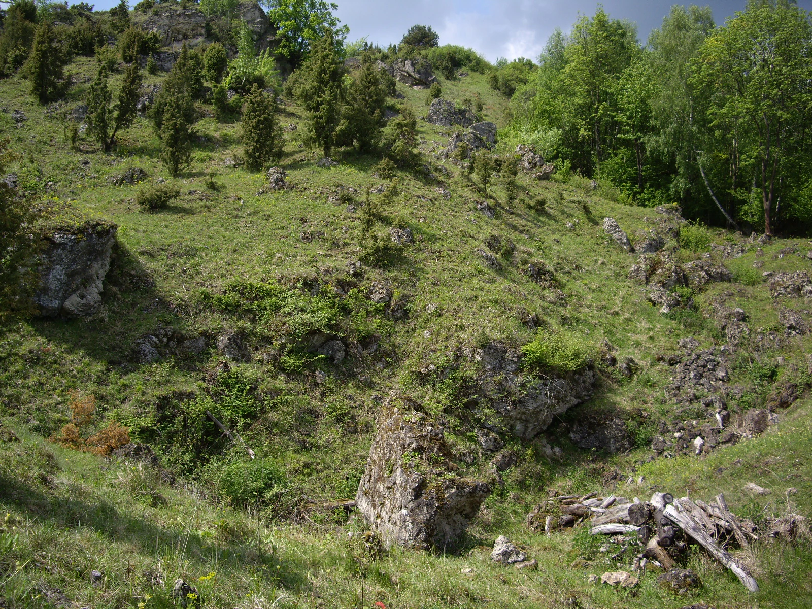
A sloped grassy hillside dotted with juniper trees, scattered grey rock formations, and some deciduous trees under a cloudy sky.
The southern slope of the Hielöcher nature reserve, featuring karst rock formations and juniper-dotted grassland.

Kripp- and Hielöcher Nature Reserve history and protected-area timeline

The protected geological and cultural significance of Kripp- und Hielöcher goes back at least to the era of local industrial and agricultural use of the karst springs that emerge from the Zechstein deposits. The historic Oberdorfer and Blaumühle along the trail demonstrate that the karst waters of the Hielöcher have supported milling and rural settlement for generations, integrating the site into the everyday life of the Berkatal communities.

A striking modern event in the reserve's history occurred in 1958, when a team of draft cattle collapsed into a newly opened doline in the Kripplöcher area; the resulting 31 meter deep sinkhole is still locally referred to as the Kuhloch, or cow hole, and serves as a vivid reminder of the active and ongoing dissolution of the underlying gypsum. This episode helped reinforce public awareness of how dynamic the karst terrain really is, even on the surface.

Formal protection came through designation as a Naturschutzgebiet, registered under CDDA code 164260, reflecting recognition of both the geological value and the associated dry grassland and juniper heath habitats. The 2008 publication by Naturpark Meißner-Kaufunger Wald on the Naturschutzgebiet Kripp- und Hielöcher marked a consolidation of public information about the area, complementing the more general regional hiking literature, such as Eduard Brauns's 1971 guide to northern Hesse and Waldeck. Since designation, the reserve has continued to depend on traditional shepherding as a practical conservation tool, rather than on fencing or active reintroduction, which keeps the landscape connected to its long agricultural past.

Kripp- and Hielöcher Nature Reserve landscape and geographic character

The physical landscape of Kripp- und Hielöcher is a textbook example of a small-scale gypsum and dolomite karst terrain, in which the surface has been quietly but persistently shaped by underground dissolution over many millions of years. The reserve rises to around 240 meters above sea level on the southwestern approaches to the Hoher Meißner, set in the rolling terrain of the Meißner foreland. Because the underlying rock, deposited by the Zechstein Sea roughly 250 million years ago, is relatively soluble, water moving through the subsurface has carved out voids that occasionally collapse, producing the characteristic dolines and sinkholes for which the site is renowned.

The two sub-areas of the reserve present subtly different surface expressions. The northern Kripplöcher are more rugged and remote, with limited formal trail access and significant relief, including dramatic collapse features; the southwestern Hielöcher are gentler and more openly traversed, with broader slopes of juniper heath and dry grassland interrupted occasionally by dolomite cliffs and small escarpments. Natural monument rock features such as the Kleiner Marstein and the larger Großer Marstein stand out as visual anchors within the Hielöcher, marking both the structural hardness of the rock and the scenic rhythm of the reserve.

Water is an essential part of the landscape's identity. Several karst springs, including the Kressenborn and the Breitenborn, emerge cleanly from the dolomite and gypsum bedrock and feed small streams that historically powered traditional mills in the area. The presence of these springs, combined with the porous rock and varied microtopography, creates the moisture gradients that support the reserve's botanical richness and give the karst landscape its distinctive alternating pattern of dry slopes and damp spring horizons.

Kripp- and Hielöcher Nature Reserve ecosystems, habitats, and plant life

The ecological character of Kripp- und Hielöcher is tightly bound to its unusual geology, producing a habitat mosaic that is disproportionately rich for such a small protected area. The dominant vegetation types are juniper heath on stony or thin soils and species-rich dry grasslands on warmer, often south-facing slopes, both of which depend on the high proportion of exposed rock and the natural drainage provided by the soluble bedrock. These open habitats form the structural backbone of the reserve and give it much of its conservation value.

Within the juniper heath, the reserve is notable for its botanical diversity, which includes striking flowering species such as the gold thistle (Carlina acaulis), several orchid species, and gentians, which together transform the slopes during the growing season. The dry grasslands, known locally as Magerrasen, host a wide range of wild herbs and are among the most species-rich plant communities in the reserve. Together, these communities create a layered vegetation structure in which open rock, low heath, and taller flowering grasslands alternate across short distances, supporting a rich associated fauna.

A particularly important feature of the nature section is the active role of traditional shepherding in habitat maintenance. Grazing by the Timmerberg Dudenrode flock, which also produces the regional Meißner lamb, prevents juniper and scrub from dominating the heath and keeps the dry grasslands open. This combination of geology and ongoing land use makes the reserve a working example of how cultural practices and ecological character can reinforce one another over long time spans.

Kripp- and Hielöcher Nature Reserve wildlife and species highlights

Although the reserve is small, it supports a characteristic set of karst and dry grassland fauna, with mammals, Lepidoptera, and other insects representing the most visible wildlife groups. Badgers and red foxes are regularly present and benefit from the dry, well-drained slopes and the network of cavities provided by the karst terrain, which offers good denning and shelter opportunities. These mammals also benefit from the edge structure created where juniper heath, dry grassland, and rock meet.

Lepidoptera are a particular highlight of the reserve, with rare butterflies documented in the area. The blues (Bläulinge) are among the more conspicuous and valued groups, while burnet moths (Widderchen) contribute further to the insect diversity of the dry grasslands and herb-rich slopes. The presence of these species reflects the health of the wildflower-rich grasslands and the persistence of flowering host plants, which themselves depend on continued traditional grazing to maintain their open character.

More broadly, the combination of dry habitats, karst features, spring heads, and nearby woodland edges of the Meißner foreland creates a sequence of microhabitats that supports a wider insect community, with associated ecological functions such as pollination and nutrient cycling. While the reserve is not promoted as a large mammal destination, its small-scale mosaic nature gives it an outsized importance for invertebrates and for the mammals that depend on edge habitats within a deeply karstified landscape.

Kripp- and Hielöcher Nature Reserve conservation status and protection priorities

The conservation significance of Kripp- und Hielöcher rests on the unusual combination of relict Zechstein geology and habitat types that are rare or declining elsewhere in Hesse. By formally protecting a functioning gypsum and dolomite karst complex with its associated dolines, rock outcrops, and springs, the reserve safeguards a geological reference site for the region, while also protecting the juniper heath and species-rich dry grasslands that have evolved in conjunction with it. The official CDDA code 164260 reflects this integrated recognition across geological and ecological conservation criteria.

A central conservation value is the persistence of the open habitat structure itself. Juniper heath and dry grassland communities of this kind are among the most threatened habitat types in central Europe, and they depend on continued disturbance regimes, usually grazing or mowing, to prevent succession into scrub or forest. By maintaining an active tradition of shepherding through the Timmerberg Dudenrode flock, the reserve aligns its conservation management with the historical land use that shaped the site, providing a more resilient model than abandonment alone would. This grazing regime also produces the regional Meißner lamb, linking biodiversity protection with continuing local cultural and economic activity.

Additional conservation priorities include protecting visitors from the karst hazards that come with collapse features, as illustrated by the 1958 Kuhloch event, and maintaining the visitor trails in the Hielöcher while restricting off-trail access in the more sensitive Kripplöcher. The path discipline applied across the reserve helps reduce trampling pressure on fragile dry grassland flora, and limits disturbance to ground-nesting invertebrates and small mammals.

Kripp- and Hielöcher Nature Reserve cultural meaning and human context

Kripp- und Hielöcher is embedded in the rural cultural fabric of the Berkatal community, where karst springs, juniper heaths, and dry grasslands have long interacted with local farming life. The presence of historic mills along the karst-fed streams, including the Oberdorfer Mühle and the Blaumühle, shows that the hydrology of the reserve has been useful to local communities for generations, integrating the karst landscape into everyday rural infrastructure rather than leaving it as purely natural scenery.

Shepherding remains a defining cultural practice at the site, with the Timmerberg Dudenrode flock providing both ecological management and a regional product in the form of Meißner lamb. This gives the reserve a distinctive cultural identity, in which the maintenance of high biodiversity depends on a continuing agricultural tradition rather than on fencing off nature from human use. The naming of landscape features, such as the Kuhloch, also reflects local oral memory of dramatic karst events, in this case the 1958 collapse under a team of cattle, anchoring the reserve in the lived experience of nearby residents.

Top sights and standout views in Kripp- and Hielöcher Nature Reserve

Among the most distinctive features of Kripp- und Hielöcher are the Zechstein gypsum and dolomite karst surface with its dolines, the locally famous 31 meter deep Kuhloch collapse, and the pairing of juniper heath with orchid and gentian-rich dry grasslands on top of an unusually soluble bedrock. The Hielöcher section in particular combines accessible walking terrain with karst springs such as Kressenborn and Breitenborn, natural monument rock features like the Großer Marstein, and historic mill sites that give the short circular trail a layered story of geology, botany, and rural heritage.

Best time to visit Kripp- and Hielöcher Nature Reserve

Late spring into early summer is the most rewarding period for experiencing the botanical highlights of Kripp- und Hielöcher, when orchids, gentians, and the gold thistle come into flower across the dry grasslands and juniper heath, and the limestone-loving butterflies and burnet moths become more active. Early mornings and long evenings in this season are particularly good for insect viewing and for cooler walking conditions. Outside the botanical peak, the karst features, including dolines, rock outcrops, and springs, are visible year round, so quieter visits in late autumn or winter are well suited to those focused on geology and the wider Meißner landscape scenery.


Monthly climate preview

Long-term representative point measurements for temperature and precipitation rhythm

Kripp- und Hielöcher Climate Normals and Annual Temperature Patterns

Representative point measurements for Kripp- und Hielöcher document a measured annual temperature range from negative values in winter months to warmer peaks in midyear alongside consistent daily precipitation rates. Examining the full twelve-month climate profile provides deeper context for long-term meteorological patterns recorded across the terrain.
Annual mean8 °C
-1 °C18 °C
Jan-1°
Feb
Mar
Apr
May12°
Jun16°
Jul18°
Aug18°
Sep14°
Oct
Nov
Dec
Warmest month
July

18.3 °C

Coolest month
January

-1.1 °C

Wettest month
July

2.6 mm/day

Driest month
April

1.4 mm/day

Park location guide

Geography guide, regional context, and park location map for Kripp- and Hielöcher Nature Reserve

Kripp- and Hielöcher Nature Reserve park geography, regions, and map view in Germany

Understand where Kripp- and Hielöcher Nature Reserve sits in Germany through a broader geographic reading of the surrounding landscape, nearby location context, and its mapped position within the national park landscape.

How Kripp- and Hielöcher Nature Reserve fits into Germany

Germany is a federal republic in Western and Central Europe with a population of over 83 million across sixteen constituent states. It is Europe's largest economy by nominal GDP and a major global exporter and importer. The capital is Berlin, and the country borders Denmark, Poland, Czech Republic, Austria, Switzerland, France, Luxembourg, Belgium, and the Netherlands.

Wider geography shaping Kripp- and Hielöcher Nature Reserve in Germany

Germany is located in Western and Central Europe, spanning 357,022 km². It borders Denmark to the north, Poland and the Czech Republic to the east, Austria and Switzerland to the south, and France, Luxembourg, Belgium, and the Netherlands to the west. The country has coastlines on the Baltic Sea and North Sea to the north, with the Alps located in the southern region.

Map view of Kripp- and Hielöcher Nature Reserve

Use this park location map to pinpoint Kripp- and Hielöcher Nature Reserve in Germany, understand its exact geographic position, and read its mapped placement within the surrounding landscape more clearly.

Pigeon | © OpenStreetMap contributors

Location context for Kripp- and Hielöcher Nature Reserve

Werra-Meißner-Kreis

Explore protected area imagery, rocky outcrops, and unique gypsum habitats.

Kripp- und Hielöcher Photos and Scenery: Visualizing the Karst Landscape

Visual documentation captures the complex topography and rare botanical habitats defining Kripp- und Hielöcher. Examining these detailed landscape photographs reveals the underlying geological character of the gypsum and dolomite terrain.

A sloped grassy hillside dotted with juniper trees, scattered grey rock formations, and some deciduous trees under a cloudy sky.

A green, hilly meadow with a path winding through it; there is a small sinkhole or depression in the foreground and a larger rocky, uneven area on the right, typical of the karst terrain.

Park atlas

Discover related reserves, regional karst terrain, and connected natural habitats

Exploring Parks Near Kripp- und Hielöcher and Surrounding Protected Landscapes

Continue browsing protected areas near Kripp- und Hielöcher to compare regional geological formations, distinct juniper heaths, and surrounding highland terrain. Evaluating adjacent reserves expands regional geographic context and clarifies the broader conservation patterns defining northern Hesse.
Watercolor painting of a mountain landscape with green slopes, coniferous forests, and rocky outcroppings under a soft, light-filled sky.
Nature reserveHesse
About 1.5 km away#1 closest

Southwest

Meißner Nature Reserve in Northern Hesse: Mapping the Hoher Meißner Basaltic Massif

A comprehensive look at forest wilderness, bogs, and volcanic geology

Covering roughly 930 hectares, the Meißner nature reserve in northern Hesse protects an ecologically distinct upland landscape. The area features a significant basalt plateau, ancient scree slopes, mountain meadows, and hanging spring bogs, offering a prime example of protected central German topography and forest wilderness.

Area
9.322 km²
Established
1989
IUCN
IV
Relief
Mountain
A soft, minimalist watercolor painting of rolling hills and trees set against a white background.
Nature reserveHessen
About 3.9 km away#2 closest

East

Bilstein im Höllental: Protected Diabase Cliff and Ravine Forest in Hessen

Geological landscape and Natura 2000 protected area

Discover the geographic significance of Bilstein im Höllental, a nature reserve in the Werra-Meißner-Kreis that showcases a rare juxtaposition of warm rock refuges and cool, shaded ravine environments. The reserve protects significant cliff-dwelling plant communities and traces of medieval history upon its 284-meter diabase summit, providing a focused example of geological resistance shaping valley terrain.

Area
0.032 km²
Established
1960
IUCN
IV
Relief
Mountain
A soft, light-colored watercolor painting of a rolling hilly landscape with sparse trees and open grassy meadows.
Nature reserveWerra-Meißner-Kreis
About 4.1 km away#3 closest

West

Bühlchen bei Weißenbach Nature Reserve: Protected Limestone Grasslands in Werra-Meißner-Kreis

Geographic atlas of a historic juniper heath and limestone hilltop.

Bühlchen bei Weißenbach represents a rare, semi-open cultural landscape shaped by centuries of sheep grazing on shell limestone summits. This nature reserve, integrated into the Natura 2000 network, offers a dense concentration of rare orchids and gentians across its rocky, nutrient-poor slopes, serving as a critical site for regional ecological study and landscape preservation.

Area
0.08 km²
Established
1985
IUCN
IV
Relief
Mountain
A wide watercolor illustration of a rolling landscape with green fields, patches of pink flowers, and distant purple hills under a pale sky.
Nature reserveWerra-Meißner-Kreis
About 6.8 km away#4 closest

East

Jestädter Weinberg: Protected Zechstein Cliffs and Werra River Valley Mosaic

A botanical and geological hotspot in northern Hesse

Jestädter Weinberg represents a critical protected landscape defined by its steep dolomite rock faces and sun-exposed slopes. This nature reserve provides an essential habitat for orchids and diverse insect populations, bridging the gap between high-altitude limestone ridges and the riparian meadows of the Werra river valley.

Area
0.6 km²
Established
1924
IUCN
IV
Relief
Upland
A watercolor painting showing a soft, green landscape with gentle rolling hills, small clusters of trees, and a small meandering stream, framed by delicate wild flowers in the foreground.
Nature reserveWerra-Meißner-Kreis
About 7.4 km away#5 closest

West

Quellgebiet der Weißen Gelster: Nature Reserve Geography and Protected Area Mapping

Calcareous spring mires and wet meadows in Werra-Meißner-Kreis

Located at the foot of the Meinetsberg, Quellgebiet der Weißen Gelster features a series of groundwater-dependent habitats including Davall's sedge fens and golden oat meadows. The reserve represents a key segment of the regional protected-area network, preserving rare vegetation types on Keuper bedrock within a characteristic upland agricultural valley.

Area
0.115 km²
Established
1991
IUCN
IV
Relief
Upland
A horizontal watercolor illustration depicting gentle rolling hills, grassy meadows, and distant mountain silhouettes in muted pastel tones.
Nature reserveThuringia
About 8.2 km away#6 closest

Northeast

Röhrsberg - Hasenwinkel - Mühlberg: Mapping the Protected Landscapes of Thuringia

Geological ridge systems and native forest habitat networks.

The Röhrsberg - Hasenwinkel - Mühlberg nature reserve represents a significant protected area in Thuringia, characterized by the juxtaposition of Muschelkalk limestone hills and Zechstein dolomite ridges. This site offers a concentrated view of regional terrain, shifting from closed beech forests to open juniper heaths. It serves as an essential geographic reference for understanding the ecological mosaic of the lower Werra hill country.

Area
4.51 km²
Established
1999
IUCN
IV
Relief
Upland
Watercolor painting of a pastoral landscape with light green hills in the distance, a field with flowering pink trees, and a pale green meadow in the foreground.
Nature reserveWerra-Meißner-Kreis
About 9.2 km away#7 closest

North

Ebenhöhe-Liebenberg Nature Reserve: Geography and Protected Habitat Mapping

Protected calcareous forests and dry grassland mosaic

Explore the mapped boundaries and natural terrain of the Ebenhöhe-Liebenberg nature reserve. This site provides a critical habitat mosaic including orchid-rich beech woodlands, nutrient-poor grasslands, and sandstone outcrops that form a significant conservation area within the Hessian highlands.

Area
142.48 km²
Established
1995
IUCN
IV
Relief
Upland
Wide watercolor illustration of green trees and hills with purple mountains in the background under a pale sky.
Nature reserveThuringia
About 9.3 km away#8 closest

East

Stein, Rachelsberg, Gobert: A Protected Limestone Landscape in Western Thuringia

Mapping a historic nature reserve and beech forest complex

Stein, Rachelsberg, Gobert stands as a key protected area within Thuringia. This nature reserve offers deep insights into limestone ridge geography, historic border woodland continuity, and diverse habitats ranging from dry grasslands to tufa springs and orchid-rich beech forests.

Area
7.16 km²
Established
1999
IUCN
IV
Relief
Mountain

Common questions about visiting, size, designation, and location context for Kripp- and Hielöcher Nature Reserve

Kripp- and Hielöcher Nature Reserve FAQs for park facts, access, geography, and protected area context

Find quick answers about Kripp- and Hielöcher Nature Reserve, including protected-area facts, park geography, trail and visitor context, and how the park fits into its surrounding country and regional landscape.
MoriAtlas Explorer

Continue Your Protected Areas Search Across the Global Atlas

Deepen your exploration by continuing the structured search for national parks and protected areas worldwide. Utilize the comprehensive filtering capabilities to compare different conservation landscapes and refine your understanding of global park geography. Discover more about the distribution and characteristics of protected natural areas.

Global natural geography