
Mori Atlas logo
Nature reserveKrosewicker Grenzwald

Analyze the geography and transboundary woodland character of this protected German nature reserve

Krosewicker Grenzwald Nature Reserve: Mapping the Protected Border Woodlands of Münsterland

(Naturschutzgebiet Krosewicker Grenzwald)

Krosewicker Grenzwald serves as a compact woodland refuge located directly along the international border between Germany and the Netherlands. Spanning roughly seven hectares near Vreden, this nature reserve provides a striking contrast to the surrounding open agricultural landscape of the western Münsterland. The area features rare birch and Molinia pipegrass vegetation and includes a central waterbody that sustains local habitat diversity within the regional Natura 2000 network.

border forestMünsterlandbirch woodlandpipegrasssmall nature reserveNatura 2000
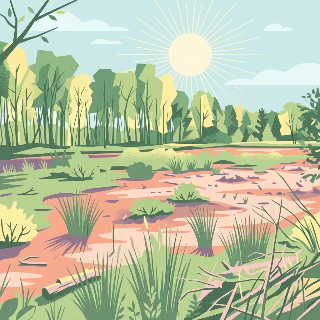
A flat-style digital illustration depicting a sunlit woodland scene with trees in the background and a grassy marsh area in the foreground under a pale blue sky.

Krosewicker Grenzwald

Nature reserve

Park overview

Structured park overview, official facts, and landscape profile for Krosewicker Grenzwald

Krosewicker Grenzwald park facts, protected area profile, and essential visitor context

Review the core facts for Krosewicker Grenzwald, including designation, size, terrain, visitor scale, habitats, and operating context in one park-focused overview.

About Krosewicker Grenzwald

Krosewicker Grenzwald is one of the smaller protected natural areas in the western Münsterland, yet it plays a meaningful role within the regional network of nature reserves administered by Kreis Borken. Covering about 7 hectares, the reserve is essentially a patch of forest standing in contrast to the surrounding agricultural mosaic that dominates the landscape around Vreden. Its name reflects its location: "Grenzwald" literally means "border forest," referring to the fact that the woodland sits directly along the international boundary between Germany and the Netherlands.

The reserve's ecological structure is shaped by birch trees (Betula) and pipegrass (Molinia caerulea), the latter being a graminoid typically associated with damp, nutrient-poor conditions. This combination suggests an underlying moist substrate and helps explain why a small waterbody was added in the mid-1980s to enhance habitat conditions. The artificial pond became a focal element of the reserve, introducing an aquatic component into an otherwise predominantly terrestrial woodland mosaic.

Administratively and ecologically, Krosewicker Grenzwald is treated as part of a larger, transboundary protected complex. It is listed alongside the Witte Venn on the Dutch side within the Natura 2000 network, indicating that conservation planners view the border forest not as an isolated patch but as one element of a broader, cross-border ecological system. Its IUCN Category IV designation reflects its function as a Habitat/Species Management Area, where targeted management helps maintain specific habitat features rather than allowing purely natural processes.

The reserve also carries a quiet human and recreational identity. A prehistoric burial mound found in the woodland ties the site to the deeper prehistoric landscape of the Münsterland, where such tumuli are widespread. A marked border hiking trail and several cycling routes, including the NRW cycling node network and the themed Flamingoroute of the Radregion Münsterland, use or pass through the area, making it a point of contact between nature conservation, cultural heritage, and cross-border recreation.

Quick facts and research context for Krosewicker Grenzwald

Krosewicker Grenzwald is a nature reserve (Naturschutzgebiet) of about 7.39 hectares located in the municipality of Vreden, Kreis Borken, North Rhine-Westphalia, Germany. It lies directly on the Dutch-German border, northwest of Vreden and close to the village of Ellewick-Crosewick, within the broader Münsterland region. The site was legally designated as a protected area in 1985 and is administered by Kreis Borken.

The reserve carries the official identifier BOR-046 in North Rhine-Westphalia's protected-area register, has a World Database on Protected Areas entry (WDPA 164264), and is integrated into the Natura 2000 ecological network under the designation DE-3807-302, also referred to as Witte Venn, Krosewicker Grenzwald. Its IUCN management category is IV, classifying it as a Habitat/Species Management Area. Vegetation is dominated by birch woodland with pipegrass (Molinia), and a small artificial pond lies at its center.

Protection and recognition

Examine official designation records and management frameworks for Krosewicker Grenzwald.

Krosewicker Grenzwald Protection Status and Designated Area Recognition

Krosewicker Grenzwald conservation parameters and registered protection status are compiled through verified international databases. Official designation metrics provide clear reference points for evaluating the protected landscape framework.

Protection details

WDPA ID
164264
Park context

Deeper park guide and search-rich context for Krosewicker Grenzwald

Krosewicker Grenzwald history, landscape, wildlife, and travel context

Explore Krosewicker Grenzwald through its history, landscape character, ecosystems, wildlife, conservation priorities, cultural context, and seasonal travel timing in a structured park guide built for atlas discovery and search intent.

Why Krosewicker Grenzwald stands out

Krosewicker Grenzwald is best known as a compact woodland refuge set right on the German-Dutch border, surrounded by open farmland that makes the small forest highly visible in the landscape. It is notable for its birch and pipegrass (Molinia) vegetation, a combination that gives the reserve a distinctive character compared to typical Münsterland agricultural habitat. The site is also recognized for being fully integrated into cross-border conservation frameworks, forming part of the Natura 2000 area Witte Venn, Krosewicker Grenzwald that continues across the international boundary into the Netherlands. Its placement, directly on the state border, gives the reserve a symbolic meaning as a piece of connected, transnational habitat protection.
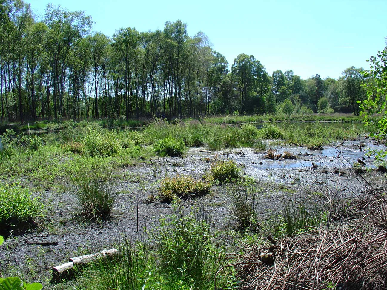
A marshy area with dark mud, patchy water, and green marsh plants, surrounded by a dense green forest under a clear sky.
A marshy wetland area within the Krosewicker Grenzwald nature reserve.

Krosewicker Grenzwald history and protected-area timeline

The area now known as Krosewicker Grenzwald was formally established as a nature reserve (Naturschutzgebiet) in 1985, during a period when Germany significantly expanded its network of small, targeted protected-area designations. The mid-1980s designation coincided with the creation of the small artificial waterbody at the center of the site, suggesting that the reserve was conceived not just to protect existing woodland but also to actively shape habitat conditions.

Its integration into the Natura 2000 network came later, as part of the European Union's expanded ecological framework for habitat and species protection. Within that framework, Krosewicker Grenzwald is treated together with the adjacent Dutch Witte Venn area under the shared Natura 2000 site DE-3807-302, known as Witte Venn, Krosewicker Grenzwald. This transboundary recognition underlines how the reserve's conservation significance extends beyond the German side of the border.

A further layer of historical context comes from the presence of a prehistoric burial mound (Hügelgrab) within the woodland. Such tumuli are characteristic of the broader Münsterland archaeological landscape and indicate that this stretch of border forest has been used and recognized by human communities for a very long time, long before its modern protected-area designation.

Krosewicker Grenzwald landscape and geographic character

The landscape of Krosewicker Grenzwald is shaped by contrast rather than scale. The reserve itself is a small, compact woodland patch, while the surrounding territory consists of open agricultural fields typical of the western Münsterland. This juxtaposition gives the border forest a pronounced visual and ecological presence within an otherwise cultivated matrix.

The terrain is low and gentle, reflecting the broader setting of the region near Vreden, where the surface consists of relatively flat, sandy and loamy substrates shaped by glacial and periglacial processes common across northern Westphalia. Within the reserve, the most prominent artificial landscape feature is a small waterbody at the center, constructed in the mid-1980s to introduce standing-water habitat into the otherwise dry woodland setting.

The defining linear feature of the area is the international border between Germany and the Netherlands, which essentially traces through or along the forest. This boundary is not just an administrative line but a recurring physical motif for the site: hiking and cycling routes run along it, and the reserve's identity as a "Grenzwald" draws directly from its position astride this frontier.

Krosewicker Grenzwald ecosystems, habitats, and plant life

Ecologically, Krosewicker Grenzwald represents a small but characteristic example of a moist birch woodland with a strong pipegrass (Molinia) understory. Such birch-Molinia communities are relatively unusual in intensively used agricultural landscapes like the western Münsterland, which makes this compact site disproportionately important for local habitat diversity.

The presence of pipegrass suggests damp, relatively nutrient-poor soil conditions and a recurring wetland influence within the woodland. The establishment of a small central waterbody reinforces this wetland character, adding open water and transitional marshy edges to a habitat that would otherwise be dominated by closed-canopy birch forest. Together, these features create a structural mosaic of woodland, wet grassland components, and aquatic habitat within a very small footprint.

Because the reserve is embedded directly into a Natura 2000 site that continues across the Dutch border into the Witte Venn, its ecological value is best understood as part of a larger transboundary habitat complex. Management efforts in the area focus on maintaining these specific habitat structures; the reserve's IUCN Category IV designation reflects this targeted, management-oriented approach.

Krosewicker Grenzwald wildlife and species highlights

The available source material does not provide detailed accounts of specific fauna at Krosewicker Grenzwald. The habitat composition of birch woodland, pipegrass-dominated ground vegetation, and a central pond, however, points toward a mix of woodland-edge and wetland-associated species typical of small forest patches in western Münsterland.

Features such as the small artificial waterbody and the pipegrass stands offer habitat elements that, in similar regional reserves, support amphibian life, wetland invertebrates, and small woodland bird communities, while the birch canopy provides nesting opportunities for typical lowland forest birds. Detailed wildlife data is not available in the supplied source, so this section should be treated as indicative rather than comprehensive.

Krosewicker Grenzwald conservation status and protection priorities

Krosewicker Grenzwald is a formally designated nature reserve under North Rhine-Westphalian nature protection law, classified as IUCN Category IV, a Habitat/Species Management Area. Its designation in 1985 marked the start of active, targeted conservation management for this small but ecologically distinctive woodland patch.

A key part of the reserve's conservation significance lies in its integration into the Natura 2000 network, where it is recognized under the designation "Witte Venn, Krosewicker Grenzwald" (DE-3807-302). This status places the site within the European Union's framework for protecting habitats and species of conservation interest and links it functionally with the Dutch Witte Venn area across the border.

The site's broader conservation value stems from what it represents in the regional landscape: a small, structurally diverse woodland-wetland complex surrounded by intensive agriculture. By preserving birch woodland, Molinia-rich ground vegetation, and a small standing-water body, Krosewicker Grenzwald maintains habitat diversity in a region where such structural richness has otherwise been greatly reduced. Protection is administered at the district (Kreis) level by Kreis Borken.

Krosewicker Grenzwald cultural meaning and human context

The reserve sits in a borderland that has long been a zone of contact between German and Dutch communities, and the site's modern recreational infrastructure reflects that cross-border character. A marked hiking trail runs along the international boundary, and regional cycling networks, including the Flamingoroute of the Radregion Münsterland and a cross-border cycle route known as "8-er de grens," pass through or near the area. Cycle node 20 even lies right on the Dutch-German frontier, directly connecting the reserve to the Dutch node-based cycling network.

A more distant cultural layer is preserved within the woodland itself in the form of a Hügelgrab, a prehistoric burial mound. Such tumuli are found across the wider Münsterland and reflect prehistoric land use and ritual practices in this region. While small and easily overlooked, the mound adds an archaeological dimension to the otherwise ecological profile of the reserve, linking the site's modern conservation purpose to much older human interactions with the same stretch of border landscape.

Top sights and standout views in Krosewicker Grenzwald

Krosewicker Grenzwald is notable for its compactness and contrast: a roughly seven-hectare woodland reserve sitting like an island within the open farmland of the western Münsterland. Its birch and Molinia pipegrass vegetation combination gives it a habitat character that is increasingly rare in this intensively used agricultural region.

The reserve's border-forest identity is central to its appeal. Sitting directly on the Dutch-German frontier, it functions as a transboundary conservation node, jointly protected within the Natura 2000 site Witte Venn, Krosewicker Grenzwald, and crossed by hiking and cycling routes that tie it into both German and Dutch outdoor networks. The presence of a prehistoric burial mound within the woodland adds a further layer of cultural landscape value to the site.

Best time to visit Krosewicker Grenzwald

Krosewicker Grenzwald can be visited year-round as a low-key walking and cycling destination, since the site is small, accessible along marked border paths, and does not rely on specific seasonal openings. Late spring and early summer are generally the most rewarding periods for experiencing the woodland at its most visually active, when the birch canopy is fully leafed out and the Molinia pipegrass ground layer is at its strongest growth.

Autumn offers a different character, with birch foliage turning yellow and the surrounding agricultural fields producing open views across the border landscape. In winter, the leafless canopy makes the forest structure and the central pond more visible. Because the reserve is embedded in an open, flat farming landscape, weather and season affect atmosphere rather than access, and visitors can expect a quiet, contemplative experience in any season.

Monthly climate preview

Long term representative temperature and precipitation averages recorded at coordinate sample points

Krosewicker Grenzwald Climate Normals and Monthly Weather Patterns

Krosewicker Grenzwald displays measured monthly temperature variations alongside steady precipitation rates spanning twelve recorded climatology intervals. Reviewing the complete meteorological profile provides deeper analytical context for long term environmental conditions across the terrain.
Annual mean10 °C
2 °C18 °C
Jan
Feb
Mar
Apr
May13°
Jun16°
Jul18°
Aug18°
Sep15°
Oct10°
Nov
Dec
Warmest month
July

18.4 °C

Coolest month
January

1.6 °C

Wettest month
December

2.5 mm/day

Driest month
April

1.5 mm/day

Park location guide

Geography guide, regional context, and park location map for Krosewicker Grenzwald

Krosewicker Grenzwald park geography, regions, and map view in Germany

Understand where Krosewicker Grenzwald sits in Germany through a broader geographic reading of the surrounding landscape, nearby location context, and its mapped position within the national park landscape.

How Krosewicker Grenzwald fits into Germany

Germany is a federal republic in Western and Central Europe with a population of over 83 million across sixteen constituent states. It is Europe's largest economy by nominal GDP and a major global exporter and importer. The capital is Berlin, and the country borders Denmark, Poland, Czech Republic, Austria, Switzerland, France, Luxembourg, Belgium, and the Netherlands.

Wider geography shaping Krosewicker Grenzwald in Germany

Germany is located in Western and Central Europe, spanning 357,022 km². It borders Denmark to the north, Poland and the Czech Republic to the east, Austria and Switzerland to the south, and France, Luxembourg, Belgium, and the Netherlands to the west. The country has coastlines on the Baltic Sea and North Sea to the north, with the Alps located in the southern region.

Map view of Krosewicker Grenzwald

Use this park location map to pinpoint Krosewicker Grenzwald in Germany, understand its exact geographic position, and read its mapped placement within the surrounding landscape more clearly.

Pigeon | © OpenStreetMap contributors

Location context for Krosewicker Grenzwald

Nordrhein-Westfalen

Visual reference for birch woodland habitats and border conservation scenery

Krosewicker Grenzwald Photos and Landscape Scenery Exploration

Visual documentation captures the striking contrast of a compact woodland island set against the open agricultural fields of the western Münsterland border region. Photographic archives reveal the distinct birch stands and protected wetland habitats that define the character of this international transboundary reserve.

A marshy area with dark mud, patchy water, and green marsh plants, surrounded by a dense green forest under a clear sky.

Park atlas

Compare nearby nature reserves and cross-border conservation areas in the region

Explore Parks Near Krosewicker Grenzwald and Surrounding Protected Landscapes

Discover other protected areas and woodland reserves situated near Krosewicker Grenzwald in the border region. Expanding the geographic comparison reveals broader ecological patterns across the surrounding agricultural landscape.
Nature reserveNordrhein-Westfalen
About 0.3 km away#1 closest

Southeast

Moore und Heiden des westlichen Münsterlandes Nature Reserve: Regional Protected Landscapes

Bog and heathland geography in western North Rhine-Westphalia

The Moore und Heiden des westlichen Münsterlandes nature reserve is a vital complex of peatlands, wet meadows, and bog woodlands situated in western Germany. This site offers a unique geographic study of restored hydrology and open moorland, providing critical habitats for rare waders and the northernmost breeding colony of Greater Flamingo in Europe.

Area
23 km²
Established
1983
Watercolor painting of a low-lying, marshy landscape with soft green meadows and sparse vegetation against a white background.
Nature reserveNorth Rhine-Westphalia
About 9.4 km away#2 closest

Northeast

Lüntener Fischteiche Nature Reserve: Geography and Protected Area Landscape Map

A preserved mosaic of Münsterland heath and bog ecosystems

Lüntener Fischteiche is a specialized nature reserve in North Rhine-Westphalia, documented here for its distinct heath-pond character and ecological significance within the German-Dutch borderland. The site preserves remnants of bog and heath vegetation embedded within a pine forest matrix, serving as an important hub for regional waterbird populations and transboundary habitat connectivity.

Area
1.011 km²
Established
1959
IUCN
IV
Nature reserveGelderland
About 10 km away#3 closest

Southwest

Korenburgerveen Nature Reserve: Geography and Protected Peatland Landscapes in Gelderland

A vital wetland and raised bog complex in the Dutch Achterhoek

Korenburgerveen represents a key protected peatland basin in Gelderland, featuring a diverse mosaic of marsh woodland, blue grassland, and active raised bog. Use this geographic entry to analyze the reserve's position within the wider Nationaal Landschap Winterswijk and observe the hydrological restoration of its rare wetland terrain.

Relief
Lowland
Climate
Temperate
Scope
Terrestrial
Water
Major water bodies
Nature reserveOverijssel
About 12 km away#4 closest

Northeast

Witte Veen Nature Reserve: Mapped Protected Landscapes and Bog Terrain in Overijssel, NL

Regional peatland geography and cross-border conservation status

Witte Veen is a protected nature reserve in eastern Overijssel, known for its distinct raised bog habitat and active restoration efforts. This site forms an essential link in the Dutch-German border chain, offering a unique look at fragmented wetland terrain, bog pools, and heathland ecosystems managed for ecological recovery.

Area
2.9 km²
Established
2013
Relief
Lowland
Climate
Temperate
Nature reserveGelderland
About 17 km away#5 closest

West

Stelkampsveld Protected Nature Reserve and Restored Achterhoek Kampenlandschap in Gelderland

Tracing the mapped boundaries of historic heath and fen ecosystems

Stelkampsveld acts as an ecologically distinctive protected area in the eastern Netherlands. Covering 102 hectares, the terrain showcases a recovered mosaic of hedgerows, small enclosed fields, and re-established wetlands. The site is recognized for its botanical diversity, including rare orchid and moss species within the broader Natura 2000 network of Gelderland.

Area
1.02 km²
Established
2013
Relief
Lowland
Climate
Temperate
Nature reserveNetherlands
About 18 km away#6 closest

South

Wooldse Veen Nature Reserve: Mapped Geography and Protected Bog Landscapes in the Netherlands

A transboundary peatland system in Gelderland.

Wooldse Veen preserves a rare fragment of raised bog and peatland habitat in the Dutch-German borderlands. The reserve features restored bog pools, historic smugglers paths, and a mosaic of heathland and birch woodland that reflects the regional geography of the Winterswijk National Landscape.

Area
1.5 km²
Established
1949
Relief
Lowland
Climate
Temperate
Nature reserveOverijssel
About 24 km away#7 closest

North

Landgoed Lonnekermeer Nature Reserve: Geographic Landscape and Protected Area Mapping

Twente region, Overijssel province, Netherlands

Landgoed Lonnekermeer is a 98 hectare nature reserve in Overijssel characterized by a designed early twentieth century landscape, lakes originating from historic sand quarries, and expansive wet heath. Explore the protected boundaries of this estate as it serves as a living model for habitat restoration, showcasing the successful recovery of local fens, brooks, and biodiversity-rich hay meadows within the eastern Netherlands.

Area
1.05 km²
Established
1902
Relief
Lowland
Climate
Temperate
Watercolor painting of a wide landscape with clusters of trees, green meadows, and soft, distant hills under a pastel sky.
Nature reserveOverijssel
About 29 km away#8 closest

Northwest

Borkeld Nature Reserve: Overijssel Protected Landscape and Geographic Atlas

Heathland, juniper shrubland, and prehistoric archaeological terrain

Discover the geographic character of the Borkeld nature reserve in Overijssel. This protected area stands out for its large juniper shrubland, unique clay pit habitats, and deep archaeological history preserved within a gently rolling landscape of forest and heath.

Area
6 km²
Relief
Upland
Climate
Temperate
Access
Easy access

Common questions about visiting, size, designation, and location context for Krosewicker Grenzwald

Krosewicker Grenzwald FAQs for park facts, access, geography, and protected area context

Find quick answers about Krosewicker Grenzwald, including protected-area facts, park geography, trail and visitor context, and how the park fits into its surrounding country and regional landscape.
MoriAtlas Explorer

Continue Your Protected Areas Search Across the Global Atlas

Deepen your exploration by continuing the structured search for national parks and protected areas worldwide. Utilize the comprehensive filtering capabilities to compare different conservation landscapes and refine your understanding of global park geography. Discover more about the distribution and characteristics of protected natural areas.

Global natural geography