

Mori Atlas logo
Nature reserveKulunata State Nature Reserve

Analyzing the protected juniper forests and clustered terrain of the Fergana Range foothills

Kulunata State Nature Reserve: A Detailed Map and Geographic Atlas of Protected Mountain Landscapes

Kulunata State Nature Reserve represents a critical protected refuge within the mountainous terrain of the Osh Region in southern Kyrgyzstan. This atlas provides a detailed look at its split-cluster geography, encompassing the primary Kulunata area and the secondary Tonzoo section. By focusing on the preservation of juniper-conifer woodlands and their surrounding montane habitats, the reserve serves as a vital element in the regional conservation landscape of the Fergana Range.

juniper forestsmountain reservesstrict nature reserveIUCN Category Iaconifer woodlandssouthern Kyrgyzstan
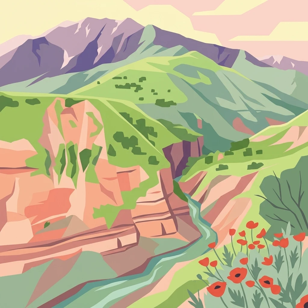
A stylized digital illustration of a mountainous valley with red cliffs, a flowing river, and bright red poppies in the foreground.

Kulunata State Nature Reserve

Nature reserve

Park overview

Structured park overview, official facts, and landscape profile for Kulunata State Nature Reserve

Kulunata State Nature Reserve park facts, protected area profile, and essential visitor context

Review the core facts for Kulunata State Nature Reserve, including designation, size, terrain, visitor scale, habitats, and operating context in one park-focused overview.

About Kulunata State Nature Reserve

The Kulunata State Nature Reserve is one of Kyrgyzstan's strictly protected natural reserves, established by government decree in August 2004. Its creation reflected a broader national effort to preserve the country's natural heritage in the face of growing pressures on land use and biological resources in mountainous regions.

Located within the Kara-Kuldzha district of Osh Region, the reserve sits among the southern foothill and mountain landscapes of Kyrgyzstan. Its territory is split into two separate clusters. The main Kulunata section covers a substantial area, while the smaller Tonzoo section adds further protected landscape to the reserve's footprint. Together, these units form a network of juniper-dominated mountain habitat that supports the region's ecological identity.

The reserve's overarching purpose is the conservation of biodiversity and the genetic resources of juniper-conifer forests, which have long been characteristic of Central Asia's mid-elevation mountain belts. By placing these forests and their associated wildlife under formal protection, the reserve helps safeguard ecological processes, watershed functions, and the natural legacy of the Osh Region for future generations.

Quick facts and research context for Kulunata State Nature Reserve

Kulunata is a strictly protected nature reserve classified under IUCN Category Ia (Strict Nature Reserve) and is part of Kyrgyzstan's system of especially protected natural areas. Its total area is approximately 245 square kilometers, divided into two distinct units, with Kulunata covering about 185 square kilometers and Tonzoo covering about 60 square kilometers.

Protection and recognition

Terrestrial protected area classification and documentation records.

Kulunata State Nature Reserve Protection Status and Governance

Kulunata State Nature Reserve maintains a defined terrestrial protection scope with structured administrative records. Official conservation status and designation details provide clear reference data for the protected landscape.

Protection details

Protection scope
Terrestrial
Transboundary protection
No
Park context

Deeper park guide and search-rich context for Kulunata State Nature Reserve

Kulunata State Nature Reserve history, landscape, wildlife, and travel context

Explore Kulunata State Nature Reserve through its history, landscape character, ecosystems, wildlife, conservation priorities, cultural context, and seasonal travel timing in a structured park guide built for atlas discovery and search intent.

Why Kulunata State Nature Reserve stands out

Kulunata is known primarily for protecting extensive juniper-conifer forests and the biodiversity associated with these mountain woodlands. Its purpose centers on safeguarding the genetic resources of these trees and the wider plant and animal communities that depend on this montane forest environment.
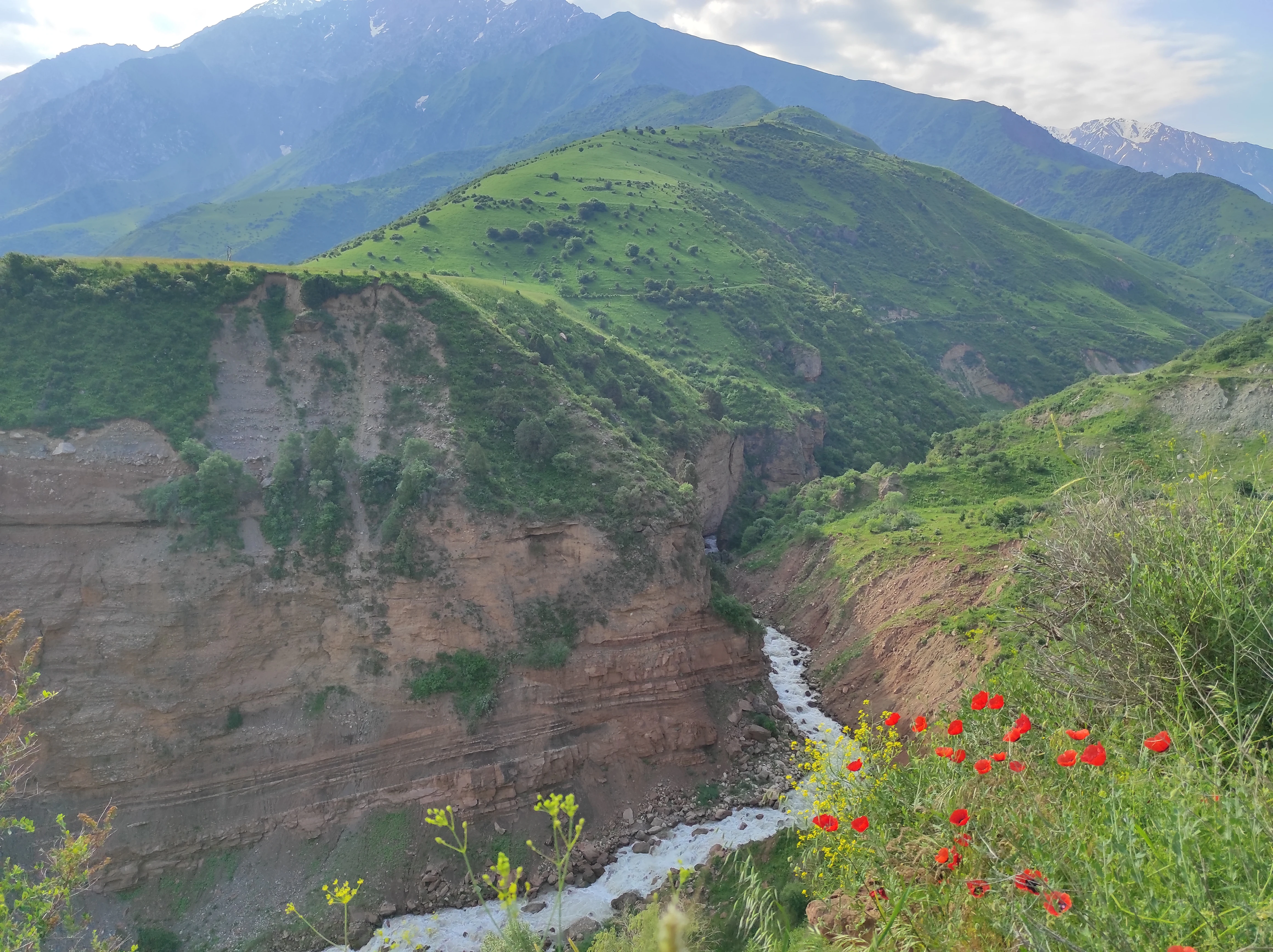
A deep river canyon with rugged, layered brown rock walls, green grass-covered mountains in the background, and red flowers in the foreground.
A view of the river gorge and surrounding green slopes within Kulun-Ata State Nature Reserve.

Kulunata State Nature Reserve history and protected-area timeline

Kulunata State Nature Reserve was established in 2004 through a resolution of the Government of the Kyrgyz Republic dated 11 August 2004, numbered 598. The formation of the reserve was driven by the need to preserve biodiversity and the rich gene pool of the region's juniper-conifer forests, as well as its broader flora and fauna.

Beyond biodiversity conservation, the reserve was also intended to strengthen the protection of biological resources and to extend the national network of especially protected natural areas. Its establishment represented a step in expanding the formal protection of southern Kyrgyzstan's mountain ecosystems.

Kulunata State Nature Reserve landscape and geographic character

The reserve lies in the mountainous terrain of southern Kyrgyzstan, where elevation changes create the layered habitats typical of the Fergana Range foothills. Slope, aspect, and altitude influence forest cover, exposing variations between dense juniper stands, more open woodland patches, and intervening valleys.

The protection of this landscape is central to the reserve's value, since juniper-conifer forests of this kind are characteristic of Central Asian mountain belts and are closely tied to soil stability, watershed health, and regional climate patterns.

Kulunata State Nature Reserve ecosystems, habitats, and plant life

At its ecological core, the reserve protects juniper-conifer forests and their associated vegetation communities. These forests represent an important montane woodland type in Central Asia, providing habitat structure and seasonal resources that support a wide range of plant and animal species.

The conservation of this forest environment extends to the broader botanical and faunal richness it shelters, forming a representative sample of southern Kyrgyzstan's natural biological heritage.

Kulunata State Nature Reserve conservation status and protection priorities

Kulunata's central conservation role is the preservation of juniper-conifer forest genetic resources, alongside the broader plant and animal communities typical of these mountain woodlands. By placing the area under IUCN Category Ia strict nature reserve status, the Kyrgyz government has committed to a high level of protection that limits extractive and disruptive activities.

The reserve's two-cluster design expands the geographic spread of protected habitat, helping to maintain ecological processes and biological resources across the region. Its establishment was also part of a wider national effort to strengthen Kyrgyzstan's protected-area network.

Top sights and standout views in Kulunata State Nature Reserve

Kulunata distinguishes itself through its strict IUCN Ia protection status, its focus on juniper-conifer forests, and its two-cluster layout comprising the main Kulunata section and the smaller Tonzoo section. Together these features embody the reserve's role as a dedicated refuge for southern Kyrgyzstan's mountain biodiversity.
Monthly climate preview

Long-term monthly temperature and precipitation patterns sampled at representative elevations

Kulunata State Nature Reserve Climate Normals and Annual Temperature Rhythm

Historical climate data for Kulunata State Nature Reserve records recorded average temperatures ranging from severe winter lows to mild summer highs alongside steady monthly precipitation rates. Detailed twelve-month climatology records provide complete temperature bounds and precipitation metrics for further geographic study.
Annual mean-1 °C
-13 °C11 °C
Jan-13°
Feb-11°
Mar-6°
Apr
May
Jun
Jul11°
Aug11°
Sep
Oct
Nov-6°
Dec-11°
Warmest month
July

11.2 °C

Coolest month
January

-13.2 °C

Wettest month
May

1 mm/day

Driest month
September

0.3 mm/day

Park location guide

Geography guide, regional context, and park location map for Kulunata State Nature Reserve

Kulunata State Nature Reserve park geography, regions, and map view in Kyrgyzstan

Understand where Kulunata State Nature Reserve sits in Kyrgyzstan through a broader geographic reading of the surrounding landscape, nearby location context, and its mapped position within the national park landscape.

How Kulunata State Nature Reserve fits into Kyrgyzstan

Kyrgyzstan is a landlocked Central Asian country located in the Tian Shan and Pamir mountain ranges. With a population of approximately 7.4 million, it is bordered by Kazakhstan to the north, Uzbekistan to the west, Tajikistan to the south, and China to the east. The capital and largest city is Bishkek. Ethnic Kyrgyz make up the majority of the population, with significant Uzbek and Russian minorities. The country gained independence from the Soviet Union in 1991.

Wider geography shaping Kulunata State Nature Reserve in Kyrgyzstan

Kyrgyzstan is located in Central Asia, situated in the Tian Shan and Pamir mountain ranges. It is landlocked, bordered by Kazakhstan to the north, Uzbekistan to the west, Tajikistan to the south, and China to the east and southeast. The capital Bishkek lies on the northern border with Kazakhstan.

Map view of Kulunata State Nature Reserve

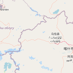
Use this park location map to pinpoint Kulunata State Nature Reserve in Kyrgyzstan, understand its exact geographic position, and read its mapped placement within the surrounding landscape more clearly.

Pigeon | © OpenStreetMap contributors

Location context for Kulunata State Nature Reserve

Osh Region

Explore detailed imagery showcasing the rugged mountain terrain and juniper forests of southern Kyrgyzstan.

Visualizing Kulunata State Nature Reserve: Landscapes, Scenery, and Protected Habitats

Visual documentation captures the steep mountain terrain, dense juniper woodlands, and varied ecological zones that define Kulunata State Nature Reserve. Examining these field photographs helps researchers and observers understand the physical composition and protected character of the Fergana Range foothills.

A deep river canyon with rugged, layered brown rock walls, green grass-covered mountains in the background, and red flowers in the foreground.

Park atlas

Compare regional mountain reserves and connected protected landscapes across southern Kyrgyzstan

Explore Parks Near Kulunata State Nature Reserve and Surrounding Protected Areas

Continue geographic discovery by comparing Kulunata State Nature Reserve with other protected natural areas across the surrounding mountain terrain. Broadening the protected area comparison reveals regional ecological connections and wider patterns within Central Asian juniper forest ecosystems.
State or regional parkKyrgyzstan
About 40 km away#1 closest

Northwest

Kara-Shoro State Nature Park: Protected Landscape and Geographic Atlas Context in Kyrgyzstan

Explore its mapped boundaries and regional protected area identity.

Kara-Shoro State Nature Park is a vital protected area situated within the mountainous geography of Kyrgyzstan. This park detail page facilitates a structured exploration of its specific landscape character, mapped terrain, and its significance as a state or regional park within the Central Asian atlas. Understand the park's protected nature and its role in the country's conservation landscape through detailed geographic context.

IUCN
II
Scope
Terrestrial
State or regional parkKyrgyzstan
About 87 km away#2 closest

Northwest

Saymaluu-Tash State Nature Park: Mapped Protected Landscape in Kyrgyzstan

Explore its geographic setting and natural terrain.

Saymaluu-Tash State Nature Park is a designated protected area offering crucial insights into Kyrgyzstan's natural geography. This page focuses on the park's mapped boundaries and its place within the regional landscape context of Central Asia. Utilize this resource to understand the specific geographic features and protected status of this significant nature park, contributing to a comprehensive atlas of protected lands.

IUCN
II
Scope
Terrestrial
State or regional parkKyrgyzstan
About 121 km away#3 closest

Northwest

Kan-Achuu Nature Park: Kyrgyzstan's State or Regional Protected Landscape

Explore mapped boundaries and regional geography in Central Asia.

Kan-Achuu Nature Park, a designated state or regional park in Kyrgyzstan, offers an opportunity for detailed geographic exploration. This protected area serves as a focal point for understanding the mapped landscape and natural terrain of Central Asia. Engage with its specific protected boundaries and its placement within the country's diverse geography, ideal for atlas-style discovery.

IUCN
II
State or regional parkKyrgyzstan
About 169 km away#4 closest

Northeast

Salkyn-Tor State Nature Park: Kyrgyzstan's Mapped Protected Landscape Identity

Explore its natural terrain and regional geographic context.

Salkyn-Tor State Nature Park stands as a key protected area, offering a distinct geographic identity within Kyrgyzstan's mountainous geography. This park serves as a focal point for understanding mapped protected lands in Central Asia. Delve into the park's regional context to appreciate its contribution to the natural landscape. MoriAtlas provides detailed geographic insights, enabling a structured exploration of Salkyn-Tor State Nature Park's protected boundaries and its place within the atlas of natural terrain.

IUCN
II
Scope
Terrestrial
State or regional parkKyrgyzstan
About 173 km away#5 closest

West

Kyrgyz-Ata State Nature Park: Protected Landscape Atlas and Regional Geography

Discover the mapped terrain and protected area identity within Kyrgyzstan.

Delve into the protected landscape of Kyrgyz-Ata State Nature Park, a state or regional park located in Kyrgyzstan. This page highlights its geographic significance, mapped park boundaries, and its role within the country's natural terrain. Gain a deeper understanding of its protected area status and its context within the broader Central Asian geography.

A soft watercolor painting of a mountain valley with green rolling hills and a winding stream, rendered in light pastel tones on a white background.
Nature reserveNaryn Region
About 198 km away#6 closest

Northeast

Naryn Nature Reserve: Mountain Conservation and Geological Landscapes in Naryn Region

Strictly protected mountain terrain and river basin geography

Naryn Nature Reserve encompasses a vast protected area in the Naryn Region of Kyrgyzstan, showcasing the diverse ecological and geological character of the inner Tien Shan. The reserve functions as a vital anchor for regional biodiversity, spanning high plateaus, river valleys, and isolated mountain ridges that remain largely untouched by development.

Area
1,080.23 km²
Established
1983
IUCN
Ia
Visitors
80 annual
Nature reserveJalal-Abad Region
About 210 km away#7 closest

Northwest

Ryazan-Say Botanical Zakaznik: Protected Botanical Landscapes in the Jalal-Abad Region

Nature reserve geography and relict plant conservation in Kyrgyzstan

Ryazan-Say Botanical Zakaznik is a concentrated nature reserve dedicated to the survival of rare, relict subtropical flora. The protected area encompasses a narrow, steep-walled gorge system that funnels moisture to sustain species like wild fig and pomegranate. This site provides a critical reference for studying how sheltered mountain canyons maintain ecological diversity within the wider landscape of western Kyrgyzstan.

Area
1.1 km²
Established
1987
IUCN
IV
Relief
Upland
State or regional parkKyrgyzstan
About 220 km away#8 closest

North

Ala-Archa Nature Park: Kyrgyzstan's State or Regional Protected Landscape Identity

Explore its mapped terrain and geographic context.

Investigate Ala-Archa Nature Park, a distinct protected area situated in the mountainous geography of Kyrgyzstan. This state or regional park offers valuable insight into the mapped natural landscapes and regional context of Central Asia. Understanding its boundaries and geographic character provides a foundation for deeper atlas-based exploration of Kyrgyzstan's protected lands.

Scope
Terrestrial

Common questions about visiting, size, designation, and location context for Kulunata State Nature Reserve

Kulunata State Nature Reserve FAQs for park facts, access, geography, and protected area context

Find quick answers about Kulunata State Nature Reserve, including protected-area facts, park geography, trail and visitor context, and how the park fits into its surrounding country and regional landscape.
MoriAtlas Explorer

Continue Your Protected Areas Search Across the Global Atlas

Deepen your exploration by continuing the structured search for national parks and protected areas worldwide. Utilize the comprehensive filtering capabilities to compare different conservation landscapes and refine your understanding of global park geography. Discover more about the distribution and characteristics of protected natural areas.

Global natural geography