Mori Atlas logo
Marine protected areaKuop

Understanding the mapped reef boundaries and protected aquatic landscapes of this uninhabited Pacific atoll

Kuop Marine Protected Area: An Atlas of Coral Reefs and Remote Island Geography in Chuuk State

Kuop represents a significant conservation landmark as the largest marine protected area within the Federated States of Micronesia. Located just south of the Chuuk Lagoon, this uninhabited atoll consists of a 21.5 kilometer coral ring encompassing an undisturbed lagoon and reef system. Explore the precise geographic structure of these protected waters, which serve as a critical ecological refuge in the western Pacific.

atolluninhabited islandmarine protected areacoral reefPacific atollChuuk

Kuop

Marine protected area

Park overview

Structured park overview, official facts, and landscape profile for Kuop

Kuop park facts, protected area profile, and essential visitor context

Review the core facts for Kuop, including designation, size, terrain, visitor scale, habitats, and operating context in one park-focused overview.

About Kuop

Kuop is an uninhabited coral atoll in Chuuk State, in the western Pacific portion of the Federated States of Micronesia. Although it is tiny in land terms, with only 0.5 square kilometers of dry ground scattered across two islands and two islets, its surrounding reef and lagoon system is large enough that the area is officially recognized as the largest marine protected area in the country. This combination of barren land and expansive protected sea gives the atoll a unique profile compared with more developed Micronesian islands.

The atoll lies only about 3 kilometers south of the southernmost point of Chuuk Lagoon, one of the most celebrated lagoon systems in the Pacific and the centerpiece of Chuuk State. Despite its proximity to inhabited islands, Kuop itself has no permanent population, and administratively it falls within Uman municipality. This administrative connection hints at its place in Chuuk's broader island geography, even though ecologically it remains distinct due to the absence of human settlement and development.

Kuop's defining importance today is ecological. Because it has never been permanently inhabited and is described as a desert island, its reef and lagoon environment remain comparatively undisturbed. In a Pacific region where many reefs face pressure from fishing, coastal development, and upstream impacts from populated islands, Kuop stands as a rare example of a near-pristine atoll ecosystem. This makes it valuable both as a natural reference site for Chuuk's marine biodiversity and as a quiet but meaningful component of Micronesia's protected-area network.

Quick facts and research context for Kuop

Kuop is an uninhabited coral atoll in Chuuk State, Federated States of Micronesia. It is administratively part of Uman municipality and lies about 3 kilometers south of the southernmost point of Chuuk Lagoon. The atoll is roughly 21.5 kilometers long and up to 8 kilometers wide, with a combined land area of only 0.5 square kilometers spread across two small islands and two islets. It is officially classified as the largest marine protected area in the Federated States of Micronesia.

Protection and recognition

Documented conservation scope, management frameworks, and international recognition records

Kuop Protection Status and Marine Protected Area Designations

Marine protection parameters define the baseline conservation framework and administrative scope established for Kuop. Public records track official designation attributes, boundary contexts, and institutional recognition histories for this protected marine territory.

Protection details

Protection scope
Marine
Transboundary protection
No
Park context

Deeper park guide and search-rich context for Kuop

Kuop history, landscape, wildlife, and travel context

Explore Kuop through its history, landscape character, ecosystems, wildlife, conservation priorities, cultural context, and seasonal travel timing in a structured park guide built for atlas discovery and search intent.

Why Kuop stands out

Kuop is best known for being the largest officially designated marine protected area in the Federated States of Micronesia, despite having almost no permanent land area. Its remote, uninhabited status and its position just south of one of the most famous lagoon systems in the Pacific give it a distinctive dual identity: a near-barren coral atoll above water and a substantial conserved marine zone below. It is also notable among Pacific atolls for its clean, undisturbed reef environment.

Kuop history and protected-area timeline

Kuop is believed to have first been recorded by the Spanish navigator Alonso de Arellano in 1565, placing it among the early European-known atolls of the western Pacific. Like many islands in Chuuk State, it would have been part of long-established Micronesian maritime and cultural networks before that point, though documented history in the European sense begins with this Spanish contact.

During World War II, Kuop became an incidental site of military history when, on February 4, 1944, as part of Operation Hailstone at Chuuk Lagoon, the Japanese destroyer Tachikaze ran aground on the atoll's reef and later sank. The broader Operation Hailstone was a major American naval assault on the Japanese fleet anchored at Truk, and Kuop's reef became a small but tangible part of that campaign simply because of its proximity to the lagoon.

In the modern era, Kuop's history has shifted from one of navigation and wartime hazard to one of conservation designation. As an uninhabited desert island, it has been formally recognized as the largest marine protected area in the Federated States of Micronesia, a status it continues to hold.

Kuop landscape and geographic character

Kuop is a classic low-lying coral atoll, defined more by its reef and lagoon geometry than by any dramatic land features. The atoll stretches about 21.5 kilometers along its long axis with a maximum width of around 8 kilometers, forming an elongated oval ring of reef enclosing a central lagoon. Its land area is exceedingly small in proportion to this reef structure, amounting to only about 0.5 square kilometers in total.

The visible land consists of two small islands and two islets perched on the reef. The largest of these, known both as Givry and Feneppi, lies at the northern end of the atoll. These land surfaces are typical of Micronesian atolls: narrow, low, and composed largely of coral-derived material, with vegetation shaped by salt spray, wind, and limited freshwater resources. The reef rim itself is the dominant landscape feature, marking the boundary between the open Pacific and the protected lagoon waters within.

Kuop conservation status and protection priorities

Kuop's principal significance lies in its conservation status. As an uninhabited coral atoll, it has been officially designated the largest marine protected area in the Federated States of Micronesia, a status that remains in place currently. Its protected designation reflects the value of its largely undisturbed reef and lagoon ecosystem in a region where populated islands and busy lagoons face increasing environmental pressure.

The atoll's combination of very small land area and substantial marine protected zone illustrates a conservation model in which the surrounding ocean, rather than the islands themselves, is the primary habitat of concern. This makes Kuop an important reference site for understanding what Micronesian reef ecosystems look like in the absence of sustained human settlement or industrial activity.

Top sights and standout views in Kuop

Kuop stands out as one of the few truly uninhabited atolls in Chuuk State, with no permanent population and a land area of only 0.5 square kilometers spread across two islands and two islets. It holds the formal distinction of being the largest marine protected area in the Federated States of Micronesia, giving its reefs and lagoon a protected status that contrasts with the heavily used Chuuk Lagoon just a few kilometers to the north. Its remoteness, combined with its WWII-era role as the grounding site for the Japanese destroyer Tachikaze in 1944, gives the atoll both a modern conservation identity and a small but visible place in Pacific military history.

Monthly climate preview

Examine measured monthly temperature averages and daily precipitation records for Kuop.

Kuop Climate Normals: Long Term Average Temperature and Precipitation Patterns

Representative coordinate records outline consistent annual temperature ranges alongside steady monthly precipitation totals throughout the year. Detailed monthly climate profiles provide a complete twelve month breakdown of long term meteorological measurements for Kuop.
Annual mean28 °C
28 °C28 °C
Jan28°
Feb28°
Mar28°
Apr28°
May28°
Jun28°
Jul28°
Aug28°
Sep28°
Oct28°
Nov28°
Dec28°
Warmest month
December

28.5 °C

Coolest month
July

27.9 °C

Wettest month
August

9.8 mm/day

Driest month
February

7 mm/day

Park location guide

Geography guide, regional context, and park location map for Kuop

Kuop park geography, regions, and map view in Micronesia

Understand where Kuop sits in Micronesia through a broader geographic reading of the surrounding landscape, nearby location context, and its mapped position within the national park landscape.

How Kuop fits into Micronesia

The Federated States of Micronesia (FSM) is a sovereign island nation in the Caroline Islands region of Micronesia, Oceania. Comprising four states spanning nearly 2,700 km across the western Pacific just north of the equator, the federation includes around 607 islands with a land area of approximately 702 km². The capital is Palikir on Pohnpei Island, and the largest city is Weno in Chuuk. The nation achieved independence in 1986 through a Compact of Free Association with the United States.

Wider geography shaping Kuop in Micronesia

The Federated States of Micronesia lies in the western Pacific Ocean, northeast of Indonesia and Papua New Guinea, south of Guam and the Marianas, west of Nauru and the Marshall Islands, and east of Palau and the Philippines. The four states span a longitudinal distance of almost 2,700 km just north of the equator. Each state is centered on volcanic islands with outlying atolls, situated within the Caroline Islands archipelago.

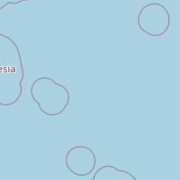
Map view of Kuop

Use this park location map to pinpoint Kuop in Micronesia, understand its exact geographic position, and read its mapped placement within the surrounding landscape more clearly.

Pigeon | © OpenStreetMap contributors

Location context for Kuop

Chuuk State
Park atlas

Compare regional protected areas and connected island ecosystems across Micronesia.

Explore Other Parks Near Kuop and Surrounding Protected Marine Landscapes

Continue exploring protected areas beyond Kuop to examine related marine reserves and remote island ecosystems across the region. Regional park comparison reveals wider conservation patterns and surrounding oceanic habitats in Micronesia.
Biosphere reservePohnpei
About 668 km away#1 closest

East

And Atoll Biosphere Reserve: A Protected Coral Atoll and Marine Landscape in Pohnpei

Geographic overview of Pohnpei's primary marine biosphere reserve

Trace the geography of And Atoll Biosphere Reserve, a distinct ring-shaped coral formation in Pohnpei, Micronesia. This profile examines the protected marine boundaries, lagoon structure, and forested island islets that sustain green and hawksbill turtle nesting grounds and diverse reef ecosystems.

Area
9.5 km²
Established
2007
Relief
Lowland
Climate
Tropical
Marine protected areaKosrae
About 1,238 km away#2 closest

East

Utwe-Walung Marine Park: A Protected Marine and Terrestrial Landscape in Kosrae

Mapping the intersection of volcanic forest and coral reef systems.

Utwe-Walung Marine Park encompasses a contiguous protected area on the island of Kosrae, featuring a dramatic transition from dense interior rainforests to sheltered mangrove inlets and vibrant nearshore coral reefs. This conservation zone is known for its high-quality habitat continuity and serves as a significant example of community-managed island ecosystems within the Federated States of Micronesia.

Established
1990
Relief
Lowland
Climate
Tropical
Scope
Mixed
Wildlife reserveMorobe Province
About 1,541 km away#3 closest

South

YUS Conservation Area: Mapping the Geographic Range of a Community-Led Wildlife Reserve

Protected tropical forest landscapes in Morobe Province, Papua New Guinea

YUS Conservation Area represents a significant shift in regional conservation, protecting a massive altitudinal gradient on the Huon Peninsula. From coastal coral reef environments to the rugged ridges of the Saruwaged Mountains, the area preserves critical montane habitats and riverine corridors. This dataset provides insight into its unique geography, spanning lowland forests to highland peaks while showcasing a model of land management driven by customary community agreements.

Area
760 km²
Established
2009
Relief
Mountain
Climate
Tropical
Marine protected areaYap
About 1,550 km away#4 closest

West

Nimpal Channel Marine Conservation Area: Geography and Protected Marine Landscapes in Yap

Community-managed coastal reefs and tidal mangrove systems

Located in Yap, the Nimpal Channel Marine Conservation Area functions as a protective node for local reef ecosystems. This 77-hectare reserve serves as a model for community-based stewardship, linking the health of mangrove-fringed shorelines with the resilience of the surrounding tidal channel habitats in the western Pacific.

Area
0.77 km²
Relief
Lowland
Climate
Tropical
Access
Access unknown
Stylized illustration of a mountain with waterfalls, river, and trees under a bright sky with clouds
Protected areaPapua New Guinea
About 1,615 km away#5 closest

Southwest

Mount Wilhelm Protected Area: Papua New Guinea's Highest Peak and Alpine Terrain

Mapped geography and protected landscape context for a key Oceania peak.

Mount Wilhelm represents a significant protected area and the highest mountain in Papua New Guinea. Situated within the Bismarck Range, its dramatic granite peak defines a unique alpine environment, transitioning from dense rainforests to high-altitude grasslands. The presence of twin glacial lakes, Piunde and Aunde, adds to its distinctiveness, offering insight into the region's varied natural terrain and its role as a key geographical landmark.

Relief
Mountain
Climate
Alpine
Access
Moderate access
Scope
Terrestrial
Nature reserveWestern Highlands Province
About 1,634 km away#6 closest

Southwest

Baiyer River Sanctuary: Protected Highland Rainforest and River Valley Geography

Nature reserve in the Western Highlands Province of Papua New Guinea.

Located within the Western Highlands, Baiyer River Sanctuary protects 740 hectares of dense oak-dominated rainforest. This nature reserve provides essential habitat for birds-of-paradise, maintaining a continuous canopy across high-rainfall mountain slopes that bridges the transition between lowland and alpine ecosystems.

Area
7.4 km²
Established
1968
Relief
Upland
Climate
Tropical
Protected areaMarshall Islands
About 1,648 km away#7 closest

East

Ailinginae Atoll Protected Area: Geographic Overview and Mapped Lagoon Systems

Remote coral atoll landscape in the Marshall Islands

Uncover the geographic structure of Ailinginae Atoll, an uninhabited coral ring in the Marshall Islands characterized by its expansive internal lagoon and narrow island segments. This protected area offers significant insight into the terrain of low-lying Pacific atoll ecosystems and their role within the Ralik Chain geographic framework.

Area
2.8 km²
Relief
Lowland
Water
Water-dominated
National parkMorobe Province
About 1,690 km away#8 closest

South

McAdam National Park; Geographic Atlas of Protected Highland Forests in Morobe Province

Highland montane forest and rugged ridge landscapes

McAdam National Park preserves a rugged stretch of montane rainforest in Papua New Guinea's Bulolo region. Rising over 1,200 meters, this protected area features steep forested slopes and narrow valleys that define the geography of the Morobe interior. Our atlas provides insights into the park's boundaries and its position within the broader highland ecosystem of the province.

Relief
Mountain
Scope
Terrestrial
Water
Minor water

Common questions about visiting, size, designation, and location context for Kuop

Kuop FAQs for park facts, access, geography, and protected area context

Find quick answers about Kuop, including protected-area facts, park geography, trail and visitor context, and how the park fits into its surrounding country and regional landscape.
MoriAtlas Explorer

Continue Your Protected Areas Search Across the Global Atlas

Deepen your exploration by continuing the structured search for national parks and protected areas worldwide. Utilize the comprehensive filtering capabilities to compare different conservation landscapes and refine your understanding of global park geography. Discover more about the distribution and characteristics of protected natural areas.

Global natural geography