
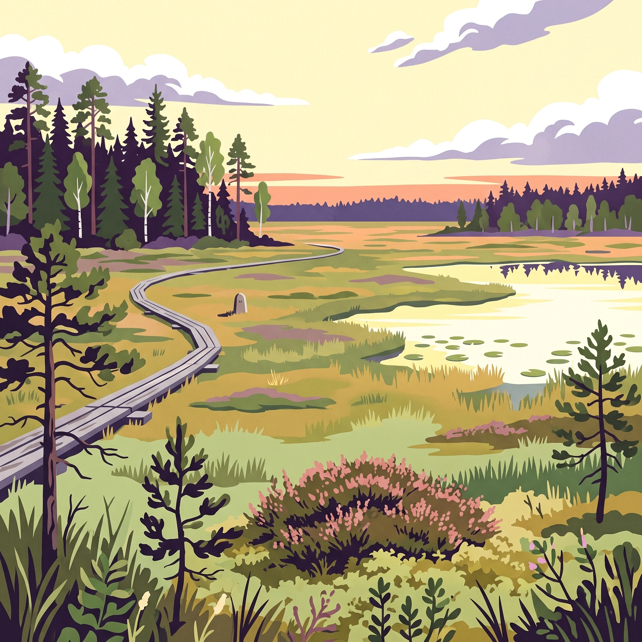
Planning Fundamentals
When is the best time to visit Kurjenrahka National Park
Determining the best time to visit Kurjenrahka National Park requires balancing a preference for the long, bright days of summer against the stark, atmospheric stillness of the Finnish winter. Most visitors find that late spring, specifically from May through September, offers the most accessible conditions for exploring the park signature bog landscapes and old-growth forests. During these warmer months, daylight extends significantly, providing ample time for navigating the 200 kilometers of marked trails, including the popular routes near Lake Savojärvi and the nature towers that overlook the peatlands.
Balancing Daylight and Seasonal Access
The fundamental trade-off for any trip to this region is rooted in the dramatic variation in daylight and ground conditions across the year. In midsummer, visitors benefit from nearly 19 hours of daylight, which is ideal for long-distance hiking and bird watching. However, those who visit during the transition periods of late autumn or early spring must account for rapidly changing conditions. By late December, daylight drops to approximately 5.4 hours, creating a very different, more restricted experience. While the park remains open throughout the year, the practical realities of navigation shift drastically as temperatures drop below freezing and snow cover persists, typically from late December through March.
Understanding Temperature and Precipitation Patterns
Temperature is a primary driver of the visitor experience, with summer highs often reaching into the mid-20s Celsius in July, while winter months see deep freezes that can push temperatures well below -15 Celsius. The park unique geography, characterized by expansive bogs and peatlands, adds a layer of complexity to timing your visit. During the spring thaw in March and April, the ground can become saturated, and some trail sections may experience temporary flooding, which can impact accessibility on lower-lying paths. Choosing your window involves prioritizing either the convenience of dry, firm trails in the summer or the unique aesthetic of a frost-covered forest, provided you are properly equipped for the sub-zero temperatures and short, dark days that define the winter landscape. Regardless of your chosen season, visitors should always verify current trail conditions and weather alerts via official authorities before departing, as local conditions in the peatlands can fluctuate independently of regional averages.
Seasonal Visiting Windows
Best months to visit Kurjenrahka National Park for specific travel goals
Peak Hiking and Bog Exploration: May to September
The most accessible period for hikers and nature observers is from late spring through the end of summer. During these months, the forest floors and bog walkways are at their most stable, allowing for easier navigation across the park's characteristic peatland terrain. May signals the arrival of significant daylight, with hours increasing toward the summer solstice in June. This window is ideal for those prioritizing long, bright days for birdwatching or exploring the extensive trail network. While early May may still see damp ground as winter snows recede, the warming temperatures bring the bog ecosystem to life, making this the primary season for experiencing the park’s diverse peatland flora.
Transition and Autumnal Atmosphere: September and October
For visitors who prefer cooler temperatures and the aesthetic shift of the boreal forest, the early autumn months offer a distinct trade-off. By September, the daylight hours begin to recede, and temperatures drop from their summer highs. This period often suits those looking to avoid the peak activity levels of midsummer while still benefiting from relatively dry trail conditions. The risk of rain increases slightly during this time, and visitors must be prepared for more rapidly changing weather. It is a quiet season, perfect for those seeking solitude among the old-growth stands, provided they account for the shorter windows of functional light.
The Winter Wilderness: November to April
Visiting during the winter months, from late autumn into early spring, requires a different set of expectations. This period is defined by limited daylight, which reaches its minimum in December and January, and significantly colder temperatures. While the park does not close, the experience shifts toward snow-based activities or bracing winter walks. Navigating the bogs becomes a different challenge as surfaces freeze, and the landscape takes on a stark, quiet beauty. Travelers who choose these months should prioritize adequate thermal gear and navigation skills, as the short, dark days mean that time spent on trails is constrained.
Timing Your Visit Based on Trail Access
Understanding the melt cycle is critical when choosing your dates. The transition from late winter to spring, typically occurring between March and April, represents a period of potential instability for hikers. As snowmelt saturates the ground, trails that are otherwise stable may experience temporary flooding. If your primary goal is to traverse the raised bogs via the marked boardwalks, targeting the months from June to August minimizes the risk of encountering impassable or heavily saturated terrain. Those seeking the unique flora of the peatlands should plan for the late spring and early summer period to witness the height of the growing season.
Annual Climate Overview
Monthly weather patterns and climate averages in Kurjenrahka National Park
Interpreting the Annual Temperature Cycle
The climate in this part of Southwest Finland follows a distinct cycle, defined by significant thermal shifts between the harsh winter months and the relatively mild, temperate summer. Historical normals from 1991 to 2020 show that the coldest period centers on January and February, where mean temperatures frequently drop below -4°C, and average minimums can reach as low as -18°C. These months represent the most extreme thermal environment for any visitor. Conversely, the transition into spring is rapid, with mean temperatures climbing from a sub-zero state in March to double digits by May. July represents the annual peak for warmth, with average maximums reaching approximately 27°C, though these are long-term climate averages and should not be viewed as a guarantee of heat for any single visit. Daily conditions often fluctuate, and even in the height of summer, visitors should be prepared for cooler air as temperatures drop overnight.
Daylight Availability and Seasonal Rhythms
One of the most consequential factors for planning a trip is the dramatic change in daylight duration throughout the year. The park experiences a swing from just over five hours of daylight in December to nearly 19 hours during the height of June. This variation effectively dictates the amount of time available for exploring the bog trails and forest paths. While the winter months offer a unique, stark aesthetic, the brevity of daylight limits the window for outdoor navigation. By contrast, the late spring and summer months provide extensive daylight hours, allowing for longer excursions into areas like the Pukkipalo old-growth forest. The rapid increase in daylight starting in March aligns with the arrival of spring, providing a wider margin of safety and flexibility for those planning longer hikes.
Precipitation and Ground Conditions
Rainfall and humidity patterns throughout the year significantly influence the terrain within the park, which is dominated by peatlands and bogs. While precipitation remains relatively consistent across the months, averaging between 1.5 and 2.6 mm per day, the impact of this moisture varies depending on the season. Humidity levels remain consistently high, often exceeding 90 percent during the coldest winter months and hovering around 77 to 80 percent during the drier periods of late spring and early summer.
A critical consideration for visitors is the relationship between temperature and ground stability. As temperatures rise in March and April, the thawing of frozen ground can lead to saturated, muddy, or even flooded trails, particularly in the lower-lying bog areas. While these monthly averages offer a baseline for expected precipitation, they do not account for the immediate impact of snowmelt or sudden spring rains. Visitors planning trips during the transitional spring months should recognize that the combination of lingering moisture and warming temperatures creates a period where trail conditions are at their most variable. It is important to remember that these long-term climate normals represent the recorded history of the area and do not act as a forecast for the specific weather you may encounter during your visit.
Seasonal conditions
Seasonal patterns and weather transitions in Kurjenrahka National Park
The annual cycle of light and ground conditions
Kurjenrahka experiences a distinct rhythm dictated not just by temperature, but by the dramatic swing in daylight and the state of the bog surfaces. The park year does not neatly fit a four-season model because the transition into and out of winter is characterized by hydrologic changes that significantly alter trail accessibility. The most vital distinction for any visitor is the shift between the period of frozen ground and the thaw-driven saturation that follows.
The active growth and accessible months: May to September
This core visiting window is defined by high daylight availability, reaching its peak in mid-summer. During this phase, the landscape is at its most stable, allowing for the full use of the extensive trail network. From May through September, temperatures are at their highest, yet humidity levels remain moderate compared to the late autumn months. This is the period when the bog terrain is firmest, as the underlying peat has drained sufficiently from the spring snowmelt. Visitors during these months will encounter the park in its most lush state, with the diverse flora of the raised bogs and the dense, unmanaged forests of Pukkipalo fully accessible.
The late autumn transition: October and November
As daylight begins its rapid decline in October, the park enters a transitional phase that tests equipment and preparation. Rainfall often increases, and the temperature mean shifts downward toward the freezing point. The ground begins to hold more moisture, which can make trails, especially those traversing open bogs on boardwalks, slippery or prone to light flooding. This period serves as a natural reset for the park, as the deciduous vegetation sheds its leaves and the wildlife prepares for the approaching winter dormancy. It is a quiet, contemplative time, but one where the reduced daylight hours and fluctuating temperatures require careful planning for shorter excursions.
The winter wilderness phase: December to March
Winter in Kurjenrahka is marked by deep cold and limited daylight, creating a starkly different environment from the summer months. The freezing temperatures typically solidify the landscape, turning the saturated bogs into firm, snow-covered plains. While this can provide easier passage in some swampy areas, it introduces the challenge of sub-zero wind chills and the necessity for appropriate winter gear. The period from January to March represents the deepest winter, where average minimums consistently remain well below freezing. For those prepared for the cold, this phase offers a profound sense of solitude, as the park’s forests become silent and the vast peatlands are transformed by ice and snow.
The spring thaw and mud season: April
April acts as a brief but critical environmental pivot. As temperatures climb above freezing, the snowpack melts rapidly, flooding the trails and saturating the low-lying mineral soils. This is often the most challenging time for hiking, as the ground becomes unstable and muddy. This short window is an essential biological bridge, marking the return of migratory species and the beginning of the cycle that leads back to the May growth period. While the days lengthen noticeably, visitors during this transition should expect the trails to be at their most demanding in terms of ground conditions.
Seasonal Experiences
What visiting Kurjenrahka National Park is like through the year
Navigating the bog and forest transitions
The experience of exploring Kurjenrahka depends heavily on the ground conditions, which fluctuate significantly between the summer hiking season and the winter freeze. During the long days of May through August, the park is defined by its accessible peatlands. The extensive boardwalks allow visitors to traverse the raised bogs without disturbing the fragile ecology, providing a clear vantage for observing the diverse flora and fauna typical of southern Finnish wetlands. The firm ground during these months makes circular routes, such as the 6-kilometre loop around Savojärvi, reliable options for day hikers.
As the season shifts into autumn, the ground becomes increasingly saturated. While the forest trails through areas like Pukkipalo remain navigable, the bog environments can become more demanding as precipitation rises and daylight diminishes. This period is less about long-distance trekking and more about shorter, well-maintained paths where stability is higher. Visitors should adjust their expectations for pace and focus, as the cooling temperatures and increased moisture can make longer routes feel more strenuous than the same distances in mid-summer.
Seasonal wildlife and landscape observation
The park acts as a stage for distinct natural shifts that align with the calendar year. In the spring and early summer, the bog ecosystems are particularly active, making them prime locations for bird watching. The observation towers at Vajosuo and Kurjenrahka serve as central hubs for those tracking avian activity. As summer transitions into the height of the season, the focus shifts toward the old-growth forests of Pukkipalo. These areas, characterized by century-old trees and significant amounts of deadwood, offer a more enclosed, stable experience regardless of the open-bog conditions.
When winter arrives, the character of the park undergoes a complete transformation. The bogs, often impassable or sensitive during the transitional melt, become solid through the deep freeze. This allows for cross-country skiing across areas that are strictly off-limits to foot traffic during the warmer months. It is important to note that the usability of these frozen routes is entirely dependent on recent snow conditions. Skiers often find the open bogs more manageable than the dense forest trails, where navigation can be difficult due to overhanging branches and uneven snow accumulation. Those visiting during this time must be prepared for short daylight windows, which significantly compress the viable time for outdoor exploration.
Flexibility in trail use and activity planning
The diverse trail network, ranging from simple circular routes near the visitor centre to extensive multi-day trekking circuits, requires visitors to match their chosen path with the calendar period. The Kuhankuono trail network provides consistent access to various biotopes, but the intensity of the experience changes with the weather patterns. Visitors planning to use the network should verify the current status of specific paths, especially during the spring thaw or late autumn, as trail conditions are not static. The ability to use the park for both summer walking and winter skiing requires selecting routes that align with the seasonal strengths of the terrain, rather than expecting every trail to remain accessible or suitable year-round.
Visitor Priorities
Optimizing Your Visit to Kurjenrahka National Park by Activity and Preference
Prioritizing Longer Days for Extended Exploration
Visitors seeking the maximum amount of time to navigate the extensive Kuhankuono trail network should focus their travel on the period from late May through early August. During this window, daylight extends well beyond 17 hours, peaking in June with nearly 19 hours of potential activity. This abundance of light provides a critical advantage for those planning the longer, multi-day routes like the 35 to 55-kilometre traverse between Yläne and the Rantapiha area. Because these routes often involve navigating dense forest terrain and occasionally uneven boardwalk sections, the extended daylight allows for a significantly slower, safer pace without the risk of being caught in the dark. The compromise for these long days is the potential for peak summer warmth and higher humidity, which may make strenuous movement across exposed bog sections more tiring than in the cooler shoulder months.
Targeting Drier Ground Conditions for Hiking
If your primary goal is stable, firm footing for hiking, target the late summer months of August and September. While early summer offers the most daylight, the peatlands and forest trails can remain quite damp following the spring thaw that occurs throughout April. By August, the ground has typically stabilized after the cumulative drying effect of the preceding months. September provides arguably the best balance for walkers, as the temperatures become more moderate, averaging around 11 to 12 degrees Celsius, and the humidity begins to drop compared to the mid-summer peak. This period is ideal for those who prefer to keep their focus on the trail rather than on navigating muddy or saturated surfaces. The trade-off is that daylight hours decrease noticeably during September, falling back toward 12 hours by the end of the month, meaning longer daily treks must be planned more carefully.
Ideal Windows for Winter Activities and Skiing
For those drawn to the park's winter landscape for cross-country skiing, the window of stability is quite narrow. February is generally the most reliable month for this, as it balances sufficient snow cover with a gradual increase in daylight, which reaches over eight hours. In January, the limited six hours of daylight makes long-distance travel on skis through the forest quite difficult. By March, while days are much longer and brighter, the cycle of freezing and thawing begins to impact the snow quality on the bogs. Travelers prioritizing skiing should be prepared for the fact that conditions are highly variable and weather-dependent. The primary compromise here is the extreme cold, with minimums often dropping well below minus 15 degrees Celsius, requiring specialized gear and a high level of comfort with winter navigation where trail markings may be obscured.
Choosing for Mild Temperatures and Walking Comfort
Visitors who prefer moderate, manageable temperatures rather than extreme summer heat or winter cold will find May and early June to be the most agreeable time for lighter day hikes. While the trails may still carry some moisture from the earlier spring melt, the combination of crisp air and the return of forest life makes this a popular window for those utilizing the shorter circle routes like the 1.7-kilometre Karpalopolku trail near Kurjenpesä. The temperature averages at this time are exceptionally pleasant for physical activity, keeping comfortably away from the highs seen in July. The main consideration during this window is to remain flexible with your route choice, as some of the lower-lying or more remote bog paths may still require waterproof footwear.
Access and Logistics
Seasonal access considerations and planning for Kurjenrahka National Park
Navigating park entry and trailheads
Kurjenrahka National Park is accessible via a variety of routes that connect to the wider trail network, including the historic Kuhankuono boundary stone area. The primary access point for many visitors, particularly those relying on public transit, is the Kurjenpesä nature hut. While road access to the various parking areas is generally possible for standard vehicles, visitors should note that many of the access roads are unpaved. These gravel roads can be prone to seasonal degradation during the spring thaw or following heavy autumn rains, which may influence your choice of vehicle or the timing of your visit. Always verify the current drivability of these routes through official park authority alerts before departure.
Seasonal variations in transport and connectivity
Public transportation availability to the park often shifts based on the season. While specific local bus services from Turku, such as those operated by Föli, provide reliable connections to the Kuhankuono entrance, these services often see increased frequency during the summer months and on weekends compared to mid-week or off-season periods. For travel during the winter or early spring, connectivity to more remote trailheads may be restricted or entirely unavailable compared to the high-summer season. Because public transport schedules and the specific availability of coaches to stops like Yläne are subject to change, it is essential to check current timetables on official transit provider websites rather than relying on historical trip planning resources.
Practical planning for decentralized trailheads
Unlike parks with a singular gated entrance, Kurjenrahka consists of multiple areas intermingled with private land, meaning your point of entry dictates your experience. Trailheads such as Rantapiha, Töykkälä, and the Vajosuo parking areas offer distinct access to different sections of the bog and forest landscape. When planning your route, consider that the distance between these entry points can be significant. If you are not arriving by car, access to locations like Elijärvenkulma near Vaskijärvi may require significant coordination, as these areas are less served by public transit than the main Kurjenpesä gateway. If your trip depends on specific trail loops or nature towers, confirm that the relevant trailhead parking or transit stop remains active for your chosen dates.
Verifying facility and operational status
While the national park is technically open to visitors year-round, the state of amenities such as visitor centers, nature huts, and marked trail services can vary. During the winter, certain facilities may have limited access, and trail conditions can change rapidly due to snow cover or icy patches on boardwalks. Because maintenance, fire safety restrictions, and access rules are governed by regional authorities, always consult the latest updates from the official park administration to ensure that your planned activities are permitted and that facilities are functioning as expected during your visit window.
Safety and Preparation
Seasonal Weather Hazards and Packing for Kurjenrahka National Park
Adapting to Finnish Bog and Forest Conditions
Preparation for visiting this national park relies on anticipating the specific, highly variable moisture levels of the peatland environment. The terrain is characterized by extensive raised bogs and soft forest floors, meaning that surface conditions can change rapidly depending on the time of year. During the warmer months from May to September, the primary challenge is the persistence of damp conditions. While boardwalks provide stable footing across many sensitive areas, off-trail sections or older paths can remain muddy or waterlogged even in midsummer. Sturdy, moisture-resistant footwear is generally recommended to ensure comfort during long walks across these uneven surfaces.
Seasonal Temperature Fluctuations and Clothing Strategy
Visitors must account for a wide range of temperatures, which can shift dramatically from the cold of winter to the warmth of July. Average mean temperatures dip significantly below freezing from December through March, and even the shoulder months like April and October often see nighttime temperatures nearing zero degrees Celsius. Layering remains the most effective strategy for managing these shifts. A flexible approach to clothing allows you to adapt to the high humidity levels, which often reach over 95 percent during the winter months, making the air feel sharper and more penetrative. Even during the peak of summer, evenings can be significantly cooler than the daytime highs, particularly when near the open, exposed bog areas where wind speeds remain consistent.
Daylight Constraints and Navigation Awareness
Daylight availability serves as a critical factor for planning the timing of your outings. In the winter months, daylight drops to roughly five to six hours, limiting the window for outdoor activities significantly. Visitors planning trips during these months must ensure they have adequate time to complete their routes before darkness falls. Conversely, the long, bright days of June and July offer extensive opportunities for exploration, though the intensity of the sun in these open environments requires attention. Always verify current weather forecasts and official park alerts before heading out, as these will provide the most accurate information regarding potential trail closures, recent rainfall impacts, or unexpected conditions that could influence your safety and navigation. Always stick to marked paths to avoid damaging fragile bog ecosystems and to remain within the monitored, safer areas of the park infrastructure. If you encounter wildlife, remember that sightings of bears or wolves are rare and typically involve animals avoiding human presence, but maintaining distance is the standard practice for all visitors.
Final Decision
How to choose the right time to visit Kurjenrahka National Park
Determining the right time for your visit requires a deliberate evaluation of your personal tolerance for environmental variables and your specific objectives for the landscape. Because Kurjenrahka National Park functions as a dynamic peatland environment, the physical state of the terrain is the primary driver of your experience. If you prioritize consistent access to the full trail network and the benefit of extended daylight for long-distance hiking, the summer months from late May through August offer the most stability. During this period, the boardwalks remain the most reliable way to navigate the expansive bogs, and the warmer temperatures allow for a more flexible pace without the need for specialized cold-weather gear.
Conversely, those drawn to the park for its winter character must accept significant trade-offs regarding accessibility and daylight. The winter season, spanning roughly from December through March, transforms the bogs into a frozen wilderness, which can be ideal for cross-country skiing or winter hiking if conditions permit. However, this comes with the reality of minimal daylight hours and the requirement for robust cold-weather preparation. Transition periods such as April, when the spring thaw creates saturated or potentially impassable ground, necessitate the highest level of flexibility and a willingness to alter your plans on short notice. Autumn, while visually striking, often brings increased moisture and shifting weather patterns that require careful attention to trail conditions.
Ultimately, there is no single month that satisfies every visitor preference, as the park experience is fundamentally dictated by the interplay between seasonal climate and the inherent fragility of the bog ecosystem. Instead of searching for an ideal date, focus on aligning your travel goals with the seasonal reality of the boreal forest. If your priority is ease of movement, target the drier summer months. If you seek the quiet and unique aesthetic of the Finnish wilderness during its harshest months, prepare for the logistical constraints of winter. Always remember that climate normals describe historical patterns rather than daily reality. Regardless of when you choose to go, you must consult official park authority channels for current trail status, weather alerts, and local operating information before finalizing your travel plans.