
Mori Atlas logo
Nature reserveLago di Loppio

Tracing the protected marshlands, historic island sites, and transitional ecological terrain within the Adige valley corridor.

Lago di Loppio Nature Reserve: Mapping the Wetland Mosaic and Archaeological Landscapes of Trentino

(Biotopo Lago di Loppio)

Lago di Loppio serves as the largest palustrine protected area in Trentino, Italy, offering a distinct landscape where seasonal wetlands meet high-altitude slopes. This former alpine lake, now an expansive nature reserve, features a complex mosaic of reedbeds, alder woods, and the archaeologically significant Island of Sant'Andrea. The site provides essential habitat for migratory amphibians and birds of prey while preserving layers of Roman, Byzantine, and medieval history.

wetlandmarshlandbiotopeisland archaeologymountain valleymixed forest
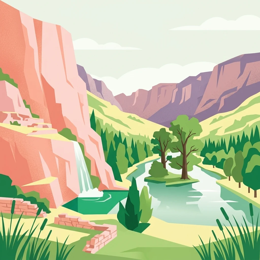
A flat-style digital illustration showing a valley with a small waterfall flowing from a rocky cliff into a pond, surrounded by trees and stylized vegetation.

Lago di Loppio

Nature reserve

Park overview

Structured park overview, official facts, and landscape profile for Lago di Loppio

Lago di Loppio park facts, protected area profile, and essential visitor context

Review the core facts for Lago di Loppio, including designation, size, terrain, visitor scale, habitats, and operating context in one park-focused overview.

About Lago di Loppio

Lago di Loppio sits in the Loppio valley in the Autonomous Province of Trento, at roughly 220 meters above sea level, just southeast of the San Giovanni pass and a short distance from the upper Lake Garda basin. The municipality of Mori borders the site, while the western shores form the boundary with Nago-Torbole, giving the wetland a strategic position between the Adige valley corridors and the northern edge of Lake Garda.

The depression was originally a natural lake fed by local waters, but during construction of the Adige-Garda hydro tunnel in 1956 the water table collapsed and the basin lost its main inflow. Since then the area has behaved more like an intermittent marsh than a permanent lake, swelling significantly after prolonged rainy seasons and shrinking to expose wide mudflats and channels during drier periods. The resulting landscape is unusually layered for an inland site of this size: dry rocky slopes to the north where the Altissimo di Nago rises, mixed deciduous and coniferous forest on the surrounding terrain, reed beds along the wettest margins, and a central island that has become a refuge for mature oak woodland.

On 19 October 1987, the Provincial Government of Trento formally established the area as a protected biotope, recognizing its value as a habitat mosaic and its hydrological fragility. Management remains under the Autonomous Province of Trento, and the protection extends across approximately 112 hectares of land. The site combines wetland conservation with cultural heritage preservation, since the Island of Sant'Andrea, sitting at the center of the basin, hosts one of the most significant multi-period archaeological sites in the region.

Beyond its ecological role, Lago di Loppio carries a memorable historical episode: in 1439, the Republic of Venice organized the famous galeas per montes enterprise, transporting a small fleet of war galleys across the Alpine passes to reach Lake Garda as part of a military engineering campaign. The Loppio valley was one of the stages of that unusual overland naval transit, lending the lake a place in military and engineering history alongside its natural history.

Protection and recognition

Terrestrial protected area designation and Natura 2000 records

Lago di Loppio Protection Status and Official International Recognition Data

Lago di Loppio maintains documented terrestrial protection status and official Natura 2000 recognition sources. Conservation framework details outline international designation records and management scope for this protected landscape.

International recognition

Protection details

Protection scope
Terrestrial
Transboundary protection
No
Park context

Deeper park guide and search-rich context for Lago di Loppio

Lago di Loppio history, landscape, wildlife, and travel context

Explore Lago di Loppio through its history, landscape character, ecosystems, wildlife, conservation priorities, cultural context, and seasonal travel timing in a structured park guide built for atlas discovery and search intent.

Why Lago di Loppio stands out

Lago di Loppio is best known for two very different but intertwined identities. The first is its status as a partially drained historical lake turned into the largest wetland biotope in Trentino, a mosaic of marsh, willow and alder woods, oak forest on the island, and rocky cliffs that draws amphibians, waterbirds, and raptors. The second is the Sant'Andrea archaeological island, which preserves centuries of occupation from the Roman period through the medieval era, with rare finds such as a Lombard cemetery, a unique Alpine infant burial in terracotta, and the only known solidus siliquae of Justinian I found in such a context.
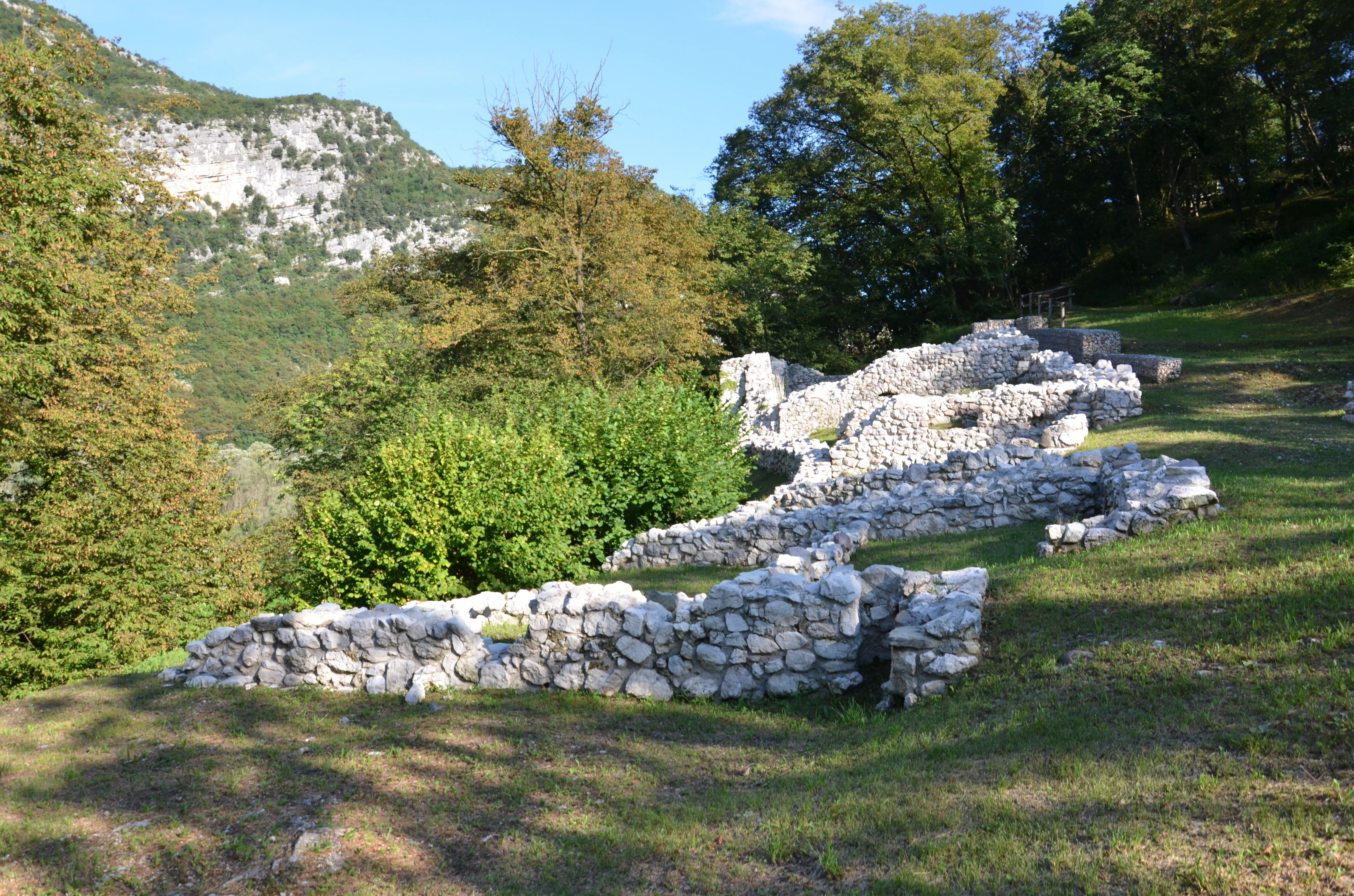
Ancient stone wall ruins located on a grassy hillside, surrounded by trees and mountains at Lago di Loppio.
Archaeological ruins on Sant'Andrea Island within the Lago di Loppio basin.

Lago di Loppio history and protected-area timeline

The natural lake of Loppio has been known for centuries as a small but distinct body of water in the mountains south of the San Giovanni pass. In 1439, it was part of the route taken by the famous galeas per montes, the Republic of Venice's extraordinary military engineering effort that moved war galleys overland across the Alps toward Lake Garda. The Loppio valley served as a transit point on that campaign, giving the lake a documented role in fifteenth-century Alpine military logistics.

In the modern era, the lake's hydrology was fundamentally altered. During construction of the Adige-Garda tunnel in 1956, a subsidence of the water table accidentally drained the basin. The lake never fully recovered and, over the following decades, the empty basin gradually converted into an intermittently flooded wetland, with water levels rising sharply only in particularly rainy seasons and falling back to expose muddy shores the rest of the time.

Recognition of the site's environmental value came on 19 October 1987, when the provincial government of Trento issued decree 11130 establishing the Biotopo Lago di Loppio as a protected area, a status later updated by a 1996 modification. The classification as a biotope reflected the unusual combination of habitats now formed in the basin: marshland, riparian woods, mixed forests, and rocky cliffs, all compressed within a relatively small area at the foot of the surrounding mountains.

Alongside its natural transformation, Lago di Loppio developed a parallel identity as an archaeological site. Investigations on the Island of Sant'Andrea, beginning in 1900 and continuing through later campaigns, uncovered traces of Roman-era occupation, a Lombard-era settlement, a Byzantine-period necropolis beneath the Romanesque Church of Sant'Andrea, and medieval remains. Findings have included Roman glass, coins, a possible defensive castrum, longobard jewelry and helmets, rare siliquae of Justinian I, and an infant burial in a terracotta container, the first of its kind found in the Alpine area.

Lago di Loppio landscape and geographic character

Lago di Loppio occupies a depression in a side valley of the Adige system, framed to the north by the slopes of Monte Altissimo di Nago and bordered to the west by the uplands rising toward the San Giovanni pass. At around 220 meters above sea level, the wetland sits between the warmer Mediterranean-influenced microclimate of nearby Lake Garda and the cooler Alpine valleys, which gives the area a transitional botanical character.

The dominant visual feature is the broad, shallow basin itself, now a marshland mosaic rather than an open water body. In dry phases, exposed mudflats, channels, and scattered pools give way to reedbeds, while in wet periods the basin swells and partially submerges the alder stands along its margins. To the east, the small settlement of Loppio rises above the basin, with the fifteenth-century Villa Castelbarco and the Church of the Name of Mary, whose bell tower still bears scars from First World War artillery fire.

The surrounding terrain shifts rapidly within a short distance. Rocky cliffs and stones with crevices and small caves overlook parts of the basin, especially along the western shore, providing nesting ledges for raptors and shelter for bats. Above these cliffs, mixed forests climb the slopes, while on the Island of Sant'Andrea the soils support an unusually well-preserved mature oak woodland, with hornbeam, smoke tree, hazelnut, hawthorn, and other understory species flourishing in a setting isolated from the surrounding landscape by the seasonally rising waters.
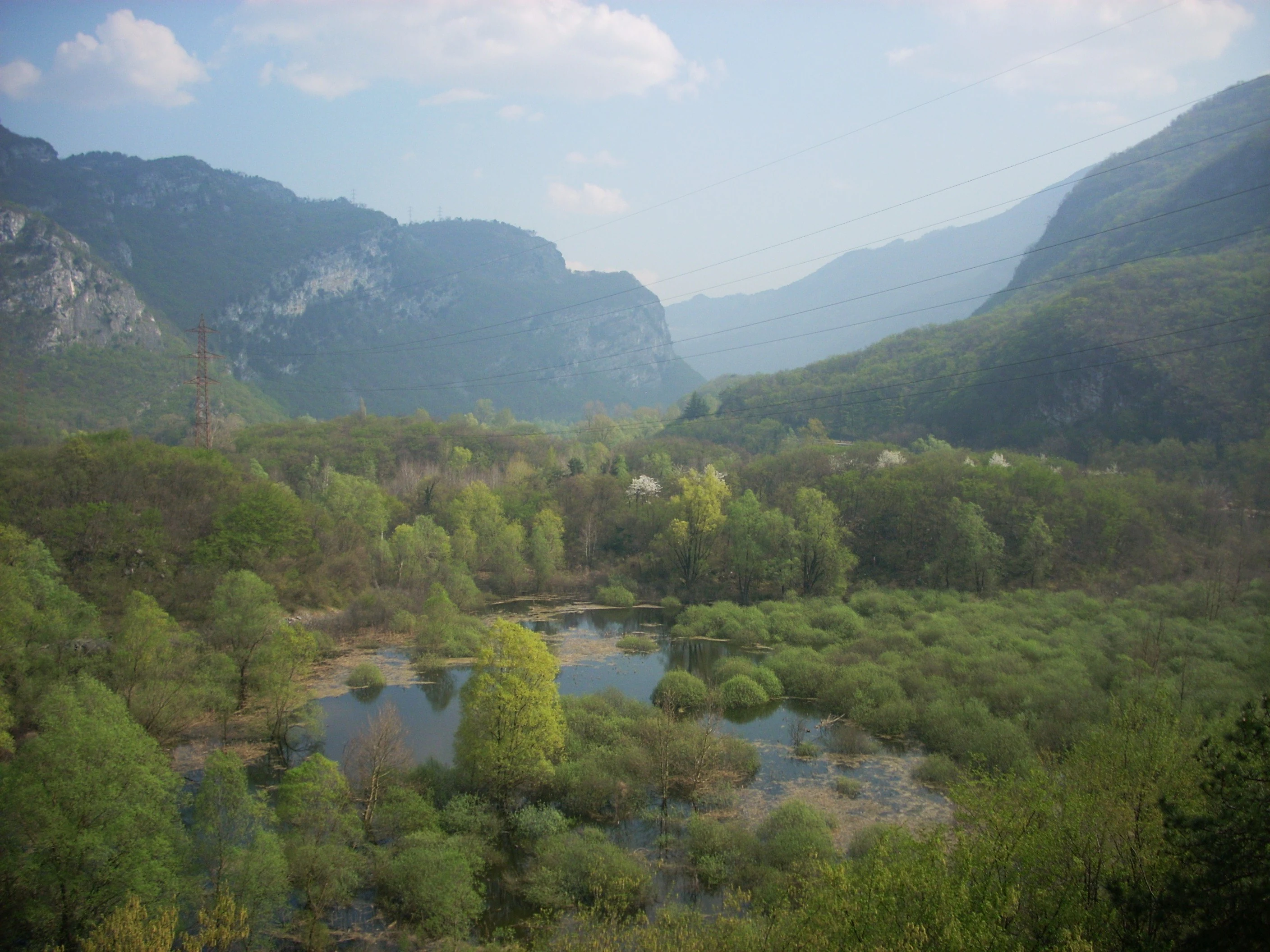
A wide-angle landscape shot of a marshy wetland area with small pools of water and lush green trees in the foreground, set in a valley between steep mountain slopes under a soft, slightly hazy sky.
A view of the wetland landscape of Lago di Loppio, surrounded by the mountains of Trentino.

Lago di Loppio ecosystems, habitats, and plant life

The vegetation at Lago di Loppio is shaped by the unusual coexistence of marshland, dry woodland, and rocky slopes within a small area. The basin itself is dominated by reeds (Phragmites australis), yellow flag iris (Iris pseudacorus), white poplar (Populus alba), and alder, all species adapted to prolonged flooding alternating with dry phases. Along the margins, scattered willows, chestnuts, beech, and Scots pine form a typical mixed mountain forest framing the wetland.

The most ecologically distinctive habitat is found on the Island of Sant'Andrea. Here a mature pedunculate oak (Quercus robur) woodland has developed, accompanied by its original layer of shrubs and herbaceous species: hop hornbeam, smoke tree, hazelnut, hawthorn, honeysuckle, manna ash, and a variety of herbaceous plants. In spring, this woodland extends visually onto the nearby shores as species flower and leaf out.

Around the edge of the basin, the intermittent hydrology produces a shifting mosaic. White water lilies (Nymphaea alba) appear in some years, while the ever-present reed beds and alder stands define the wet zones. The combination of permanently moist patches and seasonally dry open ground creates a dynamic pattern of plant communities that responds directly to rainfall and groundwater levels.
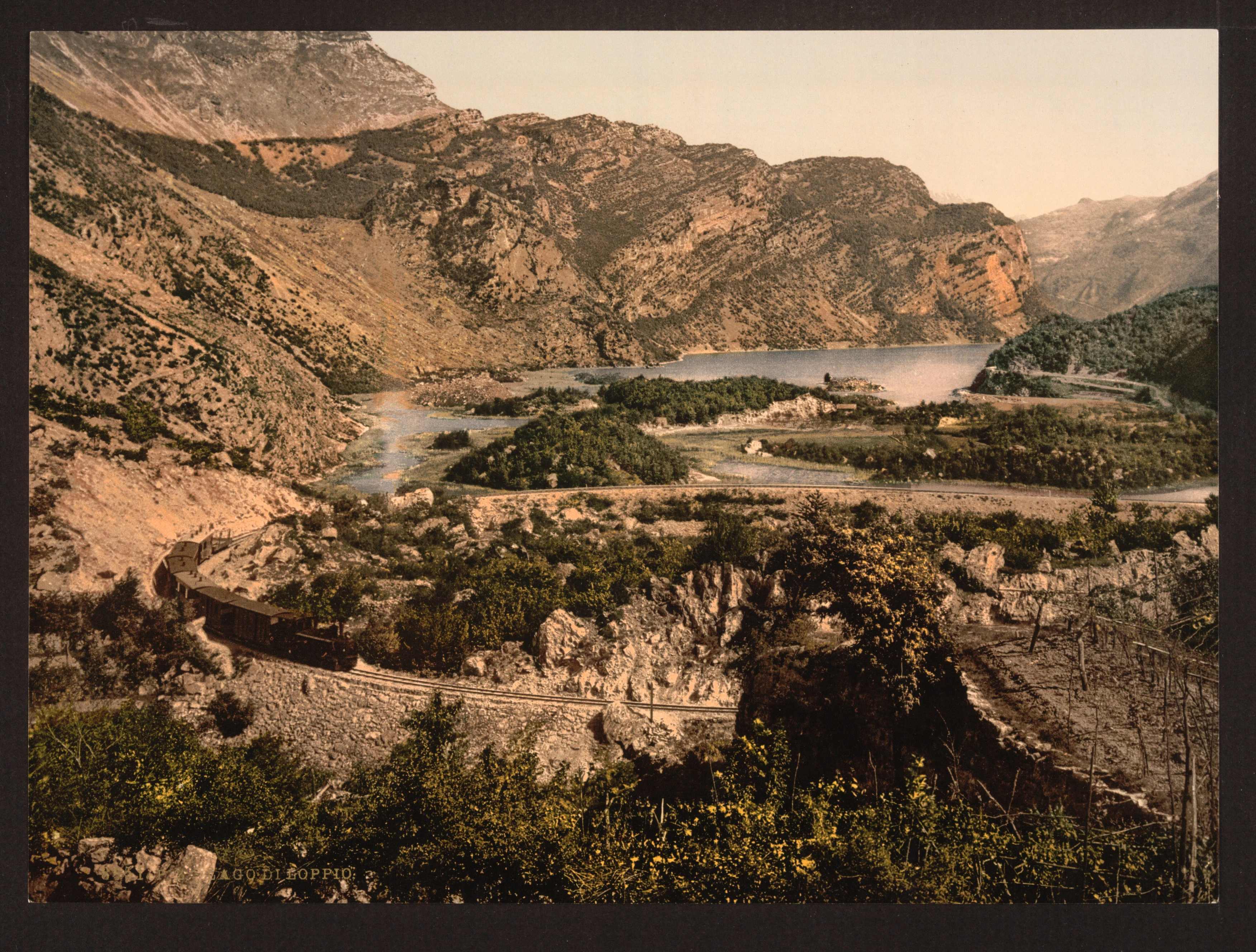
A vintage photographic print showing a valley with a lake, marshy vegetation, and rocky mountains in the background, with a train visible on a track in the foreground.
A historic view of the marshy basin of Lago di Loppio surrounded by rocky mountain terrain.

Lago di Loppio wildlife and species highlights

The wildlife profile of Lago di Loppio reflects its mosaic of habitats: marsh, wet meadow, mixed woodland, and rocky cliffs within a compact area. As water levels fall, deer (Cervus elaphus), roe deer, and wild boar regularly move down from the surrounding forests to feed on the exposed mudflats, joined by foxes, stoats, beech martens, squirrels, edible dormice, hares, badgers, weasels, hedgehogs, and European moles.

Smaller mammals are particularly diverse on the Island of Sant'Andrea, where bank voles, yellow-necked mice, and garden dormice are abundant. The site has also seen the documented presence of the elusive European polecat, a mustelid that had largely disappeared from Trentino and has apparently resettled at Loppio in recent years, with multiple sightings, scent traces, and footprints reported across the basin. Otters, once frequent here, have not been confirmed since the early 1990s, marking the loss of one of the wetland's most characteristic predators.

Larger predators have returned more recently. Wolves are now considered resident, traveling between the lake and the Valle del Cameras, while several bears, including a female with cubs, have been documented in the surrounding woods of Gresta and Stivo. A golden jackal has also been captured on camera traps nearby. The cliffs and grottoes overlooking the lake host a notable bat fauna, including greater mouse-eared bats, lesser horseshoe bats, Daubenton's bats, common pipistrelles, and brown long-eared bats.

Birdlife is exceptionally rich. Raptors recorded include golden eagles (mostly young passing individuals), short-toed snake eagles, hen harriers, peregrine falcons, red and black kites, common buzzards, common kestrels, lanner falcons, and Eagle owls, while ravens, little owls, barn owls, tawny owls, scops owls, and Eurasian eagle-owls use the cliffs and woodlands. Forest and rock-dwelling species include great spotted woodpeckers, crag martins, alpine swifts, whinchats, linnets, rock thrushes, hoopoes, rock sparrows, ortolans, tawny pipits, red-backed shrikes, and collared flycatchers.

Along the marsh and open water, mallards, gadwalls, common moorhens, bitterns, Eurasian teals, mergansers, coots, reed warblers, white-throated dippers, and grey herons breed in the reedbeds, while colonies of grey herons nest in the alders along the basin. Little ringed plovers have nested annually for several years, and recent observations have added Marsh harriers, little egrets, great white egrets, kingfishers, pygmy cormorants, purple herons, and great cormorants, drawn temporarily to drying pools by illegal fish introductions. Amphibians are especially diverse, with alpine newts, common newts, fire salamanders, yellow-bellied toads, common toads, common frogs, agile frogs, green toads, and European tree frogs migrating en masse each spring to the basin to breed; dedicated barriers and tunnels under the busy Strada Statale 240 help protect them from road traffic.

Lago di Loppio conservation status and protection priorities

Lago di Loppio is a small but ecologically high-value protected area, designated as a provincial biotope by decree 11130 of 19 October 1987, with later updates in 1996. The protection covers about 112 hectares of land and is managed by the Autonomous Province of Trento. The designation reflects the site's unusually compressed mosaic of habitats, marshland, woodland, rocky cliffs, and seasonal wet-grounds and the species assemblages these habitats sustain.

From a conservation perspective, the biotope plays an important role for amphibians. Each spring, dense populations of newts, toads, and frogs migrate into the basin to breed in its temporarily refilled waters, a phenomenon significant enough that the authorities have installed specific road barriers and small tunnels under the adjacent State Road 240 to guide the animals safely toward the water. The site also supports notable bat colonies in the surrounding cliffs and grottoes, an unusual concentration of raptors and owls, and a birdlife list that runs into dozens of species across raptors, waterbirds, and forest passerines.

The protection also extends to ecological recovery. The accidental drainage of 1956 transformed a lake into an unstable wetland, and the regime of intermittent flooding continues to shape management priorities, including monitoring of waterbirds responding to illegal fish introductions and continued attention to large carnivores such as wolves and bears that have begun to use the area again. The biotope sits within the EUAP (Elenco Ufficiale delle Aree Naturali Protette, the official list of Italian natural protected areas) network under code EUAP0484, giving it formal recognition in the national conservation system.

Lago di Loppio cultural meaning and human context

The cultural dimension of Lago di Loppio centers on the Island of Sant'Andrea, an archaeological site that layers evidence of human occupation from the Roman period through the Middle Ages. Finds include Roman pottery fragments, walls, necropolis remains, Lombard weapons and jewelry, and rare siliquae of Justinian I, while a particularly notable discovery is the first documented burial of an infant in a terracotta container ever found in the Alpine region. Excavations have divided the island into three main sectors (north-eastern, southern, and central), each corresponding to a distinct period and function, including a Roman castrum, a Lombard necropolis, and a Byzantine-era necropolis beneath the Romanesque Church of Sant'Andrea.

Beyond archaeology, the area carries traces of larger historical events. In 1439, the Loppio valley was part of the route of the galeas per montes, the Republic of Venice's ambitious overland transport of war galleys toward Lake Garda. Closer to the modern era, the bell tower of the nearby Church of the Name of Mary in Loppio still bears visible marks from First World War artillery, situating the basin within the layered military history of the Trentino front.

Top sights and standout views in Lago di Loppio

The strongest single feature of Lago di Loppio is the contrast between ecological fragility and ecological richness: an accidentally drained basin that has become one of the most diverse small wetlands in Trentino, hosting dozens of bird species, several bat species, and a remarkable amphibian community that migrates each spring to its temporary waters.

Equally distinctive is the Sant'Andrea archaeological island, which contains within a few hectares evidence of Roman, Lombard, Byzantine, and medieval life, including rare finds such as Justinian I silver siliquae and the first Alpine infant burial in terracotta.

Finally, the area combines this natural and cultural value with notable historical resonance, from the 1439 Venetian galley transport to the First World War damage still visible on the nearby church tower, making the site a place where landscape, archaeology, and history intersect in a small but unusually dense setting.

Best time to visit Lago di Loppio

The character of Lago di Loppio changes significantly with the seasons. Spring is generally the most dynamic period ecologically: as temperatures rise and waters return to the basin, large numbers of amphibians migrate toward the wetland to breed, while woodland on the island and along the shores comes into leaf and flower. This is also a good moment for observing waterbirds, raptors, and the early stages of forest vegetation.

In wet years, late spring and early summer can offer the most visually impressive marshland, with the basin partially refilled and reedbeds and waterlilies established, while dry summers expose wide mudflats that, paradoxically, attract wading birds and visible mammal activity along the shores. Autumn brings quieter conditions, with migratory raptors and passerines passing through, while winter tends to be the most subdued season, with reduced bird activity but a clearer view of the basin's structure and the surrounding snowy peaks.


Monthly climate preview

Track representative annual temperature swings and monthly precipitation patterns across the protected landscape

Lago di Loppio Climate Normals and Long Term Weather by Month

Representative coordinates record long term monthly temperature ranges and precipitation averages across the protected terrain of Lago di Loppio. Examining the complete twelve month climate profile reveals detailed shifts in annual thermal rhythms and precipitation distribution.
Annual mean6 °C
-4 °C16 °C
Jan-4°
Feb-3°
Mar
Apr
May10°
Jun14°
Jul16°
Aug16°
Sep12°
Oct
Nov
Dec-3°
Warmest month
July

16.2 °C

Coolest month
January

-4.4 °C

Wettest month
October

3.8 mm/day

Driest month
January

1.4 mm/day

Park location guide

Geography guide, regional context, and park location map for Lago di Loppio

Lago di Loppio park geography, regions, and map view in Italy

Understand where Lago di Loppio sits in Italy through a broader geographic reading of the surrounding landscape, nearby location context, and its mapped position within the national park landscape.

How Lago di Loppio fits into Italy

Italy is a unitary parliamentary republic in Southern and Western Europe, located on the Italian Peninsula with the Alps to the north. It borders France, Switzerland, Austria, Slovenia, Vatican City, and San Marino, and shares maritime boundaries with several Mediterranean countries. The country has approximately 59 million residents and uses the Euro as its currency.

Wider geography shaping Lago di Loppio in Italy

Italy occupies a boot-shaped peninsula in southern Europe, bordered by the Alps to the north. It shares land borders with France, Switzerland, Austria, Slovenia, Vatican City, and San Marino. The country includes the Mediterranean islands of Sicily and Sardinia, along with approximately 800 smaller islands.

Map view of Lago di Loppio

Use this park location map to pinpoint Lago di Loppio in Italy, understand its exact geographic position, and read its mapped placement within the surrounding landscape more clearly.

Pigeon | © OpenStreetMap contributors

Location context for Lago di Loppio

Trentino
Recorded earthquake history

Browse the Historical Earthquake Catalogue for Lago di Loppio

Access a detailed collection of recorded seismic events associated with the geography of Lago di Loppio. This historical database provides structured insights into regional seismic activity and chronological event data for the nature reserve.

Lago di Loppio Earthquake History

Catalogued events

77 events

Strongest magnitude

Magnitude 5.1

Most recent event

Jan 9, 2026

This history includes earthquakes recorded inside the park or within 50 km of its borders

Explore photographic records of marshlands, rocky cliffs, and the Sant'Andrea archaeological island.

Lago di Loppio Photos and Landscape Scenery: Visualizing the Protected Wetland Habitat

Visual documentation captures the unique terrain, seasonally flooded basin, and diverse habitats defining the protected wetland environment. Examining these protected area views reveals the complex topography and botanical character of the valley without relying on travel descriptions.

Ancient stone wall ruins located on a grassy hillside, surrounded by trees and mountains at Lago di Loppio.

A peaceful lake in a valley with trees growing in the water and a steep, tree-covered mountain slope in the background.

A wide-angle landscape shot of a marshy wetland area with small pools of water and lush green trees in the foreground, set in a valley between steep mountain slopes under a soft, slightly hazy sky.

A vintage photographic print showing a valley with a lake, marshy vegetation, and rocky mountains in the background, with a train visible on a track in the foreground.

Park atlas

Compare regional wetland biotopes, mountain valley reserves, and connected terrain.

Explore Other Parks Near Lago di Loppio and Surrounding Protected Landscapes

Visitors exploring Lago di Loppio can continue comparing regional protected areas and wetland habitats across the surrounding mountain valleys. Extending the geographic review helps trace broader ecological patterns and conservation landscapes throughout northern Italy.
Nature reserveTrentino-Alto Adige
About 2.8 km away#1 closest

Northwest

Biotopo Monte Brione: Protected Nature Reserve and Mediterranean Landscape Map

Exploring the limestone ecology of northern Italy

Biotopo Monte Brione stands as a remarkable protected area where southern European vegetation, including holm oaks and Phoenician juniper, flourishes against a backdrop of sun-exposed limestone cliffs. Situated as a natural buffer near Lake Garda, this reserve offers a deep look into the intersection of Mediterranean floral diversity and Alpine geographic settings, providing a essential refuge for protected raptors and rare invertebrate species.

Area
0.663 km²
Established
1992
IUCN
IV
Nature reserveTrentino-Alto Adige
About 13 km away#2 closest

North

Biotopo Lomasona Nature Reserve: Protected Landscapes and Alpine Geography in Trentino

A small-scale conservation area in the heart of Val Lomasona

Biotopo Lomasona stands as a specialized nature reserve in the Italian Province of Trento. This compact protected area focuses on habitat conservation within the alpine terrain, serving as an important ecological anchor in the valley landscape of Comano Terme and the wider Trentino-Alto Adige region.

Area
0.26 km²
Established
1987
IUCN
IV
Soft watercolor painting of layered green hills and distant mountain ranges with a hazy, light-filled sky.
Nature reserveTrentino-Alto Adige
About 13 km away#3 closest

North

Biotopo Marocche di Dro: Geologic Protected Landscape in Trentino-Alto Adige

Discover the massive postglacial rockfall deposits of northern Italy.

Biotopo Marocche di Dro is a protected nature reserve defined by its expansive, boulder-strewn arid surface and exceptional postglacial rockslide deposits. Unlike typical wetland biotopes, this site provides a rare, sun-exposed habitat for reptile-rich fauna and unique plant communities within the broader Trentino landscape, offering a window into the dramatic geological transformations that have shaped the valley floor.

Area
2.508 km²
Established
1989
IUCN
IV
A watercolor painting showing a panoramic view of a green wetland landscape with soft purple mountains in the background.
Nature reserveTrentino-Alto Adige
About 15 km away#4 closest

Northwest

Biotopo Fiavé: A Protected Wetland and Archaeological Landscape in Trentino-Alto Adige

Mapping glacial lake basins and ancient prehistoric heritage sites

Located at the foot of Monte Cogorna, Biotopo Fiavé functions as a vital wetland reserve characterized by extensive peat bogs and mixed willow-alder thickets. This area offers a unique intersection of natural hydrological evolution and UNESCO-protected archaeological history, serving as a rare, compact cross-section of alpine valley ecosystems and prehistoric human settlement patterns.

Area
1.373 km²
Established
1988
IUCN
IV
Nature reserveTrentino-Alto Adige
18 km away#5 closest

Northeast

Torbiera delle Viote Nature Reserve: Alpine Wetland Plateau Geography and Protected Boundaries

A high-elevation peat bog enclave within the Monte Bondone mountain landscape

Situated on the Piana delle Viote in the Trentino-Alto Adige region, this nature reserve protects a rare alpine peat bog ecosystem. The site functions as a unique wetland basin framed by dense conifer forests, offering significant insight into high-altitude hydrology, amphibian habitats, and the specific terrain features that define this protected mountain landscape.

Area
0.13 km²
Established
2003
A soft watercolor painting of a tranquil lake surrounded by gentle, rolling green hills and wetland vegetation.
Nature reserveTrentino-Alto Adige
19 km away#6 closest

West

Lago d'Ampola: Mapping the Ecology of a Glacial Nature Reserve in Trentino

A critical protected wetland and montane biotope

Lago d'Ampola preserves a remarkably layered habitat of glacial origin, where water lilies, marsh vegetation, and spruce-beech forests converge. This protected site in Trentino-Alto Adige offers a focused look at the intersection of glacial geography and successful ecosystem recovery in an Alpine valley setting.

Area
0.5 km²
Established
1990
Relief
Mountain
Climate
Alpine
A horizontal watercolor illustration depicting a lake framed by green rolling hills and distant purple mountain ridges.
Nature reserveTrentino-Alto Adige
About 20 km away#7 closest

North

Biotopo Lago di Toblino Protected Area and Regional Landscape Geography

Nature reserve featuring Alpine and sub-Mediterranean plant habitats

Biotopo Lago di Toblino acts as a sheltered basin where lake, marsh, and woodland habitats create an essential corridor for wildlife. This protected landscape is shaped by the interplay between the surrounding steep mountains and the influence of nearby Lake Garda, fostering an unusual climatic overlap that supports a wide range of native flora and waterbird populations within an important European conservation site.

Area
1.705 km²
Established
1992
IUCN
IV
Nature reserveTrentino-Alto Adige
About 46 km away#8 closest

Northeast

Biotopo Prati di Monte: Nature Reserve and Protected Alpine Landscape Discovery

Geographic overview of the Dossone di Cembra alpine ridge

Biotopo Prati di Monte represents a protected nature reserve in Trentino-Alto Adige, known for its unique concentration of peatland habitats. The area encompasses the remnant Lago di Valda basin, acidic spruce forests, and diverse wetland meadows. This atlas-focused perspective highlights the reserve as a significant refugium for sub-arctic flora situated along the porphyritic mountain terrain between the Val di Cembra and the Bassa Atesina.

Area
0.06 km²
Established
1994
IUCN
IV

Common questions about visiting, size, designation, and location context for Lago di Loppio

Lago di Loppio FAQs for park facts, access, geography, and protected area context

Find quick answers about Lago di Loppio, including protected-area facts, park geography, trail and visitor context, and how the park fits into its surrounding country and regional landscape.
MoriAtlas Explorer

Continue Your Protected Areas Search Across the Global Atlas

Deepen your exploration by continuing the structured search for national parks and protected areas worldwide. Utilize the comprehensive filtering capabilities to compare different conservation landscapes and refine your understanding of global park geography. Discover more about the distribution and characteristics of protected natural areas.

Global natural geography