

Mori Atlas logo
Wildlife reserveLake Chelan-Sawtooth Wilderness

Examining the glacial cirques, subalpine meadows, and rugged high country of the North Cascades

Lake Chelan-Sawtooth Wilderness: A Comprehensive Geographic Atlas and Protected Landscape Mapping

Lake Chelan-Sawtooth Wilderness represents a critical block of protected terrain in the Washington Cascade Range. This area encompasses dense coniferous forests, steep mountain slopes, and dozens of high-elevation glacial lakes. The wilderness functions as an essential ecological bridge between the Lake Chelan National Recreation Area and the North Cascades, offering a distinct landscape characterized by dramatic vertical relief and expansive alpine basins.

wilderness areaCascade Rangealpine lakesglacial cirquessubalpine meadowsconiferous forest

Lake Chelan-Sawtooth Wilderness

Wildlife reserve

Park overview

Structured park overview, official facts, and landscape profile for Lake Chelan-Sawtooth Wilderness

Lake Chelan-Sawtooth Wilderness park facts, protected area profile, and essential visitor context

Review the core facts for Lake Chelan-Sawtooth Wilderness, including designation, size, terrain, visitor scale, habitats, and operating context in one park-focused overview.

About Lake Chelan-Sawtooth Wilderness

The Lake Chelan-Sawtooth Wilderness is one of the designated wilderness areas in Washington's Cascade Range and forms a substantial eastern anchor within the region's network of protected landscapes. It lies largely within the Sawtooth Range and surrounding terrain on the west side of the upper Lake Chelan valley, with portions of the wilderness extending across both Okanogan and Chelan counties. Because of its position adjacent to Lake Chelan National Recreation Area and North Cascades National Park, the wilderness functions as part of a broader corridor of conserved public land in the North Cascades.

Ecologically and scenically, the area spans a wide vertical range, from dry, open forest below tree line to exposed alpine slopes and rocky summits above. The terrain includes dense coniferous stands, subalpine meadows, and basins carved by glacial activity, with numerous small lakes occupying these higher settings. The south-facing portion of the range transitions into more open, rolling high country that drops steeply into the Lake Chelan valley, a sharp geographic break that defines much of the wilderness's southern boundary.

The wilderness offers an extensive trail network of roughly 194 miles, oriented around climbs into the high country rather than long ridge traverses. Trailheads on the south side of Lake Chelan are typically reached only by boat across the lake, adding a layer of access isolation that helps preserve the area's remote character. Together, the mix of forest, alpine lake basins, glacial scenery, and limited road access makes the Lake Chelan-Sawtooth Wilderness a representative example of the high, lake-dotted Cascade Range wilderness that defines north-central Washington.

Quick facts and research context for Lake Chelan-Sawtooth Wilderness

The Lake Chelan-Sawtooth Wilderness covers 153,057 acres across portions of the Okanogan and Wenatchee national forests in Washington State. It is managed by the U.S. Forest Service and was formally designated as wilderness in 1984 through the Washington Wilderness Act.

The area straddles Okanogan and Chelan counties and is bordered by Lake Chelan National Recreation Area and North Cascades National Park to the northwest. The nearest community of meaningful size is Twisp, in the Methow Valley. Terrain ranges from forested lowlands below tree line to steep alpine country containing numerous lakes, meadows, and glacial cirques.

Protection and recognition

Examine the official terrestrial protection scope and historical designation data.

Lake Chelan-Sawtooth Wilderness Protection Status and Designation History

Lake Chelan-Sawtooth Wilderness maintains a documented terrestrial protection status established in nineteen eighty-four with dedicated management scope. Official records compile historical designation details and international recognition frameworks for rigorous geographic analysis.

Protection details

Protection scope
Terrestrial
Designated year
1984
Transboundary protection
No
Park context

Deeper park guide and search-rich context for Lake Chelan-Sawtooth Wilderness

Lake Chelan-Sawtooth Wilderness history, landscape, wildlife, and travel context

Explore Lake Chelan-Sawtooth Wilderness through its history, landscape character, ecosystems, wildlife, conservation priorities, cultural context, and seasonal travel timing in a structured park guide built for atlas discovery and search intent.

Why Lake Chelan-Sawtooth Wilderness stands out

The wilderness is best known for the combination of forested valleys below tree line and open, lake-studded alpine country above. Many of its 63 lakes sit in glacial basins and cirques reached by steep trail climbs, giving the area a defined character of remote high basins rather than continuous ridge travel. It is also recognized as an important connective piece of the wider North Cascades protected landscape, linking Lake Chelan, North Cascades National Park, and the Stephen Mather Wilderness into a larger block of conserved Cascade Range terrain.
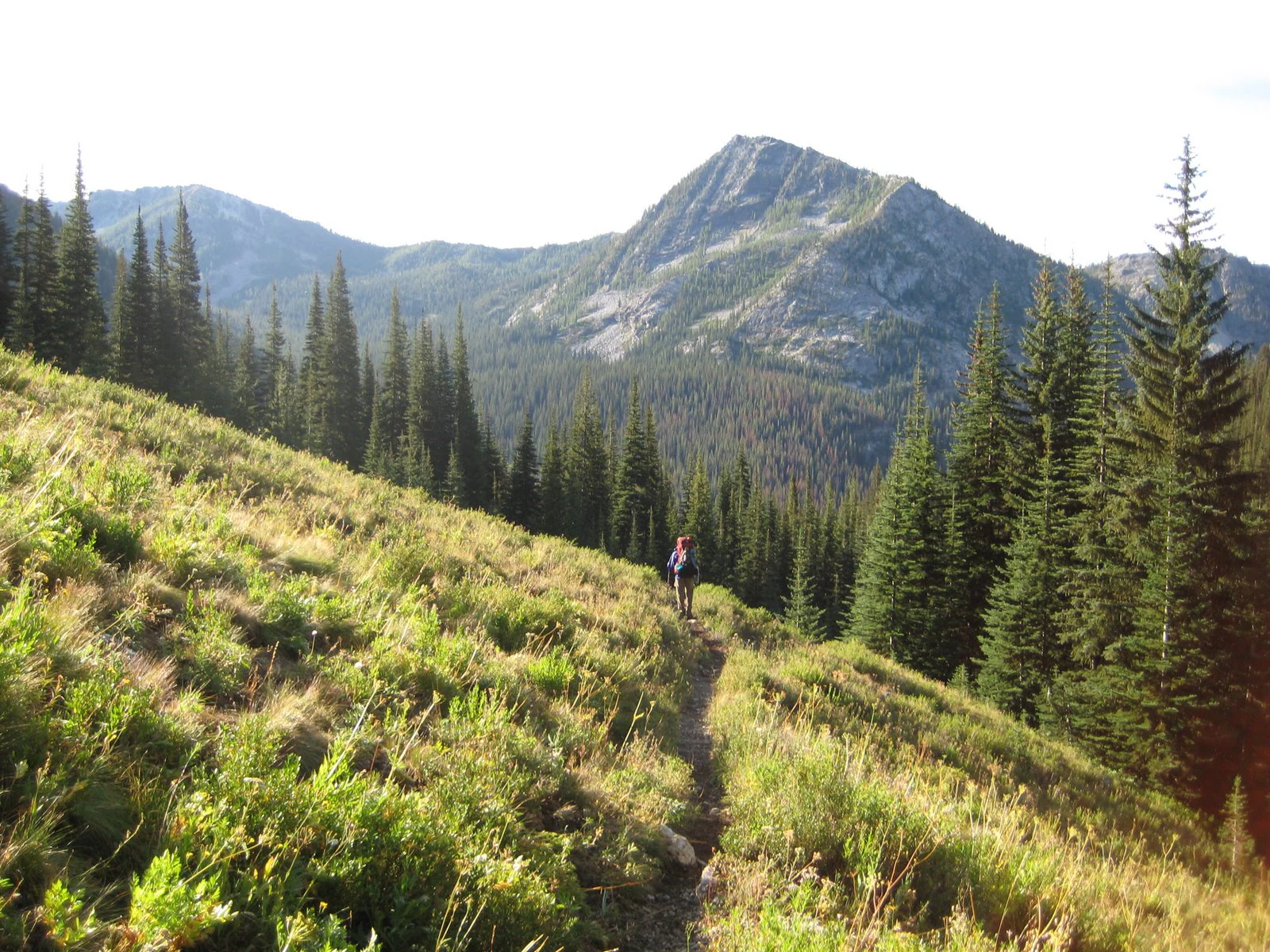
A lone backpacker walks along a narrow dirt trail winding through a grassy, sunlit mountain slope with dense conifer forests and rocky peaks in the background.
A hiker treks along the Prince Creek trail, showcasing the alpine terrain of the Lake Chelan-Sawtooth Wilderness.

Lake Chelan-Sawtooth Wilderness history and protected-area timeline

The lands within today's Lake Chelan-Sawtooth Wilderness were historically part of the Chelan Division of the Washington Forest Reserve, an early federal forest reserve that set the stage for later national forest management. Those lands eventually became part of both the Okanogan and Wenatchee national forests as the federal forest system was reorganized.

The wilderness itself was formally designated in 1984 with the passage of the Washington Wilderness Act, a major piece of legislation that added multiple wilderness areas throughout the state. The 1984 designation converted a large block of already federally managed forest land into formally protected wilderness, placing roughly 153,000 acres under the stricter protections that come with the wilderness designation.

Since designation, the area has remained under U.S. Forest Service management and has functioned primarily as a backcountry landscape shaped by trail-based use rather than road-based recreation. Its relationship to neighboring protected areas, including Lake Chelan National Recreation Area and North Cascades National Park, has continued to reinforce its role as part of a larger North Cascades conservation landscape.

Lake Chelan-Sawtooth Wilderness landscape and geographic character

The Lake Chelan-Sawtooth Wilderness occupies rugged terrain in the eastern part of the North Cascades, with landforms shaped heavily by glacial and alpine processes. The Sawtooth Range and its surroundings present a steady progression from forested lower slopes up through open subalpine meadows and into rocky alpine terrain. Many of the higher basins are the classic bowl-shaped cirques associated with past glaciation, and these cirques often hold the wilderness's 63 lakes, several of which remain unnamed on maps.

The south-facing portion of the range has a distinctive profile of open, rolling high country that contrasts with the dense forest found at lower elevations. This upper terrain falls abruptly into the deep Lake Chelan valley, creating one of the steepest and most dramatic landscape transitions in the area. The vertical relief between the lakeshore and the high rims gives the wilderness much of its scenic intensity and contributes to the broad habitat range found within its boundaries.

Below tree line, the landscape shifts to open forest and meadow systems that frame the transition into the alpine zone. The combination of cirques, basins, forested slopes, and a sharp drop toward Lake Chelan gives the wilderness a layered geographic identity that is unusual even by Cascade Range standards.

Lake Chelan-Sawtooth Wilderness ecosystems, habitats, and plant life

Ecologically, the wilderness spans conditions typical of Washington's east-side Cascade Ranges, moving from drier, open coniferous forest below tree line to cool, wet subalpine and alpine environments above. The lower forest is dominated by conifers suited to the dry side of the Cascades, with open stands that support ground vegetation and allow wildlife movement, while the upper forest and meadows support denser, more sheltered communities typical of higher elevations.

The combination of forest, meadow, lake, and alpine habitats gives the wilderness a layered ecological structure. Lakes and wet meadows scattered through the high country create microhabitats distinct from the surrounding rocky slopes, and the abrupt rise from the Lake Chelan shoreline to the high rims compresses a wide range of vegetation zones into a relatively small horizontal distance.

Snow plays an important role in shaping the ecological rhythm of the area. Seasonal snow cover that often persists from mid or late October through late June strongly influences both the growing season in the high country and the way wildlife uses different elevations throughout the year.

Lake Chelan-Sawtooth Wilderness wildlife and species highlights

The Lake Chelan-Sawtooth Wilderness supports wildlife typical of the dry-side Cascade Range, with mammals such as bears and mule deer commonly using the open forest below tree line. Mule deer in particular are associated with the more open, forest-meadow transition zones where forage and cover are both available, while black bears range widely across both forested and subalpine habitats.

Higher and more remote portions of the wilderness provide habitat for species that thrive in rocky, less disturbed terrain, though specific details of the full faunal community are shaped by elevation, snowpack, and the relative isolation of the upper basins. The numerous lakes and meadows scattered through the high country also support a range of birdlife and small mammal communities adapted to these mosaic habitats.

The wilderness's size and connectivity to surrounding protected landscapes, including North Cascades National Park and the Stephen Mather Wilderness, give its wildlife populations room to move across a much larger block of habitat than the wilderness alone provides.

Lake Chelan-Sawtooth Wilderness conservation status and protection priorities

The Lake Chelan-Sawtooth Wilderness is significant from a conservation standpoint because it preserves a large, contiguous block of federally protected wilderness in a heavily roaded part of the Pacific Northwest. Designation under the Washington Wilderness Act of 1984 placed roughly 153,000 acres under the higher protection standards associated with wilderness status, limiting road construction, mechanized use, and development within its boundaries.

Its position bordering Lake Chelan National Recreation Area, North Cascades National Park, and the Stephen Mather Wilderness gives it added conservation importance as part of a larger complex of protected lands in the North Cascades. This connectivity helps maintain ecological processes for wide-ranging species and reduces fragmentation across what would otherwise be a heavily managed national forest landscape.

Snow persistence, the absence of significant road access within the wilderness itself, and reliance on foot or boat entry for many trailheads all help reduce human pressure on the area. The wilderness thus functions less as an isolated preserve and more as a key eastern node within an interconnected North Cascades conservation landscape.

Top sights and standout views in Lake Chelan-Sawtooth Wilderness

Among the wilderness's standout qualities is the network of 63 high-country lakes, many of them small and unnamed, occupying glacial basins and cirques reached only by trail. The roughly 194 miles of trails, climbing steadily into these basins, define the typical experience of the area and support extended backpacking routes through varied terrain.

The dramatic transition from the forested uplands down to the Lake Chelan shoreline is another defining feature, with south-facing high country dropping steeply into the lake valley. This combination of upper-alpine scenery and lake-side access creates a layered visual identity that distinguishes the wilderness from many other Cascade Range protected areas.

Its role as a connector between Lake Chelan National Recreation Area, North Cascades National Park, and the Stephen Mather Wilderness further reinforces its significance within the larger North Cascades protected landscape.

Best time to visit Lake Chelan-Sawtooth Wilderness

Seasonality strongly shapes a visit to the Lake Chelan-Sawtooth Wilderness because of its heavy snow cover, which often lingers from mid or late October through late June across much of the higher terrain. Summer and early autumn are typically the most accessible periods, when snow has melted out of the basins, lakes are accessible, and trails can be followed into the high country without specialized snow travel.

Late summer through early fall is also when the open forest and subalpine meadows are most exposed and visible, making it a productive period for both scenery and wildlife observation. Visitors planning to use south-side Lake Chelan trailheads should also keep in mind that those approaches depend on boat access rather than road access, which further shapes the practical timing of any trip.
Monthly climate preview

Long-term representative temperature and precipitation averages across the annual cycle

Lake Chelan-Sawtooth Wilderness Climate Normals and Weather by Month

Representative coordinate records show average temperatures ranging from sub-zero winter minimums to positive summer maximums alongside varying monthly precipitation rates. Examining the full twelve-month profile provides complete historical averages for long-term climate analysis.
Annual mean2 °C
-7 °C14 °C
Jan-7°
Feb-6°
Mar-4°
Apr
May
Jun10°
Jul13°
Aug14°
Sep10°
Oct
Nov-3°
Dec-7°
Warmest month
August

13.6 °C

Coolest month
December

-7.3 °C

Wettest month
November

5.1 mm/day

Driest month
August

0.9 mm/day

Park location guide

Geography guide, regional context, and park location map for Lake Chelan-Sawtooth Wilderness

Lake Chelan-Sawtooth Wilderness park geography, regions, and map view in United States of America

Understand where Lake Chelan-Sawtooth Wilderness sits in United States of America through a broader geographic reading of the surrounding landscape, nearby location context, and its mapped position within the national park landscape.

How Lake Chelan-Sawtooth Wilderness fits into United States of America

The United States of America is a federal presidential republic and one of the world's largest countries by area and population. It consists of 50 states across a vast territory spanning multiple time zones, with its capital in Washington, D.C. and largest city in New York City. The nation has a diverse economy, influential political system, and significant cultural and military presence globally.

Wider geography shaping Lake Chelan-Sawtooth Wilderness in United States of America

The United States occupies a vast territory in North America, bordered by Canada to the north and Mexico to the south. The 48 contiguous states stretch from the Atlantic to the Pacific Ocean, while Alaska occupies the northwestern region and Hawaii is an archipelago in the Pacific. The country encompasses diverse terrain including the Rocky Mountains, Appalachian Mountains, Great Plains, and extensive river systems.

Map view of Lake Chelan-Sawtooth Wilderness

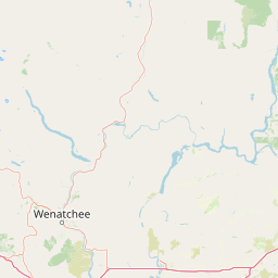
Use this park location map to pinpoint Lake Chelan-Sawtooth Wilderness in United States of America, understand its exact geographic position, and read its mapped placement within the surrounding landscape more clearly.

Pigeon | © OpenStreetMap contributors

Location context for Lake Chelan-Sawtooth Wilderness

Washington
Recorded earthquake history

Explore Historical Earthquake Records for Lake Chelan-Sawtooth Wilderness

Review recorded seismic activity and historical earthquake epicentres near Lake Chelan-Sawtooth Wilderness. This MoriAtlas catalogue provides transparent access to USGS data for researchers and geography enthusiasts tracking seismic trends across the North Cascades.

Lake Chelan-Sawtooth Wilderness Earthquake History

Catalogued events

46 events

Strongest magnitude

Magnitude 4.6

Most recent event

May 28, 2022

This history includes earthquakes recorded inside the park or within 50 km of its borders

Visualizing alpine cirques, forested valleys, and high-country terrain

Lake Chelan-Sawtooth Wilderness Photos and Landscapes

Visual records capture the rugged terrain, glacial basins, and dense coniferous forests defining Lake Chelan-Sawtooth Wilderness. Examining these protected landscapes reveals the dramatic vertical relief between alpine ridges and the deep valley floor.

A lone backpacker walks along a narrow dirt trail winding through a grassy, sunlit mountain slope with dense conifer forests and rocky peaks in the background.

Park atlas

Compare surrounding Cascade Range wilderness terrain and adjacent alpine conservation lands.

Explore Parks Near Lake Chelan-Sawtooth Wilderness and Connected Protected Areas

Browse other parks and protected areas near Lake Chelan-Sawtooth Wilderness to analyze related mountain terrain and high-country ecosystems. Comparing adjacent conservation lands provides deeper context on regional geography and connected Cascade Range habitats.
A pale, minimalist watercolor painting depicting a calm lake surrounded by low, rolling mountains and forest under a soft pastel sky.
Protected landscapeChelan County
Park boundaries overlap#1 closest

West

Lake Chelan National Recreation Area: Protected Geography and North Cascades Map

Glacial terrain and remote mountain valleys in Chelan County

Lake Chelan National Recreation Area protects a rare transition of alpine environments and river-carved valleys in north-central Washington. The terrain is dominated by the long, deep waters of the lake and the steep ridges of the North Cascades, creating an isolated habitat for wild landscapes and historic inland communities. Explore the physical boundaries and topographic features that define this rugged recreation area.

Area
250.74 km²
Established
1968
IUCN
V
Visitors
38.2K annual
National parkWashington
Park boundaries overlap#2 closest

Northwest

North Cascades National Park: US National Park Protected Landscape and Geographic Context

Explore mapped boundaries and regional Washington geography.

Gain insight into North Cascades National Park, a vital US National Park located in Washington. This entry focuses on its protected land status, mapped geographic extent, and its role within the regional atlas. Users seeking to understand the park's landscape character, natural terrain, and its specific location in Washington will find this an essential point for detailed park geography exploration and protected area discovery.

Area
2,042.26 km²
Established
1968
IUCN
II
Visitors
16.5K annual
A watercolor painting of a mountain landscape with soft-colored rolling hills, a green forest line, and foreground vegetation on a white background.
Protected landscapeWashington
Park boundaries overlap#3 closest

North

Okanogan, Wenatchee National Forest: A Comprehensive Look at Washington's Protected Mountain Landscapes

Mapping ecological gradients and wilderness boundaries across the eastern Cascade Range

Spanning from the moist coniferous forests of the western Cascades to the arid plateaus of the Okanogan, this massive national forest protects an unmatched diversity of terrain. Explore the intricate geography of river-carved valleys, glacial cirques, and remote wilderness areas that characterize this critical environmental corridor in the Pacific Northwest.

Area
6,066.33 km²
Established
1911
Visitors
397K annual
Relief
Mountain
A soft watercolor illustration depicting a range of layered mountain peaks with green slopes and snow-covered summits against a white background.
Wildlife reserveWashington
1.2 km away#4 closest

Southwest

Glacier Peak Wilderness: Mapping the Volcanic and Glaciated Geography of Washington State

A detailed look at one of the most remote volcanic reserves in the Cascade Range.

Defined by the presence of an isolated stratovolcano and extensive glacial systems, Glacier Peak Wilderness represents a significant protected area within the Washington Cascades. This overview details the rugged landscape, from the deeply incised river valleys of the Chiwawa and Suiattle to the high-alpine rock and ice environment at the peak summit, providing essential geographic context for this roadless wilderness.

Area
2,290.75 km²
Established
1960
IUCN
Ib
Relief
Mountain
A watercolor painting showing a panoramic view of mountain peaks in the distance above green foothills and plains.
Protected landscapeWashington
23 km away#5 closest

Southwest

Mount Baker, Snoqualmie National Forest: Mapped Geography and Protected Landscape Analysis

Exploratory atlas of Washington's primary Cascade Range wilderness

Delve into the structural geography of Mount Baker, Snoqualmie National Forest. This protected area corridor serves as a major ecological transition zone between the Puget Sound lowlands and the interior Cascades, characterized by extensive glaciers, wild river systems, and iconic stratovolcanoes that define the regional landscape of Washington state.

Area
6,978 km²
Established
1974
Relief
Mountain
Climate
Alpine
A soft watercolor painting of a calm river or lake flowing through a green meadow with a forest and mountain range in the background.
Protected landscapeWashington
31 km away#6 closest

Northwest

Ross Lake National Recreation Area: A Glacial Reservoir Landscape in Washington

Mapping the Skagit River and North Cascades alpine corridor

Located in the heart of Washington, Ross Lake National Recreation Area preserves a unique landscape of connected reservoirs and deep, glacier-cut valleys. This protected area acts as a vital geographic link within the North Cascades, offering access to high-altitude peaks, riverine forests, and the distinct turquoise waters of Diablo Lake.

Area
475.81 km²
Established
1968
IUCN
V
Visitors
998K annual
A horizontal watercolor painting depicting a soft-focus mountain landscape with rolling green meadows, patches of coniferous forest, and distant pale mountains under a white sky.
State or regional parkBritish Columbia
55 km away#7 closest

North

E. C. Manning Provincial Park: A Comprehensive Geographic Atlas and Protected Area Overview

Mountainous terrain and ecological transitions in southern British Columbia

Spanning the cross section of the Canadian Cascades, E. C. Manning Provincial Park preserves a high-elevation landscape of wildflowers, glacial valleys, and mountain ridges. The protected area links temperate coastal rainforests with the arid interior, providing a study in regional hydrology and subalpine ecology defined by the Hozameen Range and the northern reaches of the Pacific Crest Trail.

Area
836.71 km²
Established
1941
IUCN
II
Visitors
1.1M annual
A horizontal watercolor painting showing a range of purple-tinted mountain peaks above a green forest and a light pinkish shoreline.
Wildlife reserveWashington
77 km away#8 closest

Northwest

Mount Baker Wilderness: Mapped Volcanic Peaks and Glacial Geography in Washington State

Protected wilderness boundaries in the Northern Cascades

Mount Baker Wilderness encompasses a vast mountain landscape characterized by an active stratovolcano and significant permanent snowfields. The terrain features a vertical gradient from dense west side conifer forests to exposed alpine summits, creating a distinct ecological corridor connected to neighboring protected areas in the Pacific Northwest.

Area
485.58 km²
Established
1984
IUCN
Ib
Relief
Mountain

Common questions about visiting, size, designation, and location context for Lake Chelan-Sawtooth Wilderness

Lake Chelan-Sawtooth Wilderness FAQs for park facts, access, geography, and protected area context

Find quick answers about Lake Chelan-Sawtooth Wilderness, including protected-area facts, park geography, trail and visitor context, and how the park fits into its surrounding country and regional landscape.
MoriAtlas Explorer

Continue Your Protected Areas Search Across the Global Atlas

Deepen your exploration by continuing the structured search for national parks and protected areas worldwide. Utilize the comprehensive filtering capabilities to compare different conservation landscapes and refine your understanding of global park geography. Discover more about the distribution and characteristics of protected natural areas.

Global natural geography






