
Mori Atlas logo
Nature reserveLampertstal und Alendorfer Kalktriften mit Fuhrbach und Mackental

A karst-rich nature reserve featuring expansive juniper heaths and ancient limestone landscapes

Lampertstal und Alendorfer Kalktriften mit Fuhrbach und Mackental: Eifel Region Protected Area

(Naturschutzgebiet Lampertstal und Alendorfer Kalktriften mit Fuhrbach und Mackental)

Discover the geographic complexity of Lampertstal und Alendorfer Kalktriften mit Fuhrbach und Mackental, an extensive protected mosaic within the Eifel region of North Rhine-Westphalia. This nature reserve preserves rare calcareous spring mires, orchid-rich beech woodlands, and diverse karst landforms such as dolines and swallow holes across eighteen distinct parcels. The area represents a significant conservation intersection of open dry grassland and natural forest habitats.

nature reservelimestone grasslandjuniper heathbeech forestkarst landscapecalcareous spring mire
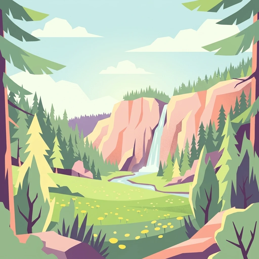
A flat-style digital illustration of a scenic valley with a waterfall cascading down a cliff into a stream that flows through a flower-dotted meadow, framed by evergreen trees.

Lampertstal und Alendorfer Kalktriften mit Fuhrbach und Mackental

Nature reserve

Park overview

Structured park overview, official facts, and landscape profile for Lampertstal und Alendorfer Kalktriften mit Fuhrbach und Mackental

Lampertstal und Alendorfer Kalktriften mit Fuhrbach und Mackental park facts, protected area profile, and essential visitor context

Review the core facts for Lampertstal und Alendorfer Kalktriften mit Fuhrbach und Mackental, including designation, size, terrain, visitor scale, habitats, and operating context in one park-focused overview.

About Lampertstal und Alendorfer Kalktriften mit Fuhrbach und Mackental

Lampertstal und Alendorfer Kalktriften mit Fuhrbach und Mackental forms a sizeable and ecologically varied nature reserve at the edge of the northern Eifel, within the municipality of Blankenheim in Kreis Euskirchen. It stretches in eighteen individual parcels south of the main village of Blankenheim and around the Blankenheim district of Ripsdorf, with the upper course of the Ahr river and the B 258 federal road running nearby to the northeast. The reserve sits prominently within the Dollendorfer Kalkmulde, a structural limestone basin whose geology strongly determines the soils, hydrology and plant communities of the area.

The defining feature of the reserve is its extensive complex of calcareous dry grassland (Kalkmagerrasen), much of it enriched with juniper, covering the limestone hills around Alendorf, including Kalvarienberg, Hämmersberg and Eierberg. These sunny, south-facing slopes support some of the most species-rich dry grassland communities in the region and have led to the area being recognized as the largest juniper conservation site in North Rhine-Westphalia. The dry grasslands are interlaced with natural beech forests on the cooler, mostly north-facing slopes, including stands of Zahnwurz-Buchenwald, Perlgras-Buchenwald and Orchideen-Buchenwald, as well as conifer stands of pine and spruce that reflect older planting history on former grassland.

Beyond its chalk grassland and woodland, the reserve protects a remarkable range of small-scale habitats that reflect its karst geology and hydrology. Karst features such as dolines, swallow holes, karst springs, and dry valleys shape the Lampertsbach, Fuhrbach and Mackental valleys, while small calcareous spring mires (Kalksümpfe), wet meadows, fens and reedbeds add moisture-dependent vegetation to the otherwise predominantly dry landscape. Old quarry sites and former surface iron-ore workings (Pingen) form additional small-scale habitats within the reserve. As part of the FFH site "Gewässersystem der Ahr", the area is integrated into a broader Natura 2000 framework that recognizes its importance for stream fauna, bats, amphibians and insects across the upper Ahr catchment.

Quick facts and research context for Lampertstal und Alendorfer Kalktriften mit Fuhrbach und Mackental

Lampertstal und Alendorfer Kalktriften mit Fuhrbach und Mackental is a designated nature reserve (Naturschutzgebiet) within the municipality of Blankenheim in Kreis Euskirchen, North Rhine-Westphalia, in western Germany. First protected sections date from 1952, and the reserve was consolidated under its current name and extent through the Blankenheim landscape plan in 2007.

The protected landscape spans roughly 1.101 hectares across eighteen separate parcels south and southeast of Blankenheim and around its Ripsdorf district. It is part of the larger FFH (Fauna-Flora-Habitat) site "Gewässersystem der Ahr", designated in 2000, and is documented in the World Database on Protected Areas. Most of the area lies within the Dollendorfer Kalkmulde, a structural limestone basin whose karst geology shapes both terrain and drainage.

Protection and recognition

Documented terrestrial protection scope, designation history, and official recognition records

Lampertstal und Alendorfer Kalktriften mit Fuhrbach und Mackental Protection Status

Lampertstal und Alendorfer Kalktriften mit Fuhrbach und Mackental maintains documented terrestrial protection status established in two thousand seven. Official records detail the designated area boundaries and administrative recognition history for this protected landscape.

Protection details

Protection scope
Terrestrial
Designated year
2007
Transboundary protection
No
WDPA ID
82029
Park context

Deeper park guide and search-rich context for Lampertstal und Alendorfer Kalktriften mit Fuhrbach und Mackental

Lampertstal und Alendorfer Kalktriften mit Fuhrbach und Mackental history, landscape, wildlife, and travel context

Explore Lampertstal und Alendorfer Kalktriften mit Fuhrbach und Mackental through its history, landscape character, ecosystems, wildlife, conservation priorities, cultural context, and seasonal travel timing in a structured park guide built for atlas discovery and search intent.

Why Lampertstal und Alendorfer Kalktriften mit Fuhrbach und Mackental stands out

The reserve is best known as the largest juniper (Wacholder) protection area in North Rhine-Westphalia, with extensive stands of juniper on species-rich limestone dry grassland (Kalkmagerrasen) around the hills above Alendorf. These calcareous grasslands support rare butterflies, grasshoppers and breeding birds, and are paired with natural beech forest and orchid-rich beech woodland on north-facing and sunny slopes. It is also recognized for its karst landforms within the Dollendorfer Kalkmulde, including dolines, swallow holes (Bachschwinden), karst springs and dry valleys, as well as for its calcareous spring mires (Kalksümpfe). This combination of juniper heath, dry limestone flora, wet calcareous habitats, and natural woodland gives the reserve a particularly varied ecological profile for a German inland protected landscape.
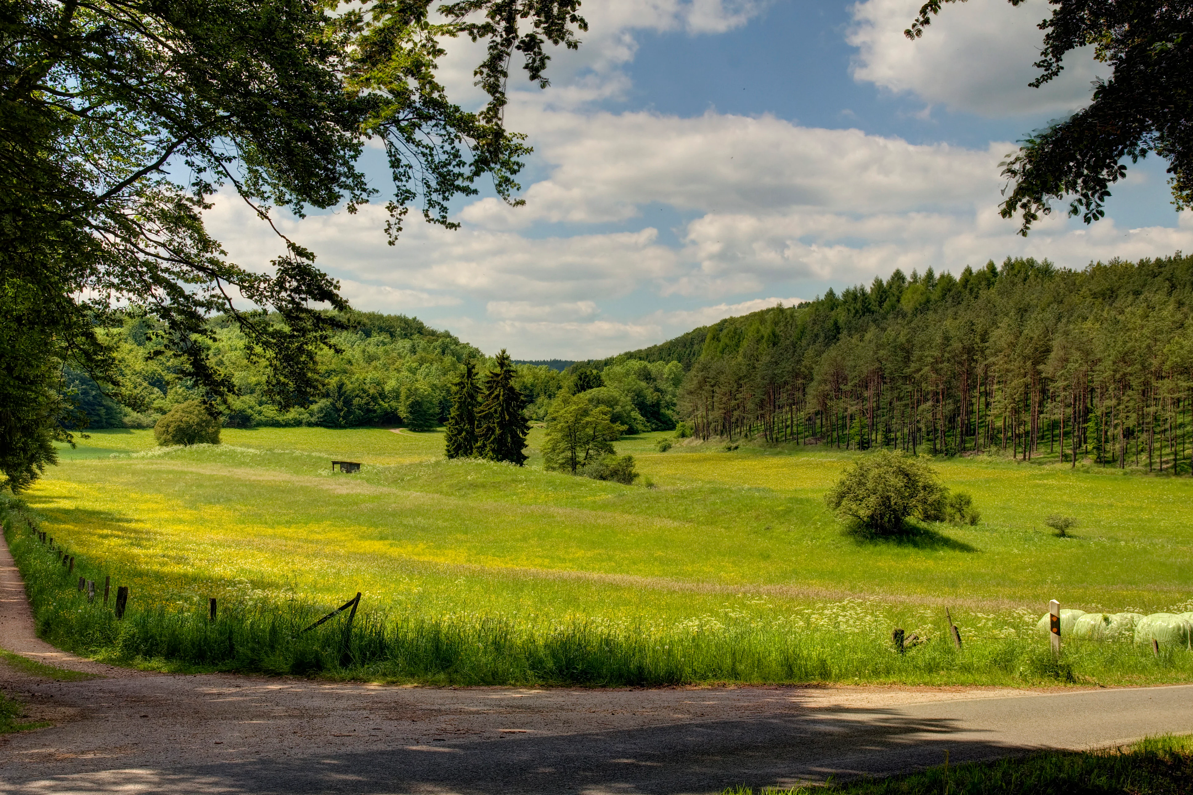
A wide, green valley landscape with rolling meadows, scattered trees, and dense forest slopes under a bright blue sky with light clouds.
A view of the Wammesbachtal valley within the Lampertstal nature reserve.

Lampertstal und Alendorfer Kalktriften mit Fuhrbach und Mackental history and protected-area timeline

Parts of what is now the reserve were first designated as protected areas in 1952, marking some of the earliest nature protection efforts in the Blankenheim area. These early designations already targeted the region's limestone dry grasslands and juniper stands, which had long been shaped by traditional sheep and cattle grazing.

The history of the landscape is closely tied to land use change. From around 1900, and especially between 1950 and 1970, large areas of calcareous grassland were lost to conversion into arable land and to extensive afforestation with spruce, Scots pine, black pine and Serbian spruce, partly carried out by the Reichsarbeitsdienst before 1936/37. Further losses followed the abandonment of traditional grazing with sheep and cattle, which led to scrub encroachment and the spread of naturally colonizing pine. Since 1986, the area of open dry grassland has gradually increased again through the clearing of former woodland, and from 1996 onward the NRW-Stiftung (North Rhine-Westphalia Foundation for Nature Conservation, Homeland and Cultural Care) has been actively purchasing former grassland to secure it for conservation.

In 2000, the broader landscape within the upper Ahr river system was designated as the FFH area "Gewässersystem der Ahr", giving the region formal Natura 2000 recognition. In 2007, the current nature reserve was legally formalized under its present name and extent through the Blankenheim landscape plan, covering about 1,101 hectares across eighteen parcels.

Lampertstal und Alendorfer Kalktriften mit Fuhrbach und Mackental landscape and geographic character

The reserve is built on the geological foundation of the Dollendorfer Kalkmulde, a folded limestone basin whose soluble bedrock gives the area a distinctive karst character. Across the reserve, this geology is expressed in landforms such as dolines, swallow holes where small streams disappear underground, karst springs, and dry valleys that carry water only intermittently. The limestone hills above Alendorf, most prominently the Kalvarienberg, Hämmersberg and Eierberg, rise as rounded, sunny elevations whose thin, base-rich soils support dry grassland and juniper, and are the visual signature of the protected landscape.

The Lampertsbach, Fuhrbach and Mackental valleys cut through this limestone terrain and structure the reserve into a pattern of dry upper slopes, sloping valley sides, and gently graded valley floors. Valley sides are clothed largely in natural beech forest, with orchid-rich beech woodland on the warmer, sun-facing aspects and taller, more closed beech forest, including Zahnwurz-Buchenwald and Perlgras-Buchenwald, on the mostly north-facing and higher slopes. Stands of pine and spruce remain from historical afforestation and are visible behind the open grassland in many views.

The reserve also preserves small but ecologically significant open-water and wetland features within the dry karst setting. Notable elements include a calcareous spring mire east of the Griesheuel along the road from Ripsdorf to Alendorf, a further calcareous mire between Alendorf and Feusdorf north of the K 43, and small fens along the valley floors. The contrast between open, sun-warmed limestone hills, deeply incised wooded valleys, scattered wet flushes, and old quarries and Pingen (former iron-ore workings) gives the landscape its distinctive, finely textured character.
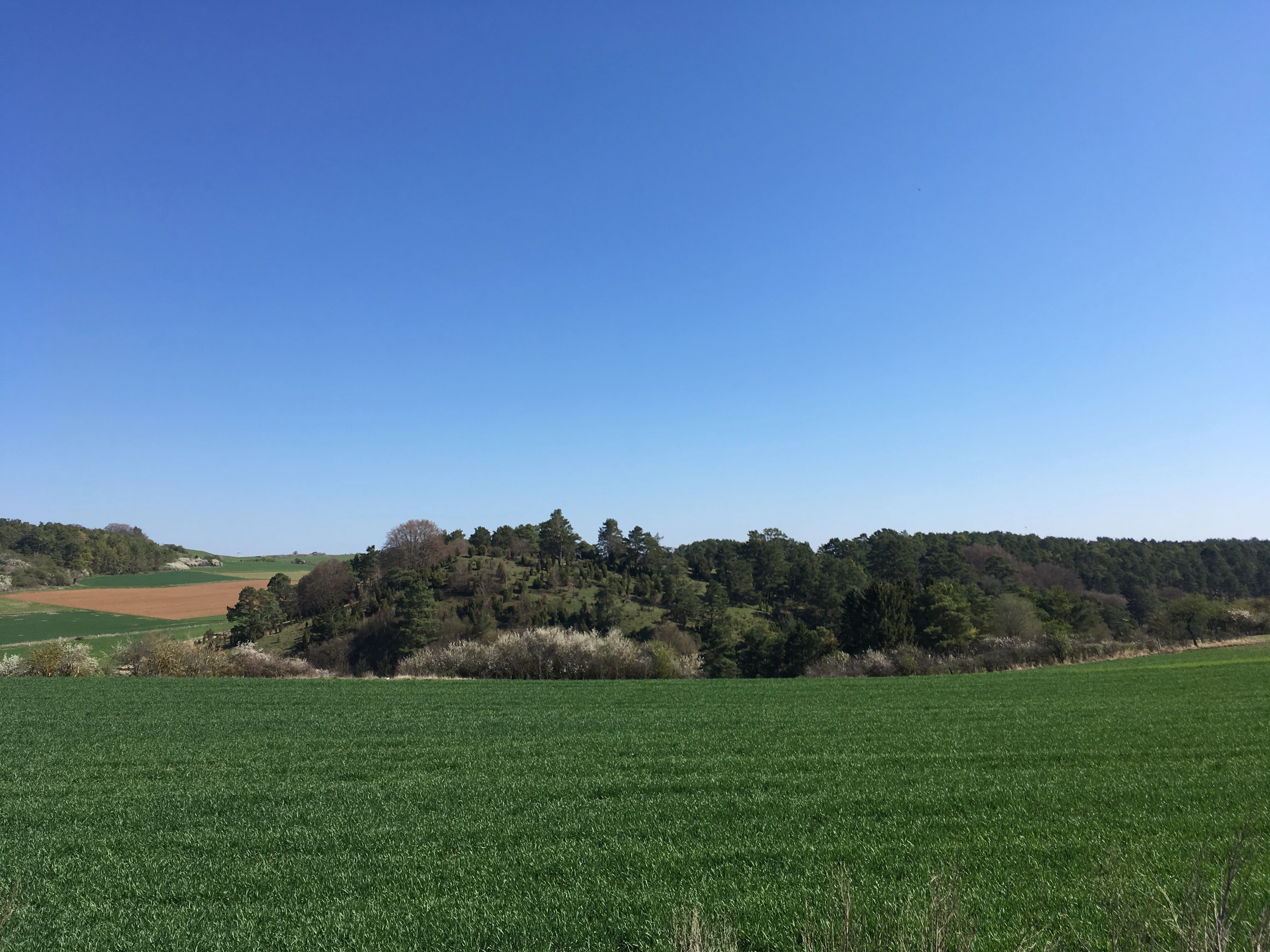
A wide, eye-level landscape shot featuring a green agricultural field in the foreground, leading to a wooded hill and hedgerows under a clear blue sky.
A view of the rolling landscape and hedgerows within the Lampertstal nature reserve.

Lampertstal und Alendorfer Kalktriften mit Fuhrbach und Mackental ecosystems, habitats, and plant life

Ecologically, the reserve is dominated by its calcareous dry grassland complexes, which form the most important and characteristic habitat type within the protected landscape. These grasslands are floristically rich, base-rich in soil chemistry, and support abundant juniper bushes, particularly around Alendorf, where numerous mature Wacholder individuals give the area its status as the largest juniper conservation area in North Rhine-Westphalia. On suitable slopes, these grasslands grade into dry and semi-dry grassland communities (Trocken- und Halbtrockenrasen) that have been the focus of conservation management.

Wetland and spring habitats form a crucial complement to the dominant dry grassland. Springs, small streams, fens, reedbeds, wet meadows, and two notable calcareous spring mires (Kalksümpfe) provide humid micro-habitats within an otherwise dry karst landscape. Small-scale rocky features, screes, caves, and abandoned mine workings and quarries add further habitat diversity, supporting mosses, ferns and other specialist flora, as well as shelter for bats.

Forests occupy a substantial share of the protected area. The northern and higher slopes are dominated by natural beechwood types, including the Zahnwurz-Buchenwald and Perlgras-Buchenwald communities, while the sun-facing slopes carry orchid-rich beech woodland (Orchideen-Buchenwald). Alongside these natural and near-natural forests are stands of spruce, Scots pine, black pine and Serbian pine, many of them legacies of afforestation on former dry grassland between the 1930s and 1970s, which the current management seeks partly to convert back to open grassland.

Lampertstal und Alendorfer Kalktriften mit Fuhrbach und Mackental wildlife and species highlights

The reserve has been designated primarily because of its importance for threatened fauna, in particular for invertebrates and breeding birds associated with its dry grassland, juniper scrub, woodland mosaic, streams and karst features. The combination of open dry grassland, scattered juniper bushes, woodland edges, and small wetland habitats creates a high structural diversity that supports many Red List species in North Rhine-Westphalia.

Among the characteristic invertebrate fauna are butterflies such as the Skabiosen-Scheckenfalter, and notable grasshopper communities on the calcareous grassland. Streams and damp micro-habitats host river fauna including the Groppe (bullhead), as well as amphibians and reptiles, and form important feeding grounds for several bat species, with documented use by Teichfledermaus (pond bat), Bechsteinfledermaus (Bechstein's bat) and Großes Mausohr (greater mouse-eared bat).

The reserve is also significant for birdlife, particularly for raptors and habitat specialists of dry, structured landscapes that include open ground, low scrub and woodland. Documented breeding and visitor species include the Wespenbussard (honey buzzard), Rotmilan (red kite), Uhu (eagle owl), Grauspecht (grey-headed woodpecker), Schwarzspecht (black woodpecker), Braunkehlchen (whinchat), Neuntöter (red-backed shrike) and Raubwürger (great grey shrike). Together with the invertebrate communities, these bird populations are central to the area's recognition as a key refuge and regeneration zone for threatened species.

Lampertstal und Alendorfer Kalktriften mit Fuhrbach und Mackental conservation status and protection priorities

The reserve is protected under formal German nature conservation law as a Naturschutzgebiet and is embedded in the Natura 2000 network through its integration in the FFH site "Gewässersystem der Ahr", designated in 2000. This layered protection highlights the area's value as a refuge and regeneration zone for plants and animals listed on North Rhine-Westphalia's Red List, especially butterflies, grasshoppers, amphibians, reptiles, fish and benthic organisms, as well as for bats and breeding birds.

The reserve's conservation significance rests heavily on its calcareous grasslands and juniper stands, which are among the most threatened habitat types in central Europe. A central conservation goal is the long-term restoration and maintenance of open Kalkmagerrasen, which has been actively pursued since 1986 through woodland clearance and, since 1996, through land purchases by the NRW-Stiftung. Equally important is the protection of natural beech forest communities on the valley slopes, the conservation of karst hydrology, springs, fens and calcareous mires, and the safeguarding of small-scale habitats such as quarries, caves and former iron-ore workings.

Specific management rules reflect this conservation focus. Restrictions apply to grassland rolling and harrowing in spring and early summer, to grazing intensity (including a cap on horse grazing and seasonal restrictions on sheep), to winter grazing where it may conflict with conservation aims, to the use of traps capable of killing wildcats, and to soil liming in sensitive spring, mire and nutrient-poor habitats. Together these measures aim to maintain the open character and species composition of the dry grassland, protect sensitive wetland areas, and support the diverse faunal communities for which the reserve is recognized.

Lampertstal und Alendorfer Kalktriften mit Fuhrbach und Mackental cultural meaning and human context

Although the area is primarily valued for its natural features, it also carries a clear cultural-historical imprint. The protected landscape overlies an old settlement area where traces of long-term human land use are still visible: the medieval ruins of Burg Dollendorf above the Ahr valley, centuries-old stations of the cross along the Kalvarienberg near Alendorf, old Pingen from open-cast iron-ore mining, and abandoned quarries where limestone and Buntsandstein were once extracted.

The present landscape is also the product of centuries of pastoral use. Traditional sheep and cattle grazing once maintained the open Kalkmagerrasen that now form the ecological backbone of the reserve. When grazing declined in the twentieth century and large areas were afforested or left to scrub, the open character of these hills began to disappear. The conservation story of the reserve is therefore as much a story of recent cultural land-use change as it is of underlying natural history, with restoration work since 1986 deliberately seeking to recover the semi-open, juniper-rich grassland landscape shaped by past generations.

Top sights and standout views in Lampertstal und Alendorfer Kalktriften mit Fuhrbach und Mackental

Largest juniper conservation area in North Rhine-Westphalia, anchored on the species-rich limestone dry grasslands around Alendorf and the hills Kalvarienberg, Hämmersberg and Eierberg.

A fine-scale mosaic of dry calcareous grassland, natural beech forest including orchid-rich beech woodland, conifer stands with conservation history, calcareous spring mires, fens, and karst landforms such as dolines, swallow holes and dry valleys within the Dollendorfer Kalkmulde.

Regionally important refuge for Red List butterflies, grasshoppers, amphibians, bats, and breeding and visitor birds including Wespenbussard, Rotmilan, Uhu, Grauspecht, Schwarzspecht, Braunkehlchen, Neuntöter and Raubwürger.

A landscape shaped by both natural karst geology and a long history of grazing, iron mining, and quarrying, with medieval ruins and centuries-old cross stations preserved within its boundaries.

Best time to visit Lampertstal und Alendorfer Kalktriften mit Fuhrbach und Mackental

Late spring and early summer bring the dry limestone grasslands into their most expressive phase, when the species-rich Kalkmagerrasen and their associated butterflies and grasshoppers are most active and the warm, south-facing slopes carry a strong bloom. Summer offers the broadest visibility across the open landscape, with juniper stands fully leafed out and long views over the hills above Alendorf. Autumn tends to bring quieter conditions, warmer lowland colors, and good opportunities to observe breeding and migrant birds as activity shifts. Winter visits showcase the underlying karst topography, woodland structure, and cultural-historical features more starkly, though visitor infrastructure is limited and weather in the northern Eifel can be harsh.

Monthly climate preview

Long-term temperature and monthly precipitation patterns for North Rhine-Westphalia

Lampertstal und Alendorfer Kalktriften mit Fuhrbach und Mackental Climate Normals

Representative measurements from 1991 to 2020 record average monthly temperatures ranging from near freezing to warm midyear highs alongside steady precipitation totals. Examining the full twelve-month profile reveals complete meteorological trends across the protected landscape.
Annual mean9 °C
0 °C18 °C
Jan
Feb
Mar
Apr
May12°
Jun15°
Jul18°
Aug18°
Sep14°
Oct
Nov
Dec
Warmest month
July

17.9 °C

Coolest month
January

0 °C

Wettest month
June

2.5 mm/day

Driest month
April

1.6 mm/day

Park location guide

Geography guide, regional context, and park location map for Lampertstal und Alendorfer Kalktriften mit Fuhrbach und Mackental

Lampertstal und Alendorfer Kalktriften mit Fuhrbach und Mackental park geography, regions, and map view in Germany

Understand where Lampertstal und Alendorfer Kalktriften mit Fuhrbach und Mackental sits in Germany through a broader geographic reading of the surrounding landscape, nearby location context, and its mapped position within the national park landscape.

How Lampertstal und Alendorfer Kalktriften mit Fuhrbach und Mackental fits into Germany

Germany is a federal republic in Western and Central Europe with a population of over 83 million across sixteen constituent states. It is Europe's largest economy by nominal GDP and a major global exporter and importer. The capital is Berlin, and the country borders Denmark, Poland, Czech Republic, Austria, Switzerland, France, Luxembourg, Belgium, and the Netherlands.

Wider geography shaping Lampertstal und Alendorfer Kalktriften mit Fuhrbach und Mackental in Germany

Germany is located in Western and Central Europe, spanning 357,022 km². It borders Denmark to the north, Poland and the Czech Republic to the east, Austria and Switzerland to the south, and France, Luxembourg, Belgium, and the Netherlands to the west. The country has coastlines on the Baltic Sea and North Sea to the north, with the Alps located in the southern region.

Map view of Lampertstal und Alendorfer Kalktriften mit Fuhrbach und Mackental

Use this park location map to pinpoint Lampertstal und Alendorfer Kalktriften mit Fuhrbach und Mackental in Germany, understand its exact geographic position, and read its mapped placement within the surrounding landscape more clearly.

Pigeon | © OpenStreetMap contributors

Location context for Lampertstal und Alendorfer Kalktriften mit Fuhrbach und Mackental

North Rhine-Westphalia

Visualizing limestone dry grasslands, juniper scrub, and karst terrain across the protected landscape

Lampertstal und Alendorfer Kalktriften mit Fuhrbach und Mackental Photos and Landscape Scenery

Examinations of park photography reveal the complex terrain, sunlit limestone hills, and wooded valleys defining Lampertstal und Alendorfer Kalktriften mit Fuhrbach und Mackental. Visual records provide essential context for understanding the juniper scrub, calcareous spring mires, and protected habitats shaping the regional Eifel ecosystem.

A wide, green valley landscape with rolling meadows, scattered trees, and dense forest slopes under a bright blue sky with light clouds.

A sunny grassy hillside in the Lampertstal nature reserve with many small juniper bushes, a wooden park bench in the foreground, and a nature reserve sign on a post to the right.

A wide, eye-level landscape shot featuring a green agricultural field in the foreground, leading to a wooded hill and hedgerows under a clear blue sky.

Park atlas

Compare adjacent protected areas and surrounding regional limestone landscapes

Parks Near Lampertstal und Alendorfer Kalktriften mit Fuhrbach und Mackental

Browsing other protected areas near Lampertstal und Alendorfer Kalktriften mit Fuhrbach und Mackental reveals broader ecological patterns across the Eifel region. Analyzing these connected landscapes provides helpful regional context for comparing limestone terrain and juniper habitats.
Nature reserveNorth Rhine-Westphalia
About 4.9 km away#1 closest

Northeast

Vogelschutzgebiet Ahrgebirge Nature Reserve, North Rhine-Westphalia Protected Landscape

Mapped ridge terrain and woodland habitat in the western Eifel region

The Vogelschutzgebiet Ahrgebirge serves as a significant nature reserve protecting the North Rhine-Westphalian side of the Ahrgebirge ridge. Its geography consists of dense, near-natural deciduous forests, stream-cut valleys, and deadwood habitats that provide breeding ground for specialist avian species, forming part of a larger interconnected network across the Rhenish Slate Mountains.

Area
5.8 km²
Established
2004
Nature reserveNorth Rhine-Westphalia
About 14 km away#2 closest

West

Simmeler Bach Nature Reserve: Geographic Atlas and Protected Landscape Overview

Riparian stream valleys and forest habitats in North Rhine-Westphalia

Simmeler Bach serves as a vital nature reserve and restored stream corridor in the Eifel district of Euskirchen. The protected area features a diverse landscape including open wet meadows, alder-lined brook banks, and rare mat-grass sward, all integrated into a wider regional network of conserved riparian habitats across western Germany.

Area
1.086 km²
Established
2001
Relief
Upland
Climate
Temperate
A horizontal watercolor illustration showing soft, rolling hills, patches of forest, and a grassy foreground in muted green and pink tones against a pale yellow sky.
Nature reserveRhineland-Palatinate
About 17 km away#3 closest

South

Ernstberg Nature Reserve: Volcanic Geology and Forested Terrain in Rhineland-Palatinate

A key protected geological monument in the West Eifel

Ernstberg is a major basalt stratovolcano within the Vulkaneifel region, characterized by its distinct crater wall and historic millstone quarries. The area functions as a protected nature reserve and FFH site, showcasing important geological features such as the rocky Martinswand. Explore the physical geography, mapped volcanic profile, and protected habitat context of this significant German natural monument.

Area
0.96 km²
Established
1978
Relief
Mountain
Climate
Temperate
Nature reserveRheinland-Pfalz
About 17 km away#4 closest

East

Quiddelbacher Höhe / Nürburgring Nature Reserve: A Protected Highland Plateau in the Eifel

Explore the regional geography and conservation landscape of Rheinland-Pfalz

Quiddelbacher Höhe / Nürburgring protects a distinct highland plateau surface known for its rare vegetation and critical role in local ecological conservation. Situated near major transit corridors and the famous racing circuit, the site provides a quiet, open landscape contrast within the larger Ahrweiler region of Germany.

Area
0.27 km²
Established
2002
Relief
Upland
Climate
Temperate
A soft watercolor painting of a rolling landscape with gentle hills, distant mountain ridges, and a foreground of trees and meadows.
Nature reserveNorth Rhine-Westphalia
About 18 km away#5 closest

West

Lewertbach mit Nebenbächen Nature Reserve: A Detailed Geographic and Landscape Atlas Profile

Examining the Nordeifel stream system and protected pastoral habitats

Located in the Euskirchen district, Lewertbach mit Nebenbächen protects a diverse mosaic of naturally flowing brooks and hedgerow-structured pastures. The reserve functions as a key component of the regional FFH habitat network, showcasing the delicate balance between aquatic drainage lines and traditional lowland meadow landscapes across three distinct parcels.

Area
0.713 km²
Established
2001
IUCN
IV
Nature reserveNorth Rhine-Westphalia
About 19 km away#6 closest

North

Kakushöhle Nature Reserve: Atlas and Geographic Mapping of an Eifel Travertine Landscape

Geographic study of travertine cave formations and archaeological terrain in Germany

Kakushöhle constitutes an essential protected area for understanding travertine rock formation and human history within the Eifel. The site features an open cave complex nestled in the Kakusfelsen, providing a clear window into prehistoric geological and human occupation patterns across the North Rhine-Westphalia landscape.

Area
0.058 km²
Established
1932
Relief
Upland
Climate
Temperate
Watercolor painting depicting gentle, rolling hills covered in light green forest, with a soft horizon line and pale foreground.
Nature reserveRhineland-Palatinate
About 21 km away#7 closest

South

Nerother Kopf: Volcanic Cinder Cone Landscape and Nature Reserve in Rhineland-Palatinate

Geological and protected woodland study in the German Eifel

Investigate the volcanic terrain of Nerother Kopf, a double cinder cone landmark in Rhineland-Palatinate. This nature reserve provides essential insights into Eifel geology, featuring a combination of protected beech forest, historical castle ruins, and visible basalt quarrying.

Relief
Mountain
Climate
Temperate
Access
Easy access
Scope
Terrestrial
Nature reserveRhineland-Palatinate
About 22 km away#8 closest

Southwest

Niesenberg bei Weinsheim Nature Reserve: Geography and Protected Area Overview

Dolomite hill and calcareous grassland in Rhineland-Palatinate

Niesenberg bei Weinsheim is a protected nature reserve located in the Eifel region of Germany, centered on a distinct dolomite hill. The reserve protects a fine-grained mosaic of semi-natural dry grasslands and pine stands that contrast sharply with the surrounding slate uplands. Its unique soil chemistry supports a specialized array of flora, making it an essential point of study for understanding the biodiversity of the Prüm Limestone Basin.

Area
0.085 km²
Established
1985
Relief
Upland
Climate
Temperate

Common questions about visiting, size, designation, and location context for Lampertstal und Alendorfer Kalktriften mit Fuhrbach und Mackental

Lampertstal und Alendorfer Kalktriften mit Fuhrbach und Mackental FAQs for park facts, access, geography, and protected area context

Find quick answers about Lampertstal und Alendorfer Kalktriften mit Fuhrbach und Mackental, including protected-area facts, park geography, trail and visitor context, and how the park fits into its surrounding country and regional landscape.
MoriAtlas Explorer

Continue Your Protected Areas Search Across the Global Atlas

Deepen your exploration by continuing the structured search for national parks and protected areas worldwide. Utilize the comprehensive filtering capabilities to compare different conservation landscapes and refine your understanding of global park geography. Discover more about the distribution and characteristics of protected natural areas.

Global natural geography