
Mori Atlas logo
Nature reserveLangenstüttig und Basaltblockmeer am Buchschirmküppel bei Batten

Examining the unique volcanic basalt boulder fields and layered forest successions within the Rhön highlands

Langenstüttig und Basaltblockmeer am Buchschirmküppel bei Batten Nature Reserve: A Detailed Geographic Atlas

(Naturschutzgebiet Langenstüttig und Basaltblockmeer am Buchschirmküppel bei Batten)

This protected area in Hessen encompasses significant volcanic geological features and varied forest ecosystems across the Rhön highlands. Visitors can trace the spatial distribution of expansive basalt blockfields, near-natural spring woodlands, and species-rich mountain meadows that define the terrain from the Buchschirmküppel summit to the lower slopes. The site serves as a vital ecological reference for studying forest succession and long-term land development in a complex montane landscape.

Rhön highlandsBasalt blockfieldVolcanic geologyBeech forestMontane woodlandSpring and seepage mires
A flat vector-style illustration of a landscape with a waterfall cascading down rocky cliffs, a dead tree in the foreground, and a field of yellow flowers under a bright sun.

Langenstüttig und Basaltblockmeer am Buchschirmküppel bei Batten

Nature reserve

Park overview

Structured park overview, official facts, and landscape profile for Langenstüttig und Basaltblockmeer am Buchschirmküppel bei Batten

Langenstüttig und Basaltblockmeer am Buchschirmküppel bei Batten park facts, protected area profile, and essential visitor context

Review the core facts for Langenstüttig und Basaltblockmeer am Buchschirmküppel bei Batten, including designation, size, terrain, visitor scale, habitats, and operating context in one park-focused overview.

About Langenstüttig und Basaltblockmeer am Buchschirmküppel bei Batten

Langenstüttig und Basaltblockmeer am Buchschirmküppel bei Batten is a Hessian nature reserve that captures some of the most distinctive geology and woodland ecology of the northern Rhön highlands. The reserve occupies a transitional position between the higher, more open Hohe Rhön to the south and the rolling Kuppenrhön landscape of basalt hills further north. Its roughly 97 hectares span elevations from approximately 540 meters in the Langenstüttig area up to about 725 meters at the Buchschirmküppel, the highest point of the protected area.

The defining physical feature of the reserve is its basalt boulder landscape. Local geological processes fractured the ancient volcanic basalt into dense fields of broken rock that now cover large parts of the slopes. These blockfields, known as Basaltblockmeer, are not just scenic; they form a specialized substrate for cold-tolerant lichens, mosses and other pioneer vegetation. Their conservation is one of the explicit goals of the protected area.

Woodland forms the dominant land cover inside the reserve. The forest communities reflect the underlying geology, moisture conditions and long history of grazing use. The most widespread type is the Zahnwurz-Buchenwald, a beech forest with a richly developed herb layer including characteristic species such as bulbous toothwort, wood anemone and, in places, expansive stands of wild garlic along the freshwater flows. In seepage zones and along block-strewn slopes, slow-growing Bergahorn-Eschenwald communities and smaller patches of Sommerlinden-Bergulmen blockschuttwald add further structural diversity. Cold, slow-moving springs feed patches of Hainmieren-Erlenwald.

Although the area lies on both sides of a state road, it is not directly crossed by marked hiking trails; instead, visitors typically experience it from the perimeter viewing the adjacent Buchschirm summit. The protected status discourages heavy infrastructure, and the focus is on conservation, succession monitoring and scientific recording. Ongoing research by the Senckenberg Society for Natural Research has documented a substantial fraction of an estimated 40,000 native animal species present in the broader region, reinforcing the reserve's value as a living laboratory for upland ecology.

Quick facts and research context for Langenstüttig und Basaltblockmeer am Buchschirmküppel bei Batten

Heimatwald und Naturschutzgebiet in der hessischen Rhön, ausgewiesen 2013 durch Zusammenlegung der älteren Schutzgebiete Basaltblockmeer am Buchschirmküppel (seit 1970) und Langenstüttig bei Batten (seit 1985). Rund 97 Hektar Fläche, davon etwa 88 Hektar in der Kernzone des Biosphärenreservats Rhön. Eingebettet in das EU-Vogelschutzgebiet Hessische Rhön und damit Teil des Natura-2000-Netzes. IUCN-Schutzgebietskategorie IV, also ein Habitat- und Artenschutzgebiet mit Management. Geländehöhen zwischen rund 540 Metern im Langenstüttig-Bereich und etwa 725 Metern am Buchschirmküppel. Geprägt durch Basaltblockhalden, naturnahe Feuchtwälder, Quell- und Versumpfungsmoore sowie kleinflächige Bergwiesen.

Protection and recognition

Examine documented conservation frameworks and administrative designation records for this protected landscape.

Protection Status and International Recognition for Langenstüttig und Basaltblockmeer am Buchschirmküppel bei Batten

Examine the registered conservation framework and official protected area records associated with Langenstüttig und Basaltblockmeer am Buchschirmküppel bei Batten. Review structured international database identifiers and recognized environmental designations compiled within the global park atlas.

Protection details

WDPA ID
555560675
Park context

Deeper park guide and search-rich context for Langenstüttig und Basaltblockmeer am Buchschirmküppel bei Batten

Langenstüttig und Basaltblockmeer am Buchschirmküppel bei Batten history, landscape, wildlife, and travel context

Explore Langenstüttig und Basaltblockmeer am Buchschirmküppel bei Batten through its history, landscape character, ecosystems, wildlife, conservation priorities, cultural context, and seasonal travel timing in a structured park guide built for atlas discovery and search intent.

Why Langenstüttig und Basaltblockmeer am Buchschirmküppel bei Batten stands out

The reserve is best known for its extensive basalt blockfields, locally called Basaltblockmeer, which are unusual geological features even within the volcanic Rhön landscape. Beyond their geomorphological interest, these basalt blocks support a rich cover of lichens and mosses that gives the boulder fields their distinctive scientific value. The area is also recognized for its mosaic of upland woodland communities, including Zahnwurz-Buchenwald (toothwort beech forest), Bergahorn-Eschenwald (sycamore-ash forest), Sommerlinden-Bergulmenwald and small patches of Hainmieren-Erlenwald along streams. Combined with springs, mires, orchid-rich fallow land and species-rich meadows, the site has become a reference location for studying forest succession and the development of flora and fauna on former grazing land.
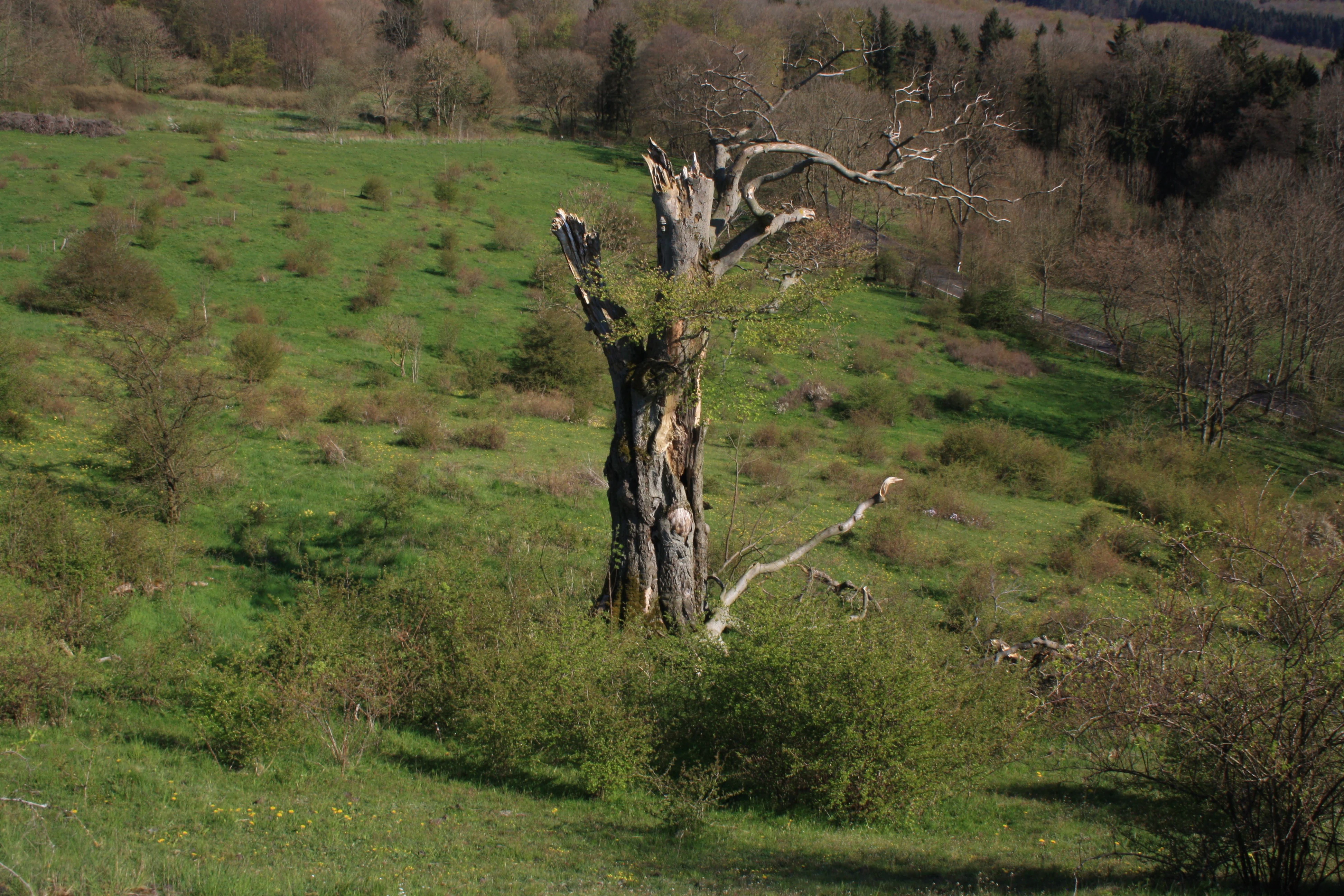
A large, old, and partially decayed tree trunk stands in a sloping, green meadow filled with small shrubs and bushes under daylight.
A weathered, dead tree stands prominently in the middle of a grassy, shrub-dotted landscape in the nature reserve.

Langenstüttig und Basaltblockmeer am Buchschirmküppel bei Batten history and protected-area timeline

The reserve has a layered protection history that reflects evolving conservation thinking in Germany over several decades. The western portion around the Buchschirmküppel was first protected in 1970 as the Naturschutzgebiet Basaltblockmeer am Buchschirm, making it one of the earlier landscape-scale conservation measures in this part of the Rhön. The eastern portion around Langenstüttig bei Batten followed in 1985 with its own designation, expanding protection to roughly 47 hectares of woodland on the opposite side of the state road.

In 2013 the two earlier reserves were merged into a single Hessian nature reserve under a unified name and identifier, integrating legacy protection into a modern, larger unit. The merger did not diminish protection; rather, it consolidated overlapping ecological values, streamlined management and aligned the site with the framework of the Rhön Biosphere Reserve and the EU Natura 2000 network.

Human use of the area stretches back much further than formal conservation. From around the 11th century the high Rhön was progressively brought into cultivation and even arable farming, but the shallow, wet, basalt-strewn ground around the Buchschirm was too marginal for crops. It was instead used as Hutung, a form of communal grazing land where livestock, mostly sheep in later periods, were pastured among scattered veteran trees, the so-called Hutebäume. As the mechanization of agriculture after the Second World War made extensive shepherding uneconomic, these communal pastures lost their grazing pressure and began a process of natural reforestation that continues into the present. The transformation from open woodland pasture to closed-canopy beech forest is one of the key successional stories now unfolding within the reserve.

Langenstüttig und Basaltblockmeer am Buchschirmküppel bei Batten landscape and geographic character

The reserve sits within a classic Rhön upland topography: rounded basalt hills, gentle ridges and shallow valleys shaped by long volcanic history and sustained periglacial weathering. Elevations inside the area stretch from roughly 540 meters along the lower Langenstüttig slopes to about 725 meters at and around the Buchschirmküppel summit, giving the protected area a meaningful vertical range despite its small size.

The most striking landscape feature is the basalt blockfield. Vast numbers of fractured basalt boulders carpet the slopes around the Buchschirm and, to a lesser extent, the Langenstüttig area, creating a rocky, uneven ground that strongly controls what vegetation can establish. In places these blockfields form almost continuous seas of stone, locally called Basaltblockmeer, which lend the area its name. Smaller outcrops of Buntsandstein and Muschelkalk bedrock appear in the Langenstüttig section, interrupting the otherwise basalt-dominated geology.

Water shapes the landscape in subtle but important ways. Cold, slow springs feed short streams and seepage zones that develop mires and boggy depressions. These wet pockets form ribbons of greener vegetation through the otherwise dry, rocky slopes. The mosaic of dry blockfield, moist seepage woodland and small meadow patches along the protected zone edges gives the area a strongly patterned, easily readable landscape character.
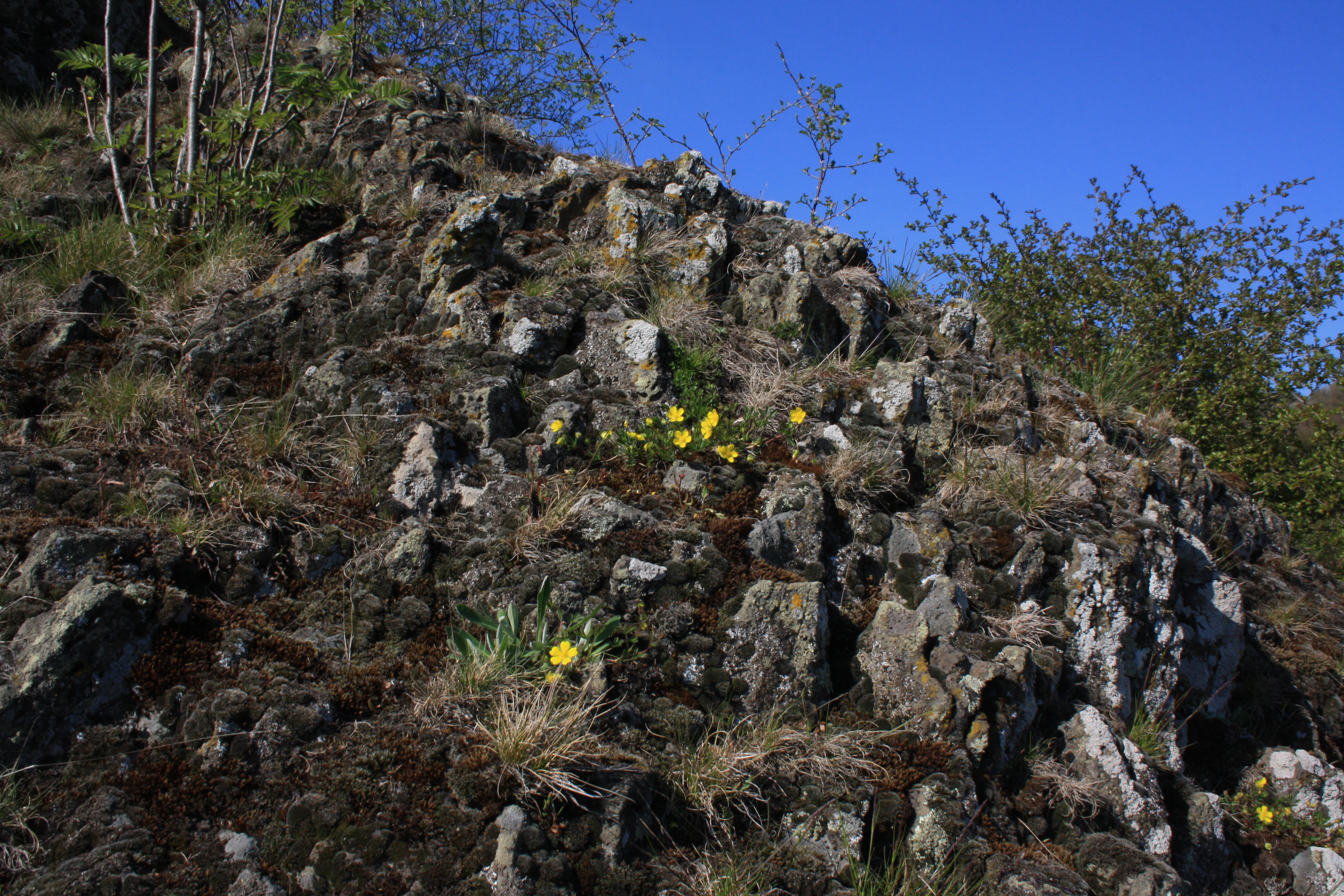
A steep slope covered in jagged, dark basalt rock blocks, with patches of grass and small yellow flowers growing between the crevices under a clear blue sky.
A view of the basalt rock formations and vegetation at the Buchschirmküppel nature reserve.

Langenstüttig und Basaltblockmeer am Buchschirmküppel bei Batten ecosystems, habitats, and plant life

Ecologically, the reserve is defined less by a single habitat than by the close interplay between extremely harsh substrates and unusually sheltered microclimates. The basalt boulders provide stable surfaces for lichens, mosses and certain specialist plants, while the cold springs and seeps beneath the slopes create refuges for moisture-loving vegetation that could not otherwise survive at these elevations.

Woodland dominates the protected area and appears in a surprising range of forms. Toothwort beech forest is the most widespread community, often arising from former woodland pasture on basalt ground and developing a rich herb layer of wood anemones, wild garlic, toothwort and other classic Rhön woodland species. On block-strewn, seepage-moist slopes a different arrangement emerges: a slow-growing sycamore and ash forest with associated woodland herbs, while summits and drier blockfields support small islands of summer linden and wych elm block-rubble woodland. Alder-dominated riparian woodland traces the smallest streams.

Mires and flushes are another important element. Several species-rich spring and seepage mires are scattered across the slopes, with small open areas that support cotton grass, marsh marigold, marsh cinquefoil and various orchids. Abandoned oat stubbles within the former pastureland harbor further orchid populations. Together, the basalt boulder habitats, near-natural moist forests and small mires give the site a dense concentration of habitat types within a small footprint.
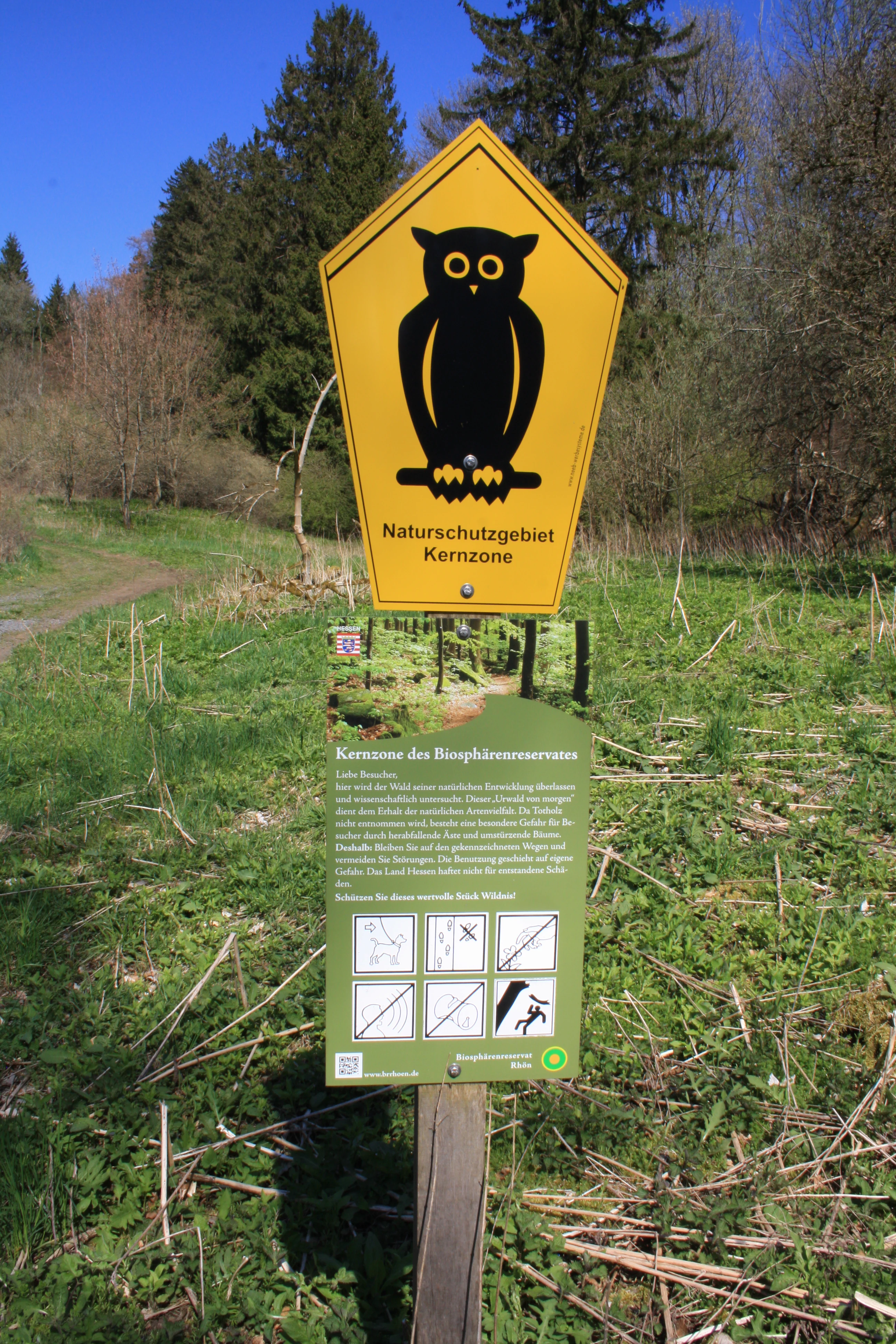
A yellow pentagonal nature reserve sign featuring a black owl icon, mounted above a secondary green information board with various pictograms and text, set in a grassy meadow with trees in the background.
Information signage at the Buchschirmküppel nature reserve marking the core zone.

Langenstüttig und Basaltblockmeer am Buchschirmküppel bei Batten wildlife and species highlights

The reserve sits within a richly studied region that supports an estimated 40,000 native animal species, and the protected area itself has been the focus of intensive biological survey work since the late 1990s. Researchers from the Senckenberg Society for Natural Research have systematically documented the fauna here, building a record of species succession across the transition from open grazing land to closed forest.

Because of the strong habitat mosaic, the wildlife character of the reserve reflects its geology. The cold, wet, block-strewn slopes and the surrounding mosaic forest host populations of typical Rhön upland species adapted to montane conditions. Small streams and riparian woodlands provide habitat for amphibians, aquatic invertebrates and stream-dependent insects. The varied flowering plants in the small meadows, fallows and mire margins sustain diverse pollinator communities, especially bees, hoverflies and butterflies.

Because the area is small, highly protected and surrounded by other green spaces within the biosphere reserve, large mammals of interest include typical forest species using the wider forest network. Birdlife is shaped by the area's inclusion in the EU Hessische Rhön Birds Directive site, with the surrounding forests and meadows providing habitat for characteristic Rhön breeding and foraging species. Documented species detail beyond this level would go beyond what the source material supports.
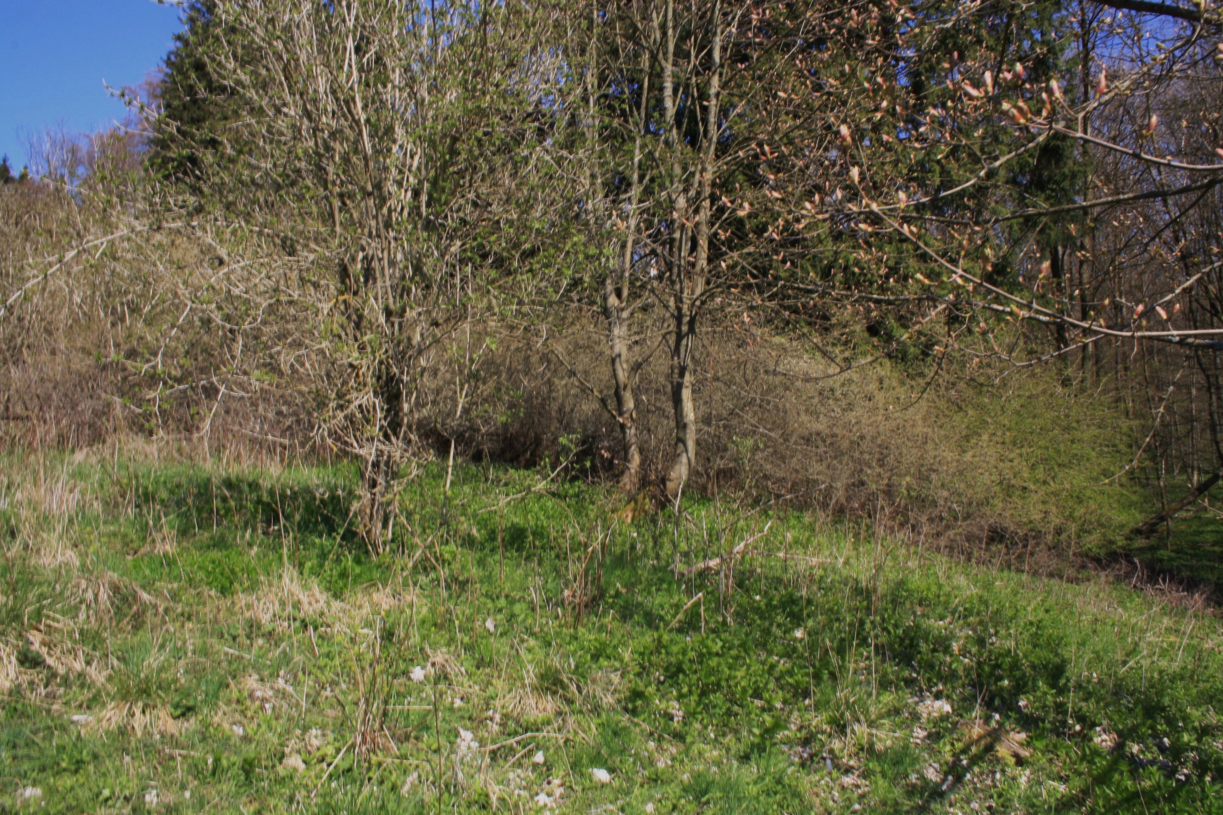
A view of green grassy ground with sparse deciduous trees and forest edge in early spring.
Vegetation and forest edge at the Buchschirmküppel nature reserve.

Langenstüttig und Basaltblockmeer am Buchschirmküppel bei Batten conservation status and protection priorities

Conservation significance is the central reason the reserve exists. The protected area was specifically established to safeguard the unusual basalt blockfields and the biodiversity they support, while at the same time maintaining natural forest dynamics, springs and mires. Because most of the land lies within the core zone of the Rhön Biosphere Reserve, it is managed according to strict biosphere reserve principles, with the remaining small portion managed as a care zone that allows slightly more flexibility.

A second conservation focus is ecological succession. The reserve is not managed as a static museum of past landscapes; instead, it is designed in part as a scientific site where the gradual transformation of former communal grazing land into closed forest can be observed, recorded and learned from. The systematic documentation of flora and fauna by Senckenberg researchers is part of that mission.

Inclusion in the EU Birds Directive site Hessische Rhön connects the reserve to the wider European Natura 2000 network, extending its conservation profile beyond national nature protection. Combined with the protected status from 1970 and 1985 in different sections of the area, this layered legal framework gives the basalt boulder fields and their associated habitats long-term protection against the kind of intensive land use that shaped much of the surrounding Rhön landscape in the 20th century.

Langenstüttig und Basaltblockmeer am Buchschirmküppel bei Batten cultural meaning and human context

The reserve reflects a deep cultural layer in which humans have shaped the high Rhön landscape for many centuries. From around the 11th century the uplands of the region were progressively opened to agriculture and even grain cultivation, but the harsh, basalt-strewn ground around the Buchschirm proved unsuitable for crops. Instead, it was set aside as communal grazing land used collectively by the surrounding villages, a tradition that left the scattered old trees known as Hutebäume as living witnesses of this older land use.

Later social and economic change reshaped these traditions. As mechanized agriculture after the Second World War reduced the practicality of shepherding on marginal land, traditional communal grazing largely collapsed. The reduction of grazing pressure triggered widespread shrub encroachment across the former Hutewald, a process that continues today and shapes how conservationists and visitors experience the landscape. This transition from medieval communal land use to modern protected area is one of the defining cultural and ecological stories of the reserve.

Top sights and standout views in Langenstüttig und Basaltblockmeer am Buchschirmküppel bei Batten

The reserve's most distinctive highlights are its basalt blockfield landscape around the Buchschirmküppel and the layered forest communities that have developed from former grazing woodland. The boulder fields are not only visually striking but ecologically important, supporting specialist lichens and mosses that thrive on the exposed volcanic rock.

The diversity of woodland communities within a small area is another key highlight. From open, relict Hutewald structures with veteran trees at lower elevations to closed Zahnwurz-Buchenwald at higher altitudes, and from seepage-fed Bergahorn-Eschenwald along slopes to small Hainmieren-Erlenwald ribbons along streams, the reserve packs an unusually complete sample of Rhön forest types into a single site.

Best time to visit Langenstüttig und Basaltblockmeer am Buchschirmküppel bei Batten

As an area oriented primarily around nature conservation and scientific research, the reserve has no formal visitor infrastructure inside its boundaries, and the accessible landscape experience is mostly limited to viewing from perimeter paths near the Buchschirm summit.

For scenery and atmosphere, late spring through early summer brings the most expressive display of woodland herbs, flowering seeps and meadow-margin vegetation, while the basalt boulder fields take on a particular mood under low winter light or after first frost. Visitors interested in observing the Hutewald veteran trees and old grazing landscape character typically find transitional seasons particularly evocative, while any visit benefits from the stable weather windows typical of the continental upland climate of the Rhön.


Monthly climate preview

Long-term annual temperature and precipitation measurements for this Hessen protected area

Langenstüttig und Basaltblockmeer am Buchschirmküppel bei Batten Climate Profile

Representative coordinate records show measured average monthly temperatures ranging from sub-zero winter lows to warm summer highs alongside steady daily precipitation patterns throughout the year. Reviewing the complete twelve-month climate normals provides detailed historical context for temperature variations and precipitation distributions across the protected landscape.
Annual mean8 °C
-2 °C18 °C
Jan-2°
Feb-1°
Mar
Apr
May12°
Jun16°
Jul18°
Aug18°
Sep13°
Oct
Nov
Dec-1°
Warmest month
July

18 °C

Coolest month
January

-1.6 °C

Wettest month
July

2.6 mm/day

Driest month
April

1.5 mm/day

Park location guide

Geography guide, regional context, and park location map for Langenstüttig und Basaltblockmeer am Buchschirmküppel bei Batten

Langenstüttig und Basaltblockmeer am Buchschirmküppel bei Batten park geography, regions, and map view in Germany

Understand where Langenstüttig und Basaltblockmeer am Buchschirmküppel bei Batten sits in Germany through a broader geographic reading of the surrounding landscape, nearby location context, and its mapped position within the national park landscape.

How Langenstüttig und Basaltblockmeer am Buchschirmküppel bei Batten fits into Germany

Germany is a federal republic in Western and Central Europe with a population of over 83 million across sixteen constituent states. It is Europe's largest economy by nominal GDP and a major global exporter and importer. The capital is Berlin, and the country borders Denmark, Poland, Czech Republic, Austria, Switzerland, France, Luxembourg, Belgium, and the Netherlands.

Wider geography shaping Langenstüttig und Basaltblockmeer am Buchschirmküppel bei Batten in Germany

Germany is located in Western and Central Europe, spanning 357,022 km². It borders Denmark to the north, Poland and the Czech Republic to the east, Austria and Switzerland to the south, and France, Luxembourg, Belgium, and the Netherlands to the west. The country has coastlines on the Baltic Sea and North Sea to the north, with the Alps located in the southern region.

Map view of Langenstüttig und Basaltblockmeer am Buchschirmküppel bei Batten

Use this park location map to pinpoint Langenstüttig und Basaltblockmeer am Buchschirmküppel bei Batten in Germany, understand its exact geographic position, and read its mapped placement within the surrounding landscape more clearly.

Pigeon | © OpenStreetMap contributors

Location context for Langenstüttig und Basaltblockmeer am Buchschirmküppel bei Batten

Hessen

Explore photographic records of ancient volcanic boulder fields, beech forests, and protected Rhön highlands character

Visualizing Langenstüttig und Basaltblockmeer am Buchschirmküppel bei Batten, Scenery, Basalt Fields, and Upland Habitats

Photographic views reveal the striking terrain and varied habitats spanning Langenstüttig und Basaltblockmeer am Buchschirmküppel bei Batten. Visual documentation provides direct insight into the upland beech forests, exposed volcanic blockfields, and protected ecological communities defining the reserve.

A large, old, and partially decayed tree trunk stands in a sloping, green meadow filled with small shrubs and bushes under daylight.

A green grassy hillside with scattered shrubs and a few large, dark basalt rock formations under a clear blue sky.

A steep slope covered in jagged, dark basalt rock blocks, with patches of grass and small yellow flowers growing between the crevices under a clear blue sky.

A yellow pentagonal nature reserve sign featuring a black owl icon, mounted above a secondary green information board with various pictograms and text, set in a grassy meadow with trees in the background.

A view of green grassy ground with sparse deciduous trees and forest edge in early spring.

Park atlas

Compare surrounding protected landscapes and upland volcanic terrain in the region

Parks Near Langenstüttig und Basaltblockmeer am Buchschirmküppel bei Batten

Browsing nearby protected areas reveals broader patterns of volcanic geology, upland forest communities, and regional conservation networks. Extending the geographic inquiry allows for deeper comparison of terrain features and surrounding protected landscapes across the wider upland expanse.
Nature reserveHessen
About 1.4 km away#1 closest

Northeast

Naturschutzgebiet Westlicher Rhönwald: Protected Forest and Volcanic Geology in Hessen

Core biosphere zone and montane beech woodland reserve

Spanning 44 hectares of the Hessian Rhön, Naturschutzgebiet Westlicher Rhönwald functions as a strictly protected zone dedicated to natural forest succession. The reserve is characterized by a volcanic basalt cap over a shell limestone foundation, creating cool and moist soil conditions ideal for a diverse beech-rich canopy. It remains a focal point for understanding montane woodland development in the central European uplands.

Area
0.444 km²
Established
1997
IUCN
IV
Relief
Mountain
Nature reserveThuringia
About 9.8 km away#2 closest

North

Werra bis Treffurt mit Zuflüssen: Protected River and Floodplain Network in Thuringia

Mapping an extensive 191 kilometer Natura 2000 river corridor.

The Werra bis Treffurt mit Zuflüssen protected area serves as a vital ecological corridor in Thuringia. This site encompasses a complex mosaic of fast-flowing highland brooks, expansive floodplain meadows, inland salt sites, and rare dissolution lakes. Its geography bridges high-altitude source regions with lower river valleys, creating a distinctive landscape transect that supports essential freshwater habitats and rare aquatic species across the state.

Area
22.6 km²
Established
2008
IUCN
IV
Relief
Mixed relief
Nature reserveLandkreis Fulda
About 10 km away#3 closest

South

Kesselrain Nature Reserve: Protected Woodland Geography in the Rhön Region of Hesse

Mapping a historic nature reserve in Landkreis Fulda

Kesselrain represents a key conservation site within the Rhön mountains, offering a look at structurally complex forest habitats and north-facing slopes with alpine-influenced vegetation. Spanning over thirty hectares, this nature reserve in Landkreis Fulda serves as a prime example of protected woodland geography and diverse mountain terrain within the German state of Hesse.

Area
0.316 km²
Established
1940
Protected landscapeHesse
About 10 km away#4 closest

Southwest

Naturpark Hessische Rhön: Geographic Profile and Protected Landscape Mapping

Mapping the Rhön low mountains and upland ecosystems in Hesse

Naturpark Hessische Rhön encompasses approximately 720 square kilometers of varied terrain north and west of Fulda. The area features a distinct mosaic of forests, streams, and protected biotope complexes. This overview provides insight into the regional geography and the conservation structure defining this prominent upland protected landscape.

Area
720 km²
Established
1962
Relief
Upland
Scope
Terrestrial
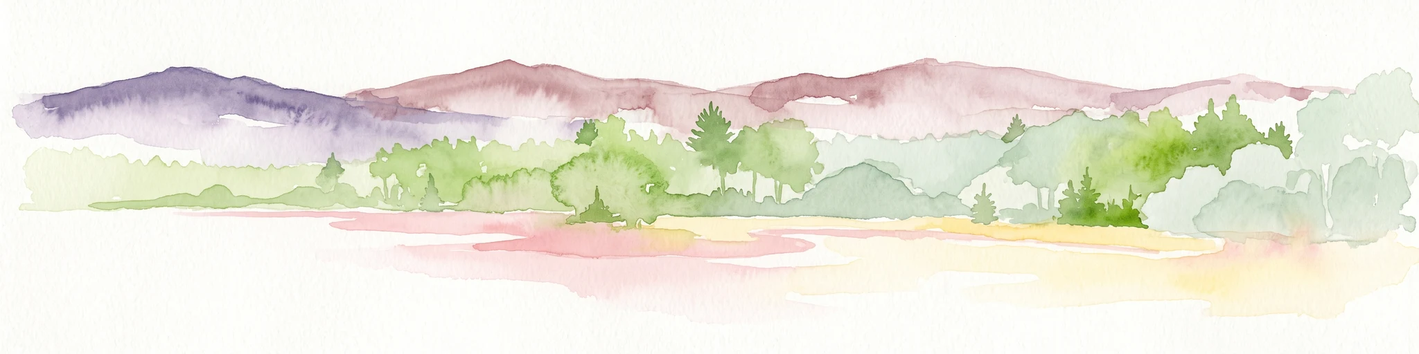
A watercolor painting depicting a soft, stylized horizon of rolling, purple and pink hills behind a line of light green trees and meadow, against a white background.
Nature reserveHesse
About 11 km away#5 closest

South

Rotes Moor Nature Reserve: Geography and Protected Bog Landscapes in the Rhön

Highland plateau ecosystems in Hesse, Germany

The Rotes Moor nature reserve is a centerpiece of the Rhön range, showcasing a complex highland bog that has undergone decades of systematic rewetting and ecological restoration. This protected landscape contains a rare mosaic of peat moss, floating mire surfaces, and birch woodlands, all framed by the dramatic volcanic basalt summits of the Hohe Rhön.

Area
3.147 km²
Established
1979
Relief
Highland
Climate
Alpine
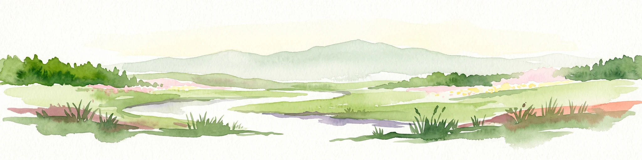
Watercolor painting of a sweeping, green highland landscape with rolling hills in the background and a winding stream flowing through meadow and moorland.
Nature reserveThüringen
About 11 km away#6 closest

South

Lange Rhön Nature Reserve: A Detailed Map and Geographic Overview of the Basalt Plateau

Highland meadow and bog landscape in Thüringen

Lange Rhön serves as the central basalt spine of the Rhön highlands, featuring a long, narrow plateau characterized by gentle slopes and wide-reaching views. This protected nature reserve encompasses significant raised bog systems and extensive grassland habitats, providing essential insights into the volcanic geology and upland biodiversity of the central German region.

Relief
Mountain
Climate
Temperate
Access
Moderate access
Scope
Terrestrial
Nature reserveThuringia
About 16 km away#7 closest

Northeast

Ibengarten Nature Reserve: Protected Yew Forest Landscape in the Thuringian Rhön

A historic protected area preserving rare ancient yew stands in central Germany.

Ibengarten encompasses a 56-hectare reserve in Thuringia, recognized for its dense concentration of wild European yew trees. This unique woodland environment, set against the basalt ridges of the Rhön, provides an essential look at historical conservation efforts and old-growth forest dynamics in the German low mountains.

Area
0.561 km²
Established
1938
IUCN
IV
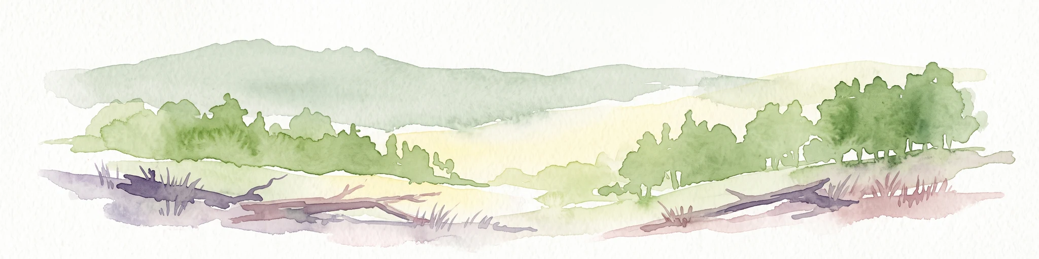
A horizontal watercolor illustration depicting rolling green hills, patches of forest, and fallen trees in the foreground on a plain white background.
Nature reserveHessen
About 16 km away#8 closest

Northwest

Naturschutzgebiet Breiter Berg bei Haselstein: Hessen Nature Reserve and Forest Atlas

Protected basalt terrain and forest mosaic in the Rhön

This nature reserve protects a vital cluster of beech woodland, moist gallery forests, and meadows in the Nüsttal municipality. The area is defined by its rounded hills, basalt-keuper soil substrates, and status as a protected Natura 2000 site within the broader Rhön biosphere conservation landscape.

Area
1.822 km²
Established
1997
IUCN
IV

Common questions about visiting, size, designation, and location context for Langenstüttig und Basaltblockmeer am Buchschirmküppel bei Batten

Langenstüttig und Basaltblockmeer am Buchschirmküppel bei Batten FAQs for park facts, access, geography, and protected area context

Find quick answers about Langenstüttig und Basaltblockmeer am Buchschirmküppel bei Batten, including protected-area facts, park geography, trail and visitor context, and how the park fits into its surrounding country and regional landscape.
MoriAtlas Explorer

Continue Your Protected Areas Search Across the Global Atlas

Deepen your exploration by continuing the structured search for national parks and protected areas worldwide. Utilize the comprehensive filtering capabilities to compare different conservation landscapes and refine your understanding of global park geography. Discover more about the distribution and characteristics of protected natural areas.

Global natural geography