
Why Laurel Fork South Wilderness stands out
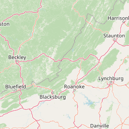
Laurel Fork South Wilderness is best known for the dense, high-elevation Appalachian forest it protects along Laurel Fork, one of the more remote and lightly trafficked corners of Monongahela National Forest. The wilderness exemplifies the kind of mid-elevation mixed hardwood and softwood forest typical of the West Virginia highlands, recovering on land that was once heavily logged for the timber industry. It is also recognized for its quiet, walk-in character. With only about 9 miles of trail and minimal signage or improvements beyond a small overlook, the wilderness is valued primarily for solitude, forest scenery, and the experience of standing in an Appalachian drainage that has reverted largely to a natural forested state.
Laurel Fork South Wilderness history and protected-area timeline
The land that makes up Laurel Fork South Wilderness was once private forestland owned by the Laurel River Lumber Company. The area was first logged using the traditional method of floating cut timber down Laurel Fork to reach downstream mills, and was later logged by rail. By 1921, the original virgin forest had been cut over, leaving behind a heavily altered landscape. Not long after, the U.S. Forest Service acquired the area and incorporated it into what was then becoming Monongahela National Forest, placing it under federal management and removing it from active timber production.
In 1983, Laurel Fork South, together with its companion unit to the north, was officially designated as wilderness under the Monongahela National Forest, West Virginia, Land Designations law. This designation placed it under the stricter management regime that defines U.S. Wilderness Areas, restricting road building, mechanized use, and most forms of development.
The wilderness was later modified by the Omnibus Public Lands Management Act of 2009, which removed approximately 89 acres on the eastern edge of the unit to allow continued vehicle travel on Forest Road 424. This small adjustment reflected a compromise between preserving wilderness character and maintaining access for forest management and local use, leaving the rest of the area as it was originally established.
Laurel Fork South Wilderness landscape and geographic character
The landscape of Laurel Fork South Wilderness is shaped by the geography of the Allegheny Plateau and the Appalachian Mountains of eastern West Virginia. The terrain consists of long, forested ridges separated by the deep, narrow hollow of Laurel Fork itself. Elevations are moderate by Appalachian standards but still high enough to support cool, moist forest communities typical of the West Virginia highlands.
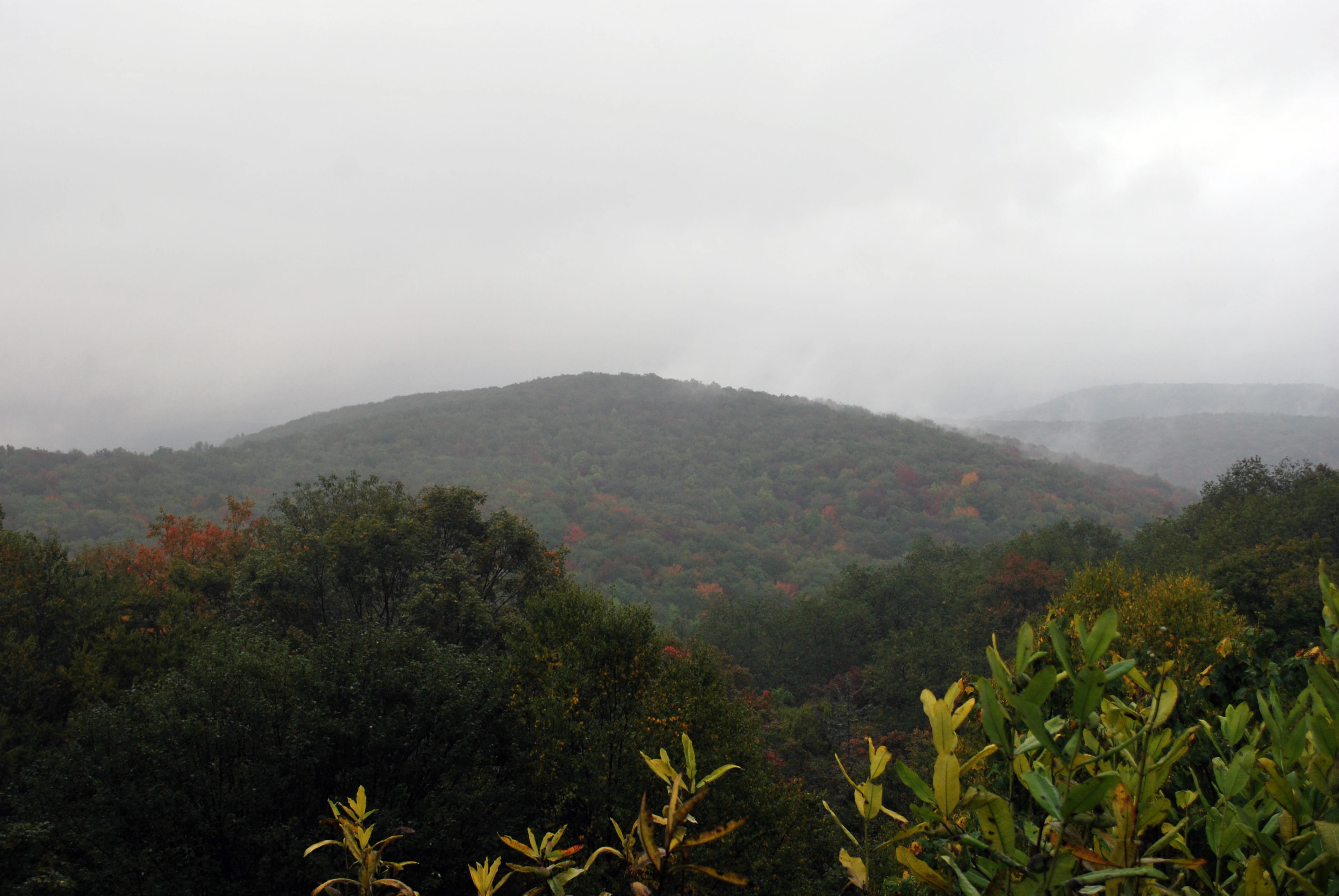
Middle Mountain rises along the western edge of the wilderness and forms a continuous forested ridge backdrop. The valley of Laurel Fork runs through the unit, with the creek cutting a gentle but well-defined drainage lined with dense stands of trees. Overlooks along Middle Mountain Road offer broad views into this valley, particularly in the fall when fog often settles into the bottom lands and accentuates the contrast between the open ridge and the wooded slopes below.
There are few dramatic cliffs, waterfalls, or alpine features in the area; instead, the landscape impression is one of consistent, unbroken forest cover over rolling terrain, with the valley of the creek providing the main organizing feature of the scenery.
Laurel Fork South Wilderness ecosystems, habitats, and plant life
Laurel Fork South Wilderness is dominated by Appalachian mixed hardwood forest, with stands that include oaks, maples, birches, beeches, and other broadleaf species typical of the region. On higher ground and along cooler, moister slopes, patches of eastern hemlock, red spruce, and other conifers add structural diversity and contribute to the cooler, shaded character of the interior.
Because the area was extensively logged in the early twentieth century, the forest stands today are predominantly second growth, but they have reached a maturity that supports a relatively full understory and a complex canopy structure. The combination of recovering hardwoods, pockets of softwood, and the moist valley along Laurel Fork creates habitat conditions suited to a range of forest interior species.
Seasonal variation plays a strong role in shaping the ecological character of the wilderness. Fall foliage colors sweep across the ridges and hollows, winter brings snow that highlights the contours of the terrain, and spring and summer revive the dense green canopy that defines the bulk of the area.
Laurel Fork South Wilderness wildlife and species highlights
The forested and relatively undisturbed character of Laurel Fork South supports wildlife typical of the central Appalachian highlands. Songbirds associated with mature eastern hardwood forests are common, especially in the mosaic of canopy and understory created by recovering second-growth forest. Ruffed grouse and other ground-dwelling birds can be found in the denser understory, while the creek corridor of Laurel Fork provides habitat for amphibians and aquatic species adapted to small mountain streams.
White-tailed deer range throughout the wilderness, as they do across most of Monongahela National Forest, and black bears are present in the broader landscape, occasionally moving through the unit. Smaller mammals such as squirrels, chipmunks, and various shrews occupy the forest floor and rocky areas, and the entire system contributes to the larger connected habitat network of the national forest.
Because the wilderness lacks intensive visitor infrastructure, wildlife observation here tends to be incidental rather than focused. The experience is less about seeking out specific charismatic animals and more about being immersed in a place where forest wildlife continues to function with relatively little direct human disturbance.
Laurel Fork South Wilderness conservation status and protection priorities
Laurel Fork South Wilderness is significant from a conservation standpoint as a representative example of high-elevation Appalachian forest within the federal Wilderness preservation system. Its designation as wilderness under the 1983 Monongahela National Forest, West Virginia, Land Designations law imposes strict limits on road building, motorized access, logging, and other activities that would alter the undeveloped character of the land, ensuring that recovery from past industrial logging can continue largely without interruption.
The wilderness also plays a role in the broader conservation network of Monongahela National Forest, contributing continuous forested habitat between other protected and managed lands. By keeping a sizable tract of mature second-growth forest in a near-natural state, the unit supports forest interior conditions, watershed function along Laurel Fork, and the long-term ecological recovery of a landscape that was once heavily exploited for timber.
Although the 2009 boundary adjustment reduced the unit by a small amount to accommodate an existing forest road, the core of the wilderness remains intact, and the area continues to function primarily as a refuge for natural forest processes rather than as a working timber landscape.
Laurel Fork South Wilderness cultural meaning and human context
The cultural context of Laurel Fork South Wilderness is closely tied to the timber industry that once dominated the central Appalachian highlands. Private ownership by the Laurel River Lumber Company and the cutting of the original forest, first by floating logs down the creek and later by railroad, reflects the broad pattern of industrial logging that swept through West Virginia in the late nineteenth and early twentieth centuries. The eventual acquisition of the land by the U.S. Forest Service and its later designation as wilderness mark a shift in regional identity, from extraction and exploitation to protection and natural recovery.
Little in the way of permanent human settlement remains within the wilderness itself. The area is best understood as a landscape whose principal human story is one of leaving the forest alone, allowing it to regrow after the era of intensive logging had passed.
Top sights and standout views in Laurel Fork South Wilderness
Among the standout characteristics of Laurel Fork South Wilderness are its unbroken expanse of recovering Appalachian hardwood forest, the quiet, narrow valley of Laurel Fork itself, and the elevated views into the wilderness from overlooks along Middle Mountain Road. The trailing system, while short, allows visitors to experience the forest at close quarters and along the creek.
Equally notable is the wilderness's place within the larger Monongahela National Forest and its relationship to its companion unit, Laurel Fork North. Together, the two wildernesses form a substantial block of protected high-elevation forest in a region where such protections are relatively rare.
Best time to visit Laurel Fork South Wilderness
Late spring through mid-autumn is generally the most rewarding window for visiting Laurel Fork South Wilderness. Summer brings dense green forest cover, warm temperatures in the highlands, and active birdlife, though humidity and insects can be significant. Fall is especially compelling because the hardwood stands across Middle Mountain and along Laurel Fork turn in a broad palette of seasonal color, and cool, foggy mornings occasionally settle into the valley below the overlook, producing some of the area's most atmospheric conditions.
Winter can also be rewarding for visitors prepared for snow and cold, as the bare forest and accumulated snow highlight the topography of the ridges and hollows. Because the trails are limited and the area is lightly used in any season, visitors seeking solitude will generally find it regardless of when they come, though weather and road conditions should always be considered at this elevation.