
Visit Planning
When to Visit Leivonmäki National Park: A Quick Overview
Determining the best time to visit Leivonmäki National Park requires choosing between two distinct experiences shaped by the Central Finnish climate: the long, light-filled days of the summer hiking season or the cold, silent stillness of the winter months. Because the park acts as a compact microcosm of regional landscapes, including raised mires and esker forests, your timing will determine which of these environments is most accessible and how you navigate the terrain. There is no single universal period for travel, as the park demands different gear and logistical preparation depending on the seasonal transition between frozen wetlands and temperate lake shores. ### Defining the Seasonal Shift The most fundamental trade-off when planning your trip is the relationship between temperature, daylight, and trail conditions. From late spring through early autumn, the park experiences significant variations in day length, peaking in June when daylight reaches over 19 hours. During this period, the warmer temperatures allow for full access to the network of trails winding through the esker ridges and around Lake Rutajärvi. In contrast, the period from late autumn through mid-spring is defined by sub-zero averages, with January and February experiencing extreme cold and significantly reduced daylight, often dropping below 6 hours. This deep winter period transforms the park into a frozen landscape that requires a different approach to mobility and safety compared to the summer months. ### Environmental Factors and Visitor Priorities The park’s character is inextricably linked to its boreal wetland and glacial deposit environments. Visitors seeking to experience the biodiversity of the raised bogs and lake shorelines will find the window between June and August most rewarding, as these months offer the highest temperatures and most predictable access. However, those looking for the solitude of a Finnish winter will find that the same geographic features provide a completely different, snow-covered landscape during the coldest months. While the climate data shows a clear warming trend in the summer and a sharp cooling in the winter, it is vital to remember that these are monthly averages rather than current conditions. The interaction between the thawing lake ice in spring and the deep freeze of December creates distinct, short-lived transitions that visitors must be prepared for regardless of when they choose to arrive. Your priority, whether it is hiking the esker ridges or experiencing the quiet isolation of the snow-bound mires, will ultimately dictate which environmental conditions are most suitable for your visit.
Seasonal Planning
Best Months to Visit Leivonmäki National Park Based on Travel Goals
Peak Summer for Trail Exploration and Water Activities
For most travelers, the period between June and August offers the most reliable window for exploring the diverse landscapes of Leivonmäki National Park. These months are characterized by the highest mean temperatures of the year, with July averages reaching 17.37 degrees Celsius. During this time, the park experiences its maximum daylight, peaking at over 19 hours in June, which provides ample time to navigate the trail network that spans the esker forests and wetlands. The primary trade-off for these long, bright days is higher precipitation, as these months also align with the park's wettest period. Visitors planning for this window should be prepared for changing weather conditions, even during the height of summer, as moisture levels and humidity remain persistent throughout the season.
Transition Months for Changing Scenery
May and September serve as significant shoulder periods for those who prioritize specific environmental conditions over swimming or extended warm-weather hiking. May acts as the transition into the light-filled summer, with temperatures rising rapidly and daylight increasing to over 17 hours by the end of the month. Travelers choosing this period often find the environment awakening after the winter freeze, though ground conditions can remain damp or unstable as snow melt concludes. Conversely, September represents the cooling trend as the region moves toward the darker, colder months. While average temperatures drop to around 10 degrees Celsius, this period provides a clearer, often drier climate compared to mid-summer. This is a common choice for those looking to avoid the peak summer insect activity while still benefiting from manageable daylight and forest access.
The Sub-Zero Window for Winter Landscapes
Visiting between November and March requires a distinct shift in expectations and preparation. During these months, the park undergoes a transition into a frozen, boreal landscape where temperatures frequently drop well below freezing, reaching monthly mean minimums of -26 degrees Celsius in January. This period is suitable for those seeking quiet, snowy vistas and a rugged, high-latitude winter experience. The significant reduction in daylight,dropping to fewer than 5 hours in December,means that all activities must be planned around a very narrow window of visibility. The primary trade-off is the extreme cold, which demands specialized gear and physical endurance. Visitors should understand that the trail conditions change entirely under snow and ice, and the environment effectively closes off standard summer activities like shore-side hiking in favor of potentially demanding winter trekking where accessible.
Annual Climate Overview
Monthly Weather and Temperature Patterns in Leivonmäki National Park
Understanding the climate of this Central Finnish park requires looking beyond simple averages, as the environment experiences dramatic shifts between the dark, cold winter and the bright, temperate summer. These climate normals, based on data from 1991 to 2020, illustrate that the park exists in a zone where temperature and daylight are the primary drivers of environmental change, directly influencing how the landscape,from the raised mires to the esker ridges,functions throughout the year. It is important to note that these figures represent long-term regional patterns rather than live forecasts or guarantees for specific days.
The Extremes of Daylight and Thermal Shift
Perhaps the most striking feature of the annual pattern is the extreme variance in daylight. Winter is defined by deep, extended darkness, with December offering less than five hours of daylight, whereas the peak of summer in June stretches to over nineteen hours. This shift is not merely a logistical consideration; it fundamentally alters the thermal environment. The coldest months, January and February, see mean temperatures hovering near negative nine degrees Celsius, with minimums frequently plummeting well below negative twenty degrees. During these months, the high relative humidity, often exceeding ninety-eight percent, creates an environment where cold is pervasive. The winter wind, while averaging a steady three meters per second, adds a biting edge to the already frigid air.
Transition Phases and Temperature Volatility
As the park moves out of winter, the transition in April and May is rapid. April serves as a bridge, where mean temperatures climb above freezing, but the average minimums still linger around negative six degrees Celsius, indicating that frost is a consistent possibility. By May, the landscape undergoes a significant thermal shift, with daytime maximums regularly reaching above twenty degrees Celsius. This rapid warming often correlates with a decrease in relative humidity, dropping from the saturation levels of mid-winter down to approximately seventy-seven percent by June. This drier, warmer phase marks the onset of the primary growing and activity period for the diverse boreal vegetation.
Summer Stability and Autumn Humidity
July represents the annual peak for warmth, with mean temperatures around seventeen degrees Celsius and maximums occasionally exceeding twenty-six degrees. While this is the warmest window, it is also when precipitation levels are at their statistical highest, averaging over three millimeters per day. Visitors should interpret this as a pattern where warmth increases the potential for convective moisture, rather than a season of constant rain. As summer turns to autumn, the daylight hours contract sharply, dropping from over fifteen hours in August to just over nine hours by October. Humidity levels begin to climb once more, signalling the return of the damp, cool conditions that precede the inevitable descent into the winter deep-freeze. By November, the pattern completes its cycle as daylight falls to under seven hours and mean temperatures return to sub-zero values.
Seasonal dynamics
Seasonal Weather Transitions and Annual Climate Phases in Leivonmäki National Park
The Boreal Deep Winter Phase: November through March
Leivonmäki enters its most static phase as temperatures consistently drop below freezing and daylight hours dwindle to their annual minimum. During this period, the landscape is defined by the absence of growth and the immobilization of water. The climate normals for these months show high relative humidity, often exceeding 98 percent, which contributes to a piercing chill. Visitors should view this as a period of environmental dormancy, where the raised bogs and lake surfaces of the park become covered in snow and ice. The transition into this phase usually begins in late October as daylight drops below ten hours, with the coldest conditions typically centered between January and February. This is not merely a colder version of autumn, but a distinct climatic regime where the park accessibility shifts to winter-specific methods, and the primary environmental influence is the persistent, low-sunlight cold.
The Rapid Spring Thaw: April to May
As daylight expands significantly in the spring, the park undergoes a dramatic shift that is fundamentally different from the slow cooling of autumn. April acts as a bridge, where mean temperatures rise above freezing, and the daylight duration pushes toward fifteen hours. This is a volatile transition phase. While the maximum temperatures may reach into the low teens by April, the ground remains saturated from melting snow, and night temperatures often dip back below zero. By May, the environment enters a rapid warming trend. The snowpack vanishes, and the moisture levels in the air drop as temperatures climb toward double digits. This is the period of hydrological reset for the park, where the frozen mires begin to release water, significantly altering the surface conditions on trails that were stable just weeks prior.
The Peak Summer Growth Window: June through August
Summer in this boreal environment is defined by light and temperature stability rather than extreme heat. June, July, and August represent the warmest and driest phase of the year. The daylight hours reach their zenith in June, with over nineteen hours of potential sun, allowing the boreal forest and wetland vegetation to complete their growth cycles in a compressed timeframe. This period is marked by the highest mean temperatures of the year, with July averages peaking at 17.37 degrees Celsius. Despite being the warmest window, these months are characterized by temperate conditions rather than tropical heat. The humidity remains moderate compared to the winter months, and the stability of the weather allows for the most consistent access to the park's diverse terrain, including the delicate esker ridges and shoreline paths.
The Autumnal Cooling Phase: September to October
September serves as the final transition before the onset of winter. The environment experiences a rapid decline in light, falling from over twelve hours in September to under ten hours by October. This phase is characterized by an increase in moisture and a steady, predictable cooling trend. The heat accumulated in the soil and water during the summer begins to dissipate, and the air humidity rises as the season progresses. Unlike the rapid thaw of spring, autumn is a long, gradual descent. Temperatures drop from an average mean of 10.15 degrees Celsius in September to just 3.33 degrees by October. This is the period when the landscape prepares for its winter dormancy, characterized by shorter days and damp, cooling air that sets the stage for the first sub-zero nights of the coming winter.
Seasonal Experiences
Experiencing the Boreal Landscapes of Leivonmäki Throughout the Year
Navigating Boreal Wetlands and Esker Ridges
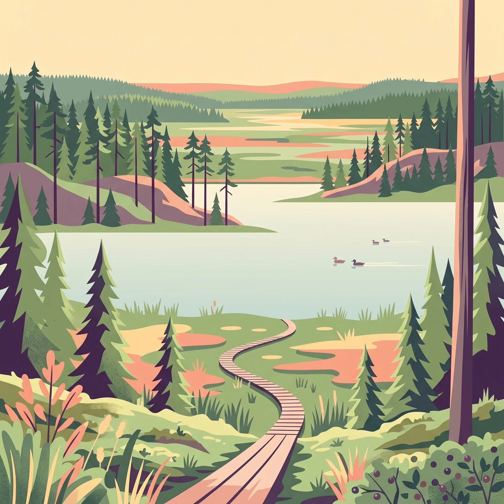
The landscape character of Leivonmäki is defined by the interaction between its raised bogs and the sandy esker ridges formed by glacial activity. These geological features dictate how one experiences the park throughout the year. During the warmer months, specifically from June through August, the raised mires become accessible via boardwalks that traverse the bog surfaces. These trails offer a focused way to observe the unique flora and open vistas that characterize Central Finland wetlands. Because these paths are designed to protect the fragile peatland ecosystems, staying on the marked routes is essential for both environmental stewardship and personal safety, as the ground can be unstable or wet depending on recent precipitation levels.
Seasonal Access to Lake Rutajärvi
Lake Rutajärvi serves as the central aquatic feature of the park, and its usage is highly dependent on the annual thermal cycle. In the summer peak, when temperatures frequently reach their highest point of the year, the lake shores become the primary destination for visitors. Activities such as swimming, canoeing, and boating are supported during this period, with islands in the lake providing specific locations for rest and reflection. The transition from the rapid thaw in April and May to the stable warmth of June and July is the period when water temperatures move from icy to manageable. By September, as daylight hours diminish and average temperatures drop, the focus shifts away from water-based recreation toward land-based viewing, where the cooling air and changing vegetation colors become the primary experiential draw.
Forest Trails and Mountain Biking Dynamics
The park hosts a specialized mountain biking trail that begins at Selänpohja, covering a significant distance through the undulating forest terrain. The viability of this trail is inextricably linked to the seasonal state of the soil. During the spring thaw and the wetter transitions of late autumn, the ground on these forest paths can become soft or muddy, which may impact ride quality and trail preservation. The drier conditions of mid-summer and the period when the ground is firmly frozen in winter offer the most consistent surfaces for cycling and hiking. While the park is open year-round, winter visitors should be prepared for the reality of limited daylight, which falls to fewer than five hours in December, significantly restricting the duration available for outdoor activities compared to the nearly 20 hours of daylight found in June. The transition periods of spring and autumn bring their own challenges, where rapid shifts in temperature and moisture levels influence the conditions of the trails and the ease with which one can explore the diverse esker and mire habitats.
Visitor Priorities
Timing Your Visit to Leivonmäki National Park Based on Travel Goals
Prioritizing Long Days and Trail Accessibility
For hikers and mountain bikers who rely on clear trail conditions and extended daylight hours, the window from June through August provides the most reliable window of access. During these months, the park experiences its peak daylight, reaching over 19 hours in June, which provides ample time for longer treks across the esker terrain without the pressure of approaching nightfall. This period features the highest mean temperatures of the year, with July averages hovering around 17.37 degrees Celsius. The primary trade-off during this peak is the increase in precipitation, as July records the highest monthly rainfall levels at 3.35 mm per day. Visitors should be prepared for more frequent, albeit often short-lived, summer showers compared to the drier, colder months of late winter.
Seeking Milder Temperatures and Lower Humidity
Travelers who prefer moderate hiking weather without the intensity of midsummer heat often find the late spring or early autumn months most suitable. September is a particularly distinct window, offering cooler average temperatures of 10.15 degrees Celsius. This period is characterized by a significant drop in relative humidity from the peak of winter and spring thaw, settling around 87.81 percent. While the daylight hours decrease compared to the summer solstice, they remain sufficient for full-day excursions. The compromise here is the increased likelihood of cooler overnight lows, which can drop near 2 degrees Celsius, necessitating appropriate layering for those camping or spending long hours in the open environments of the raised mires.
Targeting Dry Conditions for Wetland Exploration
Visitors prioritizing the driest possible conditions should look toward the late winter and very early spring, specifically the period between February and March. Data indicates that precipitation levels are at their lowest during these months, with March averages near 1.42 mm per day. This timing is ideal for those interested in the unique visual character of the boreal wetlands when the landscape is frozen and stable. However, the compromise for these dry, crisp conditions is the severity of the climate, with extreme sub-zero minimums often dropping well below -17 degrees Celsius. This window is strictly for visitors prepared for winter-specific safety protocols, as the park transitions from a hiking destination into a cold-climate environment where deep snow or ice may obscure standard trail markers and require specialized navigation skills.
Managing Daylight Trade-offs for Extended Outings
Deciding when to visit often comes down to the balance between thermal comfort and the availability of natural light. If your priority is maximizing time outdoors for activities like canoeing or exploring the lake shore, the period from May through August is essential. In contrast, if your goal is to experience the park in its most isolated, quiet state, the lower-light months of November through January offer a complete atmospheric shift. During these winter months, daylight is limited to as little as 4.92 hours in December. While this provides a unique, contemplative experience of the Finnish winter, it drastically limits the time available for any trail-based activity, making it a priority choice only for those who specifically seek the short days and deep cold of the boreal season.
Access and Planning
Seasonal Access and Practical Planning for Leivonmäki National Park
Navigating Seasonal Trail and Road Access
Planning your visit to Leivonmäki National Park requires an understanding of how local infrastructure interacts with the changing boreal landscape. While the park is open to visitors year-round, the accessibility of specific trails and parking areas varies significantly by season. During the peak summer months, from June through August, the main parking lots at Kirveslampi and Selänpohja serve as primary hubs for hikers. Road access to these points is typically straightforward for standard vehicles during the snow-free season. However, travel conditions can shift rapidly during the spring thaw or following early autumn snowfall. Visitors should always verify the current status of park roads and parking availability through official sources, such as the national parks authority or Metsähallitus, before departing, as severe weather or maintenance needs can alter access without notice.
Strategic Transportation and Arrival Logistics
For those relying on public or shared transportation, the park geography presents distinct logistical considerations. The park is situated roughly 50 kilometers south of Jyväskylä, with access points scattered along the perimeter. While buses operate via the E75 route, stopping near Leivonmäki, these services may not drop you directly at the trailhead. Local road connections, such as the 6134, are sometimes serviced by school-day transport, but this is highly variable and not a reliable option for all travelers. If you arrive by public transport, expect to walk a significant distance to reach the core trail networks. Travelers without a private vehicle should check local taxi availability or regional bus schedules well in advance to coordinate their final arrival leg.
Facility Maintenance and Special Access Requirements
Most recreational infrastructure, including camping areas and accessible trails like the Luupään Lenkki, is designed for the high-traffic summer season. Certain facilities, such as designated boat launch points or restricted-access booms, may require specific keys or advance coordination. If your visit involves specialized activities like canoeing on Lake Rutajärvi, confirm current launch rules and water safety guidance from the park administration. While the park is open during the winter, do not assume that all facilities or parking lots are plowed or fully maintained for visitor use. Winter access involves navigating deep snow and significantly shorter daylight hours, necessitating a higher level of self-sufficiency. Always check the official national park website for active alerts, facility closures, or temporary trail restrictions that might impact your planned route.
Safety and Preparation
Weather, Seasonal Safety, and Preparation for Leivonmäki National Park
Managing Thermal Exposure in a Variable Climate
Preparation for Leivonmäki requires understanding the park's radical temperature swings. While summer days can reach average maximums around 26 degrees Celsius in July, the winter landscape frequently sits well below minus 20 degrees Celsius. Visitors should monitor long-range forecasts, as the proximity to Lake Rutajärvi can influence local microclimates, often resulting in higher humidity levels that make both cold and warmth feel more intense. During the transitional months of April and October, rapid temperature fluctuations occur, necessitating a layered approach to clothing that allows for quick adjustment as weather shifts throughout the day.
Terrain-Specific Safety on Boreal Mires and Eskers
The unique topography of the park, characterized by raised bogs and soft, sandy esker soil, dictates specific safety considerations for trail users. In spring, the thawing of frozen ground can lead to saturated trails and temporary water accumulation on lower sections of the boardwalks. Staying on marked trails is essential not only for ecological conservation but also to avoid unstable terrain that can become treacherous after heavy precipitation. Visitors should anticipate that trail conditions will differ significantly between the elevated, dry esker ridges and the lower, peat-based bog environments. If you encounter flooded or damaged sections of the trail, consult current official park alerts to verify route accessibility before departing.
Daylight and Navigation Considerations
Daylight availability acts as a primary constraint on planning safe activity durations. In the peak of winter, specifically December and January, the park experiences limited daylight hours, sometimes under five hours per day. This necessitates careful timing for any outdoor activity to ensure you return to your vehicle or base before sunset. Conversely, during the extended daylight of June and July, visitors may face the temptation to overextend activity, but the lack of true darkness can disrupt sleep patterns and energy management. Always carry a reliable light source, even during bright months, and ensure someone is aware of your planned route and expected return time when venturing into more remote sectors of the park.
Preparing for Weather-Dependent Activities
Safety while swimming or boating on Lake Rutajärvi is entirely dependent on current conditions rather than seasonal averages. Water temperatures remain cold for much of the year, and rapid weather shifts can create surface chop or sudden visibility changes. Since the park lacks constant monitoring, visitors must evaluate local conditions upon arrival. If the weather forecast indicates high winds or approaching storms, plan for alternative land-based activities or delay your visit. Regularly check official channels for updates regarding water safety or site closures, as environmental conditions can change faster than climate records would suggest.
Final Trip Planning
How to Choose the Right Time to Visit Leivonmäki National Park
Choosing when to visit Leivonmäki depends on how you weigh the trade-off between the accessibility of the summer landscape and the stillness of the deep winter months. There is no universally superior time to visit, as the park transforms into two distinct environments based on the movement of the sun and the state of the local hydrology. Your decision should center on whether you prioritize the long, light-filled days that facilitate extended hiking and lake access or the quiet, monochromatic frozen scenery that defines the Central Finnish winter. By aligning your personal expectations with the realities of boreal climate patterns, you can select the window that best suits your intended pace and activity level.
Aligning Your Priorities with Seasonal Realities
If your primary goal is to traverse the esker ridges and explore the mire ecosystems under comfortable conditions, the period from June through August provides the most reliable window. These months offer the highest temperatures and longest daylight hours, allowing for a broader range of exploration within the park’s compact 29 square kilometer area. During this time, the trails are generally free of snow and ice, providing easier passage through the diverse glacial landscapes. Conversely, if you are drawn to the park for its winter character, you must be prepared for extreme cold and very limited daylight. A mid-winter visit requires a specialized approach, as the landscape becomes a quiet, sub-zero environment where the primary appeal is the stark, frozen beauty of the boreal forests and the silence of the snow-covered mires.
Moving Beyond Generalizations
Transition periods such as late April or early October present different challenges and opportunities. These shoulder seasons can be unpredictable, with rapid shifts in temperature and ground conditions that may impact the accessibility of certain trails or low-lying areas. While these times often offer solitude, they require a high degree of flexibility and local awareness. Regardless of when you choose to arrive, remember that climate normals represent long-term averages rather than precise forecasts for your specific trip dates. You should always verify current trail status, local weather alerts, and any relevant park management notices immediately before travel to ensure your visit remains safe and consistent with current environmental conditions. By approaching your planning with these seasonal realities in mind, you can set realistic expectations for your time in the park.