
Mori Atlas logo
Nature reserveLeyerbachtal

Mapping the natural watercourses, alluvial woodlands, and industrial heritage of a Remscheid valley.

Leyerbachtal Nature Reserve: A Protected Low-Mountain Valley Landscape in the Bergisches Land

(Naturschutzgebiet Leyerbachtal (NSG RS-022))

The Leyerbachtal Nature Reserve represents a significant protected area within the city of Remscheid in Nordrhein-Westfalen. This 15-hectare site preserves a near-natural low-mountain valley system centered on the meandering Leyerbach. The terrain features a layered landscape including alluvial woodland, wet floodplain meadows, and slope forests that support diverse stream-dependent wildlife such as the white-throated dipper. Alongside its ecological value, the area retains cultural traces of the industrial history of the Bergisches Land through remnants of the Hilbertshammer and other historic hammer-mills.

low-mountain valleystream valleyfreshwater habitatalluvial woodlandwet meadowfloodplain
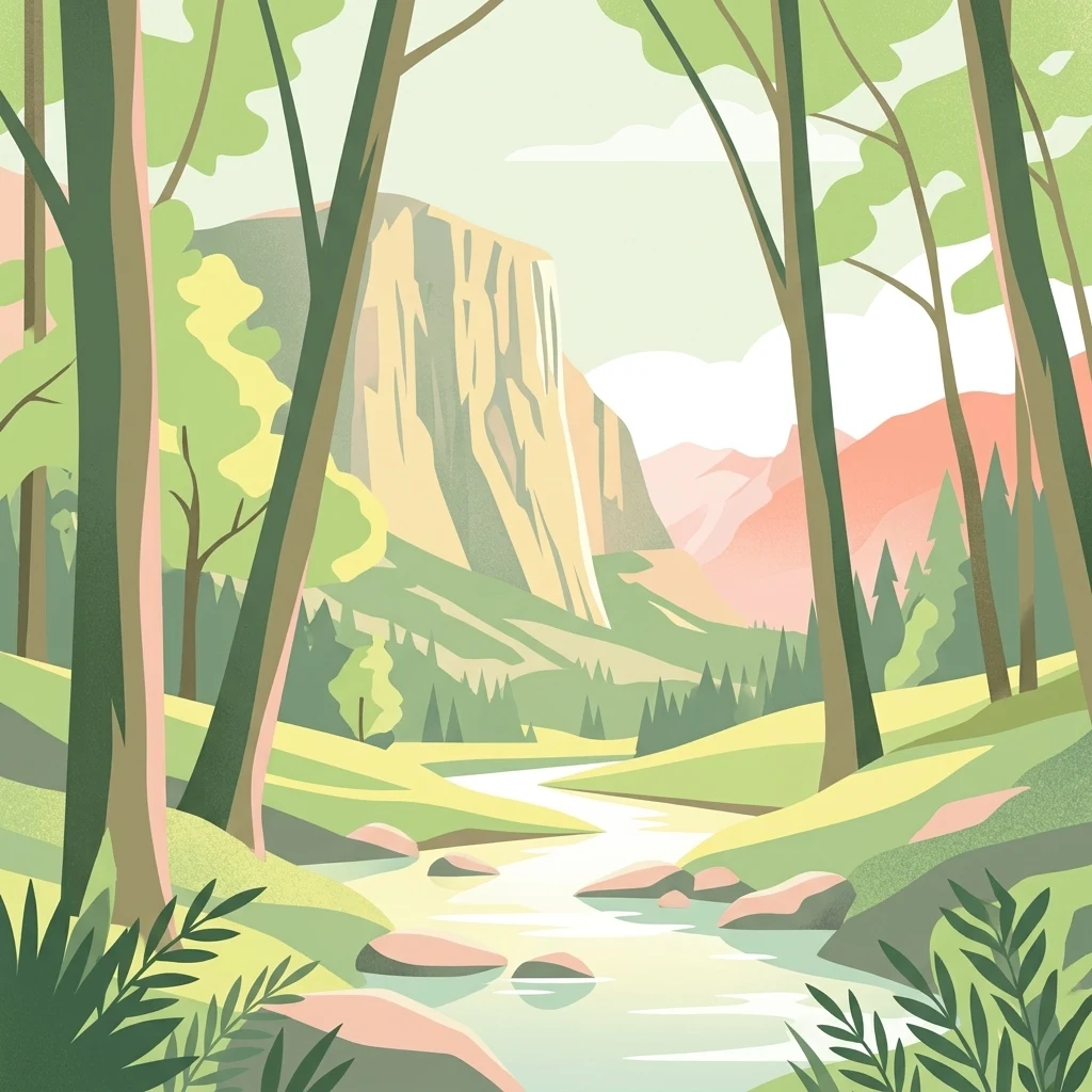
A stylized vector illustration showing a river flowing through a forest valley with tall trees in the foreground and a large sheer rock face in the background.

Leyerbachtal

Nature reserve

Park overview

Structured park overview, official facts, and landscape profile for Leyerbachtal Nature Reserve

Leyerbachtal Nature Reserve park facts, protected area profile, and essential visitor context

Review the core facts for Leyerbachtal Nature Reserve, including designation, size, terrain, visitor scale, habitats, and operating context in one park-focused overview.

About Leyerbachtal Nature Reserve

Leyerbachtal is a small but ecologically focused nature reserve in the city of Remscheid, in the Bergisches Land portion of North Rhine-Westphalia. Although it covers only about 15 hectares, the reserve captures a complete cross-section of the landscape characteristic of this part of Germany's low mountain ranges: a narrow, meandering stream, a flat valley bottom, alluvial woodland, wet and moist meadows, and the surrounding slopes that frame the watercourse.

The Leyerbach itself is the reserve's defining element. It flows in a largely natural, sinuous pattern across the valley floor, producing exposed gravel bars and conditions that support a range of stream-margin plant communities. The valley bottom is unusually broad for such a small reserve, with the alluvial zone reaching about 80 to 100 metres across. This width has allowed the development of alluvial forest stands alongside the brook and created room for an open, species-rich, partially moist central meadow that gives the protected area its distinctive open-and-wooded pattern.

Historically, poplar plantations dominated parts of the valley floor, and the protection plan explicitly foresees the gradual conversion of these stands into more natural broadleaf woodland. This long-term restructuring of the forest composition is intended to reinforce the site's value as habitat for amphibians, reptiles, insects, and breeding birds, and to align the canopy structure with the natural conditions expected for such a low-mountain brook valley. The reserve also serves a wider landscape function: by buffering the Leyerbach and preserving its hydrological dynamics, it helps maintain water quality and habitat continuity in a system that connects to other nearby protected valleys in Remscheid and the Bergisches Land.

In parallel with its ecological purpose, Leyerbachtal is shaped by a layer of industrial heritage. The area contains the Hilbertshammer, a historic hammer-mill building that is recorded as a built and ground monument, as well as additional remnants of earlier hammer mills. Water-powered ironworking of this kind was once typical of the Bergisches Land, where small streams were exploited for forging and grinding, and Leyerbachtal still preserves traces of that earlier cultural-economic relationship between the local streamscape and human industry.

Quick facts and research context for Leyerbachtal Nature Reserve

Leyerbachtal is a statutory nature reserve on the territory of the city of Remscheid in the German state of North Rhine-Westphalia. It is designated under the key number RS-022, was placed under a change-prohibition regime in 2001 and formally designated as a nature reserve in 2003, giving it legal protection under the framework of the Remscheid landscape plan. The reserve lies northeast of Remscheid's inner city, between the Birgder Hammer settlement and the village of Leyermühle, and encompasses a larger valley-floor landscape associated with the Leyerbach, a low-mountain stream typical of the Bergisches Land. Its boundaries are defined by the Ronsdorfer Straße to the north, an inter-village footpath to the south, and small local roads on the eastern and western flanks, while the stream itself meanders in relatively natural loops through the protected area.

Protection and recognition

Documented conservation records and official protected area attributes

Leyerbachtal Protection Status and International Recognition Data

Leyerbachtal brings together documented protection status, designation history, and management scope based on official records. Certified database entries outline the administrative framework and international recognition associated with this natural area.

Protection details

WDPA ID
318730
Park context

Deeper park guide and search-rich context for Leyerbachtal Nature Reserve

Leyerbachtal Nature Reserve history, landscape, wildlife, and travel context

Explore Leyerbachtal Nature Reserve through its history, landscape character, ecosystems, wildlife, conservation priorities, cultural context, and seasonal travel timing in a structured park guide built for atlas discovery and search intent.

Why Leyerbachtal Nature Reserve stands out

Leyerbachtal is best known as a protected example of a near-natural low-mountain valley stream system in the Bergisches Land. Its core identity is the meandering Leyerbach with its gravel banks, flanked by alluvial woodland, moisture-rich meadows, sedge mires, and alder stands. The reserve is also recognised for its importance to stream-dependent wildlife, especially the white-throated dipper, and for combining this ecological profile with the cultural-historical presence of the Hilbertshammer and other historic hammer-mill remnants, giving the small area both a biological and an industrial-heritage dimension.
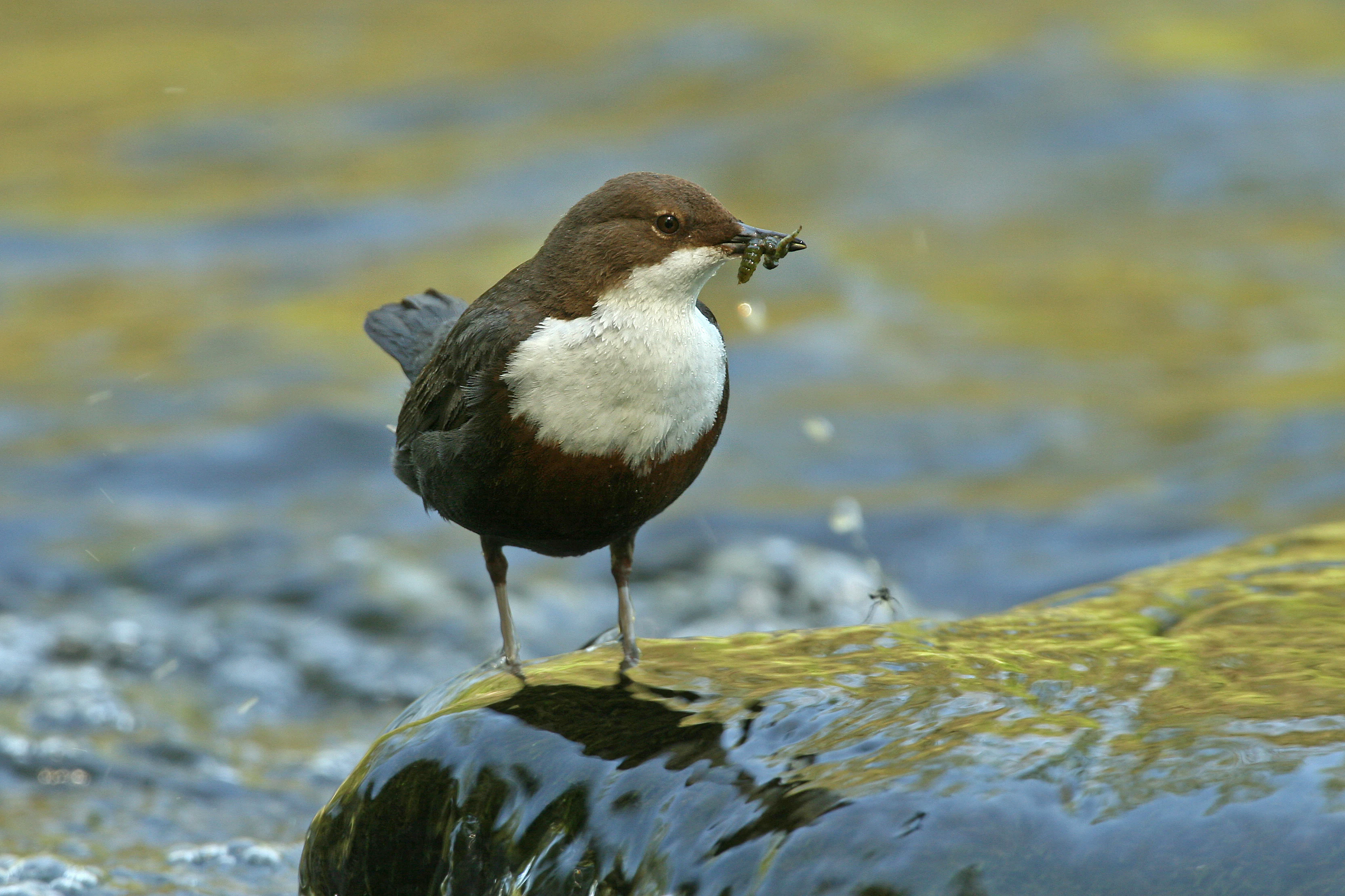
A small brown and white bird with food in its beak stands on a wet rock in a flowing stream.
A white-throated dipper stands on a wet rock in a stream, holding food in its beak.

Leyerbachtal Nature Reserve history and protected-area timeline

The modern protection history of Leyerbachtal begins in the early 2000s. In 2001, the area was placed under a formal prohibition of change (Veränderungsverbot), a precautionary step that froze the existing land-use pattern. Two years later, in 2003, the area was legally designated as a nature reserve with the official key RS-022, giving it the long-term statutory protection it still holds.

The designation was made within the framework of the Remscheid landscape plan and is administered by the lower landscape authority (Untere Landschaftsbehörde) of the city of Remscheid. Under this framework, the reserve's management aims not only to halt further loss of habitat but also to gradually convert the existing poplar stands into more natural broadleaf woodland, a structural adjustment that has already begun in places.

Long before its formal protection, however, the Leyerbachtal already carried cultural weight. The valley contained the Hilbertshammer and other hammer-mill remnants, monuments to the region's older era of water-powered ironworking, when small Bergisches streams like the Leyerbach were harnessed for forging, grinding, and metal processing. These industrial traces are preserved within the reserve as a reminder that the present-day protected valley is not only an ecological site but also a layered cultural landscape.

Leyerbachtal Nature Reserve landscape and geographic character

The landscape of the Leyerbachtal reserve is a textbook example of a small-scale, low-mountain valley in the Bergisches Land. The terrain sits between roughly 208 and 224 metres in elevation, with an average of around 216 metres, placing it firmly within the gently rolling upland profile that characterises the region.

The central feature is the valley floor itself, which reaches a width of approximately 80 to 100 metres. Along this floor, the Leyerbach meanders in a series of relatively natural loops, generating exposed gravel banks along its outer bends and slower vegetated margins along its inner curves. These gravel bars and shallow vegetated margins form key microhabitats within the reserve.

The valley floor is flanked by two visually distinct vegetation zones. Closest to the stream, the land carries alluvial woodland, a moist, periodically flooded forest community adapted to the stream's natural dynamics. Away from the immediate channel, the flat valley-bottom opens into a species-rich, partly wet central meadow. On the slopes rising from the valley, poplar plantations still dominate in places, and these are intended to be gradually transformed into more natural broadleaf stands. Together, these elements create a layered valley landscape: an active stream channel, an alluvial floodplain forest, an open floodplain meadow, and slope woodland above.
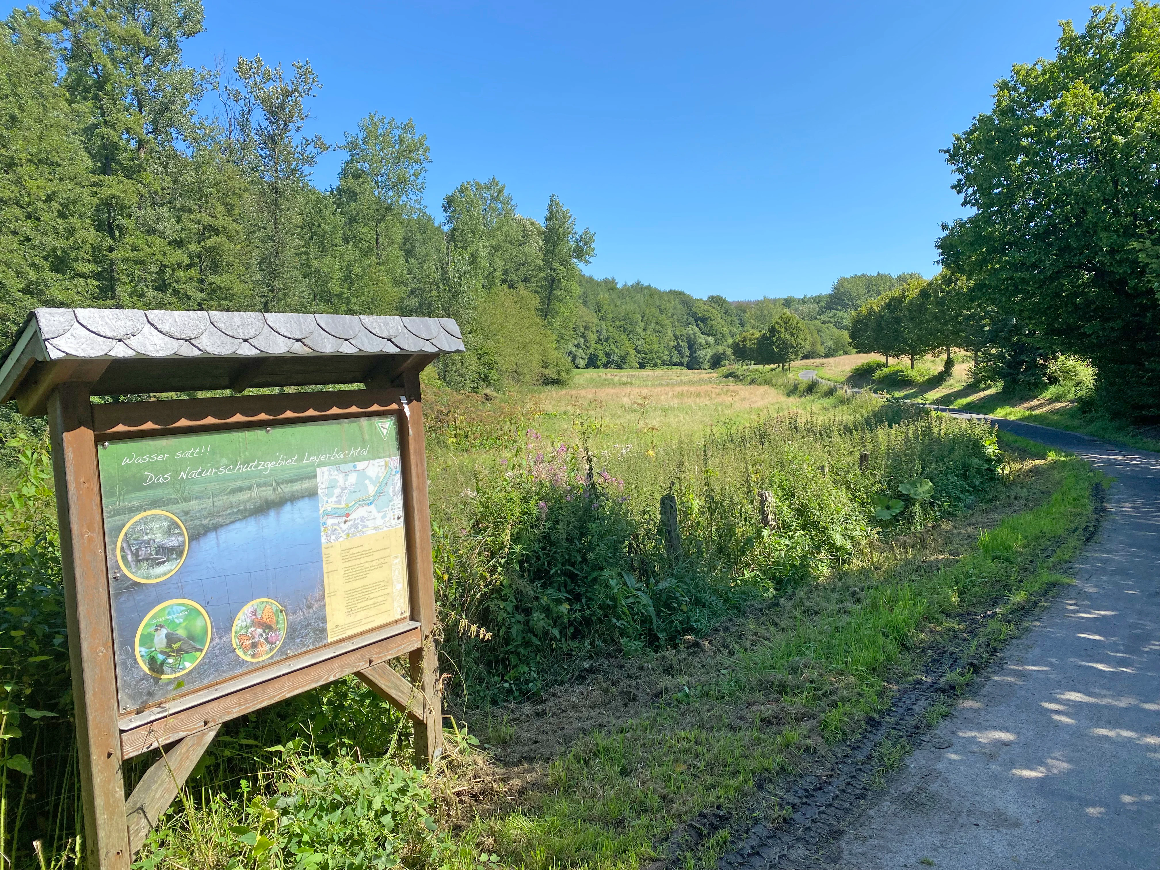
A wooden information board with a slate roof stands in the foreground next to a paved path. Behind the sign, a grassy meadow stretches towards a line of green trees under a clear blue sky.
An information board stands beside a paved path at the Leyerbachtal nature reserve, overlooking a grassy meadow and forest.

Leyerbachtal Nature Reserve ecosystems, habitats, and plant life

The ecological character of Leyerbachtal is defined by its small but concentrated valley-floor mosaic. At the lowest, wettest level, the Leyerbach and its gravel banks provide an open, dynamic habitat where pioneer plants and disturbance-loving species can establish. Standing out in the wider floodplain are patches of butterbur (Pestwurz), which colonise the gravel islands within the stream channel.

Above the waterline, the floodplain supports wet and moist meadows (Nass- und Feuchtwiesen), areas of abandoned grassland (Grünlandbrachen), and small sedge-dominated communities (Kleinseggenried), interspersed with brook-edge reed beds (Bachröhrichte). These wet, herb-rich zones grade into the surrounding alluvial woodland, which is dominated by alder (Erlenwald), and into patches of oak-hornbeam scrub (Eichen-Hainbuchengehölz) on slightly drier ground.

Springs and spring-fed brooks (Quellen and Quellbäche) contribute additional habitat diversity along the valley flanks, supporting moisture-loving species and stabilising the local hydrology. In the longer term, the reserve aims to replace the poplar-dominated slope stands with more natural broadleaf forest, a shift that would strengthen habitat continuity between the stream, the floodplain woodland, and the surrounding slopes, and would bring the site's vegetation structure closer to the conditions expected for a near-natural low-mountain valley.
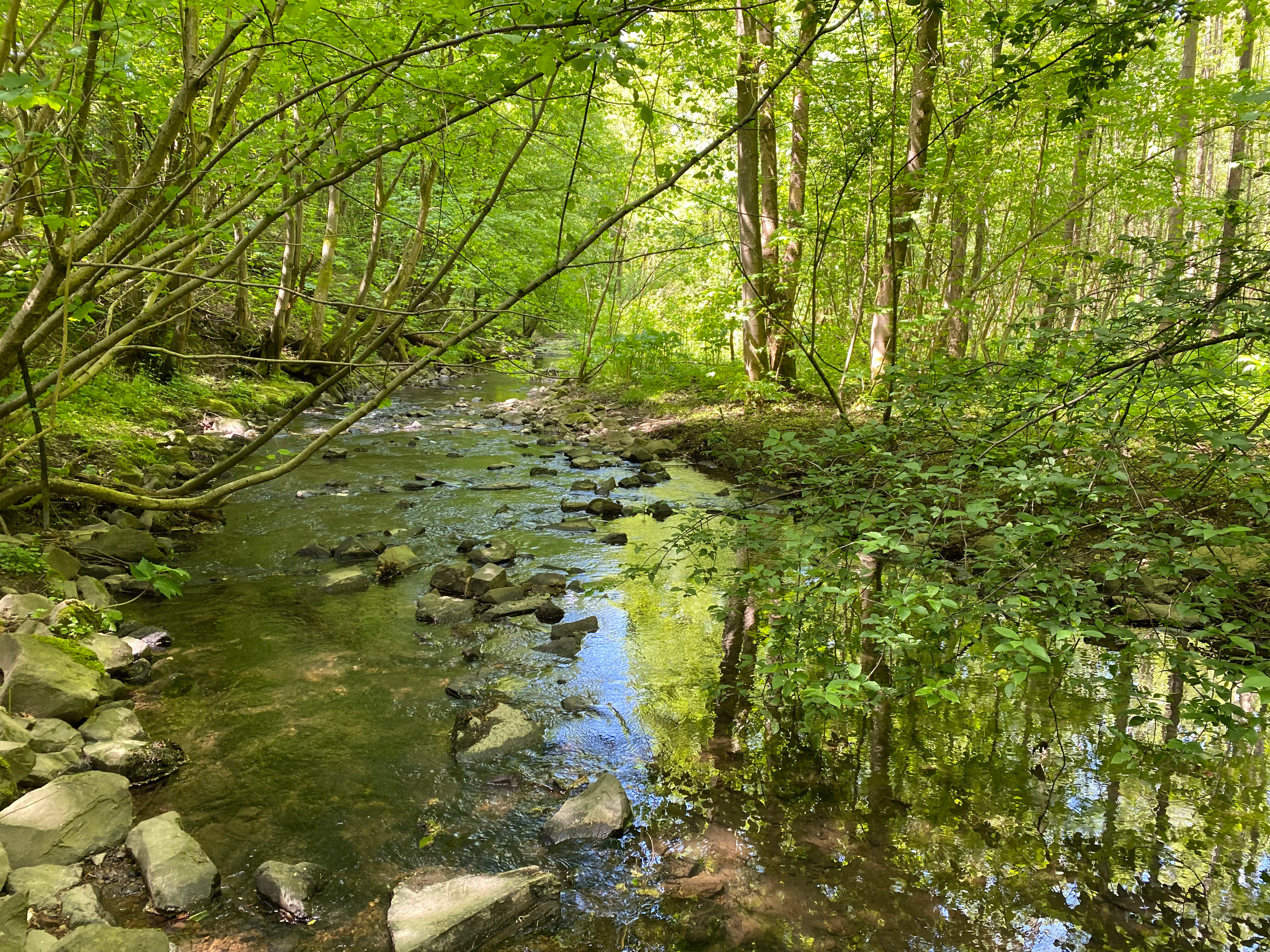
A shallow, rocky stream flows through a lush green forest with trees overhanging the water and reflecting in the pools.
The Leyerbach stream flowing through the dense floodplain forest of the Leyerbachtal nature reserve.

Leyerbachtal Nature Reserve wildlife and species highlights

Leyerbachtal's wildlife value is closely tied to the Leyerbach itself and to the wet, structurally diverse habitats of the valley floor. The reserve provides refuge for many amphibians, reptiles, and insects, groups that depend on the moist microclimate, the mosaic of pools and seepages, and the unbroken corridor of vegetation along the stream.

Among the reserve's most prominent animals is the white-throated dipper (Cinclus cinclus), a small, stream-specialist bird closely associated with clean, fast-flowing upland watercourses. The presence of the dipper is highlighted as one of the reserve's defining faunal features, both because of the species' ecological demands and because it is a recognised indicator of high stream-water quality and natural channel structure.

The grass frog (Rana temporaria) is another characteristic species associated with the Leyerbachtal's wet meadows and stream margins, breeding in the moist depressions and pool systems of the valley bottom. The combination of amphibians, reptiles, and invertebrates in a habitat of this size is a function of the site's hydrological stability and its relatively undisturbed floodplain margins, which together sustain the specialist community that defines the Bergisches low-mountain stream valleys.
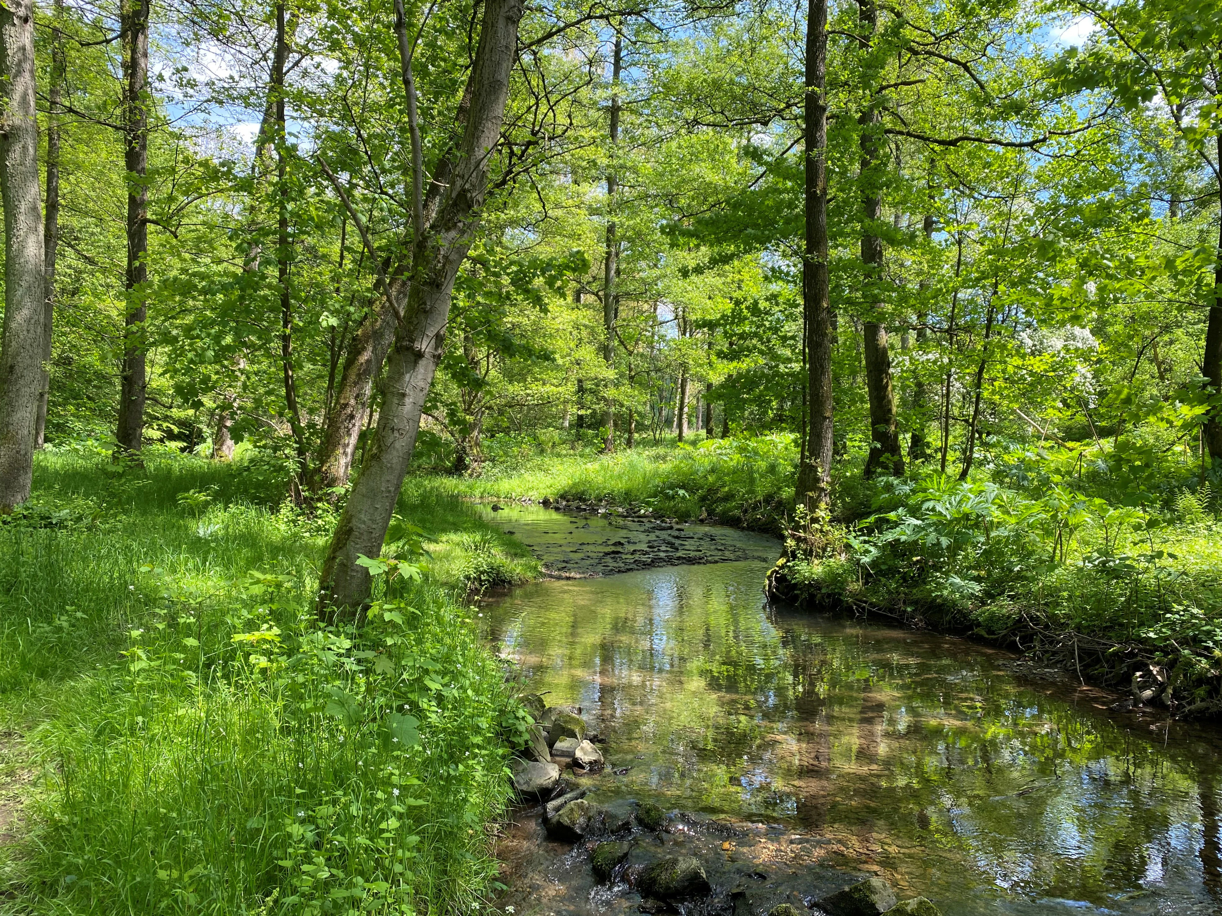
A small stream flows through a dense green forest with trees reflecting in the calm water.
The Leyerbach stream winding through the lush green floodplain forest of the Leyerbachtal Nature Reserve.

Leyerbachtal Nature Reserve conservation status and protection priorities

The Leyerbachtal reserve was legally designated to preserve and secure a near-natural low-mountain stream and the wider ecological balance of its brook ecosystem. At the core of the conservation rationale is the protection of the Leyerbach's natural hydrology and channel form, including its meanders and gravel banks, which together underpin the site's overall habitat quality.

The designation also aims to prevent any further impairment of the highly sensitive biotope structures present, particularly the stream-margin wet and moist meadows, abandoned grassland patches, springs and spring-brooks, alder woodland, sedge mires, brook-side reed beds, and oak-hornbeam stands. By keeping these habitats intact and connected, the reserve helps maintain the populations of amphibians, reptiles, insects, and stream-birds that depend on them.

An active management dimension is built into the conservation approach. The reserve's plan foresees the gradual conversion of remaining poplar plantations into more natural broadleaf forest, a structural improvement that is already underway in parts of the area. At the same time, the site is monitored for threats from invasive neophytes such as giant hogweed (Riesen-Bärenklau), whose spread is identified as a current pressure on the reserve and which is targeted for control in order to protect the native plant communities of the floodplain and valley slopes.

Leyerbachtal Nature Reserve cultural meaning and human context

Beyond its natural value, Leyerbachtal carries a clear cultural-historical dimension rooted in the industrial heritage of the Bergisches Land. The valley contains the Hilbertshammer, a historic hammer-mill recorded as both a built monument and a ground monument, as well as additional remnants of earlier hammer mills located along the Leyerbach. These structures date from the period when the small, fast-flowing streams of the Bergisches Land were harnessed to power iron forging and metalworking, an era in which the region's valleys were shaped as much by water-powered industry as by agriculture.

The presence of these monuments within the nature reserve highlights a layered human relationship with the valley: the same watercourse that once powered forge hammers and grinding mills now supports a statutory ecological protection regime. Today, the cultural elements are managed as integral features of the protected landscape, recognising that the Leyerbachtal is at once a natural habitat and a document of the region's older industrial past.
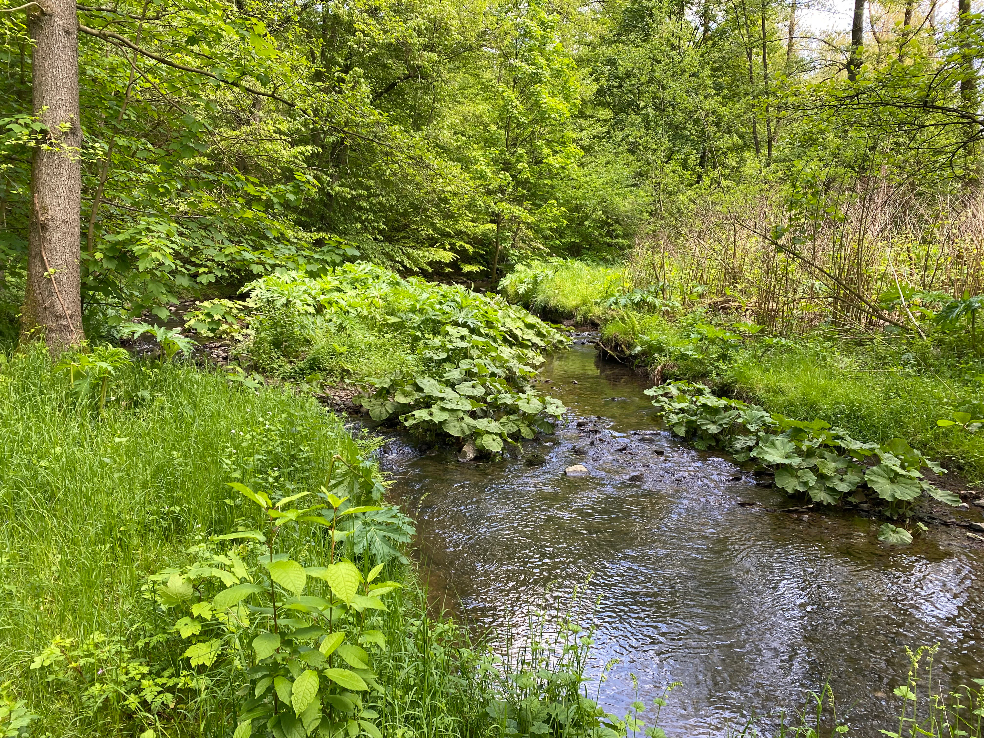
A small stream flows through a green forest valley with large-leafed butterbur plants growing densely along the water's edge and gravel bars, surrounded by trees and lush vegetation
Butterbur plants growing along the banks of a stream in Leyerbachtal nature reserve

Top sights and standout views in Leyerbachtal Nature Reserve

The Leyerbachtal reserve compresses several distinct qualities into a very small area: a near-natural meandering low-mountain stream, an unusually broad alluvial valley floor, and a layered mix of wet meadows, alluvial woodland, and slope forest. It supports a stream-specialist bird community led by the white-throated dipper and a significant amphibian, reptile, and insect fauna tied to its wet habitats. The presence of the Hilbertshammer and other hammer-mill remnants adds an industrial-heritage layer that is unusual within a statutory nature reserve. The reserve is also notable as part of Remscheid's wider network of protected brook valleys in the Bergisches Land, where many small streams share comparable ecological and cultural roles.
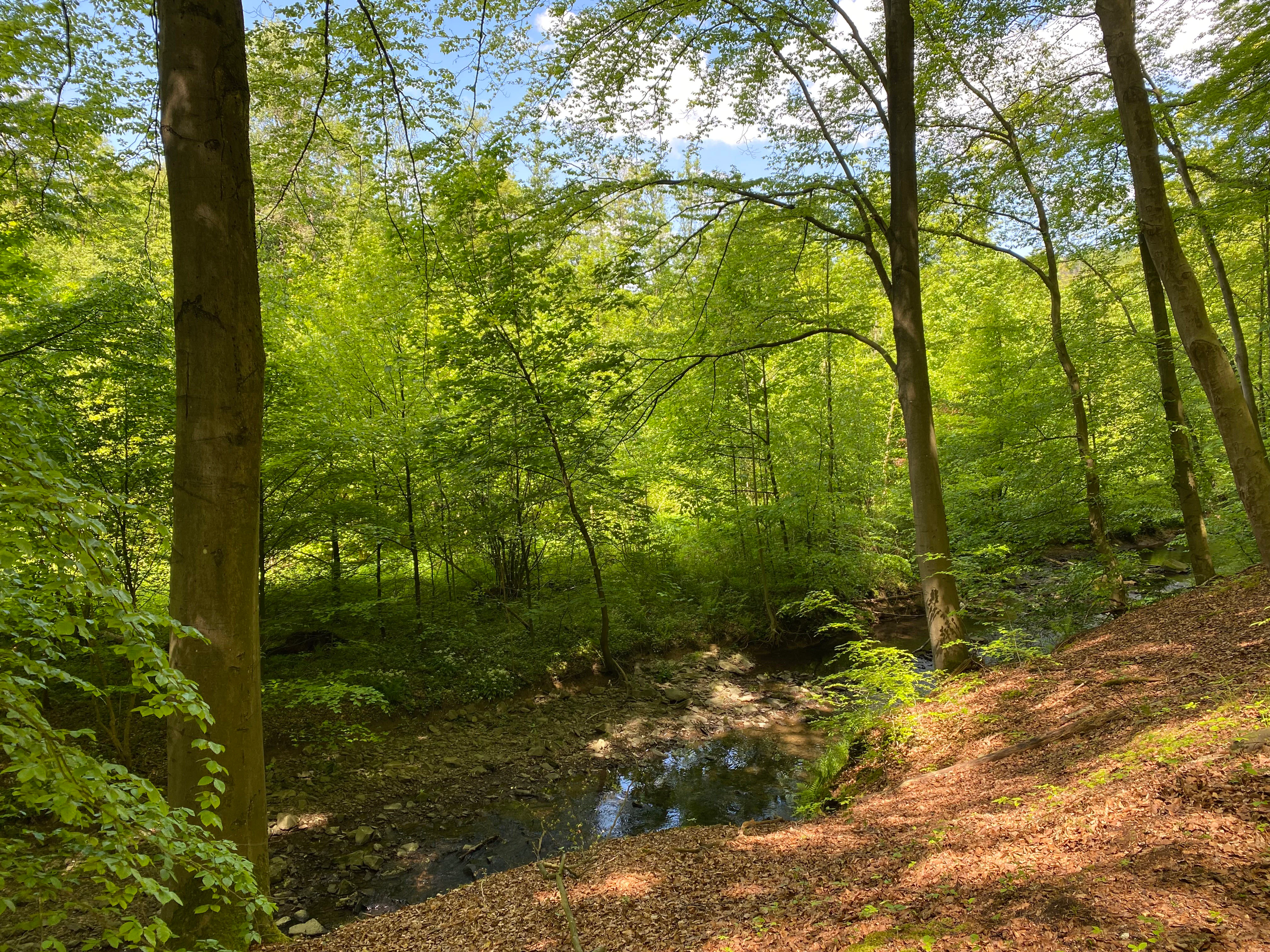
A small stream flows through a dense deciduous forest with tall tree trunks, a bright green canopy, dappled sunlight, and a leaf-covered bank sloping down on the right side.
A sunlit stream winds through the deciduous floodplain forest of the Leyerbachtal nature reserve near Leyermuhle.

Best time to visit Leyerbachtal Nature Reserve

As a small, low-elevation valley reserve in western Germany, Leyerbachtal is generally accessible year-round, but its character shifts with the seasons. Spring brings rising water levels in the Leyerbach, renewed amphibian activity around the wet meadows, and a fresh green phase in the alluvial grassland, while the breeding season makes it easier to hear stream-birds such as the white-throated dipper along the watercourse.

Summer tends to emphasise the open, herb-rich character of the valley floor, with butterbur stands on the gravel bars and a full canopy over the wooded margins. Autumn sharpens the contrast between the alluvial woodland and the open meadow, while winter reveals the structure of the meanders and the historic mill sites more clearly against the bare vegetation. The reserve can be viewed most easily from the footpath connecting Birgder Hammer and Leyermühle, which runs along the southern edge and offers the best vantage points across the protected landscape in any season.

Monthly climate preview

Long-term representative coordinate records for monthly thermal and moisture patterns

Leyerbachtal Climate Normals, Annual Temperature and Precipitation Profiles

Historical data records reveal long-term monthly temperature averages ranging from near freezing to warm summer peaks alongside steady precipitation distribution across the protected area coordinate. Reviewing the comprehensive twelve-month climate profile provides deeper analytical context into the regional thermal and moisture rhythm.
Annual mean9 °C
0 °C18 °C
Jan
Feb
Mar
Apr
May13°
Jun16°
Jul18°
Aug18°
Sep14°
Oct
Nov
Dec
Warmest month
July

18.3 °C

Coolest month
January

0.3 °C

Wettest month
December

3 mm/day

Driest month
April

1.8 mm/day

Park location guide

Geography guide, regional context, and park location map for Leyerbachtal Nature Reserve

Leyerbachtal Nature Reserve park geography, regions, and map view in Germany

Understand where Leyerbachtal Nature Reserve sits in Germany through a broader geographic reading of the surrounding landscape, nearby location context, and its mapped position within the national park landscape.

How Leyerbachtal Nature Reserve fits into Germany

Germany is a federal republic in Western and Central Europe with a population of over 83 million across sixteen constituent states. It is Europe's largest economy by nominal GDP and a major global exporter and importer. The capital is Berlin, and the country borders Denmark, Poland, Czech Republic, Austria, Switzerland, France, Luxembourg, Belgium, and the Netherlands.

Wider geography shaping Leyerbachtal Nature Reserve in Germany

Germany is located in Western and Central Europe, spanning 357,022 km². It borders Denmark to the north, Poland and the Czech Republic to the east, Austria and Switzerland to the south, and France, Luxembourg, Belgium, and the Netherlands to the west. The country has coastlines on the Baltic Sea and North Sea to the north, with the Alps located in the southern region.

Map view of Leyerbachtal Nature Reserve

Use this park location map to pinpoint Leyerbachtal Nature Reserve in Germany, understand its exact geographic position, and read its mapped placement within the surrounding landscape more clearly.

Pigeon | © OpenStreetMap contributors

Location context for Leyerbachtal Nature Reserve

Nordrhein-Westfalen

Explore detailed imagery of stream habitats, alluvial woodlands, and low-mountain terrain.

Leyerbachtal Photos and Landscape Scenery: Visualizing the Protected Valley

Visual documentation captures the natural topography, meandering stream channels, and diverse vegetative zones defining the protected valley. Examining photographic records reveals specific habitat structures, terrain contours, and the integrated ecological character of the Bergisches Land reserve.

A small brown and white bird with food in its beak stands on a wet rock in a flowing stream.

A paved footpath curves through a bright green meadow with bushes on the right, leading towards a dense forest on a hillside under a blue sky with white clouds.

A wooden information board with a slate roof stands in the foreground next to a paved path. Behind the sign, a grassy meadow stretches towards a line of green trees under a clear blue sky.

A shallow, rocky stream flows through a lush green forest with trees overhanging the water and reflecting in the pools.

A small stream flows through a dense green forest with trees reflecting in the calm water.

A rustic wooden building with a tiled roof and stone chimney stands in a dense green forest, with a wooden fence and path in the foreground.

A small stream flows through a green forest valley with large-leafed butterbur plants growing densely along the water's edge and gravel bars, surrounded by trees and lush vegetation

A small stream flows through a dense deciduous forest with tall tree trunks, a bright green canopy, dappled sunlight, and a leaf-covered bank sloping down on the right side.

Park atlas

Compare adjacent low-mountain valley reserves and connected upland stream habitats.

Explore Parks Near Leyerbachtal and Surrounding Regional Protected Areas

Browse nearby protected landscapes that share the ecological traits, alluvial woodland floors, and stream networks of Leyerbachtal. Expanding the geographic view reveals how regional valley reserves connect across the wider Bergisches Land terrain.
Watercolor painting of a rolling rural landscape with distant purple hills, green meadows, and trees, with a soft yellow sky.
Nature reserveNordrhein-Westfalen
About 2.2 km away#1 closest

West

Naturschutzgebiet Oelingrather und Grunder Bachtal: Regional Valley Conservation Atlas

Deep-dive into the stream networks of Nordrhein-Westfalen

Naturschutzgebiet Oelingrather und Grunder Bachtal is defined by its two parallel V-shaped valleys and diverse aquatic habitats. This reserve preserves a vital mosaic of wet meadows, nutrient-poor grasslands, and deciduous forests that function as an essential stepping-stone within the regional ecological network of the Bergisches Land.

Area
0.222 km²
Established
2003
IUCN
IV
Relief
Upland
Nature reserveNordrhein-Westfalen
About 5.6 km away#2 closest

East

Wilhelmsthaler und Haller Bachtal Nature Reserve: Bergisches Land Landscape and Map

A study of protected stream valleys and habitat mosaics in North Rhine-Westphalia.

Located in Remscheid, the Wilhelmsthaler und Haller Bachtal nature reserve protects a diverse array of interconnected stream-side and grassland habitats. This area demonstrates the ecological value of traditional valley landscapes in the Bergisches Land, providing essential connectivity for rare flora and local stream ecosystems through its unique relief and water corridors.

Area
0.103 km²
Established
2003
IUCN
IV
Relief
Upland
A watercolor painting showing a soft, stylized landscape of a meadow with low rolling hills in the background.
Nature reserveNordrhein-Westfalen
About 5.7 km away#3 closest

South

Naturschutzgebiet Orchideenwiese bei Heintjeshammer: Regional Nature Reserve and Landscape Atlas

Examining meadow diversity and protected habitats in North Rhine-Westphalia

Spanning roughly 4.3 hectares on a hillside above the Eschbach valley, this nature reserve protects a rare assemblage of wetland, heathland, and wooded siefen habitats. It remains a key focus for understanding the distribution of species-rich grassland ecosystems that persist in the rolling topography of the Bergische Hochfläche.

Area
0.043 km²
Established
2000
IUCN
IV
Relief
Upland
Nature reserveNordrhein-Westfalen
About 6.3 km away#4 closest

Southwest

Wupper und Wupperhänge südlich Müngsten Protected Nature Reserve and River Valley Geography

Mapped river slopes and protected forest landscapes in Nordrhein-Westfalen

This nature reserve protects a 2.8 kilometer stretch of the Wupper valley, defined by steep ravines, rocky slate outcrops, and ancient broadleaf forests. As an important habitat for local river-dependent flora and fauna, the area offers a structured look at low mountain landscape ecology and complex hydraulic stream networks in the Bergisches Land region.

Area
1.443 km²
Established
2003
IUCN
IV
Nature reserveOberbergischer Kreis
About 6.8 km away#5 closest

East

Wupper bei Radevormwald: Protected River Valley and Riparian Woodland Geography

Nature reserve landscape in the Oberbergischer Kreis region

Wupper bei Radevormwald serves as a critical protected area within the Wupper river corridor, featuring a mosaic of beech-oak forests and floodplain alder stands. The reserve highlights the contrast between calm, impounded reaches and energetic, meandering water sections, providing an essential study of river valley morphology and natural recovery in the Bergisches Land.

Area
1.208 km²
Established
2003
IUCN
IV
Relief
Upland
A horizontal watercolor painting depicting a meandering stream flowing through open, green, and pink-toned marshy grasslands bordered by a distant treeline.
Nature reserveNordrhein-Westfalen
About 8.9 km away#6 closest

Northeast

Spreeler Bachtal Nature Reserve: Geography and Protected Valley Landscapes

An upland nature reserve in the Bergisches Land region of Germany.

This nature reserve centers on the meandering Spreeler Bach, a gravel-bedded stream defining a diverse protected area in North Rhine-Westphalia. The terrain includes wet meadows, spring-fed grassland, and managed deciduous forests on steeply rising valley slopes. It serves as a prime example of targeted habitat conservation within the larger slate landscapes of the Bergisches Land, straddling administrative boundaries between Radevormwald and Ennepetal.

Area
0.21 km²
Established
2019
IUCN
IV
A soft watercolor illustration of a green valley with a central stream or river winding through meadows towards distant hills.
Nature reserveOberbergischer Kreis
About 9.8 km away#7 closest

Southeast

Leiverbachtal und Talhänge: Protected Stream Valley and Forest Habitat in Oberbergischer Kreis

Examining the geography of a Bergisches Land nature reserve

Leiverbachtal und Talhänge stands as a significant nature reserve within the Oberbergischer Kreis, defined by its near-natural meandering stream and diverse riparian ecosystem. The site offers a detailed look at floodplain meadows, slope forest transitions, and the ongoing shift toward broadleaf woodland within the German Mittelgebirg landscape.

Area
0.92 km²
Established
2006
IUCN
IV
Relief
Upland
Nature reserveNorth Rhine-Westphalia
About 12 km away#8 closest

Southeast

Wupperaue bei Westenbrücke Nature Reserve Landscape and Geographic Mapping

Protected riparian floodplain in the Oberbergischer Kreis

This nature reserve protects a vital 2.3 kilometer segment of the Wupper river valley. Its landscape is characterized by a mosaic of wet meadows, alder and willow stands, and riparian corridors, providing a crucial stepping-stone habitat within the Hückeswagen area of North Rhine-Westphalia.

Area
0.318 km²
Established
2013
IUCN
IV

Common questions about visiting, size, designation, and location context for Leyerbachtal Nature Reserve

Leyerbachtal Nature Reserve FAQs for park facts, access, geography, and protected area context

Find quick answers about Leyerbachtal Nature Reserve, including protected-area facts, park geography, trail and visitor context, and how the park fits into its surrounding country and regional landscape.
MoriAtlas Explorer

Continue Your Protected Areas Search Across the Global Atlas

Deepen your exploration by continuing the structured search for national parks and protected areas worldwide. Utilize the comprehensive filtering capabilities to compare different conservation landscapes and refine your understanding of global park geography. Discover more about the distribution and characteristics of protected natural areas.

Global natural geography